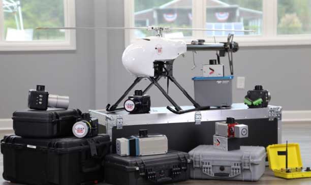
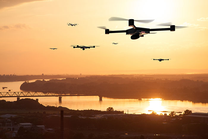
The UAV market has been growing rapidly for the past several years, especially in the U.S. with the Federal Aviation Administration (FAA) Part 107 regulations becoming active in August 2016. Before then, it was impossible to tell what systems were real and would weather the marketplace, and which were just a dream. Multicopters dominate the marketplace. (DJI’s M600 — out since 2016 — offers a 1–6-kilogram payload option). In late 2019, InnoFlight introduced the Galaxy 950 unmanned helicopter, a single-rotor platform capable of carrying more than 6 kilograms. It is available with battery power only, providing flights under an hour, but soon will support a gas-driven option for flights exceeding 2 hours. The system can be ready to deploy in less than 10 minutes.
Lidar USA provides a range of available lidar systems weighing about 5 kilograms, which work well with heavy-lift systems such as the Galaxy 950. In 2019, the Optech CL-90 was released; later the same year, the CL-360 hit the market. Lidar USA integrated each scanner into its product family and immediately saw the possibilities with the Galaxy 950.
The Lidar USA CL-series, together with the Galaxy 950, easily falls in the under-55-pound category set by the FAA. This means users can tackle small (5-acre) and large (500- to 5,000-acre) mapping jobs with confidence in their drone platform, the quality of the scan data, and the resulting lidar point cloud. The Galaxy 950 can easily support the CL-series with supporting cameras. The Optech CL-series provides survey-grade lidar accurate data: +/– 0.01 foot from a car on a paved surface. The system can operate from 400 feet with scan lines every inch at speeds of 14 mph (6.3 m/s). Of course, not all pulses make it to the ground due to vegetation, but the Optech CL-series provides up to four echos per pulse with a small beam size of 0.3 milliradians. Depending on the clipping angle, the scan width can range upwards of 1,200 feet, equating to about 34 acres per minute along a corridor. This system provides the surveyor with high-quality, accurate and dense lidar data.
Drone-maker DJI has filed an 89-page formal comment urging the U.S. Federal Aviation Administration (FAA) to allow drone pilots to choose which method of remote identification to use with their drones.
DJI’s filing includes an independent economic study that concludes the FAA’s Remote ID proposal would prove nine times as costly as the FAA’s estimates, imposing $5.6 billion worth of burdens on society over the next decade. The analysis finds many of those costs could be obviated if drone pilots could choose between two different methods of compliance, rather than doing both as the FAA proposed.
The economic analysis was prepared by Christian Dippon, Managing Director at NERA Economic Consulting, who considered the societal costs of the FAA’s proposed rule. He concluded the average monthly cost of a remote ID network-based service for a drone user would be $9.83, rather than the FAA’s $2.50 estimate; that demand for drones would fall 10 percent if the FAA’s proposals were imposed as written; and that total costs over 10 years would be $5.6 billion instead of the FAA’s $582 million estimate.
“We have known for years that Remote ID will be required by governments worldwide and will provide members of the public with confidence in productive drone uses, but the FAA’s deeply flawed proposal poses a real threat to how American businesses, governments, educators, photographers and enthusiasts can use drones,” said DJI vice president of Policy & Legal Affairs Brendan Schulman. “We hope our detailed economic analysis and comments, as well as tens of thousands of comments from other concerned parties, will encourage the FAA to develop a more risk-based, balanced and efficient remote ID rule, so our customers and the entire industry are not hurt by the final outcome.”
Remote ID allows authorities to identify and monitor airborne drones in near-real time, so they can see the location of the drone as well as a serial number to identify its owner. Congress tasked the FAA in 2016 with exploring consensus-based technology standards that could lead to Remote ID regulatory solutions.
In late 2019, the FAA proposed that almost all drones should broadcast that information directly to nearby receivers, as well as transmit it over wireless networks to a service provider’s database, with an anticipated monthly subscription fee for that service.
DJI and many other drone stakeholders have instead said the FAA should let drone operators choose whether to use broadcast or network solutions for Remote ID. Any new Remote ID rule is unlikely to take effect before 2024.
The Federal Aviation Administration (FAA) and Association for Unmanned Vehicle Systems International (AUVSI) will co-host the 5th Annual FAA Unmanned Aircraft Systems (UAS) Symposium June 16-18 in Baltimore. The event will take place at the Baltimore Convention Center.
The symposium will bring together representatives from the FAA, other government agencies, the industry and academia. According to the show organizers, the presenters and panelists will discuss the latest information and advancements related to the diverse uses of unmanned aircraft, and how these new entrants are being safely integrated into the National Airspace System.
The show will include four primary educational tracks, including public safety, technology and innovation, international and policy. The public safety track will explore topics such as addressing community concerns, security, and using drones to conduct safer and more effective public safety missions. The technology and innovation track will cover how drones and drone technologies are innovating rapidly and fundamentally changing aviation. The international track will feature discussions on how national and international UAS experts, industry representatives, civil society stakeholders, non-governmental organizations and policy makers are working to integrate and use drones across the globe. Finally, the policy track will allow attendees to hear directly from policy decision makers and get their thoughts on regulatory, operational and technical concerns.
In addition, the FAA will operate as an on-site resource center to answer questions from UAS owners and operators. Subject matter experts will be on hand to answer questions about airspace authorizations, waivers, the Part 107 small UAS rule, changes in hobbyists’ drone operations, the Remote Identification rulemaking, and other policies and regulations, the organizers added.
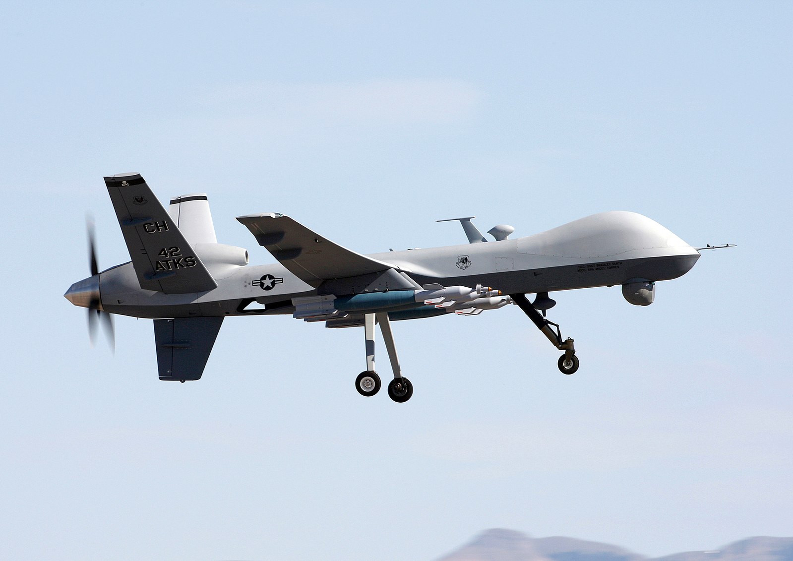
The MQ-9 Reaper drone. (Photo: U.S. Air Force/Paul Ridgeway)
A small aircraft’s encounter with a likely military drone near Edwards Air Force Base resulted in navigation failure, according to a report filed with NASA’s Aviation Safety Reporting System.
In October 2019, a single engine Piper P-46 Malibu was flying at 24,000 feet 36 miles north of Los Angeles en route San Diego.
Defense drone overhead
The pilot reported, “I saw a DOD drone (inverted V tail) pass overhead approximately 1,000 [feet] above. At the same time, my PFD [primary flight display] indicated that I had a large magnetic variation error, and in turn … indicated that I was now flying to a new way point (TCH VOR) located in Utah, well off my flight plan.”
Later, the navigation system indicated that the aircraft was on its way to a spot in Montana.
Interestingly, the flight plan displayed by another cockpit instrument, the Multi-Function Display, was not affected.
The aircraft had been operating under an Instrument Flight Plan. Federal Aviation Administration rules for light aircraft allow such operation with GPS as the sole navigation sensor.
With the primary flight display not operating properly, the aircraft was no longer able to fly a safe instrument approach to landing. Fortunately, the weather was such that it could proceed and land using Visual Flight Rules.
In the pilot’s words, “Had it not been a VMC [visual meteorological conditions] day allowing me to fly a visual approach, I would have had to [advise Air Traffic Control] – and find a way to land without any reliable approach capability.”
A combination of factors
The general consensus among experts is that this incident was inadvertent and likely arose from a combination of factors. Most significant were that the drone flew above the light aircraft, temporarily blocking some GPS signals, and emitting electromagnetic radiation from one or more of its on-board systems.
It is not possible to say what those systems and radiation may have been. It is unlikely they were intended to interfere with GPS reception, as that would pose serious safety-of-flight concerns in the nearby congested Los Angeles airspace.
GPS signals are infamously easy to disrupt, though. It is probable that the close proximity of the drone resulted in some radiation from its systems “spilling over” into GPS frequencies and causing the problem.
Of greater concern is that the light aircraft’s systems did not quickly reset and recover once the drone had moved off and the interference ceased. Had the aircraft been flying in the clouds or bad weather, the loss of its only radionavigation source could have been quite serious.
While not clear from the report, it is likely that the navigation system only recovered after a complete shutdown and restart. From the report in the NASA database:
“The system has since been checked and is operating correctly, but it seems pretty clear this was some type of interference / jamming arising from the DOD drone. Clearly, this is a significant risk to all aircraft, and because if [sic] occurred within the LA airspace it is a serious threat to safe flights.”
The need to address interference
Shortly before this incident, the International Civil Aviation Organization identified addressing interference with satellite navigation system signals an “urgent priority.” This was in response to concerns from several member countries and organizations citing safety of flight issues. One example cited was the near loss of a passenger aircraft flying in the mountains during a period of GPS disruption.
The October 2019 report of interference from the drone is number ACN 1696794 in the NASA Aviation Safety Reporting System. It can be accessed by searching here.
A proposed FAA rule — open for public comment until March 2 — would require drones over 0.55 pounds to electronically transmit their location and ID.
Northeastern Colorado was visited with a mystery in late December and January. Residents began seeing drones from 7 to 10 p.m. each night, moving in groups as large as 30, and flying in a grid pattern. The drones stayed about 200 feet to 300 feet in the air and flew steadily in squares of about 25 miles, at speeds estimated at 25–40 mph.
Reports were so numerous that a multi-agency task force was formed to investigate, including 10–15 law enforcement agencies as well as the FBI and Federal Aviation Administration (FAA). The drones were reported to measure six feet across and sound like a small jet engine. “These are not drones that people in our county can just buy,” said Washington County Sheriff Jon Stivers.
Numerous government agencies and companies denied the drones were theirs, including the U.S. Air Force, NOAA, NORAD, the FAA, and large drone developers Google, Amazon and Uber.
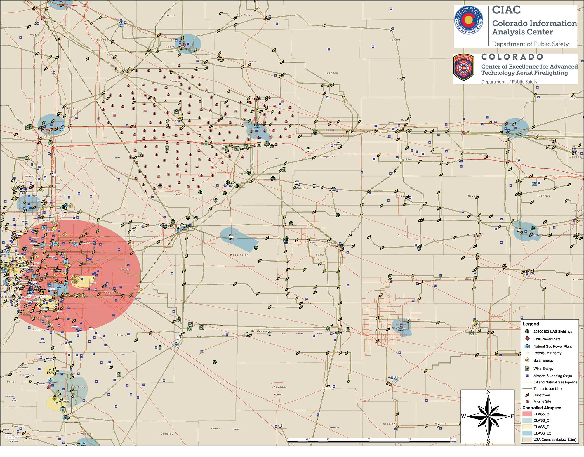
The Colorado Division of Fire Prevention and Control (DFPC) flew the state’s Multi-Mission Aircraft in an area where drones had been reported during two January missions.
This DFPC map, obtained by FOX31 TV, shows possible locations of drone sightings along with power plants, pipelines and missile sites. (Map: Colorado Division of Fire Prevention and Control)
Some suspect the drones were part of a secretive Air Force counter-drone program to protect nuclear missile silos. Another theory was a hunt for a missing nuclear warhead from one of the many intercontinental ballistic missile sites that dot the prairies of Wyoming, Colorado and Nebraska.
A group of Wichita, Kansas, drone enthusiasts also came forward, saying they had flown groups of drones in the area — but not to the same scale.
In an interview at January’s World Economic Forum in Davos, Switzerland, Transportation Secretary Elaine Chao told Yahoo Finance, “We don’t know who they belong to, we don’t know who’s operating them, to this day we do not.” Her department oversees the FAA, which issues Part 107 waivers to drone operators, allowing them to fly at night or out of line of sight of the operator. The waivers (thousands have been issued) lack enough specifics to narrow down who might be responsible for mystery drones.
A proposed FAA rule — open for public comment until March 2 — would require drones over 0.55 pounds to electronically transmit their location and ID, giving agencies access to information on drones in flight.
The new remote ID requirement would help with the creation of the Unmanned Aircraft System Traffic Management System, a project between the FAA, NASA and other agencies to “ultimately identify services, roles and responsibilities, information architecture, data exchange protocols, software functions, infrastructure, and performance requirements for enabling the management of low-altitude uncontrolled drone operations,” according to the FAA.
As of press time, no one has come forward to claim ownership of the drones. The public is encouraged to submit reports. As The X-Files’ Fox Mulder might say, “Watch the skies.”
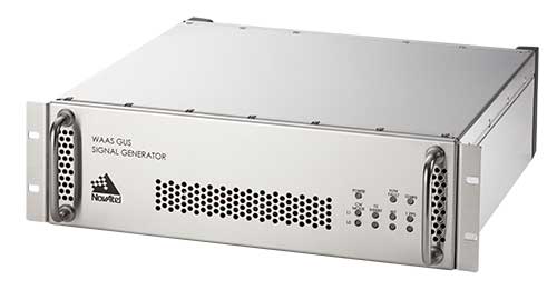
Next-generation NovAtel ground uplink station signal generators delivered for SBAS modernization
Photo: NovAtel
Hexagon/NovAtel announced that shipments of next-generation ground uplink station (GUS) signal generators have commenced in fulfillment of its contract with the United States Federal Aviation Administration (FAA) to support the FAA’s safety of life wide-area augmentation system (WAAS) navigation service.
Developed by the FAA for civil aviation, WAAS is a safety-critical navigation aid that provides integrity monitoring and differential corrections for all phases of flight. The next-generation NovAtel GUS signal generator replaces the legacy product that has operated successfully for more than 15 years and ensures continued operation for years to come.
Along with the GUS signal generator modernization, the contract includes ongoing engineering support services for the complete portfolio of NovAtel ground reference receiver products deployed by the FAA.
“We have a long-standing relationship with the FAA and worked very closely with the WAAS program team to deliver this critical next-generation technology for SBAS modernization,” stated Jonathan Auld, NovAtel Vice President of Engineering and Safety Critical Systems. “We’re very pleased to continue our commitment to support the FAA and their safety of life WAAS service.”
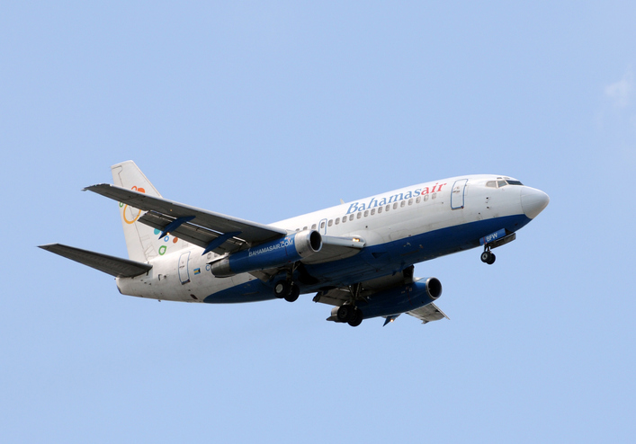
Photo: icholakov/iStock Editorial/Getty Images Plus
BahamasAir has missed the U.S. deadline for the new ADS-B mandate and is now forbidden from flying certain three of its four jets in United States airspace. The airline said it has adjusted its aircraft deployment accordingly, reports Forbes.
The U.S. Federal Aviation Administration mandated in 2010 that aircraft be equipped with hardware to use NextGen, a satellite-based air traffic control management system, to replace traditional ground radar technology. This step of the transition requires aircraft to have Automatic Dependent Surveillance-Broadcast Out (ADS-B) capability either at time of manufacture or retrofitted with a kit.
BahamasAir was unable to equip three of its Boeing 737-500s with ADS-B before the Jan. 1 deadline, so those aircraft have been taken off the routes it flies to Florida. It has one 737-700 and five ATR regional airliners that have ADS-B, and is using those aircraft for Florida. It also leased some planes to meet holiday season demands.
The airline says it’s maintaining its full schedule with no changes and the old 737s should be fixed in the next few months. Meanwhile, the agency has granted an exemption to the government of Canada for two of its old airframes.
Canadian Changes
The Royal Canadian Air Force operates four Challenger 601 business jets to take government and military officials on shorter flights in the U.S. and Canada. Two of those jets are too old to receive the ADS-B upgrade, so the FAA has said it will be allowed into U.S. airspace but may not get the most convenient routing from air traffic control, according to AVWeb. The FAA does have a process to waive the ADS-B requirement, but it has warned that the exemptions will be issued only under exceptional circumstances.
On Jan. 2, an Air Canada flight leaving Saint John was forced to avoid United States airspace on Thursday and take a longer path to Toronto, avoiding flying over Maine because of the mandate, reports the New Brunswick Telegraph-Journal. The change in flight pattern added roughly 20 minutes to the trip. Air Canada won’t speculate if the longer flight path and extended travel time will happen again.
At any given moment, more than 5,000 airplanes are flying over the United States. In a single year, nearly 778 million passengers will take to the skies — more than twice the population of the U.S., and the number increases each year. Aviation is the safest form of transportation. It is 100 times safer than driving. For every 100 traffic deaths, only one aviation related fatality occurs; and the Federal Aviation Administration (FAA) is working hard to make aviation even safer.
Safety is the FAA’s primary focus. The FAA Strategic Plan FY 2019– 2022 states its mission is to provide the safest, most efficient aviation system in the world. To achieve this goal, the FAA is implementing several initiatives. The technical aspects of these efforts fall under a framework called NextGen designed to modernize the nation’s air traffic control system. NextGen began in 2003 in the VISION 100 – Century of Aviation Reauthorization Act. At its core, NextGen is a geospatial framework with satellite navigation as its backbone.
The Geospatial Data Act (GDA) became law when President Trump signed the FAA Reauthorization on Oct. 5, 2018. You might have wondered how the GDA came to be included in the bill. It makes sense in the context of technology advancements towards a smart transportation network, specifically in aviation.
The smart transportation concept integrates all forms of transportation to provide economic and environmental benefits as well as increase safety and reduce wait times and congestion. A large part of smart transportation is based on geographic information technology. The aviation component of this smart transportation initiative falls within the FAA’s authority under the overarching framework named NextGen.
NextGen is an integrated concept improving the efficiency and safety of flight operations both on the ground and in the air. The use of geospatial technology enables precision time-management for controlling air traffic. The system allows each airplane to digitally coordinate with other aircraft in the area, taking into account such things as terrain and other known hazards to safely reroute air traffic as necessary. The FAA refers to this as trajectory-based operations. Those with a knowledge of GIS will recognize it as four dimensional: it calculates direction, speed, distance and time relative to position in x-y-z, and coordinates that information with other known data. Additionally, the system uses historical flight data and predictive analytics to maximize airspace for routing air traffic such as what is experienced during the holidays.
NextGen also uses a system called Optimal Profile Descents (OPD), which allows an airplane to trim its engines and descend along a glide slope from flight level into the airport. The point at which a plane begins its descent is a geospatial calculation to determine the precise point in space for the airplane based upon its altitude, weight, glide slope and distance to the airport. The benefits of OPD are reduced engine noise, fuel savings, less carbon emissions and a positive economic impact. NextGen is an across-the-board win for the airline industry, airline passengers, the economy and the environment.
According to an interview with Michael Whitaker, former deputy administrator of the FAA who was the Chief NextGen Officer, NextGen revolutionizes aviation by enabling digital data communication. It replaces radar-based navigation and tracking with satellite-based air traffic control. The cornerstone of NextGen is the Automated Dependent Surveillance Broadcast (ADS-B) system.
ADS-B is an aviator’s version of Waze, but with a lot more information. ADS-B(out) broadcasts an airplane’s Flight ID, ICAO Code, speed and location in three-dimensional space to air traffic controllers and to everyone who is equipped with ADS-B(in). The combination of ADS-B(out) and ADS-B(in) greatly increases situational awareness for aviators. On Jan. 1, 2020, all airplanes operating in controlled airspace needed to have ADS-B(out) installed. ADS-B transforms the entire National Airspace System into a satellite-based geospatial network. It integrates multiple sources of real-time data, such as weather, pilot reports, aircraft positions, 3D airspace information, and other sources of data, which can be overlaid on top of various basemaps and terrain elevation models, allowing pilots to make more informed and safer decisions.
Switching to ADS-B opens up more capacity in already crowded skies by decreasing the required vertical and horizontal separation distances between aircraft. At Hartsfield-Jackson International Airport, the busiest airport in the world, changing to performance-based operations allowed 8 to 12 more departures per hour; and in Memphis International Airport, one of the busiest airports for cargo operations, arrivals increased by 20%.
Rune Duke, senior director of government affairs, Airspace, Air Traffic and Aviation Security for the Aircraft Owners and Pilots Association (AOPA), said that ADS-B will allow much faster update rates for air traffic controllers on the order of once every second, compared to legacy radar systems that report positions every 8 to 12 seconds. For an airplane traveling at 350 knots, that is about 1 mile. A lot can change in a mile in densely packed airspace.
If you are reading this because of your love of maps and aviation, then I highly recommend the FlightAware and ForeFlight smartphone apps. FlightAware turns the phone into an ADS-B(in) receiver showing the location and flightpath of each aircraft in the immediate area on a basemap. I sit on my back deck and watch airplanes coming and going because I live under the flightpaths for Dulles International Airport, Reagan International Airport, Leesburg Executive Airport, the Montgomery County Airpark and the TERPZ waypoint. On occasion I see helicopters flying to Camp David because I am under that flight path as well.
So, I get to see a variety of aircraft. You can select the airplane icon to see information such as aircraft type, airline, Flight ID, departing and arrival airports, altitude, and groundspeed. Even more information is available by selecting the pop-up window. This is ADS-B information. ForeFlight, on the other hand, is a pilot’s flight bag on a tablet.
In the future, ADS-B will integrate Aircraft Hazardous Areas (AHA): temporary no-fly zones due to commercial space launches. Because of ADS-B, planes will automatically reroute around the AHA, and when the AHA expires, airplanes will be routed back through the area.
ADS-B supports evolving technologies such as remote towers, another significant change to air traffic control. Remote towers allow air traffic controllers to be at a location other than the actual airfield. Remote towers use a suite of sensors mounted at the airfield, including high-definition video, thermal and night vision that can be combined with the digital information provided by ADS-B, all of which is displayed on widescreen panels in a room duplicating the experience of being at the airport and directing aircraft. This allows smaller airports that cannot afford the huge expense of building and staffing an air traffic control tower to be part of a remote tower network. One remote tower center will be able to support several airfields. Leesburg Executive Airpark recently finished successful testing of one of the first remote tower operations in the United States.
“Over the next 10 years, we are going to see logistics and transportation open up, from being limited by currently rigid road infrastructure to operating on fully flexible and responsive aerial transportation networks,” said Patrick Watson, director of business development for Animal Dynamics.
The envisioned Platform Unmanned Cargo Aircraft. (Photo: PUCA)
ADS-B will also support the integration of unmanned aerial systems (UAS) into the airspace, specifically unmanned cargo aircraft (UCA). In the not too distant future, carrier air fleets without pilots or aircrew will be taking to the skies. UCAs do not require crews, so there will be no need for water, toilets, sewage containment, kitchens or a cockpit (in the traditional sense). Taking those out will allow for more space in the plane to carry cargo and fuel. Plus, without crews on board, there will be no time restrictions on crew hours — planes will be able stay aloft longer and travel further. ADS-B greatly enables the success of this technology.
The U.S. Department of Transportation’s Federal Aviation Administration issued a proposed rule that would require unmanned aircraft systems (UAS) to be identifiable remotely.
The rule, deemed the “Notice of Proposed Rulemaking for Remote Identification,” would apply to all drones that are required to register with the FAA (recreational drones weighing under 0.55 pounds are not required to register), as well as to persons operating foreign civil UAS in the U.S.
“Remote ID technologies will enhance safety and security by allowing the FAA, law enforcement and federal security agencies to identify drones flying in their jurisdiction,” said U.S. Transportation Secretary Elaine Chao.
According to the FAA, nearly 1.5 million drones and 160,000 remote pilots are registered with the administration. Equipping drones with remote identification technologies would build on previous steps taken by the FAA and the UAS industry to safely integrate operations, including the small UAS rule, which covers drones weighing less than 55 pounds, and the Low Altitude Authorization and Notification Capability, which automates the application and approval process for most UAS operators to obtain airspace authorizations, the FAA added.
“As a pilot, my eye is always on safety first,” said FAA Administrator Steve Dickson. “Safety is a joint responsibility between government, pilots, the drone community, the general public and many others who make our nation so creative and innovative.”
The proposed rule will be accompanied by a 60-day comment period to receive public feedback and help the FAA develop a final rule to enhance safety in the skies over the U.S.
The U.S. Federal Aviation Administration (FAA) has approved two Supplemental Type Certificates (STCs) for CMC Electronics, to help airplanes comply with automatic dependent surveillance-broadcast out (ADS-B Out) requirements.
Boeing 737 Next-Generation Aircraft
CMA-5024. (Photo: CMC Electronics)
The FAA has approved an STC to install the SBAS-capable CMA-5024 GPS on Boeing 737 Next-Generation aircraft to comply with worldwide ADS-B Out mandates as well as SBAS/GPS navigation enabling the first localizer performance with vertical guidance (LPV) approaches for B737NGs.
CMC’s solution, developed in collaboration with the FAA’s Navigation Programs office, offers operators the advantage of a cost-effective alternative to replacing their current multi-mode receiver (MMR).
The CMA-5024 is an approved DO-260B ADS-B Out positioning source that may be paired with any DO-260B compliant transponder, allowing operators to meet FAA and EASA ADS-B Out requirements, the UAE’s ADS-B Out and RNP requirements mandated by GCAA as well as India’s GAGAN requirements.
The CMA-5024 is the only solution available that is approved to introduce LPV on B737NG aircraft. With the CMA-5024, the B737NG aircraft can take advantage of satellite-based augmentation system (SBAS) navigation throughout all phases of flight.
An LPV approach is the highest precision GPS instrument approach available not requiring specialized crew training. It aims to reduce costs associated with flight delays or cancellations and provides airlines with a safe approach into airports when ILS is unavailable.
The CMA-5024 meets the requirements for an IFR civil certified GNSS and is compatible with all SBAS systems operating around the world such as WAAS, EGNOS, GAGAN and MSAS. SBAS augments GPS to provide an extremely accurate navigation solution throughout all phases of flight, from departure to en-route, through LPV CAT-l equivalent approach. The CMA-5024 complies with published Communication Navigation Surveillance/Air Traffic Management (CNS/ATM) navigational mandates.
EASA approval of the STC is in progress. Future growth to GBAS GLS precision approach capability can be obtained by upgrading to CMC’s new CMA-6024 GPS/SBAS/GBAS receiver system.
For Business Jets
CMC Electronics and DAC International received an FAA STC (ST00934DE) for aircraft equipped with Honeywell’s Primus II avionics suite.
The new STC provides a low-cost alternative to upgrading the existing onboard Honeywell equipment while meeting the DO-260B ADS-B Out worldwide mandate. This is achieved by replacing the existing non-compliant Primus II transponder with the Becker BXT6553 Diversity Transponder, paired with CMC Electronics’ CMA-3024 GPS/SBAS (GNSSU) receiver.
The STC extends the operating life of a broad range of aircraft such as Bombardier’s Challenger 600 series, Hawker 800/800XP, Learjet 45, Gulfstream G-IV and GIV-X, Cessna Citation II and V, and many more.
This is the latest addition to already existing STCs (ST03424CH and ST04159CH), which pair CMC’s CMA-3024 with the Rockwell Collins TDR-94/94D or Honeywell RCZ-8XX Primus II Com/Transponder to meet the DO-260B ADS-B Out standards mandated by the UAE’s GCAA, FAA and EASA for 2020.
Claude Chidiac, Vice President, Sales and Marketing, at CMC Electronics said: “These STCs bring together the best that CMC and DAC have to offer to economically support business jet operators. They combine the respective technological strengths of both companies, namely the most advanced GPS receiver with DAC’s worldwide distribution channels and FAA approved kits. Our joint ADS-B Out solutions deliver high integrity and the cost-effectiveness that business aviation has been waiting for.”
The CMA-3024 aviation sensor provides fully ADS-B compliant SBAS/GPS primary means navigation for business, regional, commercial air transport and helicopter aircraft. It is fully compatible and operational with all SBAS signals worldwide.
With SBAS coverage, differential corrections are incorporated to further improve RNP capability, providing RNP0.1 with outstanding navigation system availability.
Full installation kits, including the CMA-3024 and STC package, are provided by DAC International.
Raytheon has delivered the Wide Area Augmentation System Geosynchronous Earth Orbiting 6 satellite navigation payload to the U.S. Federal Aviation Administration (FAA) to broadcast the WAAS message, which corrects errors in GPS satellite signals, provides expanded coverage, improves accuracy and increases reliability.
The WAAS GEO 6 payload is now operational and fully integrated into the WAAS network, working with two other WAAS satellite payloads already in orbit.
The SES-15 satellite hosting Raytheon’s WAAS GEO 6 payload was launched in 2017 and completed extensive system integration in July 2019.
GEO 6 replaces an older WAAS geostationary satellite that had reached its end-of-service life.
About WAAS. Developed and installed by Raytheon for the FAA, WAAS is a North American satellite-based augmentation system that increases GPS satellite signal accuracy for precision approach at 200 feet altitude to meet strict air navigation performance and safety requirements for all classes of aircraft in all phases of flight.
WAAS contains space and ground equipment that works together to identify GPS satellite corrections.
Operational since 2003, the WAAS network consists of three geostationary satellites and 49 terrestrial-based stations dispersed across the continental U.S., as well as Alaska, Canada, Hawaii, Puerto Rico and Mexico.
“Never has a consistent and precise GPS signal been more critical to ensuring safety of flight,” said Matt Gilligan, vice president of Raytheon’s Intelligence, Information and Services business. “As the airspace increases in complexity, there is absolutely no room for error.”
To learn more about Raytheon’s portfolio of air traffic management solutions, visit here.
Guest column by Brian Wynne AUVSI President and CEO
Brian Wynne, AUVSI president and CEO
A recent analysis found that just 10 percent of the unmanned aircraft systems (UAS) included in the Unmanned Systems and Robotics Database maintained by the Association for Unmanned Vehicle Systems International (AUVSI) can operate beyond the visual line of sight (BVLOS) of its operator.
While the technology for BVLOS operations has existed for years, under current federal regulations, only the military is permitted to use it. The absence of federal regulation allowing BVLOS operations hinders the full value and benefits that the UAS industry has to offer.
Regulations that provide guidance and rules for operating unmanned systems are necessary for the industry’s advancement. Earlier this year, the Federal Aviation Administration (FAA) issued a proposed rule for UAS operations over people, and the UAS community is eagerly anticipating the agency will offer an additional rule requiring UAS to be equipped with remote identification.
“Remote ID is a crucial next step to gain the confidence of federal defense and security agencies, manned aviation users and the public.”
However, the rulemaking process for remote ID has been delayed by the FAA twice this year and is now slated to be released in December. The need for remote ID cannot be overstated, as the advancement of the UAS industry depends on identifying and tracking UAS flying in the airspace.
Furthermore, remote ID is a crucial next step to gain the confidence of federal defense and security agencies, manned aviation users and the public. With this confidence, UAS can further integrate into the national airspace to perform important BVLOS operations such as inspection of utility rights of way, widespread search-and-rescue missions, and package delivery.
A clear, national regulatory framework and the support of the federal government is needed to drive the adoption of unmanned systems technology and its applications. Currently, the UAS industry is working with our government partners on remote ID and tracking standards, but we recognize that more needs to be done and at a faster pace than the regulatory process allows. That is why the UAS industry is stepping up to explore near-term solutions before remote ID regulations are finalized and published.
In May, AUVSI and the Airports Council International-North America commissioned a Blue Ribbon Task Force on UAS Mitigation at Airports. The task force is working to refine procedural practices and provide a policy framework to address the timely and critical issue of incursions by unauthorized UAS at airports and how best to mitigate this threat, including industry and government recommendations for remote ID. The task force will release a report this year.
Applications of unmanned systems aren’t limited by technology or imagination; they’re only limited by regulations. We need a streamlined regulatory environment that allows for the safe deployment of unmanned systems into our nation’s transportation infrastructure so we can begin to reap the full benefits of this technology.