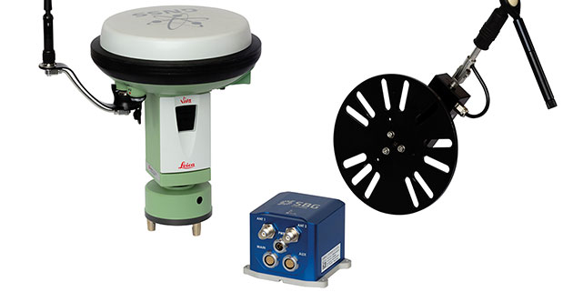
At ION GNSS+ this week, SBG Systems announced the release of the Ekinox Land Solution, an all-in-one solution combining the cost-effective inertial navigation system with an odometer, and a GNSS RTK reference station for smooth positioning in land applications. GPS positioning in urban canyons, forests, or tunnels has always been challenging. By taking the best of these complementary technologies, Ekinox Land Solution provides reliable positioning in an affordable package, the company said.
SBG Systems is exhibiting the system Wednesday through Friday at Booth 519/521 at ION GNSS+ in the Nashville Convention Center.
The combination of the Ekinox inertial navigation system with complementary technologies such as wheel-speed sensor (DMI) and RTK GNSS is the key to providing smooth vehicle positioning, even during GPS outages, SBG Systems said. To save users and integrators both time and money, the best equipment has been tested and selected to build a cost-effective and all-in-one package — Ekinox Land Solution.
Ekinox Land Solution is an integrated package built from the Ekinox Series, a range of inertial navigation systems based on robust and cost-effective MEMS technology. Mounted on a vehicle, Ekinox Land Solution provides real-time roll, pitch, and true heading (0.05° accuracy) while delivering a smooth position (2 cm). Data is output at 200 Hz and recorded in an 8-GB datalogger. Post-processing software is offered to increase attitude accuracy (up to 0.02°).
Ekinox Land Solution is designed to answer the growing need of vehicle real-time positioning, imagery sensor triggering, and data georeferencing at an affordable price. Examples of applications include mobile mapping, machine control, car motion analysis, and unmanned ground vehicle navigation.
The Ekinox series includes the Ekinox-A, and Attitude and Heading Reference System; the Ekinox-E, an Inertial Navigation System (INS) whose position feature depends on aiding equipment; the Ekinox-N, an INS with an embedded L1/L2 GNSS receiver; and the Ekinox-D, an INS with an integrated Dual Antenna GNSS receiver.
SBG Systems is a French supplier of MEMS-based inertial motion sensing solutions. The company provides a wide range of inertial solutions from miniature to high accuracy. Combined with calibration techniques and advanced embedded algorithms, SBG Systems products are designed for defense, industrial and research projects, such as unmanned vehicle control, antenna tracking, camera stabilization, and surveying applications.
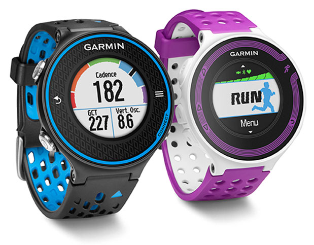
Garmin International Inc., a unit of Garmin Ltd., the global leader in satellite navigation, is now offering the Forerunner 620 and Forerunner 220 GPS running watches, both of which have color displays. The Forerunner 620 offers advanced features like recovery advisor, race predictor and VO2 max (maximal oxygen uptake) estimate to help runners train and achieve race goals. When used with the new HRM-Run (heart rate) monitor, the 620 also provides feedback on running form.
For indoor training, such as on a treadmill, the 620 and 220’s built-in accelerometer tracks distance and pace, so runners don’t need a separate sensor. Both models boast Garmin’s unique one-inch Chroma color display to easily interpret data.
“Whether running indoors or out, Forerunner 620 and 220 will change the way runners look at training,” said Dan Bartel, Garmin vice president of worldwide sales. “Advanced features in the 620 such as recovery advisor, VO2 max estimate, race predictor and stats on running economy, combined with connected features and training plan options found in both the 620 and 220, make these watches must haves for runners of all levels. To keep runners motivated the watches also notice if runners hit any personal records on that run, like their fastest mile, 5k, 10k, half or full marathon or their longest run to date.”
Regardless of a runner’s experience, motivation, or how far or fast they go, they likely want to know how they can improve and objectively measure their fitness. Forerunner 620 does just that by estimating runners’ VO2 max, which is a good indicator of athletic capability. Previously, the only way to accurately obtain VO2 max was by paying for a lab test.
When used with a heart rate monitor, the 620 incorporates several pieces of data, like running speed, beats per minute and heart rate variability, into an advanced algorithm to estimate runners’ VO2 max. The number itself indicates the maximum volume of oxygen a runner can consume per minute, per kilogram of body weight at their max performance. Theoretically, the more oxygen runners can use during high-level exercise, the more energy they can produce. A color gauge on the watch display shows how a runner’s VO2 max data compares to other individuals of their gender and age range. Based on the VO2 max estimate, the 620 can predict a runner’s race time for several distances. This can give runners a time target for their next race, assuming they’ve completed proper training.
When wearing HRM-Run, Forerunner 620’s recovery advisor and recovery check take the guesswork out when it comes to planning recovery time between hard workouts. Just like a coach, it learns the runner and their physiology based on heart rate data, so it factors this against their last workout and then shows how much time before they are fully recovered and ready for their next hard running workout. Color-coding on the high-resolution Chroma display gauge makes it easy to interpret — green means they are good to go. When runners see red on the display and a recovery time of more than three days, they might consider taking a rest day or just doing a light recovery run.
HRM-Run also has an accelerometer in the module that measures torso movement in order to calculate 3 different running metrics:
Cadence — the number of steps per minute. It displays the total steps (right and left combined)
Vertical oscillation — the bounce in runners’ running motion. It displays the vertical motion of a runners’ torso, measured in centimeters.
Ground contact time — the amount of time in each step that you spend on the ground while running, measured in milliseconds.
Thanks to their Bluetooth Smart wireless upload capabilities, Forerunner 620 and 220 can send runners’ run data to the Garmin online community, Garmin Connect, without being connected to a computer. It can transfer the data through the Garmin Connect Mobile app on their compatible smartphone. Additional connected features include live tracking, which allows runners’ friends and fans to follow along and see their stats in real-time. Runners must have their phone paired with their 620 or 220 throughout the run to use the LiveTrack feature. Victories, goals achieved and successes can be shared on runners’ social media sites by posting updates through the Garmin Connect Mobile app.
With the growing popularity of the run/walk training method in the distance running community (example: a runner runs for five minutes, walks for one minute and repeats for the duration of the course), Garmin has included a run/walk alert. This alert allows Forerunner 620 and 220’s other features, such as, Auto Lap and Auto Pause, to remain active during a run/walk session.
Both Forerunner 620 and 220 are water-resistant to 50m and can stand up to much more than rain, sweat and splashes. The Forerunner 620 has a touchscreen display responsive enough that it can be operated with running gloves, while the 220 is operated with easy to push buttons. Both models have rechargeable batteries lasting up to six weeks in watch mode and up to 10 hours in training mode.
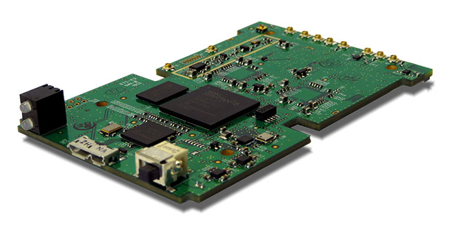
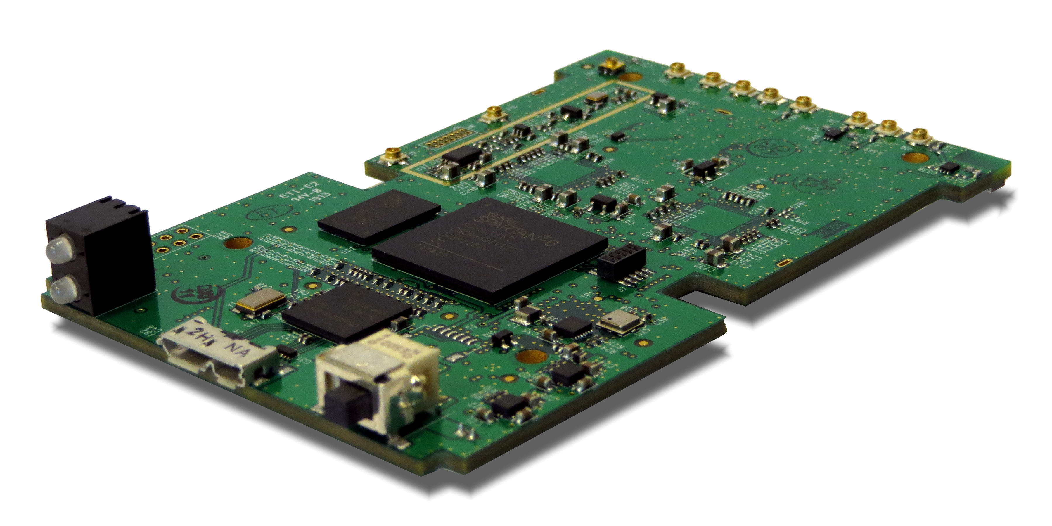
Loctronix Corporation, a provider of unified positioning solutions for GNSS-challenged environments, is making available its new software-defined radio (SDR) module, the ASR-2300, for developing high-performance positioning, navigation and timing, and communication applications.
The ASR-2300 will be on display September 16-19 at the Institute of Navigation annual meeting, ION GNSS+ 2013, in Nashville, Tennessee.
“The ASR-2300 delivers advanced SDR capabilities in a small, mobile form-factor enabling developers to readily create and field complex SDR-based solutions. The module moves SDR out of the lab and into production, providing the critical piece for tapping advanced, multi-sensor/signals of opportunity for high-performance PNT,” stated Michael Mathews, Loctronix’ CEO and founder.
According to Mathews, “The ASR-2300 is unique amongst the growing number of SDRs, having multiple, fully-integrated RF paths supporting reception of GNSS, cellular, ISM band, and UHF signals of opportunity. The ASR-2300 will benefit SDR developers working on demanding scientific, military, aerospace and commercial/industrial applications.”
The ASR-2300 is a multiple-input and multiple-output (MIMO) transceiver module incorporating two wideband Field Programmable RF (FPRF) transceivers (300 MHz to 3.8 GHz) from Lime Microsystems, 10-axis accelerometer/gyro/compass/barometer sensors, and a large programmable FPGA capable of over 300 MiB/sec sustained communications with a host processor via USB 3.0 interface. The module’s nine integrated RF path options and low size, weight, and power characteristics contribute to ease of integration and portability. Accommodating both internal 1 PPM TCXO or external frequency reference, multiple ASR-2300s can be inter-connected via an expansion port and/or UART interface, supporting real-time reception / transmission of 4, 6, 8 or more signals without the need for significant additional hardware.
With on-board flash for storing developer customizable firmware and FPGA logic, the ASR-2300 can be configured to operate in a variety of different power profiles, maximizing battery life without requiring a host processor. The modules will be factory-programmed with only the RF receiver capabilities enabled. Developers can enable transmit functionality by modifying the firmware and waveforms.
The A2300 Open Source Project at Myriad RF
To encourage innovation in PNT and communications applications, Loctronix has partnered with Lime Microsystems to provide the source materials for the ASR-2300 module under open source licensing at the Myriad RF project.
“The broad utility of the ASR-2300 makes it an ideal platform for prototyping and developing advanced applications in the communications and PNT markets. Developers can make their own boards using the documents and design database contained in the A2300 project and/or purchase hardware, development kits, support services, and licensed waveforms directly from Loctronix,” Mathews said.
“Encouraging collaboration between the open source community and industry is a natural way to promote innovation and accelerate growth of SDR technology. We are delighted to partner with Loctronix to make their innovative ASR-2300 SDR design available to open source developers for creating advanced SDR applications,” said Lime Microsystems CEO Ebrahim Bushehri, Ph.D.
The open-source software package includes basic drivers for Linux and Windows environments enabling both GNU Radio and embedded C/C++ developers to interface with the ASR-2300 module. Developers can obtain source code and design documents for modifying the ASR-2300 to suit their own applications.
The ASR-2300 will be available from Loctronix this November. Adaptors, antennas, and a housing kit will also be available that provide a variety of configuration options supporting bench-top testing to wearable, battery-operated field demonstrations.
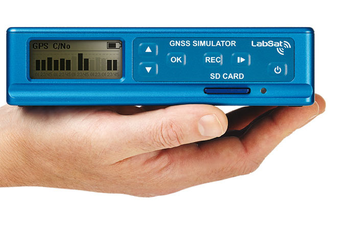
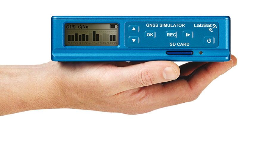
LabSat, the GPS record, replay, and simulation brand produced by Racelogic in the UK, is about to be augmented with the introduction of LabSat3.
The key feature of the new product is its simplicity. It is, essentially, a single-box device that incorporates a GPS record-and-replay system without the need for a laptop or PC. Racelogic has designed the LabSat3 with convenience at its core: it is small and light, allowing users to record GPS signals in any situation, the company said. It will also come with a pre-recorded library of worldwide scenarios to allow engineers to perform immediate bench testing.
The new LabSat is able to record signals from GPS, GLONASS, Galileo, BeiDou, QZSS, and SBAS, with the top of the range models able to output two channels simultaneously. Both the recording and replay procedures are simple one-touch operations, with data being logged to an SD card.
LabSat3 is compatible with scenarios generated with SatGen software for those that wish to create full simulations. Ethernet connectivity extends its potential to end-of-line testing where multiple units can be remotely controlled, with potentially large savings in production line testing times.
LabSat3 is set to be launched at the ION GNSS+ exhibition in Nashville next week. Prices will start at $4,400. For further details, visit the LabSat website.
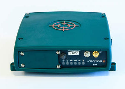
Veripos, supplier of high-precision GNSS positioning services to the offshore industry, has extended its range of integrated mobile receiver units with introduction of a multi-frequency system featuring GNSS heading, L-band positioning and wireless communication capabilities, the LD7.
Typical use is for the provision of high accuracy heading output combined with high accuracy positioning data for vessel systems.
Compatible with both GPS and GLONASS networks, the fully ruggedized 272-channel system includes an additional processor for on-board configuration and customized applications separate from its GNSS engine. Integral wireless options include Bluetooth for simple configuration in addition to an optional full-band UHF radio modem for transmission and reception of RTCM or RTK corrections.
With 2GB internal memory and provision for remote Ethernet access, the LD7 also features an extended range of interface facilities for data output, timing and event marks in addition to a second antenna port for GNSS heading.
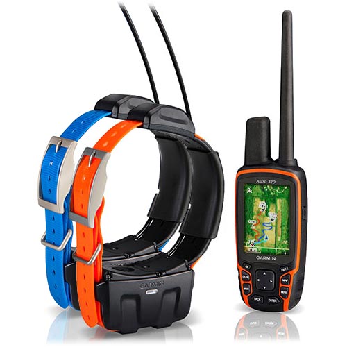
Garmin International Inc. now offers the DC 50 – a new and improved GPS dog tracking collar that’s even more robust and reliable than previous models.
“From more reliable satellite reception to a more rugged design, the new DC 50 gives sporting dog owners what they’ve been asking for,” said Dan Bartel, Garmin’s vice president of worldwide sales. “The new DC 50 has the features that will bring the benefits of GPS tracking to first-time users, and will convince existing Astro customers to upgrade.”
The DC 50’s main housing sits below the dog’s neck while a low-profile, high-sensitivity GPS antenna is now positioned atop the dog’s neck, providing a clearer view of satellites. In addition to tracking GPS satellites, the DC 50 can also utilize the GLONASS system. When using GLONASS satellites, acquisition time is (on average) approximately 20 percent faster than using GPS. And when using both GPS and GLONASS together, the receiver has the ability to lock on to 24 more satellites than when using GPS alone. In practical terms, that means sporting dog owners will spend less time waiting for the collar to acquire satellites before the hunt, and the collar will better maintain its location even in heavy cover and deep canyons during the hunt.
The Garmin Astro 320 GPS tracking device with two DC-50 collars.
The newly redesigned 22.5-inch long VHF antenna is made of braided steel that’s built to take any punishment that hard-charging dogs can deliver. Hunters can track their dogs up to nine miles in flat, unobstructed ground as often as every five seconds. A shorter 18.5-inch antenna is also included.
The battery life of the DC 50 has improved over previous generations, too. At a five second update rate, the DC 50 will get approximately 26 hours of battery life when fully charged. By slowing the update rate down to once every two minutes, the DC 50 collar can get up to 54 hours of use. As a safety feature, the DC 50 also has a selectable Dog Rescue mode, which automatically switches the DC 50 to a two minute update rate when the battery is less than 25 percent charged – making it easier to recover a lost dog.
For houndsmen, the DC 50 also features built-in Bark Detection, which alerts a hunter when their dog is barking frequently, even out of earshot. Users can customize the Bark Detection feature to adjust the frequency of barking and the manner in which the user is notified (visual, tone, vibration, or a combination of each).
The DC 50 features a standard one inch coated polyurethane collar strap that can be swapped out for a different color to easily distinguish between multiple dogs. The collar transmitter is waterproof to 10 meters (33 feet). Shipped alone, the DC 50 features a blue collar, and when purchased in conjunction with an Astro 320, the collar strap is orange.
When paired with the Astro 320, the system can track up to ten dogs per receiver at once, and will indicate the dog’s distance, direction, and status (sitting, running, pointing, or treeing). The Astro 320 features a full color, sunlight readable display with a pre-installed basemap. In addition to the pre-installed basemap, the Astro can be loaded with optional 100k Topo or 24k Topo maps or photorealistic BirdsEye Satellite Imagery. Many third-party specially-designed hunting maps are also available.
The DC 50 is compatible with Astro 320 handhelds that are currently in service, but users must download a free software update to their handheld before pairing the new collar, by visiting www.garmin.com/webupdater. The DC 50 is not compatible with the Astro 220 handheld or the Alpha Track and Train system.
Purchased alone, the DC 50 has a minimum retail price of $229.99, and the DC 50 bundled with the Astro 320 system has an MRP of $599.99.
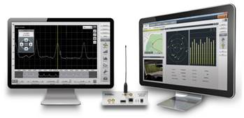
Averna, developer of test solutions and services for communications and electronics device-makers worldwide, now offers RF Studio for National Instruments Software Defined Radio Platform (USRP), converting the USRP into a portable and cost-effective RF system for the recording and playback of real-world GNSS signals.
National Instruments USRP is an affordable, PC-hosted platform used with NI LabVIEW system design software to build powerful wireless communications systems for research and education, Averna said. RF Studio is Averna’s proprietary software platform designed to streamline work with real-world RF signals. It provides user-friendly modules for capturing, processing, analyzing, archiving, and playing back RF spectrum while also maintaining the signal-recording context.
Working together, Averna and National Instruments teams developed RF Studio for the USRP, an innovative and portable solution to record and play back live RF environments to accelerate RF project work. RF Studio’s LabVIEW compatible plug-in support delivers great value to LabVIEW users as it gives them quick access to a rich toolset for their in-house applications, and supports additional capture sources and customized views.
“RF Studio for the USRP is the only cost-effective and portable product on the market that offers the flexibility to cover a wide variety of use cases, thus making it a very competitive solution for general-purpose RF record and playback,” commented Brendan Wolfe, Director of Market Development for Averna. “We’ve been working very closely with the NI teams to bring this innovative solution to market, and we expect great success from this solution partnership.”
RF Studio for the USRP offers these features:
· Record and play back real-world RF signals, up to 40 MHz wide
· Capture actual RF spectrum like FM, DAB, GPS, GLONASS, and cellular
· Visualize and record weak signals with the Noise Figure view
· Advance signal analysis with the Spectrum, Histogram, and Power views
· Use simple RF-chain configuration tools to quickly detect and set up the recording environment
· DriveView option: Log video, audio and NMEA data at the same time as recording RF
“The combination of RF Studio and the USRP provides a flexible, affordable solution for RF record and playback. Now in addition to prototyping wireless communications systems in LabVIEW, users can test them by reproducing realistic RF environments in the lab,” said Erik Luther, Wireless Communications Group Manager for National Instruments.
RF Studio for the USRP is available now to customers worldwide through National Instruments’ LabVIEW Tools Network.
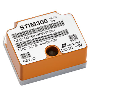
NovAtel has added Sensonor’s commercially exportable OEM-IMU-STIM300 to its SPAN GNSS + INS line of positioning products. The OEM-IMU-STIM300 is a Micro Electromechanical System (MEMS) Inertial Measurement Unit (IMU) that integrates with NovAtel’s OEM6 receiver technology to provide a powerful 3D continuous position, velocity and attitude solution, the company said.
The distinguishing characteristic of the OEM-IMU-STIM300 is its small form factor with tactical-grade performance capabilities. “As an OEM supplier, our customers come to us with a wide range of application demands. The addition of the OEM-IMU-STIM300 to our SPAN portfolio enables us to provide a cost-effective solution for weight and space constrained environments without having to compromise performance in any way,” said Jason Hamilton, NovAtel director of marketing.
NovAtel’s proprietary MEMS Interface Card (MIC) integrates the OEM-IMU-STIM300 with NovAtel’s OEM6 receiver products for full SPAN navigation capabilities. The product will be available as an integrated single-enclosure SPAN solution (SPAN-IGM-S1), enclosed standalone IMU (IMU-IGM-S1) for use with external SPAN-enabled receivers, and as an OEM component (OEM-IMU-STIM300).
OEM-IMU-STIM300 is available for delivery in September, followed by SPAN-IGM-S1 and IMU-IGM-S1 in November 2013.
GPSTrackit’s Fleet Manager Software now features an Analytics Dashboard that enables fleet managers to monitor and review fleet performance by reviewing historical data in a series of charts and graphs. Fleet Manager is a robust application providing fleet owners and managers with a comprehensive suite of integrated tools, GPSTrackIt said. The system delivers real-time GPS vehicle tracking, vehicle maintenance scheduling, and a wide range of alerts. The Analytics Dashboard brings to the system a new array of powerful and flexible capabilities.
“It puts the information fleet managers and owners need at their fingertips,” said Eddie Bermudez, GPSTrackIt’s product manager. “We already provide all the historical data via the reports system. This new feature brings that data to life with dynamic graphics.”
The dashboard displays up to six charts, which can be configured as bar charts or pie charts. Each chart can focus on particular issues important to fleet owners, managers and dispatchers: Idle Time, Drive Time, Stop Time, Speeding and Mileage.
“The charts can be configured to show data for all units or a single group,” explained Bermudez. “Or a chart can compare groups by displaying their data side-by-side using different colors.”
In addition, three composite charts are available; Engine Time, which monitors idle time and driving time; Driving Overview, which monitors idle time and driving time and stop time; Idle Stop, which monitors idle time and stop time. The time metric determines which historical data is used. Options available are week, month, quarter, and year.
“Charts can be rearranged on the dashboard by dragging and dropping,” added Bermudez. “And there are several additional options that can be configured. Chart labels of up to 25 characters can be added. The start of day can be set to any of the 24 hours. For bar charts, the average value can be shown superimposed on the graph.”
Bermudez continues, “The Analytics Dashboard can also display the highest or lowest values for a given graph. This can be configured to show values from one to 20. Selecting Highest and a numerical value of five on an Idle Time chart, for example, displays the five vehicles with the highest values for idle time.”
“This is important for fleet managers to know because of added fuel consumption, as well as vehicle wear,” according to Bermudez. ”Selecting Lowest and a numerical value of ten on a Speeding chart shows the ten vehicles with the lowest incidence of speeding.”
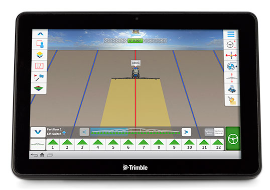
Trimble has launched the Connected Farm dashboard, which provides one centralized location for farmers to view key information impacting their operations. With this information, farmers will be able to make better daily decisions based on the latest data. The Connected Farm dashboard is customizable and accessible via Internet-enabled devices such as desktop and notebook personal computers, smartphones and tablets, and Trimble’s new TMX-2050 display.
Trimble TMX-2050 display.
The TMX-2050 display is a next-generation display built on the Android operating system. It offers an intuitive interface that enables farmers to easily implement precision agriculture solutions as their business grows. Its flexible software platform improves the ability for a customer to seamlessly add applications to their operations while the modular architecture allows for future expandability.
The TMX-2050 display is an addition to Trimble’s existing line of guidance displays, which include the EZ-Guide 250 lightbar guidance system, CFX-750 display, and FmX integrated display.
The Connected Farm dashboard will allow farmers to:
Check daily rainfall totals for each virtual rain gauge—without the use of physical rain gauges. (Made possible by Trimble’s acquisition of RainWave’s assets). This will allow a farmer to reprogram his irrigation system based on the previous evening’s rainfall, optimizing the use of water.
View the weather forecast weekly, daily, or hourly for a given location including temperature, humidity, chance of precipitation and wind speed. For example, wind speed will allow a farmer to plan when to spray a given field.
Set up a Doppler radar map to show upcoming weather patterns for their area. This will allow a farmer to assess in real time whether or not to continue with a current activity.
Check the latest commodity prices. Farmers will be able to select the commodities that matter to them and list them based on personal priority.
View farming operations data. For example, if the farmer is viewing yesterday’s planting activities, the dashboard may show population, singulation, skips and doubles.
Monitor a fleet by tracking the location and status of vehicles and receive geo-fence and curfew alerts. Farmers also can link through to Trimble’s new Connected Farm fleet app to add landmarks or for turn-by-turn directions to locate vehicles from their current position, and view historical positions.
View a boundaries map created with Trimble’s Connected Farm scout app.
Following the completion of the recently announced IQ Irrigation asset acquisition, irrigation pivot data is expected to be available on the Connected Farm dashboard in New Zealand in the fourth quarter of 2013 and the U.S. in the first half of 2014.
“With the Connected Farm dashboard, farmers can quickly see a snapshot view of their latest field operation as well as key information that may impact today’s activities such as rainfall, commodities, and the day’s weather forecast,” said Joe Denniston, vice president for Trimble’s Agriculture Division. “With this information available in one convenient central location through Connected Farm, farmers can access the information they need to make the best daily decisions about their farm. Since the dashboard can be accessed from Internet-enabled devices, farmers can make these decisions from potentially any location at any time.”
The Connected Farm dashboard is a free web portal and is currently available. To view rainfall totals, monitor pivot irrigators (when available), or for fleet management, customers will need to purchase these services.
On August 27, Trimble acquired the assets of privately-held RainWave, LLC and Hydro-Engineering Solutions, LLC of Auburn, Alabama. The acquisitions will help to extend the monitoring and reporting capabilities of Trimble’s Connected Farm solution and strengthen its water management expertise. Financial terms were not disclosed.
RainWave provides precipitation monitoring services for agribusiness, construction and engineering, government and consumer industries. RainWave will be part of the Connected Farm solution, which simplifies and integrates operations management by providing information exchange across the entire farm. This RainWave service will provide farmers across the U.S. with vital rainfall data they can use to better manage their crop production.
Using RainWave, farmers can set up a virtual rain gauge by entering GPS coordinates for identified locations to receive a rainfall report for those locations. Since on-site rain gauges are not needed, farmers no longer need to monitor dispersed gauges or manually track precipitation. The farmer will now be able to obtain this rainfall information through their Connected Farm dashboard. RainWave’s convenient, accurate rainfall information allows farmers to make better management decisions by optimizing irrigation plans and application timing, and comparing yield against rainfall to plan for next season’s crop. This results in savings of time and water usage.
Hydro-Engineering Solutions is a civil engineering company that specializes in hydrology and hydraulics. The company provides high-quality engineering services to federal, state and local governments as well as commercial entities, and has extensive experience with streams and rivers. Hydro-Engineering’s expertise in hydrology and hydraulics modeling is expected to strengthen Trimble’s water management solution in watershed analysis for both drainage and irrigation.
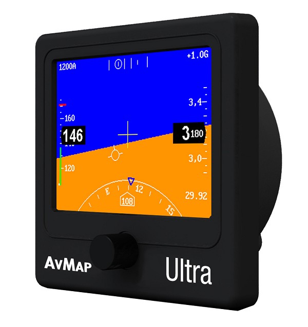
AvMap, the Italian manufacturer of GPS since 1994, presents the Ultra EFIS, a stand-alone unit providing air data, attitude, heading and altitude reference for flights.
The AvMap Ultra EFIS is a stand-alone device with a 3.5-inch ultra bright, sunlight readable LCD display. The unit is compact (1.95 inches / 49.5 millimeters installing depth) and ultra-light (5.1 oz / 145 g) compared to other products on the market (around 1 lb 9 oz / 700 g.).
Fitting in a standard 84 millimeters (3.3-inch) panel hole, the AvMap Ultra EFIS can be installed in a panel and be connected to the GPS receiver (included) and to the aircraft Pitot-static system to provide reliable and advanced ADAHRS.
Designed for light-sport, ultra light and experimental aircrafts, the AvMap Ultra EFIS contains solid-state gyros, accelerometers, magnetic field sensors, air data sensors and UAV Navigation motion processor, the outcome of more than eight years of motion and flight control experience at UAV Navigation.
“AvMap products range is extending beyond navigation to include more and more avionic tools with the objective to provide a complete AvMap Glass Cockpit system. To this purpose we are selecting the best partners in the market to work with, such as UAV Navigation,” said Simone Lazzarini, CEO at AvMap.
AvMap Ultra EFIS is the second product developed in collaboration with UAV Navigation, after the A2 ADAHRS module launched this April.
AvMap can stand alone or be integrated with EKP V. According to cockpit space availability and navigation needs, users can choose two displays or one device. The Ultra EFIS is the stand-alone solution for panel mounting; otherwise, for those who already own an EKP V, users may consider buying the A2 ADAHRS module to be used together with the cockpit docking station to complete the AvMap EFIS set. The A2 ADAHRS module extends the functionalities of the EKP V Aeronautical Navigator bringing attitude and airspeed to the moving map and converting it into a centralized Glass Cockpit System for both navigation and primary flight display.
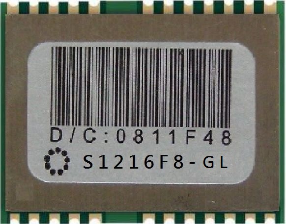
SkyTraq Technology, Inc., a fabless GNSS positioning technology company, has introduced its fast consumer-grade 50-Hz update rate S1216F8 GPS receiver module. The module supports GPS, QZSS, WAAS, EGNOS, MSAS, and GAGAN satellite signal reception. The S1216F8 receiver is based on SkyTraq’s newest 55-nm Venus 8 GPS/GNSS chipset.
The Venus 8 is a low-cost commercial GPS/GNSS chipset incorporating an IEEE-754 compliant FPU. With RISC/FPU running at 100 MHz, the S1216F8 GPS receiver module has industry leading 50-Hz update rate, very fast and accurate position/speed response, suitable for UAV, RC plane flight logging, and high-performance race car or speed boat data logging applications. When running at lower 1 Hz, 5 Hz, or 10 Hz update rate, the S1216F8 receiver can be used as a typical GPS receiver module currently available on the market.
The S1216F8 GPS receiver module measures 12mm x 16mm and consumes 26mA @ 3.3V during continuous navigation at 50-Hz update rate.
The S1216F8 is among SkyTraq’s S1216 family of form factor compatible, high-performance, low-cost GNSS modules. The S1216F8-GL GLONASS/GPS module and S1216F8-BD Beidou/GPS module both have a 20-Hz update rate.
The S1216 family of 50-Hz GPS, 20-Hz GLONASS/GPS, and 20-Hz Beidou/GPS receiver modules are in production. Datasheet, engineering sample, evaluation kit and reference design are available.