Because of circumstances following Russia’s invasion of Ukraine, Hexagon AB has made the decision to freeze all business activities in Russia. Hexagon AB is a global leader in digital reality solutions combining sensor, software and autonomous technologies.
Hexagon already suspended all exports of hardware and software licenses to Russia and is now taking further steps to adapt to the current business situation.
Given the uncertainty of the outlook, these steps are constantly under review and will be adjusted if the situation changes.
About 2 percent of Hexagon’s annual turnover can be attributed to business in Russia, with approximately 200 people employed in the country.
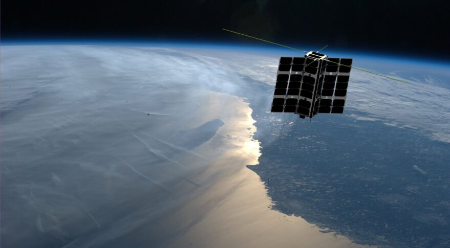
Spire Global Inc., a provider of space-based data, analytics and space services, is using its constellation of about 40 geolocation satellites to detect GPS jamming. Spire is collecting data for use by the U.S. Space Force, a particularly important task in light of Russia’s invasion of Ukraine.
“All of our fellow space companies… everyone is playing a vital role for humanity in this battle for freedom and democracy,” Spire CEO Peter Platzer told analysts March 9 in an earnings call, according to Space News.
In September 2021, Spire won a contract to supply Slingshot Aerospace with GPS telemetry data. Slingshot’s pLEO Data Exploitation and Enhanced Processing (DEEP) prototype will automate manual data exploitation techniques to deliver intuitive, easily digestible data products at low latencies for military operations.
The DEEP prototype contract is funded through the the Commercially Augmented Space Inter-Networked Operations (CASINO) program of the Space Systems Command (SSC), which develops and demonstrates the military utility of proliferated LEO satellite architectures.
Identifying and mitigating ground-based radio-frequency (RF) and GPS interferences is a critical component of national security and U.S. Space Force operations. RF signals intercepted in open airspace are liabilities that directly threaten on-orbit space assets and military missions.
Even in the absence of enemy interference and intentional jamming, RF signals from radio stations, cell phones, and various electronics cause interruptions and interferences — a problem exacerbated by the growth of modern communications technology.
The DEEP prototype is an effort by the U.S. military to take advantage of existing commercial satellite telemetry data to readily identify these sources of interference and correct any potential problems before they become a threat.
Spire’s cubesats use GPS radio occultation, a remote sensing technique that measures properties of the Earth’s atmosphere from space.
Jack Dangermond, co-founder and president of geographic information system (GIS) giant Esri, told his customers on March 10 that he is “shocked and distressed by the grim circumstances in Ukraine.” Consequently, he announced, Esri and its distributor Esri CIS have stopped all their sales to Russia and Belarus. The company is also supporting several organizations across Europe “in their humanitarian and military efforts in support of the Ukrainian government and its people.”
“The invasion of Ukraine is a devastating chapter in our history,” Dangermond continued. “We have heard from so many members of our GIS community who, like us, stand with the Ukrainian people. Make no mistake, this is a daunting moment that will demand strength, compassion, and resolve from all of us.”
In the current context of the Russian invasion of Ukraine, the issue of GNSS jamming and/or possible spoofing has intensified in geographical areas surrounding the conflict zone and other areas, according to the European Union Aviation Safety Agency (EASA). The agency issued a safety information bulletin on March 17 warning of a GNSS outage leading to navigation / surveillance degradation. According to the bulletin, which was directed at national aviation authorities and airlines, reports analyzed by EASA indicate that since February 24 GNSS spoofing and/or jamming has intensified in four key geographical areas:
the Kaliningrad region, surrounding Baltic Sea and neighboring states
Eastern Finland
the Black Sea and
the Eastern Mediterranean area near Cyprus, Turkey, Lebanon, Syria and Israel, as well as Northern Iraq.
“The effects of GNSS jamming and/or possible spoofing,” the bulletin stated, “were observed by aircraft in various phases of their flights, in certain cases leading to re-routing or even to change the destination due to the inability to perform a safe landing procedure.” It pointed out that in the present conditions it is not possible to predict these outages and their effects. Potential issues include:
loss of ability to use GNSS for waypoint navigation
loss of area navigation (RNAV) approach capability
inability to conduct or maintain various operations
triggering of terrain warnings, possibly with pull-up command and
inconsistent aircraft position on the navigation display
loss of automatic dependent surveillance-broadcast (ADS-B), wind shear, terrain and surface functionalities
failure or degradation of ATM/ANS/CNS and aircraft systems that use GNSS as a time reference and
airspace infringements and/or route deviations due to GNSS degradation.
The bulletin also offers several recommendations to airlines for mitigating these issues.
Last month we attempted to provide an overview of the issue concerning Federal Communication Commission’s (FCC) licensing of C-Band radio spectrum, the subsequent fielding of wireless service for 5G phones and the Federal Aviation Administration’s (FAA) announcements that potential interference could be possible between 5G signals and C-Band radio altimeters on commercial aircraft.
Not a big deal most people might say, as faster and improved phone and data messaging on their smartphones begins to kick in, while wireless companies continue roll-out of the new 5G service. But wait – don’t some of these people fly out on vacation and then back and land at local airports, and many of us fly around the US to visit friends and family, or each week shuttle around the country doing fly-in/fly-out business?
Well FAA and the wireless companies have largely collaborated during 5G service roll-out, and the FAA has been rapidly clearing a good number of rad-alt (radio altimeter) equipped aircraft to continue regular operations into most airports. And it seems that wireless companies have limited 5G fielding around some US airports by reducing transmitted power and/or limiting the density of 5G towers.
But where are we now? Seems some aircraft equipped with some types of rad-alt can fly into some airports – the FAA published a list for aircraft operators and pilots identifying who can do what and where. They also published several ADs (Airworthiness Directives) which limit several aircraft types from flying into certain airports, ‘prohibiting certain operations, which require radioaltimeter data to land in low visibility conditions, when in the presence of 5G C-Band interference’. For any aircraft passengers flying into LaGuardia on a foggy day or Boston when ice-fog hangs in the air – low visibility landing capability on modern aircraft is a blessing and a wonder which allows us to travel, even in bad conditions.
Seems that, typically – ‘many systems on (XY Type) aircraft rely on the radio altimeter, including autothrottle, ground proximity warning, thrust reversers and Traffic Collision Avoidance System,’ says one recent FAA AD.
That’s a whole bunch of critical systems which help an aircraft land. Many experts over many years have spent whole careers supporting the process of developing safety systems for auto-land and those which assist in the manual landing of aircraft. And the FAA and other agencies around the world have made every manufacturer prove and prove again that these systems work and work extremely, reliably, well.
Not that I’m against 5G – I have a 5G phone and I’m eagerly waiting for 5G applications to use on my phone. – the service seems to be very fast when in an area where 5G has been fielded. There are some wireless companies who have decided that 5G can by-pass cable in the distribution of TV channels – this is good stuff! Let’s have more of it!
But why on earth do we need to even partially compromise any aircraft systems which safely land aircraft?
Japan and France have been cited as counties in which 5G has not had any impact on the very same aircraft and their operations with which the FAA has found problems. Well, except those countries seem to have taken steps in the fielding of 5G which have protected their aircraft operations. The FAA quotes several mitigations used in those countries:
• Lower power levels
• Antennas adjusted to reduce potential interference to flights
• Different placement of antennas relative to airfields
• Frequencies with a different proximity to frequencies used by aviation equipment
Let’s hope that FAA’s intense efforts to test and clear rad-alts under the simulated intensity of C-Band interference around airports will continue unabated and that soon we aviation nuts will begin to breath more easily.
And let’s hope that the wireless companies cooperation, acceptance and mitigation steps – for which the whole aviation community is extremely grateful – that these very positive steps will directly lead to the whole issue fading away over time as old news.
And then a few words about ‘the war‘ which Russia just began against its neighbor and previous member of the USSR – Ukraine has been independent from Russia since the USSR ‘dissolved’ (Wikipedia) in 1991.
Ukrainians are pretty resilient and the news today is that a woman in Kyiv brought down a Russian drone by throwing a jar of pickles at it from her (high-rise?) balcony. This story of course isn’t verified, but it’s a small lightness in a very grim situation.
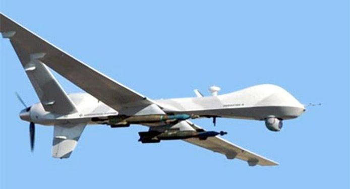
General Atomics armed MQ-9 Reaper (Militaryanalizer.com)
And its reported that Poland just placed an urgent operational requirement for armed MQ-9 Reapers in order to better protect its Eastern border with Ukraine. The border is around 530 miles long and is the main crossing point for the thousands of refugees fleeing the Russian onslaught. Poland has apparently already taken in almost a million people seeking safety.
Drones are now part of modern warfare and both East and West have pretty sophisticated, capable, weapon-carrying unmanned aircraft. But they also usually carry highly accurate satellite navigation and laser-guided weapons which may minimize unintended casualties – unless casualties are exactly what the Russians are after.
Really sad state of affairs which we all may still follow in detail through news reports, even though Russia has completely shut down social media and virtually outlawed on-the-ground news reporting.
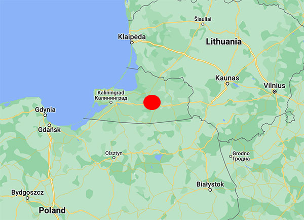
No cause for the abnormalities has been determined, but the vicinity to the Russian border during the Ukraine war seems to indicate intentional interference. In particular, interference occurs near the Russian province of Kaliningrad situated between Lithuania and Poland, both NATO members.
An aircraft operated by Lithuanian carrier Transaviabaltika has been unable to fly from Tallinn to Savonlinna for three days.
Traficom, the Finnish Transport and Communications Agency, has received numerous occurrence reports regarding GPS signal interference observed by aircraft. The interference began during the weekend and is still continuing.
On Tuesday, several aircraft reported GPS signal interference in the region around Mikkeli, Jyväskylä and Kuopio. An aircraft operated by Lithuanian carrier Transaviabaltika has been unable to fly from Tallinn to Savonlinna for three days.
Kaliningrad is the capital of the Russian province of the same name, sandwiched between Poland and Lithuania along the Baltic Coast. (Map: Google)
After receiving reports about GPS interference, Traficom on Monday requested Fintraffic Air Navigation Services Ltd (Fintraffic ANS) to issue a Notice to Airmen for pilots flying in the area.
“Flying is still safe. Airlines have procedures they follow if the GPS signal is lost,” said Director Jari Pöntinen. “Aircraft can use other systems to navigate and land safely. Air traffic control supports aircraft pilots with the help of other landing systems.” For final approach, traditional approach systems do not require a GPS signal.
Airlines make their own decisions on whether they can operate in an area where there is known to be interference to the GPS signal.
Traficom does not know what is causing the interference, but stated it will continue to monitor the situation and gather more information on the matter.
Ukraine’s hacker underground named GLONASS as one of its top priorities, according to media reports that cite a post on the “IT army” Telegram channel.
The IT army, formed on Saturday, is a collective of volunteer hackers. “We need to mobilize and intensify our efforts as much as possible,” the IT army posted.
Besides GLONASS, hackers are focusing on Russian telecom companies and the railway network in Belarus — a key staging area for Russia’s invasion of Ukraine.
The Belarusian Cyber Partisans, a hacking team focused on Belarus, told Reuters it had disabled railway traffic systems in Belarus. Another target is the electrical grid.
U.S. forces have detected Russian jamming of GPS signals in the Ukraine region, according to Breaking Defense. But Pentagon officials say the jamming has not affected U.S. support operations.
U.S. reconnaissance aircraft have detected jamming over the Black Sea, but when asked about Russian jamming, a U.S. Space Command spokesperson told Breaking Defense, “There are no impacts to U.S. and Allied forces in Europe at this time.”
Russia’s space agency Roscosmos is suspending cooperation with Europe on space launches from the Kourou spaceport in French Guiana, including future Galileo satellite launches.
As reported by Rueters, Roscosmos chief Dmitry Rogozin said Saturday the action is in response to Western sanctions over Russia’s invasion of Ukraine.
“In response to EU sanctions against our companies, Roscosmos is suspending cooperation with European partners on space launches from Kourou, and is withdrawing its technical staff…from French Guiana,” Rogozin said in a post on his Telegram channel.
Russia’s decision will have “no consequences on the continuity and quality of Galileo and Copernicus services,” EU Commissioner Thierry Breton said in a statement. “This decision does not call into question the continuity of the development of these infrastructures either.”
“We are also ready to act with determination, together with the Member States, to protect these critical infrastructures in the event of an attack.”
“We will, in due course, take all the necessary decisions in response and resolutely pursue the development of the second generation of these two sovereign space infrastructures of the Union,” Breton said. “We are also prepared to act determinedly together with the member states to protect these critical infrastructures in case of an attack, and to continue the development of Ariane 6 and VegaC to guarantee the strategic autonomy with regard to carrier rockets.”
The Galileo program had already planned to shift to using Ariane 6 rockets for satellite launches. The launcher is undergoing the final stages of development, led by prime contractor ArianeGroup.
From 2023 onward, the remaining Galileo Batch 3 satellites will be launched with the new Ariane 62 launch vehicle, a variant of Ariane 6 with two strap-on solid boosters.
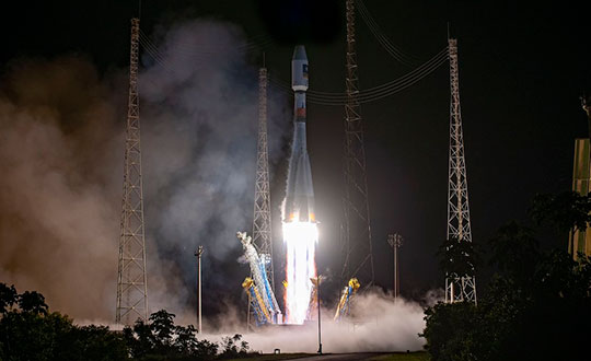
The most recent Galileo satellite launch took place on Dec. 5, 2021, using Soyuz launcher VS-26 to carry the first pair of Galileo Batch 3 satellites into orbit. The announcement will delay a Soyuz launch of two more Galileo satellites scheduled for April from French Guiana; a third pair of Galileo satellites was scheduled to launch in autumn on another Soyuz.
Galileo launch 11 from Europe’s spaceport in French Guyana. (Photo: ESA/CNES/Arianespace)
Russia’s military could target GPS and communication satellites as part of its war in Ukraine, reports Space News.
The news outlet cites U.S. National Reconnaissance Office (NRO) Director Christopher Scolese speaking Feb. 23 at the National Security Space Association’s Defense and Intelligence Space Conference.
“I think we’re seeing pretty clearly that Russia is committed to doing what they want to do in Ukraine, and they want to win,” Scolese said. “So I think it’s fair to assume that, to the extent that they can, and to the extent that they feel it won’t extend the conflict out of their control, that they will extend it into space.”
An attempt to disrupt the United States’ space ability could affect satellites of private operators as well, such as Maxar, which is distributing imagery of the conflict.
A next-generation GPS III satellite on orbit. (Artist’s Rendering: Lockheed Martin)
In mid-November, Russia destroyed a retired satellite with a ground-based anti-satellite (ASAT) weapon. This created significant debris, which endangered other assets in low-Earth orbit, including the International Space Station (ISS). Two Russian cosmonauts were serving on the seven-person ISS crew at the time.
Based on the ASAT demonstration and unclassified reports from the U.S. Director of National Intelligence, it is pretty clear that Russia can destroy all, or at least most, GPS satellites in one go.
What is less clear, is whether Russia would really do that.
To find out, Dana A. Goward spoke with George Beebe, who once served as the Central Intelligence Agency’s top analyst for Russia and Eastern Europe. He is now the director of programs at the Center for the National Interest, a center-right think tank.
Dana A. Goward: Russia’s threat to destroy GPS was made shortly after they destroyed an old satellite in space. What do you make of that demonstration, and all the dangerous debris it created?
George Beebe: Well, they were clearly sending a message — several messages, in fact. First, of course, that they have the ability to destroy satellites in space. This is part of a larger narrative they want to tell — that they are a world power which must be reckoned with. And it is no coincidence that this was done while they were amassing troops along Ukraine’s borders.
Another message is that they know the U.S. and Europe are very dependent on space, and we are vulnerable there.
DG: But the space debris will threaten satellites and people in low-Earth orbit for years to come. That seems to be reckless and counter to their own interest.
GB: While others see that as reckless and irresponsible, Russian officials almost certainly see it as an expression of resolve. That was actually another message. They were saying, “We are willing to endanger our own equipment and people.”
Translate that to their concern about keeping Ukraine from joining NATO and otherwise falling into the West’s sphere of influence. It might be, “We are willing to accept the pain in order to keep Ukraine from leaving our orbit.”
Unfortunately, I am not sure most Western leaders picked up on the “We are resolved” message.
DG: Attacking GPS would be a huge, devastating and dangerous move, though. How could things get so bad they would do that?
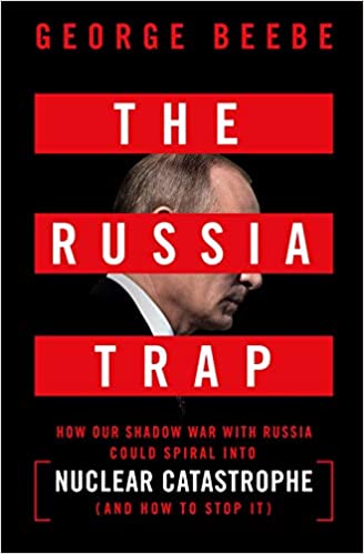
Beebe is the author of The Russia Trap. (Cover: Thomas Dunne Books)
GB: Russia sincerely believes it is generally threatened by the West, and specifically by NATO.
Since the fall of the Soviet Union, they have seen their global influence recede, and Western influence on their borders greatly expand. Some of their neighbors have joined NATO. Others, like Ukraine, have not, but would like to eventually come under the NATO umbrella. For the Kremlin, this is unacceptable. It is akin to what Soviet missiles in Cuba were for the United States.
Over the last decade and a half, Putin has rebuilt the Russian military. He is now looking to draw lines in the sand for the West to not cross.
At the same time, the West feels threatened by Russia. Hitler’s aggression and refusal to be appeased by territorial concessions is standard reading in every Western history class. American and European leaders feel compelled to hold the line and not give into what they see as Putin’s territorial ambitions.
This is a very dangerous situation as both sides see themselves acting defensively and the other acting aggressively.
DG: I guess it is much easier to justify something to yourself and your compatriots if you think you are only acting in self-defense.
GB: Exactly. The problem comes when one side does something in self-defense and, in response, the other side feels compelled to do something as well. This can spawn an escalating tit-for-tat that spirals out of control into a bigger conflict no one wants.
DG: The West is imposing economic sanctions. At least that is harder to interpret as aggressive.
GB: Before World War II, the U.S. imposed severe economic sanctions on Japan in response to its expansionist moves in Asia. The sanctions were so severe that they were crippling and threatened to bring down Japan’s military government. The week before Pearl Harbor, the Japanese delivered a diplomatic note to the United States saying the sanctions amounted to an act of war. So, economic sanctions are not always an absolutely safe route.
DG: Do you think Russia would ever really attack GPS? And how might that go down?
GB: It depends on how backed into a corner they feel. They certainly know that our military and our homeland are very dependent on GPS, and we have no real alternative in place. It doesn’t help that they are much less dependent on GLONASS and have an alternative for when signals from space are not available.
So, they can definitely do more harm to us than we can to them by interfering with navigation satellites.
It would take a lot to goad them into physically attacking GPS satellites. That would be an irreversible step they undoubtedly understand could lead to all-out war.
Far more likely would be a cyber-attack on the systems controlling the GPS constellation. Such an attack could be harder to attribute to them. It could also be reversed if they got what they wanted.
I could also see them jamming GPS and Galileo signals across Europe and the United States as part of an escalated conflict. Russian forces excel at electronic warfare, and the jamming could easily be turned off once they achieved their goals, or if things seemed to be getting out of hand.
Photo: Stanislav Ostranitsa/iStock/Getty Images Plus/Getty Images
A new platform will detect and characterize GNSS spoofing operations using artificial intelligence and commercially available data
Geospatial intelligence company Orbital Insight has been awarded a contract from the U.S. Department of Defense (DoD) to deliver a technology platform for identifying intentional GNSS interference and manipulation operations across the world.
The platform will leverage commercially available data to detect GNSS spoofing, where falsified or manipulated GNSS signals are used to confuse adversaries or obscure illicit activities, presenting risk to both government and commercial operations. Orbital Insight was selected through DoD’s Defense Innovation Unit (DIU) solicitation process seeking commercial solutions to counter the growing threat of GNSS disruptions to national security.
Research suggests that Russia conducted nearly 10,000 spoofing operations from 2016 to 2018 alone.
The new technology will significantly improve situational awareness for warfighters, intelligence analysts and safety-of-life applications. Orbital Insight’s platform will leverage its multisensor data stack, artificial intelligence and machine-learning capabilities to alert analysts and operators to potential jamming and spoofing events, techniques commonly used by adversarial actors to cover up activities or sabotage operations.
The platform leverages a suite of geolocation data — satellites, AIS, ADS-B and internet-of-things devices — along with new advanced algorithms designed to automatically recognize anomalies linked to spoofing, complemented by research intelligence from the nonprofit partner Center for Advanced Defense Studies. Research suggests that Russia conducted nearly 10,000 spoofing operations from 2016 to 2018 alone.
“Helping organizations understand what’s happening on and to the Earth is at the heart of what Orbital Insight does, and spoofing is a national security problem that has proven challenging to solve,” said Kevin O’Brien, CEO, Orbital Insight. “GNSS spoofing is essentially a data problem, and Orbital Insight’s AI and deep data stack can help identify spoofing, along with other major humanitarian and environmental challenges. This is a perfect example of private and public sectors uniting through technology.”
Other areas that may be addressed: identifying drug trafficking, illegal fishing, sea-borne piracy and unintentional commercial aviation disruptions
The technology has broad implications that extend beyond situational awareness of intentional GNSS interference. Other national security, humanitarian and environmental challenges may be addressed, such as identifying drug trafficking, illegal fishing, sea-borne piracy and unintentional commercial aviation disruptions.
Federal agencies are increasingly complementing their systems with commercial technology and data sources that are unclassified, universally accessible, and shareable with allies. The National Air and Space Intelligence Center will be the first customer to utilize the technology. Upon successful integration, the goal will be to expand this platform widely across the defense, intelligence and civil communities.
Orbital Insight received the DoD contract on the heels of announcing a Phase II Small Business Innovation Research contract from the National Geospatial-Intelligence Agency to deliver a computer-vision model that uses synthetic data to detect novel classes of objects.
The company also recently launched a new class of multiclass object-detection algorithms within its flagship GO platform to help the intelligence community monitor and differentiate activity at thousands of areas of interest. Like all of Orbital Insight’s products, these algorithms are being developed within an ethics framework that shapes the company’s work and values privacy.
 Because of circumstances following Russia’s invasion of Ukraine, Hexagon AB has made the decision to freeze all business activities in Russia. Hexagon AB is a global leader in digital reality solutions combining sensor, software and autonomous technologies.