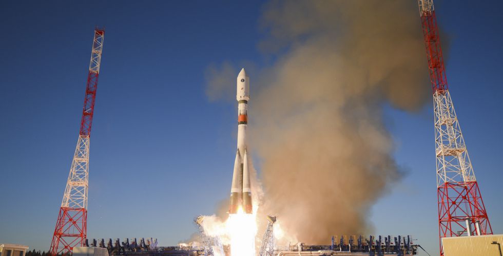
A new Glonass-M navigation satellite is now aloft, preparing to join Russia’s GLONASS constellation.
The satellite launched Dec. 11 at 11:54 Moscow time aboard a Soyuz-2.1b launch vehicle from the Plesetsk cosmodrome, the Russian Ministry of Defense’s Information and Communications Department said.
The launch was initially scheduled for December 10, but was postponed for a day for technical reasons.
Glonass-M satellites form the basis of the orbital constellation of the GLONASS system. They provide navigation information and accurate time signals to land, sea, air and space consumers.
The Ministry of Defense noted that pre-launch operations and the launch of the rocket were normal. “Means of the ground-based automated spacecraft control complex of the Russian orbital group controlled the launch and flight of the rocket,” the military department said.
The Fregat booster unit was manufactured by NPO Lavochkin (part of Roscosmos State Corporation.) The Glonass-M navigation satellite was produced by ISS Reshetnev (Reshetnev Information Satellite Systems).
Europe’s scattered monitoring of GNSS signals found almost 500,000 interference events over three years. About 59,000 were clearly intentional. European standards for resilient receivers have been published and acquisition of an interference detection network is underway.
Russia is improving its terrestrial Loran/Chayka PNT system for military use and has promised to make the upgraded service available to civilians.
China has retained its terrestrial Loran PNT system as an augmentation/backup for its BeiDou GNSS. It is also testing PNT satellites in low earth orbit (LEO) to provide more powerful and reliable signals than available from current GNSS.
In contrast to the actions of other countries, little is being done in the United States to protect civilian GPS/GNSS users.
The U.S. Department of Defense (DoD) has been very active protecting its own with GPS M-code signals and receivers. It is exploring use of LEO communications satellites and high-powered, low-frequency ground transmissions, such as Loran, to add to the GPS signals.
Yet DoD claims civilian use of GPS has limited its ability to use it as a military tool. It says it has no intention of sharing any new PNT systems with civilians.
At the same time, the 99% of GPS use in the U.S. that is non-military is arguably more important to the nation’s safety and security. GPS signals are used by every networked technology and every mode of transportation. They are so important that officials at the Department of Homeland Security have called GPS “a single point of failure for critical infrastructure.”
The U.S. military recently updated its PNT strategy, has a designated leader for its PNT efforts, and clearly defines the responsibilities of its various staffs and organizations.
Civil agency responsibilities were last updated in 2004 and are spread across more than a dozen departments, agencies, and staffs.
Most significantly, no one is in charge.
This has meant that over the past 15 years, many of the civil mandates and responsibilities to protect signals and users have gone unfulfilled. As just one example, rather than ramp up to address increases in jamming, the Federal Communications Commission has reduced its enforcement equipment and staff.
Putting someone in charge is key to reversing America’s civil PNT decline and energizing both federal and private stakeholders.
A single, empowered federal leader should be responsible, not for doing everything, but for leading and coordinating federal and other civil efforts. This would be someone to be held accountable, and to hold others accountable — an evangelist for the essentiality of these services, and their advocate at the highest levels of government.
Such a leader should be positioned outside the daily turmoil of the White House and National Security Council. They should be in the civil department with the portfolio that most depends on GPS and other PNT. The one that suffers first when GPS and other PNT are not available — the Department of Transportation (DOT).
DOT is already the federal interface with civil GPS users, and co-chairs the national PNT executive committee with DOD. A few edits to national policy and a few staff reassignments could establish a national PNT leader in DOT and make all the difference.
Regaining U.S. PNT leadership is essential to America’s future security and prosperity. We must take the first step by appointing and empowering a single federal leader to make it happen.
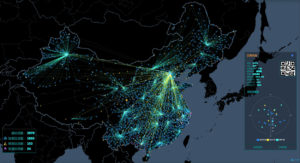
China’s National Reference Station Network. (Image: BeiDou)
A Russian law was approved July 26 that sets forth cooperation between Russia and China on using GLONASS and BeiDou for peaceful purposes.
According to the RosCosmos website, the law was approved at a meeting of the Council of Federation of the Federal Assembly of the Russian Federation. The law is officially named, “On ratification of the agreement between the Government of the Russian Federation and the Government of the People’s Republic of China on cooperation in the use of GLONASS and Beidou global navigation satellite systems for peaceful purposes.”
An intergovernmental agreement was signed on Nov. 7, 2018, in Beijing during the 23rd regular meeting of the heads of government of Russia and China. The agreement creates an institutional and legal framework for cooperation in the development and manufacture of civil navigation equipment using GLONASS and Beidou systems.
It also establishes cooperation in the development of Russian-Chinese standards for the application of navigation technologies using both systems — in particular, standards for the control and management of traffic flows across the Russian-Chinese border. The border is 4,200 kilometers (2,615.5 miles) long — world’s sixth-longest international border.
Under the agreement, the two countries plan to place in their own countries measuring stations for the other country’s GNSS, on a reciprocal basis.
Photo: Ministry of Defense of the Russian Federation
Israeli security officials publicly accused Russia of disrupting and spoofing GPS signal reception in Israeli airspace throughout the month of June. The electronic warfare at which Russia is known to be adept was reportedly traced to the Khmeimim Air Base in Syria, where Russia maintains and actively flies a large number of warplanes on behalf of the Syrian government. The base is approximately about 350 kilometers (217 miles) north of Ben Gurion, so if the accusation is true, fairly powerful equipment is behind the attack.
Both Israeli and other-nationality airline pilots have reported interruptions in GPS reception during take-off and landing at Tel Aviv’s Ben Gurion International Airport. The Israeli Airline Pilots Association labeled the interruptions a spoofing attack, causing airplane receivers to report false positions.
The International Federation of Air Line Pilots’ Associations issued a Notice to Airmen: “GPS signal loss affects RNAV arrivals and departures and may create numerous alerts for systems that rely on internal position accuracy. Flight Crews should be aware of the potential risk, avoid distractions, and plan for alternative procedures as necessary.”
Pilots have since for the most part relied on Instrument Landing System, a precision runway approach aid based on two radio beams which together with both vertical and horizontal guidance during an approach to land at Ben Gurion International Airport.
The Israeli Airports Authority stated that the GPS attacks affected only airborne crews and not terrestrial navigation systems, and that they occur only during daytime.
The Russian ambassador to Israel has denied the accusations.
In April, a U.S. research institute, the Center for Advanced Defense Studies, documented more than 10,000 separate incidents of GPS disruption on Russian soil, in northern Scandinavia and in the Middle East between February 2016 and November 2018. It said Russia was “pioneering” the technique to “protect and promote its strategic interests.” GPS World summarized the report here, stating that “The Russian Federation is growing and actively nurturing a comparative advantage in the targeted use and development of GNSS spoofing capabilities to achieve tactical and strategic objectives at home and abroad.”
Tie-in with Iran Tensions. Meanwhile the Helsinki Times reported that researchers at the Finnish Geodetic Institute noticed unusual power variations in the GPS signal on June 20 and 21: “an increase of up to 10dBHz in the carrier-to-noise ratio readings comparing with the usual daily values.” Normally the variations are between -0.5 and 0.5 dBHz.
The same findings were communicated to the research community by Peter Steigenberger, senior scientist at the German Aerospace Center, DLR:
“Based on carrier-to-noise density ratio observations (C/N0) of IGS receivers, we observed global flex power operations on June 20 and 21, 2019. Flex power started subsequently for all healthy Block IIR-M and IIF satellites on June 20 between 15:18 and 17:49 UTC. C/N0 of the P(Y)-code tracking increased by roughly 10 dB for all healthy Block IIR-M and IIF satellites whereas C/N0 of the C/A-code decreased by about 2-3 dB for the healthy IIR-M satellites only. The changes in power levels are similar to flex power mode III discussed in “Steigenberger P, Thölert S, Montenbruck O. (2019) Flex power on GPS Block IIR-M and IIF, GPS Solutions, doi:10.1007/s10291-018-0797-8″. All satellites returned to normal power levels on June 21 between 6:00 and 10:00 UTC.”
On June 20, a US military drone was downed down by Iranian missiles. On June 21 President Trump tweeted that he had called off a dawn attack on Iran that day.
Whether the spoofing affecting Israeli airspace has any connection to building tensions 1,500 kilometers to the east is unknown.
New GLONASS-K2 satellites will improve the accuracy of Russia’s satellite navigation system from 3-5 meters to less than 1 meter, said Chief Designer Mikhail Korablyov of the Joint Stock Company GLONASS, operator of the ERA-GLONASS traffic accident emergency response system, at a transport conference in Moscow in late May.
Russia plans to launch the first K2 satellite in late 2019 or early 2020. By 2030 the GLONASS constellation will consist wholly of K2 space vehicles, 24 of them.
The improved accuracy will better determine vehicle location in analyzing a traffic accident, according to Korablyov. It will not, however, be sufficient for lane-keeping and other advanced driver assistance systems, nor for more stringent autonomous driving requirements, at least according to emerging Western standards.
“There are also tasks linked with the country’s defense, there are special precision weapons, the requirements for which already make up less than a meter,” Korablyov added.
Yury Urlichich, First Deputy Director General, Roscosmos. (Photo: Roscosmos)
Numbers. Writing in the December 2018 issue of GPS World, Yury Urlichich, First Deputy Director General, Roscosmos State Space Corporation, gave a somewhat more precise figure for the new accuracy to be achieved via the K2 generation. “The new signals will allow lowering the hardware-dependent SC-user ranging error by an order of magnitude, reducing the influence of signal reflections from buildings, constructions and landscape (multipath effect), thus enabling their effective use for high-precision navigation with real-time errors below 0.1 m.
“This SC will enable navigation not only using legacy FDMA signals available for users for more than 35 years, but simultaneously with a full row of CDMA signals in all GLONASS frequency bands: L1, L2 and L3.”
Later in the same piece, Urlichich wrote “Mission Definition Requirements for Glonass-K2 define user range error to be 0.3 m, qualitatively improving GLONASS user performance.”
The new K2 satellite will transmit nine navigation signals and will weigh about 1,800 kg, twice as much the latest GLONASS-K generation, known as K1. Of the 24 currently orbiting operational satellites, only two are K1 space vehicles. The other 22 are older GLONASS-M satellites.
A Shock to the System. A bolt of lightning struck the rocket launcher for the latest GLONASS-M satellite to rise, on May 27. It did not adversely affect the bird’s journey to space, and all systems were found to be functioning properly once the satellite was released into preliminary orbit, Russian space officials said.
A new investigative report by the Russian independent media group “The Project” into luxury dachas owned by high-ranking government officials revealed that most all include GNSS jammers among their amenities. Attempts by the journalists to photograph the dachas from the air using drones were routinely foiled by jamming.
Most all nations’ military and security services have equipment that can block GPS and other satellite navigation signals over areas both large and small. Russia, though, has advanced this to a fine art which it regularly demonstrates.
Russian forces always been proud of their electronic warfare capabilities. They see them as an essential counter to the effectiveness of western high-tech weapons. The news outlet “Sputnik” reported in 2015 Russian military claims that their ability in electronic warfare “makes aircraft carriers useless.”
GPS is an underlying technology for many western weapons, and for much of the west’s critical networked infrastructure. As a result, jamming and spoofing GPS and other GNSS has long been a priority for Russian forces.
In 1997 a Russian company offered a handheld four-watt GPS and GLONASS jammer that was effective at ranges of up to 150 to 200 kilometers. They also reported working with the Russian military on directional antennas for this jammer. These antennas would focus the disruption on a particular target while leaving most other users unaffected. The U.S. Army was sufficiently interested that, in 2002, they reportedly spent almost $200,000 to purchase the jammers for testing and evaluations.
In 2016 Russia announced a program to add GPS jammers to more than 250,000 cell towers as a partial defense against a U.S. cruise missile attack.
That same year a Moscow Times headline proclaimed, “Kremlin Eats GPS for Breakfast!” GPS users near the Kremlin had been regularly finding their cell phones reporting that they were 20 kilometers away at an international airport. This was playing havoc with Uber and Lyft drivers, as well as delivery services that depended upon satellite navigation. This spoofing, or sending false information to receivers, was reported to be an effort to protect the Kremlin and leaders from attack and surveillance by drones. Most drones are programmed at the factory with the locations of airports and to fly away from them. Convincing receivers near the Kremlin or elsewhere that they are really near an airport helps keep the area drone-free.
Independent technologists in Moscow also reported that this spoofing employed a classic electronic warfare technique called “herding.” GPS L2 and L5 signals and Russia’s GLONASS satellite navigation signals were jammed. This forced receivers to rely upon the L1 signal which was spoofed.
That same year this same kind of activity was also detected in the Black Sea. The RNT Foundation reported that over 600 ships had been “transported” to airport locations ashore. A subsequent report in 2019 by the non-profit group C4ADS revealed almost 10,000 instances of ships being spoofed in the Black Sea, the Baltic and in Russia’s west near Vladivostok between 2016 and 2018. It also drew a strong correlation between the movements of Russian President Vladimir Putin and the spoofing events.
Russian jamming and spoofing has not been limited to its homeland. Vehicles, ships and aircraft in other nations, as well as in international waters and airspace, have been impacted. This despite Russia’s treaty obligations under the International Telecommunications Union radio regulations which provide that “All transmissions with false or misleading identification are prohibited.”
The C4ADS report documented a massive Russian “smart jammer” operating almost continuously in Syria that had impact far beyond that nation’s borders. Smart jammers, by their definition, transmit messages that seem to be valid GPS signals, but with content that does not allow receivers to calculate a location. The operation in Syria has caused multiple warnings by the U.S. Maritime Administration of GPS disruptions in nearby international waters, and the European air traffic agency issuing warnings for international airspace in the eastern Mediterranean.
The Baltic and Scandinavia have also seen Russian GPS jamming in recent years. In 2017 the Secretary General of NATO complained about Russian naval jamming that also degraded cell phone service in Latvia, Norway and Sweden.
Early this year Norway protested Russian jamming in its far north, some of which was timed for NATO exercises. Five significant jamming events in the previous 17 months impacted, aviation, construction and other users.
Russia regularly demonstrates that GNSS jamming and spoofing can be a useful tool for internal security and an effective method of power projection. Its actions, along with the portability and proliferation of jamming and spoofing equipment, are undoubtedly meant to remind the west that Russia can take away essential GNSS services at any moment with a just the flip of a switch.
Analysis of Satellite Data Exposes Threats to Civil Aviation
The Russian Federation is growing and actively nurturing a comparative advantage in the targeted use and development of GNSS spoofing capabilities to achieve tactical and strategic objectives at home and abroad.
Cover: C4ADS
A new report titled “Above Us Only Stars: Exposing GPS Spoofing in Russia and Syria,” presents findings from a year-long investigation ending in November 2018 on an emerging subset of electronic warfare (EW) activity: the ability to mimic, or spoof, legitimate GNSS signals to manipulate PNT data.
Using publicly available data and commercial technologies, the authors detect and analyze patterns of GNSS spoofing in the Russian Federation, Crimea and Syria. They profile different use cases of current Russian state activity to trace the activity back to basing locations and systems in use.
The report is issued by C4ADS, a Washington, D.C.-based nonprofit organization dedicated to providing data-driven analysis and evidence-based reporting on global conflict and transnational security issues. Its website, c4ads.org,lists transnational organized crime, proliferation networks (rogue nations and non-state actors), threat finance and supply-chain security as areas of focus.
Pinpointing interference. Todd Humphreys, a University of Texas at Austin associate professor and head of the university’s Radionavigation Laboratory, collaborated on the research underpinning the report.
Humphreys stated that, as far as he knew, the study constitutes the first characterization of GNSS interference from space, and cited “some interesting findings:
“Using Automatic Identification System (AIS) data captured by overhead satellites, we monitored spoofing in the Black Sea, around St. Petersburg, Archangelsk, etc., and built a picture of interference activity that spans two years. All such activities occur near Russian coastal waters.
“Correlating this activity with the travel schedule of the Russian head of state, we have strong evidence that the spoofing is a protective measure used to thwart drone attacks on Vladimir Putin.
“By exploiting a software-defined GNSS receiver my lab is operating on the International Space Station, we were able to pinpoint a powerful source of interference, which we found to be coming from the northwest quadrant of a Russian-operated airbase in Syria. This explains the many reports of GNSS interference in the eastern Mediterranean during the past year.”
Global Threat. The tools and methodologies for perpetrating GNSS interference are proliferating at a rapid rate, and the frequency of such incidents around the world increases steadily. GNSS attacks, and GPS attacks specifically, now constitute an active, present, disruptive strategic threat in every theater of operation.
The C4ADS website, in announcing the report, states that “The Russian Federation has a comparative advantage in the targeted use and development of GNSS spoofing capabilities. However, the low cost, commercial availability and ease of deployment of these technologies will empower not only states, but also insurgents, terrorists and criminals in a wide range of destabilizing state-sponsored and non-state illicit networks. GNSS spoofing activities endanger everything from global navigational safety to civilian finance, logistics and communication systems.”
Examining GNSS spoofing events across the entire Russian Federation, its occupied territories and overseas military facilities, the report identifies 9,883 suspected instances across 10 locations that affected 1,311 civilian vessel navigation systems since February 2016. It demonstrates that these activities are much larger in scope, more diverse in geography, and longer in duration than any public reporting suggests to date.
C4ADS believes the Russian Federal Protective Service (FSO) operates mobile systems to support this activity. It chronicles the use of GPS spoofing in active Russian combat zones, particularly Syria, for airspace-denial purposes. This capability is scarcely reported in the public domain. C4ADS identified ongoing activity that poses significant threats to civilian airline GPS systems in the region.
Norway has electronic proof that Russian forces disrupted GPS signals during recent NATO war games, according to a report in Reuters news service.
The Scandinavian country and North Atlantic Treaty Organization (NATO) member has demanded an explanation from its neighbor. “We recognize Russia’s right to exercise and train its capacities [but] it is not acceptable that this kind of activity affects security in Norwegian air space,” stated the Norwegian defense ministry.
Finland and Norway published claims in November that Russia may have intentionally disrupted GPS signals before and during NATO military exercises. The radio-frequency interference also affected the navigation of civilian air traffic in the Arctic. Both countries protested to Russia, which dismissed the allegations.
“We gave them the proof,” Norwegian Defence Minister Frank Bakke-Jensen stated publicly. Russia demurred, with Foreign Minister Sergey Lavrov terming the Norwegian allegations “a fantasy,” and said it would conducts its own investigation. “To be a neighbor of Russia you need to be patient,” added Bakke-Jensen.
Could Russia have targeted Norway intentionally? The minister replied: “They were exercising very close to the border and they knew this will affect areas on the other side.”
November saw NATO’s largest exercise in decades, involving forces from 31 countries in an area stretching from the Baltic Sea to Iceland.
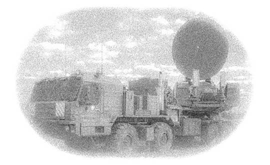
Above: Krasukha jammer mounted on a heavy-duty truck, part of the radio electronic warfare unit (EW) of the Western Military District. (Photo: Ministry of Defense of the Russian Federation)
The ground station will be built in Bengaluru, a city that is already home to the ISRO Telemetry, Tracking and Command Network (Istrac). Istrac will host the Russian ground station as well.
A memorandum of understanding was signed between the two nations in October 2016. In return, Roscosmos will host ground-measurement gathering stations in Russia for India’s NavIC, which will boost the operations of the IRNSS satellites.
The Orientale Basin in a 4K NASA video of the lunar surface using observations from the Lunar Reconnaissance Orbiter. (Photo: NASA)
Russian positioning satellites could circle the Moon by 2040.
In a draft document describing Russia’s program for lunar exploration, plans include deployment of navigational and communications satellite groupings in lunar orbit.
The document, adopted at a Nov. 28 joint meeting of Roscosmos and Academy of Sciences officials, was obtained by Russian news agency Sputnik, which described it here.
According to the document, the tasks described for 2025-2030 include “the delivery to the Moon of a series of spacecraft for orbital research and the establishment of a global communications and positioning system.”
The concept envisions the deployment of a lunar satellite navigation constellation between 2036 and 2040.
Russia’s Earthly navigation constellation is GLONASS.
A Roscomos press release Nov. 28 says a moon base is the agency’s top priority. “The interest of mankind to the moon is associated primarily with the fact that unique regions with favorable conditions for the construction of lunar bases were discovered on the satellite. The implementation of the lunar program will be held in several stages until 2040.”
Russia will reportedly implement its new strategy in three phases: the launch of an orbital station, a manned mission to the surface, and the eventual construction of a permanent base.
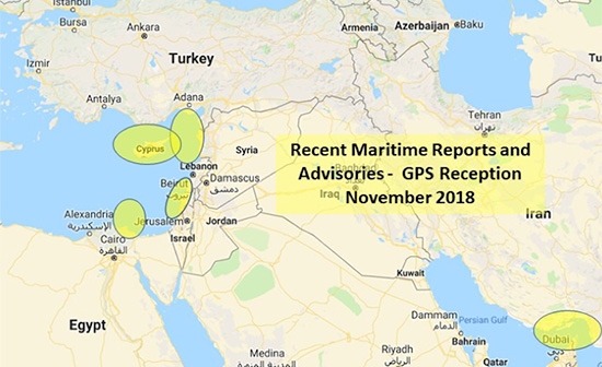
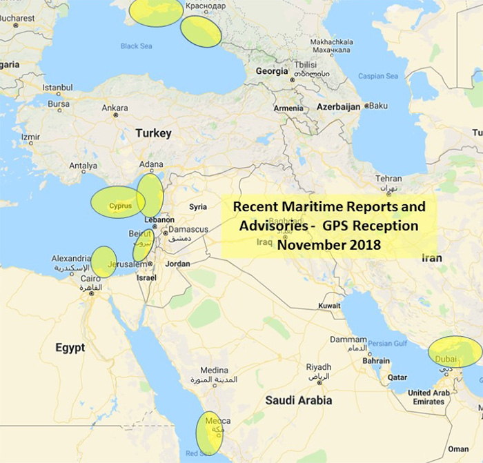
The U.S. Maritime Administration issued an expanded advisory for GPS disruptions in the Middle East. The new advisory renews and repeats warnings for the eastern Mediterranean and adds the Port of Jeddah in Saudi Arabia.
Reports have also been filed with the U..S Coast Guard Navigation Center about disruptions in Israel’s Port of Haifa and the Straits of Hormuz.
Analysis by the Resilient Navigation and Timing Foundation and the non-profit firm C4ADS has also shown on-going disruptions in Russian waters of the Black Sea. Also, GPS jamming by Russia is suspected during a recent NATO exercise.
The armed conflict in Syria has been blamed for much of the disruptions off of its shores.
GPS jamming in support of illegal fishing is suspected by some as the cause of problems off of Port Said, and disputes over mineral rights has been suggested for the disruptions seen near Cyprus.
Disruptions in the Black Sea are suspected to be security measures associated with the travel of Russian government officials.
Map: U.S. Maritime Administration Advisory 2018-014-GPS
Text of Maritime Administration Advisory
2018-014-GPS Interference-Eastern Mediterranean and Red Sea
This revised advisory cancels U.S. Maritime Advisory 2018-007.
Reference: U.S. Maritime Alerts 2018-004A, 2018-004B, 2018-008A.
Issue: Multiple instances of significant GPS interference continue to be reported by vessels and aircraft operating in the Eastern Mediterranean Sea. These reports have been concentrated near Port Said, Egypt, the Suez Canal, and in the vicinity of the Republic of Cyprus. Additional instances of similar interference were reported in October 2018 near Jeddah Port, Saudi Arabia. This interference is resulting in lost or otherwise altered GPS signals affecting bridge navigation, GPS-based timing and communications equipment.
Guidance: Exercise caution when transiting these areas. The U.S. Coast Guard Navigation Center (NAVCEN) and NATO Shipping Center websites contain information regarding effective navigation practices for vessels experiencing GPS interference. The information reaffirms safe navigation practices when experiencing possible GPS disruption, provides useful details on reporting possible GPS disruption, and is intended to generate further discussions within the maritime community about other disruption mitigation practices and procedures. This guidance also recommends taking note of critical information such as the location (latitude/longitude), date/time, and duration of the outage/disruption, and providing photographs or screen shots of equipment failures during a disruption to facilitate analysis. The NAVCEN information is available at https://go.usa.gov/xQBaU.
Contact Information: GPS disruptions or anomalies should be immediately reported to the NAVCEN at https://go.usa.gov/xQBaw or via phone at 703-313-5900, 24 hours a day. The NATO Shipping Center has requested that instances of GPS interference also be reported to them using the format on their Cyber Interference link.
Cancellation: This message will automatically expire on May 2, 2019.
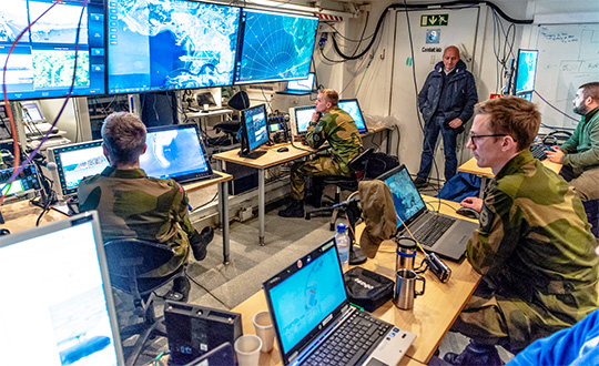
NATO conducted its largest military exercise since the Cold War in the frigid waters and icy mountains of Norway Oct. 25-Nov. 7.
During the final days of the Trident Juncture exercise, GPS signals guiding ships, aircraft, tanks, trucks and troops began to fail. Tracking screens flickered and positions were suddenly wrong from a few meters to hundreds of kilometers.
Civilian airliners, cars, trucks, cargo ships and smartphones operating in and around Norway and Finland experienced similar disruptions. Norway-based airline Wideroe told The Barents Observer that its pilots were reporting the loss of GPS signals when flying to airports in northern Norway and Finland. Airfields affected ranged from Kirkenes, on Norway’s border with Russia, to Lyngen in Troms, much further west.
Russia is the chief suspect of jamming the signals in reaction to the massive size and proximity of the military exercises. Russia also has recently conducted massive military exercises in the Baltics.
“It is possible that Russia has been the disrupting party in this,” Finland’s Prime Minster Juha Sipila told local media. “Russia is known to possess such capabilities.”
Trident Juncture involved all 29 NATO alliance members. Neutral Sweden and Finland also took part amid growing uncertainty over Russia’s ambitions in the tense region.