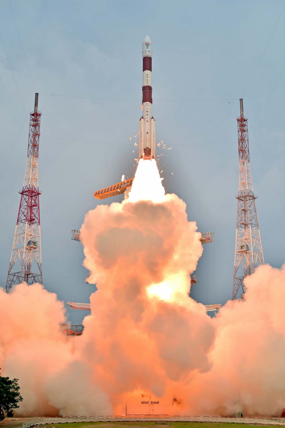
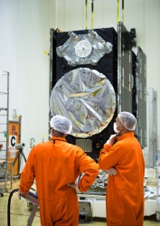
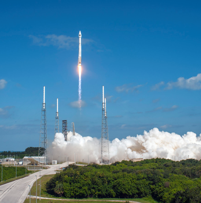
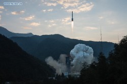
IRNSS-1E heads for orbit on Jan. 20. (Photo: IRNSS)
The fifth satellite in the Indian Regional Navigation Satellite System (IRNSS) constellation lifted off on time Jan. 20 from Satish Dhawan Space Center on Sriharikota Island, on India’s east coast.
As in the previous four launches of IRNSS satellites, the navigation satellite rode aboard a Polar Satellite Launch Vehicle (PSLV). This is the 33rd launch for the PSLV.
After the PSLV-C31 lift-off at 0401 GMT Wednesday (11:01 p.m. EST Tuesday) with the ignition of the first stage, the subsequent important flight events — strap-on ignitions and separations, first stage separation, second stage ignition, heat-shield separation, second stage separation, third stage ignition and separation, fourth stage ignition and satellite injection — all took place as planned.
After a flight of about 18 minutes 43 seconds, IRNSS-1E Satellite was injected to an elliptical orbit of 282.4 km X 20,655.3 km inclined at an angle of 19.21 degree to the equator (very close to the intended orbit) and successfully separated from the PSLV fourth stage.
After injection, the solar panels of IRNSS-1E were deployed automatically. ISRO’s Master Control Facility (at Hassan, Karnataka) took over the control of the satellite. In the coming days, four orbit manoeuvres will be conducted from Master Control Facility to position the satellite in the geosynchronous orbit at 111.75 deg East longitude with 28.1 deg inclination.
IRNSS-1E is the fifth of the seven satellites constituting the space segment of the Indian Regional Navigation Satellite System. IRNSS-1A, 1B, 1C and ID, the first four satellites of the constellation, were successfully launched by PSLV on July 02, 2013, April 04, 2014, October 16, 2014 and March 28, 2015, respectively. All the four satellites are functioning satisfactorily from their designated orbital positions.
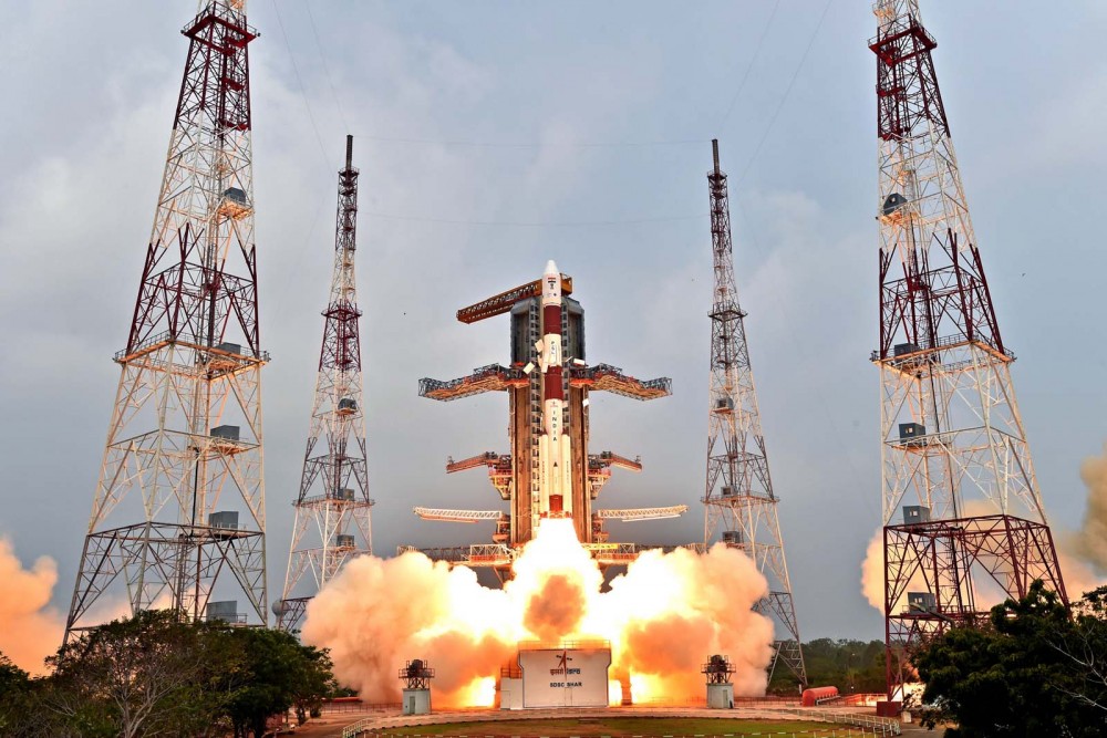
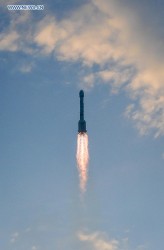
IRNSS-1E, the fifth satellite in India’s regional constellation, lifted off Jan. 20. (Photo: IRNSS)
IRNSS is an independent regional navigation satellite system designed to provide position information in the Indian region and 1500 km around the Indian mainland. IRNSS would provide two types of services, namely, Standard Positioning Services (SPS) — provided to all users — and Restricted Services (RS), provided to authorized users.
A number of ground stations responsible for the generation and transmission of navigation parameters, such as satellite ranging and monitoring, have been established in 18 locations across the country. In the coming months, the remaining two satellites of this constellation, namely, IRNSS-1F and IG, are scheduled to be launched by PSLV, thereby completing the entire IRNSS constellation.
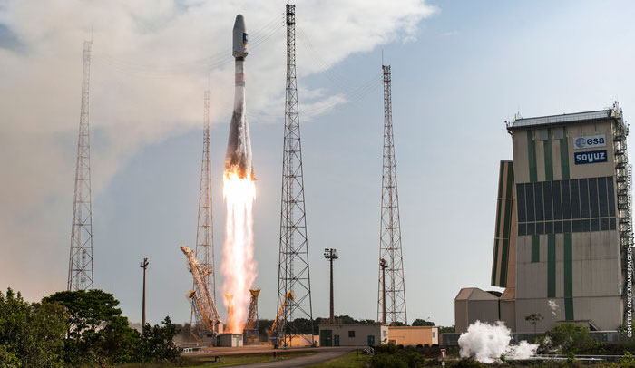
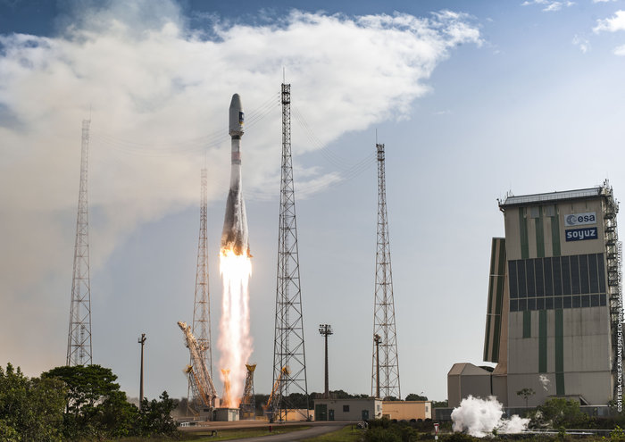
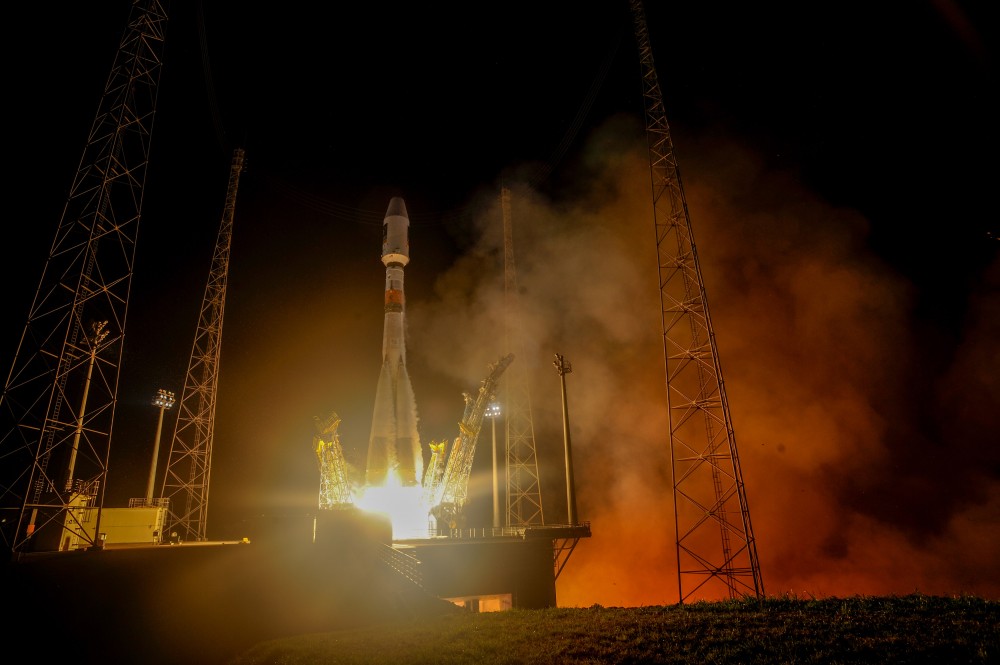
The pace of deploying Europe’s own satellite navigation system continued to increase with today’s launch of the latest pair of Galileo satellites, doubling the number of satellites in space within nine months.
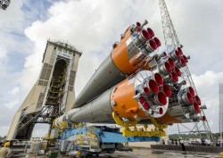
Galileo 11 and 12 lifted off together at 11:51 GMT (12:51 CET, 08:51 local time) atop a Soyuz rocket from French Guiana.
This sixth Galileo launch was a textbook operation: all Soyuz stages performed as planned, culminating in the Fregat upper stage deploying the twin satellites into orbit close to 23,500 km altitude, around 3 hours and 48 minutes after liftoff.
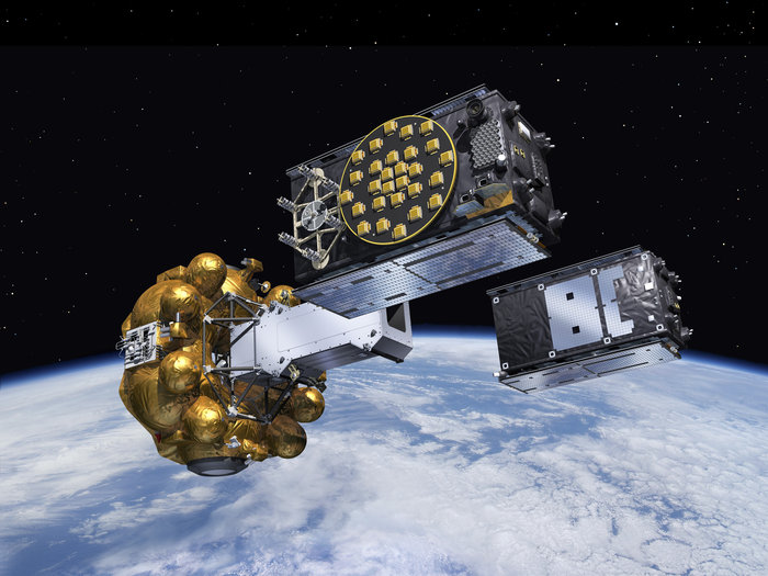
Liftoff of Galileo satellites 11 and 12 aboard Soyuz VS13 took place at 11:51 GMT on Dec. 17, 2015. (Photo: ESA)
“With today’s launch, Europe has doubled the number of its Galileo satellites in orbit in just nine months,” commented Jan Woerner, director general of ESA.
“Along with the ground stations put in place around the globe, this brings Galileo’s completion within reach. Initial Galileo services are scheduled to begin within next year, which proves the importance of this wise investment.”
“The excellent performance of these satellites, as measured on the ground, allows Europe to join the club of the worldwide providers of satellite navigation services,” noted Didier Faivre, ESA’s Director of Galileo and Navigation-related Activities.
“Production, testing and launch of the remaining satellites are now proceeding on a steady basis according to plan.
The Fregat upper stage flew the latest two Galileo satellites most of the way up to medium-Earth orbit before they finally separated. (Artist’s concept, courtesy of ESA).
“Then, after the summer break in 2016, the tempo of deployment will increase further with the first of three customised Ariane 5 launchers that will carry four rather than two satellites into orbit each time.”
This month will see the 10th anniversary of the launch of Europe’s very first navigation satellite: GIOVE-A, on Dece. 28, 2005. It secured the frequencies set aside for Galileo, gathered data on the medium-altitude orbit environment and flight-tested hardware for the working system.
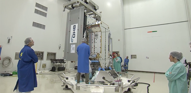
Galileo satellites 11 and 12 are mated with their dispenser. (Photo: ESA)
News from the European Space Agency
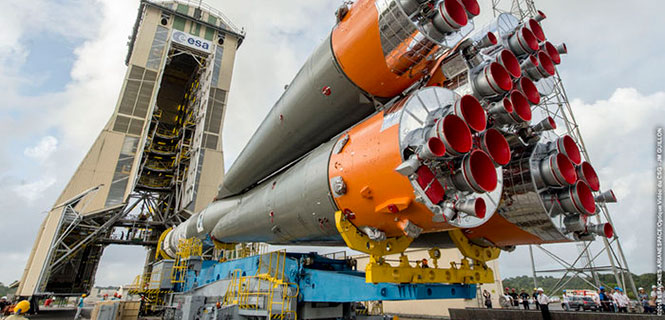
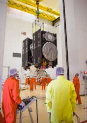
Galileos 11 and 12 are on the launch pad, attached to the top of their Soyuz rocket in readiness for this week’s launch. Europe’s next navigation satellites are due for launch at 11:51 GMT (12:51 CET, 08:51 local time) on Thursday, Dec. 17, from Europe’s Spaceport in French Guiana.
On Dec. 10, the two satellites, already attached to their carrier, were fixed to the Fregat upper stage before the halves of the protective Soyuz fairing were closed around them on Friday. This marked the completion of the ‘upper composite’ — the combination of Galileo satellites, dispenser and the upper stage that will fly them the bulk of the way up to their medium-altitude orbit.
Meanwhile, the first three stages of the Soyuz were assembled horizontally, rolled out to the pad, and raised to the vertical. The upper composite was moved to the pad on Sunday afternoon, hoisted to the top of the tower and then then carefully attached to Soyuz.
The Dec. 14 Launch Readiness Review opened the way to Soyuz fueling and finally launch.
Galileos 11 and 12 are on the launch pad, attached to the top of their Soyuz rocket in readiness for this week’s launch. (Photo: ESA)
This latest Galileo campaign began with the arrival of the satellites in French Guiana on Oct. 30. This is the sixth Galileo launch overall, and the third launch of 2015, and will bring the number of Galileo satellites in space to 12. It takes place just 11 days before the 10th anniversary of the liftoff of Europe’s very first navigation satellite.
The experimental GIOVE-A took off on Dec. 28, 2005, to reserve operational frequencies, test key hardware and gather data on the orbital environment for the Galileo constellation to follow. GIOVE-B followed in April 2008.
Since then, not only has the first third of the Galileo constellation reached orbit, but a network of Galileo ground stations has been erected across the globe.
In future, the number of satellites that can be inserted into orbit with a single launch will double from two to four, when a customized Ariane 5 rocket becomes available to complement Soyuz.
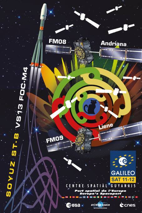
Launch poster for the upcoming launch of Adriana and Liene, also known as Galileo 11 and 12.
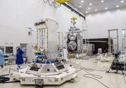
The two spacecraft for Arianespace’s latest Soyuz launch at the service of Europe’s Galileo satellite-based navigation system — and the company’s record 12th mission overall in 2015 — have been integrated at the French Guiana Spaceport in preparation for their Dec. 17 liftoff.
The launch of Galileo satellites 11 and 12 — dubbed Adriana and Liene — will conclude a year when the number of Galileo satellites in orbit will have doubled.
With this launch, ten years after the launch of GIOVE A, on Dec. 28, 2005, the Galileo constellation will become a reality.
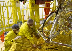
During activity in the Spaceport’s S3B clean-room facility, the spacecraft pair was mated with their dispenser, which will deploy the satellites by firing a pyrotechnic system for separation in opposite directions at the orbital insertion point.
The satellite/dispenser combination is ready for integration on Soyuz launcher’s Fregat upper stage, followed by the payload fairing encapsulation. This will create the “upper composite,” which is to be installed atop Soyuz once the vehicle has been moved to its Spaceport launch site.
Arianespace’s Dec. 17 mission, designated Flight VS13 in the company’s launcher family numbering system, will orbit two Galileo FOC (Full Operational Capability) satellites, further augmenting the European constellation of navigation spacecraft. The satellites are built by prime contractor OHB System in Bremen, Germany, with their onboard payloads supplied by UK-based Surrey Satellite Technology Ltd (SSTL), which is 99 percent owned by Airbus Defence & Space.
Galileo 11 and 12 are prepared for launch in the clean room. (Video capture: ESA)
The Galileo system is designed to provide high-quality positioning, navigation and timing services under civilian control. Its Full Operational Capability phase is managed and funded by the European Commission, with the European Space Agency (ESA) delegated as the design and procurement agent on the Commission’s behalf.
Flight VS13 will close out a busy year — complementing the 11 previous missions in 2015, which were composed of two other launches with the medium-lift Soyuz, three using the light-lift Vega and six with the heavy-lift Ariane 5.
PlanetiQ has signed a contract with Antrix Corporation Limited, the commercial arm of the Indian Space Research Organization (ISRO), for the launch of PlanetiQ’s first two weather satellites on a Polar Satellite Launch Vehicle (PSLV) during the fourth quarter of 2016.
Ten more satellites are planned for launch in 2017 to complete an initial set of 12 satellites that will dramatically improve global weather forecasting, climate monitoring and space weather prediction, and enable advanced analytics for numerous industries worldwide.
The ISRO’s PSLV is among the world’s most reliable launch vehicles with 30 consecutive successful flights. It has launched 51 satellites for international customers from 20 countries, in addition to 33 Indian national satellites.
“The stellar track record of the PSLV combined with our seven-year satellite design life provides the reliability and data continuity not just desired, but required by the operational weather forecast community,” said Chris McCormick, Chairman and CEO of PlanetiQ. “Within days after launch, we will validate and start delivering high-quality data and services to our customers.”
24 hours of data from 12 PlanetiQ satellites = ~34,000 occultations/day.
Each of PlanetiQ’s 10-kilogram microsatellites will fly PlanetiQ’s Pyxis-RO sensor, an advanced satellite weather sensor in a small package that can penetrate through clouds and storms down to the Earth’s surface. Pyxis-RO uses a technique called radio occultation to track the bending of GPS and other signals as they travel through Earth’s atmosphere, and then converts the bending angle into high-precision measurements of global temperature, pressure and water vapor in the atmosphere, and electron density in the ionosphere.
Pyxis-RO quadruples the data collection capability of radio occultation sensors on orbit today by tracking signals from all four major satellite navigation systems — GPS, Galileo, Beidou and GLONASS. With 12 satellites on orbit, PlanetiQ will collect 34,000 occultations per day, evenly distributed around the globe with high-density sampling over both land and water.
Each occultation is a vertical profile of atmospheric data with high vertical resolution, comprised of measurements less than every 200 meters from the Earth’s surface up into the ionosphere. The data is similar to that collected by weather balloons, but more accurate, more frequent and on a global scale.
“The world today lacks sufficient data to feed into weather models, especially the detailed vertical data that is critical to storm prediction. That’s why we see inaccurate or ambiguous forecasts for storms like Hurricane Joaquin, which can put numerous lives at risk and cost businesses millions of dollars due to inadequate preparation or risk management measures,” McCormick said. “Capturing the detailed vertical structure of the atmosphere from pole to pole, especially over the currently under-sampled oceans, is the missing link to improving forecasts of high-impact weather.”
The United Launch Alliance (ULA) declined Nov. 16 to submit a bid to launch the GPS III satellite, leaving the field wide open for commercial launch service SpaceX, reports Space News.
The first GPS III satellite is expected to launch in 2018.
Every operational GPS mission has launched on a ULA or heritage rocket — the most recent being the GPS IIF-11, which launched on Oct. 31.
ULA said it did not submit a bid in part because it does not expect to have an Atlas 5 rocket available for the mission, according to Space News. Legislation passed by Congress in 2014 requires the Air force to phase out its use of the Russian-made RD-180 engine that powers the Atlas 5 rocket used by ULA.
The U.S. Air Force successfully launched its 11th and next-to-last Boeing-built Global Positioning System GPS IIF series satellite aboard a United Launch Alliance Atlas V 401 launch vehicle from Space Launch Complex 41, Cape Canaveral Air Force Station, Fla., on Oct. 31 at 12:13 p.m. EDT (9:13 a.m. PDT).
GPS IIF satellites provide improved signals to support both the warfighter and the growing civilian needs of a global economy. Featuring a new operational third civil signal — L5 — that benefits commercial aviation and safety-of-life applications, the GPS IIF series provides improved accuracy through advanced atomic clocks, a longer design life than previous GPS satellites on orbit.The GPS constellation is healthy, stable and robust with two GPS IIAs, 12 GPS IIRs, seven GPS IIR-Ms and 10 GPS IIF satellites on orbit providing precise global positioning, navigation, and timing services to users around the globe.
Colonel Steven P. Whitney.
“The successful outcome of today’s mission is due to the tremendous commitment of a world class team focused on mission success,” said Col. Steve Whitney, director of the Space and Missile Systems Center’s (SMC) GPS Directorate. “I am pleased to say it’s truly an honor and privilege to be part of a mission that plays such a critical role in our nation’s infrastructure. To the men and women of SMC, the 45th, 50th, 310th Space Wings, Boeing, United Launch Alliance, The Aerospace Corporation, GPS IIF and the Atlas V launch teams, thank you!”
“The GPS IIF satellites play a key role in our modernization effort to provide new space-based capabilities for users around the globe and for decades to come,” said Lt. Gen. Samuel Greaves, SMC commander and Air Force Program Officer for Space. “The successful outcome of today’s mission is due to the tremendous commitment of a world-class team focused on mission success.”
“As the nation’s premier gateway to space, we are proud to be part of the team providing GPS and its capabilities to the world,” said Brig. Gen. Wayne Monteith, 45th Space Wing (Patrick Air Force Base, Fla.) commander, who served as the Launch Decision Authority. “GPS IIF-11 was the 16th launch this year for the wing. Our team diligently prepared for this important mission through a series of rigorous rehearsals, readiness reviews and pre-operational checkouts. Together, with the Space and Missile Systems Center and our industry partners, we make up one team delivering assured space launch and combat capabilities for the nation.”
The integrated team is now preparing GPS IIF-12, the last model of the series, scheduled for launch on Feb. 3, 2016. An airmen-led processing team at Cape Canaveral has processed every launch of the series since GPS IIF-1 launched there in May 2010.
Operated by Air Force Space Command’s 50th Space Wing at Schriever Air Force Base, east of Colorado Springs, Colo., the GPS constellation provides precise positioning, navigation and timing services worldwide as a free service provided by the U.S. Air Force, seven days a week, 24-hours a day.
Major General David Thompson announces a 24-hour delay for the launch of the eleventh GPS-IIF satellite.
Major General David Thompson, Vice Commander, U.S. Air Force Space Command, announced this morning that the GPS IIF launch scheduled for today will be delayed for 24 hours due to a water deluge suppression system at the launch site. Launch should only be delayed for 24 hours.
The water deluge suppression system is a launch site safety issue. Officials made the call on Thursday evening to postpone the launch to correct a leak discovered in a ground support equipment valve for the launch pad water suppression system. The valve will require repair or replacement.
The 19-minute launch window on Saturday extends from 12:13 to 12:32 p.m. EDT (1613-1632 GMT).
A United Launch Alliance Atlas V 401 will launch the GPS IIF-11 mission for the U.S. Air Force on Saturday, Oct. 31, from Space Launch Complex-41 at Cape Canaveral Air Force Station, Fla.
GPS IIF-11 is the second to last of the Block IIF satellites, incorporating improvements to provide greater accuracy, increased signals, and enhanced performance for users.
The GPS IIF satellites deliver second civil signal (L2C) for dual-frequency equipment, and a new third civil signal (L5) to support commercial aviation and safety-of-life applications. The next generation of GPS satellites is GPS III.
GPS IIF-11 will be the third GPS mission ULA launches in 2015. GPS IIF-9 launched on a Delta IV in March, and GPS IIF-10 launched in July. This mission will be ULA’s 11th in 2015 and 102nd since the company was founded in 2006.
All seven satellites of Indian Regional Navigation Satellite System (IRNSS) are expected to be in orbit by March 2016, reports New Delhi Television, citing Indian Space Research Organisation (ISRO) Chairman Kiran Kumar.
“We expect by March 2016 all the seven constellation of IRNSS to be in orbit,” Kumar said.
Four IRNSS satellites are now in orbit, with three remaining to complete the system. The next IRNSS satellite, 1E, is scheduled for launch in November, and 1F is set for launch in December.
Also, the GSAT-15 satellite, which has a GAGAN payload, will be launched on Nov. 10.
Kumar made his comments after inaugurating GNSS User Meet 2015 at the ISRO Satellite Centre (ISAC) in Bengaluru, India. The event was jointly organized by ISRO and Airports Authority of India (AAI).
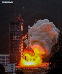
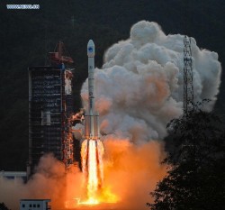
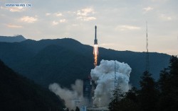
The 20th BeiDou satellite is launched, Sept. 30, 2015.
China launched a new-generation BeiDou satellite into orbit at 7:13 a.m. China Standard Time on Wednesday, Sept. 30, according to the Xinhua News Agency, the 20th satellite for the BeiDou Navigation Satellite System.
The satellite was launched from Xichang Satellite Launch Center in the southwestern province of Sichuan aboard a Long March-3B carrier rocket.
In a first for BeiDou, the new BeiDou satellite is equipped with a hydrogen maser atomic clock. A series of tests related to the clock and a new navigation-signal system will be undertaken, according to the center as reported by Xinhua.
China plans to expand the BeiDou services to most of the countries covered in its “Belt and Road” initiative by 2018, and offer global coverage by 2020.
Named after the Chinese term for the plough or the Big Dipper constellation, the BeiDou project was formally launched in 1994. The first BeiDou satellite was launched in 2000.
Two videos of the launch are available on the CCTV website.
Galileo satellites 9 and 10 are functioning perfectly, and the initial series of flight operations is continuing as part of the critical launch and early orbit phase, according to a European Space Agency Rocket Science blog by Daniel Scuka, senior editor for Spacecraft Operations at ESOC, ESA’s European Space Operations Centre, Darmstadt, Germany.
Galileo 9 and 10 lifted off together on Sept. 11 from Europe’s Spaceport in French Guiana atop a Soyuz launcher, bringing the total number of Galileo satellites in orbit to 10.
“The pair are being stepped through an intense series of check-outs, confirmations, mode changes, configurations and health verifications by the joint ESA/CNES mission team working around the clock at ESOC, Darmstadt, Germany,” according to the blog. “The team are now focusing on conducting a series of thruster burns designed to start the drift of the two satellites toward their target orbital positions.”
“Following the burns performed during the LEOP (launch and early orbit phase), the satellites will continue naturally drifting, ending up in their final desired operational orbits at about 23,222 km after another set of thruster burns, planned to achieve fine positioning in orbit, around the end of October,” said Liviu Stefanov, co-flight director from ESA.
With the excellent performance of the spacecraft and the ground teams, the LEOP is expected to wrap up soon.
All the Soyuz stages performed as planned during the September 11 launch, relieving anxieties tied to a faulty Soyuz launch in September of last year. The Fregat upper stage released the satellites into their target orbit close to 23,500 km altitude, around 3 hours and 48 minutes after liftoff.
“The deployment of Europe’s Galileo system is rapidly gathering pace,” said Jan Woerner, director general of the European Space Agency (ESA). “By steadily boosting the number of satellites in space, together with new stations on the ground across the world, Galileo will soon have a global reach. The day of Galileo’s full operational capability is approaching. It will be a great day for Europe.”
Two more Galileo satellites are scheduled for launch by end of this year. These satellites have completed testing at ESA’s ESTEC technical centre in Noordwijk, the Netherlands, with the next two satellites also undergoing their own test campaigns.
More Galileo satellites are being manufactured by OHB in Bremen, Germany, with navigation payloads coming from Surrey Satellite Technology Ltd in the UK, in turn utilizing elements sourced from all across Europe.
“Production of the satellites has attained a regular rhythm,” said Didier Faivre, ESA’s Director of Galileo and Navigation-related Activities. “At the same time, all Galileo testing performed up to now — including that of the ground segment — has been returning extremely positive results.
“And while the continuing deployment of Galileo remains our priority, along with exploitation of EGNOS — Europe’s already operational satellite navigation augmentation system — ESA is also looking farther ahead.
“With the European Commission, we are doing the technical work to ensure Galileo goes on forever — locking in continuity of Europe’s navigation services into the long term, to meet performance on a par with the other global satellite navigation systems.”
Next year Galileo deployment will be boosted by operation of a specially customized Ariane 5 launcher that can double, from two to four, the number of satellites that can be inserted into orbit with a single launch.
European SBAS Advances, Improves
After extensive ground and space testing, the SES-5 GEO satellite has entered into the European Geostationary Navigation Overlay Service (EGNOS) operational platform, broadcasting EGNOS Signal-In-Space (SIS). Replacing Inmarsat-4F2, SES-5 will ensure reliable EGNOS services until 2026, and will enable a range of performance improvements. In particular, EGNOS will offer even greater stability during periods of high ionospheric activity.
“SES-5 is the first step of the complete renewal of the EGNOS Space Segment, securing the EGNOS services for the next decade and the future transition to the dual-frequency multi-constellation services,” said Carlo des Dorides, European GNSS Agency executive director. “It will be completed by the introduction of the ASTRA-5B signals and the procurement of a new EGNOS payload which are both planned for 2016.”
SES-5, carrying EGNOS L1 and L5 band payloads, was launched in July 2012. The integration of a second EGNOS SBAS L1/L5 band payload on SES ASTRA-5B GEO satellite is currently ongoing. The introduction of the second SES GEO satellite for EGNOS is planned at the end of 2016.
GAO Report Spotlghts OCX Delays, Cost Increases
According to a report released by the U.S Government Accountability Office (GAO) on Sept. 9, titled “Actions Needed to Address Ground System Development Problems and User Equipment Production Readiness,” the Air Force has experienced significant difficulties developing the GPS next-generation operational control system (OCX). According to the report, completion of OCX will require $1.1 billion and four years more than planned to deliver OCX. The report Highlights section states, “The Air Force began OCX development in 2010,” and “accelerated OCX development in 2012 to meet optimistic GPS III satellite launch timeframes even as OCX development problems and costs grew, and then paused development in 2013 to address problems and resolve what it believed were root causes.
“However . . . OCX cost and schedule growth have persisted due in part to a high defect rate, which may result from systemic issues. Further, unrealistic cost and schedule estimates limit OSD visibility into and oversight over OCX progress. “ The full report may be read online.
During the course of development the Air Force made changes, updating the specifications for connections to other government systems and in the M-code signal requirements. Officials for Raytheon, the prime OCX contractor, estimated that, as a result of various modifications “nearly two-thirds of the requirements baseline as of [preliminary design review] had changed by mid-2012.” Subsequent software updates and modifications contributed to a high defect rate in the OCX software. “
If you have requirements change at the same time you’re developing the software, it’s more likely that you could have a higher amount of defects that you have to change after the fact,” said Matthew Gilligan, Raytheon’s vice president for navigation and environmental solutions.
The Galileo Control Centre in Oberpfaffenhofen, Germany, monitors and controls the constellation with a high degree of automation. (Photo: ESA)
News courtesy of the European Space Agency
Europe’s latest pair of Galileo satellites has passed its initial check out in space, allowing control to be handed over to the main control centre and join the growing fleet.
“This was a beautifully smooth start to the mission,” said ESA mission director, Richard Lumb. “From liftoff through to handover to the constellation operator and beyond, this has been a textbook performance not only of the satellites but also for all the operations and manufacturer teams on the ground.”
Galileos 9 and 10 were launched on Sept. 11. Their individual lives began within four hours, as they separated from their rocket’s final stage, overseen from ESA’s ESOC operations centre in Darmstadt, Germany. Days of round-the-clock effort followed, to bring the satellites to life, beginning with closely monitoring the unfolding of their solar wings and their pointing towards the Sun.
The various satellite elements were methodically switched on, their health checked and readied for work. Liviu Stefanov, an ESA flight director, described the process as “one of the smoothest yet.” The satellites fired their thrusters to drift towards their target orbital positions at around 23,222 km altitude — helped along in this case by a near-perfect orbital injection to begin with.
Firings will resume around the end of October to stop the drift and achieve fine positioning in orbit, guided by ESOC’s specialist flight dynamics team.
The accuracy of the Galileo system relies on the orbital position of its satellites being fixed to a very high level of precision.
Once on their way, the satellites were handed over on 19 and 20 September, respectively, to the Galileo Control Centre in Oberpfaffenhofen, Germany managed by SpaceOpal.
The team of engineers from ESA and France’s CNES space agency are preparing for the next launch, scheduled for December. The early phase for Galileos 11 and 12 will be overseen from CNES in Toulouse, France, which alternates with ESOC as hosts.
The navigation payloads on Galileos 9 and 10 still need to undergo detailed testing, led from ESA’s Redu centre in Belgium with the support of both Oberpfaffenhofen and the second Galileo Control Centre in Fucino, Italy, which has oversight of Galileo’s navigation mission.
This phase ensures the latest satellites’ navigation and search and rescue payloads are operating normally, giving them a clean bill of health before they can join the Galileo constellation.