Blog

  • Mass rescue operation takes place in Arctic Circle with Galileo SAR

    Mass rescue operation takes place in Arctic Circle with Galileo SAR

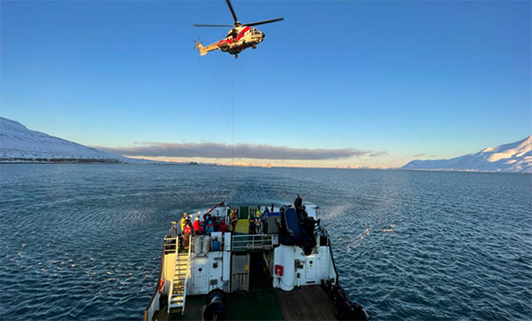
    The AMRO 2021 exercise tested the rescue of 200 cruise-ship passengers using Galileo SAR. (Photo: EUSPA)
    The AMRO 2021 exercise tested the rescue of 200 cruise-ship passengers using Galileo SAR. (Photo: EUSPA)

    News from the European Union Agency for the Space Programme (EUSPA)

    In freezing arctic waters 60 nautical miles off of Svalbard, a search-and-rescue enactment proved the capabilities of Galileo as a life-saving system.

    The Arctic Mass Rescue Operation (AMRO 2021) took place on Oct. 8, organized by the Norwegian authorities. The scenario surrounded a cruise ship that caught on fire with around 200 passengers onboard, located northwest of Spitsbergen far from roads, cabins, rescue crews and other infrastructure.

    The vessel’s crew activated a Galileo-enabled EPIRB compatible with Galileo’s Return Link Service. Once activated, it took only 2:20 minutes for the Galileo System to track down the ship with an accuracy below one kilometer and deliver an SOS acknowledgement to the active EPIRB.

    Once the Mission Control Centers received the distress signal and established the location, two Super Puma helicopters from the Governor of Svalbard, a Sea King from the 330 squadron of the Royal Norwegian Air Force, and a Norwegian coast guard support vessel were scrambled to support the massive evacuation of the passengers.

    ‘’The AMRO 2021 exercise was an excellent opportunity for the European Union Agency for the Space Programme to showcase the power of Galileo SAR and the robust performance of Galileo at high latitudes in comparison to other GNSS constellations,’’ said Guerric Pont, Head of Galileo Department at EUSPA.

    The Galileo RLS allows people in distress to receive an automatic acknowledgment that their signal has been picked up by the first responders. Galileo’s contribution to the Medium Earth Orbit Satellites Search and Rescue System (MEOSAR) — managed by the international COSPAS-SARSAT program — translates into 2,000 lives saved per year.

    In support of Galileo’s SAR operations, the Copernicus Marine Service provides authorities and rescue centers input such as wave height, sea current direction as well as and water temperature among others.

  • Japan successfully launches first QZSS replacement, QZS-1R

    Japan successfully launches first QZSS replacement, QZS-1R

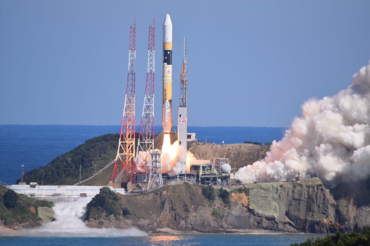
    A successor to the first Quasi-Zenith Satellite System (QZSS) satellite, QZS-1R, was launched at 11:19 a.m. Japan Standard Time, Oct. 26, from the Tanegashima Space Center.

    QZS-1R was carried aboard H-IIA rocket No. 44 by Mitsubishi Heavy Industries. The flight proceeded as planned, and, 28 minutes 6 seconds after launch, the payload separated from the launch vehicle.

    Designed for a 15-year lifetime, QZS-1R will replace the QZS-1 (Michibiki-1). QZS-1 launched on Sept. 11, 2010, and entered its quasi-zenith orbit 10 days later. Three other quasi-zenith navigation satellites launched in 2017 to complete the constellation.

    QZSS began service in November 2018 with four satellites. The Japan Aerospace Exploration Agency (JAXA) plans to have seven satellites aloft by 2023.

    A H-2A rocket launches from Tanegashima Space Center carrying the QZS 1R satellite. (Photo: MHI)
    An H-2A rocket launches from Tanegashima Space Center carrying the QZS-1R satellite. (Photo: MHI)
  • Navigation 2021 conference to be both virtual and in person

    Navigation 2021 conference to be both virtual and in person

    logo

    Navigation 2021 will bring together experts from industry, research institutions, government agencies and investors whose primary goal is to work together for a more navigable world, organizers said. Conference themes will include PNT systems and technology, robust PNT, PNT applications, animal and human navigation, and navigation in society.

    The November event will unite two conferences: the International Navigation Conference and the European Navigation Conference. The conference is sponsored by the Royal Institute of Navigation and the European Group of Institutes of Navigation (EUGIN). It takes place Nov. 15-18 in Edinburgh, Scotland, and virtually.

    The full conference will take place online on a highly interactive platform. Organizers have also been able to include an in-person element of the conference with the primary objective of enjoying the keynotes, networking and exhibition for those who are in a position to do so.

    The majority of session talks will be online only, with the option of watching back talks on the platform at a later date. Learn more about the chosen platform.

    The in-person element of Navigation 2021 will take place in the EICC conference center in Edinburgh. The EICC has compiled a guide to the in-person element of the conference.

  • Galileo Control Segment upgrade ready for next launch

    Galileo Control Segment upgrade ready for next launch

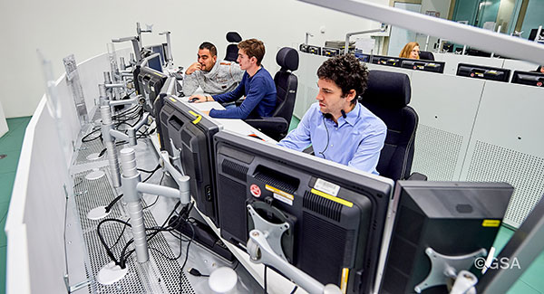
    Galileo Control Centre in Oberpfaffenhofen, Germany. (Photo: ESA)
    Galileo Control Centre in Oberpfaffenhofen, Germany. (Photo: ESA)

    News from the European Space Agency (ESA)

    The 11th launch of Galileo satellites, planned for Dec. 1, marks an important program milestone. With an upgrade of the Galileo Control Segment (GCS), this will be the first launch where the satellites’ first steps into space will be overseen from the Galileo Control Centre in Oberpfaffenhofen, Germany.

    Up until now, the Launch and Early Operations Phase (LEOP) of Galileo satellites has been overseen from an external mission control site — either ESA’s ESOC control centre in Darmstadt, Germany, or French space agency CNES’s site in Toulouse, France.

    The demanding upgrade of the GCS to Version 3.0 was performed by an industrial consortium led by GMV in Spain. The control segment encompasses the two Galileo Control Centres in Oberpfaffenhofen in Germany and Fucino in Italy, as well as six Telemetry, Tracking and Control (TT&C) ground stations used to monitor and command the 26 Galileo satellites in orbit.

    As well as increasing overall reliability and cybersecurity, the new upgrade opens the way to significant expansion of the Galileo constellation, enabling oversight of up to 38 satellites.

    Over the last three years, a complete technological refresh of the GCS software and hardware was done, including porting of software modules corresponding to several million lines of code, the deployment of equipment at many Galileo sites, and the execution of a rigorous level of testing throughout all elements comprising the system.

    Commencing in mid-2018, the upgrade had to contend with the worldwide COVID-19 pandemic midway through its lifetime, but the team pushed on to conclude at the end of July. Since Aug. 4, it has been used to nominally operate all the satellites in the constellation.

    The project was overseen by ESA in its System Prime role managing Galileo’s design, development, qualification and deployment of future upgrades on behalf of the European Commission, Galileo’s owner.

  • Orolia to acquire Seven Solutions for resilient PNT

    Orolia to acquire Seven Solutions for resilient PNT

    Photo:

    Merger to deliver high-end performance and ultra-accurate timing and frequency products for commercial, critical infrastructure and defense markets worldwide

    Orolia has entered into a definitive agreement to acquire Seven Solutions, a global innovator in White Rabbit sub-nanosecond time transfer and synchronization technology. This transaction is subject to customary closing conditions and approvals required by the Spanish government and is expected to close before the end of the year.

    This is Orolia’s 11th acquisition in the past seven years.  

    The merger with Seven Solutions, based in Granada, will enhance Orolia’s portfolio for defense, aerospace, data centers, telecom, financial services, smart grids and other critical infrastructure industries, and will enable the next-generation applications dependent on ultra-precise, resilient timing and frequency technology.

    GPS World published an article about Seven Solutions and its White Rabbit technology in its October issue.

    “Orolia and Seven Solutions under one umbrella will combine our world-leading technologies to draw a new frontier in network timing to sub-nanosecond levels, delivering the most robust and accurate resilient PNT solutions for our customers,” said Orolia CEO Jean-Yves Courtois. “Seven Solutions’ long history of delivering cutting-edge time distribution solutions to sectors like telecommunications, smart grids, aerospace, defense and scientific facilities aligns perfectly with Orolia’s DNA.”

    Orolia and Seven Solutions will integrate global sales, marketing, product development and operations.

    Orolia’s full-scale, modular approach to resilient PNT includes atomic clocks with a combination of GNSS signals protected with interference detection and mitigation technology, together with low-Earth-orbit secure alternative signals. The addition of Seven Solutions’ products will deliver terrestrial sub-nanosecond time distribution from distant and potentially redundant locations.

    “We believe the union of our companies will produce the future of time transfer and frequency distribution solutions in terms of accuracy, reliability and interoperability,” said Rafael Rodriguez, chief technology officer and co-founder of Seven Solutions. “Finance, 5G telecommunications, data centers and hyperscalers have new and upgraded functionalities requiring ultra-accurate time distribution accuracy. To maximize interoperability, our solution for time transfer is based on the White Rabbit concept that has been pushed over the last decade to become the basis of the standard high accuracy time transfer profile (within the recent release of IEEE 1588 of precision time protocol).”

    Orolia and Seven Solutions are members of the Open PNT Industry Alliance. The international organization focuses on market concepts that strengthen economic and national security by supporting government efforts to implement resilient PNT capabilities for critical infrastructure.

  • STMicroelectronics introduces automotive-qualified GNSS module

    STMicroelectronics introduces automotive-qualified GNSS module

    Photo: STMicroelectronics
    Photo: STMicroelectronics

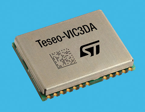
    STMicroelectronics has introduced the Teseo-VIC3DA, the latest member of the Teseo module family, designed for vehicle positioning.

    Teseo-VIC3DA combines ST’s high-performing Automotive Teseo III GNSS IC with the automotive 6-axis MEMS inertial measurement unit (IMU) and dead reckoning software to create a convenient, automotive-qualified navigation module. The module enables competitively priced in-car navigation, fleet-management, and insurance-monitoring applications.

    The automotive Teseo III GNSS IC at the heart of the system is proven in high-end systems and is already highly regarded for its accuracy and efficiency. With multi-constellation awareness, Teseo III offers robust positioning capabilities by simultaneously receiving signals from GPS, Galileo, GLONASS, BeiDou and QZSS constellations.

    The ST 6-axis automotive-grade MEMS IC introduces super-high-resolution motion tracking in advanced vehicle navigation and telematics applications.

    With the combination of ST’s Teseo III, IMU and dead reckoning, the Teseo-VIC3DA ensures extremely accurate positioning performance in critical environments such as tunnels, beneath structures such as bridges or multi-level highways, in covered areas such as underground parking lots, and in urban canyons between tall buildings.

    The Teseo-VIC3DA module operates from 3.3V, helping to simplify system integration, and has a standby mode that draws just 17 µA to minimize demand on the vehicle’s electrical supply. Containing a highly accurate integrated temperature compensated crystal oscillator, the module achieves excellent accuracy of 1.5 m circular error probability for typical automotive use cases. In addition, a dedicated real-time clock oscillator helps ensure fast time to first fix.

    Coming with firmware pre-loaded onto built-in flash memory, the Teseo-VIC3DA can be updated with new firmware as necessary using the free Teseo-Suite software. Teseo-VIC3DA can provide up to 30Hz dead-reckoning fix-rate and has very low latency to reduce the UART-channel jitter. Teseo-VIC3DA can autonomously work with and without odometer information.

    The Teseo-VIC3DA is tested and certified by ST according to the EU’s Radio Equipment Directive, applicable ETSI standards, and EN safety standards, helping customers achieve mandatory product-level approvals quickly and efficiently. A standalone, USB-powered evaluation platform, EVB-VIC3DA, is available to jump-start development.

    The Teseo-VIC3DA is in production now and supplied in a 16 x 12.2 x 2.42 mm 24-pin LCC package.

  • TUM Autonomous Motorsport wins Indy Autonomous Challenge

    TUM Autonomous Motorsport wins Indy Autonomous Challenge

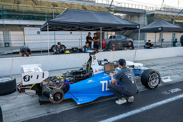
    TUM Autonomous Motorsport preps its autonomous vehicle. (Photo: Indy Autonomous Challenge)
    TUM Autonomous Motorsport preps its autonomous vehicle. (Photo: Indy Autonomous Challenge)

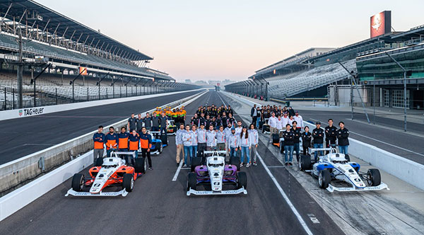
    TUM Autonomous Motorsport from the Technische Universität München (TUM) won on Saturday the Indy Autonomous Challenge Powered by Cisco, the first autonomous racecar competition at the Indianapolis Motor Speedway.

    TUM competed in a field of nine teams from 21 universities to win the $1 million grand prize.

    Rules of the IAC competition required each team to compete in a fastest-lap competition that included an obstacle avoidance component. The winning team recorded the fastest two-lap average speed of 135.944 mph on the famed oval track.

    “Participating in the Indy Autonomous Challenge allowed our team to advance autonomous driving technologies, and being able to take first place after two years of hard work acknowledges that we had an outstanding team,” said Alex Wischnewski, team leader of TUM Autonomous Motorsport. “Our next goal is to win a high-speed autonomous head-to-head race.”

    Organized by Energy Systems Network and the Indianapolis Motor Speedway, the primary goal of the IAC is to advance technology that can speed the commercialization of fully autonomous vehicles and deployments of advanced driver-assistance systems (ADAS).

    These enhancements will lead to increased safety and performance in motorsports, as well as all modes of commercial transportation. The competition also serves as a platform for students to excel in science, technology, engineering and math (STEM) and inspire the next generation of innovators.

    In addition to thousands of attendees at the IMS, and more than 20,000 viewers on the AWS livestream, the IAC hosted 350 high school STEM students representing more than 50 urban, rural and suburban school districts across Indiana.

  • US Coast Guard Nav Center warns of GPS rollover concern

    US Coast Guard Nav Center warns of GPS rollover concern

    Image: Infadel/ iStock/Getty Images Plus/Getty Images
    Image: Infadel/
    iStock/Getty Images Plus/Getty Images

    The U.S. Coast Guard has issued a statement on a possible GPS software bug that could send systems back to 2002.

    The potential vulnerability may cause an event of the “GPS Week Number Rollover” type to occur within systems utilizing Network Timing Protocol Daemon (NTPD) and GPS Daemon (GPSD) software.

    On Oct. 24, a bug in older versions of the software may trigger the system date to roll back to sometime in March 2002. All systems running the most recent software update, version 3.23.1 (released Sept. 21) should be unaffected.

    While this is not a problem with GPS, this has the potential to cause significant impact, the Coast Guard stated. All networks operating are encouraged to verify that they are using the most recent version (3.23.1) and report any problems to the Navigation Center watch by phone 703-313-5900 or by email at [email protected].

  • CGI to develop 5G for UAV positioning for ESA

    CGI to develop 5G for UAV positioning for ESA

    Image: KENGKAT/iStock/Getty Images Plus/Getty Images
    Image: KENGKAT/iStock/Getty Images Plus/Getty Images

    CGI has been awarded a contract by the European Space Agency (ESA) to develop a proof of concept to enhance the navigational capabilities of airspace users in areas where traditional navigation systems alone cannot provide sufficient performance.

    Future aircraft, such as UAVs and innovative air mobility solutions, will need to safely operate beyond visual line of sight (BVLOS) within cities and other built-up areas, where GNSS signals  are often disrupted.

    The concept being developed by CGI and its partners leverages 5G networks, alongside traditional navigation systems, to provide hybrid-positioning solutions. In addition to secure communications for command and control of vehicles, and delivery of high-quality streaming video for BVLOS operations, 5G networks can also be used as a source for navigational data that will improve the accuracy, integrity and availability beyond that which satellite navigation systems alone can provide. The service will also offer greater resilience against natural or intentional disruption of positioning, navigation and timing (PNT) services.

    “The UK is a leading innovator in aerospace and GNSS technology. It’s great to see the team developing resilient PNT solutions for aerospace leveraging existing communication infrastructure,” said Andy Proctor, UK Lead Delegate to the ESA Programme Board for Navigation & PNT Innovation lead at UK Research and Innovation (UKRI). “The 5G-PNT project will enable and promote future aviation applications in the UK and globally, especially in the fast-growing future air mobility sector that will enable wider economic growth in many key sectors.”

    “This exciting project brings together PNT and mission-critical systems integration expertise to advance the enabling technologies for future navigation applications,” John Hanley, Senior Vice President for UK & Australia Secure and Assured Space Solutions at CGI said. “The challenges posed by PNT service disruption have become a significant concern for operators and regulators and this project will help improve navigation capabilities to support both this challenge and further development of the aerospace sector.”

    CGI will work with ESA, u-blox, the Advanced Communication, Mobile Technology and IoT (ACMI) Research Centre at the University of Sussex and air navigation service provider NATS, to define use cases and system requirements for a 5G-based complement to existing GNSS receivers. This hybrid navigation solution will be targeted at installation on any air vehicles intended to operate within the coverage of commercial 5G networks.

    The project will culminate in a real-world demonstration of the technology, comparing its performance to that offered by GNSS alone.

  • Indy Autonomous Challenge livestreams Saturday

    Indy Autonomous Challenge livestreams Saturday

    Photo: IAC
    Photo: IAC

    Autonomous racecar competition takes place at the Indianapolis Motor Speedway

    The Indy Autonomous Challenge will be livestreamed on Oct. 23 through Amazon Web Services for viewers worldwide. Teams from 21 universities from nine countries will compete for the $1 million grand prize, which will be used to advance the education and research missions of the winning universities.

    Livestreaming begins at 1 p.m. EDT and can be viewed on the IAC website homepage and on Twitch @IndyAChallenge.

    “Due to the generous support of Amazon Web Services (AWS), we will have a global audience for the first autonomous high-speed competition at the Racing Capital of the World — the Indianapolis Motor Speedway,” said Paul Mitchell, president and CEO, Energy Systems Network, co-organizer of the IAC. “This is critically important as the IAC is a global competition having involved at its inception 41 universities from around the world.”

    Organized by Energy Systems Network and the Indianapolis Motor Speedway, the primary goal of the IAC is to advance technologies that can speed the commercialization of fully autonomous vehicles and deployments of advanced driver-assistance systems (ADAS). These enhancements will lead to increased safety and performance in motorsports as well as all modes of transportation.

    In addition, the competition is a platform for students to excel in science, technology, engineering and math (STEM) and inspire the next generation of innovators.

  • Video celebrates 10 years of Galileo

    Video celebrates 10 years of Galileo

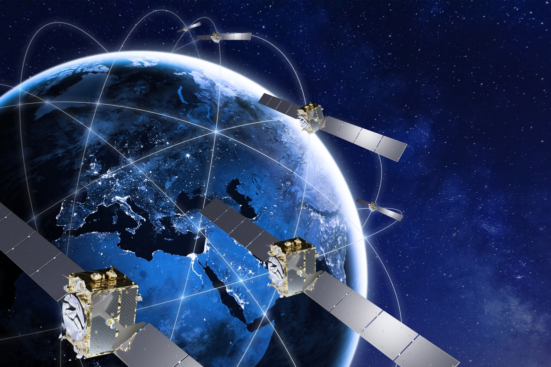
    A new video celebrates the first decade of Europe’s satellite navigation system Galileo, which celebrates its 10-year anniversary on Oct. 21.

    Galileo delivers meter-level accuracy anywhere on Earth. It is also saving lives, by relaying distress calls for search and rescue. Today, 26 Galileo satellites orbit 23,222 km above the Earth. The first was launched on Oct. 21, 2011; nine more launches followed to create the constellation.

    The satellites in space are supported by a globe-spanning ground segment. The system as a whole is set to grow, with the first dozen Batch 3 about to join the current satellites in orbit and Galileo Second Generation satellites in development.

    Galileo is financed by the European Union and developed by the European Space Agency. Services are delivered by the EU Agency for the Space Programme.

    Illustration: Thales Alenia Space
    Illustration: Thales Alenia Space
  • Speakers, program announced for Geo Week conference

    Speakers, program announced for Geo Week conference

    125+ speakers and 50+ sessions are confirmed for the 2022 edition of Geo Week in Denver

    Image: Geo Week 2022

    Organizers of Geo Week, which brings together geospatial technologies and the built world, have announced its conference sessions and speakers for the 2022 event, which will take place Feb. 6-8  in Denver, Colorado.

    The conference program features more than 125 speakers across 50 sessions with content that explores best practices in 3D capture, working in the built environment, gaining return on investment (ROI) from building information management (BIM), defining what’s possible now with lidar, and more.

    The coming together of AEC Next Technology Expo & Conference, International Lidar Mapping Forum, and SPAR 3D Expo & Conference to form Geo Week reflects the increased integration between the built environment, advanced airborne/terrestrial technologies, and commercial 3D technologies.

    Partner events taking place in conjunction with Geo Week include ASPRS Annual Conference, MAPPS Winter Meeting and USIBD Annual Symposium, ensuring the presence of geospatial and built-world industry experts in one place.

    Presenters represent Autodesk, Esri, USGS, The Beck Group, Hexagon Geosystems, GM, Caltrans, Velodyne Lidar, Draper, MLB and NASA. These experts will share their expertise on a range of topics. Sessions include:

    Geo Week will have multiple tracks with content clearly identified as relevant to one or more of the audience groups feeding into Geo Week.

    • The International Lidar Mapping Forum (ILMF) audience has historically been comprised of precision measurement professionals in surveying and mapping who use airborne and terrestrial lidar and related remote sensing technologies.
    • The AEC Next audience has historically been comprised of professionals in architecture, engineering and construction that use technologies such as reality capture, automation, artificial intelligence and XR to bid and manage projects and improve workflows.
    • The SPAR 3D audience has historically been comprised of professionals who use 3D capture, scanning, visualization and modeling technologies across a variety of verticals.

    “We’ve witnessed the growing convergence between geospatial and the built world,” said Lee Corkhill, group event director at Diversified Communications, organizer of Geo Week. “We believe the market is ready and eager for this next step of leveraging the confluence of technologies for improved collaboration, increased efficiency, and better outcomes. Much of the conference content and technology being showcased will reflect and support this increasing integration. At the same time, we recognize that individuals and organizations are at differing levels of adoption, and so there will be ample content more focused on what were traditional AEC Next, ILMF and SPAR 3D topics.”

    Geo Week will provide education, technology and resources for professionals in industries including AEC, asset and facility management, disaster and emergency response, Earth observation and satellite applications, energy and utilities, infrastructure and transportation, land and natural resource management, mining and aggregates, surveying and mapping, and urban planning and smart cities.

    More than 80 companies have confirmed booths on the Exhibition Floor with additional companies being confirmed every week and more than 100 associations and media companies are signed on as supporters.

    Geo Week takes place Feb. 6-8, 2022, with conference programming and exhibits all three days. Additional features of the programming are vendor-delivered product reviews, exhibition theaters, workshops and programming hosted by ASPRS, MAPPS and USIBD. Visit www.geo-week.com for more information on attending or exhibiting. Register before Dec, 10 for early bird rates.