UPDATE: Because of bad weather, the launch is now scheduled for Oct. 26 (Oct. 25, 18:45 p.m. PT).
The launch of the “QZS-1R”, the replacement for QZS-1 by H-IIA No. 44 scheduled for Oct. 25 is postponed as a result of weather assessment. New launch date is Oct. 26. #H2AF44
A successor to the first Quasi-Zenith Satellite System (QZSS) satellite is planned for launch from the Tanegashima Space Center on Monday, Oct. 25, from 11 a.m. to 12 p.m. Japan Standard Time (2-3 a.m. UTC).
Michibiki Unit 1 was launched on Sept. 11, 2010, and entered its quasi-zenith orbit 10 days later. QZSS began service in November 2018 with four satellites. The Japan Aerospace Exploration Agency (JAXA) plans to have seven satellites aloft by 2023.
The satellite, designated QZS-1R, will be carried aboard H-IIA rocket No. 44. The QZSS launch will be streamed live. The broadcast program will begin at 10:35 a.m. JST.
Local launch times
Houston: Sunday, October 24, 21:00 New York: Sunday, October 24, 22:00 London: Monday, October 25, 03:00 UAE: Monday, October 25, 06:00 Singapore: Monday, October 25, 10:00
To follow upcoming GNSS satellite launches, see our launch table, provided by Innovation editor Richard Langley.
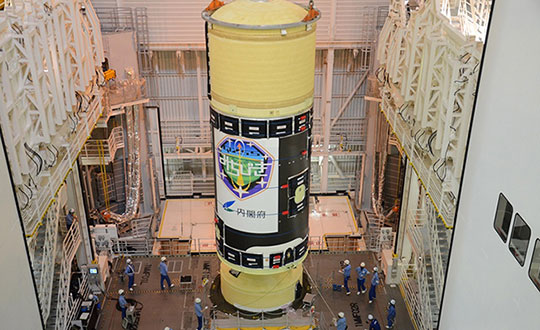
H-IIA Launch Vehicle No. 44 at the Yoshinobu Vehicle Assembly Building, JAXA Tanegashima Space Center. in preparation for launch of the successor to the Michibiki Unit 1 on Oct. 25. (Photo: MHI)
Shinichi Nakasuka, professor at the University of Tokyo Graduate School of Engineering and member of the Cabinet Office Space Policy Committee, released the following statement about the upcoming launch.
“Three years after the full operation of the four-machine Michibiki started in 2018, as the chairman of the Quasi-Zenith Satellite System Business Promotion Committee of the Cabinet Office, we strive to ensure the reliable operation and expansion of the use of this world-class system.
“I feel that high-precision positioning and two-way communication services in the event of a disaster, which cannot be achieved by GPS alone, are gradually taking root as social infrastructure. In modern society, the provision of highly accurate position and time is exactly the infrastructure that is indispensable as the ‘nerve network’ of society.
“To make that more reliable, the successor to the first machine, which pioneered this system, is about to be launched. We pray for the success of the launch and satellite operation, and hope that the Quasi-Zenith Satellite System will become more and more established in society, and that many people will be able to use this system for various purposes, including business.”
This week Sen. Patrick Leahy (D-Vt.), chair of the Senate Appropriations Committee, released that body’s version of nine different appropriations bills. The accompanying report for the bill to fund the Transportation Department (DOT) outlines the Senate’s intentions and way forward for establishing alternatives to GPS.
The report provides $15 million for the fiscal year that began on the first of October “to establish a program that leads to wide adoption of multiple technologies that provide the necessary GPS backup and complementary PNT as identified by the Department’s report.”
The department report referenced was on a demonstration project that examined GPS backup and complementary technologies from 11 different vendors. That DOT report found, based on the technologies demonstrated, a combination of signals delivered from space, terrestrial low frequency (LF) and ultra-high frequency (UHF) broadcasts, and fiber would best meet the nation’s needs.
The Senate report accompanying the funding bill outlines components of the GPS alternatives program, including:
development of safety-critical PNT requirements and standards,
user adoption models to facilitate responsible use of resilient PNT, and
procurement of services deemed appropriate by the department.
The Senate Committee report can be found here. Relevant provisions are on page 12.
Services Contracts
While not setting a deadline for issuance of a Request for Proposal, the mention of procuring services is seen by many as a strong indication that Congress expects more than just additional studies.
Services contracts, as opposed to the government building its own system, have long been advocated by numerous members of industry and by the Resilient Navigation and Timing Foundation. Contracting for services with commercial providers is a better model, they have argued, as the needed technologies are mature and commercially available. Also, issuing one or more services contracts would avoid the need for the huge funding lines and lengthy delays inherent in a government major systems acquisition.
Many have suggested that services contracts would also be a much more economical approach for the government. They say commercial interests can operate their systems more efficiently, and that they could offer additional services to other customers, potentially reducing costs to the government.
ADS-B Sets Example
Such an approach was used by the Federal Aviation Administration (FAA) for the ADS-B air traffic safety and management system. The FAA needed to monitor and use signals from ADS-B equipment aboard a wide variety of aircraft flying in U.S. airspace. Rather than building a nation-wide ground infrastructure, the FAA issued a long-term service contract for a company to collect and provide the signals. The awardee, Exelis (now L3Harris), won the contract, built the infrastructure, and now provides ADS-B information to the FAA and others on a subscription basis.
Most observers expect the portions of the Senate bill and report about the GPS alternatives program to be adopted in conference with the House and then enacted into law.
How far the Department of Transportation will be able to develop the program this fiscal year remains to be seen. The Senate provisions do require DOT to report on its progress in a year’s time. Earlier informal reports and updates to the committee are likely to inform funding and other legislation on this effort for fiscal year 2023.
Dana A. Goward is President of the Resilient Navigation and Timing Foundation
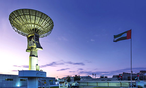
The Mohammed Bin Rashid Space Center builds and operates Earth observation satellites. (Photo: MBRSC)
The Mohammed Bin Rashid Space Center (MBRSC) in the United Arab Emirates (UAE) will use a RUAG Space GNSS navigation receiver to determine the position of its new satellite. Founded in 2006, MBRSC is home to the UAE National Space Program.
RUAG Space’s LEORIX receiver will precisely determine the satellite’s position in orbit, with an accuracy of about 1 meter. The high accuracy is achieved through simultaneously processing of multi-frequency signals from GPS and Galileo satellites.
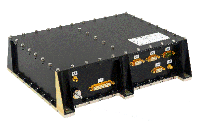
The LEORIX receiver from RUAG Space. (Photo: RUAG Space)
Based in Switzerland, RUAG Space offers three types of space-hardened navigation receivers. The LEORIX for low Earth orbit, the GEORIX for geostationary Earth orbit and the PODRIX for precise orbit determination are all based on the European Space Agency’s latest GNSS processing technology.
The PODRIX receiver had its maiden flight to space in November 2020 and precisely determines the position of the European environmental satellite Sentinel-6. The LEORIX receiver flew for the first time in space in March 2021. In total, more than 80 receivers of the latest receiver generation (LEORIX, GEORIX and PODRIX) have been ordered by customers in Asia, Europe, the Middle East and the United States. They will be launched for different low-Earth and geostationary orbit missions within the next months and years.
The MBRSC builds and operates Earth observation satellites, offering imaging and data analysis services to clients around the world. The center launched the first Emirati-made satellite, KhalifaSat, in 2018, and the DubaiSat-1 and DubaiSat-2 satellites in 2009 and 2013 respectively. MBRSC is also responsible for the Emirates Mars Mission Hope probe, the first Arab interplanetary mission, which is collecting data from the Red Planet.
AgEagle will acquire senseFly, a Parrot Group subsidiary, for US$23 million.
AgEagle Aerial Systems Inc. is a a provider of drones, sensors and software, and Parrot is a European drone company. Founded in 2009, senseFly develops and produces a proprietary line of eBee-branded, high performance, fixed wing drones for professional use.
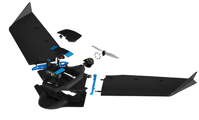
The eBee Geo drone was introduced in March. (Photo: SenseFly)
The development positions AgEagle to provide a full-stack fixed-wing drone solution for agriculture, government, engineering and construction, among other industry verticals. SenseFly also brings to AgEagle solid engineering talent focused on advanced research and development, a well-established global reseller network, and a strong portfolio of intellectual property, AgEagle stated in a press release.
The eBee drones are designed to be safe, ultra-light and easy to use. They are in use by thousands of customers around the world in agriculture, government, engineering and construction to collect aerial data. Headquartered in Lausanne, Switzerland, senseFly employs 90 people, generating total annual revenues of US$12.5 million in 2020.
“Recognized as the producer of the world’s most widely used fixed wing drones, senseFly is an ideal strategic fit for AgEagle,” said Brandon Torres Declet, chief executive officer of AgEagle.
Moving forward, Parrot will focus its expertise and resources on the growth of its professional quadcopter drone equipment and drone data analysis software activities, according to Parrot founder and CEO Henri Seydoux. “The transaction will provide additional cash and lower operational expends to drive Parrot’s growth and industry standing,” Seydoux said. “With the capabilities of the ANAFI line of professional drones and of the Pix4D software suites, Parrot will continue to address its core market segments: 3D mapping, surveying and inspection, agriculture, and defense and security.”
In tandem with the closing of the acquisition, which is expected shortly, Labossiere will resign as CEO of senseFly. Michael O’Sullivan, who previously served as the company’s head of global marketing, will be appointed managing director of the new AgEagle subsidiary. All other senseFly employees will retain their current responsibilities.
For details relating to the terms and conditions of the acquisition, refer to the Form 8-K to be filed by AgEagle with the U.S. Securities and Exchange Commission upon closing of the transaction and accessible at www.sec.gov.
The tremendous benefits of having four complete GNSS constellations
In 2020, with the completion of China’s BeiDou-3 (aka BDS) and Europe’s Galileo, the number of available global navigation satellite system (GNSS) constellations doubled.
Analogously to the addition of GLONASS to GPS a quarter century earlier, but much more so, this sharp increase in the number of available satellites and frequencies greatly improved the precision of satellite-based positioning, the speed of first fix, and the confidence in the results — especially in GNSS-challenged places, such as under thick canopy and in deep urban canyons.
Additionally, this new ability to track three or four GNSS constellations makes the overall positioning solution more resilient to malicious RF interference (jamming and spoofing), to accidental GNSS service disruptions such as Galileo’s one-week service outage in July 2019, and to deliberate withholding of service such as might occur in times of war.
While all this may make little practical difference to a driver needing to know which highway exit to take or to a pedestrian looking for the nearest pharmacy, it is very valuable in high-end applications, such as surveying and construction. In fact, surveyors who have transitioned to using all the available constellations are ecstatic.
This month’s cover story, on the benefits of having four complete GNSS constellations, is in two parts. First, Oliver Montenbruck and Peter Steigenberger discuss “the practical relevance and implications of having four GNSS in parallel for both mass-market and high-end users.” Next, I present the comments of three surveyors and a receiver manufacturer:
Gavin Schrock, PLS, is a practicing land surveyor, the operator of a cooperative real-time GNSS network in Washington state, and a technology writer
James Richards is the senior land and utility surveyor at Benchmark Surveys in Venny Bridge, UK
Choice Sterling is the survey manager at Kiewit Corporation in Federal Way, Washington
Xiaohua Wen is the CEO and founder of Tersus GNSS, a manufacturer of GNSS surveying receivers based in Australia.
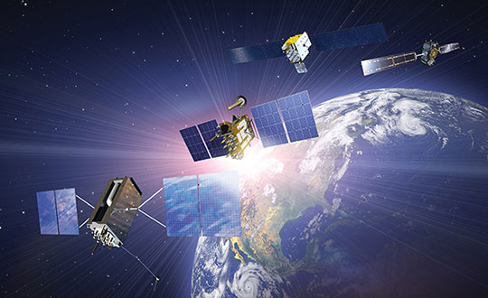
(Satellites from left) GPS: In July 1995, GPS achieved full operational capability (FOC). GLONASS: In December 1995, the (then) Soviet system achieved FOC. BeiDou: On June 23, 2020, China launched the final satellite of the BeiDou-3 constellation. Galileo: The constellation has 21 usable satellites.(Credit: Satellites from public sources; background image: NASA/Chaykovsky Igor/Shutterstock.com)
James Richards Senior Land and Utility surveyor Benchmark Surveys, Venny Bridge, UK
James Richards, Benchmark Surveys
What kinds of surveying projects do you run?
We run many different types of surveying projects. From small single-story bungalow extensions and redevelopment to development of new home sites of several hundred acres. We cover land, underground utility, and measured-building surveys of any size project, using the latest equipment in total stations, laser scanners, drones, GPS receivers, ground-penetrating radar (GPR) and electromagnetic location (EML).
How have you transitioned to using multiple constellations?
Ordnance Survey benchmarks in the UK are no longer maintained. Therefore, it has been a must to move forward with the surveying world and use multi-constellation GNSS equipment. We have stayed at the forefront of GNSS receivers, starting with a Topcon GRS1 then moving onto a Trimble R10 and a Topcon HiPer SR. Now, I feel we’ve taken another leap with the Trimble R12i, working in areas where we previously did not even consider using a GNSS receiver.
How does the availability of four complete GNSS constellations, plus two regional ones, benefit your work?
The availability of four complete GNSS constellations and two regional ones gives us more reliability as well as improved position and time accuracy in the data that we receive. It also gives us better coverage over the entire UK, including near buildings and under foliage. The Trimble R12i has 672 available channels, which makes it future-proof to new frequencies and additional space vehicles.
Choice Sterling Survey manager, Kiewit Corporation Federal Way, Washington
What kinds of surveying projects do you run?
I am the survey manager on $1–3 billion mega projects, ranging from bridges and highways to tunnels and rail, including a couple of projects for the U.S. Department of Defense.
How have you transitioned to using multiple constellations?
The use of multiple constellations became available as we adopted technologies that could capitalize on their availability. Through the latest hardware and software, we have begun leveraging GNSS to a greater magnitude than we would have just a few years back.
How does the availability of four complete GNSS constellations, plus two regional ones, benefit your work?
Not long ago, the use of GPS for construction staking was an extremely risky proposition given its unreliability, primarily in the vertical component, and lack of confidence in its horizontal accuracy. With residuals exceeding most construction tolerances, GPS was primarily utilized for earthwork or to establish geodetic pairs that could then be traversed to establish control for more precise work. With the utilization of multiple GNSS constellations, we have gained confidence in the accuracy of our results and have started leveraging GPS for construction staking where we were once not willing to take the risk.
Having the ability to leverage GPS under a canopy of trees or against structures or walls has proved invaluable when running traverses or levels, typically enabling us to use a single person rather than a two-person crew. Increased confidence in repeatability and accuracy while using GPS has been a game changer when working on projects where efficiency and cost management are of the greatest importance.
How have you transitioned to manufacturing multiple-constellation GNSS receivers?
Early in 2016, we produced a GNSS receiver evolution road map to take advantage of GPS/GLONASS modernization, the continuing development of Galileo and QZSS, and the completion of BeiDou-3. In 2019, we released our current GNSS receiver, which has 576 tracking channels and supports all five major GNSS constellations (GPS, GLONASS, Galileo, BeiDou-3 and QZSS) and triple-band broadcasts (GPS L1+L2C+L2P+L5, GLO G1+G2+G3, GAL E1+E5a+E5b, BDS B1+B2a+B2b and QZSS L1+L2C+L5). We expect to release our next generation receiver, with 832 channels, in February 2022. It will support all available constellations (GPS, GLO, GAL, BDS, QZSS, IRNSS/NavIC, SBAS) and all civil signals, including the AltBoc and AceBoc.
How does the availability of four complete GNSS constellations, plus two regional ones, benefit your end users?
The most significant advantage of modern GNSS receivers is their robust high-accuracy performance with the aiding of the new constellations and signals, especially in harsh GNSS environments, such as deep canyons and heavy foliage. It greatly extended the RTK fix capability, and now reliable GNSS RTK fix solutions can be easily achieved in areas where it was impossible to do in the past.
In the past, multipath always has been a problem for RTK GNSS receivers, as it might cause blunder errors. The improved RTK fix reliability based on robust RTK integrity monitoring takes advantage of the redundancy of observations to identify and isolate deteriorated observations and confirm the fixed result. Additionally, RTK achieves RTK fix solutions faster and maintains the RTK fix solutions easier with better accuracy than before.
Compared to the dual-band (L1+L2) of GPS plus GLONASS, the triple-band (and multi-band) can allow long-range RTK capability, which can provide reliable RTK solutions with a remote GNSS base station far from the 20–30 km base and rover separation of the past. It also will provide more confidence in RTK positioning during the coming ionospheric disturbance peak in 2023.
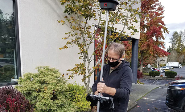
Knowing your position is only part of navigation. (Photo: Oliver Montenbruck)
By Oliver Montenbruck and Peter Steigenberger
A year ago, the U.S. Global Positioning System celebrated its silver jubilee upon completing 25 years in operation. Also, it was more than 20 years ago that President Clinton agreed to switch off Selective Availability, thus offering seamless positioning to the civil community. The 10-bit GPS week count experienced its second rollover, and people worldwide got addicted to a ubiquitous positioning capability in those decades. Be it for finding the nearest restaurant or to track a Sunday afternoon bike ride, positioning-related services building on GPS have become an integral part of our daily life. In fact, GPS has almost become a synonym for navigation itself.
One cannot underestimate the contribution that GPS has made to society. It is for sure most deserved that the fathers of GPS were ultimately awarded the highly prestigious Queen Elizabeth Prize for Engineering in the year of the above jubilee. As always, success creates followers, and GPS is no longer the sole player. Next to the Russian GLONASS, two new actors — namely the European Galileo and the Chinese BeiDou-3 GNSS — have mounted the stage. So, users are now offered a choice of four independent GNSS.
However, do we really need so many systems? Isn’t one enough and all others just a waste of taxpayers’ money? The answer to the last question is certainly a clear “no.” Our society already depends on, to a large extent, the availability of positioning, navigation and timing (PNT) services in much the same way we depend on electricity and telecommunication. While mass-market applications such as the ones mentioned above may appear dispensable, there are “hidden” but much more critical applications of GPS, such as synchronizing power lines, stock trading or the base stations of cellular networks.
Clearly, there is a well-justified rationale for nations or groups of nations to build their independent, space-based navigation systems. Well beyond possible military considerations, this is a basic strategic interest for protection of the local economy and of critical infrastructure. Along with these interests, various regulatory conditions may apply that only endorse the use of selected systems for specific applications, such as emergency call systems. Overall, however, all GNSS in place today can be received and utilized by all interested users around the globe.
So, let’s have a closer look at the practical relevance and implications of having four GNSS in parallel for both mass-market and high-end users. The most obvious consequence is certainly an almost four-fold increase in the number of satellites. As of today, the four GNSS comprise more than 100 satellites, out of which 30 to 40 are simultaneously visible and available for positioning at common sites with open-sky conditions. As a rule of thumb, this provides a factor-of-two reduction of statistical errors compared to using only GPS.
Most importantly, however, the prospects for tracking enough satellites for positioning in obstructed sites is greatly improved. The larger number of visible satellites is particularly appealing for GNSS radio scientists who aim to derive temperature and humidity profiles from subtle variations in GNSS signals passing through diverse atmospheric regions. Multiple GNSS allow for better resolution and ultimately benefit weather forecasts.
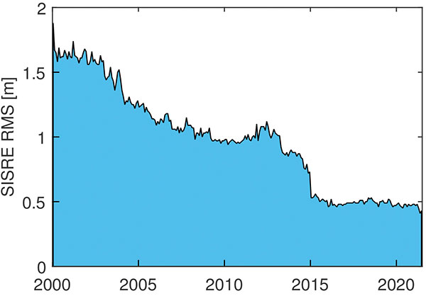
In terms of positioning, the simple statistical benefits of tracking a large number of satellites are probably outweighed by technological advances in GNSS satellites and ground systems, as well as substantial progress in receiver technology. For GPS, the signal-in-space range error (SISRE) that describes the contribution of broadcast orbit and clock errors to the position accuracy has decreased by more than a factor of three (Figure 1).
FIGURE 1. Evolution of the GPS signal-in-space range error over time. (Image: O. Montenbruck and P. Steigenberger)
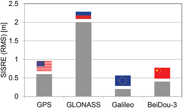
For GPS, but also Galileo and BeiDou-3, the use of highly stable atomic frequency standards has contributed to a notable reduction of the error budget of broadcast ephemerides. The same applies for fast upload capabilities, as in Galileo, or the use of intersatellite links in BeiDou-3. With SISRE values of 0.1–0.2 m and 0.3–0.4 m, these constellations enable even more accurate positioning today than GPS and GLONASS (Figure 2).
Figure 2. Signal-in-space ranging errors of the four GNSS. (Image: O. Montenbruck and P. Steigenberger)
However, improvements from new signals and multiple constellations are not only limited to single-point positioning, but likewise apply for precise point positioning (PPP) users. Stable clocks onboard the satellites reduce the update rate and bandwidth for real-time correction users. Digital signal generation units in modernized satellites ensure clean chip shapes in the transmitted ranging signals and reduce the scatter of satellite/receiver biases. Last but not least, the increased number of tracked satellites contributes notably to reducing the convergence time required for successful ambiguity fixing.
Concurrent progress in receiver technology was certainly a prerequisite for being able to track the multitude of new signals that became available with the new and modernized constellations. Compared to early GPS receivers with a few tens of channels, modern geodetic receivers may (or even must) support in the order of 1,000 channels. For mass-market users, the recent introduction of dual-frequency chipsets for mobile phones and car navigation systems marks the most important step forward. These chipsets support joint tracking of signals from GPS, Galileo and BeiDou-3 at the common L1/E1/B1 and L5/E5a/B2a center frequencies. The signals’ chipping rates, modulations and signal power are designed to offer reduced measurement noise, better multipath protection, and improved weak-signal tracking. At the same time, the use of two signal frequencies allows for rigorous elimination of ionospheric path delays, thus removing the biggest contributor to the error budget of low-cost positioning devices.
All in all, the availability of four GNSS means better performance, robustness, diversity and flexibility for navigation users. We should not forget, however, that all GNSS use basically the same core technology and share the same vulnerabilities. We must still give due attention to the challenge of toughening, augmenting and complementing GNSS to meet society’s needs for robust and assured PNT.
Oliver Montenbruck is the head of the GNSS Technology and Navigation Group and Peter Steigenberger is a senior scientist at the German Space Operations Center, German Aerospace Center (DLR).
In a slight expansion from our previous monthly UAV newsletter columns, we’re now looking at autonomous systems with a wider outlook, capturing the automated world as it evolves.
The Eve air taxi. (Image: EmbraerX)
News this month covers steps toward air taxi qualification, highly challenging underground UAV and robotic capers, and long-distance watercraft autonomy in Denmark.
EVE gets order boost by Bristow
We’ll soon be seeing them — electric powered manned and unmanned flying taxis buzzing in the city skies above us. Embraer, the Brazilian commuter aircraft manufacturer (you might have taken their EMB-1xx series turboprop aircraft on short hauls between city centers) has apparently progressed its Eve manned/unmanned aircraft development to the stage of a program for qualification/certification being scoped by EmbraerX in Florida and the Bristow Group.
Parent company Embraer established EmbraerX in Melbourne, Florida, as a new-concept UAV developer and manufacturer, launching the Eve urban mobility vehicle as its first product.
Eve subscale demonstrator. (Photo: EmbraerX)
Although we are still only seeing concept-artist renderings of the Eve eVTOL (electric vertical take-off and landing) aircraft, and photographs of a small-scale flying prototype, Embraer has already built an impressive order book. There are reports of more than 500 orders on hand, originally led by Uber and recently joined by the Bristow Group with an order for 100. All orders are likely contingent on aviation agency approval of the aircraft for public transportation.
Based worldwide, Bristow has been around in one form or another since 1955, and currently operates more than 250 helicopters in support of the oil and gas industry, search and rescue (SAR), and various military-related applications, including unmanned aircraft operations with the U.S. Coast Guard. This experience is expected to aid EmbraerX through a joint program to eventually gain an operating certificate for the Eve air taxi.
An Elios drone from team CERBERUS roams a moulin in an earlier challenge. (Photo: DARPA)
DARPA’s Subterranean Challenge
The U.S. Army’s Defense Advanced Research Projects Agency (DARPA) has been running a competition since 2018 to find unmanned products and technologies that can find their way around underground environments such as subway systems, sewers, mines and naturally occurring caves and tunnels. The object is to rapidly and remotely map, navigate and search these complex underground locations.
Known as DARPA’s Subterranean Challenge, several groups of competitors were slimmed down to three very capable teams over several months through some initial selection evaluations. Then, on final competition day, teams CSIRO Data61, CERBERUS and MARBLE went at it in an array of challenging environments at the Louisville Mega Cavern — a massive retired limestone mine so large it not only hosts a ropes course and a mountain bike park, but also has tram-guided tours for visitors.
Finalists in the competition had to navigate through elements from previous events, including simulated underground mines, a metropolitan infrastructure, and cave systems. Smoke was even used in places to increase the confusion.
Team CERBERUS — an international consortium that included the University of Nevada Reno (UNR), ETH Zurich, the Norwegian University of Science and Technology (NTNU), the University of California Berkeley, the University of Oxford, Flyability, and the Sierra Nevada Corporation — was ultimately successful.
The ANYmal climbs stairs. (Photo: ANYbotics)
In previous phases of the competition, Flyability used its caged Elios 2 UAV with video and thermal cameras and a high-intensity LED lighting system to create accurate internal maps of underground spaces. However, in the final competition, ANYbotics four-legged ANYmal C autonomous robots were primarily employed — carrying visual and thermal cameras, lidar and a spotlight.
In the final competition, Team CERBERUS managed to locate and identify 23 of 40 hidden “artifacts” in the allocated time and earned the $2 million DARPA first-place prize.
Autonomous Tugboat round Denmark
Sea Machines in Boston has been around since 2015, focusing on automating shipping control and monitoring. It hopes to bring a system to market that will enable an autonomous voyage all the way around Denmark.
With investors who include Toyota Ventures, Huntington Ingalls, Brunswick Corporation, Accomplice and Dolby Fund, the company is not a mega-million venture, but has still successfully engaged the likes of A.P. Moller-Maersk, the U.S. Department of Transportation and the U.S. Navy in autonomous waterborne projects.
The tugboat Nellie Bly on its 1,000 nm circumnavigation of Denmark will use an SM300 autonomous system that uses radar, inertial navigation, a depth transducer, the automatic identification system (AIS) and video cameras for obstacle avoidance. It will provide high-definition remote situation awareness to monitoring controllers in Boston, 3,600 miles away.
Autonomous tugboat Nellie Bly. (Photo: Arie Boer)
Throughout the voyage, the Nellie Bly will have two professional pilots onboard, and will stop at ports along the way to demonstrate the technology. Sea Machines will stream the journey live on a website with updates from the ship, the crew and the command center, enabling real-time and recorded access to “The Machine Odyssey” as the project is now known.
To sum up, lots of autonomous projects are proceeding, with progress toward getting air taxis up and running for business, DARPA sponsoring technology for underground navigating, and mapping and long-distance autonomous navigation around Denmark — lots of diversity and opportunity.
Gavin Schrock, PLS, shared his thoughts on how the evolution of GNSS has affected surveying. Schrock is a practicing land surveyor, the operator of a cooperative real-time GNSS network in Washington state, and a technology writer.
Gavin Schrock has been using satellite navigation since the early days of GPS and the Doppler-based Transit system before that. “I am a bit of a dinosaur,” he said. “What I find interesting about the evolution of GPS, especially when it went to multi-constellation, is that it instills more confidence in what somebody is doing, in several ways.”
For commercial use of GPS, the first units were static and required post-processing. “If you were out in the wide open sky and could get your minimum of four to five satellites and observe enough data, you could process that and get outstanding precision — less than 3 cm in 3D in a reasonable amount of time with 95% confidence,” Schrock said. “Now, with more satellites, you can get it a lot faster and in more places.” Using certain procedures, early GPS adopters could get down to millimeters. “You can get that precision now, but you get there a heck of a lot faster.”
An obstructed view of the sky, tree canopy, multipath and other factors limit where surveyors can use GNSS. One of the ways the new constellations and signals help, Schrock explained, is through the evolution of processing. “I like to call it the fourth wave of GNSS field equipment for high precision — for surveying, machine control and construction. In just the past few years, many of the manufacturers have had to put huge processors in their high-end rovers to process many more satellites and signals, as well as new RTK [real-time kinematic] engines with improved onboard multipath mitigation.”
While some rovers built a decade ago could track and use many of these signals, this new wave of gear, with more powerful processing, takes much greater advantage of the multi-constellation. The updated interface control document (ICD) for BeiDou-3 was released just over two years ago; it may still take a lot of development work to enable older receivers to take advantage of it, if it is even possible, he said. By contrast, “Many newer units hit the ground running with full constellation capabilities.”
“Much of the new wave can do amazing things in the way they can mix and match signals, though there are different approaches to this,” Schrock said. “They can do such things as processing many satellites and multiple signals from each, under one filter for a more robust solution. You might have L1, L2, L5, B3, E1, E5a, and E5b in the mix, to name a few. Then you have the alternative BOC modulation (AltBOC), where it is kind of processed together to give a wide lane solution. That can really bring in your high precision a lot faster and, in many cases, improve on the high precision that you used to get with your old rovers.”
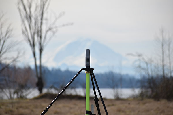
Mount Rainier (above) serves as the backdrop for a field project by Schrock (right). (Photo: Gavin Schrock)
How GLONASS Brought Change
Surveyors using equipment more than four years old, which Schrock calls “legacy gear,” often cannot take full advantage of the availability of multiple constellations. “Years ago, there was a mini-boost when manufacturers began to include GLONASS; you suddenly had more satellites. Early GLONASS was a mess, but it got better. It remains a little noisy, but you have extra satellites. When you are trying to get a minimum of five satellites to do your RTK or your network RTK, we really struggled when it was GPS only. GLONASS changed that. You could work in many more places, without worrying about the time of day and looking up what the satellite’s availability was going to be and have to plan ahead.”
The latest boost, thanks to the two new GNSS constellations, is “much more impactful” than the addition of GLONASS was, Schrock said. Galileo now has five or more usable signals, depending on how each manufacturer chooses to use them. In addition to the extra satellites, “you also have more modernized signals. They are not as noisy as the old GLONASS ones. GPS signals are still very clean, and about half of the GPS satellites now broadcast the L5 signal, which you can throw into the mix.”
RTK units now can mix and match satellites from different constellations in outstanding ways, Schrock said. “The advantages are great when you are struggling in canopy. You still must be cautious, but you can check repeatability much more quickly.”
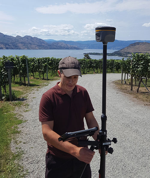
GNSS today: A four-leaf field test of a South rover with MicroSurvey software. (Photo: Gavin Schrock)
In the old days, Schrock recalled, when surveyors used GPS only, carried giant receivers and huge antennas, and did long static sessions, they had to return to sites for repeat observations on different days and at different times.“The method was based on the premise that if you can repeat a solution with a different geometry, that gives you more confidence. Now you may have up to 40 satellites in view. In Asia, 50 in view is not uncommon, because they have India’s NavIC constellation and Japan’s QZSS in view as well. The rover will pick and choose the best ones to use for that solution. So now, instead of having to go back 40 minutes later or the next day to get a different geometry, in several of the manufacturers’ field software, you have a way to just ask it to pick different geometries.” Comparing these geometries to the results from repeated occupations on multiple days, Schrock saw no difference.
Some users of the network he operates are “over the moon,” he said. One construction company told him multi-constellation fundamentally changed the way it approaches parts of their construction projects and cited the confidence factor. Adding GLONASS and Galileo to their mix, users told him “I’ve been missing out all these years. I should have gotten into this earlier!” Schrock has not received as much positive feedback from end users as within the past few years. “[Multi-constellation] has made a lot of difference, including in the way I approach my own field projects.”
Brandmotion LLC is collaborating with DENSO Products and Services Americas to offer a one-stop service to cities seeking to equip vehicles with advanced vehicle-to-everything (V2X) technology.
DENSO is a global mobility supplier and Brandmotion develops vehicle integration for V2X deployments. By combining forces, the two companies are offering cities and agencies an easier path to vehicle integration for V2X deployment testing.
V2X technology has been proposed by the U.S. Department of Transportation as the best way to address the chronic death toll on America’s roadways, with nearly 37,000 lives lost and a record 6,721 pedestrians killed at intersections in 2020. Many city managers and state transportation agencies are looking to deploy V2X technology regionally to reduce vehicle crashes and fatalities and improve pedestrian safety.
The DENSO-Brandmotion partnership simplifies the process of equipping vehicles for long-term testing. Many cities have had to assemble the elements of a large vehicle V2X deployment manually, developing specifications and coordinating multiple vendors.
Brandmotion has served the Tampa Connected Vehicle Pilot for five years and provided responsive professional-grade automotive integration and service capability. DENSO is the on-board unit (OBU) supplier to OEMs for phase 4 of Tampa’s pilot project, bringing true Tier 1 development capabilities to the project.
The partnership will provide transportation agencies with the following vehicle-related deployment services:
the DENSO On Board Unit (OBU) platform (Hercules), which has the ability to run and process applications that support both cellular V2X (C-V2X) communications and dedicated short range communications (DSRC) in an automotive environment (while DSRC is still permitted by the U.S. Federal Communication Commission)
a standard set of applications, including blindspot/lane-change warning, electronic emergency brake light, forward crash warning, intersection movement assist, red light violation warning, and traffic signal priority
custom application development for specific agency application goals
thorough vehicle-specific installation planning, vehicle system design and validation
small to large-scale installation and tech support.
Intelligent transport company Cohda Wireless is applying its vehicle positioning solution to the Oyu Tolgoi mine in Mongolia to drive safety and productivity.
In its first use for mining, Cohda’s V2X-Locate technology is being deployed at the Oyu Tolgoi copper and gold mine, managed by Rio Tinto, to provide vehicle and personnel location accuracy.
V2X-Locate was initially developed to solve vehicle positioning accuracy challenges inherent in the urban canyons of cities where large buildings, underground parking lots and tunnels interfere with GNSS signals. Using dedicated short-range communication (DSRC) signals, Cohda’s signal processing and positioning algorithms provide highly accurate vehicle position irrespective of GNSS availability or quality.
Cohda Wireless is headquartered in Australia and has offices in Europe, the United States and China. Its V2X (Vehicle-To-Everything) technology connects vehicles with each other and with roadside infrastructure to create a cooperative and intelligent transport environment.
The system can integrate and manage location data from multiple sensor types with sub-meter accuracy throughout the mine site, said Paul Gray, Cohda Wireless CEO. He called it a significant improvement on using a combination of disparate collision avoidance systems across the mining environment, as is usually the case.
“When you have hundreds of vehicles and personnel operating in close proximity underground, a meter matters. And whilst the prevention of injury and death is always the top priority, we also know that the ability to visualize, optimize and monitor vehicles brings significant operational benefits and efficiencies,” Gray said.
More than 200 mining vehicles of all types are being fitted with Cohda’s XBU-V specially adapted on-board units that connect vehicles to each other and to XBU-I roadside units installed in mine tunnels. Mining vehicles are fitted with a human-machine interface that will notify operators to warn them of potential collisions. More than 2,000 personnel will use V2X-Locate-compatible cap lamps, enabling time-of-flight analysis of wireless signals to resolve spatial locations.
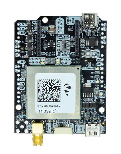
The mosaic-X5 and mosaic-H modules are being integrated into ArduSimple’s new evaluation kits, making resilient cm-level positioning easily accessible for testing and prototyping
With these new kits, ArduSimple brings to market triple-band real-time kinematic (RTK) GPS/GNSS as a plug-and-play solution for the most popular development platforms such as Arduino, STM Nucleo, Raspberry Pi, Ardupilot and Nvidia Jetson.
ArduSimple enables developers of robotics, UAVs and autonomous systems to easily try out mosaic, a unique module offering the latest high-performance GNSS positioning technology.
“The mosaic module complements the ArduSimple RTK product portfolio with a higher-end solution for the most demanding applications,” said Marc Castillo, senior consultant at ArduSimple. “Triple-band GNSS brings extra reliability to the RTK solution and removes the headache of transitioning from L2 to L5 band. This, combined with its feature-rich software, will allow our customers to accelerate even more their time-to-market.”
In addition to triple-band GNSS, mosaic module offers unmatched resilience to radio interference. This is especially important in robotic devices where electronic components, such as cameras and servos, are located close to the GPS/GNSS receiver, often interfering with GPS signals, which are weak, and causing positioning degradation. High-accuracy positioning is delivered at a uniquely high update-rate by mosaic-X5 in single antenna mode. Meanwhile, the board which mounts mosaic-H offers all-in functionality with dual-antenna mode for accurate GNSS heading.
“By partnering with ArduSimple we are bringing mosaic to emerging markets where its outstanding performance makes a difference. Mosaic makes accurate positioning so much easier to integrate and use, while giving a competitive edge to new products,” said Gustavo Lopez, market access manager at Septentrio. “ArduSimple is a great partner because they are known in the industry for offering user-friendly and affordable evaluation kits for RTK positioning, complemented by software tools, making integration and rapid prototyping easy.”
The SimpleRTK3B board, which allows evaluation of the mosaic GNSS module, is now available for purchase via the ArduSimple web shop. For more information about mosaic or other Septentrio products visit septentrio.com or contact Septentrio.
The free resources are intended to advance the design of PNT systems and increase resilience of critical infrastructure to PNT disruptions.
The GPS Whitelist Development Guide presents a software assurance approach to addressing potential vulnerabilities and increasing reliability of GPS receivers. The guide addresses data-related requirements in the Resilient PNT Conformance Framework, which provides guidance for defining expected behaviors in resilient PNT equipment.
“We hope this guide and related resources will help industry advance towards a cybersecurity-based approach to PNT resilience,” said S&T Technical Manager Ernest Wong.
Originally released in March 2021 as open source on GitHub, the PNT Integrity Library provides users with a method to verify the integrity of the received GPS data. The update includes:
A compliance check on Interface Control Document (ICD) IS-GPS-200, which is a formal means of establishing, defining and controlling communication between the GPS space and other user systems; and
A Do-It-Yourself (DIY) Toolkit, which describes how a perspective end-user of the PNT Integrity Library can assemble a demonstrational toolkit with commercial-off-the-shelf (COTS) hardware.
“Since GPS signals can be jammed or spoofed, critical infrastructure systems should not be designed with the assumption that GPS data will always be available or will always be accurate,” said S&T Project Manager Brannan Villee. “Application of these tools will provide increased security against GPS disruptions. However, DHS also recommends a holistic defense strategy that considers the integrity of the PNT data from its reception through its use in the supported system.”