Lockheed Martin Corporation demonstrates its Indago UAS at Unmanned Systems 2015, held May 4-7 in Atlanta. The Indago payload system features a quick disconnect adapter which allows the operator to choose the appropriate payload for the mission, according to Lockheed Martin. The payloads are available for a variety of different applications, including agricultural, mapping, inspection and ISR.
Blog
-
Man Arrested Trying to Fly Drone Outside White House
Secret Service detained a man Thursday afternoon who was trying to fly an unmanned aerial vehicle over the White House fence, reports CNN.
The park on the north side of the White House was locked down while the incident was investigated, but the lockdown was lifted by Thursday afternoon.
President Barack Obama is not in the White House, but at Camp David.
This is the second drone incident this year, following an incident where a hobbyist who had been drinking crashed a drone on the White House lawn. A no-fly zone covers most of the D.C. area.
-
Senators Propose Bill to Expedite UAV Exemptions
Two U.S. senators have jointly proposed a new bill that could expedite the commercial introduction of drones.
The senators believe the U.S. is falling behind other countries when it comes to creating rules for commercial drones. Sen. Cory Booker (D-N.J.) and Sen. John Hoeven (R-N.D.) introduced the Commercial UAS Modernization Act, which would set temporary rules for those who want to fly commercial unmanned aircraft systems before the FAA establishes permanent laws regarding drone use.

Sen. Cory Booker The Commercial UAS Modernization Act outlines basic rules for commercial use around registration, certification, insurance, tests and safety. Operators would be required to keep the drones under 500 feet, fly only in daylight, and operate within visual line of sight (LOS). However, the proposal also creates a deputy administrator position that would be able to make an exemption for a commercial drone operator for beyond visual LOS and for “heavier unmanned vehicles.”
“Not later than 90 days after the date of the enactment of this Act, the Deputy Associate Administrator, in consultation with the Administrator, shall expedite and expand exemptions from the interim operating restrictions otherwise applicable to unmanned aircraft under section 337,” the act reads.

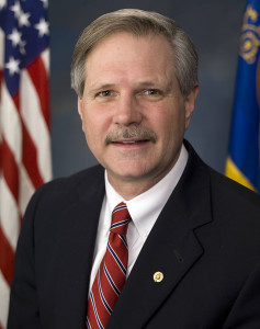
Sen. John Hoeven When GPS World talked with Sen. Hoeven this week, he emphasized that this bill seeks to accelerate the commercial use of drones in the U.S. and to make more use of the UAV test centers that the FAA has set up. These centers are capable of doing more, and can be the points that prospective drone operators visit to register their craft and take knowledge and proficiency qualification tests.
The bill gives tight timescales to the FAA to set up accessible locations to achieve registration and set up these operator qualification programs. In addition, the bill establishes a new deputy administrator position responsible for the safe integration of UAS in U.S. airspace, while also streamlining regulations that currently slow the industry’s ability to innovate new aircraft technologies.
In essence, the bill takes the core elements of the FAA’s past Section 333 approvals — less the requirement for a private pilot’s license — and makes them law. Operators would no longer need to ask the FAA for an exemption.
GPS World asked Sen. Hoeven if the FAA has responded to the proposed bill, and he said he would be meeting with FAA Administrator Michael Huerta on May 14. “This follows their rules,” the senator said, so his message is let’s move forward together.
-
Tim Tebow, GPS, Space Acquisition, 60 Minutes and the GAO

Don Jewell Tim Tebow, GPS, space acquisition, 60 Minutes and the GAO.
One of these things is not like the others. When you first learn this Sesame Street song as a child, where it may be presented as a series of cartoonish pictures, the odd item is usually fairly obvious. Years later, when you encounter this deceptively simple statement on a physics test at Stanford University — where the choices are beguilingly similar formulas or algorithms — the correct answer may be a bit more difficult to determine, and may actually require serious thought.
It seems the U.S. government (USG) acquisition cadre seems to have a similar problem when it comes to recognizing the critical importance of small businesses. The USG has a federally documented mandate and stringent policies (unfortunately, often ignored) in place to support small businesses in the United States. Supposedly, a quota system is in place where, in a perfect world, 23 percent of all eligible contracts should be won and performed by small businesses — the word eligible being the fly in the ointment.
Small Business
For government contractor purposes, what exactly is a small business? This is not an easy question to quantify or answer simply but let’s try. NAICS (North American Industry Classification System) codes specify, among other requirements, the maximum number of employees in a business qualified to compete for contracts of a certain dollar amount — that is one way to designate not only a small company, but their small business qualifications as well. Some companies are not only small in size, but have special qualifications that allow them to compete in a special category for certain contracts; such as being owned by a woman, a Native American, an Eskimo, a handicapped person (any of the five senses), or by the economic success or lack thereof, where the business is geographically located, or the population it serves and employs.
As you can readily see, this small business definition can become unwieldy in a hurry. For our purposes, let’s describe a small business as a company of 500 employees or less that may meet any or all of the aforementioned qualifications, but most importantly meets the operational requirement of having a certain field of expertise for which it is known and at which it excels in. In short, the small company is the domain expert in a certain field of endeavor and typically is sought after by government (municipal, state and federal) and commercial entities alike for their expertise.
Such companies are also sought out by large government contractor competitors known as prime companies that may range in size from several thousand to hundreds of thousands of employees. These companies have historically been likened to a battleship that takes forever to change course. The large primes are the Warren Buffets of government contracting, as they typically have tons of resources and stores of cash, but they historically lack the flexibility, expertise and low cost structure (read low overhead) of the small companies. Therefore, the smaller companies are frequently sought out as critical team members on large government contracts at all levels. Plus, since there is supposedly, in writing anyway, a small business quota system in place, if you can place a small company on any government contract, so much the better. To the prime and the U.S. government, it may be just statistics, but to the small company, it is often a matter of success or failure for the company.
It is a fact of life in government contracting that many times the small companies’ domain expertise is why the prime, who put a winning team together, wins the big contract in the first place. You would think this would ensure success for the small company. However, “build a better mouse trap” and “build it and they will come” are nice clichés, but often get lost in the real profit-and-loss world of government contracting.
In my experience, problems typically come about because both the government and the prime contractors lose sight of why the small, domain expert company is on the team in the first place. Great small companies are so good at what they do, they typically under promise and over deliver and begin to make both the government oversight institutions and the prime look bad. By bad, I mean less efficient, not as capable, and burdened with a plethora of rules and regulations and monstrous overhead rates that rarely apply to small companies.
Don’t think that I have a problem with prime contractors. I worked for two of the largest for many years and they were and are great companies. None of the satellites we have in orbit today would be there without prime contractors. So prime contractors are a great asset to this country and to the space programs, but even large primes occasionally lose their way or fail to deliver.
Acquisition Analogy
Bear with me as I present a simple football analogy some serious thought as it pertains to GPS contracting.
Tim Tebow was/is arguably one of the most famous and sought after American college football quarterbacks of all time. He was the first college sophomore to win the coveted Heisman Trophy, the First round NFL draft pick in 2010, and the winner of two NCAA National Football Championships.
At the conclusion of his phenomenal college career, Tim Tebow held the Southeastern Conference’s all-time records in college football for both career passing efficiency and total rushing touchdowns, appearing second and tenth (respectively) in the NCAA record book in these categories.
Playing his rookie season for the Denver Broncos, Tim started the last three games and became the team’s full-time starting quarterback beginning in the sixth game of 2011. The Denver Broncos were a dismal 1–4 before Tim became the starting quarterback, but began winning with him on the field, playing just as he did in college, often scrambling and running with the football and coming from behind late in the fourth quarter to win. Under his tutelage and leadership, Denver won their first AFC West title and first playoff game since 2005, defeating the Pittsburgh Steelers in overtime.
Tebow the Pro
What happened next? This is where is gets interesting and pertinent to government space acquisitions.
What happened is Tebow changed. He was made to conform to what is viewed as proper professional football behavior. Professional football pundits criticized Tim Tebow for everything from his scrambling and running plays to his obviously devout displays of Christian faith. Statements were made such as “He will get hurt scrambling and running the ball so much, then Denver will not have him as a starting quarterback.” “These college plays he keeps running just don’t work in the NFL.” “Tim needs to wake up and realize he is not in college anymore.”
Amazingly, despite all the critiques, the Tim Tebow college-based solution was working. College plays and Christianity were the formula that worked for Tim in college and was obviously, despite his critics, working well in the NFL, at least for the Denver Broncos. For all the other NFL teams, not so much. Then it all started to come apart, because what the other NFL teams were really admitting to was what psychologists call social phobia or the fear of being embarrassed. In other words, what the other NFL teams were really saying was:
“Come on Denver, we can’t have a college quarterback, using old college plays, defeating the NFL’s finest teams. It makes us all look bad. People pay big money to see NFL teams win on Sunday and Thursday. So get this flea flickering wunderkind under control and come back into the fold. You and your college quarterback are embarrassing the league with your success!”
The Denver Broncos and subsequently other teams in the NFL bowed to pressure and forced Tim Tebow to drastically change the way he played football. The winning formula was shelved, and T2 was made to conform. When that happened, he became the league’s top-losing quarterback. His once accurate passes started to miss their mark because he was told to stay safely in the pocket and not scramble or run with the ball, even though historically his most accurate passes were thrown while on the run. Since he no longer scrambled or ran, he not only lost accuracy but historically the yards he gained running with the football were gone as well. So he rapidly became just what the league declared he should be, not a winning collegiate quarterback in the NFL, but a nominal losing NFL quarterback. At least he was not doing anything outside the norm for the NFL. He was no longer embarrassing the league by winning, but by finally playing by the rules and losing.
Now let’s take the Tim Tebow saga and apply it specifically to federal government GPS acquisitions, or simply to space acquisition practices in general.
Random Scenario
Let’s take a random and totally make-believe scenario and say the federal government requires a new command and control system (C2) for a large global satellite constellation. For purposes of this imaginary scenario, I need to remind you of an old adage, that unfortunately is not imaginary, in the national security space business concerning space C2 systems. It goes like this: The space hardware is 95 percent complete when a team member remarks, ‘Wow! this satellite system is going to be the best in the world at what it does! I can’t wait to see the whole system up and running.” Another team member ponders that statement and replies, “A system, what system? All we have is space hardware. How are we going to launch it, control it (TT&C) and send and receive operational data? Oh yeah, we need a space C2 system. We better get right on that!” You may laugh, but this exact scenario has been played out more times than anyone cares to admit. But, of course, this is all just make believe! Right?
RFI/RFQ
Now imagine for a moment that you find yourself in this situation. As a member of the U.S. government acquisition team, at an SPO or (Special, Space, Strategic, Scientific — take your pick) Program Office, you quickly put an RFI (Request for Information) or an RFQ (Request for Quote) together just to see which companies have the requisite expertise and how much they, the companies, estimate it will cost to complete the C2 system for your constellation. The only problem being that in the RFI or RFQ, which is typically just a few pages, you only delineate the actual basic requirements and you only give the responding companies 30 days to determine how they will go about controlling a constellation you have been building for the last five years. Imagine that! The important part of the scenario is that the RFI/RFQ is actually on the street.
You can be assured most of the five big space primes are going to reply. After all, they have teams of highly qualified proposal writers that do nothing but respond to these requests. While the response process is often a thing of beauty, it is also frequently highly inefficient and misleading. Remember an RFI/RFQ format is almost inconsequential, as it is just the response the government is looking for at this point: Does your company or team of companies have the qualifications to do the work? How long will it take? How much will it cost?
This is far from the end of the story or process. Typically several small companies also respond to Space C2 RFIs and RFQs, primarily because the request concerns their area of expertise, not from a process point of view but from a domain expertise point of view, which may require radically different approaches.
Small technological companies in the space control business are usually flexible and agile, no-nonsense, lean and mean, replete with subject matter experts that specialize in C2 for satellite systems, both commercial and for the USG. They may well be the best in the world at what they do. Alas, they initially and naively think that is all that is required. They may even be under contract to the federal government doing exactly the type of work the RFI/RFQ specifies is needed, but they are frequently overlooked because they are, you guessed it, a small company. However, being small and sometimes naïve, they answer the RFIs and RFQs with enthusiasm, expectations and hope that the system will work and they will be recognized for their expertise, low cost, low overhead and even their outstanding past and present performance. Then, to quote Gilda Radner, “Oh, Never mind!”
Finally, the other shoe drops, as eventually the actual thousand-plus page RFP (Request For Proposal) is released. The RFP has critical detailed data for program success but unfortunately also contains frequently superfluous documentation and tedious requirements lists known as CDRLS (Contract Data Requirements Lists) that commonly reference hundreds of compliance documents so obscure that the USG provides the documents in a special digital online library, because no entity other than the USG would ever bother to keep such sleep-inducing documentation on hand. In this case, 90 percent of the CDRLs do not involve actual C2 of a space constellation, or whatever expertise is required to accomplish the mission, but rather they invariably pertain to some obscure government regulation concerning report formats and interfacing with the government oversight companies and committees.
Too Small To Succeed
Unfortunately we have all heard of companies and institutions that are supposedly too big to fail but what about too small to succeed? In one real-world example, and the USG actually put this in writing, the small expert company that was utilizing its expert system software to actively launch and control spacecraft flawlessly for seven years and is still actively controlling critical space payloads today was told in a competition debrief that they did not fully qualify for the new C2 RFP. Not because of any lack of expertise or past or current performance issues, but because they were too small — not that they could not and were not actually successfully accomplishing the same mission currently (they were the incumbent), but that they did not have the requisite number of personnel to interface with the government on a daily basis during the C2 contracts development phase. This 200+ person small expert company was told they would need to hire another 80 administrative staff just to keep up with the government paperwork and oversight the new C2 program would generate. None of these ‘required’ positions were engineers or subject-matter experts, just paper pushers that generate tons of paper and of charge at a high hourly rate that would add approximately $5M to the contract bid price. True story; sad but true.
So the small company, fully qualified to accomplish the task in record time and for a pittance, a fact nervously recognized by some in the government and by the primes, is not awarded the contract because their hourly rates are half those of the big primes, they can do the work in two years versus six, which for some reason is considered a high-risk proposal, and they do not have the additional 80 staff members sitting around waiting to respond to every government inquiry. Just like Tim Tewbow they were embarrassing the USG and worrying the big primes.
All is not lost. The small company is approached by Prime-A, a large company that is competing for the C2 contract even though they had never launched or controlled a satellite of this type before and are not known for their expertise in the space C2 area. Seeing the handwriting on the wall, the small company agrees to join Prime-A’s team on the six-year $900M effort that the small company was prepared to accomplish for $200M in only 24 months. Twelve months later, the contract is awarded to Prime-A. During the government debrief, one of the primary reasons for the “win” for Prime-A is because they teamed with the right small company — you guessed it, the one with all the domain expertise that was currently doing the work. Smart move by Prime-A.
Ok, so all’s well that ends well, right? Unfortunately, Prime-A now makes a bad move and announces just days after winning the new C2 contract that, having reconsidered their position, now that they have won, they will not be utilizing the tried-and-true operationally proven system from our small expert company, that actually helped them win the contract. No, Prime-A has decided to develop their own brand-new C2 system, become a competitor to the small expert company (a teammate), and allow the government to pay for it all. Of course, the end product, if it is ever successfully developed, will be a totally unproven and proprietary system and will take twice as long, cost five times as much and be far less capable, without any flexibility. But competition is king!
Time Passes
Five years into our imaginary scenario and the C2 program is years behind schedule. The only deliverables the USG has in its possession are those accomplished by the small company partner with the C2 domain expertise, along with invoices from Prime-A that add a 20 percent handling fee or surcharge to all the small company’s accomplishments and that now make the original $900M program a $1.8B program that will only accomplish 50 percent of the original RFP’s stated objectives. The program has moved so far to the right that full completion of all program phases will now take 10-12 years at a cost surpassing $4.2B, during which time all the space hardware will be placed in storage for an additional cost of $1M per space vehicle per year, because the space hardware cannot be launched and fully utilized without the C2 system that makes them incredibly valuable global assets instead of space junk on orbit. More space debris if you will.
Of course, if the small expert company had been awarded the contract or their product had been utilized by Prime-A at the outset, to do the job it currently does so well, valuable space assets would be ready for launch today and ready to benefit mankind worldwide. BTW the USG would also have $1.4B more in its coffers.
But, alas, that is not how our imaginary scenario plays out. In this scenario the small space company experiences the Tim Tebow process and government indoctrination. Their expertise is discounted because they are playing with the “big boys” now, and they are required to hire 80 additional administrative personnel just to compete. They are required to submit all work product through Prime-A that adds an extra 20-50 percent just to process the paperwork and keep the marching army of support staff employed.
As a consequence of the teaming agreement, the small expert company can no longer talk directly to USG representatives who are now suddenly very interested in the original $200M, 24-month proposal. As a member of Prime-As team, the small expert company cannot undertake any independent actions. It is under the thumb of the prime, and the USG will never have the opportunity to take the road less traveled that leads to success and a winning season with a small company. They have been Tebowed!
Rare
Fortunately, the imaginary scenario you just read rarely happens. The USG acquisition teams are very good at what they do, and they rarely allow the scenario described to take place. However, rarely is not “never,” and unfortunately similar scenarios do occasionally take place. Sometimes the USG just makes bad decisions. They fail to realize the true potential and the true domain expertise provided by small expert companies.
Budget
In this budget seques-castration era USG acquisition personnel and decision makers need to look beyond procedures, precedence and tradition. They need to think outside the proverbial box and consider all their options. A satellite C2 system does not require a huge prime company and a marching army of a thousand or more personnel. Constellation C2 can and has historically been accomplished by companies just like the 200+ commercial company in our scenario. Additionally once the USG realizes the prime has failed they need to stop throwing “good money after bad” and restructure the contract, reassign tasks or simply re-compete the contract. As I have said in these pages many times there is not a single satellite constellation in orbit today that requires a $1.6B and certainly not a $4.2B C2 system. And we should not have to wait for 10-12 years for it to come to fruition.
That is outrageous, I hear you say, and you would be correct. But, of course, this is just an imaginary scenario! Surely that never really happened, did it?
To quote Winston Churchill, as I have numerous times, “Gentlemen, we have run out of money; now we have to think.”
60 Minutes and GAO
Recently the investigative news program 60 Minutes has become keenly interested in space and so far it has been a great experience for AFSPC (Air Force Space Command), the United States Air Force (USAF) and the USG. Space and the technology it enables are force multipliers and our freedoms in this great country of ours depend more and more on the space domain and billions of people around the globe depend on GPS for positioning, navigation and timing. GPS is without a doubt the most successful and important constellation in orbit today; bar none. It is a good news story and one of which we can all be proud. Let’s hope it continues to be a good experience.
However, when the GAO, or Government Accountability Office, comes calling the story or experience is not always so positive. The word is out that the GAO has been snooping around AFSPC and several prime space contractors and small space companies as well. As the investigative arm of Congress, government programs rarely fare well or, should I say, sometimes bid “farewell” once the GAO is on the scent. I challenge you to find a single government program manager that can say he is just waiting with fond hopes for Congress to tell him how to run his program.
Bottom Line
This could be an outstanding and pivotal year for NFL football, for Tim Tebow and for USG space acquisition programs, if we all learn the hard lessons from the Tim Tebow experience. Don’t mess with success, and bigger and more sophisticated is not always better.
So, which word in the title is not like the others? Only time will tell.
Until next time, happy navigating, and remember: GPS is brought to you free of charge, courtesy of the U.S. Air Force.
-
McMurdo Opens Emergency Response Experience Center
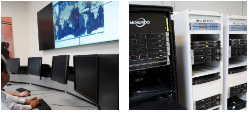
McMurdo has opened an Emergency Readiness and Response Experience Center at its Washington, D.C., location. The center will showcase the latest innovations and technology developments for search and rescue (SAR) in an immersive experience with real-time demonstrations of the entire SAR process — from distress beacon activation to satellite-based location detection to emergency response coordination.
The facility will feature a working MEOSAR (Medium Earth Orbit Search and Rescue) satellite-based search and rescue system, the next-generation version of the current Cospas-Sarsat satellite system that has saved more than 37,000 lives since 1982. When fully deployed in the next 3 to 5 years, MEOSAR will greatly improve the existing SAR process with global coverage, near instantaneous distress beacon detection and a unique Return Link Service feature that acknowledges distress signal receipt. MEOSAR’s advanced technologies will be able to accurately detect and locate a distress beacon signal almost instantaneously instead of taking up to 30 minutes today.
For background on how GNSS satellites will be used in the MEOSAR system, see “The Distress Alerting Satellite System” Innovation article.
Visitors to the center will gain an understanding of the different search and rescue technologies by taking part in various search and rescue scenarios. Participants will also have the opportunity to sit at the controls of mission control center and rescue coordination center systems, similar to the McMurdo solutions used around the world by NASA, National Oceanic and Atmospheric Administration (NOAA), Australia Maritime Safety Authority (AMSA), Maritime New Zealand (MNZ) and other SAR authorities.
“This cutting-edge Experience Center allows us to demonstrate the incredible advancements being made in search and rescue all in a single location,” said Jean-Yves Courtois, CEO of McMurdo. “Our decades of experience in pioneering the latest SAR advancements, our leadership position as the only company that provides an end-to-end SAR ecosystem and our ongoing commitment to saving lives put us in the unique position to showcase these emergency readiness and response solutions for our customers, our partners and the industry.”
Guests will also see SAR-enhanced applications such as fleet management, coastal surveillance and innovative partner solutions for aviation, fishing, maritime, military and other industries. Classroom training and other educational sessions led by industry experts and SAR specialists will take place at the new center.
“The McMurdo Experience Center is unique in its ability to make the entire search and rescue process come to life, which we haven’t seen done before in a centralized setting,” said Bruce Reid, CEO, International Maritime Rescue Federation (IMRF). “We at the IMRF are delighted to be working with McMurdo on a variety of SAR training, education and awareness activities. Access to this location as a true center of excellence for the search and rescue sector can only enhance this activity.”
Personalized, custom tours of the McMurdo Experience Center for customers, partners and press can be reserved.
McMurdo products and services are used by some of the biggest names in the world including Airbus, Boeing, British Airways, Embraer, Southwest and United Airlines as well as the British Royal Navy, U.S. Coast Guard and numerous global search and rescue authorities. McMurdo was instrumental in the high-profile rescue of Clipper Round the World Race Sailor Andrew Taylor and was recently named as the official safety beacon partner of the hit reality series Deadliest Catch.
-
CartoPac, EDM Implement Inspection Software for Western Power
CartoPac International and EDM International have implemented a new transmission line inspection solution based on the CartoPac Software platform for the Western Area Power Administration. Western markets and delivers hydroelectric power within a 15-state region of the central and western U.S.
Western sought quotes for a commercial-off-the-shelf (COTS) utilities inspection software application that would provide a more efficient, integrated process and technology for improving Western’s transmission line inspection practices/process. Teaming with EDM, CartoPac was awarded the contract to deploy the CartoPac software platform, configure the COTS solution to meet specific needs for Western, and provide training to field personnel for use of the new system.
With the COTS solution, Western now has a fully integrated application within their Esri GIS system, leveraging Windows OS field computers for field inspection of transmission lines. The CartoPac solution provides Western linemen with complete, streamlined access to data needed in the field. Using ruggedized laptop computers, field personnel have access to a complete suite of tools, including GIS maps and digital inspection forms to perform the required inspection tasks in the field. CartoPac provides a streamlined process for data transfer in and out of the system, and provides a standardized, centralized application across all of Western. In addition, the new solution provides tools for GIS, foremen, and other key stakeholders to review, validate, and report on critical information.
Through the partnership established with EDM, CartoPac and EDM were able to provide a proven enterprise mobile technology, combined with expertise and experience in the electric transmission inspection and maintenance arena. EDM provided configuration and training of the solution using experienced subject matter experts, trained in configuration of CartoPac technology, with knowledge and experience in transmission line inspection and maintenance. The combination of the existing COTS CartoPac platform and EDM’s experienced personnel has created an electric industry offering with a highly flexible software platform and industry proven workflows.
CartoPac is hosting two webinars on the utility industry:
May 28 — CartoPac for Electric Utilities
-
Boundless Releases OpenGeo Suite 4.6 to Improve Performance
Boundless, a provider of spatial IT solutions, has released OpenGeo Suite 4.6, the newest version of its powerful enterprise geospatial software platform.
OpenGeo Suite 4.6 is open-source geospatial software that powers web, mobile and desktop maps and applications across large and small organizations. New capabilities and enhancements in Version 4.6 include:
- Enhanced OpenGeo Suite Composer, which allows anyone to build and style maps by making it easier to add data to GeoServer, style layers, and publish to the Web. Originally released in OpenGeo Suite 4.5, the latest release of OpenGeo Suite Composer improves layer management, allows publishing to OpenLayers3 templates for easy website embedding, and makes it even simpler to use the YSLD syntax for styling. OpenGeo Composer is available to all OpenGeo Suite Enterprise customers.
- Improved reliability, handling and security when executing geospatial analysis.
- Multiple updates to rendering and tile design capabilities.
- Numerous updates and bug fixes to all components to improve stability and reliability across the entire software stack.
OpenGeo Suite Enterprise from Boundless is open source geospatial software designed for users with complex deployment requirements who want to build robust solutions for demanding production environments that often require features such as connections to enterprise databases, advanced runtime environments, or sophisticated clustering solutions in support of scalability requirements. Organizations with complex enterprise needs should no longer feel locked in to proprietary software with significant license costs in order to accomplish sophisticated projects, Boundless said.
“Boundless is committed to making geospatial software that is open, readily available and easy to use for all business applications,” said Ann Johnson, CEO, Boundless. “OpenGeo Suite 4.6 is the next step in our continued efforts to add features, functionality and usability to meet the demands of our customer base.”
Boundless offers a host of service packages and training to help customers and free users get the most from their OpenGeo Suite deployment. Boundless also supports a variety of deployment options, including on-premise and cloud environments such as AWS and Microsoft Azure.
-
FAA Selects Mississippi State as Center of Excellence for UAS
After a rigorous competition, the Federal Aviation Administration (FAA) has selected a Mississippi State University team as the FAA’s Center of Excellence for Unmanned Aircraft Systems (COE UAS). The COE will focus on research, education and training in areas critical to safe and successful integration of UAS into the nation’s airspace.
The team brings together 15 of the nation’s leading UAS and aviation universities that have a proven commitment to UAS research and development and the necessary resources to provide the matching contribution to the government’s investment.
“This world-class, public-private partnership will help us focus on the challenges and opportunities of this cutting-edge technology,” said U.S. Transportation Secretary Anthony Foxx. The Department of Transportation oversees the FAA. “We expect this team will help us to educate and train a cadre of unmanned aircraft professionals well into the future.”
The COE research areas are expected to evolve over time, but initially will include:
- detect and avoid technology
- low-altitude operations safety
- control and communications
- spectrum management
- human factors
- compatibility with air traffic control operations
- training and certification of UAS pilots and other crew members, in addition to other areas.
“This team has the capabilities and resources to quickly get up and running to help the FAA address the demands of this challenging technology over the next decade,” said FAA Administrator Michael Huerta.
The FAA expects the COE will be able to begin research by September 2015 and be fully operational and engaged in a robust research agenda by January 2016.
Congress appropriated $5 million for the five-year agreement with the COE, which will be matched one-for-one by the team members.
In addition to Mississippi State University, the other team members include: Drexel University; Embry Riddle Aeronautical University; Kansas State University; Kansas University; Montana State University; New Mexico State University; North Carolina State University; Oregon State University; University of Alabama, Huntsville; University of Alaska, Fairbanks; University of North Dakota; and Wichita State University.
The FAA will determine the relationship between the new COE and the six UAS sites the FAA announced last year once the new team develops detailed research plans. The FAA expects COE flight testing to occur at one or more of the existing test sites.
Congress mandated that the FAA establish the COE under the Consolidated Appropriations Act of 2014. Like university think tank partnerships, the agency’s Centers of Excellence bring together the best minds in the nation to conduct research to educate, train and work with the FAA toward solutions for aviation-related challenges.
-

ESA Aims to Map Sea Surfaces with GNSS Radio Occultation
The International Space Station. (Photo: ESA) Feature from the European Space Agency
A new concept that involves mounting an instrument on the International Space Station and taking advantage of signals from navigation satellites could provide measurements of sea-surface height and information about features related to ocean currents, benefiting science and ocean forecasting.
We have all seen the beautiful photographs of our planet taken by astronauts, but orbiting Earth 16 times a day just 400 km above, the Space Station also offers a platform from which to measure certain variables related to climate change.
So, in 2011 the European Space Agency (ESA) called for proposals to explore how the Space Station could be used to make scientifically valid observations of Earth. After reviewing and assessing numerous proposals, the result is to further develop the GEROS-ISS mission concept.
Jason Hatton, GEROS-ISS project coordinator, said, “The concept is still going through feasibility studies, but the aim is to launch the experiment towards the end of 2019. It would be carried to the Space Station on a cargo vehicle and installed on ESA’s Columbus space laboratory using a robotic arm, after which GEROS-ISS would run for at least a year.”
GEROS-ISS stands for GNSS reflectometry, radio occultation and scatterometry on board the ISS. GPS and Galileo satellites send a continual stream of microwave signals to Earth for navigation purposes, but these signals also bounce off the surface and back into space.
The idea is to install an instrument with an antenna on the Space Station that would capture signals directly from these satellites as well as signals that are reflected or scattered from Earth. This process could be used to calculate the height of the sea surface, and to measure waves — or “roughness” — that can then be used to work out the speed of surface winds.

Variations in sea-surface height (cm) obtained by merging multiple altimeter measurements. GEROS-ISS would be able to observe this variability so that maps covering latitudes 51° N to 51° S can be produced every four days. (Photo: ESA) GEROS-ISS is primarily an experiment to demonstrate new ways of observing Earth. However, if taken beyond the testing phase this new approach would complement measurements from satellites carrying altimeters such as CryoSat and Sentinel-3, and satellites carrying wind scatterometers such as MetOp.
Importantly, it is the first concept to assess the potential of spaceborne GNSS reflectometry to determine and map ocean height at scales of 10–100 km or longer in less than four days. Current satellite altimeters, in comparison, offer global maps at scales of around 80 km, which are produced from multiple datasets every 10 days.
A system based on GEROS-ISS would, therefore, complement existing satellite systems, helping to map ocean variability at finer spatial and temporal scales over a range of seas in tropical and temperate regions. It would also refine our understanding of how well the concept would work for measuring the roughness of the ocean surface.
In this respect, the development of GEROS-ISS benefits from experience gained with the UK’s TechDemoSat-1, which also measures ocean-surface roughness using a similar technique. It is also hoped that NASA’s upcoming CYGNSS constellation of mini satellites will help pave the way for GEROS-ISS.
In addition, GEROS-ISS uses a technique called radio occultation whereby the antenna receives signals that are refracted as they pass through the atmosphere. This can be used to generate vertical profiles of atmospheric humidity, pressure and temperature, as does the GRAS instrument on the MetOp satellites, for example.

GEROS-ISS will be installed on the upper balcony of ESA’s Columbus space laboratory, which provides mechanical interface plates as well as power, command and data links to the ISS systems. (Photo: ESA, taken by ESA astronaut Luca Parmitano during his spacewalk on July 9, 2013. ) “It is very flexible, combining different mission concepts and applications in one: GNSS-reflectometry to determine sea-surface height, scatterometry to measure sea-surface roughness and radio occultation for atmospheric studies,” said Jens Wickert who leads the science team that proposed GEROS-ISS.
ESA engineer Manuel Martin-Neira noted, “The original concept actually goes back over 20 years and has matured considerably through numerous studies and campaigns, however, it has never been duly tested from space.”
“Being able to use the International Space Station in this way means that we can quickly validate innovative observing techniques without having to build an entire satellite, and we expect this to lead to new opportunities for science,” added Michael Kern, ESA’s GEROS-ISS mission scientist.
The GEROS-ISS feasibility studies are being carried out through ESA’s General Studies Programme.
Editor’s Note: GPS World discussed the use of GPS for radio occultation in its March 1994 Innovation column, “Monitoring the Earth’s Atmosphere with GPS,” by Rob Kursinski.
-
UAV Product Showcase
GNSS Post-Processing UAS
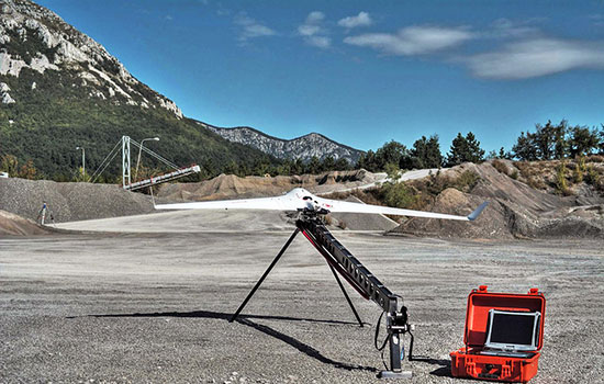
The Bramor RTK GNSS Post-Processing UAS is designed for surveying and remote-sensing applications that need a quick, high-precision set of results down to sub-centimeter level in the absence of a grid of ground control points. It is equipped with C-Astral high-rate GPS and IMU precision data-logging electronics. The system has both air and ground segments, consisting of a GNSS onboard receiver and ground base station. It has an L1 and L2 GNSS reciever (GPS, GLONASS, BeiDou and Galileo-ready), plus a survey-grade antenna.
C-Astral, www.c-astral.com

Aqua Drone for Offshore Missions
The QuestUAV Aqua Pro is designed for offshore/onshore data-gathering in fields such as environmental, gas and oil, coast guard and security. It is a fixed-wing waterproof UAV based on the QuestUAV 200 airframe.
The Aqua Pro is capable of offshore missions and recovery in both fresh- and salt-water environments. It can withstand pressure differentials induced by rapid temperature changes, and overcome complexities of waterproofing/marine-grade electronics, sensors and avionics. It uses a GPS unit from SkyCircuits.
QuestUAV, www.questuav.com

Electronic Warfare System
NovAtel’s GAJT-AE GPS anti-jam technology is designed for military and security weight- and size-constrained airborne and ground unmanned platforms, including UAVs. GAJT-AE provides the null forming antenna control electronics for a four-element controlled reception pattern antenna.
NovAtel, www.novatel.com

High-Accuracy Laser Scans
The Riegl RiCopter is an unmanned multirotor UAS, integrating a high-performance and complete LiDAR system, the RIEGL VUX-SYS. The VUX-SYS comprises the VUX-1 LiDAR sensor, the Applanix AP20 IMU/GNSS system, a control unit, and up to four high-resolution cameras.
The Riegl RiCopter can acquire high-accuracy, high-resolution laser scan and image data. The excellent measurement performance of the VUX-1 in combination with a precise fiber-optic gyroscope and GPS/GLONASS receiver results in survey-grade measurement accuracy in fields such as precision farming, forestry and mining. The IMU/GNSS unit provides roll and pitch accuracy of 0.015 degrees and heading accuracy of 0.035 degrees. Riegl is a maker of laser scanners, and using a high-end unmanned airborne platform allows data acquisition in dangerous and hard-to-reach areas.
Riegl, www.riegl.com
Survey-Grade Mapping Drone
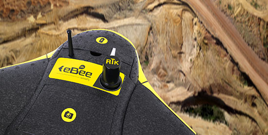
The eBee RTK by senseFly is a fully autonomous survey-grade mapping drone with a built-in L1/L2 GNSS receiver capable of receiving corrections from most leading brands of base station. This ensures high positional accuracy without the need for ground control points, so the aerial photography can produce orthomosaics and 3D models with accuracy down to 3 centimeters. It has 226 channels and tracks GPS L1, L2, L2C; GLONASS L1, L2, L2C; and SBAS.
Sensefly, www.sensefly.com
-
Satnav Augmentation Systems Settle on Common Channels Post-2020

EGNOS is Europe’s first venture into satellite navigation. EGNOS broadcasts augmented information through a trio of geostationary satellites linked to a network of monitoring ground stations, to sharpen the accuracy and reliability of GPS signals across the continent. (artist’s concept: ESA) News from the European Space Agency
The next decade’s aircraft pilots will be able to rely on enhanced, reliable satellite navigation signals on a seamless basis across much of the world, thanks to decisions made at the latest gathering of worldwide satnav augmentation system providers and experts.
The U.S. Wide Area Augmentation System (WAAS) and European Geostationary Navigation Overlay Service (EGNOS) are leading examples of satellite-based augmentation systems (SBAS) that apply additional ground stations and satellite transponders to sharpen the accuracy and reliability of existing satnav services across given geographical regions.
These performance enhancements permit satnav to be employed for safety-of-life services, especially aviation. Such systems are based on the U.S. GPS for now, but plans are being laid to move to a multi-constellation design employing Europe’s Galileo, China’s Beidou and Russia’s GLONASS satnav systems beyond 2020.
The 28th Satellite-based Augmentation Systems Interoperability Working Group (IWG), planning standardization of SBAS systems to come, was hosted at ESA’s ESTEC technical centre at Noordwijk, the Netherlands, on April 1-3.
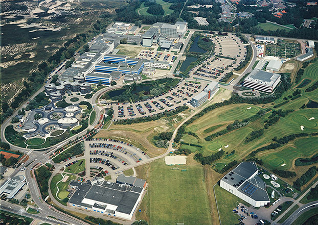
The ESTEC facility in Noordwijk, The Netherlands. (Photo: ESA) All participants unanimously endorsed the “message definition” for a new secondary SBAS channel — to be known as L5, along with the current L1 — for the planned second-generation SBAS systems, which will utilize dual-frequency multi-constellation signals.
Using dual frequencies greatly increases the accuracy of navigation systems, by allowing interference from the ionosphere — an electrically active outer layer of Earth’s atmosphere — to be largely subtracted from the final result.
“This definition is presented in what is called the Dual Frequency Multi-Constellation Definition document,” explained Didier Flament, representing ESA. “It represents the outcome of a four-year activity, which started at IWG 19 in Japan, back in 2010, coordinated between all IWG members under the technical leadership of ESA and French space agency CNES on the European side, and the Federal Aviation Authority (FAA) and Stanford University on the U.S. side.
“The formal IWG review loop for the document took six months to conclude, with this IWG 28 then allowing endorsements to be gathered by SBAS project managers, culminating in formal signatures to the document,” Flament said.
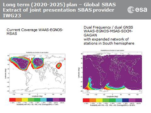
SBAS coverage for 2020: Comparing current worldwide SBAS coverage — based on WAAS, EGNOS and MSAS — to the situation envisaged for 2020–25: near-global coverage based on WAAS, EGNOS, MAAS, SDCM and GAGAN, with an expanded network of stations in the southern hemisphere, all based on a common dual-frequency/dual satnav standard being finalized by the SBAS Interoperability Working Group. (Image: ESA) IWG members now intend to have this document accepted by the official international SBAS standardization bodies: the International Civil Aviation Organisation, the U.S. Radio Technical Commission for Aeronautics (RTCA) and the European Organisation for Civil Aviation Equipment.
“This next step is very important,” added Didier. “Not only for the coming 2016-22 implementation of the European EGNOS v3 but for implementation of other second generation SBAS in other regions of the world.”
The meeting also reported on the state of development of the other global SBAS systems. Along with the four operational systems — the U.S. WAAS, European EGNOS, Japan’s Multi-functional Satellite Augmentation System (MSAS) and India’s GPS-aided geo-augmented navigation or GPS and geo-augmented navigation system (GAGAN) — these comprise South Korea’s KASS, China’s Beidou SBAS, Russia’s System for Differential Corrections and Monitoring (SDCM) and the West African Agency for Aerial Navigation Safety in Africa and Madagascar (ASECNA) SBAS.
The follow-up IWG meeting will take place in October, hosted by the FAA in Washington, D.C., in conjunction with the next RTCA meeting.