

Blog

  • FAA Proposes New Rules for Unmanned Aircraft Systems

    FAA Proposes New Rules for Unmanned Aircraft Systems

    Walkera_QR_X350_Quadcopter_Hovering
    A Walkera QR X350 quadcopter. (Photo credit: Wikimedia Commons).


    The Federal Aviation Administration has proposed a framework of regulations that would allow routine use of certain small unmanned aircraft systems (UAS) in today’s aviation system for commercial purposes.

    “We have tried to be flexible in writing these rules,” said FAA Administrator Michael Huerta in a statement. “We want to maintain today’s outstanding level of aviation safety without placing an undue regulatory burden on an emerging industry.”

    The FAA proposal offers safety rules for UAS under 55 pounds conducting “non-recreational” operations. The rule would limit flights to daylight and visual line-of-sight operations. It also addresses height restrictions, operator certification, optional use of a visual observer, aircraft registration and marking, and operational limits.

    The proposed rules also includes extensive discussion of the possibility of an additional, more flexible framework for “micro” UAS under 4.4 pounds. The FAA is asking the public to comment on this possible classification to determine whether it should include this option as part of a final rule. The FAA is also asking for comment about how the agency can further leverage the UAS test site program and an upcoming UAS Center of Excellence to further spur innovation at “innovation zones.”

    The public will be able to comment on the proposed regulation for 60 days from the date of publication in the Federal Register. The FAA also intends to hold public meetings to discuss innovation and opportunities at the test sites and Center of Excellence.  These meetings will be announced in a future Federal Register notice.

    “Technology is advancing at an unprecedented pace, and this milestone allows federal regulations and the use of our national airspace to evolve to safely accommodate innovation,” said Transportation Secretary Anthony Foxx.

    The proposed rule would require an operator to maintain visual line of sight of a small UAS. The rule would allow, but not require, an operator to work with a visual observer who would maintain constant visual contact with the aircraft. The operator would still need to be able to see the UAS with unaided vision (except for glasses). The FAA is asking for comments on whether the rules should permit operations beyond line of sight, and if so, what the appropriate limits should be.

    Under the proposed rule, the person actually flying a small UAS would be an “operator.” An operator would have to be at least 17 years old, pass an aeronautical knowledge test and obtain an FAA UAS operator certificate. To maintain certification, the operator would have to pass the FAA knowledge tests every 24 months. A small UAS operator would not need any further private pilot certifications (such as a private pilot license or medical rating).

    The new rule also proposes operating limitations designed to minimize risks to other aircraft and people and property on the ground:

    • A small UAS operator must always see and avoid manned aircraft. If there is a risk of collision, the UAS operator must be the first to maneuver away.
    • The operator must discontinue the flight when continuing would pose a hazard to other aircraft, people or property.
    • A small UAS operator must assess weather conditions, airspace restrictions and the location of people to lessen risks if he or she loses control of the UAS.
    • A small UAS may not fly over people, except those directly involved with the flight.
    • Flights should be limited to 500 feet altitude and no faster than 100 mph.
    • Operators must stay out of airport flight paths and restricted airspace areas, and obey any FAA Temporary Flight Restrictions (TFRs).

    The proposed rule maintains the existing prohibition against operating in a careless or reckless manner. It also would bar an operator from allowing any object to be dropped from the UAS.

    Operators would be responsible for ensuring an aircraft is safe before flying, but the FAA is not proposing that small UAS comply with current agency airworthiness standards or aircraft certification. For example, an operator would have to perform a preflight inspection that includes checking the communications link between the control station and the UAS. Small UAS with FAA-certificated components also could be subject to agency airworthiness directives.

    The new rules would not apply to model aircraft.  However, model aircraft operators must continue to satisfy all of the criteria specified in Sec. 336 of Public Law 112-95, including the stipulation that they be operated only for hobby or recreational purposes. Generally speaking, the new rules would not apply to government aircraft operations, because we expect that these government operations will typically continue to actively operate under the Certificate of Waiver or Authorization (COA) process unless the operator opts to comply with and fly under the new small UAS regulations.

    In addition to this proposal, earlier today, the White House issued a Presidential Memorandum concerning transparency, accountability, and privacy, civil rights, and civil liberties protections for the Federal Government’s use of UAS in the national airspace system, which directs the initiation of a multi-stakeholder engagement process to develop a framework for privacy, accountability, and transparency issues concerning commercial and private UAS use.

    The current unmanned aircraft rules remain in place until the FAA implements a final new rule. The FAA encourages new operators to visit www.knowbeforeyoufly.org.

    For more information:
     

  • GPS World Unveils Industry-Exclusive Online Buyers Guide

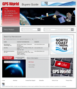
    gps_world_buyers_guideGPS World, the leading publication serving the GNSS Industry, is pleased to announce the industry’s first online buyers guide — gpsworldbuyersguide.com — featuring access to information on hundreds of manufacturers, products and services.

    “We’ve taken the GPS World Buyers Guide in print, which we’ve been publishing for 20+ years, to an entirely new level,” said Alan Cameron, editorial director and group publisher of GPS World. “Adding a robust online version offers many benefits to the industry.”

    Engineers, integrators, professional end-users and others in search of products and services will continue to have two resources available to them — the print Buyers Guide publishing in June — and the cutting-edge, robust version accessible 24/7 at: gpsworldbuyersguide.com.

    Visitors can search for manufacturers by name or location. Products and services are searchable by name or via the following categories:

    • Accessories
    • Antennas
    • Differential GPS
    • Digital compasses
    • Electronic charts/maps
    • GLONASS hardware/software
    • Integrated navigation equipment
    • Integrated instrumentation with GPS
    • Mapping
    • Photgrammetry/GPS integrated systems
    • Precise ephemeris information
    • Publications, guides, videos, training software
    • Receive components
    • Receiver-performance analysis
    • Receivers
    • Satellite signal simulators/pseudolites
    • Security code decryption devices
    • Seminars/training
    • Software
    • Surveying-related equipment
    • System design/integration
    • Timing
    • Tracking services (mobile assets, roadside assistance, E-911, etc.)
    • Vehicle location/tracing workstations and systems (computer-aided dispatch)

    These categories are also searchable by sub-categories.

    Manufacturers and suppliers are now in control of their listings year-round by having the ability to make listing updates in real time. Listings are free and numerous upgrades are available. Listings found at gpsworldbuyersguide.com will automatically be used to create the print version of the directory.

    GPS World’s new online product offers many economical ways for a manufacturer or supplier to enhance their exposure,” said Steve Copley, GPS World publisher. “We’re excited to offer an online element to our print product and provide a positive experience for users.”

    Manufacturers and suppliers are encouraged to review their current listings by using the search functionality found on the directory’s home page. Manufacturers and suppliers not listed in directory are encouraged to create a new listing. All questions relating to the online directory should be directed to Chloe Kalin, Buyers Guide Marketing & Sales Manager, at 216-363-7929.

  • DoT Hosts Third Workshop on GPS Adjacent Band Compatibility

    The U.S. Department of Transportation will host a third workshop to continue discussions of the GPS Adjacent Band Compatibility Assessment on March 12.

    The workshop will focus on the following topics:

    1. Identification of GPS and GNSS receivers to be considered for testing that are representative of the current categories of user applications
    2. Discussion of a GPS/GNSS receiver test plan.

    Anyone interested in presenting on either or both of the above topics should contact Stephen Mackey by March 2.

    The workshop will be held 8:30 a.m.-3:30 p.m. PDT at Aerospace Corporation, 2310 E. El Segundo Blvd., El Segundo, California.

    For more information, see the full Federal Register notice.

  • Esri Maps Colleges and Universities Attended by American Presidents

    In honor of Presidents Day, Esri’s Presidential Colleges story map features colleges and universities attended by all 44 American presidents. Search by president or college, and discover the varied academic undergraduate experiences of each president.

    esri-presidents-day-W

  • CycloMedia Talks HD-Cycloramas, New App, Esri Partnership

    Paul Smith gives us updates from CycloMedia at the 2015 Esri Federal GIS Conference, held Feb. 9-10 in Washington D.C. CycloMedia launched an HD-Cyclorama with 360-degree, 100-megapixel panoramic images — a resolution 10 times higher than the previous generation Cycloramas. Smith also announced a partnership with Esri for street imagery and introduced its Streetsmart app.

  • Big Data Reveals Patterns of Urban Bacteria

    An interactive map allows residents of New York to see what bacteria was mapped at their neighborhoods subway stops. (Image: Wall Street Journal)
    An interactive map allows residents of New York to see what bacteria was mapped at their neighborhoods subway stops. (Image: Wall Street Journal)

    A Big Data project in New York last summer set out to map germs on the city subway system, reports the Wall Street JournalThe scientists, from Weill Cornell Medical College, identified hundreds of types of bacteria in the transit system as a way to study the microbiology of urban environments.

    In the 18-month study, researchers found germs that can cause bubonic plague uptown, meningitis in midtown, stomach trouble in the financial district and antibiotic-resistant infections throughout the boroughs, the WSJ writes. The team also found bacteria that keep the city livable, by sopping up hazardous chemicals or digesting toxic waste. They even tracked the trail of bacteria associated with cheese and sausage, popular snack foods among commuters.

    The study is the first genetic profile of a metropolitan transit system. Microbiologists hope to discover new ways to track disease outbreaks, detect bioterrorism attacks, and combat the antibiotic resistance among microbes, which causes about 1.7 million hospital infections every year. Similar projects are taking place in Oregon (classrooms), Virginia (plumbing in buildings), and Chicago (hospitals).

    The research team gathered DNA from turnstiles, ticket kiosks, railings and benches, then sequenced the genetic material and sorted it by supercomputer. They compared the results to databases of known bacteria, viruses and other life-forms. The findings uncovered how commuters seed the city subways every day with bacteria from the food they eat, the pets or plants they keep, and their shoes, trash, sneezes and unwashed hands. The team detected signs of 15,152 types of life-forms.

    An online database at the Wall Street Journal allows residents to see what microbes were found at the stations they frequent.


  • Los Angeles Geospatial Summit Coming Feb. 27

    The Fifth Annual Los Angeles Geospatial Summit will take place at the Japanese American National Museum on Feb. 27, 9 a.m. – 6 p.m. The event will feature addresses and discussions from leading innovators in the world of geographic information science (GIS) and technology. The summit also will feature presentations from students representing more than a dozen different Southern California colleges and universities.

    Registration is available here. A detailed program breakdown can be found here.

    “At the USC Spatial Sciences Institute, we collaborate with a cross-cutting array of researchers, businesses, non-profits, NGOs, and other entities from a wide range of disciplines and industries to analyze, model, and visualize location-based data,” said John P. Wilson, USC Spatial Sciences Institute and summit program committee member. “Although there are many geospatial conferences across the country and around the world, our summit has the distinctive mission to connect current leaders in the spatial sciences with students from numerous different academic institutions who are the next generation of innovators.”

    At the summit, students will be able to learn about emerging trends in geospatial science, technology, and applications; present papers and posters about their own research; network with industry professionals; and introduce themselves to geospatial company representatives at the closing Industry and job fair.

    Industry professionals will have the opportunity to learn what leaders in their field see as emerging geospatial trends, create greater awareness for their company by sharing materials at the industry fair, network with other geospatial professionals, and have a chance to influence what academic programs are teaching to the next generation of GIS professionals.

    Plenary speakers will be Gil Elbaz, CEO, Factual Inc., presenting “Location-Based Data and GIS: Changing the Future;” Keith Masback, CEO, United States Geospatial Intelligence Foundation; and Chris Mattmann, Ph.D., chief architect, Instrument and Data Systems Section, presenting the case study “Data Science from the Trenches: NASA, Academia, and Open Source Trial by Fire.”

    Moderators and panelists for the day’s panel discussions and concurrent presentations will include:

    • Estella M. Geraghty, M.D., Chief Medical Officer and Health Solutions, Esri
    • Chris B. Dunbar, Principal Director, Guidance & Control Subdivision, The Aerospace Corporation
    • Mark Sarojak, Vice President, PIXIA Corp.
    • Bingcai Zhang, Technical Fellow, BAE Systems
    • Robert Fassett, M.D., Director, Care Delivery Transformation, PricewaterhouseCoopers
    • David DiBiase, Team Lead – Education Industry, Esri
    • Isaiah Mack, Manager, California Surveying and Drafting Supply, Inc.
    • Thomas A. Horan, Professor and Dean, Claremont Graduate University
    • Myles G. Cockburn, Associate Professor of Preventive Medicine and Spatial Sciences, USC
    • Andre Doumitt, CEO, Digital Adopxion
    • R. Maxwell Baber, Director of Academic Programs, United States Geospatial Intelligence Foundation

    The summit is sponsored by California Surveying and Drafting Supply, California Geographic Information Association, Esri, PIXIA Corporation, United States Geospatial Intelligence Foundation, and the USC Spatial Sciences Institute.

  • Los Angeles Geospatial Summit Coming Feb. 27

    The Fifth Annual Los Angeles Geospatial Summit will take place at the Japanese American National Museum on Feb. 27, 9 a.m. – 6 p.m. The event will feature addresses and discussions from leading innovators in the world of geographic information science (GIS) and technology. The summit also will feature presentations from students representing more than a dozen different Southern California colleges and universities.

    Registration is available here. A detailed program breakdown can be found here.

    “At the USC Spatial Sciences Institute, we collaborate with a cross-cutting array of researchers, businesses, non-profits, NGOs, and other entities from a wide range of disciplines and industries to analyze, model, and visualize location-based data,” said John P. Wilson, USC Spatial Sciences Institute and summit program committee member. “Although there are many geospatial conferences across the country and around the world, our summit has the distinctive mission to connect current leaders in the spatial sciences with students from numerous different academic institutions who are the next generation of innovators.”

    At the summit, students will be able to learn about emerging trends in geospatial science, technology, and applications; present papers and posters about their own research; network with industry professionals; and introduce themselves to geospatial company representatives at the closing Industry and job fair.

    Industry professionals will have the opportunity to learn what leaders in their field see as emerging geospatial trends, create greater awareness for their company by sharing materials at the industry fair, network with other geospatial professionals, and have a chance to influence what academic programs are teaching to the next generation of GIS professionals.

    Plenary speakers will be Gil Elbaz, CEO, Factual Inc., presenting “Location-Based Data and GIS: Changing the Future;” Keith Masback, CEO, United States Geospatial Intelligence Foundation; and Chris Mattmann, Ph.D., chief architect, Instrument and Data Systems Section, presenting the case study “Data Science from the Trenches: NASA, Academia, and Open Source Trial by Fire.”

    Moderators and panelists for the day’s panel discussions and concurrent presentations will include:

    • Estella M. Geraghty, M.D., Chief Medical Officer and Health Solutions, Esri
    • Chris B. Dunbar, Principal Director, Guidance & Control Subdivision, The Aerospace Corporation
    • Mark Sarojak, Vice President, PIXIA Corp.
    • Bingcai Zhang, Technical Fellow, BAE Systems
    • Robert Fassett, M.D., Director, Care Delivery Transformation, PricewaterhouseCoopers
    • David DiBiase, Team Lead – Education Industry, Esri
    • Isaiah Mack, Manager, California Surveying and Drafting Supply, Inc.
    • Thomas A. Horan, Professor and Dean, Claremont Graduate University
    • Myles G. Cockburn, Associate Professor of Preventive Medicine and Spatial Sciences, USC
    • Andre Doumitt, CEO, Digital Adopxion
    • R. Maxwell Baber, Director of Academic Programs, United States Geospatial Intelligence Foundation

    The summit is sponsored by California Surveying and Drafting Supply, California Geographic Information Association, Esri, PIXIA Corporation, United States Geospatial Intelligence Foundation, and the USC Spatial Sciences Institute.

  • PDF3D Releases Version 2.11.0 of its 3D PDF Software Suite

    PDF3D_v211_WPDF3D has improved the quality of tools and has introduced new features in version 2.11.0 of its 3D PDF software suite. The suite includes ReportGen, SDK Developer Toolkit and XML Server.

    The company said in a news release that in response to customers, a large number of technical issues have been addressed.

    “For our geospatial customers, we’ve extended the Geospatial 3D PDF solution profile with new input data formats, new processing methods and new library features for developers,” said Ian Curington, head developer at PDF3D. “And for engineers and CAD users, we’ve added new engineering representations and advanced texture mapping surface material characteristics.”

    The release features new textures, material characteristics and templates available within the software.

    “Those working with 3D terrain, point cloud data and scans will find various new formats and functions, including the addition of GeoTIFF 16 and 32-bit Raster Elevation Data and IMAGINE IMG Raster Data Format for multi-channel imagery and elevations,” said Curington. “With IRAP Classic Grid Formats, Landmark ZMap Elevation Grids and layered 2D PDF Geospatial map drawing now extended, there are some great new visual features in the tool.”

    Version 2.11.0 is available to download immediately.

  • ISRO to Launch Google’s Skybox Satellite This Year

    Skybox_Imaging_Google_Acquisition_WThe Indian Space Research Organization (ISRO) will launch Google’s Skybox Imaging satellite by the end of this year, according to The Asian Age.

    ISRO will launch its first U.S. satellite from the Satish Dhawan Space Center in Sriharikota, according to the news brief.

    Google acquired Skybox Imaging in August of 2014 to develop advanced GPS mapping using its own network of satellites, according to the company’s blog. The Asian Age says Skybox had previously entered into an agreement with Antrix Corporation.

    The article says the satellite will launch alongside a main payload this year.

  • GIS for Disaster Management to Boost Market in China

    The increased use of Geographic Information Systems (GIS) in disaster management has resulted in the growth of the GIS market in China, which is expected to post a CAGR of 11.75 percent from 2014-2019, according to research from TechNavio.

    The report “GIS Market in China 2015-2019” focuses on the increased use of GIS technology across various systems such as forest fire management, flood management and climate change, which has made GIS technology an effective tool for disaster management in China.

    “Governments and natural resource sectors are heavily dependent on GIS for disaster management. The technology provides detailed information on an area’s geography, and any changes or deviations in the typical information can lead to an inspection by experts,” said Faisal Ghaus, vice president of TechNavio.

    The report emphasizes increased investments in GIS software. The market is witnessing the presence of several large international GIS solution providers that are making huge investments, leading to high economic growth in China. “The increased adoption of GIS solutions across different sectors has motivated large international vendors to make investments in providing GIS solutions in China,” Ghaus said.

    The report covers:

    • Market segmentation, size and forecast through 2019
    • Market growth drivers: Increased use of GIS for disaster management
    • Market challenges: Availability of open-source GIS software
    • Market trends: Increased investments in GIS software
    • Key vendors:
      • Autonavi Holdings Ltd.
      • HERE
      • Hexagon AB
      • NavInfo Co. Ltd.
    • Other vendors:
      • Autodesk
      • Beijing Supermap
      • Bentley System
      • China Information Technology

    Other GIS market research reports available include:

  • Esri Offers Online Seminar on Collector for ArcGIS

    Esri is hosting an online seminar to familiarize customers with its Collector for ArcGIS app. Using the app can mean replacing paper-based data inspection and maintenance workflows with computerized ones that allow anyone in an organization to easily capture and update data from their tablet or smartphone when they’re out in the field.

    The Esri live training seminar Simplify Field Data Workflows with Collector for ArcGIS will be held on February 19. The presenters will demonstrate how the app, included with ArcGIS organizational accounts, can help organizations maintain accurate and up-to-date GIS data while making the information collection process easier and more efficient.

     After viewing the seminar, Esri says that participants will understand how to:

    • install Collector for ArcGIS on a smartphone or tablet and connect to an ArcGIS organization.
    • create and configure maps.
    • capture accurate feature locations and information efficiently.
    • attach notes, photographs, and videos to the data.

    GIS managers and analysts, data managers, field-workers, and others who are interested in using Collector for ArcGIS are encouraged to attend this hour-long seminar, Esri said.

    Participants will need a broadband Internet connection and an Esri account to watch the live training seminar. To create an account, visit esri.com/lts, click Login at the top right, and register your name and e-mail address.