Blog

  • What Is a Brigadier? And as a GPS User, Why Do I Care?

    What Is a Brigadier? And as a GPS User, Why Do I Care?

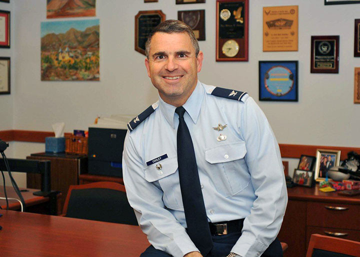
    Col. William Cooley, Director, U.S.A.F. Global Positioning Systems Directorate.
    Col. William Cooley, Director, U.S.A.F. Global Positioning Systems Directorate.

    This is the story we ran in GPS World magazine just moments after the announcement was made that Colonel William Cooley, Ph.D., director of the GPS Directorate, was nominated by President Obama to the U.S. Senate for appointment to the rank of Brigadier General in the United States Air Force (USAF).

    Colonel William Cooley, director of the Global Positioning Systems Directorate, has been nominated by President Obama to the Senate for appointment to the rank of brigadier general, United States Air Force, according to an announcement by Secretary of Defense Chuck Hagel. He is the first SPO director in many years to be nominated for general officer rank, according to Don Jewell, GPS World’s contributing editor for defense.

    Cooley is currently serving as senior materiel leader and director, Global Positioning Systems Directorate, Air Force Space Command, Los Angeles Air Force Base, California.

    “This is a great accomplishment for Bill and for the GPS community,” Jewell said. “We are all certainly very proud of him and his accomplishments and his unflagging support for the PNT community globally.”

    “This nomination is an outstanding achievement as it clearly demonstrates continued senior leadership confidence in his ability to lead the men and women in our Air Force. We have been privileged to see that for ourselves here at SMC,” said Samuel A. Greaves, Lieutenant General, USAF, Commander, Space and Missile System Center.

    Col. Cooley authored GPS World’s Directions 2015 article on the outlook for GPS in our December issue,What It Takes to Make a Gold Standard.”

    So What?

    For those of us who have spent our lives as military “brats” and/or as members of the U.S. military, announcements such as this are certainly great news, but we tend to take them in stride, as this is the way promotions to the General Officer ranks have always been announced. However, shortly after this short article appeared, I received numerous emails that, after extending congratulations to Colonel Cooley, tended to fall into specific categories:

    1. So what? Why should I care?
    2. Obviously promotions are a good thing, but why is this one so important?
    3. What is a brigadier general anyway?
    4. The Air Force does not have brigades, so how can he be a brigadier general?
    5. How many different kinds of generals are there, and where does a brigadier general place if you put them in order?

    Our editor-in-chief, Alan Cameron, had some of the same questions asked of him, so we thought we would briefly put this announcement in perspective for those of you not steeped in military history and lore. I will concentrate on the USAF, United States Air Force, as this is most pertinent to our discussion concerning Colonel Cooley. I will add links to rank charts and explanations for the other services as well. I will concentrate on the officer ranks for the purpose of this article. Plus, I will highlight Colonel Cooley’s career as an officer in order to make it more personal and easier to relate.

    If you are one of those civilians who do not understand the military hierarchy, especially the rank structure, do not feel alone. It was revealed just a few days ago that in our new Congress, only 20 senators (20%) and 89 representatives (20.5%) are veterans, according to the authoritative Vital Statistics on Congress, published by The Brookings Institution. That is down from more than 77% in both houses of Congress after WWII and more than 75% in 1975 toward the end of the Vietnam War. How times have changed.

    United States Air Force (USAF) Rank Structure

    U.S. Air Force Ranks — Enlisted and Officer, from Lowest to Highest
    Pay Grade Rank Abbreviation Classification
    E-1 Airman Basic AB Enlisted Airman
    E-2 Airman Amn Enlisted Airman
    E-3 Airman First Class A1C Enlisted Airman
    E-4 Senior Airman SrA Enlisted Airman
    E-5 Staff Sergeant SSgt Noncommissioned Officer
    E-6 Technical Sergeant TSgt Noncommissioned Officer
    E-7 Master Sergeant MSgt Noncommissioned Officer
    E-8 Senior Master Sergeant SMSgt Noncommissioned Officer
    E-9 Chief Master Sergeant CMSgt Noncommissioned Officer
    E-9 Command Chief Master Sergeant CCM Noncommissioned Officer
    E-9 Chief Master Sergeant of the Air Force CMSAF Noncommissioned Officer (Special)
    O-1 Second Lieutenant 2d Lt Commissioned Officer
    O-2 First Lieutenant 1st L Commissioned Officer
    O-3 Captain Capt Commissioned Officer
    O-4 Major Maj Field Officer
    O-5 Lieutenant Colonel Lt Co Field Officer
    O-6 Colonel Col Field Officer
    O-7 Brigadier General Brig General Officer
    O-8 Major General Maj G General Officer
    O-9 Lieutenant General Lt Ge General Officer
    O-10 General Gen General Officer
    O-10 General of the Air Force GAF General Officer


    The USAF officer rank structure is similar for all the services, except that the USAF no longer has warrant officers. Please allow me to answer upfront the most frequent question from audiences where I am asked about senior military rank: “If a major outranks a lieutenant, then why does a lieutenant general outrank a major general?” It sounds strange, but understand that the designation of lieutenant general historically, since the Middle Ages, was held by the second in command on the battlefield, who was normally subordinate to a captain general, which is a term and rank no longer in use today. Clear as mud, right? These designations have been around for hundreds of years and are really pretty simple once you take the time to learn them.

    Promotions

    If we look at Colonel Cooley‘s dates of promotion, you will see how long he spent in each grade — grades are depicted numerically 0-1 through 0-10 and ranks are spelled out. An 0-1 is a second lieutenant, etc. Colonel Cooley is currently a field grade officer, what some informally call a full-bird colonel. The insignia for a colonel is an eagle, and the grade is 0-6. Colonel Cooley has been nominated to be a senior officer, general officer (GO), an 0-7 or brigadier general (Brig Gen), which is designated by a single star. Don’t let all the nomenclature confuse you. Colonel Cooley is about to become a Brig Gen, or BG as it is sometimes referred to, and that is a feather in his cap as well as for GPS, the directorate and SMC. As Martha Stewart is fond of saying, “It’s a good thing.”

    Colonel Cooley’s Effective Dates of Promotion

    • Second Lieutenant May 19, 1988
    • First Lieutenant June 19, 1990
    • Captain June 19, 1992
    • Major Oct. 1, 1999
    • Lieutenant Colonel March 1, 2004
    • Colonel Sept. 1, 2007
    • Nomination to be a Brigadier General January 2015

    Just as in the civilian world, typically as you climb up the ladder of rank, your responsibilities increase. In the military, typically you become more of a generalist, and you are looked to more for your leadership abilities than your specific technical or educational abilities. Although it all comes together in a package, when you are promoted to the General Officer ranks. The senior leadership in the USAF considers the whole man when deciding who will lead the airmen of the future. Everyone in the USAF is an airman, in that they serve in the United States Air Force, and then they are designated by their rank.

    Colonel Cooley has been in the USAF for almost 27 years and could conceivably remain for another seven years or so. Most GOs retire at about 55 years of age. The only reason this number is nebulous is that as a general officer, you serve at the convenience of the president of the United States, and he can ask you to leave the service or retire at his pleasure, or he can ask you to remain, just as CEOs do in corporate life and careers. Except in this case, the asking or directing is being accomplished by the highest-ranking leader in our government and the U.S. military, the president of the United States fulfilling his role as the commander-in-chief of the U.S. Armed Forces.

    Colonel Cooley’s Education

    Another major factor in military life is education, although in recent years — primarily during the last 10 years we have been at war —several military leaders have tried to downplay that facet of military preparedness, which I personally think is a mistake. Those who argue for not considering education as a key element for promotion point out that leadership, especially during war time, is key, and leading and inspiring men and women is more important than academic degrees. Without a doubt, leadership qualities are important, but how does an education disqualify anyone from being a leader? It does not; just the opposite is true, because in today’s increasingly technically oriented world, I maintain that both qualities are critically important in our leaders. I would much rather follow a Harvard-educated president with a law degree from Columbia than I would an unemployed felonious house painter. This is a history test! Did you pass? Now, let’s take a look at Colonel Cooley’s rather impressive educational background.

    • 1988 Bachelor of Science, Mechanical Engineering, Rensselaer Polytechnic Institute, Troy, N.Y.
    • 1990 Master of Science, Mechanical Engineering, University of New Mexico, Albuquerque, N.M.
    • 1995 Squadron Officer School, Maxwell AFB, Ala.
    • 1997 Doctor of Philosophy, Engineering Physics, Air Force Institute of Technology, Wright-Patterson AFB, Ohio
    • 2003 Air Command and Staff College, Maxwell AFB, Ala. (Distinguished Graduate & No. 2 in class)
    • 2007 National War College, Fort Lesley J. McNair, Washington, D.C.
    • 2008 Program Managers Course, Defense Systems Management College, Fort Belvoir, Va.
    • 2009 Senior Manager Course in National Security, Elliott School of International Affairs, George Washington University, Washington, D.C.
    • 2009 Executive Program Managers Course, Defense Systems Management College, Fort Belvoir, Va.
    • 2011 USAF Enterprise Leadership Seminar, University of Virginia, Charlottesville, Va.

    I mention education here primarily because it is so critical, and it is evident that Colonel Cooley is one of those well-educated leaders who continually seek to improve themselves. All war-time education aspersions aside, it is one of the obvious reasons he has been nominated to be a general officer. Statistics show that only 0.23% of all officers will be promoted to the rank of brigadier general — roughly 1/5 of 1% — and that only 1.76% of officers in the USAF have Ph.Ds.

    Having said that, the USAF is also the most educated officer corps of all the services, with 36% having bachelor’s degrees, 49% having master’s degrees, 1.76% having Ph.D.s and 10.32% having professional degrees such as MDs and JDs (2.92% didn’t respond). If you are adding in your head, you will see this adds up to 100%, because having a college degree is a requirement to be a commissioned officer in the USAF. So you see, education does matter, and is a core concept for the entire USAF officer corps. This is not true of all services.

    Location, Location, Location

    As in corporate life, certain jobs and positions in the military prepare an individual to be a general officer. Usually these jobs are well known. Being a successful squadron, group and/or wing commander certainly prepares you to be competitive for a general officer nomination. In effect, this can mean that you command anywhere from 50 to 5,000 personnel, and how well you execute your command and accomplish your mission usually determines how competitive you will be for increased rank and responsibility.

    I mention this only because Colonel Cooley had to overcome what can only be described as a handicap as his position as wing commander of the GPS Wing, which was then redesignated as a directorate, at which time he became director of the GPS Directorate. This position, although critically important to the success of the GPS mission, has not exactly been a breeding ground for general officer nominations.Indeed, it has usually been perceived as a final or retirement assignment for most of the colonels assigned there. I can only remember four other colonels in the last 40 years, and I have known them all, that went on to become general officers. Several of the colonels have gone on to higher positions in the government as civilians, but only four prior to Bill have actually made general officer rank.

    Scrutiny

    Allow me point out what should be obvious by now. Unlike corporate America, every aspect of the senior military officer’s life is open to public scrutiny and review. They literally live in glass houses. As you have seen, where we were educated, how much money we make, when we made each promotion — to the day, and where we were assigned is open for anyone to view. The life of a senior military officer is indeed an open book, and that can be both good and bad. On the plus side, smart junior officers learn from that openness and prepare for their future accordingly. If things go wrong, however, there is no place to hide.

    Personal Life

    Now for a personal comment: I have had the pleasure of knowing and working with Colonel William Cooley, whom I affectionately refer to as Wild Bill, for several years, both at the Air Force Research Laboratory (AFRL) and the Space and Missile Systems Center (SMC) at Los Angeles Air Force Base. I can honestly say I have been impressed. He has a great sense of honor and integrity and is obviously well educated. He engenders respect from his peers and subordinates alike, because when he is engaged with you in a discussion, you have his undivided attention. He makes you feel as if you are the only person in the room and your opinion is the only one that matters. Once you realize that, it makes you want to ensure what you are saying is absolutely correct and worthwhile.

    It is a trait shared by many great leaders, and Wild Bill practices it daily. It is indeed a trait or a talent that I wish more of our leaders would/could employ. That is not to say that Bill, especially the engineer and Ph.D. part of his personality, will not question you, argue with you or disagree with you, but he will never disparage you or your opinion, and that is but one of the key traits, along with his great sense of humor, that makes Colonel Cooley a great leader. Most importantly, it engenders loyalty among his peers and subordinates alike. I hope there will be many more stars in his future.

    That’s Why!

    Now you know why Colonel Cooley being nominated to be a Brigadier General is so important, and why it is specifically important for the GPS Directorate, as it gives future directors hope, and why it is important to us as GPS users — there is now another general officer and leader that understands GPS and can defend it when necessary from all the naysayers and pseudo-political wannabe subject matter experts I wrote about last month. Colonel Cooley is the real deal. I know I sleep better at night knowing there are leaders like Brigadier General Select William (Wild Bill) Cooley standing watch. Aim high!

    What Is Don Reading?

    I won’t go into the gory details but I had major heart surgery recently and just a week or so before Christmas I was contentedly settled in my Colorado mountain home with the snow swirling outside amid sub zero temperatures. Inside the fireplace was roaring and I was comfortably ensconced in my favorite leather chair just wishing for a good book to read when what should arrive in the mail but The Elbe Resolution, the latest creation and continuing World War I and World War II saga by Dr. Lloyd Holm.

    You may remember his first book, The Ledgerbegan with the famous and recently celebrated 100th Anniversary of the Christmas Truce of WWI.


    I wrote about Dr. Holm’s wonderful first book, back in August 2013 and I have been anxiously awaiting the sequel ever since. The second volume continues the same story line in fine fashion and I can truly say that, just like the first book, I could not put it down. What a wonderful read.

    It is painstakingly accurate historically and linguistically, while the characters, many of who carry over from the first book, are all absolutely believable and captivating. The story is alternatingly heart-warming and heartbreaking as you are caught up in the drama and pathos of World War II.

    The best news is that the story continues, and now I have the opportunity to anxiously await the third volume!
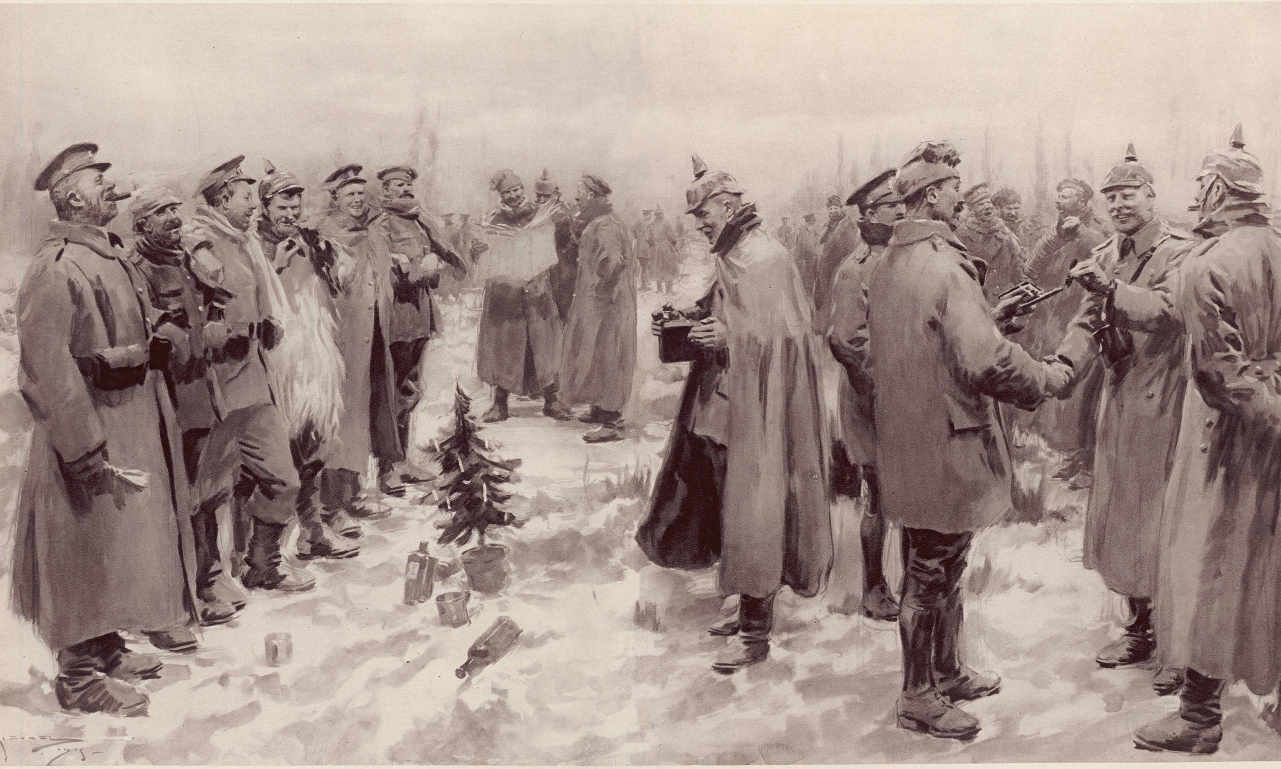

    An artist's impression from The Illustrated London News of January 9, 1915: "British and German Soldiers Arm-in-Arm Exchanging Headgear: A Christmas Truce..."
    An artist’s impression from The Illustrated London News of January 9, 1915: “British and German Soldiers Arm-in-Arm Exchanging Headgear: A Christmas Truce…” Photo: The Illustrated London News
    Author Dr. Lloyd Holm.
    Author Dr. Lloyd Holm.

    Whatever you do, please find a copy of this book today and settle in for a great read. You will not be disappointed.

    And while you are reading, note how many times the primary issue that many of our soldiers, sailors and airmen faced during the two world wars was figuring out where they were and where the enemy was located. It was almost a full-time job. What they would have given for a GPS!


  • Janam Introduces Rugged Mobile Computer with Multi-OS Support

    Janam Introduces Rugged Mobile Computer with Multi-OS Support

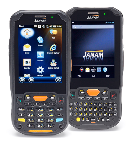
    The Janam XM5 series has both Windows and Android OS.
    The Janam XM5 series has both Windows and Android OS.

    Janam Technologies LLC, a provider of rugged mobile computers that scan barcodes and communicate wirelessly, today announced the launch of its XM5 family of rugged mobile computers. Designed to maximize the mobility investments of enterprise and government organizations, the new XM5 has high-sensitivity GPS and Assisted GPS, and supports Windows Embedded Handheld 6.5 and Android operating systems on the same hardware.

    Having both OS enables customers to choose the OS strategy and application migration schedule that best meet their mobility requirements, Janam said.

    The XM5 provides the power and flexibility required by mobile workers in field sales, field service, public safety, direct store delivery and transportation and logistics markets, Janam said. Customers can choose between integrated, best-in-class, 1D/2D imager or 1D laser scanner for instant decoding of the hardest-to-read barcodes. Embedded RFID and NFC reading capabilities ensure more efficiency and accuracy in a variety of applications including inventory management, asset tracking, personal identification and mobile point of sale.

    “Janam’s XM5 is one of the few rugged mobile computers that allows a customer to migrate from Windows to Android without purchasing new hardware,” said Harry B. Lerner, CEO of Janam. “Packed with all the features that enterprise requires, built to exacting standards of quality and available at an attractive price point, the XM5 catapults Janam to the lead position among hardware providers that not only listen to what customers need, but deliver to those requirements.”

    The XM5 comes with either a QWERTY or Numeric keypad and a specially-fortified 3.5-inch VGA display that withstands heavy-duty use. It also offers 802.11a/b/g/n dual-band WLAN and 4G-ready UMTS/HSPA+/HSDPA/HSUPA/GSM WWAN communications for access  to high-quality and reliable voice and data inside and outside the four walls.

    Built to withstand the rigors of everyday use in the enterprise, the XM5 is sealed to IP65 standards, can withstand five foot drops to concrete and is UL-certified for hazardous environments. In addition, the XM5 ships with a 4000mAh rechargeable Li-ion battery, providing extended battery life as a standard feature, not an optional one.

    XM5 Features

    • Android 4.2 and Microsoft Windows Embedded Handheld 6.5 operating systems
    • ARM Cortex-A8 processor @1GHz
    • 3.5 inch VGA fortified-glass display
    • Multiple 5’/1.5m drops to concrete
    • IP65 sealing against environmental elements
    • Embedded RFID and NFC capabilities
    • 3G/4G WWAN technology (UMTS/HSPA+/HSDPA/HSUPA/GSM)
    • 512MB/1GB with expansion capability
    • 802.11a/b/g/n Wi-Fi and Bluetooth
    • High sensitivity GPS and Assisted-GPS
    • Motion sensing accelerometer
    • 5.0MP autofocus camera
    • 3.5mm headset jack with Secure Lock
    • 4000mAh rechargeable Li-ion battery
  • Self-Driving Cars Find Their Way at CES

    This year’s CES featured the usual big TV screens, loudspeakers, wearables, 3D printers, drones and connected vehicles surrounded by 150,000 attendees over several Las Vegas meeting venues. What was interesting was the continued rise of autonomous, or self-driving, vehicles and platforms. Lost in all of the noise was a small, but important, location-based services enclave that consisted of GPS-enabled wearables and indoor positioning.

    LAS VEGAS—A big chunk of the estimated 30 billion worldwide connected devices will be those linked to vehicles, say industry experts at the International Consumer Electronics Show here. Nearly all automakers had a presence at CES — all with a long-term connected vehicle strategy.

    No matter how big and exhausting CES is, with long taxi lines and 150,000 attendees, there is good reason to come a day before the giant conference, as the Consumer Telematics Show and AT&T Developer’s Conference feature many industry executives and new developments. At the Consumer Telematics Show, speakers explained how and why connected vehicles are transitioning to autonomous capability.

    The connected car industry has matured to the point where technology and market points are coming together, said Thilo Koslowski, Gartner vice president and practice leader, automotive vehicle ICT mobility, at CTS. “The opportunity of connected vehicles are becoming the center of mobile and [Internet of Things] innovations. It has come from, in 1997, a pure telematics safety and security device to vehicle integration, digital lifestyle convergence and Internet of cars,” he said. “At the end of the year, there will be 25 million connected vehicles in the world, but most in mature markets. That might not look like a lot, but only in five more years, I think that number is going to 150 million vehicles.”

    In some cases, the newer outfitted vehicles will have only safety and security features, Koslowski said, but most will have two-way data communication, part of the 30 billion devices connected by 2020. He predicted last year that most automakers would have shifted general mobile applications to vehicle and customer-specific services.

    Koslowski says the top connected car features that consumers have asked for include automated map updates, real-time weather and news, parking spot finder and driving assessment and coaching. “Consumers don’t want application downloads directly into the car. In addition, in-vehicle media purchases are not there yet, as are in-vehicle social networking updates,” he said. “I predicted in 2013 that 25 percent of the automakers would monetize mobile commerce transactions in their connected vehicle offerings such as parking, buying gas, etc.,” he said.

    Self-Aware Vehicle Emergence

    Imagine sleeping, or reading, in your car during the morning commute. It may be a reality, but major technical, cultural and legal issues need to be resolved before fully autonomous vehicles hit the road. “There is going to be trouble if [automakers] don’t get consumers involved early on. Or allow governments and insurance companies telling people when to hit the button (to drive),” Koslowski said. “You press the [drive yourself] button and you pay 30 percent more in insurance. About 39 percent of those we surveyed are interested in some sort of self-driving car — that doesn’t mean fully autonomous vehicles. But 61 percent say they are not ready.”

    Koslowski says there is a lot of education that includes basic acceptance of the technology and trust that it really works. “There usually is a 30-second rule. The first 30 seconds is ‘holy moly, this thing drives itself’,” he said. “The second 30 seconds is ‘is this beneficial?’ There are real benefits such as reducing the cost of accidents, which amount to $900 per U.S. citizen.”

    In terms of cyber security and privacy, Koslowski said it’s a big deal for autonomous vehicles. “A couple of breaches will be a big deal. Still, consumers are not that paranoid. They are willing to share information, especially if there is a monetary or societal function,” he said.

    Cost is still big factor that will drive the adoption of autonomous vehicles. Koslowski says that consumers polled will only pay an additional $1,404 for autonomous capability. The cost of a test vehicle, right now, is about $85,000. “The good news is that number is coming down. It is shrinking to less than $6,595,” he said.

    At the Transportation Research Board meeting a week after CES in Washington, Chris Urmson, who heads Google’s self-driving vehicle program, said the Kentucky Fried Chicken bucket-looking gizmo on top of their car cost $70,000 alone.

    Cost aside, by 2016, three automakers will have concrete plans for upcoming autonomous vehicle launches, Koslowski said. “This is happening a lot faster from a technology standpoint than experts thought it would,” he said.

    Overall, Koslowski said that big IT companies need to step up to make autonomous vehicles work. “Governments are a little behind. The slowness of automotive companies also make them vulnerable to technology companies to step in and take over the industry,” he said.

    Indoor Positioning and Other Location Markets at CES

    Such companies as CSR were at CES and said the show was good for indoor location providers. “CES was good for us. We had good interest in our live demo of indoor location where customers were free to walk around testing the performance of our (solution). We also saw a lot of interest from the automotive market for an indoor/outdoor navigation (product), such as being able to find your way back to the car in a complex shopping mall and the best place to park for access to your indoor destination,” said Dave Huntingford, CSR’s director of product line for location.

    In 2015, the company believes that one of the key drivers for indoor location will be the ubiquity of maps for public locations, Huntingford said. “The availability of indoor maps for malls, airports and retail chains will help drive indoor location awareness with consumers for both utility value (not getting lost) and retail marketing applications,” he said. “We also expect to see a variety of social networking applications supporting indoor location, reflecting the fact that we spend the vast majority of time indoors.”

    Huntingford believes a key limitation of many indoor technologies is the requirement to have dedicated, or upgraded, infrastructure such as BT Smart beacons or updated Wi-Fi access points with new location capabilities, and a dedicated manual survey of the building to measure indoor Wi-Fi signatures.

    At CES, Magellan rolled out its line of 5-inch RoadMate Auto GPS Devices with 3D buildings and landmarks. “The units retail from $169 to $229. “We are surprised at the interest our PNDs are having in the market, particularly with back-up video,” said William Strand, Magellan associate director, product marketing. “The dash camera is a small market, but catching on to block insurance fraud.”

    In other CES news:

    • Audi pulled off a coup when it invited journalists to drive with its autonomous vehicle from San Francisco to Las Vegas.
    • Most location companies have wearables product lines that are making retail chains take notice.

    Transportation Research Board Meeting Becoming Big Autonomous Show

    WASHINGTON—The Transportation Research Board Annual Meeting here has grown to be one of the bigger autonomous vehicle meetings, with 12,000 mainly government execs and academics meeting.

    About 300 people showed up for a panel headlined by Chris Urmson, who heads up Google’s autonomous vehicle program. All was well and good hearing about Google’s self-driving vehicle technology except TRB had 100 chairs for 300 attendees…a lot of people left. But that is the level of interest autonomous vehicle is having in the government and academic community.

    “We are planning to find out how our car does with red lights flashing in front of it. The software will figure out, along with GPS and insertional and high-resolution maps,” Urmson said. “The world isn’t empty. Our vehicle has to know about the pick-up making a lane change, the bicyclist pedaling next to it.”

    Urmson said there are no sensors on the market that power the car — Google makes them in-house.

    In other TRB news, TomTom announced it is partnering with the I-95 Corridor Coalition. The company is using one of three main real-time traffic products in its portfolio, said Nick Cohn, TomTom senior business developer. “It is all about our TomTom Traffic Flow product, which provides speed information for individual road segments every minute, based on our mix of probe data sources,” he said. “This is one of three main real-time traffic products we have. TomTom Traffic provides one-minute updates of locations and delays of traffic jams and other traffic incidents. The third product is a set of APIs for providing, for example, travel times that can be displayed on variable message signs along roadways to inform drivers about delays.”

    The government market is a steady business for TomTom, which has seen traffic management success mainly in European cities such as Berlin, Rome and London, Cohn said.


  • Automakers No Longer the Neanderthals of Tech

    Automakers No Longer the Neanderthals of Tech

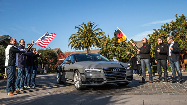
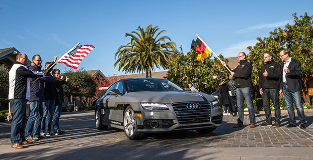
    Start of the 550 mile piloted drive from Silicon Valley to Las Vegas: Ricky Hudi, Executive Vice President Electric/Electronic Development, (left) and Ewald Gössmann, Excecutive Director Electronic Research Lab California (ERL), (third from right) drop the flag for the Audi A7 piloted driving concept car.  Photo: Audi
    Start of the 550 mile piloted drive from Silicon Valley to Las Vegas: Ricky Hudi, Executive Vice President Electric/Electronic Development, (left) and Ewald Gössmann, Excecutive Director Electronic Research Lab California (ERL), (third from right) drop the flag for the Audi A7 piloted driving concept car. Photo: Audi

    In the wake of CES and the North American International Auto Show in Detroit, it’s clear that times are a-changing. Self-driving concept cars filled three football-field-sized areas to show off what lies ahead. Verizon and Ford did a cosmic switcheroo, with Verizon morphing into the auto space and Ford starting a transformation into a mobility company. Automated reality/augmented reality isn’t as big as would be expected, and is suffering from a lack of content. Wearables continue to do remarkable things, notably in the health and fitness sector, and smart watches will become more exciting with interaction to vehicles and home.

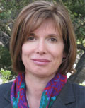
    Janice Partyka
    Janice Partyka

    When Mark Field, current CEO of Ford, announced the Ford Sync from the CES stage in 2007, attendees found the presence of an auto company at CES to be out of place. The auto industry was considered Neanderthals of tech. Today, the most exciting mobile technology is vehicle related, and more exciting developments from the auto industry were seen in Las Vegas, rather than Detroit.

    Field was back at CES with a visionary perspective that Ford isn’t going to be just about cars and trucks. He is broadening Ford’s focus to mobility in preparation of the changes in transportation that will occur in response to global megatrends of urbanization, growth of the middle class, air-quality issues and evolving consumer attitudes. To test out new ideas of flexible user-ship and collaborative transportation, Ford is operating 25 experiments around the world to test out solutions for specific mobility challenges. Ford is looking to be a leader and enabler of a market where people may be sharing or swapping vehicles or relying on crowd-based transportation. It is refreshing to see out-of-the-box thinking from Detroit.

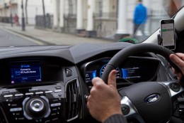
    Ford Mobility Experiment in London — driving-on-demand with Ford fleet. Photo: Ford
    Ford Mobility Experiment in London — driving-on-demand with Ford fleet. Photo: Ford

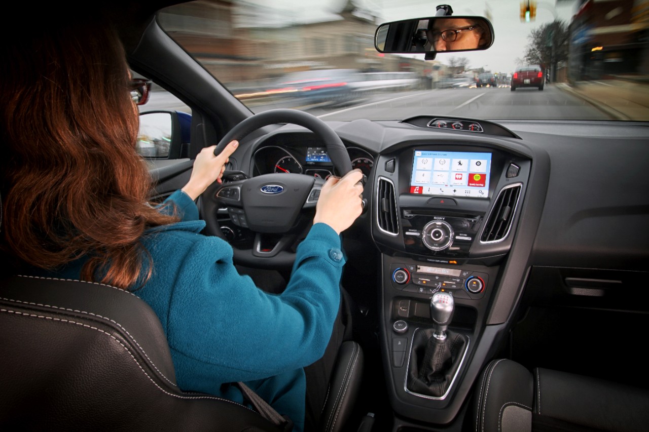
    Far from its beginnings in 2007, Ford announced SYNC 3, an updated version of its in-vehicle communication and information system. SYNC technology is already in 10 million vehicles on the road. SYNC 3 will be released in new car models this year and will include more conversational speech recognition, a more smartphone-like experience with a touch screen and easier-to-read graphics. In addition, AppLink 3.0 will roll out and give drivers the ability to access their navigation app — much as they do on a smartphone — on in-vehicle touch screens.

    Ford SYNC 3. Photo: Ford
    SYNC 3 has been designed to keep the drivers eyes on the road and hands on the wheel, even when controlling their favorite phone apps. Photo: Ford

    You may recall that GM had announced OnStar would be dropping Verizon for AT&T communications staring in 2015. The announcement of Verizon Vehicle, a new connected vehicle service that duplicates some of the features of OnStar, must be the impetus. The subscription-based service will be compatible with all vehicle models sold in the U.S. since 1996. The service will include GPS-directed roadside assistance, crash notification, emergency assistance with a live agent, a hotline to connect with mechanics on vehicle issues, maintenance alerts, and stolen vehicle location assistance. Notably, the offering doesn’t include navigation, a mainstay of OnStar, but readily available on smartphones. The service uses an OBD II dongle and a head unit that can attach to a visor and contains a Bluetooth speaker and call buttons.

    Mercedes-Benz, Audi and BMW all showed advances in self-driving vehicles. Mercedes-Benz demoed the F015 Luxury in Motion concept car, which is fully autonomous and completely powered by a battery and fuel cell. Audi impressed by having its own concept vehicle drive itself from Palo Alto, California, to Las Vegas. BMW offered demonstrations of its i3 electric car, with ActiveAssist technology, able to prevent collisions at speeds up to 15 mph.

    Delphi and Valeo technology suggest that current adaptive cruise-control systems may soon add self-steering. Drivers could allow the car to take over in stop-and-go traffic and on long highway segments. Although unlikely to see production in the short term, Delphi showed the full capabilities of its self-driving technology in an urban environment.

    The next big feature to be commercialized during our wait for automated driving is self-parking. As demonstrated by BMW, the driver arrives at a parking garage entrance, gets out of the car, and sends it to find a parking place. When ready to depart, the driver summons the car, which drives itself to a special pickup zone in front of a parking garage. BMW says it will be offering self-parking cars in one to two years.

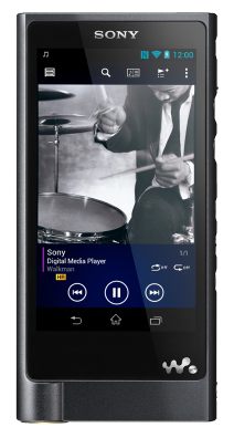
    The Sony Walkman, now $1,100. Photo: Sony
    The Sony Walkman, now $1,100. Photo: Sony

    Unfortunately, augmented reality hasn’t quite lived up to the hype, but Hyundai is showcasing a production-ready augmented reality heads-up display concept. It’s an easy-to-understand system with animated information and warnings to describe road conditions ahead. For instance, it provides warnings when another car is about to unexpectedly enter the car’s lane, and shows arrows leading to exit ramps, highlighted street signs and one-way street markings. Hyundai has linked the augmented heads-up display to a wearable band that will vibrate with warnings. The band includes a heart-rate monitor that can notify 911 if a driver’s heart rate changes rapidly.

    I don’t want to neglect the things in life that don’t change. It is comforting to know that Palm Pilots, record players and Walkmans are back at CES. The new Sony Walkman will set you back $1,100. So things do change.

  • W3C, OGC to Integrate Spatial Data on the Web

    The World Wide Web Consortium (W3C) and the Open Geospatial Consortium (OGC) are collaborating to improve interoperability and integration of spatial data on the Web. Spatial data — describing geographic locations on the Earth and natural and constructed features — enriches location-based consumer services, online maps, journalism, scientific research, government administration, the Internet of Things, and many other applications. In the United States alone, geospatial data and services are estimated to generate $1.6 trillion annually.

    “Location, as well as providing context to much of today’s online information, is vital to the emerging field of connected devices,” said Ed Parsons, Geospatial Technologist at Google. “Through this collaboration we hope to make the understanding of geospatial knowledge a fundamental component of the Web.”

    Spatial data is integral to many of our human endeavors and so there is a high value in making it easier to integrate that data into Web based datasets and services. For example, one can use a GIS system to find the nearest restaurant, but today it is difficult to associate that restaurant with reviewer comments available on the Web in a scalable way. Likewise, concepts used widely on the Web such as “the United Kingdom” do not match the geographic concepts defined in a GIS system, meaning Web developers are missing out on valuable information available in GIS systems. Bridging GIS systems and the Web will create a network effect that enriches both worlds.

    “Location plays a vital role for BBC Online, not least in our remit to provide timely information for Weather, Travel and Local News,” said Chris Henden, service owner for location services at BBC Future Media. “It matters across the service, from maps showing places of note in World War One, to detailed context for breaking news. We source data from various third parties, then transform, curate, and make it available to our front-end services. There is a perceptible gap between the specialised world of geographic data, and that of the Web. Bridging that gap can take significant, repeated effort, and is not always successful or possible. Therefore this collaboration between the OGC and W3C is more than welcome.”

    More than 100 participants discussed these challenges at the March 2014 Workshop on Linking Geospatial Data, co-organized by OGC and W3C in partnership with the UK Government Linked Data Working Group, Google, and Ordnance Survey (the UK mapping agency). Stories ranging from management of data in response to the Fukushima nuclear plant accident to the use of spatial data to create new services from spatial and historical data in the Netherlands illustrated a diverse set of integration benefits and challenges.

    Informed by the conclusions from that workshop, the collaboration announced today will enable publishers of spatial data, providers of services that consume the data, and application developers to establish common practices and reduce the cost of integrating spatial data on the Web. Through the collaboration, the geospatial and Web communities will document use cases and requirements, develop best practices for publishing spatial data on the Web, and advance some existing technologies to W3C Recommendations and OGC standards.

    “Through this collaboration we will ensure that governments and research labs will have a way to open up their spatial data to be used transparently by scientists, industry, and citizens alike,” said Kerry Taylor, principal research scientist at Australia’s CSIRO.

    “With growing demand for weather data services delivered via the Web, this joint effort will ensure the progress of practical and usable standards for the integration and communication of location related data,” added Richard Carne, chief digital officer at the MetOffice.

    Participants will evaluate the use of Linked Data for managing the complex evolution and integration of spatial data. The Linked Data approach enables people to produce data independently, and to then easily integrate heterogeneous data from diverse sources.

    “We have used Linked Data — including early work on W3C’s Semantic Sensor Network ontology and OGC’s GeoSPARQL — to monitor and manage ground water levels affecting vulnerable underground archaeological sites,” said Linda van den Brink of Geonovum, the Dutch government geospatial standards body. “We demonstrated that when you have a way to easily express location in Linked Data, you can combine geo-information with other data and discover new information without much effort.”

    For this collaboration, W3C and OGC have each launched a Spatial Data on the Web Working Group (W3C homeOGC home). The groups, both chaired by Ed Parsons and Kerry Taylor, will coordinate closely and publish deliverables jointly.

    For W3C, this work is supported in part by the SmartOpenData project.

  • Second Wayward Galileo FOC Moving Higher

    Second Wayward Galileo FOC Moving Higher

    At a press conference on Jan. 16, Director General Jean-Jacques Dordain of the European Space Agency (ESA)  announced that the second errant full-operational capability (FOC) satellite, launched in August, had started its orbital change maneuver the previous day. He anticipated that the orbital change would be completed and the final orbit — “albeit somewhat lower in height than the one into which it was supposed to go” — achieved in “a few weeks.” He confirmed that both in-orbit FOCs are working well, fully operational, and providing excellent “on specification” positioning data.

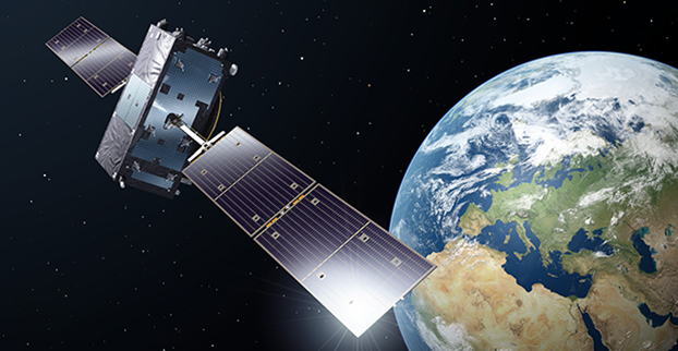
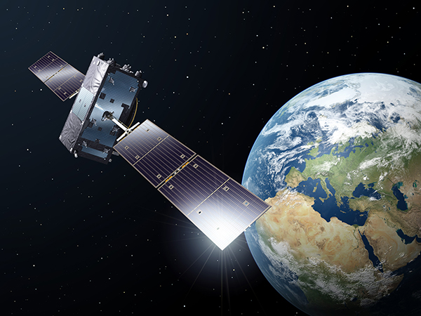
    The fifth Galileo satellite is now pointing toward Earth.
    The first errant Galileo satellite is now pointing toward Earth.

    Two more FOC satellites are ready for launch, and a third has undergone thermal vacuum testing at ESA’s European Space Research and Technology Centre (ESTEC) facility in the Netherlands. Dordain said four would be available to launch soon, and he anticipated up to six FOCs being ready for launch during 2015.

    The previous plan had called for four for 2015, but the year’s anticipated total now includes the two that were held back from launch during a December 2014 window, so the total number is the same. The actual launch schedule and launch vehicles are still under discussion, according to Dordain, and he said the European Commission (EC) would make a decision at the end of January on this issue. He refused to be drawn out on what ESA would recommend to EC on this front.

    Jean-Jacques Dordain
    Jean-Jacques Dordain

    “As you know, Soyuz did not place the first two FOC satellites in the right orbit. They only achieved very low orbits. This led and is still leading to delays in the deployment of the Galileo constellation. However, it’s not all bad news, because the two FOC satellites are working perfectly,” Dordain said.

    “One of the two has already had its orbit changed, last November, and once in its new orbit, we ran all the new payload tests, and all the data that we have show that the FOC payload is the best in orbit today of the Galileo satellites. We were able to achieve on-spec positioning with the first FOC and the IOV satellites. It provides us with highly accurate positioning data,” Dordain said.

    “Once we have both FOCs in their final orbits, not their nominal orbits, it’s true, but they are orbits that mean they will be usable for a long time, because they no longer go through the Van Allen belts.”

    A video of the news conference is available here. The Galileo portion of the 2-hour video begins at 11:45. The event took place at ESA-HQ, Paris, France.

  • Six Galileo Satellites Planned for 2015 Launch

    Six Galileo satellites are scheduled to be launched this year, European Space Agency (ESA) Director General Jean-Jacques Dordain said on January 16.

    “The launch of six satellites is scheduled for 2015. The [European] Commission will determine the terms of the launches at the end of January,” Dordain said at a press briefing. The satellites will be put into orbit by Ariane 5 and Soyuz carrier rockets.

    The Galileo project is jointly implemented by the European Union and the ESA.


  • Galileo Service Interruption Planned for System Upgrade

    Galileo Service Interruption Planned for System Upgrade

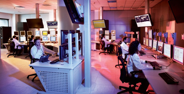
    Operators of Galileo's Ground Mission Segment at the Galileo Control Centre in Fucino, Italy. These operators oversee the navigation services of the Galileo constellation.
    Operators of Galileo’s Ground Mission Segment at the Galileo Control Centre in Fucino, Italy. These operators oversee the navigation services of the Galileo constellation. Photo: Galileo

    Galileo’s navigation messages will shortly stop being updated to enable the migration of a new release for Galileo’s ground mission segment, announced the European Space Agency.

    Although the actual navigation signals will continue to be transmitted, the generation and uplink of the navigation message — which renews the contents of the signal — will be interrupted during the last week of January for about five weeks.

    The accuracy of the navigation message received by users will slowly degrade, or in case of a reset in the satellite signal generator the message content will be dummy material. The users will be informed accordingly through a warning flag in the disseminated message, or through the online Notice Advisory to Galileo Users.

    “The main benefits of this migration from V1.2 to V2.0 of the Galileo Ground Mission Segment are better overall performance and availability, increased robustness and improved operability,” explained ESA’s Martin Hollreiser, who is overseeing the mission segment’s development with Thales Alenia Space France as prime contractor. “The latter is achieved through enhanced operator interfaces, increased access to performance data and the automation of procedures.

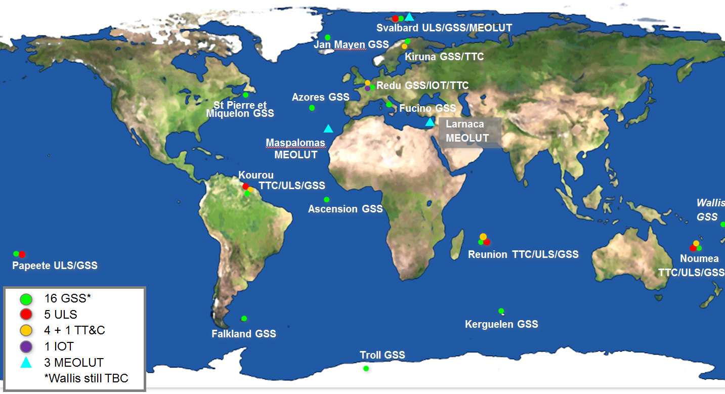
    “Various ‘non-conformances’ identified by operators over time have been fixed, while overall security has been further strengthened through treatment plans,” Hollreiser said. “This is in particular true for the Public Regulated Service, or PRS, the most secure Galileo class of signal. Finally, the number of Galileo Sensor Stations will increase from 12 to 15 worldwide and the number of Galileo Uplink Stations from four to five.

    “The new Sensor Stations will be on Santa Maria in the Azores, Ascension Island in the mid-Atlantic and Kiruna in the Swedish Arctic. The additional Uplink Station will be on Papeete, in French Polynesia. Such system improvements have always been part of our planning since the contract began in 2011.”

    Galileo’s worldwide ground mission segment is one of the most complex developments ever undertaken by ESA, with twin European Galileo Control Centres and a network of sensor and uplink stations deployed on remote sites across the world. They are all interconnected via a robust satcoms realtime network.

    While satellite control and housekeeping are performed by Galileo’s Ground Control Segment in Oberpfaffenhofen, Germany, the Ground Mission Segment that provides the navigation and timing services and related performances is operated from a separate centre in Fucino, Italy.

    Galileo’s ground segment encompasses twin European Galileo Control Centers and uplink stations on remote sites across the world. They are all interconnected via a robust satcom network. It includes Galileo Sensor Stations (GSSs) to provide coverage for clock synchronization and orbit measurements; uplink Stations (ULSs) to uplink navigation and integrity data to the Galileo satellite navigation payloads for rebroadcast to users; Telemetry, Tracking and Command Stations (TT&Cs) to manage the satellite platforms; an In-Orbit Test (IOT) site at Redu for satellite payload testing and a trio of Medium-Earth Orbit Local User Terminals (MEOLUTs) for search and rescue activities.
    Galileo’s ground segment encompasses twin European Galileo Control Centers and uplink stations on remote sites across the world. They are all interconnected via a robust satcom network. It includes Galileo Sensor Stations (GSSs) to provide coverage for clock synchronization and orbit measurements; uplink Stations (ULSs) to uplink navigation and integrity data to the Galileo satellite navigation payloads for rebroadcast to users; Telemetry, Tracking and Command Stations (TT&Cs) to manage the satellite platforms; an In-Orbit Test (IOT) site at Redu for satellite payload testing and a trio of Medium-Earth Orbit Local User Terminals (MEOLUTs) for search and rescue activities.

    A user’s satnav receiver needs signals from at least four satellites. It actually measures the time the signal takes to reach its antenna from the satellites, then converts time into distance to compute its spatial position as the intersection of the four resulting spheres. To reach sufficient level of precision, the time synchronization of the overall system clocks must stay accurate to a few billionths of a second, and any drift in satellite orbits must be corrected for.

    This is the task of the Ground Mission Segment in the control center, which continuously receives signal measurements from the sensor stations around the world. Based on these measurements, it computes exact satellite orbits and time synchronization for the satellites’ onboard atomic clocks.

    These corrections are incorporated into the ephemerides included in an updated navigation message, which is uplinked to the satellites for dissemination to the user. The updated ephemerides information in the navigation signal provides to the user receivers the information required to compute their exact position.

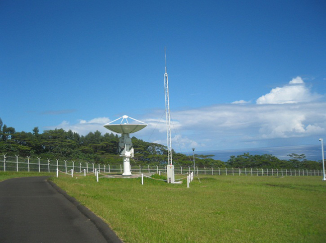
    The new Papette Uplink Station in Tahiti, French Polynesia, used for uplinking navigation messages for rebroadcast to users from Galileo satellites.
    The new Papette Uplink Station in Tahiti, French Polynesia, used for uplinking navigation messages for rebroadcast to users from Galileo satellites. Photo: Galileo
  • Kickstarter Launched for NMEA Dongle to Connect GPS, iOS

    Kickstarter Launched for NMEA Dongle to Connect GPS, iOS

    NMEA-dongle-W
    Photo: NMEA

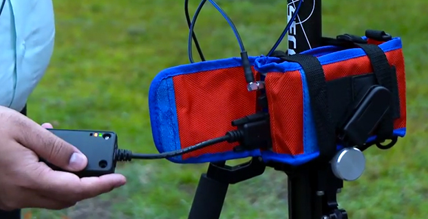
    kickstarter campaign has launched for an NMEA dongle that connects any existing GPS receiver to iOS devices. The device connects and communicates with high-accuracy GPS/GNSS devices and other field sensors that emit NMEA data to iOS devices over Bluetooth, allowing users to collect data on an iPad or iPhone using one or more sensors in the field.

    Primary functions include:

    • overriding the internal GPS on iOS device with the location data coming from the external GPS so all existing apps using internal location services can benefit from the increased accuracy without any changes to the app.
    • providing the ability to connect with other field sensors that emit NMEA-format data (such as underground cable locators, lasers, resistographs, and audiographs) simultaneously with a GPS so data from multiple sensors can be incorporated into the data-collection application.

    Garg explained the need for the dongle on his Kickstarter page: “The accuracy and precision of the internal GPS on iPads and iPhones is highly unreliable — it works fine for navigational purposes but fails miserably for mapping and asset management applications. The accuracy varies in range from a few meters to a few hundred meters depending on operating conditions, and there is no easy way to reliably ascertain that. Tests have proven that the accuracy rating on the location data returned by Apple is more of a general estimate than a reliable metric.”

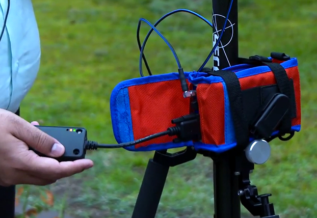
    The NMEA dongle is business-card-sized, and has an internal battery and a long-range Bluetooth. The dongle plusg into an existing GPS receiver’s serial port or connects via bluetooth to transmit the GPS data to the iPad. This allows users to feed RTK/NTRIP data to their iOS device.

    “We have tested our solution with most of the leading brands of GPS receivers available in U.S., including Trimble, Topcon, John Deere, Altus, Geneq, EOS, CHC,” developer Sharad Garg told GPS World, “on most of the popular networks that we could get access to, including the Leica, Trimble, MyWayRTK, a few state-run networks and of course Unavco. Our solution is compatible with all of them, so its a very generic product at this point compatible with just about all the different solutions out there.”

    Garg said his team also designed the dongle so that it allows users to connect to sensors such as laser range finders, valve exercising machine, Resistographs or agricultural sensors that emit data in NMEA format. The National Marine Electronics Association (NMEA) specification defines the interface between various pieces of marine electronic equipment, a standard that permits marine electronics to send information to computers and to other marine equipment.

    “We have actually improved the design very significantly to be very modular and be compatible with all sorts of GPS connections that might be offered by the different vendors out there,” Garg said.

    This YouTube video shows the dongle’s RTK functionality.

    GPS World published general articles on NMEA and RTK in Innovation:

    NMEA 0183: A GPS Receiver Interface Standard

    RTK GPS

  • U.S. Army Interested in eLoran PNT for the Warfighter

    The United States Army is soliciting information for eLoran receivers for the warfighter, either stand-alone or integrated with GPS.

    The Jan. 14 Request for Information (RFI) provides an outline for the potential use of the receivers in Army and other Department of Defense (DoD) maritime, aviation, or vehicular platforms and for position and timing purposes.

    “As part of the Assured Positioning, Navigation and Timing (APNT), program effort, the Army is investigating the potential benefits from utilizing eLORAN ‘signals of opportunity’ to aid in developing PNT solutions for the warfighter. Thus, the Army is interested in leveraging the recent technology development efforts in the industry mainly for adding eLoran capabilities into Army APNT solutions,” the RFI reads.

    Primary technical areas the Army is interested in include the receiver specifications; its use for maritime, aviation, vehicles, and timing; SWaP-C considerations for an integrated GPS and eLoran receiver; potential benefits of one-way messaging capabilities using the eLORAN data channel; signal tracking where GPS is unavailable (indoors, under water, in urban environments); and how quickly a demonstration could be held.

    The assumption is for an order quantity of 50,000 units after a five-year development effort. The Army hopes to determine industry interest in developing such a receiver if the DOD “were to consider eLoran as a PNT source/signal of opportunity.”

    For more information and full details, see the RFI here.

  • L-3 Communications Awarded $8.5M MGUE Contract Modification

    L-3 Communications has been awarded an $8.5 million modification to the Military GPS User Equipment (MGUE) contract to accelerate the MGUE program. The goal is to speed delivery of upgraded, more powerful GPS receivers to warfighters.

    L-3 Communications has been providing hardware for the Air Force in related contracts since 2012 for the GPS user equipment program, reports Defense Systems. The next phase of L-3’s project includes procurement of pre-prototype receiver card deliveries as well as test support activities. The receiver card deliveries will greatly increase the fielding of Military Code (M-code) capable GPS receivers to soldiers.

    MGUE is a joint service program to develop a modernized set of military GPS receivers delivering improved capabilities to allow for accurate and reliable positioning, navigation, and timing service where current receiver performance might be compromised or unavailable.

    Work will be performed in L-3 Communications’ Anaheim, California, location, with an expected completion date of Sept. 30, 2016. Fiscal 2015 research, development, test and evaluation funds in the amount of $1,814,560 are being obligated at the time of award.

    The Space and Missile Systems Center, Los Angeles Air Force Base, California, is the contracting activity.


  • Terry Moore Considers Future of GNSS in RIN Lecture

    Terry Moore
    Terry Moore

    Professor Terry Moore explores “Where next for GNSS? ” in the Anderson Memorial Lecture at the Royal Institute of Navigation on March 2. Moore is the associate dean for infrastructure and director of the Nottingham Geospatial Institute, Faculty of Engineering, at the University of Nottingham.

    Moore will review the current status and proposed modernization of GPS with an emphasis on the benefits that the developments and new signals will bring to a variety of user domains. In a similar manner, the Russian GLONASS will also be described documenting the evolution to the system’s current status and the planned developments.

    The new European Galileo and Chinese BeiDou systems also will be described along with consideration of the international efforts directed towards interoperability of all the global systems. Other nascent and proposed systems will be introduced, such as IRNSS and QZSS.

    The lecture is presented by the Royal Institute of Navigation in conjunction with the RAF Cranwell Branch of the Royal Aeronautical Society. There is no charge for RIN or RAeS members, but RIN members who would like to attend should book through [email protected] to be informed of the security and entry arrangements. The lecture will be held at Whittle Hall, RAF Cranwell, Sleaford, Lincs, U.K.

    A member of the GPS World Editorial Advisory Board, Moore holds a B.Sc. degree in Civil Engineering and a Ph.D. degree in Space Geodesy from The University of Nottingham. He is a Fellow of the Royal Institute of Navigation, a former vice president and a member of its council. He is a member of the European Space Agency GNSS Scientific Advisory Committee and a member of the UK Space Agency Telecoms and Navigation Committee. He is also a member of The Institute of Navigation and a Fellow of the Royal Astronomical Society.