Blog

  • GPS Helps Solve Mystery of Sliding Rocks

    GPS Helps Solve Mystery of Sliding Rocks

    Rarely formed sheets of ice push rocks across a dry lake in Death Valley.
    Rarely formed sheets of ice push rocks across a dry lake in Death Valley.

    In Racetrack Playa in Death Valley, California, hundreds of rocks — some weighing as much as 700 pounds — seem to have been dragged across the ground, leaving synchronized trails that can stretch for hundreds of meters. Though many phenomena were speculated (hurricane-force winds, dust devils, slick algal films, thick sheets of ice), no one knew what caused the movement.

    To solve the mystery, in 2011 a team of researchers led by paleobiologist Richard Norris, Scripps Institution of Oceanography, UC San Diego, began monitoring the rocks remotely. The research team fit 15 similar rocks with custom-built, motion-activated GPS units (the National Park Service disallowed use of native rocks) and installed a high-resolution weather station capable of measuring gusts to one-second intervals. Then — in what Ralph Lorenz of the Applied Physics Laboratory at the Johns Hopkins University suspected would be  “the most boring experiment ever” — the researchers waited for something to happen.

    In December 2013, Richard Norris and co-author and cousin Jim Norris discovered that the playa was covered with a pond of water three inches deep. Shortly after, the rocks began moving.

    “Science sometimes has an element of luck,” Richard Norris said. “We expected to wait five or ten years without anything moving, but only two years into the project, we just happened to be there at the right time to see it happen in person.”

    Their observations show that moving the rocks requires a rare combination of events. First, the playa fills with water, which must be deep enough to form floating ice during cold winter nights but shallow enough to expose the rocks. As nighttime temperatures plummet, the pond freezes to form thin sheets of “windowpane” ice, which must be thin enough to move freely but thick enough to maintain strength. On sunny days, the ice begins to melt and break up into large floating panels, which light winds drive across the playa, pushing rocks in front of them and leaving trails in the soft mud below the surface.

    “On December 21, 2013, ice breakup happened just around noon, with popping and cracking sounds coming from all over the frozen pond surface,” said Richard Norris. “I said to Jim, ‘This is it!’”

    The rocks moved under light winds of about 3-5 meters per second (10 miles per hour) and were driven by ice less than 3-5 millimeters (0.25 inches) thick, a measure too thin to grip large rocks and lift them off the playa, which several papers had proposed as a mechanism to reduce friction. Further, the rocks moved only a few inches per second (2-6 meters per minute), a speed that is almost imperceptible at a distance and without stationary reference points.

    “It’s possible that tourists have actually seen this happening without realizing it,” said Jim Norris. “It is really tough to gauge that a rock is in motion if all the rocks around it are also moving.”

    Individual rocks remained in motion for anywhere from a few seconds to 16 minutes. In one event, the researchers observed rocks three football fields apart began moving simultaneously and traveled over 60 meters (200 feet) before stopping. Rocks often moved multiple times before reaching their final resting place. The researchers also observed rock-less trails formed by grounding ice panels — features that the Park Service had previously suspected were the result of tourists stealing rocks.

    “The last suspected movement was in 2006, and so rocks may move only about one millionth of the time,” Lorenz said. “There is also evidence that the frequency of rock movement, which seems to require cold nights to form ice, may have declined since the 1970s due to climate change.”

    The team’s findings were published in the journal PLOS ONE on August 27.

  • Topcon Releases New UAS for Aerial Mapping

    Topcon Releases New UAS for Aerial Mapping

    Sirius-Topcon-UAS-O

    Topcon Positioning Group has released two unmanned aerial systems (UAS) for mapping — the Sirius Pro and Sirius Basic. Both systems are designed to produce the most accurate solutions for the automated mapping of a wide range of sites — regardless of terrain — including construction sites, mines and quarries, and for use in land surveying, power line and pipeline inspection as well as precision agriculture field mapping.

    The fixed-wing systems resulted from a partnership with MAVinci GmbH, a UAS development company with which Topcon recently entered into a worldwide distribution agreement.

    “The Sirius Pro system is unique to the UAS marketplace. Instead of using traditional ground control points, Topcon combines RTK (real-time kinematic) GNSS solutions with precision timing technology to provide more accurate mapping results when compared to other products,” said Eduardo Falcon, executive vice president and general manager for the Topcon GeoPositioning Solutions Group.

    “The system is easy to use and rugged — allowing operators to use a simple hand launch with precise automatic operation from takeoff to landing, and it can be flown safely in nearly all weather conditions,” Falcon said.

    The Topcon Sirius Basic is an entry-level system offering many of the advantages of the Sirius Pro with options to upgrade. “The Sirius Basic shares the same hardware components of the Pro model, providing affordability with the same level of sturdiness and ease of operation,” said Falcon. “Additionally, when the need arises for the increased accuracy and productivity of the Pro system, a simple upgrade makes the transition practically effortless.”

    Both systems also offer autopilot assisted manual control, automatic flight planning and safety features.

  • Galileo 5 and 6 Operating Smoothly Despite Wrong Orbit

    Galileo satellites 5 and 6 are safely under control, despite having been released on a lower and elliptical orbit instead of the expected circular orbit on August 22. Each satellite’s set of solar arrays is fully deployed and generating power, and operations continue smoothly.

    The European ground teams deployed at the European Space Agency’s (ESA)  control centre ESOC in Darmstadt, Germany, in cooperation with satellite manufacturer OHB, confirm that both satellites are in a safe state, correctly pointing to the sun, properly powered, and fully under control of the ESA-CNES integrated team.

    Controllers are ready to proceed to the next stage of the launch and early operations phase activities.

    In parallel, ESA teams are investigating the possibilities of exploiting the satellites to maximum advantage, despite their non-nominal injection orbits and within the limited propulsion capabilities. Different scenarios will then be assessed before decisions are taken for a recovery mission, according to ESA.

    After the separation of the two Galileo satellites launched August 22, ongoing analysis of the data provided by the telemetry stations operated by the ESA and the French space agency CNES showed that the satellites were not in the expected orbit.

    An independent inquiry commission was appointed August 25 by Arianespace, the European Space Agency (ESA) and the European Commission to investigate the anomaly.

  • Intel Showcases Standalone 3G Modem for the Internet of Things

    XMM-6255-Board-Size-Comparison-Embargo-8-26-2014-12am-pstIntel has commercially launched the XMM 6255 modem to provide a wireless solution for the billions of “smart” and connected devices that are expected in the coming years. At about 300 square millimeters, Intel says it is the world’s smallest standalone 3G modem, designed for networked sensors and other Internet of Things applications such as wearables, security devices and industrial equipment.

    The XMM 6255 features the SMARTI UE2p transceiver, which is based on the new Intel Power Transceiver technology, a design that combines transmit and receive functionality with a fully integrated power amplifier and power management on a single chip. This design approach reduces XMM 6255’s component requirements, resulting in a smaller modem that helps manufacturers minimize their build of material costs. It also protects the radio from overheating, voltage peaks and damage under tough usage conditions, which is important for safety monitors and other critical IoT devices.

    Additionally, the XMM 6255 modem features a radio architecture that enables it to perform exceptionally well in challenging real-world situations, including:

    • Low signal network coverage: The XMM 6255 modem provides reliable communication when it comes to transmitting information in low signal zones like a parking garage or a home basement.
    • Small-sized devices: Devices with a small form factor like a smartwatch or a sensor may not have enough space for a normal-sized 3G antenna, which can affect connectivity quality and reliability. The XMM 6255 modem is specially designed for such devices and delivers great 3G connectivity even with small volume antennas not meeting conventional mobile phone quality standards.

    PrintThe integration of the power amplifier and transceiver in this modem simplifies the design and minimizes device development costs, which means developers can launch more products more quickly, and in a more cost-effective manner.

    The XMM 6255 is available in the u-blox SARA-U2 module and Intel expects to have additional partnerships in the coming months.

    For more product information, download the brochure.

  • GeCo in the Rockies Combines Two Geospatial Conferences

    GeCo in the Rockies — a combined conference of GIS in the Rockies and GeCo West — will be held September 22-26 in Grand Junction, Colorado.

    Two full days of presentations and workshops will showcase the projects, applications, and solutions of geospatial professionals. A special Technology Panel showcases innovators and leaders in the field, who will address “The Future of GIS.”

    LizardTech, a provider of software solutions for managing and distributing geospatial content, will exhibit at the conference and prsesent a workshop titled “Compressed Data Workflow in a GIS Environment” on September 23, hosted by LizardTech’s Regional Territory Manager Genie Hays.

    In the workshop, Hays will introduce the MrSID file format, which provides a complete geospatial workflow, from data acquisition, to access and delivery on desktop and mobile devices. She will demonstrate how to use MrSID files for imagery and LiDAR in industry tools. Her demonstrations of industry tools will include ArcMap, AutoCAD, Global Mapper, Q-GIS, GeoServer, Google Earth, ArcGIS Explorer Online, Trimble devices, UAV data samples, and more.

    “We are really excited to share with the GeCo attendees how they can make the most of MrSID data using common industry programs and applications,” Hays said.

    Other Conference Highlights

    The keynote speaker is the founder of What3Words, who will discuss the creation of a universal address system based on words rather than numbers. Also, GeCoX is a premier kick-off event highlighting short, focused talks about the changing technology landscape.

    Esri will provide a hands-on Learning Lab, with an introduction to ArcGIS software in a variety of self-paced training sessions.

    A networking social provides an opportunity to meet the leading businesses in the geospatial industry and learn more about the changing tools, software, hardware, and solutions, and a Student and Career Exploration Breakfast provides an interactive session with education and industry experts to learn, which personal and technical GIS skills are in demand for today’s GIS employee. The breakfast is open to all students for free.

    Learn more at the conference website.


  • GeCo in the Rockies Combines Two Geospatial Conferences

    GeCo in the Rockies — a combined conference of GIS in the Rockies and GeCo West — will be held September 22-26 in Grand Junction, Colorado.

    Two full days of presentations and workshops will showcase the projects, applications, and solutions of geospatial professionals. A special Technology Panel showcases innovators and leaders in the field, who will address “The Future of GIS.”

    LizardTech, a provider of software solutions for managing and distributing geospatial content, will exhibit at the conference and prsesent a workshop titled “Compressed Data Workflow in a GIS Environment” on September 23, hosted by LizardTech’s Regional Territory Manager Genie Hays.

    In the workshop, Hays will introduce the MrSID file format, which provides a complete geospatial workflow, from data acquisition, to access and delivery on desktop and mobile devices. She will demonstrate how to use MrSID files for imagery and LiDAR in industry tools. Her demonstrations of industry tools will include ArcMap, AutoCAD, Global Mapper, Q-GIS, GeoServer, Google Earth, ArcGIS Explorer Online, Trimble devices, UAV data samples, and more.

    “We are really excited to share with the GeCo attendees how they can make the most of MrSID data using common industry programs and applications,” Hays said.

    Other Conference Highlights

    The keynote speaker is the founder of What3Words, who will discuss the creation of a universal address system based on words rather than numbers. Also, GeCoX is a premier kick-off event highlighting short, focused talks about the changing technology landscape.

    Esri will provide a hands-on Learning Lab, with an introduction to ArcGIS software in a variety of self-paced training sessions.

    A networking social provides an opportunity to meet the leading businesses in the geospatial industry and learn more about the changing tools, software, hardware, and solutions, and a Student and Career Exploration Breakfast provides an interactive session with education and industry experts to learn, which personal and technical GIS skills are in demand for today’s GIS employee. The breakfast is open to all students for free.

    Learn more at the conference website.


  • GPS Network Shows Drought in the U.S. West

    GPS Network Shows Drought in the U.S. West

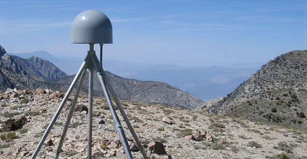
    A GPS station in the Inyo Mountains, Calif. Credit: Shawn Lawrence, UNAVCO.
    A GPS station in the Inyo Mountains, Calif. Credit: Shawn Lawrence, UNAVCO.

    A network of GPS stations in the western United States is revealing the severity of the drought in that region.

    Compared to the nine years before the drought, the GPS data show that the western United States has lost 240 gigatons of water, which is enough to flood the entire region in 10 centimeters of water.

    Investigating ground positioning data from GPS stations throughout the west, researchers at the Scripps Institution of Oceanography at the University of California, San Diego, found that the water shortage is causing an uplift effect up to 15 millimeters (more than half an inch) in California’s mountains and on average four millimeters (0.15 of an inch) across the west.

    Results of the study, which was supported by the U.S. Geological Survey (USGS), appear in the August 21 online edition of the journal Science.

    The measurements have a much better resolution — 200-300 kilometers — than data provided by NASA’s GRACE satellites, which shows how the water mass has changed on and below the Earth’s surface.

    California_Drought_Dry_Riverbed_2009
    A dry riverbed in California.

    Researchers Adrian Borsa, Duncan Agnew, and Dan Cayan used data from more than 700 GPS stations in the National Science Foundation’s Plate Boundary Observatory to measure the rising and falling of Earth’s surface due to the presence of water. Water in lakes or aquifers weighs down on the Earth causing the surface to sink, while during a drought the surface rises. Each station provides time and position information that is used to calculate the station’s location to within 1-2 millimeters horizontally and 3-5 millimeters vertically.

    The current drought began in 2012, when data shows that in general, the ground rose by about four millimeters. The rise in the Sierra Nevada mountain range was 15 millimeters.

    While poring through various sets of data of ground positions from highly precise GPS stations within the National Science Foundation’s Plate Boundary Observatory and other networks, Borsa, a Scripps assistant research geophysicist, kept noticing the same pattern over the 2003-2014 period: All of the stations moved upwards in the most recent years, coinciding with the timing of the current drought.

    Agnew, a Scripps Oceanography geophysics professor who specializes in studying earthquakes and their impact on shaping the earth’s crust, says the GPS data can only be explained by rapid uplift of the tectonic plate upon which the western U.S. rests (Agnew cautions that the uplift has virtually no effect on the San Andreas fault and therefore does not increase the risk of earthquakes).

    For Cayan, a research meteorologist with Scripps and USGS, the results paint a new picture of the dire hydrological state of the west.

    “These results quantify the amount of water mass lost in the past few years,” Cayan said. “It also represents a powerful new way to track water resources over a very large landscape. We can home in on the Sierra Nevada mountains and critical California snowpack. These results demonstrate that this technique can be used to study changes in fresh water stocks in other regions around the world, if they have a network of GPS sensors.”

    The study was supported by USGS National Earthquake Hazards Reduction Program.

  • deCarta Powers POI Search for Major Mobile Handset Maker

    Advanced Search Engine Replaces Google Local Search in 122 Countries

    deCarta, Inc., an independent LBS platform company, is now providing the local search function for a worldwide, top-five mobile handset manufacturer. deCarta has been hosting and running the search service since August 7 using its advanced geosearch engine — L2 — and has replaced the search service previously provided by Google. The service delivers millions of responses per day to this handset manufacturer’s local search and mapping application to users in 122 countries.

    deCarta’s L2 is a high-performance, scalable local search engine with single line input and intuitive user interface. deCarta sources and indexes map and POI (points of interest) content from a wide variety of sources globally but also enables customers to easily index, control and search on their own content. The customer service announced utilizes TomTom map and POI content.

    deCarta’s L2 can be used as a pure geocoder for address search, or for POI search, or simultaneously as a combination of the two mixed in a single-line search query — with the additional ability to tune this behavior at runtime. This gives developers maximum flexibility and creativity in producing their applications. deCarta recently expanded country coverage to enable its customers to offer global services.

    The L2 Search engine is an integral component of deCarta’s LBS platform which provides specialized geospatial technologies for maps, routing, navigation, geocoding, local search and geo-data integration and processing. deCarta provides its white-label LBS platform to companies that wish to offer their own customized, branded LBS services as opposed to utilizing industry standard services such as Bing or Google.

    deCarta has two deployment options for its platform: a hosted LBS Platform Service (PaaS) or, alternatively, customers can self-host either on-premise or in a cloud service such as Amazon’s AWS.  Both approaches utilize deCarta’s REST API architecture and can scale to support billions of maps and searches and millions of users per month.

    “We are quite happy with the market reaction to L2 since its introduction last year,” said J. Kim Fennell, CEO of deCarta. “We’re seeing large mobile, telematics and automotive customers switch to L2 in competition against other local search engines and geocoders such as Google, Bing, Nokia/Here and Pitney Bowes. Customers appreciate L2’s technology advantages, customization capabilities, flexible content offerings, less restrictive license terms and our superior customer service — all of which creates a more satisfied end customer experience.”

    L2 enables deCarta’s customers to offer flexible, advanced local search capabilities that are on par with Google Maps but beyond other search engines. Examples include:

    • Single line entry of POI or address or both
    • Fast typeahead, predictive entry – ideal for mobile devices
    • High tolerance for misspellings and partial entries
    • Random ordering of address parameters
    • Search for a POI near a POI such as “ATMs near AMC Theater” or “Parking near SFO”
    • Search for POI near a specific address, i.e. “Parking near 1234 Main Street”

    Furthermore, L2 can be integrated with deCarta’s patented “Search Along A Route” technology. This combined with the ability to index custom content and boost result rankings gives automotive OEMs and service providers the ability to offer more advanced and helpful “driver-centric” connected car services.

    For more information visit www.decarta.com or go to the demo at http://labs.decarta.com. Developers can find technical details at http://developer.decarta.com.

  • Agenda, Speakers Announced for Connected Fleets USA

    Telematics Update has announced the agenda and speaker line-up for Connected Fleets USA 2014, formerly known as Telematics for Fleet Management USA. The conference and exhibition will take place November 20-21 in Atlanta, Georgia. The early registration discount ends September 26.

    As growth is seen in goods movement and driver shortages, integration of the connected fleet in the supply chain, service bays, and transport infrastructure is crucial to maintain growth in the U.S. and abroad. Experts anticipate that there will be more investment, mergers and acquisitions, and consolidation in a rush to deliver the best-in-class solution to drive fleet optimization.

    The speakers just announced to take the stage at Connected Fleets USA will be reflecting this change. They include some of the largest fleet rental/leaser, OEMs and companies from across the value chain such as Donlen, Hertz Equipment Rental, ARI, Ryder, Daimler, John Deere, Microsoft, Los Angeles County Metropolitan Transportation Authority and up-and-coming start-ups like Peloton Technology and Metro Tech, Inc.

    Connected Fleets USA 2014 will look into ways to capitalize on the integration of solutions in the supply and create solid partnership models that will increase profitability and drive the connected fleets in the mature North American market

    “It will be critical that companies evaluate the opportunity present from the integration of connected fleets into the wider enterprise and embrace key breakthroughs in the wider connected ecosystem to create an indispensable connected vehicle service package to add value to fleet operators and carriers,” Daniel Pavey, Connected Fleets USA 2014 project director, said.

    Topics and Trends

    The trends and topics to be discussed include:

    • Connectivity is the future of transportation. Explore case studies and the roadmap for autonomous vehicles and V2V/V2I technology that can be leveraged to improve transport infrastructure, mobility, goods movement and traditional fleet manager needs.
    • Enterprise and telematics converge. Integrate vehicle and telematics data to the wider connected ecosystem,  including enterprise resource planning, work order management and maintenance bays to map opportunities where connectivity can ease bottlenecks in the supply chain.
    • Complete the leasing puzzle. Overcome the complexities of fleet leasing by integrating back-end analytics from embedded and aftermarket solutions for a seamless approach for improved driver performance and vehicle life-cycle to engage government, small local and large long-haul fleets.
    • The law of connectivity. Review current and potential proposals for data logging and vehicle-to-vehicle communication to assess legal opportunities and challenges for automated and connected vehicle technologies including liability, litigation and privacy to anticipate potential roadblocks.
    • The investment drive. Investigate the motivation and strategies of private equity, industry players, and government investment, including improving congestion and road safety, widening portfolios and entering new markets to position solutions for investment.
    • Smarter services through data sharing and analytics. Crack open the OEM platform to create a sandbox of data that combine vehicle, driver and environmental data to offer a more precise service portfolio.

    Other sessions will be held on topics such as integration with the advanced connected transport project; commercial data ecosystem, platform and partnerships; and exclusive case studies and panel discussions from Donlen, Hertz Equipment Rental, ARI, Daimler, John Deere and Volvo.

    For the complete Connected Fleets USA 2014 conference program and speaker line-up, visit the conference website.

    Newly Announced Speaker Line-up

    The connected fleet specialists set to speak this year include:

    • Nick Ehrhart, Vice President Business Development, Donlen
    • Mike Dennis, Group Director Maintenance Operation, Ryder Systems, Inc.
    • Casey J Littleton, HERC Global Product Manager – Telematics, Hertz Equipment Rental
    • Shawn Meredith, Manager, Strategy & Product Management, Daimler Trucks North America
    • Conal Deedy, Director, Connected Vehicle Services, Volvo Trucks
    • Edward Olson, Program Manager, Telematics, John Deere Power Systems
    • Ernesto Chaves, Transportation Planning Manager, Los Angeles County Metropolitan Transportation Authority
    • Peter Vanderminden, Industry Manager, Manufacturing & Supply Chain, Microsoft
    • Mohammad Poorsartep, Research Scientist, Texas A&M Transportation Research Institute
    • Joshua Switkes, Founder and CEO, Peloton Technology Inc.
    • Christian Kotscher, CEO, MetroTech Net Inc.
    • Clem Driscoll, President, C.J Driscoll & Associates
    • Scott Mattson, Director, William Blair & Co

    and many other specialists from across the value chain. The full speaker line-up is available on the website.

    For the complete Connected Fleets USA 2014 conference program and speaker line-up, access the e-brochure or contact the Telematics Update team at [email protected]. Register before September 26 to take advantage of a $300 saving on all conference passes.


  • Indoor Location Has Major Growing Pains, but Big Upside

    A number of factors are holding the proximity marketing/indoor positioning markets back: standardization issues, consumer acceptance/privacy, retailer awareness and the technology itself. However, as one location executive put it, it may be the one way that retailers with brick and mortar stores can compete with Amazon and other online giants. 

    Indoor location and proximity marketing may be the way large and small brick and mortar stores can compete with online retailers in the future, said panelists at the New York Place conference, held July 22. But all of this indoor location market talk doesn’t mean much if consumers don’t find a need for it.

    “I am in an aisle at a grocery store and you sent me a coupon for cat food, and I don’t have a cat, I am not going to be interested. The retailer gets to own the data by providing a great experience to the consumer, not the spontaneous ‘you are in a store — here’s some information,’” said John Dempsey, Datalogix head of mobile and video.

    While having a broad picture of a consumer’s “mobile moment” is important, there is something to be said about bombarding a consumer with too many location-based applications, said Doug Kilponen, Wanderful Media chief operating officer. “There are a limited number of apps consumers are willing to have, but not 200 different ones. It’s one thing to have an app for say, Target, but trying to find out what is broadly available during shopping makes shopping too much work,” he said. “Trying to find out what’s available becomes too much work as there are too many options [for the consumer].”

    From a retailer’s perspective, they want consumer’s data, and will share it with partners, but they also want control, said Catherine Lindner, Shelfbucks chief marketing and merchant officer, who was an executive at Walgreens.  “If you think about your own shopping behavior, there is only a few places you actually go to and spend money — a grocer, drug store.  That retailer wants your data, and it makes sense,” she said.  “How do we spend the money to grow the business?  The idea that there is one bucket of money to transfer is not going to happen.”

    One company says that consumers don’t want to be “advertazed” by retailers. “Their job is to show you Calvin Klein, but sometimes there is not enough information or context.  They hijack moments, rather than create them,” said Scott Townsend, Urban Airstrip director of agency programs.

    Still, retailers are increasingly using indoor location as part of their mobile strategies. Jewelry chain Alex and Ani has three beacons in their Boston and New York stores, said Ryan Bonifacino, Alex and Ani vice president, digital strategy. “We really want to prove that this [indoor location] can really work.  We really want to get in front of people who wouldn’t have discovered us,” he said.

    Indoor Location Standardization? What Standardization?

    Like any new technology and market, industry standardization will have growing pains, and a lot of the problem may be with the retailers, said panel members. “There are issues with standardization. If Walmart puts a [indoor positioning] in to its store — they don’t care if it works anywhere else,” said Don Dodge, Google developer advocate.

    Indoor location is the classic chicken-before-the-egg situation, said Chris Goodall, Trusted Positioning founder and CEO. “There currently are no standards for indoor [positioning], maybe we need it.  Databases are not standardized,” he said.

    A lot of the reason that standardization has not be resolved is that no big application, the old killer app, has appeared. “Indoor is something that has not emerged yet, it’s a long tail story,” said Dan Ryan, ByteLight co-founder and CEO.  “Every location company is trying to build a network — and naturally attract developers.”

    Making Proximity and Indoor Location Relevant to Retailers 

    Some retail chains like Walgreens have used indoor positioning technology for years and are considered some of the major early adopters. However, making consumer-purchasing behavior data relevant to retailers is the only way for indoor marketing to take off.

    The concept of geofencing each store has been tested in several locations. One company envisions an image of a celebrity greeting consumers in a store with an offer. “Walgreens focused on not invading people’s privacy. But they basically asked users, what’s important to them when they walk into a store,” said aisle411 founder and CEO Nathan Pettyjohn. “[Bluetooth Low Energy] beacons can do this very elegantly.  When a consumer walks through a store, perhaps they see a celebrity popping out to greet them.”

    In many successful mobile marketing campaigns, all have a common theme — proximity components always enhance sales, said James Smith, Verve chief revenue officer.  “Every one of our studies says it drives sales. Sometimes we hear that geofences don’t work — my answer to that is they are in the wrong places,” he said. “A person can go into a place 15 days later and a beacon locks on them — the retailer is happy because it works. Consumers are more empowered because they have a research device in their hand to go where they want to go.”

    Case Study: Walkbase

    A Finland-based company is delivering market research to retailers that examines consumers’ in-store shopping behavior and loyalty patterns. Walkbase, which signed a deal with Helsinki airport operator Finavia, started in 2007 when it spun off from an indoor location company.

    “It’s a retail tool that analyzes indoor performance of marketing campaigns and [sales] conversion. It measures when consumers come into a store — do they bounce out or are they engaged?” said Juha Mattsson, Walkbase vice president, sales and marketing.  “A retailer can launch a campaign that is affected by a consumer’s indoor journey. Whether that is through coupons, or not, as some retailers don’t want that.”

    Mattsson says that the company is operating primarily in Europe — and is waiting for what indoor technologies will win. “It is just a matter of time before the market takes off. Retailers are very interested in these types of consumer spending analytics,” he said. “We will be launching a U.S. white paper on in-store optimization as it’s all about education. We also are rolling out a version 2.0 of our product in the third quarter.”

    In other LBS news:

    • According to published reports, Michael Halbherr, CEO of Nokia’s HERE mapping unit, will be stepping down. Halbherr, who is based in Berlin, steps down after eight years at the company.  As recently as 2012, HERE, then called Navteq, had been losing money but had stabilized recently. Cliff Fox, HERE senior vice president, will be acting CEO until a replacement is found.
    • I will be covering CTIA’s Super Mobility Week in Las Vegas, Sept. 8-11.  To arrange an interview with me for Wireless LBS Insider, or to submit press releases, contact me at [email protected].


  • Connected Car Isn’t a Smart Car

    Janice Partyka
    Janice Partyka

    The most interesting thing in mobile and location in 2014 is the connected vehicle. Back in the early 1990s, a bigger vision of smarter highways began to be explored. The technology was refined, and resulted in successful demos of cars talking to each other and to roadside infrastructure like traffic lights. If you lived in Southern California, you might remember seeing platoons of automated vehicles zipping along a closed section of Route 15.

    Since those heady days, the timing and visioning for smart highways and vehicles were tempered by the massive cost of the infrastructure required. Now we are seeing the “connected vehicle” starting to roll out of the doors of dealerships, but with a different and more limited type of connectivity than we started to envision in the 1990s.

    Reminiscent of the mission started decades ago, a new year-long “smart car” project and demo will be held in Ann Arbor, Michigan. The objective of the smart car project is to determine whether wireless communication between vehicles can improve safety  Three thousand cars, buses and trucks will utilize data recorders and a technology similar to Wi-Fi that can transmit information about accidents or hazardous traffic conditions.

    Drivers participating in the demo will be warned of sudden changes in traffic patterns or potential collisions through data transmitted from similarly equipped cars and roadside devices. Eight major automakers will provide vehicles and engineering assistance to the study.

    Currently, some new car models are equipped with active safety devices that can alert drivers if they are drifting out of a traffic lane or traveling too close to another car. But the smart car demo differs because will share safety information with other smart cars on the road.

    The smart car system can give drivers visual or audio warnings about sudden traffic changes experienced by another connected vehicle. Several cameras installed in the connected vehicles will also capture data on how the drivers respond to accidents and sudden changes in traffic conditions.

    Today’s connected vehicle is sometimes referred to as a smartphone on wheels, a limited vision of what can be. Now is the time to determine if the savings of fewer accidents or increased capacity on our roads will outweigh the cost of new infrastructure and added functionality in vehicles.


  • Majority Support FCC Rule Requiring Carriers to Provide Accurate Indoor Locations

    A new survey of more than 1,000 consumers found a dramatic gap between the limited location requirements for cell-phone carriers and broad public expectations that wireless callers can be found by emergency responders if they dial 9-1-1 in an emergency.

    According to the survey, two-thirds of cell-phone owners (66 percent) thought that wireless companies could help emergency responders locate them at least to their block, if they call 9-1-1 from inside their homes. Only 6 percent of cell-phone owners correctly responded that the information would likely only be accurate to the neighborhood level or worse.

    When told that current FCC regulations do not require cell-phone carriers to provide an accurate location for callers inside buildings, 83 percent said it was very or critically important to public safety for the FCC to adopt a rule to require cell-phone companies to generate that information. Reinforcing those findings, 79 percent said the FCC should begin enforcing the rule within two years, with nearly half (46 percent) saying the FCC should begin enforcement immediately.

    “When people dial 9-1-1 on their cell phones, they think the operator can find their location to send help,” said Jamie Barnett, director of the Find Me 911 Coalition and former chief of the FCC’s Public Safety and Homeland Security Bureau. “Unfortunately, the carriers have chosen cheaper, less-effective location technologies, and people are dying because emergency responders can’t find them. If you call 9-1-1 on your cell phone inside or in an urban canyon, the carriers’ technologies will often fail to accurately locate that call. Happily, technologies exist now that can find callers indoors and save lives. The carriers’ responsibilities should match consumer expectations that they can be found when they dial 9-1-1 from indoors.”

    Survey respondents also said that they would be willing to vote with their wallets, with nearly two-thirds (63 percent) saying they would consider switching cell-phone companies to a provider who could more accurately and reliably find 9-1-1 callers.

    Among the survey’s findings:

    • Most think all wireless 9-1-1 calls can be found. By a 7-1 margin, respondents thought that emergency responders could find their cell phone’s location if they dialed 911 in an emergency (59.0 percent to 8.5 percent).
    • Indoor callers think 9-1-1 locations are accurate to the block or house level.  Two-thirds of respondents (66 percent) said that cell-phone companies would share location information accurate at least to their block, and 55 percent believed it would be accurate at least to their house if they called 9-1-1 while at home.
    • Cell phones are the most common way to reach 9-1-1. Of respondents who have dialed 911, 57 percent most recently used a cell phone, not a traditional land line.
    • Half of 9-1-1 calls come from indoors or urban canyons. On their last 911 call from a cell phone, half of the respondents were inside a physical building (42 percent) or in an urban canyon (8 percent), where GPS technology is not reliable.
    • Most deeply concerned over lack of indoor location requirements. More than two-thirds of respondents (69 percent) said they would be extremely or very concerned if they learned that cell-phone companies were not required to provide an accurate indoor location to emergency responders.
    • Proposed FCC rule is vital to public safety. A large majority (83 percent) said the proposed rule is critically or very important to public safety in their communities.
    • FCC should implement requirements of rule within two years. Four-fifths (79 percent) said the FCC should begin enforcing the rule within two years, with nearly half (46 percent) saying the FCC should begin enforcement immediately.
    • Most oppose any delay in indoor location requirements. A large majority (71 percent) oppose any delay in implementation of the FCC’s rule.
    • Consumers willing to switch companies for better 9-1-1 accuracy.  Nearly two-thirds (63 percent) would consider switching their cell provider to a company with a more accurate system for 911 callers, with one in three (30 percent) saying they would definitely or probably do so.

    According to FCC estimates, at least 10,000 lives a year could be saved by improvements in response time through the FCC’s proposed rule.

    The survey was conducted online among 1,048 adult cell-phone owners in the US from August 15-18, 2014.  The survey was conducted via SurveyMonkey.com using a custom audience sample selected from the site’s 30 million users.  The survey had a margin of error of +/- 3 percent at a 95 percent confidence level.

    Find Me 911 is an effort supported by more than 200,000 individuals, as well as national and local organizations. The individuals and organizations represent a broad range of 911 operators and first responders — emergency medical services personnel, fire fighters and police.  Find Me 911 seeks to ensure that the Federal Communications Commission (FCC) move forward quickly to establish a reasonable, measurable level of location accuracy for emergency calls made indoors, enabling first responders to locate emergency calls from wireless phones from all locations rapidly and efficiently.