Blog

  • Galileo Satellites Encapsulated for Launch

    UDPATE:

    After a one-day postponement, The fifth and sixth Galileo satellites were successfully launched and deployed.

    UPDATE:

    Arianespace has decided to postpone the launch of Soyuz flight VS09 carrying Europe’s fifth and sixth Galileo satellites. This is due to unfavorable weather conditions over the Guiana Space Centre.

    Another launch date will be decided depending on the evolution of the weather conditions in Kourou.


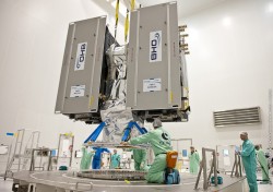
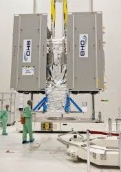
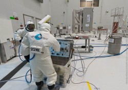
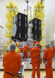
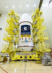
    Europe’s latest Galileo satellites have been sealed within their launch fairing, atop the Fregat upper stage that will carry them into their final orbit on August 21, ushering in the system deployment phase and paving the way for the start of initial services. Galileo SATs 5-6 are scheduled to lift off at 12:31 GMT from Europe’s Spaceport in French Guiana on top of a Soyuz rocket.

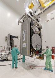
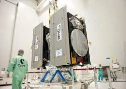
    The two Galileo satellites had been attached together on the dispenser that secures them during flight, and then delivers them into orbit. Then August 14 saw the follow-on installation of the stack — the two satellites plus dispenser — onto the Fregat stage. The following day was the last time the two Galileo satellites were seen by human eyes, as the two halves of the protective launch fairing were sealed around the satellites and their upper stage.

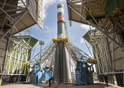
    Meanwhile, on August 18, the satellites’ three-stage Soyuz launcher was moved by rail onto its launch pad then lifted to the vertical position. The launcher’s mobile gantry was then moved into position around the upright launcher. This allows the next step of the launch campaign to take place, the hoisting up and attachment of the entire upper composite — the launch fairing containing the Galileo satellites, their dispenser and the Fregat fourth stage. At three hours, 47 minutes and 57 seconds after liftoff, the satellites will then be deployed from their Fregat by the dispenser’s pyrotechnic separation system, once their final 23,500 km altitude is reached.

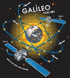
    These new satellites will join four Galileo satellites already in orbit, launched in October 2011 and October 2012 respectively. This first quartet were in-orbit validation satellites, serving to demonstrate the Galileo system would function as planned. Now that work has been done, the Full Operational Capability (FOC) satellites being launched on Thursday are significant as the first of the rest of the Galileo constellation.

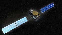
    The payloads generating navigation signals to Earth have been manufactured by Surrey Satellite Technology Ltd in the UK, while the satellites carrying them have been built by OHB in Germany.
    A steady stream of launches is planned for the next few years, with two Galileo satellites flown per Soyuz launch and four Galileo satellites flown per launch of an Ariane 5 variant currently in preparation.
    The definition, development and in-orbit validation phases of the Galileo program were carried out by ESA and co-funded by ESA and the EU. The Full Operational Capability phase is managed and fully funded by the European Commission. The Commission and ESA have signed a delegation agreement by which ESA acts as design and procurement agent on behalf of the Commission.

    The August 21 launch can be watched live here.

  • Galileo Deployment Phase Overview

    Galileo Deployment Phase Overview

    Galileo-Deployment-Video-300

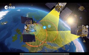
    This video by the European Space Agency recalls the success of Galileo’s in-orbit validation phase and explains what will be the mission of the fifth and sixth Galileo satellites, set to launch August 21.

    Included is an interview with Sylvain Loddo, Galileo ground segment manager. The launch itself can be watched live here.

    View the video below.

  • JAVAD GNSS Introduces TRIUMPH-F1 UAV with Video

    JAVAD GNSS Introduces TRIUMPH-F1 UAV with Video


    JAVAD GNSS is introducing its new unmanned aerial vehicle with the dramatic flourish of a video showing the UAV in flight, accompanied by the “Also Sprach Zarathustra” theme from 2001: A Space Odyssey.

    The TRIUMPH-F1 unmanned aerial vehicle is based on the JAVAD GNSS TRIUMPH-1. TRIUMPH-1 is the company’s field-tested high-precision geodetic GNSS receiver with 864 channels to track all current and future GNSS signals.

    When used on the ground, the TRIUMPH-F1 can function as a TRIUMPH-1 base or rover. The four motor arms (for eight motors) are detachable. There are four screw inserts in the bottom to attach the TRIUMPH-F1 to a pole mount for field use.

    The TRIUMPH-F1 features user-friendly mission programming. The four lithium polymer batteries that power the eight propeller motors, arranged in a stacked quad formation, each have a test button and LEDs to indicate the current charge level, as well as accessible ports for easy charging.

    The TRIUMPH-F1 also has two micro-SD slots for image storage, a SIM card slot, a USB connector for uploading flight plans and downloading collected images, and indicators for satellite tracking and communications. Other indicators are dedicated to flight status and gyro. It comes equipped with four angled documentation cameras and a downward high-precision camera for photogrammetry.

    JAVAD GNSS will exhibit the new device at InterGeo, to be held October 7-9 in Berlin.

    To learn more, watch the video or visit JAVAD GNSS.

    JAVAD-Triumph-F1


  • Motion Tracker for Industrial Applications

    Motion Tracker for Industrial Applications

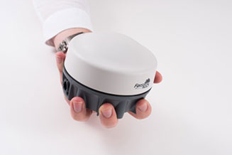
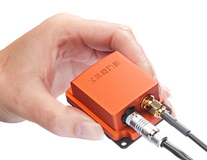
    MTi-G-700_hand-WThe MTi-G-700 by Xsens is a GPS-aided, IMU-enhanced GPS/INS that offers high-quality orientation and position. It makes use of sensory measurements from magnetometer, barometer, and a high-sensitivity GPS-L1 receiver to provide navigation estimates of position, velocity, and orientation at high data rates under high-dynamic conditions.

    The Xsens estimation engine (XEE) sensor-fusion framework enables the motion tracker to take advantage of different aiding sensor measurements and optimally fuse them to get robust tracking estimates. The MTi-G-700 has a u-blox 6 internal 50-channel L1C/A code receiver with 2-meter horizontal accuracy and 5-meter vertical accuracy; SBAS; a 4-Hz update rate; 27-second cold start-up time; and -161 dBM tracking sensitivity.

    The MTi is being used by customers for many maritime and oceanographic applications that require 3D orientation, 3D position, 3D velocity, and 3D dynamic data, such as a monitoring system in a barge master vessel where the MTi monitors the movement of a wave-compensated crane.

  • Esri Story Map Tracks Ebola Outbreaks from 1976 to Today

    Esri is making available an interactive Ebola Outbreaks story map. Users can explore the first known contact with the disease in 1976 in the Democratic Republic of Congo and every outbreak since then, including the ongoing crises in Guinea, Liberia, Sierra Leone, and Nigeria.
    The story map includes basic statistics about each outbreak, and reports from different agencies, all accessed directly from within the map. The map appears below:

  • Transportation Department to Hold GPS Adjacent Band Compatibility Workshop

    The U.S. Department of Transportation is holding a “GPS Adjacent Band Compatibility Assessment Workshop” on September 18, 10 a.m.–5 p.m. Eastern Daylight Time. Registration for the workshop is required, and closes September 4. The general public can either attend in person or via WebEx.

    The workshop is being held to discuss implementation of a GPS Adjacent Band Compatibility Assessment. Discussion will focus on the various implementation steps of the assessment, including development of GPS receiver use cases, identification of representative GPS receivers, and development of a test and analysis program. “In particular, emphasis will be placed on the information needed from GPS receiver and antenna manufacturers, and the logistics of procuring and handling that information to safeguard manufacturer proprietary data,” according to the Federal Register.

    The sponsoring agency is the Office of the Assistant Secretary for Research and Technology, Department of Transportation.

    To register, send the following information to [email protected]:

    • Name
    • Organization
    • Telephone number
    • Mailing and email addresses
    • Attendance method (WebEx or on site)
    • Country of citizenship

    The meeting will be held at the U.S. Department of Transportation, John A. Volpe National Transportation Systems Center, 55 Broadway, Cambridge, MA 02142. ID is required to enter the building.

    For more details, see the Federal Register notice.

  • Galileo Towards the Future

    GalileoVideo-W

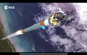
    The special significance of next Thursday’s launch for the Galileo system as a whole is highlighted in a new video by the European Space Agency, with an interview with Didier Faivre, Galileo Program director.

    On August 21, ESA will launch two more Galileo satellites on a Soyuz rocket from Europe’s Spaceport in Kourou, French Guiana. The satellites mark the beginning of a new phase for Galileo, the deployment phase, which will secure the completion of the constellation thanks to accelerated production of satellites and supported by regular launches.

    At the same time, ESA and the European Union also look toward the future and are preparing the evolution of Galileo.

    View the video below.

  • Galileo Open Service ICD Released, Comments Sought

    A new draft version of the Galileo Open Service Signal in Space Interface Control Document (OS SIS ICD), issue 1, revision 2, was published by the European Commission (EC) on June 30, and is available for download.

    The European Commission has launched an open public consultation process in order to improve and consolidate the current draft document and to ensure that any further development of the Galileo OS SIS ICD takes into account the views of key GNSS stakeholders.

    The OS SIS ICD contains the publicly available information on the Galileo Signal In Space. It is intended for use by the Galileo Open Service (OS) user community and specifies the interface between the Galileo Space Segment and the Galileo User Segment.

    The public consultation process provides stakeholders with an opportunity to improve the quality and clarity of the document and to suggest new elements to be included in future versions, for instance, inclusion of multi-GNSS products and services. According to the European Commission, the public consultation process will contribute towards a smooth and rapid rollout of Galileo equipment and applications, and the earliest possible delivery of user benefits.

    Comments are being accepted until September 22, 2014; a form for submitting comments is available via a link on this page.

  • New GNSS Market Outlook Report Forecasts to 2020

    Research and Markets has announced the addition of the “GNSS Market Outlook 2020” report to its offerings.

    Research and Markets explained that GNSS has developed its applications across various industries worldwide. Some applications are simple, such as determining a position, whereas others are complex blends of GNSS with communications and other technologies. Over the past few years, the rapid growth in GNSS commercial applications has been observed by the firms building navigation satellites and equipment. According to the report, the GNSS market is expected to flourish with new technological applications and is anticipated to grow at a CAGR of 9.4 percent during 2014-2020.

    The report “GNSS Market Outlook 2020” is an outcome of the research company’s exhaustive research and comprehensive analysis of the worldwide GNSS market. “Our report provides a complete overview of the GNSS market globally. Over and above, all the current trends and drivers coupled with the potential growth areas of the GNSS industry have been evaluated in the report,” the company said in a statement.

    The report analyzes the GNSS market by its major application areas such as location-based services, transportation, surveying, and agriculture, over a period of eight years (2013-2020). In addition, the transportation section covers the GNSS market by road, rail, air, and marine navigation segments, which are creating a wide opportunity to the overall GNSS market, according to the report.

    The report provides extensive analysis of the GNSS market by each of these segments up to 2020.

    Topics Covered:

    1. Analyst View

    2. Research Methodology

    3. Global Navigation Satellite Systems (GNSS) – Overview

    4. Current Industry Trends

    5. Market Outlook to 2020

    6. Key Country Profile

    7. Potential Growth Areas

    8. Competitive Landscape

    Companies Mentioned:

    • AgJunction
    • CSR
    • Furuno Electric Co Ltd.
    • Garmin Ltd.
    • MiTAC International Corp.
    • Raytheon Company
    • Rockwell Collins
    • TomTom NV
    • Topcon Corporation
    • Trimble Navigation Ltd.
  • CSR, Maestro Offer High-Performance GNSS Module

    CSR, Maestro Offer High-Performance GNSS Module

    maestro-a5100-a-W

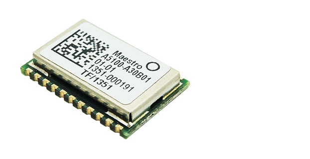
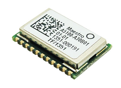
    Hong Kong-based Maestro Wireless Solutions, a manufacturer of location receivers, and CSR plc, a global provider of silicon and software solutions for location-aware applications, announce the immediate availability of the A5100-A, a next-generation SiRFstarV GNSS positioning module that combines high-performance GPS and GLONASS receiver technology in a small 10 x 15 mm package.

    The A5100-A is designed for a wide range of applications including wearable devices, cameras and automotive trackers.

    The A5100-A is the first release within Maestro’s new line of GNSS receivers. It achieves high accuracy with quad-constellation support, up to 30 percent faster time-to-first-fix (TTFF), and up to 20 percent lower power consumption using CSR’s TricklePower and Push-to-Fix (PtF) modes. The module also accelerates customer time to market and reduces development risks by integrating a number of features, including TCXO, SAW filter, RTC, antenna-control mechanism, and flash memory for future-proof upgrades, as well as offering a drop-in replacement capability for Maestro’s previous SiRFstar4 generation modules. The castellated-edge form factor also enables simpler manufacturing and reduces assembly cost, the companies said.

    Supporting all currently deployed GNSS, the A5100-A acquires and tracks all visible GPS, GLONASS, QZSS, and SBAS satellites. Concurrent GNSS performance enables the A5100-A to choose the best satellites from different constellations and deliver optimal location information. Immediate benefits are better coverage, enhanced stability, and accuracy in difficult environments, such as urban canyons, and stronger resilience to multipath and signal jamming. This ensures consumers maintain a position fix whether they’re in the middle of a busy city or in a remote rural location, the companies said.

    The A5100-A offers a range of other features including:

    • Direct to Battery connectivity: Connects directly to a rechargeable 1.8V-3.6V Lithium battery enabling system cost reduction and increased power efficiency.
    • Low Power technology: Optimized for power consumption by incorporating CSR’s PtF technology.  PtF rapidly establishes a valid position fix enabling the module to hibernate for longer periods of time, and adaptively changes power depending on the operating environment and motion conditions. Advanced algorithms and a powerful on-chip DSP processor maintain high accuracy (QoS) while achieving the lowest power level possible for the given environmental and motion conditions.
    • InstantFix Extended Ephemeris (EE): Accelerates TTFF for devices without internet connectivity such as cameras and wearable devices, by autonomously predicting EE for as long as three days and up to 31 days when connected to a network that supports SiRFInstantFix server generated extended ephemeris data (SGEE).

    “Maestro Wireless has worked closely with CSR for many years to design and commercialize highly accurate and reliable location products,” said Anthony Murray, senior vice president, Business Group at CSR. “But to win in today’s highly competitive consumer electronics market performance isn’t enough. That’s why we’ve worked with Maestro Wireless to develop a solution that excels in a range of performance metrics but also offers the small form factor essential for today’s compact devices and is highly integrated to help them get to market fast.”

    “The A5100-A is perfect for customers designing highly integrated products that need uncompromising performance but are pressured by the speed required to go-to market and lack of development resources,” said Olivier Bernard, EVP of Business Development at Maestro. “By combining low power consumption with high sensitivity, high jamming immunity and concurrent GNSS operation, and with its drop in upgrade path to the A2200-A, the A5100-A creates a fast and convenient route to the latest GNSS offering in the marketplace, to meet these needs quickly.”


  • DigitalGlobe Launches WorldView-3 High-Resolution Commercial Satellite

    DigitalGlobe, a  provider of commercial high-resolution Earth observation and advanced geospatial solutions, successfully launched WorldView-3, the company’s sixth and most advanced super-spectral, high-resolution commercial satellite.

    The satellite launched August 13 on a Lockheed Martin Atlas V rocket from Vandenberg Air Force Base in California.

    “The successful launch of WorldView-3 extends DigitalGlobe’s commanding technological lead and will enable us to help our customers see through smoke, peer beneath the ocean’s surface, and determine the mineral and moisture content of the Earth below — all with unprecedented clarity,” said Jeffrey R. Tarr, chief executive officer of DigitalGlobe.

    WorldView-3 will collect super-spectral imagery at 0.31 meter resolution — delivering five times the clarity of the company’s nearest competitor. In addition, WorldView-3 will offer the most spectral diversity available commercially, the company said, and will offer multiple shortwave infrared (SWIR) bands that allow for accurate imaging through haze, fog, dust, smoke and other air-born particulates. The satellite will also offer CAVIS — a cloud, aerosol, water vapor, ice and snow atmospheric correction instrument — which monitors the atmosphere and corrects data for an unprecedented level of consistency.

    “The unmatched abilities that WorldView-3 brings to our constellation will enable us to provide our customers with information and insight never before possible and advance our efforts to create a living digital inventory of the Earth,” Tarr said.

    The satellite and atmospheric monitoring instrument called CAVIS were built by Ball Aerospace. Exelis built the integrated, super-spectral payload consisting of a telescope, sensor and shortwave infrared system, making WorldView-3 the first commercial satellite to carry such capabilities. A United Launch Alliance Atlas V launch vehicle provided by Lockheed Martin Commercial Launch Services (LMCLS) delivered the satellite into orbit.