Arianespace has decided to postpone the launch of Soyuz flight VS09 carrying Europe’s fifth and sixth Galileo satellites, because of unfavorable weather conditions over the Guiana Space Centre.
Another launch date will be decided depending on the evolution of the weather conditions in Kourou.
The next satellites in Europe’s Galileo satellite navigation system will be launched on August 21, ushering in the system deployment phase and paving the way for the start of initial services, according to the European Space Agency (ESA).
Galileo SATs 5-6 are scheduled to lift off at 12:31 GMT (14:31 CEST, 09:31 local time) August 21 from Europe’s Spaceport in French Guiana on top of a Soyuz rocket. They are expected to become operational, after initial in-orbit testing, in autumn.
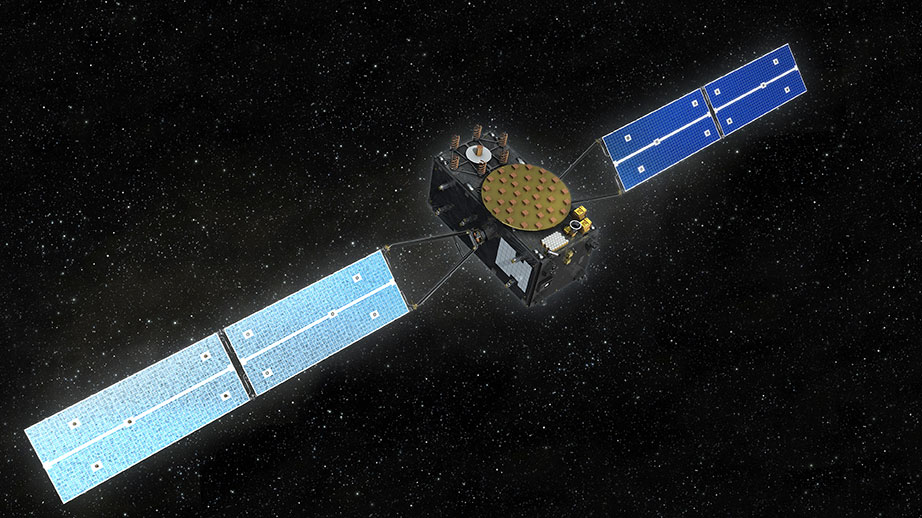
The two satellites will join the four Galileo in-orbit validation satellites already in space. Launched in pairs in October 2011 and October 2012, these four satellites — the minimum required to obtain a position fix — served to demonstrate and validate the space and ground segments of the system.
Galileo SATs 7-8 are scheduled to follow end of year 2014. Then the constellation will be gradually deployed with six to eight satellites launched per year using a series of Soyuz and Ariane launches from Kourou, along with remaining elements of the ground network.
Satellite “Midwives”
Galileo’s post-launch team at ESA has finalized its preparations for taking control of the twin satellites. Following launch, the most crucial point in the flight comes when the two satellites separate from their upper stage — and the Launch and Early Operations, or LEOP, phase begins, run from ESA’s Space Operations Centre, ESOC, in Darmstadt, Germany.
If the moment of separation is the point when satellites are born, then the LEOP team can be thought of as midwives.
Any tumbling from the satellites being pushed away pyrotechnically must be corrected, and their positions stabilized in space. Next, they have to deploy their solar wings, to ensure a steady flow of power.
Flight Operations Director Hervé Côme at ESOC.
Then comes time to switch on and check out all the satellite systems one by one, to ensure everything has endured the launch in working order.
If all goes well, LEOP should take about a week before control of the satellites can be handed over to the Galileo Control Centre in Oberpfaffenhofen, overseeing the satellites, and ESA’s Redu centre in Belgium, for detailed payload testing.
Galileo’s LEOP team has been in training for months, explained Hervé Côme, flight director for Galileo at ESOC, with preparations stretching back two and a half years. “A simulation campaign has been running since March and the system and its operators have performed flawlessly,” Côme said. “To date, 20 simulations, in both nominal and contingency cases, have been conducted.”
Testing Teams and Technology
The satellites themselves participated in multiple end-to-end system compatibility tests to ensure that they are fully compatible with the various elements of the Galileo ground segment, extending to far-flung ground stations variously belonging both to ESA and to France’s CNES space agency, the Agency’s partner for LEOP.
A joint team from ESA and CNES oversaw LEOP for the first four Galileo satellites, similarly launched in pairs in 2011 and 2012. That work was carried out from CNES’s LEOP and Network Operations Control Centre in Toulouse, France.
This time, ESOC is hosting the LEOP team, with mission control and flight dynamics systems inherited from the first four in-orbit validation satellites adapted for these new Full Operational Capability (FOC) Galileo models.
The LEOP procedures and timeline have been fully validated, and system configurations frozen. From here on in, ESOC’s Mission Control Team — following a short summer break — will concentrate on further fine-tuning their organization and procedures in advance of next month’s launch.
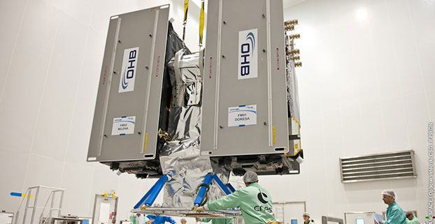
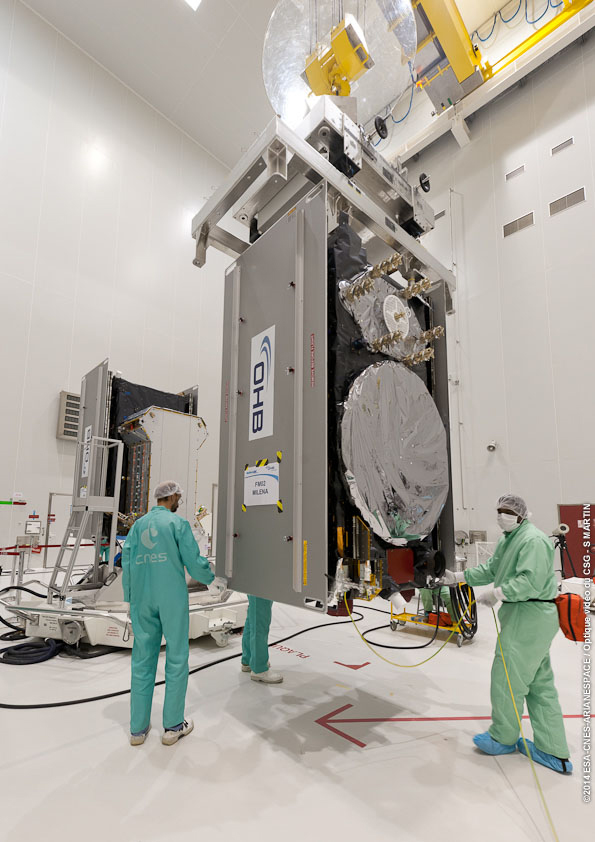
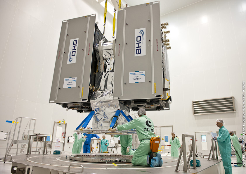
The Galileo FOC satellite named “Milena” is mated on its Soyuz dispenser unit, joining the already-installed “Doresa” satellite.The completed dispenser unit is ready to be transferred from the S5 payload preparation facility at the Spaceport in French Guiana for its integration atop Soyuz’ Fregat upper stage.The local (Kourou) poster of the launch.
What are your challenges this year? How are you driving business in today’s economy? What issues are you concerned about? We want to know, and so does the rest of the industry.
GPS World is conducting its annual State of the Industry Survey asking GNSS professionals about the state of their business, the economic climate for GNSS products and services, driving market factors, the government’s role in funding and regulating, budgets devoted to R&D, the effects of jamming, and the “Issue of the Year.”
This GoPro Hero3 video camera could be yours.
Everyone who takes the survey will be automatically entered in a drawing for these prizes:
A GoPro Hero3 professional-quality video camera
A pair of tickets to GPS World’s 2014 Leadership Dinner (for those not attending ION GNSS+ in Tampa, Florida, we’ll send a voucher for a comparable dinner in your hometown);
$50 Mastercard gift cards
The survey should take about 10 minutes, and your responses are confidential.
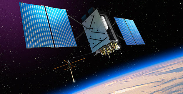
Artist’s rendering of GPS III satellite (courtesy of Lockheed Martin).
So, there I was, sipping a cold green tea in the shade on my back deck in the beautiful foothills of the Rocky Mountains in early June, when the phone began to ring off the hook. Upon answering, I was hit with a barrage of questions. Have you seen the GPS III Sources Sought? What should we do? Do you have any advice? Should we respond? But by far the question I thought expressed most everyone’s initial reaction of incredulity was “Are these guys serious?” For frankly this Sources Sought does contain a bit of a giggle factor.
The questions continued and the phone rang all week. Officially the Sources Sought being referenced is the GPS III Space Vehicles Production Readiness Solicitation Number: FA8807-14-R-0008. Prepared or not prepared by, take your pick, the space acquisition folks at SMC (USAF, Space and Missile Systems Center), and it has caused quite a stir in the PNT (position, navigation and timing) industry.
Before we get ahead of ourselves, I should explain exactly what a Sources Sought means in terms of what the U.S. government is looking for and how to respond — in my humble opinion of course.
First a Sources Sought, as defined by the business folks at Georgia Tech (GTPAC) who have researched the matter thoroughly and who I absolutely agree with, is not an actual bid or proposal solicitation; instead, it’s a solicitation of interest. You should think of a Sources Sought as market research being conducted by a government agency or service to determine the capabilities and interests of the marketplace in a specific area, product or capability. This specific Sources Sought should be of interest to companies having an interest and capability to produce products relating to GPS III specifically.
So, that’s the boring official definition, but what is a Sources Sought really? Certainly, the official definition works, but more often than not in my experience, the Sources Sought has also been used to:
Determine what companies, new and established, are players and who is still in the game.
Determine what partnerships might be formed and how companies might work together to provide a required and often difficult capability. Often government acquisition officials will discover a new capability from a trusted supplier, or discover new teaming arrangements that provide a synergy otherwise unavailable.
Determine who is paying attention.
See which companies answer the announcement. Acquisition officials say it is often just as interesting and enlightening to see which companies do not submit a response as it is reading the proposals of the responders, especially if the Sources Sought is being used as justification for a Sole Source award.
Determine if the project has any hope of succeeding, and if so, how do various companies approach the problems involved?
Provide an official and public catalyst for lethargic or too-comfortable contractors that are not getting the job done on a current contract. Fear can be a great motivator.
Enact the old marketing axiom, “Let’s run it up the flag pole and see who salutes.”
Regardless of what you feel the real reason or reasons for the GPS III Sources Sought might be, or even if you have doubts about the seriousness of the release, the one hard and fast rule among marketers is that if you have any capability that even vaguely matches the Sources Sought announcement, then by all means respond.
The official GTPAC advice — and again, I totally agree — is to always respond to a Sources Sought if it appears to be of any interest to you. Just as I have always said to company marketing reps, when asked about the company’s capabilities, the answer, a la Marketing 101, is always “Yes” until it is emphatically “No.” As in:
“Can you build that MDU?”
“Absolutely!” (Stage whisper) “What’s an MDU?”
“Dude, it’s a Mission Data unit.”
“Oh yeah, that MDU. Of course we can build it!”
It may be hard to believe, in this technological day and age, but contracting officials frequently complain about the limited responses they routinely receive to Sources Sought. Responding is usually quick and painless, and can be the first step to place your company in the running for a lucrative government contract. It distinguishes you from your competitors, who did not take the time or effort to respond. The bottom line is it may very well lead to an inside track on an eventual government contract. Just like poker — you can’t win if you are not in the game.
Of course, the reverse is also true, as almost every Sources Sought states. There are no guarantees, and a Sources Sought announcement may — or may not — be followed up by the agency or service with the issuance of an actual bid or RFP (Request for Proposal). The GPS III Sources Sought legalese reads this way: “This notice does not constitute a Request for Proposal. There has been no decision to develop an RFP for the effort in this sources sought notice.”
You take your chances, but nominally it is time well spent, as most Sources Sought require very little in the way of scripted paperwork and government forms. Sometimes the response may be in the form of a simple response on company letterhead laying out your qualifications and stating clearly that you and your company are interested.
However, the government being the government, more often than not the reverse is true, and there may be very specific instructions in a Sources Sought for responding. GTPAC recommends, as do I, that your company follow these instructions to the letter. Give the government no more or less than requested — in other words, give the federal agency or service which posted the Sources Sought notice exactly what it asks for in exactly the form it asks for it.
Now that we are all on the same sheet of music and fully understand exactly what a Sources Sought announcement means, why did this particular GPS III Sources Sought generate so much interest?
Caught off Guard
First I think, well actually I know, this announcement caught almost everyone off guard. It was a surprise, even to those of us who heard rumors about it for some time, not only because of the timing, but also the scope. It far exceeded what most everyone expected —we will get to that shortly. My sources inform me the exact wording and timing were even a surprise to Lockheed Martin Space Systems Company (LMSSC) and Exelis, who are, of course, as incumbents officially excluded from responding.
In retrospect, however, perhaps it should not have been that big of a surprise. General William (Willie) Shelton (USAF), who when this column is first released will have only 48 hours remaining as the commander of Air Force Space Command, had been telegraphing for some time, in sometimes strident language, that he was not happy and something was in the works. He has been uncharacteristically publicly critical of both LMSSC and Exelis for schedule slips and overruns pertaining to GPS III.
Without a doubt, Lt. General Ellen Pawlikowski (USAF), the most recent former commander at SMC (Space and Missile System Center) where the GPS Directorate is located in Los Angeles, California, at LA AFB, let her misgivings concerning a single provider for the GPS III payload be known for some time. Earlier this year, referring to LMSSC, General Pawlikowski was quoted as saying “They know we are not happy — that we are disappointed at the delays we have seen, the technical issues that their subcontractor [Exelis] has had, and probably they are considering whether an alternative source could provide them a better opportunity…I think that Lockheed is doing the right things to figure out how do they best deliver the GPS III in the timelines that they’re expected to.”
In LMSSC’s defense, it was always aware of a possible schedule slip, as was the USAF — for more than two years a bevy of LMSSC engineers and senior managers have been putting in overtime at the Exelis facility in Clifton, New Jersey, to try and wrestle the wayward Mission Data Unit back on track. Many of them are still there, plugging away, including the indefatigable and always optimistic former LMSSC GPS III Program Manager and VP for Space Keoki Jackson.
The MDU is the beating heart of the payload for the GPS III SVs, and it has been in trouble for some time. So, although LMSSC and Exelis are late to need for the three LMSSC GPS III payloads awaiting a heartbeat in the City of Oz or the new LMSSC manufacturing facility in Deer Creek Canyon in Littleton, Colorado, it is not from want of extraordinary efforts to deliver the payloads on time, and those efforts continue today.
Lockheed Martin spokesman Chip Eschenfelder dropped me an email recently that stated: “All GPS III SV01 (Space or Satellite Vehicle Number One) Navigation payload components — including the Mission Data Unit — have successfully completed unit acceptance testing; these components have been integrated onto the payload panel; and the panel is now undergoing panel-level testing [at Exelis]. The SV01 Navigation Payload forecast delivery to Lockheed Martin is Fall 2014.”
As I write this, I have just received an email from Kristin Jones, the senior communicator for Geospatial Systems at Exelis. She states: “Delivery of the GPS III navigation payload to Lockheed Martin continues to progress following recent Mission Data Unit build and successful test activities. The GPS III navigation payload is an original, highly advanced system that brings new capabilities to the GPS constellation, including improved user accuracy and a more robust signal for contested environments. The new flexible design is also optimized to accommodate additional capabilities in the future. This system has now successfully completed testing and has been added to the payload panel. The integrated payload panel is now going into ambient testing. Also, all six of the navigation payload transmitters have successfully completed their ATP testing. To date, significant testing with flight-like engineering units and the SV01 flight hardware indicates that signal crosstalk variances have been addressed, and GPS III will meet all mission and quality requirements. Exelis is on track for a fall delivery to Lockheed Martin.”
The Farmers Almanac states: “In 2014, the autumnal equinox brings the fall season to the Northern Hemisphere on September 22 at 10:29 P.M. EDT. Let’s see, that is only a biblical 40 days and 40 nights from now, and according to both LMSSC and Exelis the MDU problems have been resolved, to the best of their knowledge to date. The MDU for GPS III SV01 is in the final portion of panel testing, and will undergo more rigorous testing, including thermal vacuum testing at the LMCO (Lockheed Martin Company) facility in Deer Creek this Fall. That is very positive news, and it sounds as though the MDU is back on track.
LMSSC has been involved with GPS for decades, and Exelis, formerly ITT, has been involved in producing all or some portion of almost every GPS payload for four decades, since the GPS program began. So why were there technological problems at this late date? I can only say that providing the Gold Standard for space-based PNT is a complicated business, and as the Europeans are learning the hard way with Galileo, slips are just part of the environment in spaceborne PNT platforms.
How Would It Work?
A subset of the official wording of the GPS III Sources Sought, which you can view in its entirety at Fed Biz Ops.gov goes like this:
SMC/GP is conducting market research to review the industrial base and determine whether viable alternate sources exist to the continued GPS III SV production on the current baseline by LMSSC. For every block of GPS satellites over the past 40 years, the primary risk has been the navigation payload. This market research seeks to determine if alternate sources can attain a production-ready configuration for a GPS III SV with an alternate navigation payload in time to allow the Production Ready Alternate Source to compete with LMSSC for up to 22 satellites.
For many, the key phrases are “product ready” and “compete.” This is not only, as many first thought, a Sources Sought searching for an alternate source for a GPS III MDU. It is that and much more. It is a Sources Sought for new competition. SMC is also looking for a full up GPS III production capability that is able to compete with LMSSC for up to 22 more GPS III SVs, and they want it at a FFP (firm fixed price). At this stage, some pundits might say it is a solution looking for a problem.
The bottom line is SMC is asking for companies to step up and produce a full-blown and fully compliant GPS III space vehicle, with NDS and all the associated payloads. This includes a validated, certified and integrated launch capability to compete with LMSSC for the next 22 GPS III SVs, and even though it is not specifically mentioned, competitors could find themselves competing against the United Launch Alliance with launch services from SpaceX, who bill themselves as the world’s fastest-growing launch provider. Who are the competitors? Can you say Boeing, Northrop Grumman, Raytheon and General Dynamics? Because these are the usual suspects, and all conspiracy theories aside, it appears the government does not want LMSSC to have a monopoly on GPS, and the Exelis MDU worries have given them…well, let’s just say, have justifiably fed that fear. The GPS III Sources Sought is just one result.
Results
So, just what were the results of the GPS III Sources Sought? I could easily say your guess is as good as mine, but I do have my sources, and they tell me on the one hand SMC heard from the usual suspects, and now you know who they are, about what they expected to hear, but then again they also heard from a couple of surprise (only to SMC) companies. Both have significant space capabilities, but have in one case not played in the GPS arena in some time (several decades), and in another case, a well known company may be looking for a way to increase their GPS role.
I also heard that few of the submittals were compliant or met all of the required criteria, and that should definitely not have come as a surprise to SMC. Consider they are asking companies with space capabilities to commit to designing an MDU from scratch — and indeed it may need to be an advanced MDU for new capabilities that will work with the current GPS III LMSSC interface. Those specifications are not exactly common knowledge, certainly not for a Sources Sought. SMC is asking for a full-up compliant system, and only gave companies two weeks to think about it.
Going back to my original premise: How should these companies have responded? Again, Marketing 101 — hopefully they said, “Sure, we can do that,” submitted the required paperwork, and then started scrambling to put a team together and figure out how they can produce and compete. And competing against the incumbents, especially when they are LMSSC and Exelis, is no easy task. Hopefully past performance still matters.
The 2014 Lamborghini Gallardo (Wikimedia Commons).
Still the disconcerting, curious and, according to some space companies, the giggle factor, concerns the scope of this would-be proposal. LMSSC has three almost-complete (missing only one crucial part) GPS III space vehicles waiting for a fully tested and certified MDU. Every other aspect of the GPS III program is on track and has been tested.
This is analagous to Sant’Agata Bolognese, a small comune in the province of Bologna, which just happens to be the home of Lamborghini, complaining that it has three brand-new Lamborghinis waiting to be delivered, if only Audi would ship the engines. One of the reasons I like this analogy is that it happened, it works, and I love exotic sports cars. The other reason is that it is easy to see the problem is the engine, not the Lamborghini, which remains as exotic and flamboyant as it has always been. Lamborghini is only going to fix the actual problem, a tardy engine delivery. They are certainly not going to scrap everything and fund competitors to build a new Lamborghini from the ground up.
Or closer to home, consider the F-35 engine issue. The USAF did not ask for companies to design a new F-35 just because it needed an alternate engine. It just contracted for another engine supplier — a simple solution to a complex problem. Viola! Bob’s you uncle!
The F-35C Lightning II test aircraft CF-1 performs a flight test (photo by Andy Wolfe, courtesy of the U.S. Navy).
The U.S. government, DoD, USAF, Air Force Space Command, and SMC is putting forward the proposition that it will pay for another company or companies to compete with a proven system that works, and works well. LMSSC GPS IIRs and IIRMs are on orbit today and preforming well past their programmed life. LMSSC knows how to build the best GPS satellites in the world today. Like Lamborghini and the USAF, LMSSC is just waiting on a subcontractor to supply the GPS III engine or MDU.
So regardless of the purpose or multiple purposes of the GPS III Sources Sought, and whether you think it is an overreaction or not, in the end it opens the door to numerous potential players in the GPS space arena. To paraphrase that paragon of wisdom, Martha Stewart, “Competition is a good thing,” even if you have to pay for it.
Until next time, happy navigating, and remember GPS is brought to you free of charge by the United States Air Force.
MicroSurvey Software released STAR*NET 8.1, a new version of the least squares network adjustment suite. With a multitude of new and improved tools, the software makes least squares adjustment even faster and easier, MicroSurvey Software said.
Several highly requested features have been added based on feedback received directly from STAR*NET users. All network plot display options are now customizable in an intuitive grid view that allows users to control the visibility, color, linetype and size of each network element to graphically differentiate conventional, GPS, and leveling observations. Directional linetypes indicate the direction and number of observations between each network station, and intuitive mouse controls allow for smooth zooming and panning in the network plot.
Additionally, a new .PRISM inline command lets users apply a correction for measurements that were collected with an incorrect prism offset setting. Support for Google Maps and Google Earth allows users to view and export network stations and connections in popular mapping formats, and a new Level Loop Tolerance Check allows users to instantly verify the vertical closure of level loops or traverses.
Other changes include:
A new Online Updater that makes it easier for users to stay current with the latest STAR*NET updates.
A new Data File Monitor that checks for any changes made by an external program to a loaded data file and prompts users to reload files from disk if needed.
Improved file references for easy access to corresponding data files directly from the listing.
Direct access to all conversion utilities through the Import menu, with help buttons for guidance.
Improved MicroSurvey FieldGenius Support, including the ability to convert COGO measurements from raw files as bearing measurement records and to read GPS offset measurements from raw files.
Improved Carlson SurvCE Support, including the ability to average shots in multiple sets, convert resection observations as direction sets, and import point descriptions with each vector.
Improved Leica DBX Support, including the ability to export all set observations or average set observations for any sets collected with either the Sets of Angles or Traverse applications, export stakeout observations as measurement records, and export check shot deltas as comment records.
“We’ve created several powerful new productivity tools and wanted to make these immediately available to STAR*NET users,” said Brian Sloman, desktop products manager at MicroSurvey. “The flexible and independent control of conventional, GPS, and leveling data in the network plot, including the new directional arrows which indicate both the direction and number of observations for each network connection, can help you visually identify regions with lower redundancy without having to analyze the listing file. The new .PRISM inline command lets you correct distances without having to make potentially thousands of tedious calculations and manual edits, and the level loop tolerance check lets you immediately confirm whether or not your level loops or traverses fall within the maximum allowable tolerances for a desired standard of accuracy. Toss in the ability to view your data in Google Earth and Google Maps, and it al all adds up to a faster and easier least squares analysis.”
STAR*NET 8.1 is a free upgrade for any STAR*NET users who have a valid Maintenance Subscription and Support Plan. A STAR*NET upgrade tour is available at https://www.youtube.com/microsurvey. To learn more or download a free demo, visit www.microsurvey.com.
Juniper Systems is launching Cedar Tree Technologies, a rugged handheld company. Cedar Tree, based in Corvallis, Oregon, brings ruggedness, affordability, and intuitive software to its customers — mainly consisting of mapping and field service professionals, according to Juniper Systems.
Cedar Tree Technologies, which exhibited at the Esri User Conference in July, is a recently launched rugged handheld company founded by Juniper Systems.
Cedar Tree’s new products — the CT7 tablet and CT4 handheld — run on the Google Android operating system, providing access to thousands of business and field-ready apps on the Google Play Store. Both devices can easily be customized by users via software.
The CT7 tablet features a 7-inch display, while the CT4 handheld has a more compact design, with a smaller 4.3-inch display. Both devices provide useful features such as GPS and camera, as well as excellent durability and functionality — all for the price of a smartphone. The CT7 and CT4 will be shipping within the next 30 days.
“By leveraging the wide array of apps and services available through the Android operating system, Cedar Tree Technologies offers users a complete rugged data collection solution out of the box,” said Rob Davis, Cedar Tree Technologies’ General Manager. “Add to that the fact that you can purchase one of these durable devices for about the same price as your smartphone, and it really makes it an easy decision.”
“Cedar Tree Technologies builds upon Juniper’s product offering, providing customers with a broader range of choices,” said Juniper Systems’ CEO, Rob Campbell. “This additional product variety allows customers to find the best fit for their needs, whether they need maximum ruggedness from a Juniper Systems product, or whether they need a very durable product that runs on more consumer-like platforms, like Cedar Tree’s products.”
UPDATE: According to ION, Thomas Reuters is starting the indexing process, which is expected to take several more weeks.
NAVIGATION, the Journal of The Institute of Navigation, has been accepted for indexing in several Thomson Reuters databases. “This indexing is an exciting step in the fundamental growth of the journal and will increase the visibility and discoverability of all the articles published since 2012,” said Boris Pervan, NAVIGATION editor.
Beginning with V. 59 (1) 2012, NAVIGATION will be indexed and abstracted in:
Science Citation Index Expanded (also known as SciSearch)
Journal Citation Reports/Science Edition
Current Contents / Engineering Computing and Technology
The Science Citation Index Expanded covers more than 6,500 notable and significant journals, across 150 disciplines, from 1900 to the present. These journals, alternately described as the world’s leading journals of science and technology, because of a rigorous selection process, provides researchers, administrators, faculty, and students with quick, powerful access to the bibliographic and citation information they need to find research data, analyze trends, journals and researchers, and share their findings.
The Journal Citation Reports (JCR), an annual publication by the Science and Scholarly Research division of Thomson Reuters, has been integrated with the Web of Science and is accessed from the Web of Science-Core Collections. It provides information about academic journals in the sciences and social sciences, including impact factors.
The Current Contents Connect is a current awareness database that provides easy Web access to complete tables of contents, abstracts, bibliographic information, and abstracts from the most recently published issues of leading scholarly journals, as well as from more than 7,000 relevant, evaluated websites.
NAVIGATION, the quarterly Journal of The Institute of Navigation is published in partnership with John Wiley & Sons, Inc., and publishes peer-reviewed articles on all areas related to the science and technology of air, sea, land and space navigation, including estimation of position, velocity, attitude, and time.
The Carlson BRx5 GNSS receiver, an integrated all-in-one pole-top GNSS receiver, has just been released by Carlson Software, Inc. Each BRx5 contains a multi-constellation, multi-band 270-channel GNSS receiver, internal GSM cell modem, UHF radio, dual hot-swappable batteries and internal level sensors. Designed for survey and GIS professionals, the Carlson BRx5 delivers both affordability and the highest positional accuracy, the company said.
“Carlson’s exclusive LDL (live digital level) feature in SurvCE 4.0 uses the BRx5’s internal level sensors to provide electronic leveling for better x,y accuracy as you work,” said Bruce Carlson, president of Carlson Software. “In addition, it holds fix under canopy better than most GPS systems currently on the market.”
Manufactured to Carlson’s exacting specifications by Hemisphere GNSS, the BRx5 receivers can each be configured as base, rover, or network rover. They come with dual Bluetooth ports, allowing users to connect both data collector and a cell phone, and they each come with a fully integrated multi-constellation dual frequency GNSS receiver with UHF radio and GSM cell modem.
SurvCE 4.0 allows high positional accuracy with the BRx5′s integrated level sensors.
Designed for use by surveyors, contractors, builders, engineers and many others, the BRx5 can be purchased as either a Rover or as a Base/Rover package. The Base/Rover package includes two BRx5 GNSS receivers, one hard-sided carrying case, four BRx5 batteries with two chargers, one GPS tribach and one tribach adapter, and two Carlson GPS receiver poles.
With its dual hot-swap batteries, there’s no need to stop work to recharge or replace battery packs. In addition, the BRx5 is OmniSTAR-capable with submeter differential correction available worldwide.
The Carlson BRx5 GNSS receiver is designed to work seamlessly with most data collectors including Carlson’s rugged and popular data collectors: the Carlson Surveyor+, the Carlson MINI2, and the Carlson Supervisor.
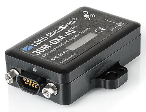
The 3DM-GX4-45 by LORD MicroStrain is a miniature, industrial-grade GPS-aided inertial navigation system that uses high-performance MEMS sensor technology. It combines a triaxial accelerometer, triaxial gyro, triaxial magnetometer, temperature sensors, pressure altimeter, and dual on-board processors running a sophisticated Extended Kalman Filter (EKF) to provide excellent position, velocity, and attitude estimates.
It offers a range of fully calibrated AHRS measurements, including acceleration, angular rate, magnetic field, deltaTheta and deltaVelocity vectors. GPS measurements include LLH position, ECEF position and velocity, NED velocity, UTC time, GPS time, and SVI. The receiver is a 50-channel u-blox 6, which receives GPS L1 C/A code, and the SBAS signals WAAS, EGNOS, and MSAS.
The 3DM-GX4-45 provides accurate navigation and orientation under dynamic conditions for applications such as GPS-aided navigation; unmanned vehicle navigation; camera stabilization; robotic control; and reconnaissance, surveillance, and target acquisition.
The European-focused imaGIne conference will provide attendees with an opportunity learn what is going on in the geospatial sector and to network with important decision-makers. EUROGI’s “imaGIne: Opportunities Everywhere” Conference will be held October 8-9 in Berlin, Germany.
The imaGIneconference will take place at the same venue and at the same time as the InterGeo trade fair.
A key aim of the conference is to showcase the best that Europe has to offer in the geospatial field, thus the conference subtitle “Geographic Information Expertise: Made in Europe.” The aim has guided EUROGI and its member associations in the selection of themes and speakers, organizers said.
Plenary Sessions and Keynotes
During the plenary sessions, presentations will be given by top European and global experts.
Roberto Viola, deputy director, Directorate General CONNECT, European Commission, will provide an outline of the European Union’s Digital Agenda Europe, with particular emphasis on geospatial aspects.
Detlef Dauke, director general, German Federal Ministry for Economic Affairs and Energy will speak on behalf of the German vice-chancellor, who is the patron for the conference.
Two speakers will provide a view of the state of the European geospatial industry from a global perspective, highlighting its strengths, weaknesses, opportunities and threats. Other issues which will be covered in the plenaries include the Internet of Things (billions of interlinked sensors across Europe), Linked Data (joining up data which was otherwise unconnected) and Big Data (massive amounts of data from diverse sources and across many fields).
In addition to the plenary sessions, there will be 15 parallel sessions of 90 minutes each, each of which has a specific thematic focus. The themes include Job Creation and Economic Growth, Energy, Environment, Demography, Smart Cities, Copernicus (Europe’s Earth Observation initiative), Open Data, Big Data, and Insurance. The sessions will not only provide interesting insights, but will also feature panel sessions with discussions of pertinent issues, as well as opportunities for audience engagement.
The European Commission’s Joint Research Centre will provide an opportunity to discuss the European Union Location Framework, a set of policies and measures which aim to facilitate the integration of geospatial information into e-government services and to increase alignment in and between existing and future EU policies.
InterGeo Fair. InterGeo is the world’s leading trade fair for geodesy, geoinformation and land management. With over half a million event website users, over 16 000 direct visitors each year from 92 countries and more than 500 exhibitors, it is one of the key platforms for business dialogue in the geospatial information sphere.
Registration for EUROGI’s imaGIneconference will automatically entitle delegates to visit the fair.
More information about the conference can be found at www.imagine2014.eu. The website also provides the opportunity to register. An early-bird discount rate will be available until August 31.
The Geospatial Sector — Huge and Growing Fast
Geospatial information, also often referred to as geographic information, is any information that has a location/position “tag.” The tags can take many forms, including for example, postal codes, street addresses, words that have a location/place reference (such as Barcelona, the Rhine, Slovenia, etc.), north/south coordinates, and more. Organizing and managing tags enables vast amounts of otherwise disparate information to be integrated and new and innovative insights and services to be provided.
According to a report published last year by Oxera, a leading UK economic research firm that was commissioned by Google, at $150-270 billion annually the geospatial sector globally was one third the size of the global airline industry. (See “What is the Impact of Geospatial Services?”)
The report states, “Geo services are making an important contribution to the global economy and to future productivity. The efficiency gains they create are helping to facilitate future economic activity and generate additional consumer welfare.”
Everyone is aware of the airline industry, but very few are aware of the geospatial industry, an industry that to a very large extent operates out of direct public view, but that produces products and services that impact on billions of people worldwide on a daily basis. The insurance, automotive, telecommunications, navigation, marine, agriculture, energy, utilities, tourism, and recreation and media industries are just some of sectors that rely heavily on geospatial products and services.
Apart from the enormous size of the sector, another key point highlighted in the Google-sponsored research report is that the sector is growing globally at about 30 percent annually. With overall global economic growth taking place in the lower single-digit range, growth of this nature can truly be described as explosive, conference organizers said.
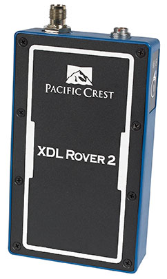
Trimble has introduced the Pacific Crest XDL Rover 2, an advanced, high-speed, wireless data link built to withstand the rigors of GNSS/RTK surveying and precise positioning.
The XDL Rover 2 is equipped with Bluetooth wireless communication for ease in configuration and operation. It can be quickly configured with an Android device in the field and UHF data can be transmitted via Bluetooth to a paired host device for operational efficiency.
The XDL Rover 2 is a lightweight, ruggedized UHF receiver designed for digital radio communications between 403 and 473 MHz in either 12.5 or 25 kHz channels. It is designed for high performance over the entire band. The XDL Rover 2 is pocket sized and provides for cableless operations. It features an internal, rechargeable battery for ease of use and portability that allows long operational hours.
“The XDL Rover 2 is an ideal, high-speed radio receiver for field operations that require a one-way communications link,” said Jess Cobb, business area director for Trimble’s Radio Communications Group. “Its interoperability with existing equipment and greater functionality allow customers to rapidly deploy the XDL Rover 2 for maximum productivity.”
This sophisticated radio leverages the latest generation XDL modem technology while remaining backward compatible with existing Pacific Crest and other products. By deploying the technology, users can instantly communicate with GNSS precise positioning receivers that share the same protocols throughout the world.
The XDL Rover 2 joins the line of XDL products that includes the XDL Micro, a transceiver OEM module. The XDL Micro is a 0.5-2.0 Watt UHF transceiver designed for integration into products that require either a one- or two-way radio communication link. The XDL radio line is based on the successful Pacific Crest ADL products.
Trimble has added advanced line acquisition technology to its Autopilot automated steering system Trimble OnSwath technology. The acquisition technology reduces the time lost turning at the end of a row by enabling the vehicle to make a tighter turn and approach the next line, or crop row, 50 percent faster.
Using OnSwath, the farmer can decrease idle driving time, fuel consumption, soil compaction, crop damage, and working time in the field — which can lead to cost savings. OnSwath is a free upgrade to customers using the Trimble Autopilot automated steering system.
The new OnSwath technology allows the user to customize their line acquisition to the vehicle, operation, and operator preference including adjusting turn angle, approach angle, and speed. Using OnSwath, the vehicle projects its path to the line, which allows it to get online faster. As a result of these improvements, vehicle performance is more controlled, predictable, and repeatable.
“By adding OnSwath to Trimble’s Autopilot steering system, we’ve enabled farmers to be more efficient with their field operations,” said Erik Ehn, Smart Machines business area director of Trimble’s Agriculture Division. “OnSwath saves time, money and fuel, while also decreasing soil compaction and crop damage. Since we’re providing the technology at no additional cost, farmers who use Trimble’s automated guidance can leverage OnSwath and measure how much it can save their farm.”
“With Trimble’s OnSwath, I’m able to get online much faster and more accurately,” said Joe Brightly, who began using the OnSwath technology this spring for planting and strip tilling operations. “After an end of row turn, I can get online in a matter of only a few feet, which has saved me a lot of time.”
OnSwath is available with a software update to the Trimble Autopilot system.
RT Logic has been awarded a $1 million follow-on contract to provide ground system components for the USAF GPS OCX program, bringing RT Logic’s total OCX contract awards to over $4 million. RT Logic is a subsidiary of Kratos Defense & Security Solutions, Inc.
OCX is the next generation GPS ground system designed to bring flexibility, adaptability, and modularity to the position, navigation, and timing (PNT) mission. RT Logic is the primary equipment supplier for the Command and Control (C2) portion of OCX, providing software front-end processor units and Air Force Satellite Control Network (AFSCN) gateways.
RT Logic supports Raytheon, the prime contractor for GPS OCX, with RT Logic’s net-centric software products for C2 of the GPS III satellites using next generation IP cryptosystems. The IP cryptosystems use industry-standard IP interfaces, eliminating the need for custom serial interfaces, which is intended to ease integration challenges, improve reliability, lower transition risk, and reduce cost.
RT Logic’s software-based products will enable Raytheon to add new features to meet evolving requirements as needed, the company said. In addition, RT Logic will build a high-fidelity lab environment that simulates the GPS mission string. This lab system will allow Raytheon to cost-effectively resolve issues, integrate and simulate new functionality, and maintain the system without impacting the operational mission or Raytheon’s regression testing schedules, the company said.