Includes: Tests Show Tech Can Meet FCC Indoor 911 Accuracy; InvenSense to Acquire Sensor Nav Companies Trusted Positioning, Movea; Business Aviation Agrees to Promote EGNOS Use at European Airports; Patent Issued for Dynamic Location Reporting; Remote Patient Monitoring to Reach €19.4B in 2018; News from the Esri User Conference; Google Acquires Satellite-Imaging Startup for $500M; EuroGeographics to Create Expert Group in GNSS Positioning; Geospatial Computing Book Published; USGS Releases Earthquake Hazard Map; Events
Scott McCormick, president of the Connected Vehicle Trade Association (CVTA) discusses Super Mobility Week, the Intelligent Transportation Systems’ World Congress, and what to expect in the connected vehicle market.
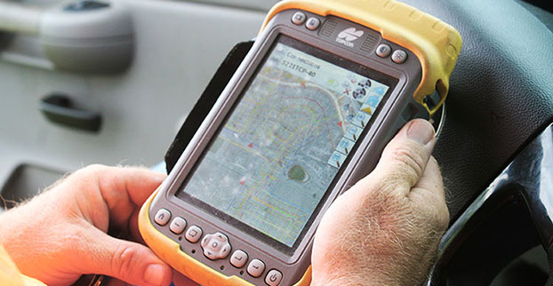
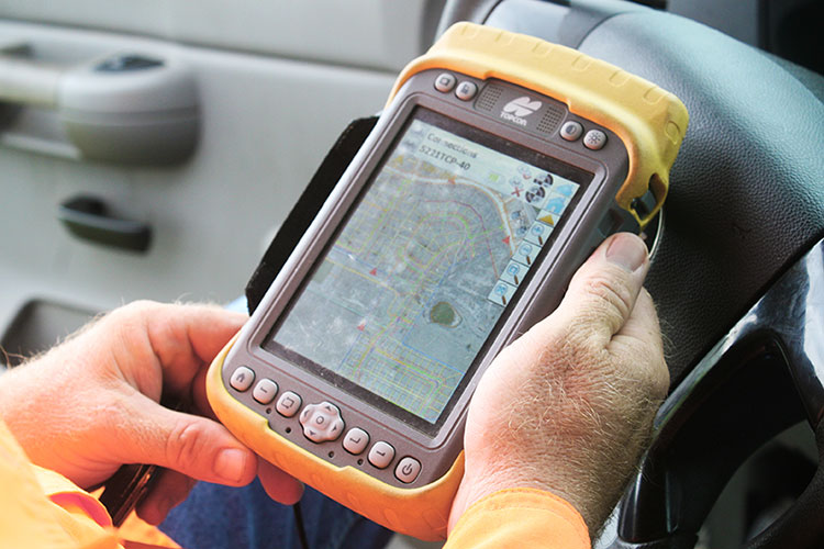
Topcon Tesla handheld controller combines the advantages of a PC tablet with the ruggedness of a fully equipped survey device.
An Oklahoma Survey Firm Is Increasing Productivity with Cloud-Based Solutions
By Larry Trojak
Until recently, the flow of real-time information and job-critical data between the office and personnel in the field for survey and construction has not kept pace with advances in onsite GNSS equipment. But enterprise software suites are closing the gap, producing across-the-board efficiencies, cost reductions, and an ability to bid more competitively.
Sisemore Weisz & Associates (SW&A) of Tulsa, Oklahoma, is an engineering specialist in site design and land planning, and has survey experience with ALTA/ACSM work, high-end civil construction, structural layout, and large survey control networks. Topcon’s cloud-based software suite Magnet gives SW&A the ability to have immediate access to the plans, data, and site information needed to respond to and complete the job.
“Providing the ability for any crew to immediately access their data from anywhere via a Tesla field tablet is invaluable. It’s literally changed the way we do business,” said SW&A chief of parties Shawn Collins.
Collins’ ultimate goal was to establish a platform for data collection, sharing, and transfer that best utilized today’s technology, including Internet access and the ability to email and text message crews in real-time.
His first instinct was that a tablet such as an iPad might be the answer, but iPads weren’t suitable for surveying Instead, they chose Topcon’s newly introduced Magnet Enterprise package along with a pair of Tesla controllers. Finding it the right solution, after a few weeks they bought more Teslas. “It was just the solution we needed,” Collins said.
Magnet Suite
Comprised of three individual software components — Field, Tools, and Office — as well as the Enterprise cloud environment itself, the Magnet suite of products is designed to bring real-time, cloud-based efficiency to any survey or construction operation, according to Jason Hallett, Topcon’s senior product manager for software applications.
“Magnet considers everything from data collection, to CAD, to data manipulation and reporting, to data exchange, to cloud-based project management in an enterprise environment,” Hallett said.
Components of Magnet:
Field. Connects field users to the cloud, and enables real-time communication, as well as cloud storage and data exchange. A powerful field software for topo, staking, roads, and calculations is included.
Tools. Allows the processing and exchange of data between the enterprise cloud and popular desktop applications, such as Autodesk Civil 3D.
Office. Exchanges design files, survey jobs, and surfaces through the enterprise cloud for simple project revisions and real-time survey data from the field.
Dillon Dossey is a one-man crew with Magnet and the cloud.
In the year since they began using Magnet, Collins said that the system has become an integral part of the way SW&A does business. “It can be something as simple as getting a crew working faster than we ever could in the past,” Collins said. “For example, say we are set to begin a large highway project several hours from the office, but we are wrestling with plans or have calculations that still need fine-tuning on one part of the job. In the past, the whole project would have been held up until those issues were resolved. Now, we can send a crew out with what we already have and, when that missing data is completed, upload it to the cloud for them to access when they need it. As a result, production is on track, deadlines are met, and the customer is pleased.”
Re-routing crews — a time-consuming effort in the past —is now a simple process. “If a crew wraps up a project and needs to be re-routed from their original follow-up job, they now can simply check email or chats on their Tesla and see what’s changed. All of their pertinent information is going to be in the chat and in the cloud — all the directives are there, all the paperwork, everything they need to make a fast, seamless transition to the next job without having to come back to the office. Just minimizing those trips back here has shown us a nice 14 percent reduction in fuel costs since going forward with Magnet. And taking that 14 percent off of a bid allows us to be that much more competitive.”
As chief of parties, one of Collins’ primary roles is quality control on projects, and Magnet has helped. “I can show up to a site to see how a crew is doing, have them upload data to the cloud, and confirm their progress. As a result, managing the parties, managing the control, managing the job flow is so much better. And, contrary to what one might think, the fact that the crews know they are being checked has not had any downside at all. They know we are all on the same team and appreciate that this technology is helping make us more competitive — which ultimately benefits everyone.”
Collins has witnessed dramatic changes in his 30 years of surveying, but sees Magnet as a game-changer for data management and flow, the exchange of information, and bidding on jobs which, thanks to Magnet Enterprise’s cloud-based environment, has become a streamlined, efficient process.
“It is now possible to easily cross-reference jobs to help in the bidding process,” he said. “We can go into our cloud and see if we did a similar job before, and, if so, view the work order, view the billing files, see how much that job actually cost, see what we bid on it, see if we were profitable, see how we did for time management, and so on. In the past that would have been a painstaking, time-consuming process. But with that all data readily at hand, it is easy to put together an informed, competitive bid and get it out to the client in no time.”
One area that Collins hopes to pursue further is deeper client involvement. “We recently added 5 GB of capacity to our cloud storage, and that should help us move forward with that push. Making it possible for the client to look at the project as it exists in real-time, to be able to review and red-line items or discuss issues, and do so without a trip to our office will be a real plus.”
One-Man Crew
A visit to a local development called Yorktown finds a single rod man, Dillon Dossey, at work, a typical scenario for SW&A. “This is a 120-lot development, and Dillon has been the sole SW&A person on this job since the outset, surveying and staking to rough in roads for the developer, and he will be here until our portion wraps up,” Collins said.
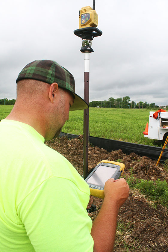
With Topcon’s PS-103 robotic total station (SW&A’s latest purchase), his Tesla, and Magnet — which is also built into the total station — Dossey can operate as a one-man crew with confidence, Collins said. “If Dillon gets into a situation where he suspects something is wrong or he needs help deciding something, he doesn’t have to break down his equipment and drive all the way back to town; he has everything he needs right there with him. He has the data, he can chat with me, with the office, and we can send data right back to him.”
Dossey offered his take on Magnet’s impact on his role at SW&A. “We are working toward eventually eliminating the need for us to go back to the office at all,” he said. “If we have to, we can come in to get gear in the morning, but that’s about it. However, right now, if I am halfway through a job and Shawn contacts me to head to another one, he just sends me all the info I need and I’m on my way. It is very cool. The amount of data that we can exchange back and forth through the cloud is just startling.”
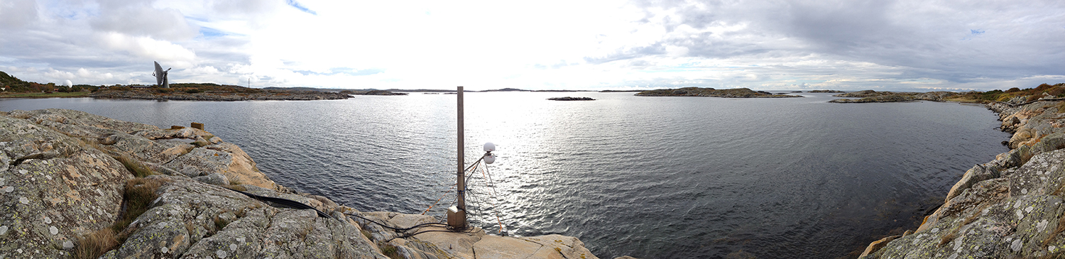
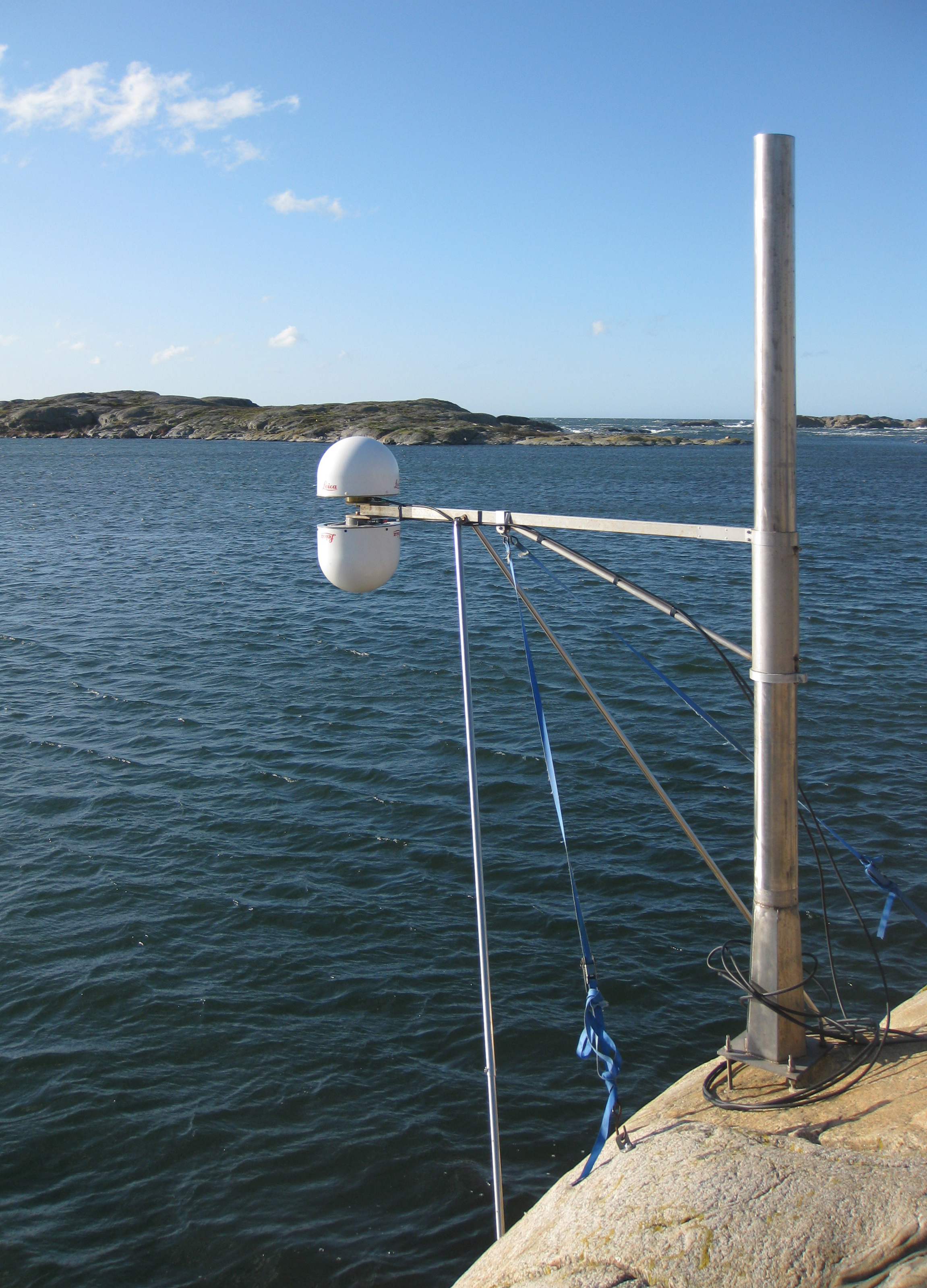
A panorama from the GNSS tide gauge at Onsala Space Observatory. When satellites pass over the sky, the GNSS tide gauge uses signals direct from the satellite and signals reflected off the sea surface to measure the sea level. Photo: Johan Löfgren
New Tide Gauge Uses GNSS to Measure Sea-Level Change
A new way of measuring and monitoring sea level — an important facet of researching climate change — has been implemented by scientists at Chalmers University of Technology in Sweden using existing coastal GPS stations.
When satellites pass over the sky, the GNSS tide gauge uses signals direct from the satellite and signals reflected off the sea surface to measure the sea level. Photo: Johan Löfgren
Measuring sea level is an increasingly important part of climate research, and a rising mean sea level is one of the most tangible consequences of climate change. Researchers at Chalmers University of Technology have studied new ways of measuring sea level that could become important tools for testing climate models and for investigating how the sea level along the world’s coasts is affected by climate change.
Johan Löfgren and Rüdiger Haas, scientists at Chalmers Department of Earth and Space Sciences, have developed and tested an instrument that measures the sea level using a GNSS tide gauge.
“The global mean sea level is rising because of climate change, but the change depends on where you are in the world,” said Rüdiger Haas. “We want to be able to make detailed measurements of sea level so that we can understand how coastal societies will be affected in the future.”
The GNSS tide gauge uses GPS and GLONASS signals. BeiDou and Galileo will be added in the future.
“We measure the sea level using the same radio signals that mobile phones and cars use in their satellite navigation systems,” said Johan Löfgren. “As the satellites pass over the sky, the instrument ‘sees’ their signals — both those that come direct and those that are reflected off the sea surface.”
Antenna Setup. Two antennas, covered by small white radomes, measure signals both directly from the satellites and signals reflected off the sea surface. By analyzing these signals together, the sea level and its variation can be measured up to 20 times per second. The sea-level time series is rich in physical phenomena such as tides (caused mostly by the gravitational pull of the Moon and the Sun), meteorological signals (high and low pressure), and signals from climate change. Through advanced signal processing, these signals can be studied further.
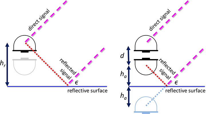
Schematic drawing of the GNSS tide gauge for SNR analysis (left) and phase-delay analysis (right). For the SNR analysis, the satellite signal with elevation ε reflects off the sea surface and interferes with the direct satellite signal at the antenna, creating an interference pattern in the recorded SNR observable that can be related to the reflector height, hr. For the phase delay analysis, the phase delays of the direct and the reflected signals are recorded separately, and through geodetic analysis of the phase delay, the baseline between the antennas can be determined and related to the height of the nadir-looking antenna over the sea surface, ha, and the vertical distance between the antenna phase centers, d.
The scientists’ initial study compared sea-level solutions from two analysis methods: signal-to-noise ratio (SNR) analysis and phase-delay analysis. The SNR analysis uses multipath signals observed with an upward-looking antenna, and the phase delay analysis uses the phase delay for both an upward- and a downward-looking antenna (see diagram).
Both GPS and GLONASS L1 and L2 signals were recorded, and the results were compared to independent measurements of sea level from a co-located pressure tide gauge. The GNSS-derived sea level showed a high correlation with the tide-gauge sea level for both analysis methods. Correlation coefficients for the phase-delay analysis and for the SNR analysis using frequency L1 were 0.95 to 0.97, whereas the correlation coefficients for the SNR analysis using frequency L2 were 0.86 to 0.87.
The phase-delay analysis shows a better agreement with the independent tide gauge sea level than the sea level from SNR analysis. Expressed as RMS differences, the phase-delay analysis achieves values of 3.5 cm (GPS) and 3.3 cm (GLONASS), whereas the SNR analysis achieves 4.0 cm (GPS) and 4.7 cm (GLONASS). The scientists concluded that, for the phase-delay analysis, it is possible to use both frequency bands, and for the SNR analysis, frequency band L2 should be avoided if other signals are available.
The GNSS tide gauge at Onsala Space Observatory uses signals from satellite navigation systems like GPS to measure the sea level. Photo: Johan Löfgren
Land and Sea. Unlike traditional tide gauges, the new GNSS tide gauge can measure changes in both land and sea at the same time, in the same location. That means both long-term and short-term land movements (post-glacial rebound and earthquakes) can be taken into consideration.
“Now we can measure the sea level both relative to the coast and relative to the center of the Earth, which means we can clearly tell the difference between changes in the water level and changes in the land,” said Johan Löfgren.
This summer, other high-precision instruments are being installed to work with the Onsala GNSS tide gauge, in collaboration with SMHI, the Swedish Meteorological and Hydrological Institute.
“Our tide gauge station will become part of a network of stations along the coast of Sweden that will be able to monitor changes in the water level to millimeter precision well into the future,” said Gunnar Elgered, professor at Chalmers Department of Earth and Space Sciences.
The scientists have also shown that existing coastal GNSS stations, installed primarily for the purpose of measuring land movements, can be used to make sea-level measurements.
“We’ve successfully tested a method where only one of the antennas is used to receive the radio signals. That means that existing coastal GNSS stations — there are hundreds of them all over the world — can also be used to measure the sea level,” said Johan Löfgren.
This work was previously reported in these publications: Larson, K.M., J. Lofgren, and R. Haas, “Coastal Sea Level Measurements Using A Single Geodetic GPS Receiver,” Adv. Space Res., Vol. 51(8), 1301-1310, 2013, doi:10.1016/j.asr.2012.04.017, 2013; and Larson, K.M., R. Ray, F. Nievinski, and J. Freymueller, “The Accidental Tide Gauge: A Case Study of GPS Reflections from Kachemak Bay, Alaska,” IEEE GRSL, Vol 10(5), 1200-1205, doi:10.1109/LGRS.2012.2236075, 2013.
URISA has released the program details of its Seventh Caribbean GIS Conference, taking place October 26-30 at the Santa Barbara Resort in Curacao. The conference, themed “Spatial Technologies: Fueling Economic Growth and Development” features regional conversations, pre-conference courses and workshops, comprehensive education, and opportunities to connect with experts, peers and private sector sponsors.
Regional Conversations
Geospatial Information High Level Meeting: Targeted at key decision makers in the industry particularly, senior personnel of international and regional bodies with responsibility for the management of geospatial data and information, senior government officials, experts on geospatial related issues in academia, members of the donor community, and private sector companies.
General Session: The Importance of Geospatial Technology in the Caribbean: An examination of the various issues that organizations are facing in the region as well as what is the overall value proposition that geospatial technology brings to the Caribbean economy. Participants will include senior representatives from national governments, donor agencies, academia, as well as experts from the vendor/consultant community.
Special Interest Group Roundtables: Important conversations including Geodetics, Open Source, Women in GIS, and Education.
Preconference Courses and Workshops:
Getting Started with GIS
Caribbean Decision Support System for a Climate Resilient Marine Managed Areas Network
Mobile and Server GIS: Field to Finish (two-day course)
URISA Certified Workshop: Addressing
URISA Certified Workshop: GIS Return on Investment
ArcGIS Online
UAV Workshop
Comprehensive Education:
Nearly 50 presenters in sessions covering important topics including:
Climate Change and Sea Level Rise
Disaster Mitigation/Modeling
Harnessing the Power of GIS for Utility, Asset and Infrastructure Management
Environmental Hazards
GIS in Disaster Management
Innovations in GIS
National GI Policy Development & NSDI
Public Participation GIS
Public Safety, GIS for Emergency Response
Addressing Systems
Change Detection
Geosciences & Regional Economic Development
Enterprise GIS and Mobile Technologies
Best Practices in Today’s Digital Organization
Spatial Technologies for Water Resource Management
GIS in Public Health
K-12 Education
Using UAVs (Drones) for Aerial Imagery Acquisition
Topcon Positioning Group has released the latest edition to the MS line of high-precision total stations in the North and South American markets. The MS AXII measuring station series is designed for precision-intensive tasks, such as monitoring, bridge construction, and other highly detailed engineering projects.
The series includes the MS1 AXII with 1-inch angle accuracy, and the MS05 AXII with 0.5-inch angle accuracy. “The MS1 AXII is perfect for long-distance measurement activities, while the MS05 AXII is built for high-accuracy survey and construction projects,” said Ray Kerwin, Topcon director of global surveying products.
“The fully robotic MS AXII models are vastly superior to conventional systems that simply lock on to the nearest targets,” said Kerwin. “The MS AXII auto-collimation system allows the instruments to lock on to targets that are closest to the center view of the telescope, providing long-rage precision and accuracy even in low-light conditions.”
Additional features include integrated Bluetooth connectivity options, durability with an IP65 rating, and TSshield technology for security and maintenance.
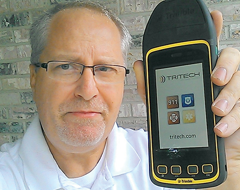
JEFF FEHLBERG, winner of the drawing for a Trimble Juno T41, grand prize in the 2013 State of the Industry Survey. You, too, can be this lucky!
Like Olympic athletes, doctors without borders, and magicians, members of the GNSS community constitute an informal international group that gathers periodically, in different centers around the world, to share knowledge and advance their craft. It is due and fitting, perhaps even necessary, that we also try to summarize or collect our views about ourselves, our field, and our future. The State of the Industry Survey is an effort to do just that.
Last year’s Survey drew 893 responses from I lost count of how many countries; the results were published in the September issue. The questions for the 2014 Survey appear on the pages immediately following, and the online interactive Surveyis now live, through the end of August. You can win cool stuff simply by answering 20 questions.
Displayed here are last year’s top prize winners. Jeff Fehlberg, a mobile business analyst from Tritech Software Systems in Little Rock, Arkansas, garnered the rugged handheld Trimble.
John Zittere of Engility Corporation in Hollywood, Maryland, sent along a selfie with giftie, and a few comments: “I really do enjoy reading GPS World and I also suggest it to our new-hire engineers. Here are a few pics from our Automated Aerial Refueling tests in Niagara, New York (see below).”
JOHN ZITTERE with his dinner ticket, the second raffle prize from the 2013 survey.
Also receiving gift cards for completing the 2013 Survey: Jinghui Wu of Kensington, New South Wales, Australia; Dr. S.M.A. Rizvi from Aligarh, Uttar Pradesh, India; and Rui Barradas Pereira of GMV in Lisbon, Portugal.
CALSPAN Lear Jet with the probe (non-functional but flight ready).AAR016, view of the tanker drogue from the Lear Jet.
With fall tradeshow season fast approaching and 2015 vehicles hitting the road, Scott McCormick, President of the Connected Vehicle Trade Association (CVTA), took the time to answer some questions for GPS World about one key conference, CTIA’s Super Mobility Week, and what to expect in the connected vehicle market for the second half of 2014. The CVTA is a nonprofit industry group dedicated to accelerating technologies in the consumer and commercial auto market. CVTA will be well represented at Super Mobility Week, with about a third of its membership comprised of companies involved in the wireless industry. However, McCormick won’t be in attendance in Las Vegas; that’s because he’s a member of the organizing committee and will be moderating sessions at ITS World Congress, being held that same week in Detroit.
Do you think that ITS World Congress will end up cannibalizing the connected vehicle crowd from Super Mobility Week?
Yes, I think it will a lot. Most of the connected vehicle companies don’t work solely in DSRC, they work in cellular and WiFi, too, so it really depends on where their business needs are. The company with the large multinational presence will certainly be at World Congress because that’s where the networking capability is, while CTIA will be most of the cellular providers. It’s about connecting with your channel partners, your supply base and your potential customers. It’s not really about seeing new technologies, but about engaging new customers.
What we are announcing is about doing something that will help benefit collaborative industries. We have our core industries, but there are now insurers, data mining companies, security companies, all these other companies that are not in the automotive space that are doing things related to it. A few years ago we had people in Silicon Valley begin working in the automotive space but they didn’t understand the user interface in the car, where you need to have control and return your attention to driving as quickly as possible. All the devices they knew were designed to focus your attention. It’s the same thing today: The insurers don’t know how to work with the automakers. Neither did the telecoms. They’re completely different business models, but they’re channel partners. This is not just about a company to hire, but where can we gain utility and expertise.
So your announcement will be about reaching into a second tier of companies that just a few years ago were not involved in the connected vehicle space?
That’s a perfect way to characterize these companies; they all have to deal with interoperability issues.
What will be the hottest topics at Super Mobility Week?
There will be three: privacy, data ownership, and security. Security is the only one that’s important, and it’s for simple reasons. The United States has no personal privacy data law and it never will. The issue is one that we’re not going to solve. Everybody wants to talk but nothing ever comes of it.
The same question with data ownership. Why would my privacy or data ownership be device-specific? It should be device-agnostic. Anytime you transfer data, there are two levels of ownership. Of the data in the connected vehicle, an infinitesimally small amount is related to location or driving behavior. Although we talk about privacy and data ownership, nobody’s going to define data ownership.
Security, however, is a huge issue, because once you clear a gateway into the system, it can be breached. I’m not concerned about terrorists, it’s more just teens with nothing to do who want to rock the system. I’m most concerned about the insufficiency of the code. There’s an average of 43 networks in a car, and while they’re not likely going to affect braking, that doesn’t mean if you tinker with things long enough you couldn’t figure it out and remotely control functions. That’s really sophisticated and of very low value to do it to one vehicle.
It’s more important to ask if the overall infrastructure is protected. Systems have to be designed to be secure, detectable, and reparable. It’s incumbent upon cellular companies to take that responsibility.
Will they accept that responsibility?
If they don’t, people won’t use it. Now we understand that when a car is purchased it’s based largely on the perception of quality of service, not just on the quality of the engine or the comfort of the ride … it’s about how long until my connection breaks off and why didn’t I know about that traffic jam or that this road was icy if another guy did in a different make and model car.
How do you think this year’s show will be different from last year’s show?
Last year a lot of industries were still coming off the recession and going back to core competencies. This year I expect to see a lot of innovative companies coming out with much more focused sort of innovation where in the past it was about trying to be everything to everybody. In particular, the connected life stuff is going to be interesting because those are the people that when you look at it you’ll say, this is something I haven’t seen before or wasn’t aware of and it’s new and consequential.
The automakers will be a part of a lot of those discussions. Do you think we’ll hear anything new?
There will be some talk about the aftermarket. The average person keeps cars for 11 years. Now if I just bought a new car and next year someone has something really cool, I can’t just go buy a new car. But if I could add it … now there’s another revenue stream for the OEMs.
What are some innovations you think we’ll see hitting the market in the next year?
The machine-to-machine market is going to have a lot. Also, I just read a report that a lab figured out how to do 1000-times the data transmission speed of the fastest fiber-optic system by running it across copper. We have certain sized pipelines today and a certain time to get data from here to there, and we’re exploring how we can best do that with what we have.
By all estimates the global connected car service market is expected to top $130 billion by 2019. What will fuel that growth the most? Safety and security? Infotainment? And is that growth sustainable?
By 2020 we’re looking at a $200 billion market … and that’s going to be because of security. The problem with the automotive industry is that they have a very difficult time communicating the value proposition, because they’re used to selling business-to-business. But in the cellular industry you don’t question paying several hundred dollars a month for your phone, because they communicate that well to consumers. So the question is really one of both developing the product and service and understanding the consumer.
CTIA has talked a lot about safe driving policy and distracted driving legislation. Where do you see this policy going in the next year?
I see the federal government moving at a glacial pace. They were 2 months late on the vehicle-to-vehicle report, they were supposed to work on the interstate commercial vehicle rule, and they’re struggling with a transportation authorization bill that’s not anywhere near where it should be. There are things that the federal government needs to be involved in and things they have no business being involved in, like setting standards. The automakers will do what the consumers want. Look what happened with backup cameras. Even before there was legislation requiring backup cameras because of kids being hit, the automakers decided to put it on certain models because the consumers wanted it.
What policies will come into play in the next year?
One is very critical. The American Jobs Act is pushing to allow unlicensed devices to use the 5.9 (GHz) spectrum (currently allocated to licensed Intelligent Transportation Systems), and we have conveyed what a bad idea that is. The FCC has tested it in lab conditions, not with hundreds of cars at an actual intersection. This is not like connecting a toaster and refrigerator, this is hundreds of people in the backseats of cars attempting to connect and disconnect (to WiFi). That’s the equivalent of a denial-of-service attack. Unless we deal with this soon, it’s going to be a real safety risk. The problem is once the spectrum gets reallocated, it’s going to be really hard to take it away.
John All takes an ice sample from a glacier in the Ishinca Valley, Peru.
A climate scientist relies on a GPS satellite communicator to get him out of tight spots.
By Tracy Cozzens Photos by Clinton Lewis, Western Kentucky University
Please call Global Rescue.
John broken arm, ribs, internal bleeding.
Fell 70 ft crevasse.
Climbed out.
Himlung camp 2.
Please hurry.
That simple text message, sent May 19 via the DeLorme inReach communicator, alerted search-and-rescue monitors that the leader of a Himalayan research team was in dire straits.
Dr. John All, director of the American Climber Science Program (ACSP), was leading a team collecting snow samples in the highest mountain range in the world to study the impacts of climate change when he tumbled into a crevasse. “After crawling back for hours to my tent, I sent texts via my sat messenger for help,” All told the local Kathmandu newspaper.
Friends and family of the expedition followed the rescue efforts every step of the way as text messages were sent via the InReach to the ACSP’s Facebook page.
The climate scientist was rescued via a helicopter and admitted to Norvic International Hospital in Kathmandu with five broken ribs, a dislocated shoulder, and internal bleeding. After a day in the ICU, he was discharged for a week of rest before returning for further care in the United States.
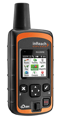
The DeLorme inReach Explorer.
In an emergency such as All experienced, the interactive SOS capability of the inReach automatically triggers remote tracking and allows users to communicate via text with responders at GEOS, DeLorme’s partner for international 24/7 search-and-rescue monitoring.
Going Out Again. All and his ACSP team departed for Huascaran National Park in Peru on June 23, just a month after his harrowing rescue in the Himalayas, for a two-month research expedition. All and several of his team members will be carrying the inReach devices.
Just like in the Himalayas, the inReach will give the team the ability to send and receive 160-character text messages from the remotest locations, provide location updates with GPS tracking, and keep them within reach of rescue with its SOS capabilities.
Besides providing peace of mind, the latest version of the inReach — the Explorer — allows the team to plan a route, mark waypoints, and create detailed track logs of their expedition.
“Knowing we would consistently be out of cell-phone range, we researched all satellite communication options to keep us connected,” All said. “A satellite phone was more than we really needed, and as a volunteer-driven non-profit program, it wasn’t very cost effective. We needed to be able to communicate back and forth in the event of an emergency, but we also wanted to keep everyone updated on the day-to-day status of the mission.”
Checking on the team’s status is as easy as visiting their Facebook page. Team members regularly post messages from anywhere in the world they might travel.
In Peru, the team of 20 students and scientists will examine changing climate conditions and the impact of human land use in the mountainous Cordillera Blanca region of the Andes, where Huascaran National Park is located. The park, a magnet for American climbers, has more than 33 peaks higher than 6,000 meters and hundreds of 5,000+ meter peaks. ACSP has been sampling snow in the region for the past three years in an effort to quantify the glacial contamination levels.
“Our work in Peru will be much more comprehensive than our high-elevation work in the Himalayas and will cover whole gamut of environmental parameters, from vegetation to water quality. The region is very remote and we will be collecting some samples from the walls of a crevasse to assess the seasonality of pollutants and their impact over time, so having an inReach with us is critical — both to communicate with each other and our team back home,” All said. Plus, he added, the students on his team will be able to communicate with their parents, providing their parents with peace of mind as their children travel to remote regions.
“Now that we’ve seen how well inReach works, we are looking forward to having more of them on this next trip — especially the newest Explorer model, which will allow us to mark waypoints during data collection,” All said.
In addition to the messaging, tracking and SOS capabilities, users of the company’s latest product inReach Explorer can view, create or navigate routes and waypoints. A map view displays routes, waypoints, tracks, and messages geo-located onscreen for backtracking or self-rescue. The built-in digital compass, barometric altimeter, and accelerometer sensors ensure accuracy and provide heading and bearing information, elevation readings, speed, and other useful trip statistics.
inReach communicates over the Iridium satellite network, providing global two-way satellite connections, high network reliability and low-latency data links (less than 60-second delivery of messages end-to-end) anywhere on Earth, with no gaps, fringe or weak signal areas. inReach has the ability to maintain a satellite signal lock even in difficult GPS environments, such as in a steep canyon or under a heavy forest canopy, DeLorme said.
The ACSP has visited Peru for climate research for three years, including in 2013 the Quillcayhuanca Valley (left) and the Ishinca Valley, places so remote that staying in touch can be a challenge. (Photos: Clinton Lewis/WKU)
Trimble has introduced the DPS900 Piling System, a dedicated land-based 3D machine control system for a variety of piling machine makes and models. The accuracy of the system allows piling contractors to increase operational efficiency and reduce costs for building structural foundations, retaining walls, coffer dams, and solar or wind farm installations.
“The DPS900 Piling System can transform the way piling contractors work,” said Alan Sharp, business area director for Trimble Heavy Civil Construction. “Without DPS900, the process is manual and often error prone. With the DPS900 system, contractors can take advantage of accurate positioning and automated reporting to ensure machines are being utilized efficiently.”
The DPS900 Piling System reduces surveying costs associated with staking and as-built checks. In addition, the system can increase on-site safety by reducing the number of people around machines, pilings and foundations. Accurate positioning in DPS900 can ensure navigation time between piles is reduced, resulting in increased piling time to maximize production and revenue per day.
Built-in, automated quality assurance and quality control reporting includes capture of start and end positions, time and elevation, as well as actual embedment depth, blow count reporting, and inclination and orientation control. In addition, unique system logins allow managers to filter reports by operator for better accountability, production optimization and forecasting.
Business Center–HCE office software by Trimble is used to create pile plans in the office, and allows for integration with data prep, estimating and reporting functions. Piling machines can be connected to the office using Trimble Connected Site solutions for wireless data transfer and GNSS corrections. In addition, machines can be tracked and monitored using VisionLink for location, hours and utilization information.
The new Trimble DPS900 Piling System is available now in Australia, Europe, North America, Chile and South Africa through Trimble’s SITECH Technology Dealer Channel.
The Mobile Marketing Association (MMA), a global trade association for the mobile marketing industry, is forming a Mobile Location Data Accuracy Group. The focus of the group will be to eliminate any confusion around mobile location data and to improve the trust and confidence brand marketers and agencies have in mobile location advertising and the data that drives it.
Simultaneously, the MMA is forming a Location Leadership Council that will be an industry “think tank” comprised of a merging together of thought leaders from the MMA’s Location and Privacy committees and experts in the various areas of location — marketing, technology, data and policy. Stemming from the council will be a number of working groups, the first of which is the Mobile Location Data Accuracy Group.
The working group will expand on the previously launched Location Terminology Guide, in which the MMA Location Committee identified eight types of location data and signals, and ranked each according to the reach and accuracy of the data. The data and signals to be examined by the working group include (from most accurate to least):
Indoor positioning system
Bluetooth
GPS
Wi-Fi hotspots
Wi-Fi triangulation
Cell tower triangulation
IP address
User reported location
Specifically the Mobile Location Data Accuracy Group will:
Dig deeper into each of these data types and elaborate further on their appropriate uses and limitations.
Develop and issue an RFI (Request for Information) to all location data vendors and validators that will establish criteria with which vendors can be aligned with the data types they use.
Establish strict, standardized definitions with the MRC that vendors will be held accountable to and audited against.
According to an April 2014 BIA/Kelsey study on local media spending, location targeted mobile advertising accounted for 40% of the $7.22 billion mobile ad spend in 2013, and is expected to grow to 52% of the $30.3 billion forecasted for 2018.
“In order to scale mobile marketing specifically driven by location data, it is critical for the industry to come together to develop a common set of definitions of the types of location data available and how they are best used,” said Greg Stuart, CEO, MMA. “By agreeing to and abiding by a common set of best practices and guidelines, MMA members will be instrumental in driving the growth in the industry while assuring brand marketers of the measurable value derived from their mobile efforts.”
With tighter definitions of location data, and the viable uses of such data, measuring results will be more consistent and reliable, the MMA said. These benchmarks will allow buyers to have a much clearer understanding of the data being used, and how it will impact their location-driven mobile advertising campaigns.
Initial members of the group will include:
xAd – Monica Ho, SVP Marketing (co-chair)
Joule – Michael Lieberman, CEO (co-chair)
Factual – Vikas Gupta, Director of Marketing
ThinkNear – Brett Kohn, Director of Marketing
Mobiquity – James Meckley, CMO
Nielsen – Tom Eaton, VP, Client Services
MEC – Bav Panchal, Mobile
OpenX – Rob Kramer, GM, Mobile
Ubimo – Ran Ben-Yair, CEO
Verve – James Smith, CRO
“Having this type of transparency into location data is a huge step forward that will allow us, as buyers, to invest in mobile with increased confidence,” said Michael Lieberman, CEO, Joule North America. “This program will, in large part, allow mobile marketing to truly scale and deliver measurable results for our clients around the world.”
“We are committed to improving clarity and defining auditable standards for location data and ultimately all of location-based services. This will remove the barriers for brands and agencies to leverage the power of this unique mobile value proposition and improve their confidence in how and what to use,” said Monica Ho, SVP Marketing, xAd. “We are excited to work with the MMA and the industry in achieving standards that we believe will be critical for scaling the mobile marketing industry.”
The Mobile Location Data Accuracy Group will be gathering the industry leaders to share initial definitions and use cases at the Location Data Accuracy Panel Session August 26 at the Crowne Plaza Times Square, New York, 6:30-9 p.m. The session will provide an opportunity for brands, agencies and key partners in the location advertising arena to meet and discuss opportunities ahead.
GigOptix, Inc., is making available samples of its newest GNSS RF receiver for road, maritime, agriculture and surveying applications.
GigOptrix is a supplier of advanced high speed semiconductor components for use in long-haul, metro, cloud connectivity, data centers, consumer electronics links and interactive applications, through optical and wireless communications networks.
The new EXG0201 device is expected to be one of several RF-focused products the company will bring to market over the next few quarters stemming from the recently acquired Tahoe RF Semiconductor, now called the GigOptix-Auburn RF Design Center after its integration into GigOptix earlier this month.
The new EXG0201 product marks the introduction of GNSS RF receivers by GigOptix. It is a low-power consumption, highly linear RF GNSS receiver in a small Quad Flat No-Lead (QFN) package. The fully integrated device is optimized for industrial applications and has dual channels supporting both the upper and lower GNSS bands.
The EXG0201 provides two modes of operation, a high-resolution mode and a low-resolution, low-power mode. It integrates RF signal processing, 12 or 3-bit analog to digital convertors, dual fractional-N synthesizers (with a shared reference to generate RF LO signals) and a three-wire SPI digital interface to provide the necessary functionality required to create a high-end GNSS receiver system. All of the EXG0201 sub-systems are programmable through the use of the on-chip SPI interface.
The GNSS industrial market, supporting road, maritime, agriculture, and surveying applications, is expected to grow to 67% in annual shipments to 43 million devices. The road segment dominates the annual quantity consuming about 98% of the total shipments. The road segment’s growth is driven by increased regulatory pressure for E911 emergency location calls.
“The EXG0201 represents our introduction of fully integrated RF-to-bits devices into a growing GNSS market, and serves as a proof point to the strategic importance of the Tahoe RF acquisition. The newly acquired IP and product capabilities put us in an excellent position to provide differentiated solutions and increased business over the long-term,” said Irshad Rasheed, director of marketing for wireless and RF products at GigOptix. “From a capabilities standpoint, the EXG0201 provides excellent performance with 28 MHz of signal bandwidth, dual-channel operation, 60 dB of instantaneous dynamic range, and 75 dB of gain, all contained within a small 72-pin QFN package.”
The EXG0201 is expected to ship in full production quantities starting in the fourth quarter of fiscal 2014.
The U.S. Patent and Trademark Office has issued 10 U.S. patents to TeleCommunication Systems, Inc. during the second quarter of 2014. TCS also received two foreign patents during the quarter.
The 10 U.S. patents describe innovations in messaging, location-based services, GIS/mapping and wireless. They include the following three:
TCS reported in the first quarter that it was issued a Prepaid Short Messaging Services patent. In the second quarter, TCS received notice that another prepaid patent was issued to the company that will serve as one of the cornerstone patents in a monetization program that TCS is planning to launch later this year. The prepaid market has grown into a multibillion-dollar per year industry, with 86 million prepaid users comprising 27 percent of all U.S. wireless users, according to a J.P. Morgan 2013 market report. The recently issued Prepaid Short Messaging patent (U.S. 8,738,496) is a continuation of earlier TCS prepaid patents, bringing TCS’ prepaid messaging portfolio to eight, with one additional pending. Most prepaid phone systems allow users a prescribed amount of prepaid messaging and wireless call time. The ‘496 patent describes techniques for determining if a recipient’s account is sufficiently funded to receive a message. If it is not, the system prevents the delivery of messages until the recipient’s account is sufficiently funded, when follow-on messages will be delivered.
A geofence defines a virtual spatial boundary for creating triggers when a mobile device either enters or exits that boundary. Geofences are commonly used in child location services to alert parents when a child’s mobile device leaves the boundary of a school or park, or by enterprises to track the location of a mobile workforce or equipment. Establishing a geofence can be complicated, requiring that the user manually draw the boundary on an electronic map. The recently issued TCS patent covering a Method and System for Identifying and Defining Geofences (U.S. 8,731,813) describes techniques to simply and easily create geofences based on real-world objects or places. Using the map/navigation application on a mobile device, the user simply selects the desired location, using its pre-defined boundary to create the geofence.
Thousands of portable computing platforms have emerged that have the capability of directly connecting to the Internet either through a wireless wide area network (such as cellular network or campus Wi-Fi network) via a front-end built into the device (smartphone, etc.), or, via Bluetooth or other short-range wireless communication, to a wireless proxy device such as a modem or a smartphone. With various low-cost, short-range wireless devices installed in vehicles for navigation or entertainment purposes, it has become increasingly important to provide an easy and efficient method for a motor vehicle manufacturer, parent or other authority to monitor and control access to certain sites when those devices are connected to the Internet. The recently issued Remotely Provisioned Wireless Proxy patent (U.S. 8,712,408) describes techniques to create white lists (allowed URLs) and black lists (disallowed URLs) within a wireless/mobile device acting as a proxy so that access to certain sites can be controlled effectively.
The remaining seven U.S. patents issued in the period are: Integrated, Detachable Ear Bud Device for a Wireless Phone (U.S. 8,688,174); N-Dimensional Affinity Confluencer (U.S. 8,688,087); Login Security with Short Message (U.S. 8,712,453); Intelligent Reverse Geocoding (U.S. 8,731,585); Secure Location Session Manager (U.S. 8,687,511); System and Method for Location Assurance of a Mobile Device (U.S. 8,718,673); and Wireless Network Tour Guide (U.S. 8,744,491).