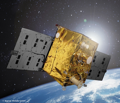
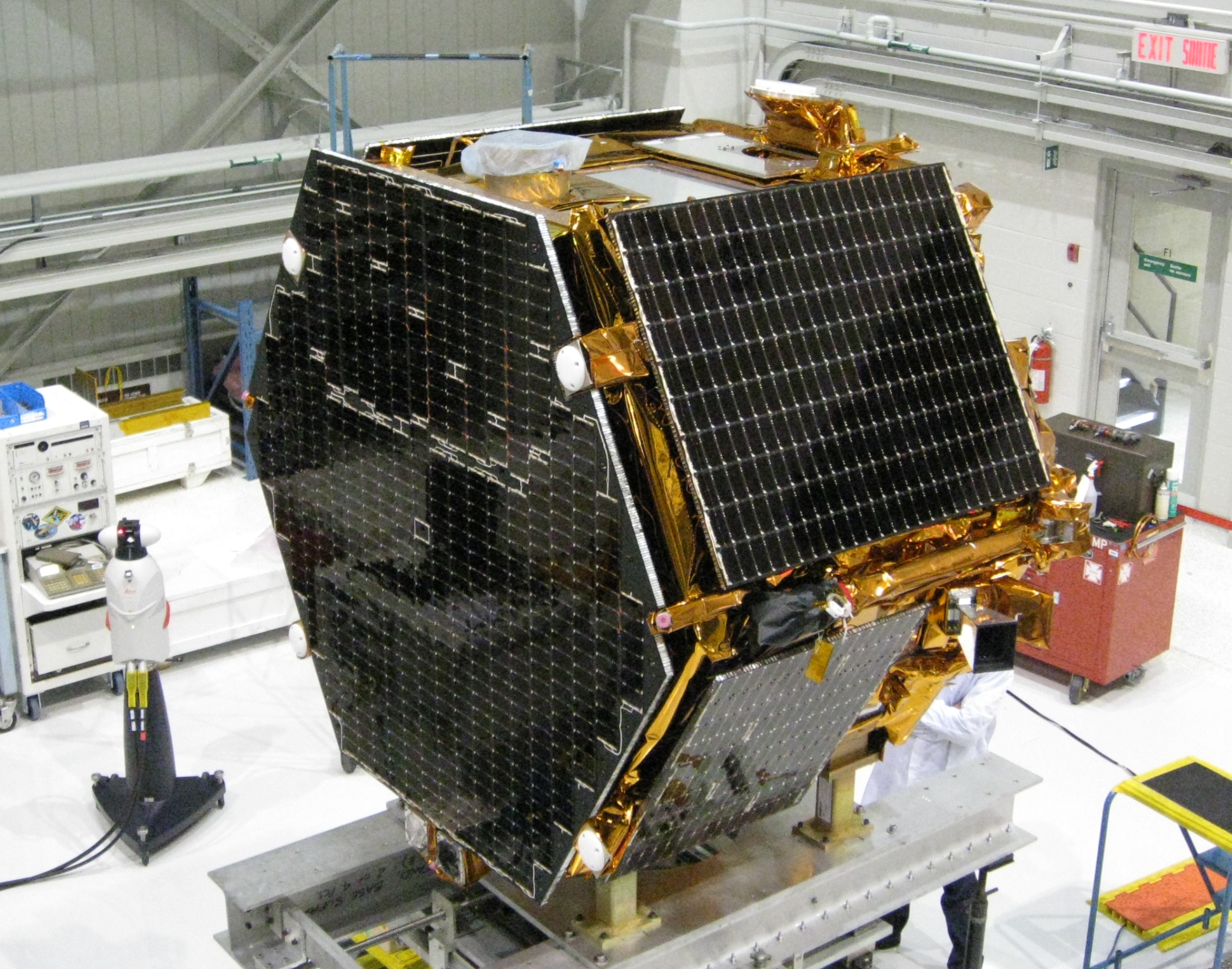
The TET-1 satellite has Septentrio on board. (Image: DLR)
Septentrio announced today that a PolaRx2 receiver has reached more than 330 hours of successful operation on board “Technologie-Erprobungs-Träger 1” (TET-1), the first satellite of the German On-Orbit-Verification program. The Septentrio receiver is the backbone of the Navigation and Occultation Experiment (NOX) developed by German Aerospace Center (DLR). The purpose of the experiment is to prove the suitability of commercial-off-the-shelf (COTS) technology for use in space missions.
The receiver provides GPS observations on the L1 and L2 frequencies, which are used for precise orbit determination and atmospheric sounding. The dual-frequency observations allow reconstructing the orbit of TET-1 with decimeter or better 3D accuracy. A dedicated antenna pointed into the anti-flight direction of the satellite is used to collect measurements during GPS radio occultations, where the signals are tracked through the Earth’s atmosphere.
After the first activation on July 26, 2012, the receiver has operated flawlessly in the harsh environment 500 km above the Earth’s surface and has been unaffected so far by space radiation. The receiver demonstrates quick acquisition of GPS signals and tracks a sufficient number of satellites even under challenging visibility conditions. The short time-to-first-fix together with the high availability of position and timing information from the navigation solution make the PolaRx2 a very suitable receiver for space-borne applications.
“We are proud to see a new illustration that our standard commercial receivers perform flawlessly even in the harshest circumstances,” said Peter Grognard, Septentrio’s founder and CEO. “Our customers benefit every day from the same high quality and robustness for their demanding industrial applications on earth ”
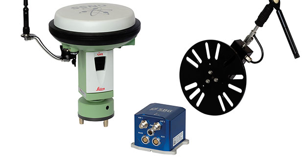
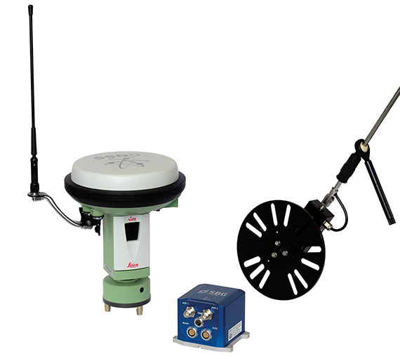
At ION GNSS+ this week, SBG Systems announced the release of the Ekinox Land Solution, an all-in-one solution combining the cost-effective inertial navigation system with an odometer, and a GNSS RTK reference station for smooth positioning in land applications. GPS positioning in urban canyons, forests, or tunnels has always been challenging. By taking the best of these complementary technologies, Ekinox Land Solution provides reliable positioning in an affordable package, the company said.
SBG Systems is exhibiting the system Wednesday through Friday at Booth 519/521 at ION GNSS+ in the Nashville Convention Center.
The combination of the Ekinox inertial navigation system with complementary technologies such as wheel-speed sensor (DMI) and RTK GNSS is the key to providing smooth vehicle positioning, even during GPS outages, SBG Systems said. To save users and integrators both time and money, the best equipment has been tested and selected to build a cost-effective and all-in-one package — Ekinox Land Solution.
Ekinox Land Solution is an integrated package built from the Ekinox Series, a range of inertial navigation systems based on robust and cost-effective MEMS technology. Mounted on a vehicle, Ekinox Land Solution provides real-time roll, pitch, and true heading (0.05° accuracy) while delivering a smooth position (2 cm). Data is output at 200 Hz and recorded in an 8-GB datalogger. Post-processing software is offered to increase attitude accuracy (up to 0.02°).
Ekinox Land Solution is designed to answer the growing need of vehicle real-time positioning, imagery sensor triggering, and data georeferencing at an affordable price. Examples of applications include mobile mapping, machine control, car motion analysis, and unmanned ground vehicle navigation.
The Ekinox series includes the Ekinox-A, and Attitude and Heading Reference System; the Ekinox-E, an Inertial Navigation System (INS) whose position feature depends on aiding equipment; the Ekinox-N, an INS with an embedded L1/L2 GNSS receiver; and the Ekinox-D, an INS with an integrated Dual Antenna GNSS receiver.
SBG Systems is a French supplier of MEMS-based inertial motion sensing solutions. The company provides a wide range of inertial solutions from miniature to high accuracy. Combined with calibration techniques and advanced embedded algorithms, SBG Systems products are designed for defense, industrial and research projects, such as unmanned vehicle control, antenna tracking, camera stabilization, and surveying applications.
Esri released an interactive flood impact map of Colorado. Flash floods in Colorado have caused massive damage throughout the state since they began on the evening of September 11, 2013.
Boulder Area
Since September 9th, the Colorado Front Range has received a large amount of rainfall. The top 50 citizen observations are shown on the map.
FEMA shelters have been established to help residents that have been impacted by heavy flooding. Click on boundaries to see population statistics for that area. Residents in Lyons were evacuated and the community was virtually cut off by damage to roads in and out of the city.
Denver Area
In the Denver area, many localities were impacted by evacuations and disruptions to the drinking water supply. Interstate 25 was closed in both directions up to Wyoming and dams in the area were breached, including one at the Arsenal National Wildlife Refuge near Commerce City.
Colorado Springs Area
Heavy rains west of Colorado Springs resulted in flash flooding on Thursday night (09/12/13). Fountain Creek, which runs through the city, surged to a flood stage and resulted in life-threatening conditions in Downtown Colorado Springs. Highway 24 was closed due to the impact of the 2012 Waldo Canyon Fire scar.
Fort Collins Area
Rivers and streams surrounding Fort Collins and Longmont have witnessed some of the worst flooding in the state, especially towns along the Big Thompson Canyon. Towns in Weld County, including parts of Johnstown and Milliken, were completely water-locked. Numerous FEMA shelters have been established in the area to help residents that have been affected.
Designed to automatically code and decode GPS signals, encryptors facilitate the exchange of user information by securely transmitting navigation payload data between the OCX ground station and the orbiting constellation of satellites.
“Following successful thermal, electromagnetic interference and security verification testing, Exelis delivered the first three of 14 encryptors,” said Kevin Farrell, positioning, navigation and timing general manager for Exelis Geospatial Systems. “Once integrated into the OCX system, the encryptors will help ensure that the next generation of GPS satellites will be ready for launch and provide advanced capabilities and security to both military and civilian users of the signal and the overall GPS modernization effort.”
Exelis provides critical elements of software in the navigation processing subsystem that will enable controllers to better understand the exact position of GPS satellites. This helps ensure accurate navigation information is securely broadcast to users. In addition to encryptors, Exelis is building high-precision receivers for use in GPS ground monitoring stations and satellite signal simulators for testing purposes.
As part of the overall GPS modernization effort, Exelis is also on contract with Lockheed Martin to provide payloads for GPS III satellites. Exelis is a major space technology provider, supporting both the satellite and ground portions of the GPS III modernization program.
For nearly 40 years, Exelis payloads and payload components have been on board every GPS satellite and have accumulated more than 500 years of on-orbit life without a single mission-related failure due to Exelis equipment.
The Air Force Institute of Technology (AFIT) and Locata Corporation have signed a Co-operative Research & Development Agreement (CRADA) to build and demonstrate new Locata multipath mitigation technology for use in GPS receivers. This cooperation is expected to leverage many years of proprietary Locata ground-based technology development to bring completely new capabilities to satellite-based GPS receivers, AFIT said.
The Air Force Institute of Technology, or AFIT, is the Air Force’s graduate school of engineering and management as well as its institution for technical professional continuing education.
The CRADA is specifically directed to evaluate Locata’s patented correlator and switching antenna technologies for use in positioning receivers running at GPS frequencies. Locata’s engineers will transfer knowledge and experience they have gained with existing Locata commercial systems to help AFIT design and build an initial multi-element GPS-based switching antenna prototype which is based on Locata’s patents. This will ensure AFIT researchers and engineers can familiarize themselves with the new antenna’s characteristics, and provide AFIT with an essential platform to develop GPS-specific versions of Locata’s correlator and switching algorithms. When built, AFIT intends to use its GPS receiver and the prototype switching antenna to physically demonstrate the feasibility of using Locata technology to improve GPS receiver performance.
An animation was created specifically to explain RF problems created by multipath and Locata’s VRay solution. The animation shows the first proof-of-concept 2D, 64-element antenna Locata’s engineers prototyped in 2011.
After initial prototypes are built, AFIT plans to design and test several other GPS-based versions of Locata’s switching antenna array to assess how Locata’s commercial antennas can be adapted to use cases which are of particular interest to the military. Designs already discussed with Locata include stand-alone antennas, arrays conformal to a vehicle’s frame (such as a Humvee’s roof or aircraft fuselage), and a version built into helmets.
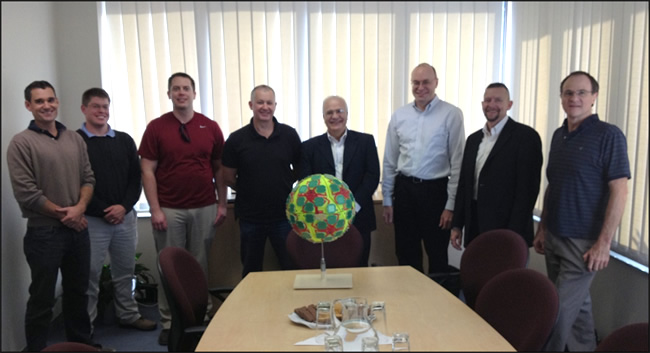
As a first step in implementing this CRADA collaboration, AFIT personnel visited Locata’s head office the week of April 29 for a detailed, wide-ranging introduction to the design fundamentals for this new type of antenna. Locata hosted AFIT’s John Raquet, Peter Collins and Jason Barhorst (see picture) in multiple engineering meetings where Locata’s current production version antenna was revealed for the first time, and then closely analyzed. AFIT and Locata engineers then workshopped the modification and design choices required to integrate Locata design into a GPS form-factor.
“If this CRADA is successful, Locata’s technology could enable a significantly improved technical performance and reduction in the cost of multiple-element GPS antennas,” said John Raquet, director, Advanced Navigation Technology Center, AFIT. “This will enable much wider adoption of the technology, resulting in more reliable GPS positioning for more users. We are excited to investigate this technology advance for the benefits it will potentially bring to American warfighters.”
“We are incredibly proud to once again be involved in a CRADA with the Air Force Institute of Technology, developing on the cutting-edge of navigation technology,” said Nunzio Gambale, CEO and co-founder, Locata Corporation. “Our previous LocataNet partnership with Dr. Raquet and his world-class AFIT researchers quickly taught us why this team is renown throughout the industry. The AFIT engineers bring an exceptional skill base to this important integration of Locata technology into GPS receivers. I’m certain that our collaboration, along with access to the USAF’s unmatched prototyping and testing capabilities, will deliver ground-breaking functionality for future GPS devices.”
AFIT expects at least one master’s degree to be awarded for the research tasks involved in the CRADA. Work against the approved CRADA project plan will commence immediately, and involve several other participants providing admin and lab support to AFIT and Locata. The final report produced by this CRADA will include results and measured performance of the Locata-enhanced GPS receiver and other design considerations gleaned from AFIT’s experience with the new Locata antenna and correlators.
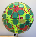
AFIT-Locata Kick-off Meeting: This is the first picture ever released by Locata which shows their radically new switching antenna, a design that AFIT will now modify for use with GPS receivers. Pictured (L-R): Dr. Steve Hewitson & Ian Sainsbery (Locata engineers); Jason Barhorst (AFIT); David Small (Locata technology inventor), Nunzio Gambale (Locata CEO), Dr. John Raquet (Director, Advanced Navigation Technology Center, AFIT), Dr. Peter Collins (AFIT), Dr. Trevor Hobbs (Locata Director of R&D).
The Esri Mobile team announced it has released an update to the ArcGIS for Android app.
There are several key bug fixes and enhancements that improve app stability (NIM084516, NIM084565), support for an on-premises Portal, and secured services (NIM84775).
In keeping with rapid demand, the USGS has posted new US Topo quadrangles covering Colorado (1,794 maps) and Minnesota (1,689). These new quads replace the first edition US Topo maps for those states. The replaced maps will be added to the USGS Historical Topographic Map Collection and are also available for free download from The National Map and the USGS Map Locator & Downloader website.
The new design for US Topo maps improves readability of maps for online and printed use, while retaining the look and feel of the traditional USGS topo map. Also, map symbols are now easier to read over the digital aerial photograph layer whether the imagery is turned on or off.
Other re-design enhancements and new features:
New shaded relief layer for enhanced view of the terrain
Military installation boundaries, post offices and cemeteries
New road classification
A slight screening (transparency) has been applied to some features to enhance visibility of multiple competing layers
New PDF legend attachment
Metadata formatted to support multiple browsers
In addition, the new Colorado US Topo quads include recreational trails in National Forests, provided by the U.S. Forest Service. Although this first test of trails was successful, the Forest Service does not yet have comparable data in other states, and schedules for adding trails in all National Forests have not been set.
Figure showing proposed US Topo production schedule. States that were updated in 2012 are in yellow; states that have, or will be updated in 2013 are colored red; and states are scheduled to be updated in 2014 are in blue.
“We are excited to about these two updates that are part of our continual effort to improve US Topo maps for our users,” said Vicki Lukas, USGS Chief of Partner and User Engagement. “First, the new design makes US Topo maps even easier to use, and the new Colorado maps include Forest Service trails as a new feature.”
US Topo maps are updated every three years. The initial round of the 48 conterminous state coverage was completed last September. Hawaii and Puerto Rico maps are being completed this year. New US Topo maps for Alaska have started, but will take several years to complete.
US Topo maps are created from geographic datasets in The National Map, and deliver visible content such as high-resolution aerial photography, which was not available on older paper-based topographic maps. The new US Topo maps provide modern technical advantages that support wider and faster public distribution and on-screen geographic analysis tools for users.
The new digital electronic topographic maps are delivered in GeoPDF image software format and may be viewed using Adobe Reader, available as a no-cost download.
Update: Elon Musk, SpaceX’s CEO and chief designer, has posted an update on the status of the upcoming Falcon 9 launch on his Twitter account. “Will do another static fire of rocket to make sure all is good & AF [[Air Force]] needs to test ICBMs, so probable launch Sept 29/30,” Musk tweeted.
“The static fire is scheduled for later this week, perhaps Wednesday, sources said. It will retest the Falcon 9 rocket after several problems cropped up during a hotfire of the launcher’s engines Thursday at Vandenberg Air Force Base, Calif.
“The U.S. Air Force Western Range, which controls a network of tracking and communications assets based at Vandenberg, is busy for the next few weeks due to Minuteman ballistic missile testing.”
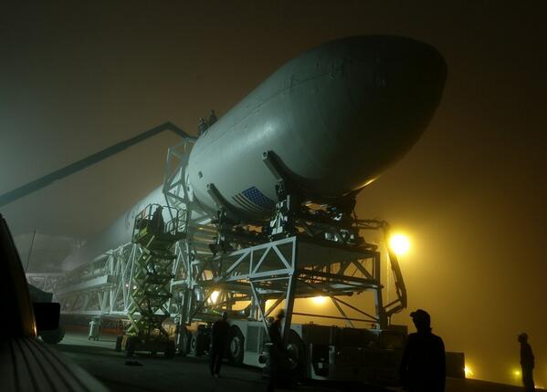
The Falcon 9 rocket, with CASSIOPE inside its fairing, on the way to the launch pad at Vandenberg Air Force Base. (Photo credit: SpaceX).
A GPS instrument designed by University of New Brunswick scientists is scheduled to be launched into space aboard the SpaceX Falcon 9 rocket on September 15. The rocket will depart Vandenberg Air Force base in California as part of the CASSIOPE (Cascade Smallsat and Ionospheric Polar Explorer) mission.
Dr. Richard Langley, GPS World Innovation editor and professor in geodesy and geomatics engineering at the University of New Brunswick, is a principal investigator behind the scientific portion of the CASSIOPE mission. Langley and his colleagues will monitor data from the GPS instrument, which is part of the Enhanced Polar Outflow Probe (e-POP) payload aboard the spacecraft.
E-POP will continue the sequence of Canada’s orbiting space environment sensors, which began with Canada’s first satellite, Alouette 1, launched in 1962 to study the ionosphere. e-POP is, perhaps, the most extensive suite of sensors for studying the ionosphere/magnetosphere/thermosphere yet to be launched, and will provide Canadian and other scientists with the opportunity to better understand the impact and variability the sun has on the space environment — what we call “space weather.”
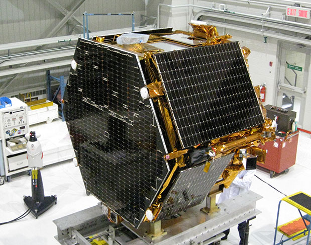
The research satellite CASSIOPE on a test platform at the Canadian Space Agency’s David Florida Laboratory. CASSIOPE hosts the GPS Attitude, Positioning, and Profiling instrument designed by GGE researchers. The four white antennas on the left-facing side of the spacecraft will be used to determine the position, velocity, and attitude of the spacecraft while the antenna on the upper side will be used to profile the ionosphere’s electron density. (Photograph courtesy of MacDonald, Dettwiler and Associates Ltd.)
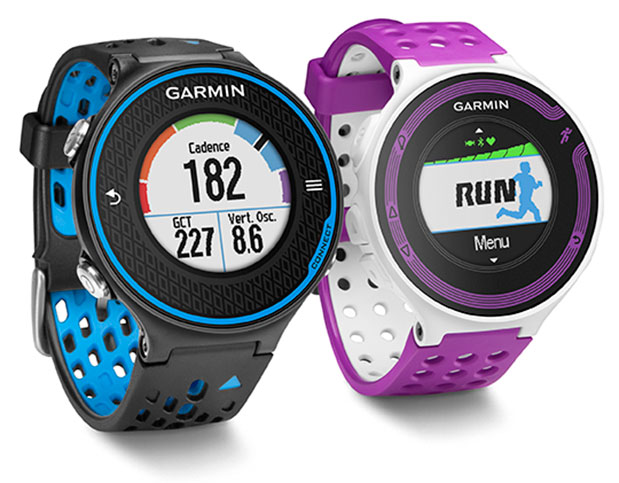
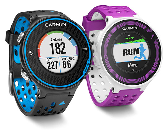
Garmin International Inc., a unit of Garmin Ltd., the global leader in satellite navigation, is now offering the Forerunner 620 and Forerunner 220 GPS running watches, both of which have color displays. The Forerunner 620 offers advanced features like recovery advisor, race predictor and VO2 max (maximal oxygen uptake) estimate to help runners train and achieve race goals. When used with the new HRM-Run (heart rate) monitor, the 620 also provides feedback on running form.
For indoor training, such as on a treadmill, the 620 and 220’s built-in accelerometer tracks distance and pace, so runners don’t need a separate sensor. Both models boast Garmin’s unique one-inch Chroma color display to easily interpret data.
“Whether running indoors or out, Forerunner 620 and 220 will change the way runners look at training,” said Dan Bartel, Garmin vice president of worldwide sales. “Advanced features in the 620 such as recovery advisor, VO2 max estimate, race predictor and stats on running economy, combined with connected features and training plan options found in both the 620 and 220, make these watches must haves for runners of all levels. To keep runners motivated the watches also notice if runners hit any personal records on that run, like their fastest mile, 5k, 10k, half or full marathon or their longest run to date.”
Regardless of a runner’s experience, motivation, or how far or fast they go, they likely want to know how they can improve and objectively measure their fitness. Forerunner 620 does just that by estimating runners’ VO2 max, which is a good indicator of athletic capability. Previously, the only way to accurately obtain VO2 max was by paying for a lab test.
When used with a heart rate monitor, the 620 incorporates several pieces of data, like running speed, beats per minute and heart rate variability, into an advanced algorithm to estimate runners’ VO2 max. The number itself indicates the maximum volume of oxygen a runner can consume per minute, per kilogram of body weight at their max performance. Theoretically, the more oxygen runners can use during high-level exercise, the more energy they can produce. A color gauge on the watch display shows how a runner’s VO2 max data compares to other individuals of their gender and age range. Based on the VO2 max estimate, the 620 can predict a runner’s race time for several distances. This can give runners a time target for their next race, assuming they’ve completed proper training.
When wearing HRM-Run, Forerunner 620’s recovery advisor and recovery check take the guesswork out when it comes to planning recovery time between hard workouts. Just like a coach, it learns the runner and their physiology based on heart rate data, so it factors this against their last workout and then shows how much time before they are fully recovered and ready for their next hard running workout. Color-coding on the high-resolution Chroma display gauge makes it easy to interpret — green means they are good to go. When runners see red on the display and a recovery time of more than three days, they might consider taking a rest day or just doing a light recovery run.
HRM-Run also has an accelerometer in the module that measures torso movement in order to calculate 3 different running metrics:
Cadence — the number of steps per minute. It displays the total steps (right and left combined)
Vertical oscillation — the bounce in runners’ running motion. It displays the vertical motion of a runners’ torso, measured in centimeters.
Ground contact time — the amount of time in each step that you spend on the ground while running, measured in milliseconds.
Thanks to their Bluetooth Smart wireless upload capabilities, Forerunner 620 and 220 can send runners’ run data to the Garmin online community, Garmin Connect, without being connected to a computer. It can transfer the data through the Garmin Connect Mobile app on their compatible smartphone. Additional connected features include live tracking, which allows runners’ friends and fans to follow along and see their stats in real-time. Runners must have their phone paired with their 620 or 220 throughout the run to use the LiveTrack feature. Victories, goals achieved and successes can be shared on runners’ social media sites by posting updates through the Garmin Connect Mobile app.
With the growing popularity of the run/walk training method in the distance running community (example: a runner runs for five minutes, walks for one minute and repeats for the duration of the course), Garmin has included a run/walk alert. This alert allows Forerunner 620 and 220’s other features, such as, Auto Lap and Auto Pause, to remain active during a run/walk session.
Both Forerunner 620 and 220 are water-resistant to 50m and can stand up to much more than rain, sweat and splashes. The Forerunner 620 has a touchscreen display responsive enough that it can be operated with running gloves, while the 220 is operated with easy to push buttons. Both models have rechargeable batteries lasting up to six weeks in watch mode and up to 10 hours in training mode.
Answer a GNSS Trivia Question and Get in on the Musical Action
Got the urge to sling notes likes a Nashville country star? Come by GPS World’s booth (#116–#118) at ION GNSS+ for a look at the brand-new Fender Telecaster electric guitar — first prize in a random drawing of correct answers in a GNSS Trivia Contest.
One lucky winner will leave ION with this music legend under his or her arm. All you have to do is correctly answer One Question, such as:
What does DRMS stand for, in the GNSS community?
A. Data Record Management System
B. Decision, Risk, and Management Sciences
C. Defense Resource Management System
D. Distance Root Mean Square
Correct answers will go in one bin, incorrect answers in another. At 3:45 p.m. Thursday in the GPS World booth, during the afternoon coffee break on the exhibit floor, one winner will be drawn at random from each bin. The winner from the first bin gets the Telecaster guitar; the winner from the second bin gets two tickets to GPS World’s Leadership Dinner on Thursday evening.
All players must complete a subscription form to qualify for a free subscription to GPS World magazine, or one of eight different email newsletters, in order to play the Trivia Game.
Winners need not be present at the drawing to win — but must respond to an email or text alert, to come by the booth before 6 p.m. on Thursday to claim either prize.
The Telecaster, a dual-pickup, solid-body electric guitar made by Fender, revolutionized sound when it burst upon the scene in 1951, and has been in continuous production ever since. Guitarists from Jeff Beck to James Burton, not neglecting Keith Richards or Bruce Springsteen, have played on a Telecaster.
Chronos Technology, global timing and synchronization company, is exhibiting its anti-jamming technology at ION GNSS+ 2013 in Nashville, Tennessee, September 18-20.
Exhibiting at Stand 723, Chronos will be demonstrating the Chronos Sentinel system, which enables a light-touch deployment of GPS jamming detection for a short period of time and allows a GPS jamming report to be created to enable management to assess the threat.
The CTL3520 handheld GPS jamming detector by Chronos Technology.
Chronos will also be displaying various GPS products, including the new CTL3520 handheld GPS jamming detector and locator system aimed specifically at detecting GPS jammers hidden in vehicles. The unit can pinpoint even the weakest jammer and identify the vehicle in which the jammer is hidden, even in a busy multi-storey car park. Other applications include detecting vehicles with jammers at ports, fleet depots, airport car parks and taxi ranks.
In addition, Professor Charles Curry, managing director with Chronos Technology, is presenting a technical paper “GPS Jamming -Threat Scenarios” on Monday, September 16, at CGSIC, which precedes ION GNSS+ 2013.
For more information about ION GNSS+ 2013, visit www.ion.org
Symmetricom will be participating in a new products panel at ION GNSS+, which will be held September 16-20 in Nashville, Tennessee.
Phil Bourekas, Symmetricom executive vice president of marketing, will take part in “New Products Panel: Legacy and Expertise in GNSS Timing” on Thursday, September 19, 8:30 a.m. to 12:15 p.m. in Grand Ballroom East of the Nashville Convention Center, Nashville, Tennessee.
The presentation will focus on Symmetricom’s suite of GNSS-applicable timing products, ranging from precision time protocols to atomic clocks, and how they can be used by the government, communications, power and enterprise verticals.
Symmetricom is also a sponsor of the exhibitor-hosted reception. In its booth (#619), Symmetricom will exhibit and demonstrate the following products:
GPS Time & Frequency Receivers (XLi and XLi SAASM GB-GRAM models)