Blog

  • Oregon Tech Offers Online Courses in Geomatics

    Unknown-1The Geomatics Department at the Oregon Institute of Technology announces that beginning September 30, selected Geomatics courses in Surveying and Geographic Information Systems (GIS) will be offered online. These courses are designed for the working professional that desires formal education to advance in their career. All courses are fully accredited and transferable to the Geomatics degree.

    The GIS courses are being taught by John Ritter, and the Surveying courses will be led by Mitch Duryea, PLS. Ritter and Professor Duryea are both faculty at the Oregon Tech campus in Klamath Falls.

    Currently recognized as the regional center for excellence for Geomatics in the Northwest and listed as one of the six best Land Surveying schools, Oregon Tech combines theory, problem-solving, and field work in a computer-intensive curriculum that prepares students for employment and licensure as Professional Land Surveyors.

    Oregon Tech is the only university in the Northwest to offer a four-year degree in Geomatics that is fully-accredited by the Accreditation Board for Engineering and Technology (ABET). The department offers instruction using state-of-the-art technology, and Oregon Tech Geomatics graduates remain highly sought after by industry. Over 95 percent of students who graduate from Oregon Tech with a Geomatics degree are hired upon or before graduation.

    According to the U.S. Bureau of Labor Statistics, the architecture and engineering occupations group which includes surveyors, cartographers, photogrammetrists, and surveying technicians is one of the top 10 occupational groups projected to have the fastest growth in employment between 2002 and 2012. Salary levels are expected to rise as demand for qualified professionals in these fields grows.

    “We’re excited to expand our program online,” said Geomatics professor and Professional Land Surveyor, Mitch Duryea. “This offers us even more ability to reach students who are unable to attend our Klamath Falls or Wilsonville campus. At this time, we have 3-4 courses available online each term and have plans to add additional courses in the future.”

    For more information about Geomatics online, contact Mitch Duryea, PLS.

  • Avenza Launches PDF Maps App 2.0 on iOS

    Avenza Systems, Inc., developer of cartographic software — such as MAPublisher for Adobe Illustrator and Geographic Imager geospatial tools for Adobe Photoshop — announced the launch of PDF Maps app 2.0 for iOS devices.

    The enhanced version incorporates suggestions from consumers that currently use the geospatial PDF and GeoTIFF reader on Apple iOS for travel, outdoor activities or business purposes out in the field. Based on the needs of its primary consumers, PDF Maps app 2.0 provides iPhone, iPad and iPod Touch users the ability to track speed and elevation in real time, and import and export data more succinctly.

    The PDF Maps app takes advantage of geospatial technology that allows travelers to view and measure real-world locations and attributes. Paired together with mobile devices that utilize GPS, such as an iPhone, the PDF Maps app provides constant access to geographic locations and even points of interest without the risk of losing reception due to cell tower proximity — making it the ultimate travel accessory for any activity in areas where Internet bandwidth is not available or while roaming outside one’s data zone, Avenza said. Features include:

    • Tracking real-time movement with GPS which includes noting speed and elevation statistics
    • Saving, exporting and importing tracks in KML format
    • Saving measurements to line data as well as importing and exporting lines in KML format
    • “Map Features” list for easy organization of placemarks, lines and tracks including folder enhancements
    • Improved export accuracy

    “When we first launched PDF Maps app in 2011, we knew there was a segment of digital map users that needed something more robust than the turn-by-turn digital maps that were useful in an internet-laden urban environment, and more accessible than the expensive GPS devices that could be used offline. PDF Maps app filled that gap, and since then, we’ve grown a dedicated following that understands we’ve created a tool that supports how they want to travel, work and play…offline,” said Ted Florence, President of Avenza Systems Inc. “Today, we’ve come to a point where we can take consumer feedback and refine it in a way that benefits everyone which has been an invaluable experience for us, and we’re excited to introduce the latest version of Avenza’s PDF Maps app 2.0 to the map users that have provided their own insight to help create it.”

    Avenza’s PDF Maps app expands a traveler’s choices, allowing them to access detailed geography or points of interest created by specific map publishers for use on land, sea or air. PDF Maps app 2.0 allows consumers to access information while at a destination, providing users an opportunity to make the most of their time experiencing their environment rather than searching for cell reception to access directions.

    Avenza’s vast PDF Maps app library covering maps for domestic and international travel includes more than 100,000 maps organized by state and area. All maps available through the in-app iTunes-like map store offer the following capabilities:

    • Access and load maps through in-app purchase, iTunes File Sharing, Wi-Fi or cellular network to read maps anytime
    • Access and interact with saved maps without the need for a live network connection (offline)
    • View your location on the PDF map using the built-in GPS device or via Wi-Fi triangulation
    • Find coordinate of any location in the map, including the ability to type in a coordinate to search
    • Display coordinates as Lat/Long (WGS84), Lat/Long (Map Default), Northing/Easting, or Military Grid Reference System (MGRS/United States National Grid (USNG)
    • Support for GeoTIFF files to create tiles similar to how a geospatial PDF is tiled
    • Map rendering in higher resolution
    • Overlay Google search results
    • Add waypoints and collect/record information about locations, including photos
    • Measure distances and areas
    • Open current map extents in the Maps app
    • Quickly view, zoom and pan maps using gestures (pinch, drag and flick, double tap)
    • Change pin colors, position and label names

    PDF Maps app 2.0 is available now on the iTunes App Store free of charge for personal and private use. Commerical, government and academic use licensing is available for a nominal fee.

  • CGSIC Agenda Released

    The 53rd meeting of the Civil GPS Service Interface Committee will be held Monday and Tuesday, September 16-17, before the Institute of Navigation GNSS+ 2013 Conference. Both events take place at the Nashville Convention Center, in Nashville, Tennessee.

    The meeting agenda is now available on the event website.

    Monday morning’s CGSIC concurrent sessions include the Timing Subcommittee and the Surveying, Mapping, and Geosciences Subcommittee. Monday afternoon’s sessions include the International Information Subcommittee and the U.S. States and Local Government Subcommittee.

    A plenary session will be held Tuesday.

  • When All Else Fails: Read the Manual, It May Save Your Life

    Audi-dash-GPS

    It was a dark and stormy night. The winds gusting to over 70 miles per hour drove the snow horizontally, straight into Lynn’s headlights, making it almost impossible to see the road. The outside temperature was -20 degrees Fahrenheit and the roads were treacherous. Lynn wondered for about the hundredth time what he was doing in the foothills of the Rocky Mountains in the middle of a blizzard.

    Certainly the day had started innocently enough with several key meetings in Washington, D.C, where Lynn had been for the entire week, and he could not wait to get home. After the last meeting, he made a dash to Reagan National Airport with visions of a quick three-hour flight to Denver and then a short trip south and home to the Rocky Mountains. That’s when things first went sour.

    Any seasoned traveler who routinely passes through the D.C. area knows that Reagan National is by far the most convenient airport, but the international Dulles airport is by far the most dependable. Unfortunately, Reagan shuts down for hours with the first raindrop or snowflake, and as luck would have it, a major winter storm slammed into Reagan about the time Lynn arrived, and the flight to Denver was delayed, incrementally of course, for over six hours.  The only upside was half the passengers gave up after a couple of hours of repeated 30-minute delays and decided that traveling on Saturday morning was the preferred option.

    But not Lynn — oh, no — having spent a great deal of time in airplane cockpits he managed to finagle a conversation with the stranded flight crew, and discovered that the aircraft in question “had” to be in Denver (DEN) before 0500 the next morning for a flight to Seattle, and then on to Anchorage later Saturday morning, so no matter what, the aircraft would eventually get to DEN. So he waited. Sure enough, the 6 p.m. Friday flight finally departed Reagan at 1:15 Saturday morning and arrived in DEN at 2:15 Mountain Standard time.

    By the time he woke up the car park personnel and convinced them, with an extra $20 bill, to brave the weather and transport him to the parking lot in Outer Mongolia, where his trusty Audi awaited, it was just after 3:00 a.m. Thus he began his journey south, in a raging blizzard. But he wasn’t concerned because wasn’t his new Audi Q7 Quattro the best four-wheel drive in the world, bar none? At least, that’s what the brochure at the dealership claimed, and Lynn had every confidence his trusty steed would find the barn. What he had not — and indeed could not — have predicted was the incredible knifing pain that struck at about 4:30 a.m. as he was just coming into North Colorado Springs. The sudden excruciating pain seared through Lynn’s leg, and he seriously thought for a moment that he might black out. Indeed, the sudden pain immediately brought back memories of a wound he had suffered in a godforsaken part of the world to the same leg many years before, but unless there was an invisible Viet Cong gunman in his passenger seat, this pain was from another source and it was, if possible, getting worse not better.

    So what do you do at 0430 on a Saturday morning in the middle of a blizzard, on a deserted highway, when you are in excruciating pain? Lynn’s first thought was to dial 911, and that was certainly a possibility, but how and when would someone locate him? Mile markers were obscured with snow and the odds were not good. Plus, if the source of the pain was a blood clot brought on by hours and hours of inactivity exacerbated by three hours of sitting in an uncomfortable airplane seat — then he might not have much time. Lynn had heard the occasional apocryphal story of blood clots on airline flights, and the outcome was not always a good one. Supposedly, once a blood clot breaks loose and reaches your heart, lungs or brain, you are pretty much toast. Great, Lynn thought, here I am in pain, slightly panicked by my own imaginings and still in the middle of a blizzard on a lonely highway in the Rockies at 0-dark-thirty with not a clue what to do.

    Then it came to him: GPS! He pushed the destination button on the Audi’s built-in GPS unit and dialed down to the “Emergency Locations” tab on the display, pushed the button again, and was immediately rewarded with the choice of the nearest:

    1. Hospital
    2. Emergency Room
    3. Service Station
    4. Fire Station
    5. Police Station

    Lynn frantically pushed number one. A female voice boomed forth and notified him that the nearest hospital was only three miles away, and he should take the next exit, which was just becoming visible through the blizzard. Lynn took that exit and within five minutes was in the emergency room of Memorial Hospital North. And since the GPS also gave him the phone number of the emergency room at the hospital and asked if he wanted to dial it, he did. He told the nurse who answered about his sudden leg pain and that he was only minutes out. Lynn was met in the emergency room parking area and placed in a wheel chair. An orderly took his car and parked it, and within about five minutes the excellent medical staff confirmed his worst fears and determined that he did indeed have a blood clot. Massive blood thinners were introduced into his system, and they obviously worked, as he is here today telling his dramatic life and death story to anyone at the Audi dealership who will listen. But it actually becomes a bit more melodramatic; the doctor on call was a cardiac specialist, pulling his emergency room rotation, and he informed Lynn that another ten minutes and it would probably have been too late. Indeed when the medical technicians first imaged the blood clot, it was already on the move, and they just managed to dissolve it before it reached something vital.

    The cardiac doc said the only other alternative would have been emergency surgery, which there was not time for, or threading a catheter through a major artery and hoping to find and grab or dissolve the clot before it did any major damage. Obviously, someone on high was looking after Lynn that night. But it also occurred to him as he lay in the emergency room and later in the ICU for follow-up treatment that most likely his GPS and his knowledge of its additional functions had saved his life. According to the doctor, it had certainly saved him from the consequences of a major stroke. All because he had taken the Audi dealer’s advice and spent a few minutes from time to time with the Audi Users Manual, learning about the integrated navigation system and exactly what it was capable of accomplishing when used properly.

    Like many advanced automobiles today, the navigation system in the Audi incorporates GPS and wheel sensors with the mapping system, POI (points of interest) database, Internet, Google Maps, 3D maps, Google Streets, radio for traffic and weather updates, and of course the telephone for automatic calls to restaurants to reserve a table or, as in Lynn’s case, to a hospital emergency room for life-saving information.

    Fast Forward to Today

    This story was brought to mind this Labor Day weekend by events that transpired as my wife and I journeyed south of Colorado to her adopted hometown in the southern part of New Mexico. Like Lynn, we were also in an Audi Q7, in my opinion one of the most comfortable cruising venues you can purchase today, when we came upon a familiar and much-needed service station in the middle of “nowhere” New Mexico, only to discover that while the bio break was possible, fueling the Audi was another matter entirely. It seems the modern-day pumping apparatus requires an Internet connection to validate credit cards, and that system was “temporarily” unavailable. And who carries around several hundred dollars in cash for gasoline purchases today, just in case? For those of you who know what “temporarily” means in New Mexico, you will understand why I immediately began to worry. Even if the pumps had started working at that moment in time, we would have been there for several hours just waiting our turn, and who knew how much gas was in the tanks at the service station and when the intermittent Internet connection might go down again? Our options were to backtrack 100+ miles, or press on and hope for another service station or drive at the most economical speed — for best miles per gallon — which my Audi info system dutifully informed me was 52 miles per hour, and just pray that the fuel quantity sensors were correct and we might just make it to our destination.

    However, in a flash of intuition I remembered Lynn’s dealership story. I pushed the “Emergency Services” button and selected the option for the “nearest service station.” Amazingly the system did not select the “out-of-service” station we had just departed, but another one 32 miles closer to our final destination that neither my wife nor I could ever remember seeing before in a tiny village of no more than 100 people. Faith springs eternal, and we were on our way. Sure enough, in about 25 minutes we were fueling the thirsty Audi at a brand-new Phillips station that I swear had not been there during any of our previous sojourns through the blink-and-you-miss-it village. Now, it may not have been a matter of life and death, but who wants to run out of gas in the middle of New Mexico on a 100+-degree day in an area with little if any cellular service? Certainly not yours truly.

    My purpose in relating these two vignettes, as humbling as they may be, is directed primarily at the macho types reading this article. Sure, you know who you are, the type that proudly boasts you have never read an instruction manual in your life. The kind of guy or gal that refuses to ask for directions. Well I am here to tell you that when it comes to your GPS — indeed, your hopefully integrated automotive navigation system — get out the book and read it and become intimately familiar with your PNT system, whatever type it may be. It could just save your life.

    And before you start that old yarn about, “If I have to read the manual, then it is not user friendly and I won’t use it,” consider the consequences of, friendly or not, being unable to use the system in a real emergency. Even the portable Garmin units that most of us cut our teeth on are integrated to an incredible extent today. It may only seem to plug into your cigarette lighter or, to be more politically correct, your auxiliary power port, but in truth the Garmin and many other portable PNT devices may well be connecting to your mobile phone and your radio for traffic and weather updates. Plus, most of the higher end Garmin units today have an incredibly detailed database with phone numbers and hours of operations for many businesses and, yes, they also have the “Emergency Locations” tab and will guide you to the nearest hospital, give you the phone number for the emergency room, possibly even dial the number, act as a speaker phone and even direct you to the next service station. There’s even a Garmin unit today that will project a heads-up display on your windscreen or windshield.

    And unlike your wife or significant other, your GPS will do so without saying, “You were supposed to turn left back there” or “I told you so!”


    Webinar: The Connected Vehicle

    All major international car-makers are installing telematics units, sending a signal that wireless information and connectivity is here to stay in the vehicle, and location will be a big part of the growth. To learn more about the rapid changes in the connected vehicle field, tune in to our September 19 webinar, hosted by Wireless LBS editor Janice Partyka. Registration is free.


    What Is Don Reading?

    This month I will quickly review two books that I hope you will find interesting.

    Sniper Elite CoverSniper Elite: One Way Trip
    A novel by Scott McEwen with Thomas Koloniar

    Obviously, this very technically correct book is about snipers, and that means it includes data on Seal Teams and Delta Force. But more importantly, this novel puts forth a warrior’s perspective of women in combat, and the actions taken by their fellow comrades in arms to keep them safe and rescue them if necessary. Indeed, the whole story revolves around Seal Team Six and Delta Force fighters that are deployed to free a captured female helicopter pilot from the 160th Special Operations Aviation Regiment (SOAR) — in other words, one of their own — who is being held, interrogated and brutalized by Taliban insurgents in Afghanistan. Throw in D.C. political intrigue and a president running for re-election who has his own opinions about women in combat and you have a real page-turner.

    GPS capabilities and units are mentioned throughout the book, and referred to when it is absolutely critical that warriors know exactly where they and their targets are located. It is clear that entire missions would be lost without the capabilities that GPS enables.

    It is a gripping read that grabs you from the first page, and again, it is tough to put down. It is even good enough that you might want to read it more than once. And yes, if this sounds familiar, both McEwen and Koliniar wrote the #1 New York Times bestseller American Sniper, which I also highly recommend.
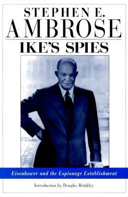
    Ike's Spies CoverIke’s Spies: Eisenhower and the Espionage Establishment
    An historical biography by Dr. Stephen E. Ambrose with an introduction by Douglas Brinkley

    The historians among you should recognize Dr. Stephen Ambrose’s name and associate him with perhaps the most prolific chronicler of our day concerning the life and times of President (General) Dwight David Eisenhower.

    Dr. Ambrose, a renowned historian, authored more than 30 books in his lifetime and more than half of them concerned Dwight David Eisenhower during some key period of his life.

    The film rights to two of his more famous books were purchased by Steven Spielberg and Tom Hanks, who used Citizen Soldiers and Band of Brothers to make the 13-hour HBO mini-series Band of Brothers.

    Cover: Band of BrothersDr. Ambrose once described his writing style: “As I sit at my computer, or stand at the podium, I think of myself as sitting around the campfire after a day on the trail, telling stories that I hope will have the members of the audience, or the readers, leaning forward just a bit, wanting to know what happens next.” And this is just the style that makes this history a page-turner. Even though you may know the outcome of the historical event, it is the insider’s view that makes this book such a fine read.

    Until next time, happy navigating, and read a good book — but first get out your GPS device owner’s manual or look it up on your iPad or computer for video tutorials, and peruse them for awhile. It could save your life one day.


  • Ford Studies Space Robots for Connected Vehicle Communications

    Ford is studying communications between space robots and Earth to enhance future applications of the connected-car communications protocol. The research furthers the company’s commitment to the development of connected vehicle communications to help reduce traffic congestion and aid in the advancement of emergency vehicle communication methods, Ford said.

    Ford has launched a three-year research partnership with the telematics department of St. Petersburg Polytechnic University in Russia in its association with that country’s space industry. The goal is to analyze space-based robotic communications systems for vehicle mesh networks to aid in mobility solutions.

    The development of connected vehicle communications has the potential to reduce traffic accidents and ease congestion by enabling vehicles to communicate with each other, and to communicate with buildings, traffic lights, the cloud and other systems to deliver a message or detect and respond to imminent collision warnings.


    Webinar: The Connected Vehicle

    All major international car-makers are installing telematics units, sending a signal that wireless information and connectivity is here to stay in the vehicle, and location will be a big part of the growth. To learn more about the rapid changes in the connected vehicle field, tune in to our September 19 webinar, hosted by Wireless LBS editor Janice Partyka. Registration is free.


    “Ford has been committed to the research and development of connected vehicle communications for more than a decade,” said Paul Mascarenas, chief technical officer and vice president, Ford research and innovation. “Our participation in this research can aid in the development of next-generation Ford driver-assist technologies. These technologies will globally benefit Ford customers, other road users and the environment.”

    Emergency Situations. One promising development from Ford’s research project with St. Petersburg Polytechnic University is the advancement in emergency vehicle communication methods. Ford is analyzing how emergency messages should be sent to ensure delivery if network failures were to occur, identifying the systems and methods that provide redundancy in case of primary delivery failure.

    For example, if an accident were to cause vehicle-to-cloud communications (V2C) to be broken, a vehicle may still have access to a vehicle-to-vehicle (V2V) communications network. An emergency signal message could potentially be sent through V2V to a vehicle nearby, and then between vehicles and infrastructures until it reached EMS.

    “The research of fallback options and robust message networks is important,” said Oleg Gusikhin, technical leader in systems analytics for Ford. “If one network is down, alternatives need to be identified and strengthened to reliably propagate messages between networks.”

    Space Telematics. Telematics — the long-distance transmission of digital information — developed for use on space stations provide excellent potential for improving the reliability of future vehicle-to-cloud, vehicle-to-infrastructure, vehicle-to-vehicle and other forms of communication (V2X). The communications blend multiple networking technologies including dedicated short-range communication (DSRC), cellular LTE wireless broadband and mesh networking to ensure robust and reliable connectivity for optimum signal strength for critical messages.

    Using the knowledge accrued from analyzing the space robots, Ford engineers could then develop an algorithm that is integrated into the V2X system resulting in a message that would route through the appropriate network depending on the level of its importance. An emergency message, for example, may be communicated through the faster mesh network, whereas an entertainment-related message would route through a vehicle-to-infrastructure application, an embedded device or a brought-in device network.

    “We are analyzing the data to research which networks are the most robust and reliable for certain types of messages, as well as fallback options if networks were to fail in a particular scenario,” said Oleg Gusikhin, technical leader in systems analytics for Ford. “In a crash, for example, a vehicle could have the option to communicate an emergency though a DSRC, LTE or a mesh network based on the type of signal, speed and robustness required to reach emergency responders as quickly as possible.”

    The specific space robots leveraged for Ford’s telematics analysis include the JUSTIN Humanoid, EUROBOT Ground Prototype and NASA Robonaut R2.

    Here is a video showing how Ford is studying space robot communications.

    Findings from this work could potentially enhance Ford’s wireless communication technologies and Blueprint for Mobility. Ford’s Blueprint for Mobility details the company’s vision on how to tackle the issues of mobility in an increasingly crowded and urbanized planet between now and 2025.

  • USGS Releases Updated U.S. Topo Maps of Alaska

    AK_Fairbanks

    The U.S. Geological Survey (USGS) announced that more than 400 new topographic maps are now available for the state of Alaska. The new maps are part of the U.S. Geological Survey Alaska Mapping Initiative, to update foundational data for the state and to replace the existing maps that are about 50 years old.

    “These new digital maps of Alaska are elevating our visual record of the surface of the state to 21st century levels,” said Anne Castle, Assistant Secretary of the Interior for Water and Science.  “The associatedadvances in human safety, navigation, and natural resource management cannot be overestimated. The productive partnership between the State government and the USGS is facilitating acquisition of the necessary data to complete digital mapping of Alaska, which is a critical chapter in the history of our geographical knowledge of the North American continent.”

    The first 400-plus new US Topo maps for Alaska are now accessible and are the beginning of a multi-year project, ultimately leading to more than 11,000 new maps for the entire state. The goal of the AMI is the production of a complete series of digital topographical maps at a scale of 1:25,000 to replace the 1:63,360-scale maps produced about 50 years ago. The maps will be published in digital PDF format (GeoPDF) and are available for free download and manipulation on a computer.

    These new maps include several layers, with an option for the user to turn them on or off. Major updated features include:

    • Satellite image layers which allows a recent view of the earth’s surface.
    • Contours and shaded relief layers showing the lay of the land derived from newly acquired 5-meter radar elevation data.
    • Surface water features from the USGS National Hydrography Dataset, which are updated by local stewards and USGS.
    • Glaciers updated using Randolph Glacier Inventory data.
    • Boundaries integrated from multiple sources, including Census and major Federal landholders.
    • The Public Land Survey System layer from the Bureau of Land Management.
    • Roads from a commercial vendor under a USGS contract.
    • Railroads and the Trans-Alaska oil pipeline data from local sources.
    • Important buildings including police stations, schools, and hospitals.
    • Airports, heliports and seaplane landing strips compiled by USGS from multiple sources.
    • Feature names from the USGS-maintained Geographic Names Information System.

    To ensure that the maps meet current accuracy specifications and standards, the maps will be made using newly acquired elevation and imagery data from multiple state, federal and commercial sources. The map-making process will be largely automated using software specially adapted by the USGS to create approximately 11,275 digital map quadrangles, covering the entire area of the state.

    Mapping in Alaska did not keep pace with records for the rest of the nation as a result of difficult terrain, remote locations, and vast distances. Modern mapping information does not exist over the majority of land in the state. Prior to this effort, topographical maps for much of Alaska were about 50 years out of date and not produced to current standards, which rely largely on high resolution digital imagery and elevation data. As a consequence, essential public services have suffered, among them transportation planning and safety, urban and regional planning, economic development, natural resource management, conservation and scientific research.

    This new generation of digital topographic maps will continue the rich and valuable USGS cartographic history, and serve the Nation by providing reliable scientific information to describe and understand the Earth; minimize loss of life and property from natural disasters; manage water, biological, energy, and mineral resources; and enhance and protect quality of life.

    For more information and download, go to: http://nationalmap.gov/alaska/

  • Garmin Updates Astro GPS Dog Tracking System with the DC 50 Collar


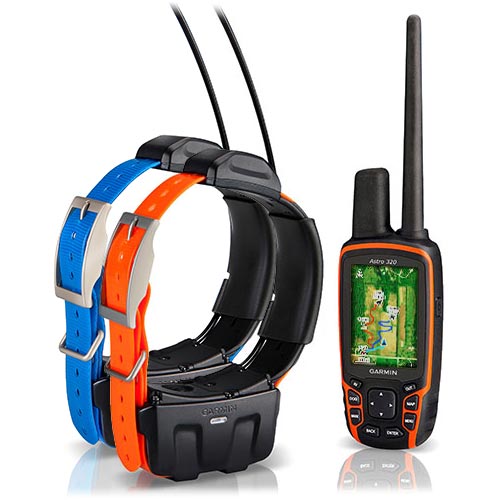
    Garmin International Inc. now offers the DC 50 – a new and improved GPS dog tracking collar that’s even more robust and reliable than previous models.

    “From more reliable satellite reception to a more rugged design, the new DC 50 gives sporting dog owners what they’ve been asking for,” said Dan Bartel, Garmin’s vice president of worldwide sales. “The new DC 50 has the features that will bring the benefits of GPS tracking to first-time users, and will convince existing Astro customers to upgrade.”

    The DC 50’s main housing sits below the dog’s neck while a low-profile, high-sensitivity GPS antenna is now positioned atop the dog’s neck, providing a clearer view of satellites.  In addition to tracking GPS satellites, the DC 50 can also utilize the GLONASS system. When using GLONASS satellites, acquisition time is (on average) approximately 20 percent faster than using GPS.  And when using both GPS and GLONASS together, the receiver has the ability to lock on to 24 more satellites than when using GPS alone. In practical terms, that means sporting dog owners will spend less time waiting for the collar to acquire satellites before the hunt, and the collar will better maintain its location even in heavy cover and deep canyons during the hunt.

    The Garmin Astro 320 GPS tracking device with two DC-50 collars.
    The Garmin Astro 320 GPS tracking device
    with two DC-50 collars.

    The newly redesigned 22.5-inch long VHF antenna is made of braided steel that’s built to take any punishment that hard-charging dogs can deliver.  Hunters can track their dogs up to nine miles in flat, unobstructed ground as often as every five seconds.  A shorter 18.5-inch antenna is also included.

    The battery life of the DC 50 has improved over previous generations, too.  At a five second update rate, the DC 50 will get approximately 26 hours of battery life when fully charged.  By slowing the update rate down to once every two minutes, the DC 50 collar can get up to 54 hours of use.   As a safety feature, the DC 50 also has a selectable Dog Rescue mode, which automatically switches the DC 50 to a two minute update rate when the battery is less than 25 percent charged – making it easier to recover a lost dog.

    For houndsmen, the DC 50 also features built-in Bark Detection, which alerts a hunter when their dog is barking frequently, even out of earshot.  Users can customize the Bark Detection feature to adjust the frequency of barking and the manner in which the user is notified (visual, tone, vibration, or a combination of each).

    The DC 50 features a standard one inch coated polyurethane collar strap that can be swapped out for a different color to easily distinguish between multiple dogs.  The collar transmitter is waterproof to 10 meters (33 feet).  Shipped alone, the DC 50 features a blue collar, and when purchased in conjunction with an Astro 320, the collar strap is orange.

    When paired with the Astro 320, the system can track up to ten dogs per receiver at once, and will indicate the dog’s distance, direction, and status (sitting, running, pointing, or treeing).  The Astro 320 features a full color, sunlight readable display with a pre-installed basemap.  In addition to the pre-installed basemap, the Astro can be loaded with optional 100k Topo or 24k Topo maps or photorealistic BirdsEye Satellite Imagery.  Many third-party specially-designed hunting maps are also available.

    The DC 50 is compatible with Astro 320 handhelds that are currently in service, but users must download a free software update to their handheld before pairing the new collar, by visiting www.garmin.com/webupdater.  The DC 50 is not compatible with the Astro 220 handheld or the Alpha Track and Train system.

    Purchased alone, the DC 50 has a minimum retail price of $229.99, and the DC 50 bundled with the Astro 320 system has an MRP of $599.99.

  • Averna, National Instruments Team on Recording and Playback of RF Signals

    AvernaRF
    Photo: Averna

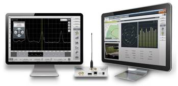
    Averna, developer of test solutions and services for communications and electronics device-makers worldwide, now offers RF Studio for National Instruments Software Defined Radio Platform (USRP), converting the USRP into a portable and cost-effective RF system for the recording and playback of real-world GNSS signals.

    National Instruments USRP is an affordable, PC-hosted platform used with NI LabVIEW system design software to build powerful wireless communications systems for research and education, Averna said. RF Studio is Averna’s proprietary software platform designed to streamline work with real-world RF signals. It provides user-friendly modules for capturing, processing, analyzing, archiving, and playing back RF spectrum while also maintaining the signal-recording context.

    Working together, Averna and National Instruments teams developed RF Studio for the USRP, an innovative and portable solution to record and play back live RF environments to accelerate RF project work. RF Studio’s LabVIEW compatible plug-in support delivers great value to LabVIEW users as it gives them quick access to a rich toolset for their in-house applications, and supports additional capture sources and customized views.

    “RF Studio for the USRP is the only cost-effective and portable product on the market that offers the flexibility to cover a wide variety of use cases, thus making it a very competitive solution for general-purpose RF record and playback,” commented Brendan Wolfe, Director of Market Development for Averna. “We’ve been working very closely with the NI teams to bring this innovative solution to market, and we expect great success from this solution partnership.”

    RF Studio for the USRP offers these features:
    ·  Record and play back real-world RF signals, up to 40 MHz wide
    ·  Capture actual RF spectrum like FM, DAB, GPS, GLONASS, and cellular
    ·  Visualize and record weak signals with the Noise Figure view
    ·  Advance signal analysis with the Spectrum, Histogram, and Power views
    ·  Use simple RF-chain configuration tools to quickly detect and set up the recording environment
    ·  DriveView option: Log video, audio and NMEA data at the same time as recording RF

    “The combination of RF Studio and the USRP provides a flexible, affordable solution for RF record and playback. Now in addition to prototyping wireless communications systems in LabVIEW, users can test them by reproducing realistic RF environments in the lab,” said Erik Luther, Wireless Communications Group Manager for National Instruments.

    RF Studio for the USRP is available now to customers worldwide through National Instruments’ LabVIEW Tools Network.

  • NovAtel Offers Commercial Tactical-Grade MEMS IMU

    NovAtel Offers Commercial Tactical-Grade MEMS IMU

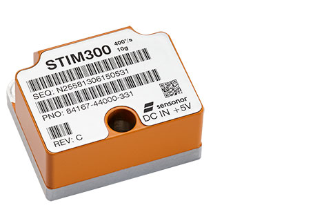
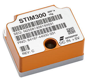
    NovAtel OEM-IMU-STIM300.
    NovAtel OEM-IMU-STIM300.

    NovAtel has added Sensonor’s commercially exportable OEM-IMU-STIM300 to its SPAN GNSS + INS line of positioning products. The OEM-IMU-STIM300 is a Micro Electromechanical System (MEMS) Inertial Measurement Unit (IMU) that integrates with NovAtel’s OEM6 receiver technology to provide a powerful 3D continuous position, velocity and attitude solution, the company said.

    The distinguishing characteristic of the OEM-IMU-STIM300 is its small form factor with tactical-grade performance capabilities. “As an OEM supplier, our customers come to us with a wide range of application demands. The addition of the OEM-IMU-STIM300 to our SPAN portfolio enables us to provide a cost-effective solution for weight and space constrained environments without having to compromise performance in any way,” said Jason Hamilton, NovAtel director of marketing.

    NovAtel’s proprietary MEMS Interface Card (MIC) integrates the OEM-IMU-STIM300 with NovAtel’s OEM6 receiver products for full SPAN navigation capabilities. The product will be available as an integrated single-enclosure SPAN solution (SPAN-IGM-S1), enclosed standalone IMU (IMU-IGM-S1) for use with external SPAN-enabled receivers, and as an OEM component (OEM-IMU-STIM300).

    OEM-IMU-STIM300 is available for delivery in September, followed by SPAN-IGM-S1 and IMU-IGM-S1 in November 2013.


  • Kickstarter Comes to GPS; Plus, Jammers and Field Technology Conference

    $2,000 for an RTK base and rover? Yes, it’s real. Well, at least it seems real.

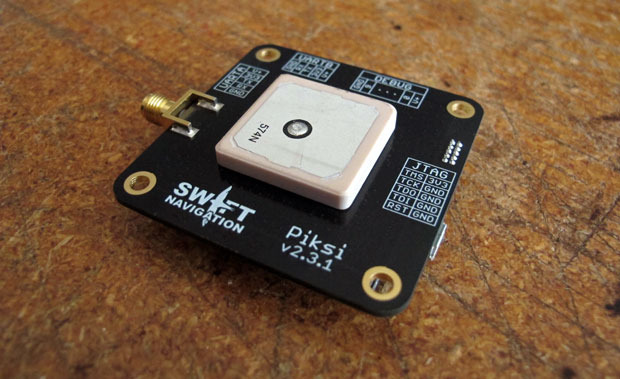
    For $2,000, you can order an RTK base and rover set named Piksi, including radios.

    Photo: Piksi (Swift Navigation)  Piksi_rugged

    It’s an intriguing opportunity, and might be the first brush stroke of the picture I’ve been painting (metaphorically speaking) for the past few years about inexpensive RTK receivers forthcoming. But, before you get really excited, read on.

    Besides the attractive price, something else that makes Piksi interesting is the way the company is financed. The way that a typical company funds new product development is through its own cash flow or financing. The company designs and produces a product, then announces it to potential buyers (you), who then touch, feel and use the product to understand how it performs…all before making the decision to purchase. Piksi (Swift Navigation) doesn’t follow that model.

    Piksi is using a new-age, crowd-sourced funding model called Kickstarter. With Kickstarter, a group of people (creators) offer to design and produce a certain product if they can recruit enough “investors” to fund their endeavor. The “investors” aren’t traditional venture capitalists, nor people who would own stock in said company. The investment is simply a commitment to buy the product based on the specifications provided by the creators, before the product is finished. If the company has enough commitments from “investors,” the creators commit to designing, building and delivering the product.

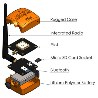
    Furthermore, there are certain levels of investment available for Piksi, from $7 which will get you a Swift Navigation micro-USB cable, to $2,000, which will get you a ruggedized version of the complete RTK kit, including base, rover, XBee radios, Bluetooth and SD card storage. So far, Swift Navigation has raised $161,369 towards the project with today, September 4, being the last day. That’s far more than the $14,000 goal it set.

    The caveat is that the product is not complete yet, at least the RTK portion. According to Swift Navigation:

    We have already built a small batch of Piksi receivers that are ready to ship and have locked down all part sourcing and manufacturing for further batches, so there are unlikely to be any unanticipated delays in the delivery of Piksi hardware.

    However, it’s difficult to know exactly how long the RTK functionality will take to implement — software development schedules seem to always run over their anticipated delivery dates, even when you take into account Hofstadter’s Law. We feel the goals we’re proposing to accomplish with this campaign are reasonable — adding a new set of software functionality (which we successfully implemented on a previous platform) upon an existing base of stable hardware and software.

    The gamble that the investor takes is that Swift will be able to finish the product, produce it, and meet the performance specifications. However, that’s only part of the battle. I spent better than 10 years of my life managing the design and production (somewhat) of GPS-based hardware and software for mapping and surveying. There are a million details. A major part of developing a hardware/software product like this is making it reliable. What I mean by reliable is that it behaves the same way every time you push the ON button, and works consistently and reliably all day until you press the OFF button. That’s not easy to achieve without a lot of sophisticated testing in different environments, and nothing can fix a poor reliability design (except a redesign).

    The guys behind the Piksi don’t seem to be total GPS-rookies, but do lack substantial real-world experience. Click here and then click on Bios to read about their backgrounds. But who knows? Maybe that’s an advantage, not being conditioned to “follow the rules.”

    One last note, and an important one. It’s only an L1 system, so don’t get too excited. L1 means that you really can’t use an RTK network (practically speaking) and that the baseline distance needs to be pretty short. The RTK initialization and re-initialization times will be measured in minutes, not seconds, and that’s assuming they get the RTK algorithms correct (and reliable).

    Sorry to burst your bubble.

    Actually, the concept of an inexpensive, bootstrapped L1 RTK system is not difficult to envision. The GPS OEM boards are readily available, as well as the GPS antennae, wireless comms and the rest of the components. At the risk of sounding pompous, I could put that kind of project together. The trickiest part of the project would be developing/implementing reliable RTK software.

    No matter what, it will be interesting to hear about what these guys come up with. In the words of the late Steve Jobs, “stay hungry, stay foolish.”

    GPS jammers are cheap, but don’t get caught using one.

    Even though they are illegal to market, sell and operate in the U.S., Americans are buying cheap GPS jammers, via Internet stores, from companies operating outside of the U.S. Operating one of these devices in the U.S. is a risky venture (as you’ll read below).


    Although they don’t seem to be a serious threat yet, they could become a threat as GPS receivers become more ubiquitous and concerns about privacy continue to ramp up.

    The Federal Communications Commission (FCC) is responsible for enforcing the U.S. laws enacted that prohibit the use of GPS jamming devices. If you look at the FCC’s enforcement history here, you’ll see that there isn’t much enforcement activity. However, a recent enforcement action was imposed on a guy in New Jersey who made the mistake of driving by the Newark International airport with his GPS jammer turned on. Uh oh. The FCC tracked down the offender and issued a Notice of Apparent Liability for Forfeiture that included a fine of nearly $32,000. Whoa, that’s a lot of dough. Wonder if he is trying to sue the company he bought it from? Not likely, as they are most certainly outside of the U.S. and out of reach of the U.S. judicial system. Caveat emptor.

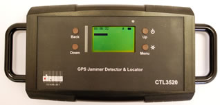
    You can be assured that if jamming reports increase, there will be more jamming detection and location equipment deployed to hold people accountable, like this new, handheld GPS jammer detector and locator from Chronos:

    Chronos_ctl3520

    You might want to visit this GPS.GOV website on GPS jamming. It contains a lot of information about the U.S. regulations surrounding the marketing, sales and use of GPS (and cell phone) jamming devices.

    Third annual Field Technology Conference

    FTC2013_logo

    In 2010, I, along with two colleagues, put together a conference here in Portland, Oregon, and named it the Field Technology Conference. We created the conference to focus on geospatial technology hardware and software used in the field. It’s the essence of what a conference should be, a group of people gathering to share ideas of common interest. It’s mostly devoid of commercial interests, save a few really neat (and valuable) giveaways and a few exhibit booths. You probably haven’t heard about the conference because we have a very small marketing budget, and the organizers (three of us) can only spend a few hours a month brainstorming, finding speakers, and organizing the event.

    This year, our third, will focus on existing and emerging technologies: GPS/GNSS, UAVs, 3D printing, mobile devices, imagery and geospatial software. Our outdoor demonstration area was very popular last year so we’ll offer that again, as well as a UAV demonstration. We’re also planning an on-site demonstration of 3D printing. Can you imagine 3D printing a topographic survey?

    Something new this year is our association with the CGSIC (Civil GPS Service Interface Committee). CGSIC is co-locating a regional event with our conference. What that means is that speakers from the U.S. government (Air Force, State Deptartment, DOT, etc.) will make GPS-centric presentations. CGSIC events are the only live communication channel between the U.S. Air Force GPS operations personnel and civilian GPS users. This is your chance to ask Air Force personnel questions, in person, that you’ve always wanted to know about GPS. If you’re unable to travel to Portland for the conference (October 23-24), GPS World magazine is planning on streaming the CGSIC presentations live over the Internet, as well as posting the recording on its website.

    Although the conference is organized by the Western Forestry and Conservation Association (which organizes a lot of conferences), take a look at the agenda and you’ll see the content will be of interest to anyone involved with geospatial data collection and processing technology, not just foresters and environmental scientists. For conference details, click here.

    Thanks, and see you next month.

    Follow me on Twitter at https://twitter.com/GPSGIS_Eric

  • USGIF Workshop Offers Preview of GEOINT 2013

    Two weeks ago, I attended a USGIF workshop in Huntsville sponsored by GEO Huntsville, through the considerable efforts of Directions Magazine Editor-in-Chief and Vice Publisher Joe Francica and his staff.  The United States Geospatial Intelligence Foundation (USGIF) is a non-profit dedicated to promoting the geospatial intelligence tradecraft across industry, academia, government, professional organizations and individual stakeholders.

     GEO Huntsville's Geospatial Intelligence (Geoint) Workshop was held August 14 at the Von Braun Center Civic Arena in Huntsville, Alabama.
    GEO Huntsville’s Geospatial Intelligence (Geoint) Workshop
    was held August 14 at the Von Braun Center Civic Arena in Huntsville, Alabama.
    Keith Masback, USGIF
    Keith Masback, USGIF chief executive officer.

    The workshop was a collection of geospatial-related presentations starting with Keith Masback, the USGIF chief executive officer, who gave an interesting history of NGA based on his extensive experience in the geospatial community.  He reviewed that NGA had a somewhat shaky start that grew out a vision of Rear Admiral Bill Owens, which was part of the 1996 “Joint Vision 2010” that formed the concept of network-centric operations. Looking at the past, the Joint Vision participants saw that the future would require a new way of doing intel business. They determined that information had to be brought near the user, not at some distant command center. It would need to be as close to real time as possible. It would have to be precise and able to ID combat targets.  It would have to be integral with missile defense and provide detailed urban data.

    So in 1996, the NIMA (National Imagery and Mapping Agency) was formed by combining the DMA (Defense Mapping Agency) and the CIO (Central Imagery Office).  The merging of mapping and imagery communities proved very difficult as the two cultures collided. Even the internal NIMA commission was bent on dissolving the marriage. Fortunately, after working through the issues, the commission came to the conclusion that the marriage was really in the best interest of the country and both communities.

    It was also at the same time that Jim Clapper took over the week of 9/11. That event sharply focused everyone’s minds. General Clapper decided that the best way to unify the command was to get rid of the separate words “imagery” and “mapping” — thus was born the new title National Geospatial Intelligence Agency, and to put it in the same company of other three-letter agencies, it was dubbed NGA. NGA really worked hard to meet the vision set in 1996.  Keith cited the Bin Laden apprehension as a good example.

    He then explained how NGA felt it needed to evolve. He cited the example that our troops needed to be as location enabled as kids are with their mobile devices. Crowd sourcing is playing an ever-increasing roll, and despite the belief that the cyber world is locationless, location is a very real aspect of cyber warfare. Users have locations as well as servers and the interconnecting framework. Asymmetrical urban warfare demands even more precise location mapping, including building interiors. Keith cited Robert Scoble’s keynote at The Next Web Conference Europe as a must-view video by everyone in the geospatial community, to place his comments in context. Robert Scoble and Shel Israel are going to be keynote speakers at GEOINT 2013.

    Additionally, although the military is taking a lion’s share of sequestration cuts, the two areas that are not seeing significant cuts because of WMDs are ISR (intelligence, surveillance, and reconnaissance) and cyber. He said that some people question the need for geospatial capabilities in a cyber world, but he quickly cited that servers have locations, that networks have locations, and most hackers/persons of interest have locations, which also point to the growing need for indoor urban tracking of users. And all this takes on even more significance with the proliferation of WMDs.  Although not as immediate, NGA is also very supportive and promotes STEM (science, technology, engineering, and mathematics) education so we maintain the pipeline of talent. He also talked about the growing drumbeat for geospatial intel certification, especially for contract work.

    Randy Jones of the Missile and Space Command spoke of the much shorter timelines of intelligence and needed action, that we have a flood of information but have a poverty of attention. That there is a growing need for “object-based intelligence” or, as some refer to it, “activity-based intelligence.”  The flood of data is overwhelming analysts, and NGA is looking for increasingly sophisticated algorithms to sort the massive data collections. The are many opportunities for small, innovative companies in this arena to help DIA, NGA, and NSA.

    Robert Zitz of SAIC gave his take on current actions in Washington. He quoted James Clapper as saying, “We’ve run out of money, so now we have to think.” He also cited Latisha Long that although DoD was seeing 5% sequestration cuts, DHS may see increases to its budget due to WMD and cyber concerns, specifically power, water and transportation. (As a side note, I harp to all my family members and friends the need to heed the DHS warning for all citizens to maintain a two-week supply of food and water in their home.)  There is also special attention being given to joint efforts of special operations, cyber security and border security.  Those intel dollars are increasing especially for real-time data collection, multi-int fusion and predictive analytics.

    A representative from Sierra Nevada and L3 talked about wide area air surveillance (WAAS), specifically Gorgon Stare and the domestic manned aircraft version Vigilant Stare, which is also being linked with full-motion video. The key issue is analytics to filter and provide timely actionable intelligence.

    MIC cameras from Bosch Security Systems feed a Coastal Remote Monitoring Program for the Alabama Department of Conservation and Natural Resources.
    MIC cameras from Bosch Security Systems feed a Coastal Remote Monitoring Program for the Alabama Department of Conservation and Natural Resources.

    A very clever use of lower cost, off-the-shelf hardware to solve a critical need was presented by Major Scott Bannon of the Alabama Marine Resources Division and Tim Erwin of Crystal Data International. Major Bannon’s small staff is tasked with monitoring more than 600 miles of Gulf Coastline. They installed a network of ruggedized video cameras, some in very remote locations, that were connected via a wireless network with all the cameras controlled by the users.  This is not much different than many systems seen in urban areas, but the challenge was building a  rugged system with some very remote locations lacking power or connectivity.  The cameras were geo-referenced on Google Earth and controllable by his staff from mobile devices.  Although the images are not directly geo-referenced, their position coupled with user knowledge permitted them to search and identify objects in the water accurately enough to task rescue assets to craft in distress. The night low-light imaging capability helped in several high-interest events.  A new version will provide accurate azimuth data recorded with the imagery.

    Dr. Michael Botts presented his work to develop common standards for web enablement of sensors. SML (Sensor Markup Language) is being backed by the OGC to permit sensor web enablement (SWE). See the OGC website for more details.

    The workshop was closed by Sandra Broadnax, the NGA Small Business Programs director.  Her presentation was probably the best received session because of her infectious enthusiasm. She explained how NGA Director Long was extremely supportive of small business innovations and contributions to the intelligence community. She explained how NGA maintains a very comprehensive list of changing requirements on both the high and low sides. She strongly encouraged all geospatial firms to monitor the NGA site, since there were many opportunities that are not published in FedBizOps. At the session she wasted no time building connections by identifying those who had SCIFs in Huntsville and those who might need access so they could view and respond to classified requirements.

    So, the key topics that I believe will dominate GEOINT 2013 are:

    • Persistent wide area air surveillance
    • Social media, big data, human geography
    • Every individual a consumer and provider of intel data
    • “Object” or “Activity” based intelligence, even inside buildings
    • Integration of real-time actionable intelligence to users in the field
    • The geospatial links of cyber threats

    As you can see, even in the short span of one year, the geospatial community continues to evolve significantly. I’m going to attend GEOINT 2013 in October and the GaTech Research Institute GIS conference Spatial Plexus in November.  If you see me, please introduce yourself.

  • Raytheon GPS Launch and Checkout Capability Cleared for Test

    Raytheon GPS Launch and Checkout Capability Cleared for Test

    Photo; Raytheon Company

    Raytheon Company has received Interim Authorization to Test (IATT) security certification for the Global Positioning System Next Generation Operational Control System (GPS OCX) Launch and Checkout System (LCS) four months ahead of schedule.

    Raytheon received a one-year certification with no liens, meaning the government does not require any changes. The LCS IATT certification enables Raytheon to move to the next stage of testing the Launch and Checkout System in preparation for launch of the first GPS III satellite.

    “Successful IATT certification ahead of our original schedule demonstrates not only that Raytheon meets the U.S. Air Force’s high standards for information assurance as we develop this critical national system, but also the efficient efforts of our government partners,” said Matthew Gilligan, Raytheon’s GPS OCX program manager and a vice president in Raytheon’s Intelligence, Information and Services business. “Typically IATT certification is given for six-month increments; the LCS one-year accreditation speaks to the quality of the information assurance design and threat protection.”

    The Interim Authorization to Test not only includes the LCS, but also Lockheed Martin’s GPS III satellite support systems, including the Exercise and Rehearsal Training Tool and Upload Generation Tool.

    The next-generation GPS ground-control system, known as OCX.
    The next-generation GPS ground-control system, known as OCX.

    Raytheon’s OCX and the Lockheed Martin-built GPS III satellites are critical elements of the U.S. Air Force’s effort to modernize the GPS enterprise while improving capabilities to meet the evolving demands of military, commercial and civilian users worldwide. OCX is being developed in two “blocks” using a commercial best-practice iterative software development process. There are seven iterations in Block 1 and one in Block 2. LCS is the fifth Iteration of Block 1, and it successfully completed Critical Design Review in June 2013.

    The first GPS III satellite is in production at Lockheed Martin and expected to be delivered to the U.S. Air Force “flight-ready” in mid-2014. GPS III satellites are expected to deliver three times better accuracy, provide up to eight times more powerful anti-jamming capabilities, and include enhancements that extend spacecraft life 25 percent further than the prior GPS block. The GPS III also will carry a new civil signal designed to be interoperable with other international global navigation satellite systems, enhancing civilian user connectivity.