Author: Alan Cameron

  • Leaders recognized at 2018 GPS World Awards Dinner

    Leaders recognized at 2018 GPS World Awards Dinner

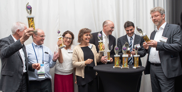
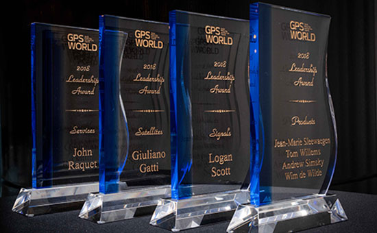
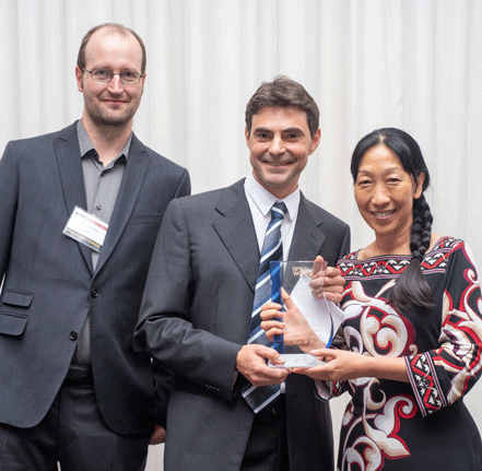
    Four innovators in the fields of satellites, signals, services and products accepted Leadership Awards for 2018 from this magazine at the GPS World Leadership Awards Ceremony and Dinner on Sept. 27 in Miami. Their remarks at the podium directed the audience of PNT industry and research community VIPs to key challenges for the future.

    Satellites

    Javier Benedicto, left, accept the Satellites Leadership Award on behalf of Giuliano Gatti of the European Space Agency, from Phil Froom of Rockwell Collins. (Photo: Melanie Beus)
    Javier Benedicto, left, accepts the Satellites Leadership Award on behalf of Giuliano Gatti of the European Space Agency, from Phil Froom of Rockwell Collins. (Photo: Melanie Beus)

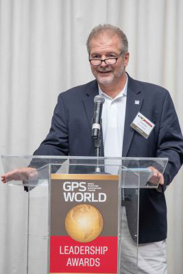
    Kicking off the ceremony, Phil Froom of Rockwell Collins mentioned that “Rockwell Collins and QinetiQ [have] signed an alliance agreement  to produce a new family of high-assurance, multi-constellation GNSS receivers for professional and military use. This new family of receivers is aimed to be complementary to the current encrypted family of Rockwell Collins receivers in service across the globe, but allow the customer to select the level of capability and protection based upon operational, political or even financial needs.”

    GPS World Leadership Dinner 2018 (Melanie Beus photo.)
    (Photo: Melanie Beus)

    Froom conferred the Satellites Award upon Giuliano Gatti of European Space Agency, for his contribution to setting up the Galileo constellation, as Space Segment Procurement Manager, from GIOVE-A through all current operational satellites, a total of 26 deployed in 7 years.

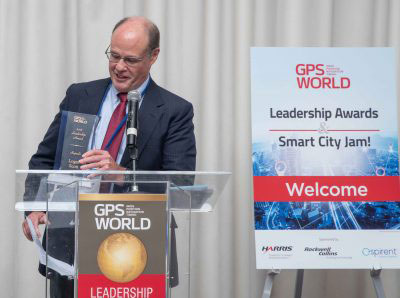
    Accepting the Award on Gatti’s behalf, Javier Benedicto of ESA told the crowd about “two moments in his [Gatti’s] professional life that were very beautiful and very difficult. The beautiful moment was January 12, 2006, when the very first Galileo satellite, GIOVE-A, started transmitting the first Galileo signals.  The most difficult moment was on August 27, 2014, when we saw that Soyuz rocket deploy our satellites a few thousand kilometers before the intended orbit. We thought, how are we going to recover? Today, the satellites are working, and they will be injected into the constellation in a few months.”

    [The full text of remarks by both award conferrers — Leadership Dinner sponsors Rockwell Collins, Harris and Spirent Federal — and award recipients will appear in the December issue of the magazine. Jointly with their remarks directing all in the PNT community to future challenges will appear the Directions 2019 special section: essays by the chief executive officers operating the GPS, GLONASS, Galileo and BeiDou constellations. Look for it!]

    Signals

    Joe Rolli, Harris Corporation. (Photo: Melanie Beus)
    Joe Rolli, Harris Corporation. (Photo: Melanie Beus)

    Joe Rolli from Harris opened by saying “I work with an amazing group in Clifton [New Jersey] that comes together, overcomes challenges, builds our [GPS III] payloads, and provides a system that everyone uses every day. I think we’ve gotten to the point where we can honestly say, almost nothing works without GPS.”

    “The challenge that I see [for the future] is  to overcome the politics: where do you draw the line between doing what’s right for the PNT solution for the common good and addressing your national security and your own agendas in protecting your own country.”

    After further comments, he called Logan Scott of LS Consultiing to the podium to receive the 2018 Signals award. Scott has been, in the words of the person who nominated him for the award, “an advocate for improved civil GPS security, and the inventor of a new asymmetric navigation security paradigm for civil GPS signals that avoids the need for secure key storage in civil GPS receivers and thus allows for widespread adoption in applications without physical security capabilities.”

    Logan Scott, LS Consulting. (Photo: Melanie Beus)
    Logan Scott, LS Consulting. (Photo: Melanie Beus)

    Scott spoke about the Chips-Message Robust Authentication (Chimera) for GPS Civilian Signals project, in which he was a key participant. “Chimera can offer security benefits far beyond what you see with data message-signing only.”

    “Moving forward, the challenge I offer to you all is this: how can we establish the integrity and truthfulness of position and time reports both locally and remotely to other people and mechanized devices? In a world of autonomous vehicles, crowd-sourced databases and geofenced capabilities and information access, and an insecure supply chain, it is not enough to say, ‘Well, I saw it on C/A code.’ ”

    Services

    This award, sponsored by Spirent Federal, brought Justin Eldredge to the microphone.

    Justin Eldredge, Spirent Federal (photo Melanie Beus).
    Justin Eldredge, Spirent Federal (Photo: Melanie Beus).

    “This year we maintain our position of being first to market with new signals, with the launch of SimMNSA. We’re currently in the final test phase of this new M-code option and it will delivering to several authorized customers by the end of the year. If M-code signals aren’t in the spectrum of testing for you, we offer products that simulate all other GNSS signals, plus a variety of other sensors.”

    Eldredge introduced John Raquet, professor at the Air Force Institute of Technology. Raquet was nominated and subsequently voted as winner of the Services award for work he and his team at the Autonomy & Navigation Technology (ANT) Center developed on PNT sensors and systems utilizing almost every available source, including GPS, GNSS, inertial, vision, lidar, magnetic field, pseudolites, radar, terrain mapping, signals of opportunity, star trackers, radio ranging, 3D audio, X-ray pulsars, clocks, and more.

    John Raquet, U.S. Air Force Institute of Technology (Melanie Beus photo).
    John Raquet, U.S. Air Force Institute of Technology (Photo: Melanie Beus).

    “Sometimes I called the ANT the Crazy Idea Factory. We’ve tried lots and lots of things,” said Raquet. “I think I have the best job in the world, because I get to experiment with many, many things, and work with amazing people.”

    “This is not the kind of community where you build something once and you’re done, you put it away. This is a growing worldwide enterprise that takes new talent to come in and fill the spots that many of the people in this room have occupied. I’m privileged to see some of the students that we’ve worked with to then go on and fill some of the gaps, really do some amazing things.”

    Products

    Jade Morton, who herself received a Leadership Award in 2015,  introduced the final honor of the evening.

    “There’s a community of people kind of like you guys, a few of them are sitting here, who are crazy about the atmosphere. That’s their livelihood. They’re talking about how to use satellite navigation technology to monitor the atmosphere, to provide forecasting and modeling technologies. All of these effects, we [navigation engineers] have done everything we can to filter them out, to make them go away. But this company built a system to analyze the real traits that the atmosphere has imprinted on GNSS signals.”

    Jean-Marie Sleewaegen from Septentrio then accepted the Products award, jointly on behalf of his colleagues Tom Willems, Andrew Simsky and Wim de Wilde. The company’s PolaRx5S receiver supports worldwide ionosphere monitoring, providing multi-frequency multi-GNSS measurements with low phase noise, high data rates, and flexible configurations, and enabling many Earth-observing applications ranging from ionospheric scintillation characterization to tectonic movements monitoring.

    Wim de Wilde and Jean-Marie Sleewaegen, Septentrio, and Jade Morton, University of Colorado (Melanie Beus photo).
    Wim de Wilde and Jean-Marie Sleewaegen, Septentrio, and Jade Morton, University of Colorado (Photo: Melanie Beus).

    Sleewaegen said, “We continue to cherish our close ties with the research community. While most of us dream of getting rid of these error sources and these perturbations, atmospheric research scientists don’t want us to filter them out — they want to focus on them and see them in their full glory! The technology that we developed [to both mitigate and preserve the perturbations] is now at the heart of all of our receivers.”

    “With the avalanche of new signals and constellations that we see — in some regions of Asia you can now see more than 60 GNSS satellites — the question is how to absorb, process and use that huge amount of data. All these questions are still not answered and will definitely keep us busy for years to come.”

    The GPS World Dinner and Awards Ceremony are held annually at the time of (although separately from and independent of) the ION GNSS+ conference. Nominations for the awards come from a group of 40 industry executives and researchers. A ballot of the nominees is then circulated to a larger group of similar make-up.

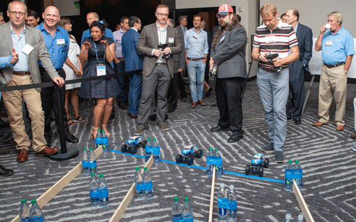
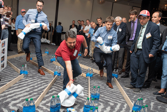
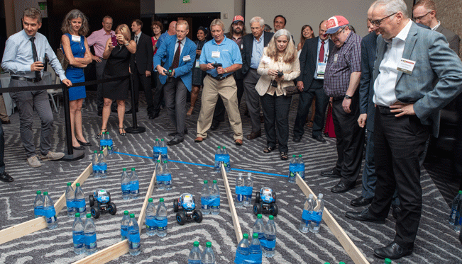
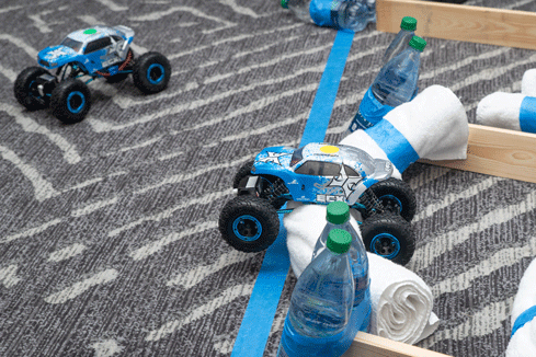
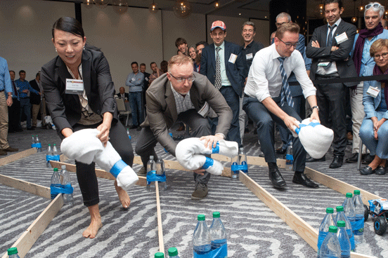
    The festive evening concluded, after dinner and dessert, with the Smart City Jam!, a group exercise in navigation and obstruction. Details in the December issue.

    At the Smart City starting line (Melanie Beus photo).
    At the Smart City starting line (Photo: Melanie Beus).
    Smart City jammers in action (Melanie Beus photo).
    Smart City jammers in action (Photo: Melanie Beus).
    And they're off! (Melanie Beus photo)
    And they’re off! (Photo: Melanie Beus)


    Last gasp, struggling to finish in second (Melanie Beus photo)
    Last gasp, struggling to finish in second place (Photo: Melanie Beus).
    GPS World Leadership Dinner 2018. You wouldn't think that professional navigation engineers would be so enthusiastic about jamming (Melanie Beus photo).
    You wouldn’t think that professional navigation engineers would be so enthusiastic about jamming (Photo: Melanie Beus).


    GPS World Leadership Dinner 2018 Somehow, the team of Leadership Award winners (LOQUATRIO) ended up winners of the Smart City Jam! as well. Smart drivers (or jammers) (or both). (Melanie Beus photo).
    Somehow, the team of Leadership Award winners (LOQUATRIO) ended up winners of the Smart City Jam! as well. Smart drivers (or jammers) (or both). (Photo: Melanie Beus).


  • ION GNSS+ 2018 plenary keys in on Emergency Location Service in Android

    ION GNSS+ 2018 plenary keys in on Emergency Location Service in Android

    Reflecting the dramatic changes and advances that have taken place in the applications of positioning technology over the last decade, the plenary session of the 37th meeting of the Institute of Navigation’s Satellite Division did not discuss satellites at all. Instead, two keynote speakers elaborated upon the application of positioning to emergency response services and to airborne mapping with lidar technology.


    Emergency Location Service (ELS) in Android

    Steve Malkos, technical program manager at Google, told the audience of approximately 800 that the new emergency location service “is our passion project at Google. Just last week we announced the expansion of ELS into the U.S. It’s here and it’s ready today. But the work isn’t done yet because of various challenges.” Google’s goal is 1-meter location accuracy for all 911 calls placed on cell phones. The algorithms discussed at ION this week, Malkos said, are part of what is driving Fused Location Provider (FLP)
    toward this future.

    In FLP, locations are computed directly on the handset as opposed to the older method, which computes on the carrier’s cell network. Google’s indoor solution consists of wi-fi augmented by network information.

    Recently released statistics show emergency call usage has flipped from what it was only a decade ago. Now, only 20 percent of emergency calls are placed on landlines. Eighty percent are placed on wireless devices.

    Malkos replayed audio from a call made recently, prior to activation of ELS, that generated a location on Miami’s emergency services of 500 meters away from the basement ballroom of the conference hotel.

    Domino’s Pizza, Uber ride service and Facebook all now use the hybrid derived location from cell phones, while emergency services typically use the location computed on the carriers’ network, and relying on cell-tower positioning. Cells range from 100s of meters to kilometers in size.

    ELS has been live in the U.K. since June 2017. Since its activation, British Telecom’s mean radius accuracy on emergency calls went from 2 kilometers to 43 meters 85 percent of timeION20.

    Malkos discussed the challenges of privacy, altitude (Z-axis) and the related difficulties in the urban high-rise landscape of floor determination and infering floor labels.

    Overall, he said, statistics show that each 1 minute sooner of arrival of emergency services translates to 10,000 saved lives.

    A Lidar History

    Paul LaRocque, vice president of special projects at Teledyne Optech gave an overview of light detection and ranging (lidar) development through the lens of a one-company centric history, that of Teledyne.

    Lidar got started in 1969, within a decade of the invention of the first laser. It began with early work in marine mapping and bathymetry from onboard ships. Airborne lidars developed in the late 1970s, looking at icefields in the Arctic, and was done at first with no absolute positioning to aid in analyzing the results..

    Early on, developers discovered that airborne lidar can get to the bare earth, penetrating under forest canopy. This eventually led to the recent dramatic discoveries of long lost Mayan cities, covered by jungle.

    In the early 1990s, GPS and inertial technologies converged, with some miniaturization, to enable building of integrated technology systems that added absolute positioning to the lidar toolbox.

    LaRocque provided a quick look at the National Geographic story, based on data from a three-wavelength Teledyne Optech Titan, one of several current machines that are generating data at millions of shots per second. Increasingly, it’s the software processing that brings out the accuracy, for example, centimeter accuracy surveyed from a kilometer up in the air.

    Challenges enumberated:

    • the speed of light is not fast enough.
    • the Earth is not flat enough.

    Teledyne developed PulseTRAK technology to cope with the “blind zones” generated by these two challenges, so as to not lose data in any gaps.

    The new frontier is spaceborne lidars. Teledyne is involved in a project tenerating lidar data from the surface of Mars on a Canadian space agency mission. This led previously to the discovery of snow in the atmosphere of Mars. The OSIRIES-Rex mission now on its years-long voyage to a very-far off asteroid represents the furthest adventure of lidar in space. The project will collect data on the asteroid’s surface and beam it back to Earth, as well as eventually returning some core samples.

  • DARPA wants photonic integrated circuits

    DARPA wants photonic integrated circuits

    High-energy photons emission (abstract illustration). (GiroScience/Shutterstock.com)
    High-energy photons emission (abstract illustration). (Photo: GiroScience/Shutterstock.com)

    The U.S. Defense Advanced Research Projects Agency (DARPA) Microsystems Technology Office is soliciting research proposals for the development of a new class of atom-based systems using integrated photonics and trapped atoms to enable high-performance, robust, portable clocks and gyroscopes.

    The military researchers are asking industry to develop relatively simple portable photonic integrated circuits (PICs) for high-performance position, navigation and timing (PNT) devices as an alternative to GPS for when satnav signals are not available.

    A PIC or integrated optical circuit, similar to an electronic integrated circuit, integrates multiple photonic (having to do with light) functions, providing capabilities for information signals imposed on optical wavelengths, typically in the visible spectrum or near-infrared, 850–1650 nanometers.

    A-PhI Program

    The Atomic-Photonic Integration (A-PhI) program seeks to develop trapped-atom based, high-performance PNT devices, reducing the complexity of these atomic systems by using PICs. According to the DARPA document, the PICs will replace the optical assembly behind devices such as sensitive and accurate angle sensors and clocks, while still enabling the necessary trapping, cooling, manipulation and interrogation of atoms.

    A-PhI aims to demonstrate that compact PICs can replace the optical bench of conventional free-space optics for high-performance trapped-atom gyroscopes and trapped-atom clocks without degrading the performance of the underlying physics package.

    Physics

    Atomic systems using trapped atoms have the potential to be made portable while maintaining their accuracy due to the atomic trap’s small size and the inherent isolation a trap offers an atomic system from the environment, especially from acceleration.

    Currently, these systems are bulky, heavy, and not notably portable, because of the complexity of the optical systems used to create the trap.
    In the past, efforts to miniaturize the hundreds to thousands of optical components in such benchtop systems have relied on removing optical elements, miniaturizing the remaining elements, and tightly integrating them in a small package.

    The products deliver degraded performance with the need to maintain very tight optical alignment, causing both poor environmental robustness and poor tolerance to design errors. Effective miniaturized atomic systems cannot be achieved at a reasonable cost with this approach.

    Recent developments in PIC research suggest that on-chip optical frequency combs based on microresonators, optical frequency synthesis, novel on-/off-chip coupling, wavelength demultiplexers, and on-chip phased arrays for dynamic manipulation of light fields can replace optical systems with readily manufacturable, low-cost chips without the alignment sensitivity of conventional free-space optics.

    Gyroscopes

    A-PhI also seeks to develop proof-of-concept trapped atom gyroscopes, a matter-wave analog of the interferometric fiberoptic gyroscope. Such a miniaturization effort could generate an order of magnitude improvement in angular sensitivity and dynamic range over current free-space products.

    A-PhI hopes to develop portable, high-performance, navigation and timing systems: the miniaturization of the optics of atomic systems without a decrease in performance.

    Subsequent work, the RFP asserts, will be required to incorporate the necessary compact and robust lasers and electronics to achieve a fully functioning, high-performance, portable PNT system.

  • Wireless and consumer emerge as key players for growth

    Wireless and consumer emerge as key players for growth

    The Now and the Mobile Next for SatNav

    With 106 operational GNSS satellites flying today (or was that yesterday’s number?) satnav’s backbone is robust, variegated, supportive of growth across many industries — and poised to leverage even more prosperity. I’ve seen forecasts of as many as 400 satellites, well beyond GNSS proper and involving low-Earth orbit telcomm constellations, constantly patrolling space above us and beaming down positioning, navigation and timing (PNT) intelligence.

    Where do you see your efforts focusing primarilly over the next decade? (Source: GPS World's 2018 State of the Industry survey)
    Where do you see your efforts focusing primarilly over the next decade? (Source: GPS World’s 2018 State of the Industry survey)

    A draft headline for the cover of this issue — The Sky’s the Limit! — actually underestimated. Not even the sky is the limit.

    Mobile. GNSS-enabled tablets and smartphones provide navigation, traffic and congestion maps to billions. These features will continue to drive demand for GNSS in all electronic equipment. As we move from the internet to the internet of things (IoT) as the dominant paradigm of advanced and developing societies, GNSS will boom louder than we have heretofore known it to do.

    What is the industry “Issue of the Year?” (Source: GPS World's 2018 State of the Industry survey)
    What is the industry “Issue of the Year?” (Source: GPS World’s 2018 State of the Industry survey)

    Communication and location-enabled transportation services such as Lyft and Uber provide only one example of novel GNSS uses that have become the norm.

    Tracking devices, whether personal, vehicular, or affixed to large assets, constitute a quiet though muscular growth market. The GPS tracking device generates high demand from industries such as information technology (IT), transportation, and telecommunication, providing real-time intelligence and advance diagnoses about products, vehicles and people, valued by consumers and businesses, enhancing security and safety — key concerns that will only grow in an increasingly vulnerable world.

    What is the key challenge for positioning and navigation in the wireless and consumer space? (Source: GPS World's 2018 State of the Industry survey)
    What is the key challenge for positioning and navigation in the wireless and consumer space? (Source: GPS World’s 2018 State of the Industry survey)

    Volume! The GPS tracking segment alone is expected to reach $2.53 billion by 2023, nearly 12% annual growth. Other mobile segments will increase in parallel. Don’t be deceived by the low-cost of low-accuracy tracking devices. Volume! Volume! Volume! is just as powerful a mantra as Location! Location! Location!

    With the wireless carriers and IoT behind it, GNSS will see growth a-plenty and virtually no downside. U.S. cell carriers are now selling access to your real-time phone location data, a key signal that economic giants put high value on the technology.


    For more results from the 2018 State of the GNSS Industry, see this page.

  • Opportunities for growth in the GNSS industry

    Opportunities for growth in the GNSS industry

    What is the greatest threat to GNSS over the next three years? (Source: GPS World 2018 State of the GNSS Industry report)
    What is the greatest threat to GNSS over the next three years? Click to enlarge. (Source: GPS World 2018 State of the GNSS Industry report)

    When we designed the survey of the global PNT community for the 2018 State of the GNSS Industry report, we put a couple of new wrinkles into the online questionnaire. We wanted to know, succinctly, what you felt was the number one obstacle to growth for your organization. And, with the same brevity, what you saw as the number one opportunity for growth.

    The answers most frequently given within each sector — mobile, OEM, survey, UAV, transportation, machine control, mapping and defense & government — appear on those respective pages in this issue. They weren’t the only answers, by far.

    Obstacles to Growth

    Other stumbling blocks that were called out included security, competitors (sometimes mentioned by name), politics (sometimes mentioned by party), budgets, funding, understanding, ignorance, management, bureaucracy, age, and that enduring favorite, time.
    The most frequently cited obstacles to growth were:

    • regulation, and
    • the lack of qualified staff, personnel, engineers.

    One ingenious survey-taker somehow found a way to cram 21 words into an answer box meant for only one or two. “In my industry, deep technical talent that addresses the specific issues. Without that, the ‘big picture’ judgments are often just wrong.”

    This problem is not new, nor is it particular to the GNSS/PNT industry. The fact that it is with us year after year suggests that it is not getting enough effective attention. Talented engineers can be imported, yes, if the homegrown supply falls short. In the current political climate, this may not be a strategy with legs. Even given a totally benign immigration regulatory landscape, it is far from a panacea. More on this in a moment.

    Growth Opportunities

    Various flavors of technology integration, both multi-GNSS and non-GNSS, led the pack in nearly every sector. Other popular answers included customization, broadband, autonomous navigation, Galileo, international markets, alt-nav, Brexit, the Cloud, M-code, anti-jamming, connectivity, flexibility, more clients, and, in riposte to the aforementioned obstacle: training, education, or simply engineering.

    The great American thinker Margaret Mead said, “We are continually faced with great opportunities which are brilliantly disguised as unsolvable problems.”

    If your organization encounters this perennial problem, this shortage of qualified staff that stifles innovation, inhibits growth, and causes you to pass on new ventures that are just out of reach, here’s the biggest whopping opportunity of all: get involved with higher education and engineering graduate schools in your area.

    The talent is there. If you’re not out actively cultivating, encouraging, training and recruiting it, those bright young engineering people will be drawn instead to Internet ventures or gaming software or other industries that sap the soul but nourish the pocket — and those are your true competitors.

  • PNT Board opposes Ligado ‘lite’ proposal, DARPA seeks photonics

    PNT Board opposes Ligado ‘lite’ proposal, DARPA seeks photonics

    On Aug. 10, the National Space-Based Positioning, Navigation, and Timing (PNT) Advisory Board, the government’s GPS expert board, sent a letter to the National Executive Committee for Space-Based PNT (a multi-agency body that steers GPS policy) that concluded, “We strongly recommend your opposition to the Ligado proposal.”

    The letter sprang from a unanimous vote five days earlier to oppose allowing Ligado Networks to use spectrum neighboring the GPS band for terrestrial communications.

    Ligado possesses licenses to broadcast on two satellite bands located adjacent to the GPS frequencies. The company has been seeking permission from the Federal Communications Commission (FCC) to repurpose these licenses from satellite-based use to ground-based use from powerful tower transmitters.

    Ligado said in May it would lower the power in its proposal for the 1526–1536 MHz band to 9.98 dBW to avoid interference with certified aviation receivers. However, the PNT Advisory Board reiterated its opposition, saying that even if the transmissions’ power was lowered to just under 10 watts, it “will create totally unacceptable interference for a great number of GPS users in the United States.”

    From the Letter: “This risk is far too great, and far too many questions remain, for Ligado’s proposal to be approved. While there are many broadband alternatives (Ligado would be a very small percentage of this national asset), there is only one GPS. Any impairment to current and future uses is clearly contrary to the national interest. Therefore, implementation of their recently proposed ~10-watt operating scheme will create totally unacceptable interference for a great number of GPS users in the United States. In fact, despite power limits in their current amended application, it is probable they could still be allowed to increase this power over time. This would be even more destructive to GPS users.

    “We believe avoiding degradation over at least 90 percent of the region near Ligado transmitters is the absolute minimum protection for GPS receivers in each class. This would be a hypothetical 90 percent Protection Evaluation. This is not an endorsement of this level since, of course, all users would prefer 100 percent protection. The Department of Transportation (DOT) Adjacent Band Compatibility (ABC) study is the only validated test to verify degradation at various received power levels.

    “Those results inform that to insure degradation not exceed 10 percent of the Region (90 percent Protection) for High Performance receivers, either:

    Ligado maximum power can be no more than .0036 watts at the 400-meter spacing they had earlier planned. Tolerable power would be 3/10ths of 1 percent of their proposed ~10 watts. Or

    the closest spacing of Ligado transmitters is 20,000 meters (over 12 miles) for their proposed ~10 watt power level (see Figure 1).”

    Figure 1. The PNTAB strongly believes that 90% is the minimum Area Protection Criterion (maximum 10 % degradation). (Chart: PNT Advisory Board)
    Figure 1. The PNTAB strongly believes that 90 percent is the minimum Area Protection Criterion (maximum 10 percent degradation). (Chart: PNT Advisory Board)

    DARPA wants photonic integrated circuits

    High-energy photons emission (abstract illustration). (GiroScience/Shutterstock.com)
    High-energy photons emission (abstract illustration). (Photo: GiroScience/Shutterstock.com)

    The U.S. Defense Advanced Research Projects Agency (DARPA) Microsystems Technology Office is soliciting research proposals for the development of a new class of atom-based systems using integrated photonics and trapped atoms to enable high-performance, robust, portable clocks and gyroscopes.

    The military researchers are asking industry to develop relatively simple portable photonic integrated circuits (PICs) for high-performance position, navigation and timing (PNT) devices as an alternative to GPS for when satnav signals are not available.

    A PIC or integrated optical circuit, similar to an electronic integrated circuit, integrates multiple photonic (having to do with light) functions, providing capabilities for information signals imposed on optical wavelengths, typically in the visible spectrum or near-infrared, 850–1650 nanometers.

    A-PhI Program

    The Atomic-Photonic Integration (A-PhI) program seeks to develop trapped-atom based, high-performance PNT devices, reducing the complexity of these atomic systems by using PICs. According to the DARPA document, the PICs will replace the optical assembly behind devices such as sensitive and accurate angle sensors and clocks, while still enabling the necessary trapping, cooling, manipulation and interrogation of atoms.

    A-PhI aims to demonstrate that compact PICs can replace the optical bench of conventional free-space optics for high-performance trapped-atom gyroscopes and trapped-atom clocks without degrading the performance of the underlying physics package.

    Physics

    Atomic systems using trapped atoms have the potential to be made portable while maintaining their accuracy due to the atomic trap’s small size and the inherent isolation a trap offers an atomic system from the environment, especially from acceleration.

    Currently, these systems are bulky, heavy, and not notably portable, because of the complexity of the optical systems used to create the trap.
    In the past, efforts to miniaturize the hundreds to thousands of optical components in such benchtop systems have relied on removing optical elements, miniaturizing the remaining elements, and tightly integrating them in a small package.

    The products deliver degraded performance with the need to maintain very tight optical alignment, causing both poor environmental robustness and poor tolerance to design errors. Effective miniaturized atomic systems cannot be achieved at a reasonable cost with this approach.

    Recent developments in PIC research suggest that on-chip optical frequency combs based on microresonators, optical frequency synthesis, novel on-/off-chip coupling, wavelength demultiplexers, and on-chip phased arrays for dynamic manipulation of light fields can replace optical systems with readily manufacturable, low-cost chips without the alignment sensitivity of conventional free-space optics.

    Gyroscopes

    A-PhI also seeks to develop proof-of-concept trapped atom gyroscopes, a matter-wave analog of the interferometric fiberoptic gyroscope. Such a miniaturization effort could generate an order of magnitude improvement in angular sensitivity and dynamic range over current free-space products.

    A-PhI hopes to develop portable, high-performance, navigation and timing systems: the miniaturization of the optics of atomic systems without a decrease in performance. Subsequent work, the RFP asserts, will be required to incorporate the necessary compact and robust lasers and electronics to achieve a fully functioning, high-performance, portable PNT system.

  • Laser facilitates GIS in natural resource management; free webinar Thursday

    Using lasers in conjunction with GPS can collect richer data, faster, and streamline survey and mapping projects across many disciplines that draw on mapping and geospatial information systems.

    To learn more about the exact processes involved in Integrating a professional measurement and mapping laser to your GIS toolbox, both saving time and enabling collection of additional attribute data attend GPS World’s free webinar on Thursday, Aug. 16: LaserGIS: Your Gateway to Collect More GIS Data in Less Time.

    The webinar will be available for download 24 hours after broadcast time, for those unable to attend live.

    The applicable fields for this enabling technology include surveying, construction, ecosystem management, watershed analysis, geological mapping, environmental impact assessments and more.

    Photo: Laser Technology Inc.
    Photo: Laser Technology Inc.

    A natural resources ecosystem manager said, “I map areas that are either impossible to occupy or simply can’t be disturbed, so using laser-based reflectorless measurement technology is ideal for wildlife habitat research. When performing soil surveys, I can easily calculate the grade of a slope by using the missing line routine. I even used the Laser Technology TruPulse once to track the progress of a wildfire. This technology is a must-have for our crews because it’s highly portable and produces reliable data.”

    A land conservation specialist performing watershed analysis added, “Stream channel surveying tools have come a long way since I graduated college. I’m now able to mark a stream’s course, calculate the gradient and measure the width of the riparian zone, all with a simple point-and-shoot TruPulse laser. For wetland delineation projects, being able to shoot directly to the bank saves a huge amount of time and keeps me and my crew as dry as possible.”

    A geologist performing mapping as part of his work routine said, “I need to accurately track geological structures in mines and outcrops, and would really struggle with collecting measurements if it wasn’t for my TruPulse 360. With the laser, I can get a measurement to any type of surface and don’t have to stand in dangerous areas, so I can be extremely productive and safe. When I have to verify the volume of our biomass stockpile, I just integrate my laser with MapSmart and get reliable calculations in minutes, right in the field.”

    Finally, an archaeologist performing an environmental impact assessment stated, “Conserving archaeology sites is just as important as researching and analyzing them. Integrating the TruPulse with GPS allows me to make better planning decisions with all types of resource considerations without compromising data integrity or delicate areas. The TruPulse’s onboard solutions for height and 3D missing line make my job so much easier and far more productive than conventional measurement tools.”

  • The current state of the Defense, Security and Government PNT sector

    The current state of the Defense, Security and Government PNT sector

    GPS World magazine recently conducted the 2018 State of the Industry survey, an online polling of the GNSS community. It has become an annual feature, probing for the technical and business challenges that are drawing attention this year, how executives, managers and product developers are driving business in today’s economy, what issues they are concerned about, and — always — what solutions hold the most promise for positioning, navigation and timing (PNT) in challenged and indoor environments, regardless of which technology provides them?

    This column reports on the answers provided by those who identified themselves as working in the Defense, Security and Government (DSG) sector of the GNSS/PNT industry, and speculates on the insights that can be drawn from the answers.

    Among all who took the survey, 18 percent said they worked in Defense, Security and Government, the second largest group among eight industry sectors, following only Survey and High Precision in size. Of the DSG group members, 82 percent were based in the United States, 6 percent each in Europe and Asia-other-than-Russia-China-and-Japan, and 4 percent from Latin America. Slightly more than half of them worked in companies of more than 500 people.

    Queried as to job title, they answered as follows:

    Owner/president/co-owner/CEO: 8 percent

    Vice president, CTO, COO, CFO or similar: 6 percent

    General Manager: 2 percent

    Product or program manager: 10 percent

    Researcher: 12 percent

    Engineer: 44 percent, the largest group

    and Other: 18percent, with this last category encompassing consultants, cartographers, a security architect systems engineer, and more.

    Each sector group taking the survey answered two questions specific to their sector, while also responding to a variety of economic and systemic questions for the industry as a whole. In the DSG group, the specific questions were:

    How vulnerable is GPS/GNSS in defense/security/critical government applications, that is, M-code or similar, to disruption by jamming, whether intentional or unintentional?

    And:

    What is the greatest threat to GNSS over the next three years?

    The answers to vulnerability appear here:

    Source: <em>GPS World</em> 2018 State of the Industry survey
    Source: GPS World 2018 State of the Industry survey


    And the answers to threat here:

    Source: <em>GPS World</em> 2018 State of the Industry survey
    Source: GPS World 2018 State of the Industry survey

    Perhaps we erred in offering an “All of the above” answer, as nearly half of respondents selcted that option. This shows a generalized awareness (and fear) of threats, but lacks the capability to then prioritize those threats.


    Delving a little further into the responses from the DSG sector, when asked “What technology will win fully enable seamless outdoor/indoor navigation, in combination with GNSS,” they answered:

    Assisted GNSS           8.57 percent

    Assisted GNSS plus any ONE of the six other answers (Cell-tower triangulation, Proximity beacons, Radio frequency pattern-matching, Sensor-based dead reckoning, Terrestrial ranging system,Wi-Fi   22.86 percent

    And the winner: Assisted GNSS plus MORE THAN ONE of the six alternatives  34.29 percent

    With Don’t Know, 17.14 percent, and Other, 8.57 percent.

    More than any other solution an integration of at least three sensors, in the opinion of the plurality, will be necessary for ubiquitous positioning and navigation.

    First choice for a GNSS back-up? The leading answer was eLoran, at 25.71 percent, followed by Low-Earth orbit satellite constellations, 22.86 percent, and Sensor-based dead reckoning, 17.14 percent.

    How much effort are you devoting to mitigation of GNSS jamming and/or spoofing?

    This is the leading concern of out research and development effort   40 percent

    This is an important concern for our R&D, but not the dominant one          20 percent

    This is one among many factors we consider; no particular importance above others 17.14 percent

    And very surprisingly: We are not focusing on jamming/spoofing mitigation at all at this time        22.86 percent

    Finally, describe the market for GNSS products/services in the Defense, Security and Government PNT industry sector as of today.

    Very healthy; strong growth   25.71 percent

    Relatively healthy; moderate growth  48.57 percent

    Flat      22.86 percent

    Slightly down  2.86 percent


    For more results from the 2018 State of the GNSS Industry, see this page.

  • Taking a look at the rest of the Ligado story

    Taking a look at the rest of the Ligado story

    Alan Cameron
    Editor-in-Chief and Publisher, GPS World

    “All the News that Fits” can sometimes be a hard motto to live up to, and it has turned out so this month. I want to get more material into our pages for your perusal, and it just could not be crammed into the System of System pages in this issue. Therefore, I cede my “Out in Front” editorial to the 27 gentlepeople, executives across the commercial, scientific and government agency spectrum, who wrote to U.S. Federal Communications Commission (FCC) chair Ajit Pai on July 18.

    The core quotes from the letter appear here. However, there’s more meat on the bones and I want to present it here.

    “The undersigned organizations, representing entities that provide and rely upon critical GPS, satellite communications (“SATCOM”) services, and essential weather and other environmental data, write to inform you that the threat of harmful interference from Ligado’s proposed ancillary terrestrial component (“ATC”) service continues to pose a significant risk of harmful interference despite Ligado’s May 31, 2018, amendments to its license modification applications in the above-referenced file numbers. The record, augmented by recent government reports, makes clear that the interference will be particularly impactful to the countless government and commercial entities that rely on GPS and SATCOM services for aviation safety and other critical services and the many groups that receive and depend upon real-time weather and related environmental information from National Oceanic and Atmospheric Administration (“NOAA”) satellites…

    “We recognize the importance of ensuring that there is sufficient spectrum for mobile broadband, and the Commission has recently taken many steps to address that challenge. However, at a time in which the Administration has placed so much emphasis on the critical importance of space-based communications — through the revival of the National Space Council and other policy initiatives — the FCC should not undermine the nation’s critical space leadership.2 Granting Ligado’s request would harm the nation’s satellite industry and the broad sectors of the country that benefit from American space leadership every day in at least three ways. First, it would threaten the reliability of critical position, navigation and timing (“PNT”) services, including GPS and also an emerging satellite time and location (“STL”) capability augmenting GPS.

    “Second, it would undermine the investment-backed expectations of those who operate commercial satellite systems by fundamentally altering the interference environment decades after licensing.

    “And third, it would convert 40 MHz of increasingly rare satellite spectrum away from satellite use, rewarding a company for underutilizing its satellite spectrum rather than investing in new satellite technologies.”

    In addition to several organizations, the letter is signed by the Aircraft Owners and Pilots Association, the American Geophysical Union, American Weather and Climate Industry Association and the National Emergency Number Association.

  • Q&A on challenged PNT

    Q&A on challenged PNT

    This editorial comes to you live from the control console of GPS World’s June webinar, “Defense PNT in Challenged Environments.”

    I’m impressed, as always, by the engagement of our webinar audience. Questions are pouring in about the speakers’ presentations, in addition to knowledgable queries submitted before the webinar began. These events strike me as, hour for hour, the best professional education one can get, short of leaving the office for a week to attend ION GNSS+ or the institute’s other conferences through the year, or the European Navigation Conference or Intergeo or others of the like. And a webinar takes only an hour of your time! From the comfort of your desk! Or sofa, even.

    Here are some of the questions posed, and brief digests of our experts’ answers. The panel included John Fischer, VP Advanced R&D at Orolia, assisted by Jon Sinden, product manager for Rugged PNT; Tim Erbes, CTO at Talen-X; and Carol Politi, CEO at TRX Systems.

    Q: Role of Galileo Public Regulated Service (PRS) in GPS-disrupted environment? Particularly given NATO alliance and cooperation? Any more detail about use of other GNSS to make solution more robust?

    A: The PRS is certainly low-hanging fruit for traditional partners to take advantage of both GPS and Galileo, and I imagine fielded solutions will soon start to show that. There are substantial benefits to be gained from use of other GNSS as well.

    Q: Please discuss the hardened military aspects of coming GPS III signals and codes. How will the new GPS III constellation impact your products?

    A: Block III alone is not enough to make this happen. A new M-code will eventually replace the SAASM M-code, and it will provide a true separation from the civilian signal, different from the current situation with M-code and C/A code. Already, a dozen or more IIF satellites are now transmitting it. But the upgrade has to happen in three places for it to become effective: the satellites, the user receiver — and this is a complex, extremely broad and varied picture in the military realm — and finally the ground control system. There have been some difficulties in deploying the new OCX. This is the biggest determining factor of when these new features will roll out.

    Q: What is the potential role of other means of PNT: eLoran, Iridium STL, lidar, and so on?

    A: ELoran a very good alternative, ideal from the point of view of diversity: terrestrial instead of satellite, high-power instead of low, other end of spectrum from GNSS. Orolia published a white paper on a holistic approach towards resilient PNT, discussing eLoran and STL; see our website.

    There are additional opportunities for outside-the-box solutions, for example, the sensors aboard tanks for anti-missile defense systems. They could also be used for PNT. Networked data radios for crowdsourced PNT data.

    And there’s more! See gpsworld.com/webinars to download the webinar and get it all.

  • New speaker added for June 21 defense PNT webinar

    Carol Politi, CEO of TRX Systems, has just joined the panel of speakers who will address a range of defense and security issues with GPS and GPS denial during a free webinar this Thursday, June 21. Politi will discuss low SWaP sensor and RF technology for supporting continued operation within denied areas and dismount operation within a broader system of systems PNT context.

    She joins John Fischer and Jon Sinden of Orolia, who will focus on “Protecting GPS-Reliant Military Systems,” and Tim Erbes of Talen-X, an expert in GNSS simulation and threat mitigation technologies, for “Defense PNT in Challenged Environments.” Register for the webinar here.

    TRX Systems delivers mapping and location for dismount personnel location in areas without reliable GPS, including indoors, underground and where GPS is intentionally denied, for the defense, public safety and industrial markets. Politi holds multiple patents for innovations related to control of mobile devices and collaborative creation of indoor maps, received her M.S.E.E. from Johns Hopkins and B.S.E.E., MBA from the University of Maryland.

    The company recently showcased the latest updates to its NEON Personnel Tracker for the 10,000 defense industry professionals at the Special Operations Forces Industry Conference. NEON is an enterprise-class 3D mapping and tracking Android application tightly integrated with a suite of algorithms fusing inertial sensor data, Bluetooth and Wi-Fi readings and inferred map and building data to deliver reliable 3D location. Personnel wearing a small, NEON Tracking Unit and carrying an Android device can now be tracked and located in real-time and for after action review.

  • With Brexit looming, EU and UK tangle over Galileo

    An increasingly bitter political and economic argument between the United Kingdom (U.K.) and the European Union (EU) has alternately stalled and unfrozen progress on Galileo.

    Why does this matter from a defense and security viewpoint? Because it’s all about access to Galileo’s Public Regulated Service (PRS), the military-grade service and signal — in addition to billions of pounds and euros.

    The byzantine maneuvering on both sides may have further implications, in the form of a much-expanded role for the current European GNSS Agency (GSA), with a corresponding reduction in funding scope for the European Space Agency (ESA).

    ESA is not directly affected by the Brexit brouhaha, but indirectly, the impacts mount and extend. ESA is technically independent of the EU, but acts as the union’s procurement body for space programs. It is run by the 22 member states on the ESA council — which crucially includes the U.K., as well as non-EU members Norway and Switzerland. Thus, the Brits, while exiting the union in March 2019, will continue to play a voting role in the space agency.

    In an second-round gambit, the U.K. had threatened to use its veto on the ESA council to delay procurement of future Galileo satellites. This was seen as an attempt to bring the EU into negotiations over U.K. access to the highly encrypted Galileo PRS.

    A navigation and timing signal restricted to use by authorized government agencies, armed forces, police, emergency and other security services, the PRS is designed to be robust to jamming and spoofing and available even in times of crisis.

    Under EU rules, only EU member states can access or work on the PRS. Similar to GPS M-code, PRS could be said to be the prime motivating factor for the origins of the European GNSS: the desire, some would say the compelling requirement, to have a military-grade signal under one’s own control.

    The U.K. says it will encounter “significant gaps” in a wide range of areas including prisoner transfers, asset recovery, sharing of financial intelligence, victim compensation and access to criminal records for child protection vetting, should it be shut out from the PRS. This doesn’t begin to reveal the real reason: the ability to conduct military, security and defense operations confidently undertaken with a secure and enrypted GNSS signal.

    The European Commission maintains that the U.K. will have to “apply” to use the PRS, like any other non-EU country, tacitly as a “foreign entity.” PRS is for EU member states only.

    U.K. companies such as CGI U.K. have developed much of the programming and coding of the PRS signal. Current EU rules bar all U.K. companies from bidding on new contracts unless they transfer their work to EU countries before Brexit. The EU wants CGI U.K. to hand its encryption security intellectual property to the Franco-Italian firm Thales Alenia Espace.

    This would poke Britain’s defense ministry where it hurts most: access to the key source codes, and a measure of security in military, defense and police operations. The U.K. government also wishes to retain the encryption expertise and personnel, rather than see them outsourced.

    Four Galileo satellites placed in the payload container prior to December 2017 launch, which brought the total Galileo constellation to 22. (Image courtesy of ESA)

    Whither GSA?

    In a separate but closely related debate within the EU, a strategic repositioning is proposed for the GSA: renaming and remaking it into the EU Agency for the Space Programme. This would not only greatly enlarge its sphere of activity and authority, it could create two sparring space agencies in Europe, one wholly under the control of the EU and one with the maverick U.K. on its ruling council.

    A draft EU document states ESA’s decision-making procedures “cannot lead to a call into question of the decisions of the [European] Commission or the European Space Agency within the framework of the actions and space programmes of the union.”

    ESA is naturally bitterly opposed to its parent organization creating a rival. It has long struggled — behind closed doors — with its semi-independent, semi-subservient role to the EU, which after all holds the ultimate purse strings.

    Some in Europe see indications that the GSA rebadging could lead to a gradual transfer of space funding from ESA to the newly rechristened agency if EU discontent rises. “A creep in power” was the term used by one official.

    The EU has long expressed concerns over ESA’s governance of the funds handed to it by the EU for space projects. The long stall in Galileo getting up a full head of steam, a period that could be said to have extended from 2002 to 2008 or thereabouts, was seen by some atop the EU as evidence of ESA over-extension: technically expert but fiscally untrained or unqualified.

    Opening Salvos

    In what now appears to be a dead issue, the U.K. had first demanded reimbursement for the €1 billion it contributed to Galileo. The EU rejected that out of hand, saying it would not negotiate “under threat.”

    In a follow-up, the U.K. claimed that while it wished to continue participating in Galileo, it could well start up its own GNSS if it did not receive adequate access to Galileo PRS. The EU stuck to its guns, so to speak: “Third countries [and their companies] cannot participate in the development of security-sensitive matters.”

    The U.K. has also bruited blocking Galileo from use of ground tracking stations in British overseas territories, such as the Falklands.

    A U.K. minister stated: “The U.K. genuinely wants to remain a major player in the project, with privileged ongoing access from outside the EU, and views its capabilities and contribution to date as giving it the right to that ticket.”

    A European spokesperson countered: “For the EU, the decision to leave inevitably entails relegation to a different role and status in the project, and, let’s be candid, offers scope for EU-located firms to take contractual business away from U.K. ones.”

    Oh, what a tangled web these mortals weave.