UPDATE: The deadline has been extended to July 16.
What technical and business challenges are getting your attention this year? How are you driving business in today’s economy? What issues are you concerned about? What solutions hold the most promise for positioning, navigation and timing (PNT) in challenged and indoor environments — regardless of which technology provides them?
We want to know, and so does the rest of the industry.
Click to enlarge. (Image: GPS World State of the Industry survey)
GPS World is asking PNT professionals about the developing technology frontiers, the state of their business, the economic climate for products and services, driving market factors, the effects of jamming, the Issue of the Year — and more! Please give us your opinions in the 2018 State of the Industry survey. It should take less than 10 minutes, and your responses are confidential.
A handful of lucky participants drawn at random will win:
TWO $100 gift cards good (virtually) anywhere.
Complete the survey by July 16. Then look for a complete report of our findings in the September issue of GPS World.
Thank you for taking the time to share your feedback and help us improve our magazine content, industry awareness — and your own business!
The survey covers such topics as:
Technology Trends. PNT is rapidly diversifying among a number of complementary technologies, as GNSS looks to inertial, lidar, laser, cellular, WiFi and other beacons, signals of opportunity, low-Earth orbit satellite constellations and more. Different market sectors have, naturally, different requirements, and these lead to different integration combinations. Where do you see the most promise?
The Global Economy and how it affects business in your sector. Customers’ availability of capital to invest is top-of-mind for most industry professionals, whether designers, manufacturers, integrators, suppliers/dealers, or end users.
Industry Confidence in the road ahead. Sound business navigation requires a fluid, responsive combination of technology, capital, investment, and often most important, human capital. .
Issues of Concern. To what extent do industry leaders take into account the following as well as further factors?
Pricing and competitive issues;
GNSS jamming, spoofing, other RF interference;
Developing compatibility and interoperability of GNSSs: GPS, GLONASS, BeiDou, Galileo;
Advantages and drawbacks of other positioning and navigation technologies.
The survey, complete with insightful infographics, will appear in the September issue. Look for it!
Eight years on, and the money generated by a hedge fund still seeks to destabilize the Global Positioning System and the billions of people who benefit from it, whether they create it, administer it, sell it or use it.
That accounts for just about everybody touched by telecommunications and the industrial network, including the brave individuals serving in the military.
For rewards to the few, the U.S. government is lobbied to levy hardship on the many. In the service of that lobbying, the truth is manipulated to suit the ends. Sound familiar?
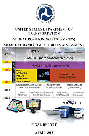
See this article for facts and findings of years of detailed study of this matter, recounted in the recently released Department of Transportation’s Adjacent Band Compatibility (ABC) Assessment Final Report. That it appears almost a year after all the research and nearly all the analysis was completed suggests that powerful forces are at work, perhaps warring with each other, within the government. Let us hope that the guys and gals with the good hats on can prevail.
The matter now rests with the Federal Communications Commission, an appointed panel not subject to the electorate nor to Congress, whose decisions sometimes carry a scent of influence from hidden quarters. Note particularly the recent ruling against net neutrality, which most agree runs counter to public interest and correlative with private corporate interests.
As our news story states, the ability to use the mobile satellite services (MSS) band for terrestrial services is “limited.” The DOT ABC Assessment, using the 1-dB Interference Protection Criterion of a 1-dB drop in carrier-to-noise density ratio that’s accepted by everybody — specifically, every engineer — on Earth except Ligado Networks, demonstrates conclusively there is no chance the company could actually deploy a viable commercial terrestrial service in the MSS spectrum without disrupting or degrading vital GPS and GNSS services.
The U.S. government and the GPS industry have both expended far too much money and time trying to accommodate a force-fit of a non-compatible use into the bands adjacent to the radionavigation satellite service band, to the benefit of one commercial company’s bottom line.
It’s high time for this nonsense to stop. Nobody, least of all the government and the GNSS industry, owes Ligado anything.
The technological underpinning for stock markets’ techno-darlings doesn’t always work perfectly. That problem produces lost revenue and lost value. So Uber, for one, has done something about it, partly based on research developed by Paul Groves at University College London and featured in the February 2012 cover story of GPS World.
Smartphones finding each other in the urban landscape constitute Uber’s business basis. When driver and rider can’t find each other, because they’re on opposite sides of the street or even opposite sides of the block, a ride can’t happen. In the GPS world, we call this multipath, reflected signals, shadowing or simply urban canyon. In Uber parlance it is “wasted supply.”
To eradicate it, Uber acquired Shadow Maps in 2016 and has integrated the company’s technology into the Uber app. Beta testing now goes on in 15 cities; early results indicate that positioning accuracy has improved twofold.
The Shadow Maps process, derived from Groves’ shadow-matching concept, directs the Uber algorithm to examine a 3D rendering of the cityscape and perform a probabilistic estimate of user location based on — simultaneously — which satellites are in direct line-of-sight and which aren’t, in conjunction with predicted satellite location, or almanac.
The process uses ray tracing, color-coding satellite signals by strength to predict likely locations. Each probability calculation takes 20–100 milliseconds, and can run every four seconds for riders and more frequently for drivers, according to Uber engineers and former Shadow Maps principals Andrew Irish and Danny Iland.
“You just want to have a better, tighter estimate to account for how much faster cars move,” Irish said.
Prior Work. Paul Groves has researched this area for nearly a decade at the Space Geodesy and Navigation Laboratory, University College London, where he is an associate professor. Lei Wang won ION’s Parkinson Award for his Ph.D. thesis on shadow matching and now works at Apple. Marek Ziebart is a professor and vice-dean, research, UCL.
“There are many different approaches to 3D-mapping-aided GNSS and several different research groups around the world working on them,” said Groves. “At UCL, we have been integrating shadow matching with 3D-mapping-aided GNSS ranging algorithms. We now have a real-time demo system running on an Android smartphone, albeit limited to Central London. By making full use of the new Android ‘raw measurements’ capability, we get around a factor of 5 accuracy improvement over conventional single-epoch GNSS in dense urban areas.”
“It’s great to see people actually making use of our research rather than it just languishing in research papers. The more widely that shadow matching and other 3D-mapping-aided GNSS techniques are used, the better.”
In February 2012, Groves and his co-authors presciently wrote:
“A practical shadow-matching algorithm must be implementable in real time on a mobile device. Three models may be considered.
A network-based solution, whereby GNSS measurements are transmitted to a server, which stores the building boundary data, computes a solution and then sends it to the user.
A handset-based solution, where the shadow-matching algorithm is run on the handset, which also stores the building boundary data.
A hybrid model, whereby the shadow-matching algorithm runs on the handset, but the building boundary data is streamed from a server as and when required.
“Using stored or streamed building boundaries, fewer than 50 comparison and addition operations are required to calculate an overall shadow-matching score for one candidate position with two GNSS constellations. Therefore, shadow matching may be performed in real time on a mobile device with several hundred candidate positions, where necessary.”
The magazine article was based on a presentation at the European Navigation Conference 2011 in London. The authors will present their latest research, reflecting significant progress over the last seven years, at ION GNSS+ 2018 in Miami, Sept. 24-28.
Contrary to the “Out in Front” editorial published in the April issue of GPS World magazine, there was an Izvestia story published on March 28 touting the possibility of a merger of the GLONASS and BeiDou systems, and there will be an International Conference on Advanced Technologies in Manufacturing and Materials Engineering in Harbin, China, at which such a possibility may hypothetically be discussed.
However, neither hard news nor any official statements have emerged to substantiate such a dubious claim, despite repeated queries to officials of both countries.
Javad Ashjaee (far left, above), CEO of JAVAD GNSS and based in Moscow, communicated that he spoke on a panel at an aerospace technology event organized by the American Chamber of Commerce in Russia, alongside representatives from NASA, Boeing, Honeywell and Roskosmos.
Ashjaee asked the Roskosmos official publicly about the prospect of a GLONASS merger with BeiDou, and “he knew nothing.”
On April 26, the U.S. Department of Transportation publicly released the long-awaited GPS Adjacent Band Compatibility Assessment. See the June issue of GPS World for an expert and measured analysis of this highly impactful document.
The article will be posted online when it becomes available in mid-to-late May.
Merger Mystery
Contrary to the “Out in Front” editorial published in the April issue of GPS World magazine, there was an Izvestia story published on March 28 touting a merger of the GLONASS and BeiDou systems, and there will be an International Conference on Advanced Technologies in Manufacturing and Materials Engineering in Harbin, China, at which such a possibility may hypothetically be discussed.
However, neither hard news nor any official statements have emerged to substantiate such a dubious claim, despite repeated queries to officials of both countries.
Javad Ashjaee (far left, above), CEO of JAVAD GNSS and based in Moscow, communicated that he spoke on a panel at an aerospace technology event organized by the American Chamber of Commerce in Russia, alongside representatives from NASA, Boeing, Honeywell and Roskosmos.
Ashjaee asked the Roskosmos official publicly about the prospect of a GLONASS merger with BeiDou, and “he knew nothing.”
Diverger Dilemma
As this magazine goes to press, stories emerge of a U.K. plan to launch a satellite-navigation system separate from the European Union’s Galileo project. This comes in response to an EU statement that the UK would be shut out of key elements of the European satnav program, particularly the Public Regulated Service, after Brexit.
Historically, in the late 1980s or early 90s the UK drew up plans for its own GNSS prior to the launch of Galileo. And UK-based Surrey Satellite Technology Ltd. built all operational Galileo payloads to date. So the country clearly has the capability. That SSTL is currently owned by Airbus (either German or Dutch division) may or may not constitute a wrinkle.
Finally, the UK spent 1.4 billion euros on Galileo, and may now file for a refund.
The Long Life of GPS III
By Robin Wrinn, Contributing Author
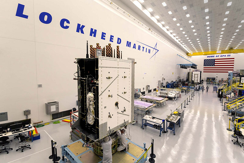
GPS III SV01 in electromagnetic interference, compatibility and passive intermodulation testing. (Photo: Lockheed Martin)
During interviews with Lockheed Martin and Harris Corporation at the 34th Space Symposium, time and space were a frequent focus of discussion, but not in the normal “continuum” kind of way.
Greater mission longevity is one of the key improvements GPS III delivers over those currently in service. Space Vehicles 1–10 have a planned mission life of about 15 years, 25 percent longer than their predecessors. Yet that begs the question “How long should a satellite live in space, with technology innovation occurring almost annually?”
Advanced payload technology provides a partial answer to that question. Both Lockheed Martin and Harris Corporation highlighted new payload capabilities with built-in flexibility to adapt satellites in orbit to technology advances, as well as changes in missions.
Lockheed Martin provided the media a tour of their Radio Frequency Payload Center of Excellence. Meanwhile, Harris recently announced completion of the fully digital Mission Data Unit (MDU), core to the navigation payload for GPS III 11 +. As a reminder, the current Harris payload for SVs 1–10 includes:
greater than three times reduction in range error,
up to eight times increase in anti-jamming power,
added signals, including L1C, compatible with other GNSS such as Galileo, and
greater signal integrity.
According to Harris, the fully digital navigation payload will provide the ability to change and upgrade the satellites incrementally over mission life.
Meanwhile, Lockheed announced a partnership with NEC to introduce artificial intelligence for computer learning in orbit. The company’s Payload Center experts touted significant advances in processers and a move toward next-generation antennas, arrays and transmitters to drive more satellite flexibility, capability and resilience.
Observation: The market pressures of ‘new space’ players is prompting delivery of products that can drive more value for less cost. In this case, delivery of a common payload architecture and electronically steered beams to make satellite antennas become any shape you want. Most likely, beams of a different size on demand is a much better business case than a static one built five years ago.
The day I interviewed Lockheed Martin’s Navigation Systems mission area Program Manager Johnathon Caldwell, the company had submitted its proposal for the U.S. Air Force’s GPS III Follow On (GPS IIIF) program. That same day, April 16, the media was given a tour of Lockheed Martin’s GPS III satellite assembly floor. It was clear from both Lockheed’s press materials and Caldwell that Lockheed Martin believes it is fully recovered from prior production hiccups and is
on track to deliver GPS Space Vehicles (SVs) 1 through 10, and
deserves to win the bid for GPS IIIF. Now that both Boeing and Northrop Grumman have dropped out of the running, Lockheed is virtually assured the contract. The government has said it will announce the award in March 2019.
What are the differences in the GPS III satellite payloads that were instituted to enable the new signals?
The main difference is the power. The Air Force’s requirements called for significantly more anti-jamming capability. All the transmitters are a higher power.
What was the most significant obstacle (or top obstacles, plural) in designing and manufacturing this new payload, to new Air Force specifications? How did you overcome it/them?
Same answer really, the higher power. Keeping in mind, we went from a 7-year mission life requirement to a 15 year. That higher power puts more strain on components and new cyber requirements in software. When you couple all that together we are not just upgrading payload technology. It is really engineering a new set of payload requirements. It’s new generation, advanced.
What are the advantages of a digital payload over the alternative?
The advantages and the 30 percent difference are the timekeeping system portion. We’re moving from a manual, analog timing to digital to deliver to the Air Force more flexibility. It’s a nice option to have to be able to reprogram in orbit and maybe enhance capabilities desired in the future.
with Johnathon Caldwell, Navigation Systems Mission Area Program Manager
Any changes in your production approach having completed SV01?
No, the performance on Vehicle 01 was as designed there were no technical or design changes necessitated throughout the rest of the fleet. So, it was a very successful from that perspective — from the standpoint of validating the design and wringing it out, Vehicle 01 served its purpose well.
It had a very good T-Vac. I would say overall when you look at the industry, Vehicles 01–02, our vacuum test campaigns are the most rigorous test. Both went through their tests quite well. Some of the best I’ve seen.
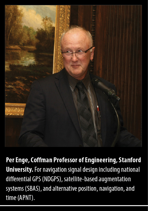
With great sadness we must report that Per Enge passed away on April 22, at home and surrounded by family. Per was a genial friend and colleague to many, and a pillar of the PNT community. He is greatly missed by all.
At the culmination of his long, fruitful career he served as the Vance and Arlene Coffman Professor of Engineering at Stanford University, where he also directed the Stanford Center for Position Navigation and Time.
For many years he conducted research funded by the Federal Aviation Administration, directed at safe and secure air navigation and leading to development of the Wide Area Augentation System (WAAS) and Local Area Augmentation Systems (LAAS). WAAS became fully operational for aviation in the United States in 2003 and is currently carried by more than 110,000 aircraft; similar systems have been deployed in Europe, Japan and India.
Per Enge at National Cheng Kung University (courtesy Shau Shiu Jan).
He received the Kepler Award from the Institute of Navigation in 2000 and was inducted into the GPS Hall of Fame by the U.S. Air Force in 2012. He served as a member of the Space-Based Position Navigation and Time Federal Advisory Committee since 2007. In 2013 he received the GNSS Leadership Award for Signals from this magazine, for signal design including national differential GPS, satellite-based augmentation systems, and alternative positioning, navigation and timing sources. He co-wrote Global Positioning System: Signals, Measurements, and Performance.
Always an educator, Per served as instructor, mentor and gentle encourager of many, many Ph.D. and other graduate-level students at Stanford who have gone on to distinguished careers of their own. In a lifetime marked by great achievements, this is perhaps his greatest and ultimately will be the most far-reaching.
Born in Norway and brought to the U.S. at age 2, he received a B.S.E.E. from the University of Massachusetts and M.S.E.E. and Ph.D. degrees from the University of Illinois.
Speaking at GPS World dinner, accepting Signals Leadership 2013 award. (Photo: GPS World file)
In remarks on accepting the GNSS Leadership Award for Signals, Per cited Faflick’s theorem, “that you will never ever work on any projects that are both interesting and important.” After calling out both GNSS and WAAS as exceptions to the theorem, he identified a third outlier: spoofing.
“Today’s e-security is based on three security factors: what we know (passwords), what we carry (key fob), and what we are (fingerprints, iris scan). And it is not enough. To meet this challenge, we need to rejuvenate the original security factor: location. In the past, transactions were secured by our presence. In the world of e-commerce, this factor has disappeared, and we must use GNSS to approximate this ancient and effective security factor.
“All of this will require the best effort of this precious community of ours.”
Further biographical details are available in an article published by the Stanford News. Among the tributes included there is this one by Brad Parkinson, who recruited Enge to Stanford in the early 1990s. “Anyone who works in GPS is aware of Per and his influence. He was just an intellectually talented person who could understand many scientific nuances and integrate them in ways others could not.”
Teaching the massive online open course.
The article also reminds us that he co-originated and co-taught, with Frank van Diggelen, a massive open online course to share GPS knowledge with a worldwide audience, far beyond Stanford’s walls. Titled “GPS: An Introduction to Satellite Navigation, with an interactive Worldwide Laboratory using Smartphones,” it enrolled 31,000 people from 192 countries. It is available here.
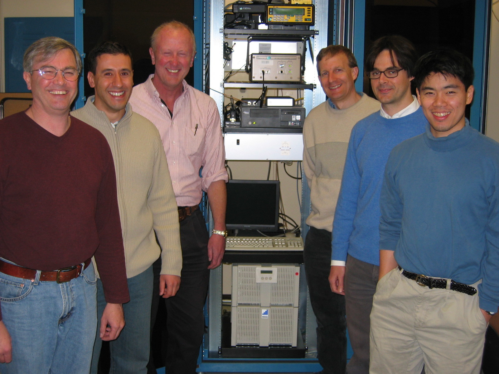
Per’s Stanford colleagues Sherman Lo, Todd Walter and Sam Pullen assisted GPS World with this article and provided these photos from personal archives. The Stanford group is working on setting up a scholarship in Per’s name. More information on it and how to support it will be on the SCPNT website once it becomes available.
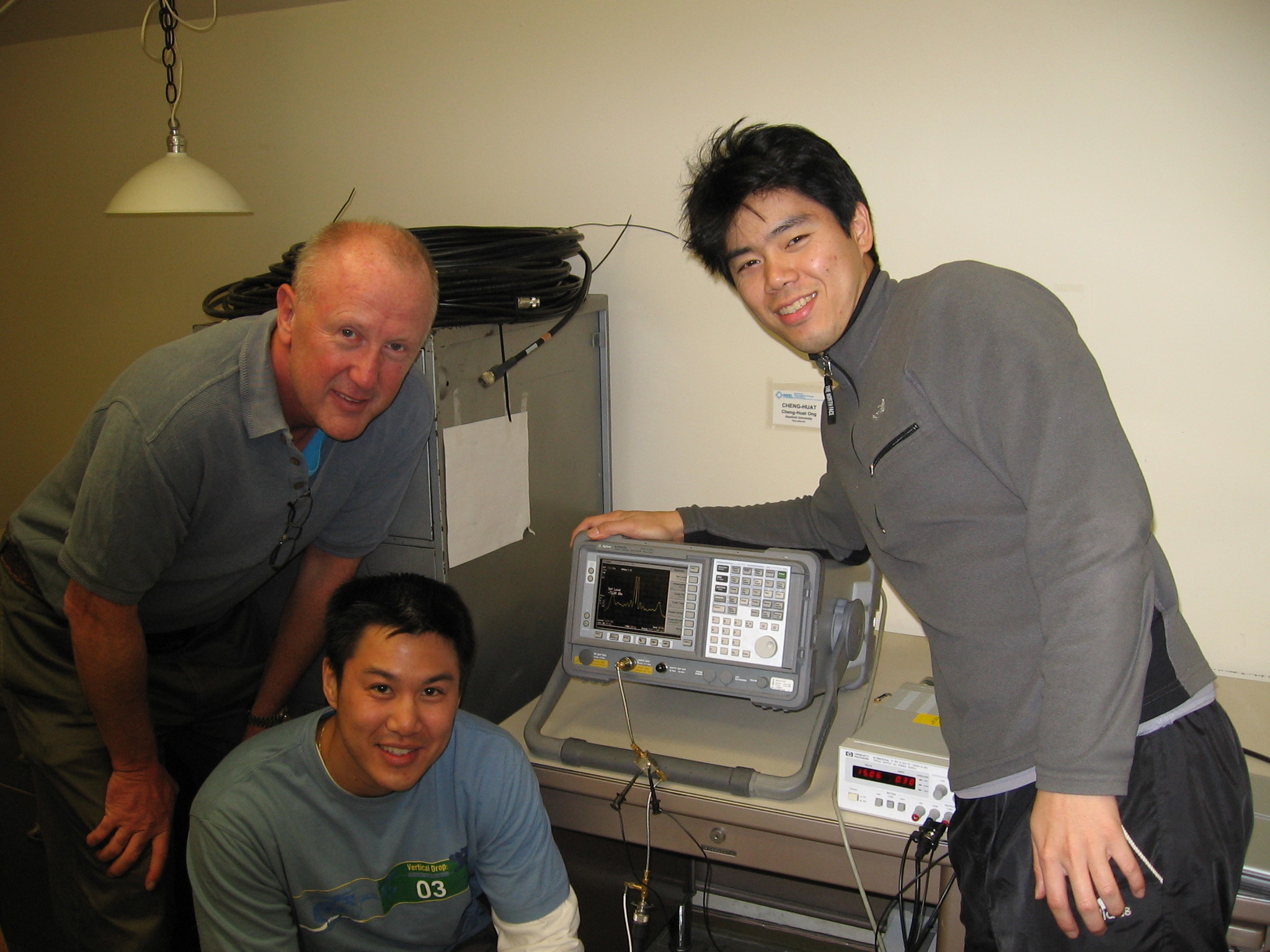
Frank van Diggelen has sent further photos, below.
At the Stanford GPS Lab with colleagues from Stanford and DLR (German aerospace agency).
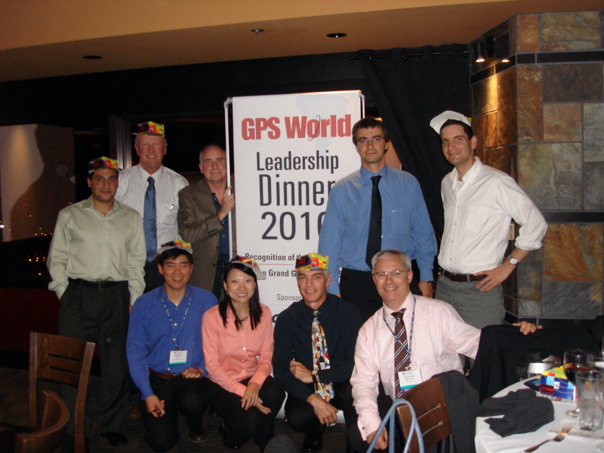
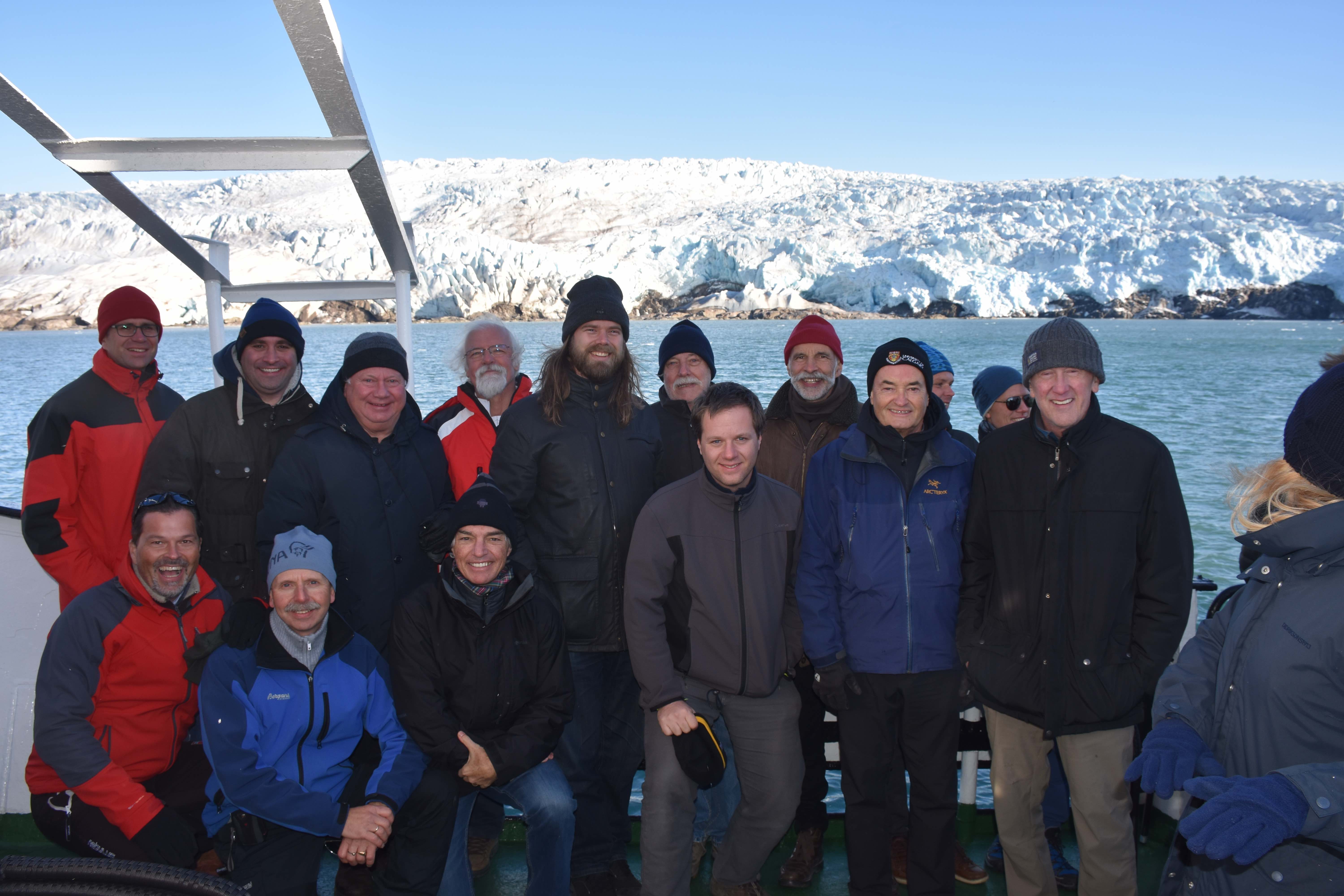
Dinner discussions with US-EU bilateral group.With Alan Chen, Sherman Lo and an early spectrum image of GIOVE-A (or Galileo).Visiting Neuschwanstein Castle in Bavaria after 2005 European Navigation Conference.At the Stanford Center Position, Navigation and Time, which he co-founded in 2005.Team China Consumers at GPS World dinner 2010. The winning team in the Grand Game of GNSS.Fierce “opponents” (examiners) for Ph.D. defense of Ignacio Fernández Hernández of EC/Galileo. Aalborg University, Denmark.Prepared to come aboard in Kobenhavn.The co-authors of Global Positioning System: Signals, Measurements, and Performance (with Pratap Misra).
A road warrior for GNSS.
Faculty of the GNSS Summer School at Svalbard, Norway (Arctic Ocean, 78.7° N).
This month, we bring you a guest column on the 34th Space Symposium in Colorado Springs, Colorado. Robin Wrinn, a communications professional based in Atlanta, gives her perspective on the premier annual space event, held in April. Among her findings: information on the mission longevity vs. technology innovation debate, GPS IIIF program bids, discussions of time and space, and more.
— Alan Cameron, editor
During recent interviews with Lockheed Martin and Harris Corporation conducted during the 34th Space Symposium (April 16-19) in Colorado Springs, time and space were a frequent focus of discussion, but not in the normal “continuum” kind of way.
Greater mission longevity is one of the key improvements GPS III delivers over those currently in service. Space Vehicles 1-10 have a planned mission life of about 15 years – 25 percent longer than their satellite predecessors. Yet that bragging right begs the question “How long should a satellite ‘live’ up in space with technology innovation occurring almost annually?” After all the last Block IIR-M series satellite was launched in 2009. To put that into perspective, that same year the Canadian company Blackberry (RIM) held 20 percent of the smartphone OS market share and was the second largest OS in the world. Apple had just introduced the iPhone two years earlier.
A partial answer to that question it seems is advanced payload technology. Both Lockheed Martin and Harris Corporation highlighted their advances in payload capabilities that would enable built-in flexibility to adapt satellites in orbit to advances in technology, as well as changes in missions. Lockheed Martin provided the media a tour of their RF (Radio Frequency) Payload Center of Excellence (Payload Center). Meanwhile, Harris Corporation recently announced that is has completed development of the company’s fully digital Mission Data Unit (MDU), which is core to the navigation payload for GPS III 11 +.)
As a reminder, the current Harris payload for SVs 1-10 includes:
Greater than three times reduction in range error,
Up to eight times increase in anti-jamming power,
Added signals – including one (L1C civil signal) compatible with other Global Navigation Satellite Systems (GNSS), like the European Space Agency’s Galileo.
And greater signal integrity.
According to Harris, the new, fully digital navigation payload it has engineered will deliver more powerful signals, PLUS the ability to change and upgrade the satellites incrementally over the mission life.
Meanwhile, Lockheed recently announced a partnership with NEC to introduce artificial intelligence for computer learning in orbit. And the company’s Payload Center subject matter experts touted their significant advances in processers and a move toward the next generation of antennas, arrays and transmitters that would drive more flexibility and capability and resilience into satellites.
Observation: It seems the market pressures of ‘new space’ players is prompting delivery of products that can drive more value for less cost. In this case, delivery of a common payload architecture and electronically steered beams to make satellite antennas become any shape you want. Most likely, beams of a different size on demand is a much better business case than a static one built five years ago.
GPS III 1-10 on track. in full production. GPSIII SV1 awaiting U.S. Air Force “Call Up” for Launch
Lockheed Martin’s GPS III SV03 became fully integrated in August 2017. Photo: Lockheed Martin
The day I interviewed Lockheed Martin’s Navigation Systems mission area Program Manager Johnathon Caldwell, the company had submitted its proposal for the U.S. Air Force’s GPS III Follow On (GPS IIIF) program. That same day, April 16, the media was given a tour of Lockheed Martin’s GPS III satellite assembly floor. It was clear from both Lockheed’s press materials and Caldwell that Lockheed Martin believes it is fully recovered from prior production hiccups and is
• “on track” to deliver GPS Space Vehicles (SVs) 1 through 10, and
• deserves to win the bid for GPS IIIF. Now that Boeing has dropped out of the running, it seems they probably have it. (The government has said it will announce the award in March 2019.)
Here is the GPS III SVs 1-10 Update:
SV 01. Declared “Available for Launch” (AFL) by the Air Force on Sept. 28, 2017. Awaiting “Call Up” for launch. A formal date has not been set. “Sometime this year” was the answer Lockheed Martin provided when asked a timeframe.
SV 02. Completed Thermal Vacuum (TVAC) testing, Dec. 2017. Currently in final environmental EMI (electromagnetic)/EMC (electromagnetic compatibility)/PIM (passive intermodulation) testing. AFL expected Summer 2018.
SV 03. Fully integrated, Fall 2017. Currently in TVAC testing, AFL expected. Spring 2019
Interview with Harris Corporation’s Jason Hendrix, PNT Program Director.
GPS World readers are familiar with the differences in the GPS III signals as compared to those transmitted by satellites to date. What are the differences in the GPS III satellite payloads that were instituted to enable those new signals?
The main difference is the power. The Air Force’s requirements called for significantly more anti-jamming capability. All the transmitters are a higher power.
What was the most significant obstacle (or top obstacles, plural) in designing and manufacturing this new payload, to new Air Force specifications? How did you overcome it/them?
Same answer really, the higher power. Keeping in mind, we went from a 7-year mission life requirement to a 15 year. That higher power puts more strain on components and new cyber requirements in software. When you couple all that together we are not just upgrading payload technology. It is really engineering a new set of payload requirements. It’s new generation, advanced.
What are the advantages of a digital payload over the alternative? When you say “Our current GPS payload is 70 percent digital” does that refer to the IIR payload? The offered “fully digital navigation payload with enhanced performance” — is that the GPS III payload? What’s the new 30 percent that has gone digital?
The advantages and the 30 percent difference are the timekeeping system portion. We’re moving from a manual, analog timing to digital to deliver to the Air Force more flexibility. It’s a nice option to have to be able to reprogram in orbit and maybe enhance capabilities desired in the future.
Can you provide any perspectives on how Harris is performing now in delivering payloads for SVs 1-10?
We’re now ahead of schedule. We delivered the 5th payload three weeks early (early March 2018). We are on time for 4 and three more are due this year.
Interview with Lockheed Martin’s Navigation Systems Mission Area Program Manager Johnathon Caldwell
Can you provide some general updates on assembly of GPS 1-10?
Photo: LMCO
Vehicle SV01: It is ready and we’re very excited about that. We defer to the Air Force on questions about launch date. But once they call it up we will install the solar panels and take it to a C-17. Then load it in the back of the plane and fly it down to Florida. We will then take it over to the vehicle processing facility and mate it up with the launch vehicle provider. The GNST – the satellite prototype -has gone to the Cape twice already. So, we have conducted a dry run for shipping SV 01.
Vehicle SV02: It has completed thermal vacuum testing – a major milestone. We’re in the last of the environmental tests. And we’re tracking to have that vehicle declared AFL this summer.
Vehicle SV03. It is fully integrated and is in the T-Vac chamber now. The door is closed and it’s going through tests. (Pump down to vacuum is achieved in approximately three hours and the total testing time is 70 days.)
Vehicle SV04: It is fully integrated on the floor. It is in its baseline electrical tests and will be in environmental tests as soon as 3 comes out of the chambers. It is staged to go in right after – 3.
Vehicle SV05: It is about to go through its integration to the propulsion core. And five has its navigation payload. Integrating it this summer.
Any changes in your production approach having completed SV01 that you are fixing in your production approach to SV02, 03 or 04?
No, the performance on Vehicle 01 was as designed there were no technical or design changes necessitated throughout the rest of the fleet. So, it was a very successful from that perspective – from the standpoint of validating the design and wringing it out, Vehicle 01 served its purpose well.
It had a very good T-Vac. I would say overall when you look at the industry, Vehicles 01 – 02, our vacuum test campaigns are the most rigorous test. Both went through their tests quite well. Some of the best I’ve seen.
We consider thermal vacuum the gold standard for testing any satellite before it goes into operations. It really is putting the craft through the paces. When it goes through the testing, the satellite is on. It is working. It is exposing it to the heat and the cold and the zero pressure while the satellite is functional. The entire thermal vac testing from start to end is a little over 70 days. “Test like you fly.” From the time it launches and deployment sequence we test it like it is real. Minus the shaking, the satellite thinks it is getting launched. Meanwhile, our people are looking at the data and its health. T Vac is a huge milestone for a satellite to go through it and come out without any issues. Which is why we are so pleased about the two.
Have there been any production delays since last year.
No, we’ve been quite stable in our production schedule.
Can you shed some light as to how many Lockheed Martin employees are involved in the production of GPS III?
The way we’re organized, there are engineers that flux in and out of the project depending the stage we’re in. This is production program, so we use the skillsets we need at the time we need them, then those engineers go on to do other work. But this also comes back to some of the commonality we’re trying to achieve across out product lines. That when you have common processes, common parts and common procedures in building spacecraft you gain leverage and major cost savings to have flex in resources.
Can you speak to any issues with subcontractors? Any delays?
No, since last year, the Harris production line has stabilized. We’ve been receiving Harris payloads, and we’ve just received the 5th payload and we’re finishing up integration. Vehicle 6 navigation payload is currently in test. And Vehicle 7 and 8 payload production is going according to schedule. We feel Harris has definitely overcome some of the challenges of the past. And we’ve been seeing stable production deliveries. By the end of this year we should receive 3 more payloads and by the first quarter of next year, the 8th, and they are contracted for 9 and 10.
From a civilian perspective, can you remind us what will be different with GPS III?
Three times better accuracy and up to eight times improved anti-jamming capabilities. And it is a longer life vehicle and healthy constellation of satellites that people can rely on. The new L1C signal is common with other GNSS, like Galileo, so as that becomes incorporated into equipment, it will give you more data points for better service, more accuracy and reliability.
For GPS IIIF requirements, are there capabilities that will require innovation or new technology?
We’ve designed with some of those capabilities in mind. If you just look down the list. The regional military protection is about bringing higher power and boosting the signal where the military needs it most. That’s not a particularly new technology per se, but it is bringing a new capability that the current GPS satellites don’t have.
The Search and Rescue payload, again, I wouldn’t consider it a new capability, it is provided by a partner nation, a Canadian company, but it effects those folks in need.
Digital payload. For 11+, fully digital payload for greater flexibility for the government. It allows the government to expand or enhance capabilities of the mission over time. It enables loading new software to do different things.
GPS III was designed with a modular, flexible architecture. Because Lockheed Martin knew that as time goes by, technology evolves. New technology becomes available and the government’s mission needs are likely to change.
Now that ability to evolve is down to the payload with a fully, 100 percent digital payload.
Lockheed Martin has been working on a lot of the GPSIII F design requirements already (preliminary design review level).
Can you speak to the other “Risk Retired” you mentioned in your slides?
Last fall, we had our first time with the OCX zero ground system. It’s one thing to talk to satellite in the high bay, it’s another thing to talk to it with the entire Air Force control network you plan to use when you’re operating. So, we were excited to get that done and run the entire chain from the vehicle out from the Air Force control network the AFCN network, utilizing the OCX system to command the vehicle. It was a big milestone for us. And previously we demonstrated our compatibility of our signals (with OCX).
Our future satellites in our GPS IIIF proposal share a common design with GPS III so they also will be compatible with OCX because we have proven that compatibility.
Can you speak to the GPS III Ground System Support Contracts Lockheed Martin has received?
The government asked us to help provide some gap fillers for the ground system (rmw note: if OCX isn’t there yet). To take the heritage AEP ground system and provide the ability to fly GPS III satellites using that ground system. So that activity has been going well and the critical design review has been completed and it is on track for delivery to the government next year. And subsequently, we were also put on contract for the M-code new signal to add some capabilities to the legacy ground system to begin to furnish early use of that new GPS III M-code signal to the military. We’ve been working hard on that. We conducted our preliminary design review last fall and just recently completed a critical design review to add that capability.
“If successful,” the story elaborated, “the project will divide the entire world into two zones of influence by two united systems: GLONASS-BeiDou and GPS-Galileo, operated by the U.S. and the European Union.”
Intriguing. Mind-boggling. With some initial smattering of verisimilitude.
I don’t want to say, “Yet in the end, spurious.” Because we haven’t yet reached the end. But indicators point in that direction.
What. The story claimed that “The countries will reportedly negotiate the merger in May at the International Conference on Advanced Technologies in Manufacturing and Materials Engineering in the Chinese city of Harbin, Izvestia daily reports.”
The primary reason for all GNSS and for GPS itself in the very beginning is military advantage. For these two superpowers in particular to share one military resource is unthinkable; for either to disclose aspects of its security and weapons guidance operations to the other, untenable.
Whence. Who is RT? According to Wikipedia, the outfit formerly known as Russia Today is an international television network funded by the Russian government, operating cable and satellite television channels and internet content directed to audiences outside of Russia. Based in Moscow, it presents around-the-clock news providing “a Russian viewpoint on major global events.” In 2008, Prime Minister Vladimir Putin included RT’s parent organization on a list of core organizations of strategic importance to Russia.
RT has been frequently described as a propaganda outlet for the Russian government and its foreign policy, and has been accused of spreading disinformation, broadcasting “materially misleading” content. In 2017, during the French presidential election, a spokesperson for successful candidate Emmanuel Macron said that both RT and the Sputnik news agency showed a “systematic desire to issue fake news and false information,” and banned them from campaign events.
Why. No one to whom I reached out in either Russian or Chinese government or satnav operations agency has returned any comment. Silence on all fronts.
We can only guess at the underlying reasons for this floated, unsubstantiated story. To stir things up, as has been done in other arenas by these same “news” actors. It’s just a bit stinging, and a bit scary, to find it in our own world of science and technology.
There is no evidence that any GLONASS officials have been in any way involved — there’s no evidence of anything at all, when you come right down to it. The development does not reflect favorably on the Russian news system, and it may be as well to take everything from Moscow with a barrel of salt until something more tangible emerges.
A GLONASS-M satellite is prepped for launched in February 2016. (Photo: Russian Ministry of Defense)
An independent technical review published earlier this month found sufficient data in three government-conducted tests to assess the risk of using frequencies near the GPS band for a ground-based communications network — specifically, the one proposed by Ligado Networks. The panel rejected two tests sponsored by Ligado Networks, saying they did not meet minimum criteria for inclusion or use.
The testing and various hearings before the Federal Communications Commission (FCC) come in response to increasing demand for commercial spectrum to support broadband wireless communications. The FCC and other branches of U.S. government are giving serious consideration to repurposing various radio frequencies, including the satellite communications bands next to GPS, to accommodate this.
Ligado Networks has petitioned the FCC to repurpose satellite frequencies near GPS to also support terrestrial telecom services, effectively transferring its license for space-based broadcasting to powerful terrestrially-based broadcast towers. Ligado’s custom networks would provide services for industrial operations such as power grids and connectivity for drones and driverless cars, in addition to consumer broadband services.
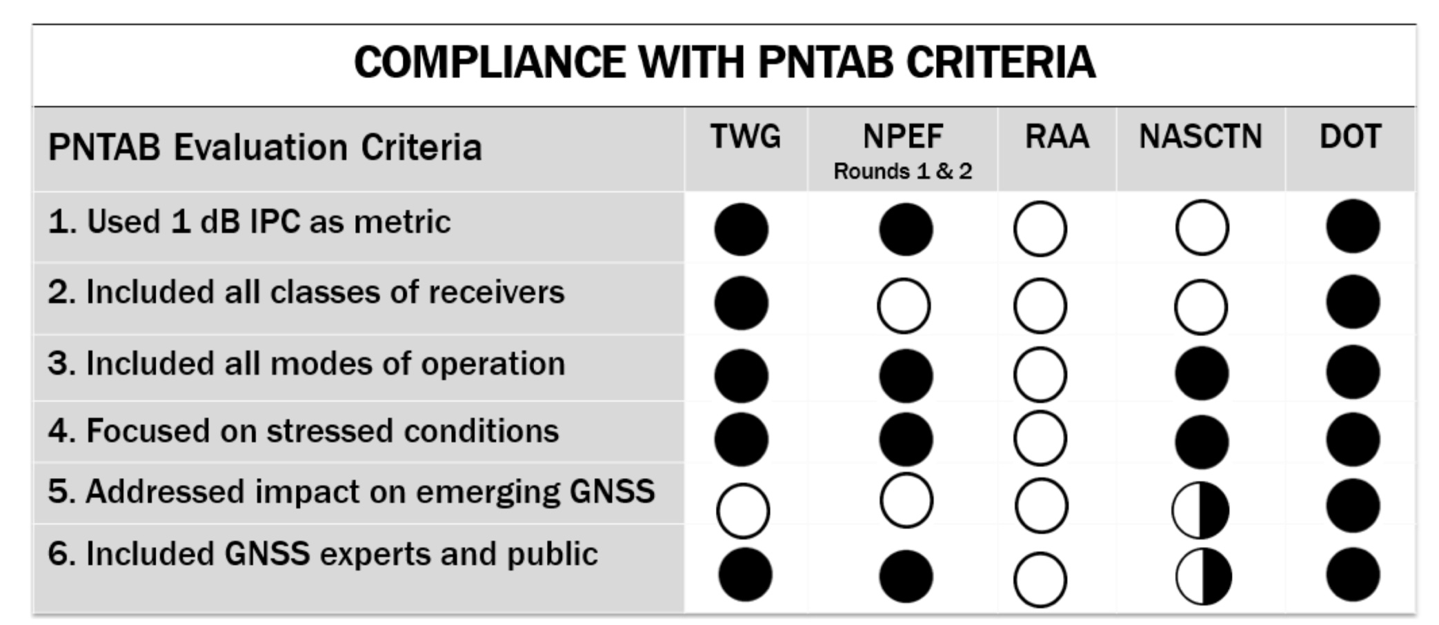
The National Executive Committee of the government’s National Coordination Office for Space-Based Positioning, Navigation, and Timing released the assessment by its National Space-Based PNT Systems Engineering Forum (NPEF) of testing methodologies used to analyze the impacts of adjacent band interference on GPS receivers. The assessment is also known as the “gap analysis.”
The NPEF evaluated five tests performed by the following organizations, the first three of them government organizations and the last two private tests sponsored by Ligado with little or no public or government input:
Federal Communication Commission (FCC)-mandated Technical Working Group (TWG) — done in 2011.
National Space-Based PNT Systems Engineering Forum (NPEF) — done in 2011.
Department of Transportation (DOT) Adjacent Band Compatibility (ABC) — done in 2017 but not previously released.
Roberson and Associates (RAA)
National Advanced Spectrum and Communications Test Network (NASCTN).
The gap analysis concluded that the results from the first three tests are sufficient and appropriate to inform spectrum policy makers on the major impacts of a proposed LTE network on GPS receivers. The DOT test results revealed the power levels that GPS and GNSS receivers can tolerate from interference sources in the adjacent band in an effort to inform the enforcement of a GPS interference protection criterion.
PNT Advisory Board’s set of minimum criteria. The two Ligado-sponsored tests are the RAA and the NASCTN. (Image: PNTAB)
The NPEF team found the scope and framework of the last two tests, sponsored by Ligado, to be insufficient when evaluated against the PNT Advisory Board’s set of minimum criteria. Key among these criteria is one that specifies use of the internationally accepted 1 dB degradation Interference Protection Criterion (IPC): a one-decibel (1 dB) degradation in C/N0, the carrier-to-noise power density ratio. Ligado has tried to redefine the standard measurement of interference to one more in its favor: a change in positioning and timing accuracy.
For further background on this and other aspects of the gap analysis, see the January 2018 GPS World article by Brad Parkinson, “A Grave Threat to GPS and GNSS.”
The NPEF strongly recommended that decisions impacting the GPS radio frequency environment be informed by data from tests that align with the PNTAB’s set of minimum criteria and with full consideration of the potential operational, scientific, and economic impacts.
The full gap analysis study can be downloaded here.
The NPEF is co-chaired by the Departments of Defense and Transportation and consists of representatives from at least 14 federal agencies.
While it sounded like good news at first, once the real results were plucked from the slurry, they resemble nothing so much as the same old uncertainties.
About the future of GPS III, I mean.
Additional money allocated by Congress to the Department of Defense budget — $80 billion on top of $549 billion for FY18 and $85 billion added to the $562 billion previously set for FY19 — alleviated longstanding worries about sufficient funding for GPS. The satnav system has always been at the mercy of raiding by other military programs, over budget and cash-strapped. At least that pressure will be off, we thought.
But money on paper does not always lead, expeditiously or at all, to boots on the ground or birds in the sky. The funds come with an enthusiasm for reorganizing everything. To streamline it, effectivize it, make it more…businesslike.
In the case of the Space and Missile Defense Command, this means eliminating three top-level decision-making positions, and designating someone other than the secretary of the Air Force as responsible for space budget prioritization.
Congress stopped short of its initial idea, which was to establish a whole new department for military space activities, separate from and equal to the Air Force. But there’s no doubt that the 2018 National Defense Authorization Act strongly rebukes the current way of doing space things in the Pentagon and the Air Force — while proffering more money to do them.
Like many announced initiatives to drain the swamp elsewhere, this one has just drawn in more murky water. It may take four or five years, according to some with Pentagon insight, to figure out new procedures, lines of command and the actual fulcrums of decision-making. In the meantime, matters will — you guessed it — slow down.
All this as the GPS III launch schedule and OCX next-generation ground-control readiness slide rightward, and military GPS user equipment can count on at least a decade to even partially update. Mind you, Increment I of the new M-code cards is not yet complete. Once it is, the three major contractors who have developed them will compete to sell their varying versions to the different branches of the military, the different arms of those branches, and the different weapon systems (716, by GAO’s count) operated by those arms.
The pursuit of increased resilience in space, clearly destined to be a contested domain in the event of large-scale international conflict, may actually inhibit itself in the near term.
As noted below, the previous wielder of this space has relinquished satnav matters to take up, as he says, “some unfinished business with life.” I owe him a great debt. He gave me my start here.
Glen Gibbons Retires
Glen Gibbons announced his retirement from active leadership of Inside GNSS magazine at the end of last year, when he wrote he was “promoting myself to Editor Emeritus.” Gibbons was editor of GPS World from 1989 to 2005, and editor and publisher of Inside GNSS from 2006 through 2017.
In 2003, he received the U.S. Institute of Navigation’s Norman P. Hays Award for inspiration and support contributing to the advancement of navigation. GPS World joins all those around the industry and the international GNSS community in recognizing and thanking him for his many years of coverage of and service to the field of positioning, navigation and timing.
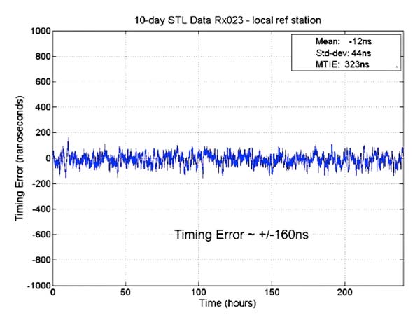
Results from new tests of the Satellite Time and Location (STL) service, using equipment configurations with a differential source and with a more accurate OCXO clock, show timing accuracy of 160 nanoseconds.
The STL service uses a signal from the low-Earth orbit (LEO) Iridium constellation.
In 2016, Satelles demonstrated sub-microsecond timing using a stand-alone TCXO-based receiver (see “Innovation: Navigation from LEO,” July 2017 GPS World).
New testing employed three different configurations of equipment, services and environment, including a Stanford Research Systems (SRS) rubidium vapor frequency reference, based on the PRS10 module, and a Satelles Evaluation Kit (EVK2) STL receiver, comprising a Maxim RF chip, Xylinx Spartan-3 FPGA, TI dual-core DSP chip, and internal OCXO (oven-controlled crystal oscillator) or external clock.
Parameters and equipment for the three tests are:
Optimal. Outdoor antenna, Rubidium clock powered on for months prior to data collection, receiver configured in static mode with a known location, and high-quality antenna.
Sub-optimal. Indoor antenna, Rubidium clock powered on six hours prior to data collection, receiver configured in static mode with an unknown location, and low-quality antenna.
Three independent receivers collecting data, receiver on-board OCXO, indoor antenna, receiver configured in static mode with an unknown location, low-quality antenna. Tests performed: 10 days with no local reference station running; 10 days with local reference station, 20-kilometers away from test receivers, providing timing corrections to STL ground segment.
See Figure 1 for more extensive test results. Also see a previous article.
FIGURE 1. OCXO timing result with base station.
The 66-satellite Iridium LEO constellation transmits overlapping spot beams, which provide location-specific data that changes every few seconds.
Air Force Issues GPS III Follow-on Contract
The U.S. Air Force Space Command released its request for proposals to build 22 new GPS III satellites, called the GPS III Follow-On Phase 2 contract.
The contract will be awarded to a single bidder, and has an estimated dollar value of $10 billion including all options.
Phase 2 is planned as a single, predominantly fixed-price incentive-type contract awarded via full and open competition for production of 22 GPS III satellites. Deadline for proposals is April 16. Delivery of the first satellite is to be in 2026.
Phase 1 contracts awarded in May 2016 to Boeing, Northrop Grumman and Lockheed Martin (builder of the first 10 GPS III satellites) “determined that viable, low-risk, high-confidence sources exist to conduct a full and open competition for Phase 2, the production of 22 GPS III SVs [space vehicles] starting in the FY19 timeframe.”
BeiDou’s Long March
On Feb. 12, BeiDou-3 28 and 29 were launched into medium-Earth orbits, following the launch of a pair of BeiDou satellites on Jan. 11. The satellites form part of a third phase of BeiDou deployment, taking BeiDou coverage from regional to covering the countries along the Belt and Road initiative by the end of 2018, and global by 2020.
This comment piqued my ears when heard over the coffee-break table at ION’s International Technical Meeting last month: “There is a great deal of mutual ignorance between the 5G and PNT communities. I think that the 5G people are pretty naive about PNT and the PNT community is missing an opportunity.”
So when news releases leading up to next week’s Mobile World Congress — several of them mentioning 5G in rosy terms, “catalyst for a better future” typical among these — started flooding my inbox this morning, it seemed an opportune time to investigate. Pardon my top-slice view; I’m not well-versed enough in the technology to discourse knowledgeably, but here’s quick round-up of salient points related to positioning in the fast-oncoming Next Step in cellular communications.
Regular contributing editor for Professional OEM and UAV Tony Murfin will return to this space next month, with a column previewing the massive AUVSI Xponential show in Denver, April 30–May 3. He’ll be there, too, covering the event!
The cellular 5G standard has been designed to target latencies under one millisecond, data rates of up to ten gigabits per second, extremely high network reliability, and better accuracy in positioning. With location awareness becoming an essential feature of many new markets, positioning is consequently considered as an integral part of the system design of upcoming 5G mobile networks.
Its feet firmly planted in both the present and the future, the cellular industry is currently in the midst of implementation of Long Term Evolution (LTE)-Advanced, an evolution of what might be called plain old LTE, and a “true 4G” mobile broadband. Simultaneously, the industry is preparing the next step, as “there is a vastly increased need for a new mobile communications system with even further enhanced capabilities, namely a fifth generation (5G) system.” 5G will process communication 10 times faster than 4G, according to experts. That’s enough to download a 3D movie in 30 seconds. It would take six minutes on 4G.
Pyeongchang
Alert techie viewers of the present ongoing Olympics in South Korea may have noted 5G in action there, in demos of such things as live-streaming virtual reality of bobsled and luge runs, putting the viewer in the breathtaking driver’s seat, and a test drive earlier this month from Seoul to Pyeongchang, a journey of several hours, without any human intervention whatsoever at the car’s controls. The demonstrations in Pyeongchang are laying down a backbone for what will be on show at the Tokyo Games in 2020, when 5G roll-out will be complete in many major metro areas.
As trumpets sound the fanfare for next week’s Mobile World Congress in Barcelona, AT&T announced it will first roll out 5G to three locations: Dallas, Texas; Waco, Texas; and Atlanta, Georgia. The plans introduce the service to about a dozen U.S. markets by late this year. Qualcomm meanwhile is offering insight into its 5G chips.
What has all this got to do with GNSS? Well, aside from the aforementioned precise positioning via cellular to be afforded by 5G, the two technologies share one prominent technique: adaptive array antennas for digital beam-forming. Here I am indebted to Gary McGraw of Rockwell Collins for a primer on the subject, which he presented at the International Technical Symposium on Navigation and Timing (ITSNT) in November 2016.
Adaptive array technologies have many advantages for PNT: primarily, in mitigation for multipath and for jamming and spoofing mitigation. Adaptive antenna arrays with digital beam-forming (DBF) are becoming increasingly important for PNT in challenging signal environments. DBF combines multiple antenna inputs to generate gain in arrival direction of the desired satellite signal and to create spatial nulls in direction of jamming.
Emerging applications of DBF in 5G involve dense networks of picocells, small cellular base stations typically covering a small indoor area. Picocells extend coverage where outdoor signals do not reach well, and add network capacity in areas with very dense phone usage. In this context, 5G cellular architectures will use adaptive array technology to achieve high data rates, spectrum reuse and communications robustness.
The implications for PNT are that 5G system architectures will require improved (relative) PNT to operate effectively, and these 5G picocells will be a source of PNT information in constrained environments.
5G involves massive directional communications via multiple-input multiple-output (MIMO), enabling high-bandwidth communications in fading (multipath) channels by using multiple antenna inputs to adapt to channel. It can do this without knowledge of user location, but it adds to the processing complexity. The directional capability can enable multiple users to be serviced in a picocell at different frequencies, while permitting spectrum re-use by nearby picocells through narrow beam-width and the limited range of millimeter-wave frequencies.
The PNT implications of 5G architectures, according to Gary McGraw of Rockwell, are, principally, that efficient operation of directional links will require some level of knowledge of user location with regard to picocells. Picocells will need to have the ability to do direction-of-arrival positioning and ranging in order to maintain connectivity with user nodes. This can be exploited by the user node for positioning and location-based services, particularly for indoor and dense urban environments. Meanwhile, the proliferation of adaptive array technology will drive down costs for other applications. Further, millimeter-wave transmit/receive modules will become commodity items, analogous to what cell phones have done for GPS chips.
McGraw’s Summary
5G picocells will be synergistic with PNT in challenged environments — naturally, indoor and dense urban. They will necessitate development of distributed, networked PNT processing and infrastructure. Availability of adaptive array technology will increase with deployment of 5G, and costs can be expected to drop dramatically. In addition to GNSS, adaptive array technologies can be employed to support short-range, relative PNT applications such as vehicle-to-vehicle communications and relative positioning.
Driving the Bus
The key driver for all this is that customers, the global We, expect the same quality of experience from Internet applications anytime, anywhere, and through any means of connectivity. The rapid proliferation of smartphones and other mobile devices that support a wide range of applications and services mean that image transfer and video-streaming, as well as more cloud-based services, such as cloud speech services, have become the new norm. Their requirement for massively more data than, say, simple texting is conveniently hidden from or forgotten by users. We want it. We want it now.
From a DOCOMO 5G White Paper: 5G Radio Access: Requirements, Concept and Technologies. NTT DOCOMO, INC., July 2014. At https://www.nttdocomo.co.jp/english/binary/pdf/corporate/technology/whitepaper_5g/DOCOMO_5G_White_Paper.pdf.
Tomorrow, or perhaps the next day, everything will be connected by wireless to enable monitoring and collection of information and control of devices. Thus, remote monitoring and real-time control of nearly all electronic devices in machine-to-machine (M2M) services and Internet of things (IoT): connected cars, connected homes, moving robots and sensors. Such services will become more extensive and enriched through richer content delivered in real-time. Get set for the tactile Internet, augmented reality, and other brave new wonders.
Fraunhofer Enters the Fray
The 5G positioning framework will thereby integrate a multitude of sensors based on both, cellular signals and 3GPP independent techniques, into a hybrid positioning scheme, according to the Fraunhofer Institute for Integrated Circuits (IIS) in Germany. Fraunhofer IIS is currently prototyping low-latency and high-precision positioning systems for legacy LTE and future 5G New Radio (NR). Two selected industrial IoT live demonstrations can be seen at next week’s Mobile World Congress 2018.
Respective positioning performance for 5G NR and other technologies in different environments. (Image: Fraunhofer IIS)
5G NR enables positioning performance by providing high bandwidths for precise timing, new frequency bands at mm-wave, massive MIMO for accurate angle-of-arrival estimation and new architectural options that support positioning. Improved levels of accuracy, robustness and latency, not possible today, can soon be achieved, according to Institute. 5G provides fast and reliable access to moving objects, to achieve time-critical process control and optimization in industrial environments not possible with today’s cellular technology. As requirements vary according to the specific use cases, 5G NR will provide a flexible air interface allowing for scalable bandwidths, data rates, latencies, and positioning accuracy levels.
High-Precision Positioning
With location awareness becoming an essential feature of many new markets, positioning is an integral part of the system design of 5G mobile networks. Increased contextual awareness of goods, parts, machines and workers will enable new interaction and collaboration.
High-precision positioning, in the view of Fraunhofer IIS. (Image: Fraunhofer IIS)
Fraunhofer IIS is working on novel approaches for sub-meter accuracy to enable tracking of mobile devices in indoor and urban areas where GNSS is not sufficiently accurate nor available. Its 5G positioning framework integrate several sensors. The key benefits of 5G in this regard are high accuracy, reliability, mobility and coverage; low latency and low power; and scalability.
The Institute offers the facilities of its Test and Application Center L.I.N.K. in Nuremberg, Germany. The test center includes a 3D positioning system capable, according to the organization, of reproducing, simulating and emulating all kinds of possible environments, using every common communication and positioning system commercially available.