Have you been to the gas station this week?
The ongoing conflict between Hamas and Israel, along with the unrest in various universities across the United States in support of Gaza Palestinians, and the continued aggression by the Houthi rebels in Yemen against shipping, are impacting several aspects of our lives, including the rising cost of gasoline.
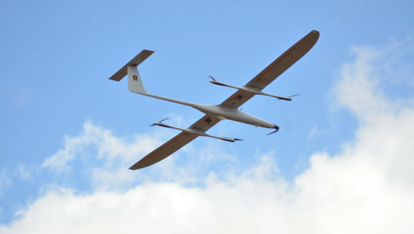
Since the United States began seeking out Houthi strongholds, it is now being reported that another MQ-9 Reaper drone has been shot down – making an apparent total of five such expensive U.S. UAVs lost over and around Yemen, according to US military reports.
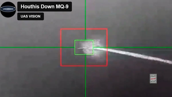
At $30 million each, compared to about $2 million for a surface-to-air missile, the Houthis are apparently ahead on cost. With a 50,000 ft ceiling, the Reaper is capable of avoiding short-range surface-to-air missiles. However, more visual or infra-red (IR) low-level detail may have been sought on this mission. In response, the U.S. military reported the downing of five Houthi UAVs over the Red Sea.
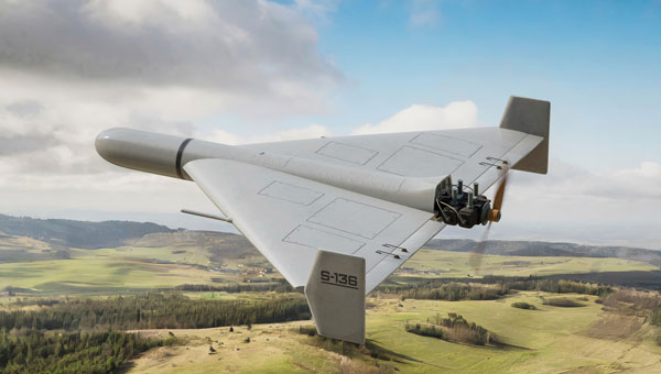
According to a Defense Intelligence Agency (DIA) report, Iran is supplying the Houthis with attack UAVs and longer-range missiles, which are often, if not always, re-assembled, repainted and re-named locally. The DIA said that one of the favorite Kamikaze UAVs used is the Iranian Shahed-136/Houthi Waid-2, which is reported to have a range of almost 1,600 miles. Neither side has yet acknowledged which drones were brought down by the United States.
However, around the same time, it was reported that perhaps two Houthi missiles hit the MV Andromeda Star oil tanker with reportedly little damage — no casualties were reported on the ship as it continued towards its destination Vadinar, India. Another ship, the MV Maisha, avoided a third missile. The missile landed nearby in the water, but the vessel put some distance between itself and the MV Andromeda, continuing safely.
The US/UK forces operating in the Red Sea have countered the more than 100 Houthi attacks on shipping with several airborne strikes on Houthi facilities. This renewed Houthi action over the weekend is thought to have been possible because they were restocked with weapons following the US/UK airstrikes, which slowed their attacks on shipping.
Hence the renewed threat to oil tanker traffic in the Red Sea has raised the already high threat level, and increased oil and gas prices at the pump are one of the consequences.
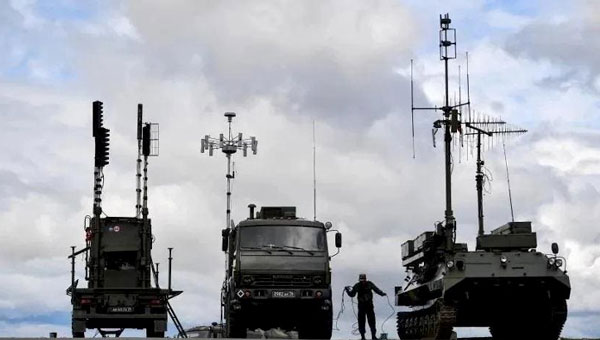
Meanwhile, Pakistan has bought 10 additional Chinese Caihong-4, which reportedly look and perform very similarly to the MQ-9 Reaper.
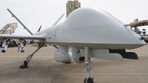
(Photo: OE Data Integration Network (ODIN))
The CH-4 can be used for both attack and reconnaissance. It features a flight endurance of 30 to 40 hours, a range of 2,200 to 3,100 miles and can carry up to six weapons.
This brings Pakistan’s complement to 20 CH-4 UAVs. The new purchase may be to offset India’s purchase of 31 General Atomics MQ-9s, which is included in a huge, recently approved $3.99 billion weapons purchase from the United States. The two countries continue to feud over the contested Kashmir region.
AeroVironment (AV) has developed an add-on for fielded Puma class hand-launched reconnaissance UAVs, which brings autonomy and machine-learning to a worldwide, mostly military fleet of thousands of air vehicles. Referred to as the Autonomy Retrofit Kit (ARK), with AVACORE software, the new update allows operators to command and control one or more vehicles autonomously. This provides computer vision capabilities and enables connection to a distributed, mobile comms network to access data for several separated operating groups.
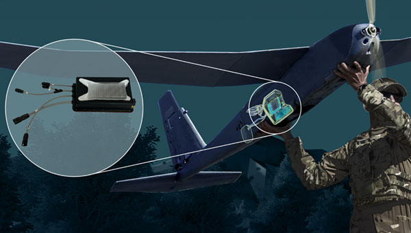
According to AV, autonomous operating tasking is possible when communications are jammed and the UAV is then still able to execute its mission without manual input. Updated computer vision allows finding, classifying, positioning and daylight or nighttime tracking of objects such as people, vehicles, aircraft and ships. AVACORE includes several software interfaces for different autopilots, sensors and radios to provide integration flexibility.
A neat way to provide significantly enhanced capability for already fielded airborne vehicles when they have some downtime.
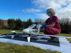
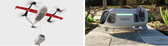
Finally, we have a short introduction to a new transport UAV being put together by a California company called MightyFly. The company is led by a woman who was highly instrumental in the success of the flight controls for the Zipline UAV, which is still blazing drone delivery trails overseas and now in North America — with more than one million deliveries. With advisory input from a retired FedEx exec, the team at MightyFly seems well on their way with both a Federal Aviation Administration (FAA) approved Part 135 application and a 20 mile ‘point-to-point’ flight corridor approval for test flights.
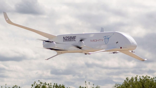
The MF-100 prototype made its first flight and demonstration delivery in April 2021, while the third-generation Cento flew for the first time in December 2022. Cento has a 6’ x 1’ x 1’ cargo hold that can accommodate 96 small USPS packages, weighing up to 100lb and Cento and later models are expected to have a range of 600 miles at up to 150 mph. While their UAVs are currently all-electric, the plan is to add a gas/rotary engine to charge batteries to achieve this forecast range for the drone.
MightyFly has significant support from the U.S. Air Force Agility Prime program and the Air Mobility Command, who continue to invest in autonomous cargo developments as an alternative to leasing helicopters to transport parts, medical supplies and more. MightyFly came up with an auto-loading capability, which resolves the issue of a potentially changing weight and balance of a last-mile cargo drone.