The Federal Aviation Administration (FAA) has authorized commercial UAV flights without visual observers in the Dallas-Fort Worth area, marking a significant milestone in U.S. aviation. This authorization has been granted to Zipline International and Wing Aviation, enabling them to conduct package delivery operations using UAVs while sharing airspace with conventional aircraft.
The UAVs remain separated from manned aircraft using unmanned aircraft system traffic management (UTM) technology, with rigorous FAA safety oversight. UTM services allow companies to share data and planned flight routes with other authorized airspace users, offering safe organization and management of UAV flights in shared airspace. All flights occur below 400 ft altitude and away from any crewed aircraft. The FAA expects initial flights using UTM services to begin in August 2024.
Typically, UAV operators must maintain visual line of sight with their aircraft. However, advancements in air traffic technology are paving the way for routine beyond visual line of sight (BVLOS) flights. This authorization is the first time the FAA has recognized a third party to safely manage drone-to-drone interactions, a significant step towards integrating UAVs into the National Airspace System.
The FAA is working on the Normalizing UAV BVLOS Notice of Proposed Rulemaking (NPRM), which aims to enable UAV operators to expand operations while maintaining high safety standards. The NPRM is expected to be released this year, following strong Congressional support in the recent FAA reauthorization.
u-blox has released the first firmware update of its ZED-F9P GNSS module to support Galileo Open Service Navigation Message Authentication (OSNMA).
The upgrade enhances the multi-band GNSS module’s spoofing and jamming detection capabilities, offering robust and reliable performance for various applications, such as robotic lawnmowers, UAVs and surveying and mapping.
The module also features improved real-time kinematic (RTK) convergence to reduce the risk of incorrect readings, which are important to surveying-related applications.
According to u-blox, the SPARTN Beidou satellite constellation support boosts the capabilities of GNSS receivers and enhances the performance of the u-blox PointPerfect GNSS correction service in certain regions. The receivers are equipped with an advanced ionospheric model for more reliable performance during elevated ionospheric activities.
The Baltic, Ukraine, and the Middle East may be hotbeds of GPS interference that can hamper UAV operations, but these are not the only places in the world where it is happening.
It also happened in San Diego at the premier event for UAV operators— the XPOTENTIAL 2024 conference of the Association for Uncrewed Vehicle Systems International (AUVSI).
AUVSI is the world’s largest nonprofit organization dedicated to the advancement of uncrewed systems and robotics. Members present included corporations and professionals from more than 60 countries involved in industry, government and academia and work in the defense, civil and commercial markets.
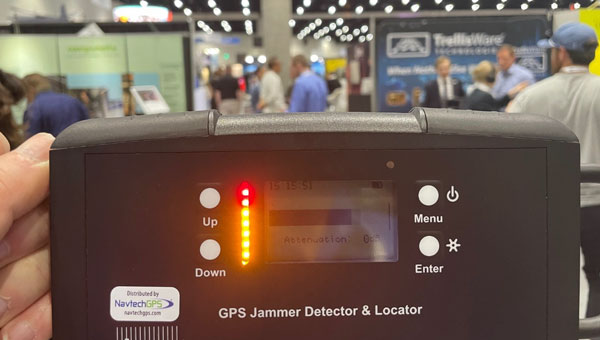
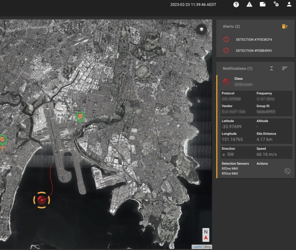
One of NavtechGPS’ directional finder identifies the source of interference at AUVSI’s Xpotential 2024 in San Diego. (Image: Dana Goward)
Among conference attendees were Franck and Trevor Boynton of NavtechGPS, a small Northern Virginia company specializing in GPS products and related services. One of their services is locating devices that are interfering with GPS reception.
“In our work around the country we have found a wide variety of devices interfering with GPS,” said Franck Boynton. “It’s a lot more common than you think. We found truckers with jammers interfering with port operations, for example,” he said. “But accidental interference is an even bigger problem. Most of the time we find it is just some malfunctioning equipment making the radio noise.”
Boynton’s experience is consistent with the 2019 European Union STIKE3 sampling project that detected more than 450,000 signals with the potential to interfere with GPS and other satnav signals. Experts determined that only about 10% of those were intentional. The rest seemed to be a byproduct of mechanical and electrical equipment not functioning quite properly.
Of course, intentional or accidental, interference with GPS signals can be a problem for both manned and unmanned aircraft, vessels and vehicles.
Intentional interference in conflict areas has turned UAVs and missiles away from their targets, and in some cases, back on attackers. It has impacted the safety and efficiency of aviation and maritime traffic nearby. As one example, regular jamming in the Baltic region recently resulted in the cancellation of scheduled commercial air service to a city in Estonia.
Accidental interference has caused survey UAVs to crash and created multi-day problems at the Denver and Dallas-Fort Worth major airports.
In at least one instance accidental interference almost ended in tragedy. In 2019 a commercial passenger aircraft near Sun Valley, Idaho nearly crashed into a mountain. Fortunately, a sharp-eyed radar controller hundreds of miles away intervened and directed the aircraft back on course.
Nearly 600 vendors filled the AUVSI XPOTENTIAL exhibit hall this year. While perusing the displays, the Boyntons detected a strong signal interfering with GPS frequencies. Thinking it was coming from one of the exhibits, they were surprised to find that not only did it turn off and on but it seemed to be moving around.
Using one of the direction finders that NavtechGPS sells, they were able to track the source to a film crew roaming the hall and speaking with exhibitors and attendees. The wireless microphone being used for interviews turned out to be the culprit. Since the film crew was unable to repair or replace the mic, the interference continued intermittently inside the hall for the rest of the event.
“Interference of all kinds with GPS and other satnav signals is a growing problem,” according to Franck Boynton. “As we continue to implement more autonomous systems, it will be increasingly important to ensure they have resilient navigation, and we eliminate as many sources of interference as possible.”
AUVSI did not respond to requests for comment for this story.
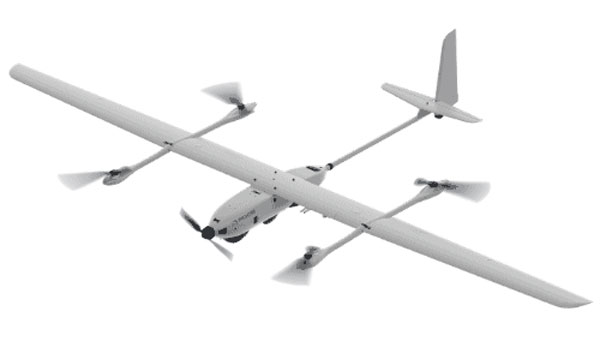
Edge Autonomy has released significant upgrades to its VXE30 Stalker unmanned aerial system (UAS) through the new “Havoc” configuration, designed to double the system’s flight endurance and payload capacity.
With the Havoc upgrades, the VXE30 can now support the complex demands of both small tactical units and larger brigade-level operations without the need for extensive reconfiguration. The upgrades are designed to make the UAS more versatile across various military applications.
The VXE30 Stalker UAS has silent, vertical take-off and landing (VTOL) capabilities and is payload agnostic with the Havoc configuration. It supports easy integration of third-party payloads and subsystems through a Modular Open Systems Approach (MOSA), requiring no additional training for current operators.
Inertial Labs has integrated the FT Technologies FT743-D-SM Acoustic Resonance air speed sensor into its inertial navigation systems (INS).
This integration aims to improve the accuracy of horizontal air speed estimation for multi-rotor UAVs, even in GNSS-denied environments. The FT743-D-SM airspeed sensor is a digital anemometer-based solution that can estimate airspeed incoming from any direction using acoustic resonance technology, which is immune to vibration and external acoustic noise. The airspeed magnitude and direction allow the INS to estimate horizontal air speed in the longitudinal and lateral axes.
The INS receives aiding data from the dual-axis airspeed sensor and experiences significantly less position drift compared to a dead reckoning alternative in GNSS-denied environments, the company said. The system can be used in mission-critical roles in multiple military or defense applications, as well as in civilian applications such as wind energy, marine navigation, UAVs and dynamic positioning systems.
An exclusive interview with Michael Gavart, CTO of M3 Systems.
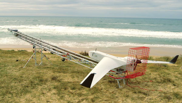
The Boreal UAV ready for departure on a maritime mission scheduled to last several hours. (Image: M3 Systems)
What is your role?
I am responsible for all the technical developments on the UAV.
Please describe it.
It’s fixed wing. It has a 4 m wingspan, a maximum takeoff weight of 25 kg, a carrying capacity of up to 7 kg and up to eight hours of flying time. What is special about this UAV is its size and the size of the payload bay, which is large enough to hold different kinds of payloads.
Do you have different versions?
We have a surveillance version, called BOREAL ISR, that has been used for several projects. Another use case for this UAV is to embed scientific payloads. For example, we had several campaigns for meteorology in partnership with Météo-France in the Indian Ocean to study cyclones and another in the Caribbean Sea to study tropical convection. We did several large scientific campaigns with Météo-France.
Most of the payloads we integrate are for scientific testing. Some of them are for cartography in the visible or infrared domain and other kinds of payloads involve radio frequency testing. Among them, we have, of course, GNSS.
The project we conducted in 2023 was a demonstration campaign for the operational use of this surveillance UAV. The campaign occurred from July to November 2023. It consisted of 20 five-hour flights, three of which were at night. In total during that campaign, the UAV flew more than 100 hours for about 8,000 km and captured data from about 20,000 sq km. This made it possible to identify hundreds of boats fishing illegally. In some cases, the country’s navy intervened and the UAV took live video of the operation to help analyze the scene.
The UAV also flew many operations over the tropical forest, some of them at night, which made it possible to identify some recent mining activities in sites that had already been destroyed some months before.
Another subject was forest fires. During one flight, we identified more than 20 forest fires and the firefighters were able to prioritize where to intervene to fight the fires.
What about flights beyond visual line of sight (BVLOS)?
The radio link enables operators to fly the UAV from up to 100 km from the ground control station, provided that we remain in radio line of sight (RLOS) conditions. Additionally, the UAV has a satellite communication system to fly beyond RLOS in some cases. For some scientific missions, the UAV was flown beyond RLOS conditions using satellite communications, and we could fly up to 250 km from the ground control station.
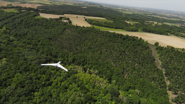
The Boreal UAV is currently deployed for various kinds of terrestrial applications. (Image: M3 Systems)
When was this UAV first available? What is the market for it?
The first big campaign occurred in 2019, for scientific meteorology over the Indian Ocean. The BOREAL drone LAB, a scientific meteorology drone, was ready to operate in 2014.
A second product, (maritime and terrestrial surveillance use cases) was developed and ready to operate in 2021.
Are you selling large numbers of this UAV or only for some special missions?
Several of them have been sold to laboratories for science. From now on, we sell hours of flights as a service on the ISR product. Each drone is used for specific missions (surveillance in particular).
You rent it out instead of selling it?
We sold UAVs to laboratories and now we sell hours of flights as a service. We don’t rent the product. We have a drone fleet that allows us to conduct several missions throughout the year.
How does all this fit in with M3 Systems’ other products and application areas?
GNSS development requires testing radio frequencies in flight. Our UAV is very useful for testing GNSS payloads. We also have a project to provide payloads for satellites. It is an intermediate step for testing these payloads in the air. The BOREAL drone also leverages the group’s expertise in ATM/UTM, making its integration into the airspace seamless.
What GNSS receiver is on the UAV? Also, what correction networks does it use?
The drone embeds a standard GNSS receiver and uses it for its own navigation needs without corrections service. However, through the PASSPORT project the objective was to demonstrate the added value of OSNMA encryption in the Galileo signal, particularly its anti-spoofing capabilities. To assess this, we needed to conduct a spoofing attack on receivers with the OSNMA functions. We used a Septentrio Polar X 5 receiver. Due to safety concerns, this could not be performed on the drone during flight. Instead, we recorded the IQ signal onboard the drone during the flight campaign and later replayed it in the lab for the receiver. During the replay, we introduced spoofing while OSNMA was disabled on the receiver and showed that spoofing was easily achieved. When enabling the OSNMA service on the receiver, spoofing was still possible but the authentication key was not received, indicating that the signal was not trustworthy.
Marking the lines of a soccer field in Vejle, Denmark using a TinyLineMaker Pro X. (Photo. Unicore)
Robotic technology is increasingly integrated into daily life, including applications such as delivery vehicles, automated lawn mowers and line painting robots. Among the critical factors shaping the navigation capabilities of these robotic machines, precise positioning and heading are paramount. Leveraging Unicore’s high-precision GNSS real-time kinematics (RTK) module, TinyMobileRobots, a Danish company, has developed advanced autonomous systems that excel in navigating complex environments.
RTK technology, which greatly compensates for errors in GNSS satellite signals, enables real-time positioning accuracy within 1 cm to
2 cm. The RTK algorithm in Unicore’s UM960 multi-constellation, multi-frequency GNSS module gives it high reliability, precision and fix rate.
Sports fields grounds maintenance teams at schools, parks, housing developments and other locations often need to refresh line markings, which is a very labor-intensive and challenging process. In search of a more rapid and efficient solution, the team marking the lines of a soccer field in Vejle, Denmark, opted for TinyMobileRobots’ autonomous system. This system is becoming popular among groundskeeping teams due to its ability to queue multiple pitches for sequential marking without recalibration, maximizing productivity. It also alerts users when it is running low on paint and estimates its remaining time and distance. The enhanced capacity afforded by the robot’s efficiency also allowed the team to explore new service offerings, such as providing line marking services to other organizations.
The TinyLineMaker Pro X estimates when it will run low on paint and alerts users. (Image: Unicore)
For outdoor robotic applications, GNSS technology’s levels of accuracy range from sub-meter positioning to decimeter and centimeter levels in real time, depending on the specific application. When integrated with complementary sensors such as inertial navigation systems (INS), vision, and radar, robotic navigation can be effectively realized across diverse and complex environments.
Several technologies — ranging from very mature to nascent — are converging to make autonomous vehicles and devices more useful, efficient, and reliable than ever. They include real-time kinematic (RTK) GNSS, inertial navigation systems (INS), cameras, and radar for navigation; cameras, lidar scanners, multibeam echosounders, and a variety of other sensors for data collection; software-defined radios (SDRs) for secure communications; and artificial intelligence (AI) to plan routes, coordinate the movements of multiple autonomous vehicles and devices (including “swarms” of UAVs), and analyze the data collected.
Read this cover story, featuring case studies from Unicore and CHCNAV, interviews with executives at Per Vices and M3 Systems, and images from Frontier Precision and YellowScan.
infiniDome, a provider of GPS protection and resilient navigation solutions, has opened infiniDome USA, a new subsidiary designed to enhance service to the United States defense industry.
By establishing infiniDome USA, infiniDome aims to strengthen its relationships with U.S. customers, offering more localized support and ensuring that its innovative GPS protection technologies meet the specific needs and challenges faced by American aerospace and defense sectors.
infiniDome’s anti-jamming technology offers resilience and reliability to critical systems across a variety of sectors including defense, timing systems, aviation, and autonomous vehicles.
According to the company, infiniDome’s expansion to the U.S. comes in response to the critical need for enhanced proportional GPS security measures amidst the growing threats to GPS-dependent technologies. In direct correlation to government and industry projects, calling for small, light, “attritable” UAVs, protection for such platforms also must be proportional in size, weight, and cost.
infiniDome invites industry partners, customers, and media to learn more about infiniDome USA and its advanced GPS protection and navigation resiliency solutions at AUVSI Xponential 2024 in San Diego, which takes place April 22 to 25.
DroneShield has launched SensorFusionAI (SFAI), a sensor-agnostic, 3D data fusion engine for complex environments.
In a recent release, Angus Bean, DroneShield’s chief technology officer (CTO), emphasized the shift towards a multi-sensor approach for detecting UAVs. He noted this approach is effective for fixed-site, and in some cases, vehicle and ship systems where budgets and space allow.
Bean added that the success of the multi-sensor approach hinges on the presence of an intelligent software engine to fuse the sensor outputs into meaningful data. He said without this crucial component, adding more sensors can lead to information overload without clear management.
In response, DroneShield designed an AI-based sensor fusion engine, initially integrated into its DroneSentry-C2 command-and-control system. This engine accommodates all common UAV detection modalities, including radiofrequency, radar, acoustics and cameras.
SFAI allows third-party C2 manufacturers to integrate SFAI into its C2 systems. This integration can be achieved through a subscription-based software-as-a-service (SaaS) model, enhancing system performance.
Key features of SFAI include behavior analysis to track an object to determine classification and predict trajectory; Threat Assessment that determines threat level based on a range of data types; and an edge processing device called SmartHub for reduced network load and high scalability.
Skydio has released the Skydio Remote Flight Deck, a new feature that allows remote control of Skydio X10 UAVs through a web browser over cellular networks. The remote flight deck offers an easy transition of flight control between local and remote pilots to continuous situational awareness via live streaming.
This solution allows operators to command UAVs from either indoors or outdoors, which can benefit public safety, utilities, construction, and transportation sectors.
When rapid response is crucial — such as in law enforcement activities, search and rescue operations or firefighting — UAVs can offer faster, more effective reactions. They can expedite infrastructure assessments, assist in determining recovery priority levels and ensure community safety.
The Skydio Remote Flight Deck allows for faster UAV deployment compared to traditional emergency response vehicles. In potentially dangerous scenarios, a ground officer can delegate flight control to a remote pilot, ensuring localized situational awareness.
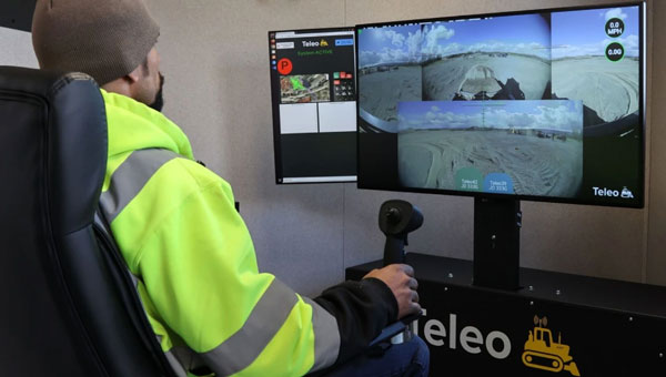
Position Partners has entered an agreement to partner with Teleo, a U.S. based company building autonomous technology for heavy equipment. Under the agreement, Position Partners will offer the full Teleo remote-operated and autonomous solutions across Australia, New Zealand and Southeast Asia.
Teleo’s system can be modified to any make and model of machine and includes the company’s proprietary software, a remote command center to operate the equipment, and a mesh network to enable two-way communication between the command center and machines.
The system incorporates sensors, including high dynamic range cameras that deliver high-definition visibility and video footage both day and night.
Once Teleo’s technology is integrated, users can control multiple machines, at multiple sites, from a single station.
“With ongoing labour and skills shortages in the construction sector, there is more work to be done than there are people to do it,” Position Partners CEO Martin Nix said.
Position Partners will offer the full Teleo solution to customers and support sales, installation and training in all countries in which the company operates including Australia, New Zealand, Singapore, Indonesia, Malaysia and the Philippines.