Category: Autonomous

  • uAvionix, CAP collaborate to expand low-altitude aircraft data for search and rescue missions

    uAvionix, CAP collaborate to expand low-altitude aircraft data for search and rescue missions

    Image: uAvionix
    Image: uAvionix

    uAvionix has partnered with Civil Air Patrol (CAP) to deploy a DO-260B-compliant, dual-band Automatic Dependent Surveillance-Broadcast (ADS-B) receiver network to complement Federal Aviation Administration (FAA) sensor data with low-altitude aircraft positions in support of CAP’s radar analysis mission.

    The ADS-B receiver technology — already in use in Virginia — is designed to shorten the accident-to-rescue time in the National Radar Analysis Team’s search and rescue efforts.

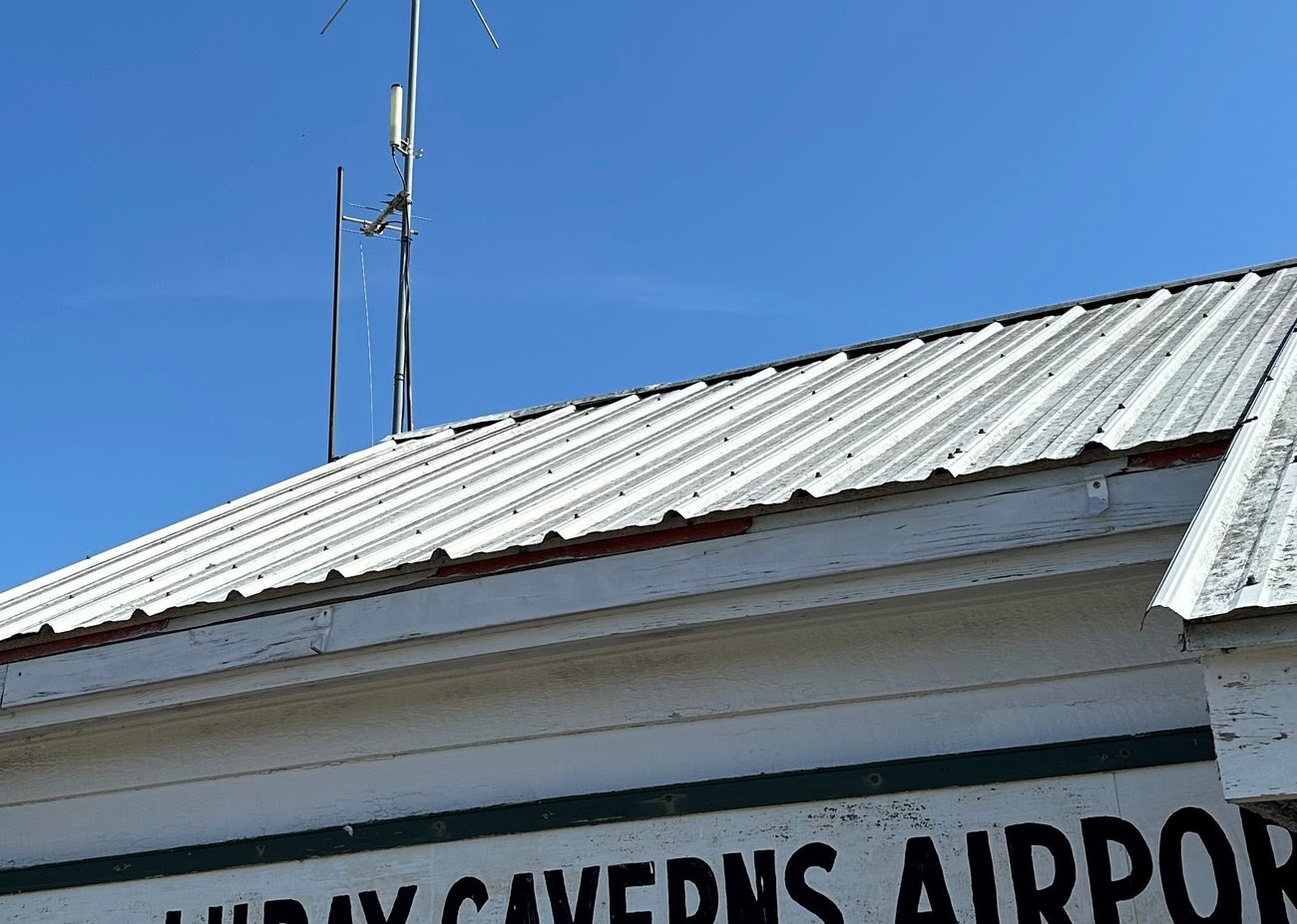
    Through the leadership of CAP’s Virginia Wing, members throughout the state have assisted uAvionix in locating suitable receiver sites and supported the installation of small, low-weight FlightStation ADS-B receivers at various airports.

    The dual-mode (1090 MHz and 978 MHz) FlightStations receive transponder data from aircraft, which is centrally received and transmitted to the radar team server at Maxwell Air Force Base, Alabama, where it’s combined with FAA sensor data.

    The CAP team uses FAA data and advanced technologies in its search and rescue efforts. The team is activated by the Air Force Rescue Coordination Center when there is a report of a possible missing aircraft or crash. Once the team is activated, analysis and actionable data can be provided in minutes to an incident commander, instead of the days or hours required before the team’s creation.

    The FlightLine roll-out consists of several ATC grade ADS-B receivers with overlapping coverage, allowing for validation of transmitted ADS-B data and pinpoint multilaterated positions. Traditional ADS-B and radar concentrate mostly on airports and higher altitudes in support of air traffic control.

    Most other available data sources largely exclude coverage for 978Mhz transponders, typically used by general aviation aircraft. Virginia is the first state in the U.S. to have complete coverage down to 500 ft of altitude. The new ADS-B is rapidly expanding to other CAP wings across the U.S.

    “The introduction of ADS-B has resulted in a significant improvement of general aviation safety,” said Christian Ramsey, managing director, uAvionix. “Expanding on the FAA coverage at lower altitude and for UAT [universal access transceiver] transponders typically carried by general aviation will further enhance the tools used in safety of life activities such as CAP’ ‘s emergency services mission.”

    The radar analysis team is calling on all CAP Squadrons to volunteer to host and install additional receivers where additional coverage is needed. Young said his team will prioritize areas where existing coverage is weak.

    For more information and to register your squadron for a FlightStation unit, click here.

  • Allies send new UAVs to Ukraine

    Allies send new UAVs to Ukraine

    Image: sandsun/iStock / Getty Images Plus/Getty Images
    Image: sandsun/iStock / Getty Images Plus/Getty Images

    Ukraine’s allies in Europe are sending the country new UAVs and counter-UAV equipment, reported The Defense Post.

    German weapons provider Rheinmetall is preparing to send its LUNA NG (next generation) unmanned reconnaissance UAV to Kyiv, the company announced August 14. The system should be delivered by the end of the year, according to Rheinmetall.

    The LUNA NG is part of a sizable military aid package for Ukraine initiated by the German government in July. Per Rheinmetall, the package includes a ground control station and several UAVs, as well as a launch catapult, an optional net equipment for catching landing UAVs and equipment for rapid repair. The system is mounted on a Rheinmetall HX truck with a swap body system.

    The UAV is designed for a range of mission-specific payloads — including LTE network and electronic warfare support measures such as detection, classification and analysis of electromagnetic radiation for threat detection.

    UAV can remain aloft for more than 12 hours and maintain a datalink range of up to 100 kilometers normally, and up to 300 kilometers when fitted with optional satellite communication equipment, according to Rheinmetall.

    The Bundeswehr (the German military) has operated LUNA UAV systems since the early 2000s. Those were originally developed by German manufacturer EMT Penzberg, which was acquired by Rheinmetall in 2021.

    Berlin has already delivered several reconnaissance UAVs to Ukraine, including 88 Vector UAVs from Quantum Systems, 20 RQ-35 Heidrun systems Sky-Watch, and 32 unspecified reconnaissance UAVs, as of August 9.

    Ukraine will also soon receive a series of Cortex Typhon counter-UAV systems made by Norway’s Kongsberg, after the company signed an agreement via the International Fund for Ukraine.

    The delivery consists of several Cortex Typhon systems — developed to counter a wide spectrum of UAVs with solutions to either physically harm or disable an aerial threat, Kongsberg said.


  • RIEGL laser scanner meets German UAV

    RIEGL laser scanner meets German UAV

    Image: RIEGL
    Image: RIEGL

    REIGL and StriekAir engineering GmbH have successfully completed the integration of an airborne scanning system, the RIEGL VUX-12023, on the StriekAir VTOL CarryAir UAV from Germany. During its inaugural flight, the integrated technology successfully captured accurate data of the ground structure.

    The RIEGL VUX-12023 laser scanner is recognized for its precision and accuracy in aerial surveys. When integrated with the VTOL CarryAir, the UAV can reach a cruising speed of 85 km/h and offers users a combination of point cloud density and efficient data acquisition.

    With the integration, users can acquire data about eight times faster than with conventional multicopters, according to REIGL. This time-saving feature aims to provide users with enhanced efficiency and data accuracy.

    Matthias Hutecek (RIEGL) and Thomas Strieker (StriekAir engineering GmbH). (Image: REIGL)
    Matthias Hutecek (RIEGL) and Thomas Strieker (StriekAir engineering GmbH). (Image: REIGL)

    The UAV can be utilized in a variety of applications — including surveying construction sites and infrastructure projects, mapping corridors, collecting topographic data for urban planning and environmental studies and more.

    The RIEGL VUX-12023 offers smooth integration on UAS/UAV/RPAS, small manned airplanes and helicopters. It is offered as a stand-alone UAV lidar sensor and also in various fully integrated UAV-based laser scanning system with appropriate INS/GNSS system and optional cameras based on users’ needs.

  • A2Z Drone Delivery launches heavy-lift delivery UAV

    A2Z Drone Delivery launches heavy-lift delivery UAV


    Image: A2Z Drone Delivery
    Image: A2Z Drone Delivery

    A2Z Drone Delivery, developer of commercial UAV delivery solutions, has launched its second generation RDST integrated cargo UAV, the RDST Longtail. The RDST Longtail features the company’s factory-integrated RDS2 drone winch, allowing payloads to be deposited safely from altitude so that spinning rotors are kept far from people and property.

    The RDST Longtail serves as an off-the-shelf, ready-to-fly delivery UAV for last mile delivery. It can deliver or retrieve payloads up to 5 kg and over a distance of 11 km, making it suitable for various applications such as local parcel or food delivery, emergency medical deliveries, water sampling programs, offshore logistics, search and rescue operations and more.

    The RDST Longtail continues the company’s focus on addressing consumer-protection concerns as the number of residential drone deliveries increases. By conducting deliveries from altitude, A2Z Drone Delivery’s solutions protect recipients from spinning UAV propellers, while mitigating privacy concerns of low-flying UAVs. Depositing payloads from altitude also keeps the UAV high above trees, power lines and buildings, enabling longer sight distances for missions requiring visual line of sight.

    With the upgrades made to the RDST Longtail, A2Z Drone Delivery aims to democratize drone delivery for residential delivery and cases where operators need to quickly and efficiently deliver or retrieve payloads. For example, A2Z Drone Delivery platforms are in use delivering emergency defibrillators to first responders in the field, collecting water samples for analysis and delivering supplies in disaster relief efforts.

    The UAV can also auto-release packages without the need for a recipient to be present at the delivery location. This is made possible by the all-new bag auto-release mechanism, allowing for easy pickups and auto-releasing of bags during deliveries.

    Designed to meet FAA regulations, the RDST Longtail is remote ID compliant with a factory-integrated remote ID beacon. The Premium edition of the drone can fly in inclement weather and features a quick-release battery system for minimal downtime.

    “Our prototype RDST Longtail has already logged 500 flight hours conducting daily residential parcel deliveries near our Ground Zero Test Facility outside Shanghai,” said Aaron Zhang, founder and CEO of A2Z Drone Delivery. “Many of the upgrades included in this second generation RDST have been made in response to customer feedback on capabilities they need to deploy for missions in inclement weather. The RDST Longtail is the flexible commercial delivery UAV for last-mile deliveries that will round out a logistics fleet.”

    For more information on A2Z Drone Delivery system, click here.

  • L3Harris completes AUV launch and recovery from underway submarine

    L3Harris completes AUV launch and recovery from underway submarine


    Image: L3Harris
    Image: L3Harris

    L3Harris has completed a fully autonomous launch and recovery of an autonomous underwater vehicle (AUV) from an underway submarine, referred to as Torpedo Tube Launch and Recovery (TTL&R). The launch used Iver4 AUV technology from L3Harris.

    The L3Harris team worked closely with the U.S. Navy to demonstrate AUV launch and recovery through a test program aboard submarines and Navy support vessels.

    The recovery of AUVs into an underway submarine allows the host platform to remain covert while the AUV performs surveys and missions in areas inaccessible to the host platform. The AUVs return with data that can be used for tactical and navigational planning — delivering manned and unmanned teaming to a fleet.

    According to L3Harris, the company welcomes the continued opportunity to support the Navy in the development of manned and unmanned operational concepts. This capability will increase operational effectiveness and allow SSN-class submarines to serve as an AUV mothership.

  • Shark-monitoring UAVs patrol New York beaches

    Shark-monitoring UAVs patrol New York beaches

    Image: mingis/iStock / Getty Images Plus/Getty Images
    Image: mingis/iStock / Getty Images Plus/Getty Images

    Off the coast of Long Island, New York, UAVs are sweeping the ocean patrolling for any danger that may lurk below the water. This follows a recent increase in shark encounters for beachgoers, reported USA Today.

    According to George Gorman, the state’s park director in Long Island, there have been five shark bites reported this year as shark season is just beginning.

    On July 6, the sighting of a 10-foot shark prompted officials to keep people out of the water at Robert Moses State Park. This is the same Long Island beach that delayed its opening on July 4, after a UAV spotted a school of 50 sand sharks off the coast.

    Even if the injuries have not been serious, Gorman and others are concerned by the spike in shark sightings and encounters.

    The UAVs conduct three sweeps a day on popular Long Island beaches — once before opening, sometime midday, and a final round before the end of the day.

    Cary Epstein, a lifeguard supervisor who pilots UAVs at Jones Beach, explained how UAVs provide additional viewpoints to lifeguards on the beach.

    “When you’re up in an elevated lifeguard station or a lifeguard stand, you can see up and you can see out, but you can’t see straight down,” Epstein said. “When we do have sharks that are eating on these fish, it’s very, very clear to us. You could see it, no questions asked.”

    Additional state funding has been provided for more advanced UAVs to spot sharks.
    New York Governor, Kathy Hochul, recently announced a new program that will provide $1 million toward purchasing 60 new shark-monitoring UAVs. The new devices will build on the enhanced shark safety measures at Long Island state park beaches — including more trained staff, new jet skis, and more buffer zones between swimming areas and fishing areas.

  • Hundreds of UAVs lost during Melbourne show

    Hundreds of UAVs lost during Melbourne show

    Image: Chesky_W/iStock / Getty Images Plus/Getty Images
    Image: Chesky_W/iStock / Getty Images Plus/Getty Images

    More than 350 UAVs were lost during a practice light display show in Melbourne, Australia, on July 14, ahead of a scheduled performance for the opening of the women’s World Cup.

    The UAVs appeared to stop mid-show and plummet into the Yarra River. Divers have since fished out hundreds of the UAVs.

    According to the Resilient Navigation and Timing Foundation, the likely cause of the mass-crash was caused by interference with GPS signals. This incident shows that having multiple and robust navigation sources is important for safe UAV operation.

  • Turf Tank releases Turf Tank Two

    Turf Tank releases Turf Tank Two


    Image: Turf Tank
    Image: Turf Tank

    Turf Tank — inventor of an autonomous, GPS-guided line marking robot, built and designed specifically for painting athletic fields — has released the Turf Tank Two.

    This robot features dual motor drives for enhanced torque and optimized wheels for traction. On its own and controlled through a tablet, the Turf Tank Two can paint a regulation 11 versus 11 soccer field in less than 24 minutes, a baseball or softball field in less than 11 minutes, a lacrosse field in less than 26 minutes, and a full 100-yard football field in less than 3.5 hours. It can also paint logos and numbers.

    The Turf Tank Two is 43 in x 33 in x 22.5 in. It weighs 123 lbs, without paint or the battery installed, and it can hold 5.5 gallons of paint.

    Enhanced features of the Turf Tank Two also include a revamped sprayer module and advanced control features — including a redesigned front panel that has convenient pause/resume options with LED indicators displaying the robot’s status and a start/stop sprayer button. An LED indicator also comes on the battery.

    Turf Tank Two is both eco- and environmentally friendly, the company says. Its batteries are rechargeable and because of the robot’s precision and accuracy, it uses significantly less paint and eliminates the overspray that is common with either painting by hand or using many of the older paint machines and sprayers in the market.

    Guided by GPS, the Turf Tank Two uses a base station to ensure its accuracy. The base station becomes a fixed point from which the robot knows to paint the same exact field every time it is dispatched. The base station communicates with satellites to ensure the accuracy of the field dimensions.

    Once the user installs a particular field layout, it becomes a simple drag and drop process through the tablet. From there, it’s as simple as setting one to four points on each field to give the robot a starting point, and then the robot will paint that field autonomously.

  • FAA issues implementation plan outlining steps to enable AAM

    FAA issues implementation plan outlining steps to enable AAM

    Image: MARHARYTA MARKO/iStock/Getty Images Plus/ Getty Images
    Image: MARHARYTA MARKO/iStock/Getty Images Plus/ Getty Images

    The Federal Aviation Administration (FAA) has released an implementation plan outlining the steps it and others will need to take to enable advanced air mobility (AAM) operations safely. The plan, called Innovate28, includes various components and a timeline for their implementation to hopefully be completed by 2028.

    This plan serves as a foundation for making entry into service routine and predictable by maximizing the use of existing procedures and infrastructure. It addresses how the agency and partners will certify aircraft and pilots, manage airspace access, ensure pilot training, develop infrastructure, maintain security and engage communities.

    The plan also includes a planning guide that can be applied to any site, laying out key integration objectives and sequences.

    Among the entities that play a role in this plan include: the FAA; the advanced air mobility industry; labor partners, NASA; United States Department of Homeland Security; United States Department of Energy; power industry; and state, local and tribal communities.

    The FAA also is collaborating with stakeholders, including through the United States Department of Transportation’s Advanced Air Mobility Interagency Working Group.

    The plan’s highlights include:

    Operations

    • Pilots will be able to fly the new advanced mobility aircraft to and from multiple locations at the sites, using predetermined flight schedules with pilots aboard.
    • Advanced air mobility aircraft likely will operate up to 4,000 feet altitude in urban and metropolitan areas, using existing or modified low altitude visual flight rules (VFR) routes where possible within controlled Class B and C airspace around major airports.

    Infrastructure

    • Operators, manufacturers, state and local governments, and other stakeholders will be responsible for planning, developing and enabling heliport/vertiport infrastructure.
    • Advanced air mobility will initially operate at existing heliports, commercial service airports and general aviation airports. Modifications may be necessary to install charging stations, parking zones and taxiing space.

    Power Grid

    • The electrical power grid may require upgrades to serve advanced air mobility operations.
    • The FAA has an interagency agreement with the Department of Energy’s National Renewable Energy Lab to determine how aircraft electrification affects a vertiport, heliport or airport’s electrical grid.

    Security

    • The Department of Homeland Security will determine what type of security is necessary.
    • The Transportation Security Administration and FAA are evaluating the need for expanded cybersecurity requirements due to the use of advanced technology and operational protocols.

    Environment

    • The FAA will consider the environmental impacts of advanced air mobility operations, including factors such as noise, air quality, visual disturbances and disruption to wildlife.

    Community Engagement

    • The FAA will engage with airports, and local, state, and tribal communities to better understand community concerns about advanced air mobility operations, including noise and mitigations.
    • Many other stakeholders, such as advanced air mobility operators and airport and vertiport operators will have important roles in community engagement.

    The FAA’s full Innovate28 plan can be found here.

  • Turkish-built combat UAV to take flight in new countries

    Turkish-built combat UAV to take flight in new countries

    Image: Turkish Aerospace Industries
    Image: Turkish Aerospace Industries

    Turkish Aerospace Industries (TAI) will begin distributing Anka, its medium-altitude long-endurance class UAVs, to several countries this year, reported the Daily Sabah. Chief Product Engineer, Ziya Dogan, added that an export deal was signed with another country for the delivery in 2024, but did not mention anything specific.

    The Anka UAV has more than 30 hours of endurance and a payload capacity of more than 350 kg. It is designed primarily for the Turkish Air Force.

    Anka performs day and night all-weather reconnaissance, target detection and identification and intelligence missions. The UAV also features autonomous flight capability, including automatic takeoff and landing.

  • Southern Company granted FAA waiver for autonomous BVLOS operations

    Southern Company granted FAA waiver for autonomous BVLOS operations

    Southern Company — an energy provider — in partnership with Skydio, has been granted a Federal Aviation Administration (FAA) conditions-based waiver enabling remote-based, autonomous beyond visual line of sight (BVLOS) dock operations across its system.

    The BVLOS waiver allows the Southern Company system to conduct remote-based infrastructure monitoring and inspection at plant sites, substations, and other fixed site locations, which enables more efficient inspections, mapping and monitoring.

    The Southern Company system will conduct these BVLOS operations using Skydio X2 and Skydio Dock. Skydio’s artificial intelligence technology enables operators to safely inspect infrastructure in close proximity to structures and in complex environments.

    The Southern Company system was previously granted a waiver in November 2022, that allowed for advanced BVLOS operations using UAVs to map and inspect stacks, transmission lines and basins at Plant Barry in Bucks, Alabama. This waiver granted the company the ability to conduct recurring inspections of its system’s critical infrastructure.

  • Autonomous trucks begin testing on Japanese expressway

    Autonomous trucks begin testing on Japanese expressway

    Image: TuSimple Holdings
    Image: TuSimple Holdings

    TuSimple Holdings, a global autonomous driving technology company, has started Level 4 autonomous test runs on the freight corridor that connects the major cities of Tokyo, Nagoya and Osaka.

    In 2021, TuSimple Japan, a subsidiary of TuSimple, completed a series of safety validation and testing work of its autonomous driving system with a truck provided by a Japanese OEM. In January, TuSimple Japan commenced regular testing on the Tomei Expressway.

    It has been reported that the Japanese government is planning to launch a self-driving lane on some sections of the new Tomei Expressway by 2024 and will allow commercial operation of SAE Level 4 fully autonomous trucks in 2026.

    TuSimple is developing a commercial-ready, fully autonomous (SAE Level 4) driving solution for long-haul, heavy-duty trucks. As of March 2023, TuSimple trucks have recorded more than 10 million cumulative miles through testing, research, and freight delivery.