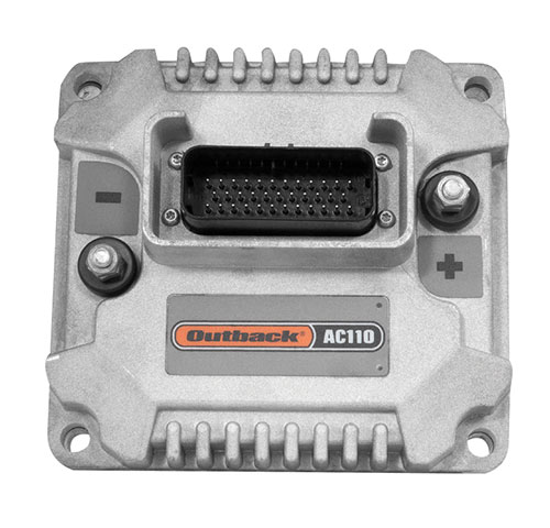
Hemisphere GNSS is primarily known for its Outback brand. It includes the Outback Guidance autosteering solution (a smart antenna that combines a GNSS receiver and a GNSS antenna in a single housing), the ESI² electric wheel that steers a tractor, the AC110 application controller that controls the rate and section, and the Rebel terminal in the cab that runs the application software. Hemisphere’s A222 smart antenna is being used by Raven and AgJunction.
“We put these product components together in different configurations for the solutions,” said Miles Ware, the company’s marketing director. “We support hundreds of tractor models with this type of solution or using our terminal for a steer-ready integration, in which you just plug our terminal and steering controller right into the tractor’s interface and it sends the commands to the hydraulic steering.”
One of the challenges with guidance for precision agriculture is that people think that tractors always operate in a wide-open field, where satellite availability is not a problem, Wares explained. That is often not true, however, due to obstructions such as tree canopies.
That is particularly an issue when using real-time kinematic (RTK) corrections for planting and seeding, which require a couple of centimeters of cross-track accuracy. Farmers want to quickly acquire a line and then maintain it. “All those functions are immediately impacted if you have challenges in the positioning solution,” Wares said.
The Outback Guidance brand offers three different packages:
Atlas Broad-Acre farming for uses that require sub-meter accuracy, such as large seeders or fertilizer sprayers;
Atlas H10 or the Atlas Row-Crop Service for row crop-level accuracy, for example to plant corn; and
a sub-inch package that uses RTK technology for automated steering.
One of the key benefits of automated steering is less fatigue for the driver, explained Roland Moelder, Hemisphere GNSS’ product manager for Agriculture Technology. “Especially when it is dark, it is very hard to do a proper job, minimizing the overlap but also not leaving gaps.”
Automated steering also enables farming practices that require more accurate driving than is humanly possible, such as for strip till, the practice of driving on exactly the same lines year after year.
Application-Guided Planting. Hemisphere’s devices can monitor, control and manipulate implements that use ISOBUS standard communications. Operators can select the attributes of their planter in the application; the display will then show them the planter’s location and which sections are active.
For example, if they are approaching a section of the field that they already planted, the AC110 control will turn off some of the seeding heads during the turn.
The same applies to spraying. The product automates the section control and coordinates it with the centimeter-accuracy steering.
Hemisphere’s solution is built around an after-market, so that farmers are not forced to buy the latest and greatest piece of equipment to take advantage of its technology, Wares added. “They can take a lot of their existing equipment, on which they may have already achieved the return on investment or are close to it, and add our solution.”
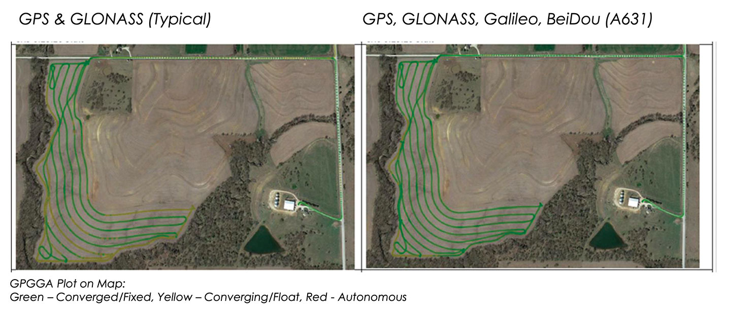
These two plots show how signals from additional GNSS constellations improve mapping. The map on the left is based on only GPS and GLONASS signals, which is typical. The one on the right is improved by adding signals from Galileo and BeiDou. In both images, the green lines are converged/fixed. In the image on the left, the yellow lines are converging/floating. (Images: Hemisphere GNSS)
Do-It-Yourself. To facilitate the installation of its smart antenna, Hemisphere works with all the manufacturers of tractors, sprayers, combines and other field vehicles to make kits that enable customers to perform the installation themselves.
“We take pride in that,” Moelder said, adding that some installations are done by dealers. The ESI2 electric wheel solution is a much easier installation than a hydraulic one. “We also support a list of ‘steer-ready’ vehicle installation kits, which are kits that utilize pre-existing components that are already on the OEM machine, where we just plug-and-play components and make it very easy for the customer to use what is already there.”
Historically, many of these solutions were built around adding hydraulic valves to a tractor, which was a lot of work. “Now, we can communicate directly to the smart valves on steer-ready models,” Wares said, “and it does not require, say, extra hoses, valves and brackets.” Electric wheels, which have tens of thousands of teeth, can manipulate the hydraulics with even finer resolution and are much easier to install than hydraulic valves.
Multi-GNSS technology has a big value for precision agriculture, Moelder said. He cited Hemisphere’s new S631 smart antenna, which tracks all available signals, greatly speeding convergence and maintaining it much better in challenging environments.
Unlike other corrections systems, Hemisphere’s Atlas uses all the available GNSS constellations. “If you are not taking advantage of them, you are really missing out,” said Wares. You cannot take full advantage of a multi-GNSS receiver without multi-GNSS corrections, he pointed out.
Successful test progresses Royal Australian Air Force’s teaming aircraft program
Boeing Australia and the Royal Australian Air Force (RAAF) successfully completed the first test flight of the Loyal Wingman uncrewed aircraft on Feb. 27.
The flight of the first military aircraft to be designed and manufactured in Australia in more than 50 years flew under the supervision of a Boeing test pilot monitoring the aircraft from a ground control station at the Woomera Range Complex in the South Australian outback.
“The Loyal Wingman’s first flight is a major step in this long-term, significant project for the Air Force and Boeing Australia, and we’re thrilled to be a part of the successful test,” said Air Vice-Marshal Cath Roberts, RAAF head of Air Force Capability. “The Loyal Wingman project is a pathfinder for the integration of autonomous systems and artificial intelligence to create smart human-machine teams. “Through this project we are learning how to integrate these new capabilities to complement and extend air combat and other missions,” she said.
Following a series of taxi tests validating ground handling, navigation and control, and pilot interface, the aircraft completed a successful takeoff under its own power before flying a predetermined route at different speeds and altitudes to verify flight functionality and demonstrate the performance of the Airpower Teaming System design.
“Boeing and Australia are pioneering fully integrated combat operations by crewed and uncrewed aircraft,” said Boeing Defense, Space & Security President and CEO Leanne Caret. “We’re honored to be opening this part of aviation’s future with the Royal Australian Air Force, and we look forward to showing others how they also could benefit from our loyal wingman capabilities.”
With support from more than 35 Australian industry teams and leveraging Boeing’s innovative processes, including model-based engineering techniques, such as a digital twin to digitally flight-test missions, the team was able to manufacture the aircraft from design to flight in three years.
This first Loyal Wingman aircraft is serving as the foundation for the Boeing Airpower Teaming System being developed for various global defense customers. The aircraft will fly alongside other platforms, using artificial intelligence to team with existing crewed and uncrewed assets to complement mission capabilities.
Additional Loyal Wingman aircraft are under development, with plans for teaming flights scheduled for later this year.
The Frontier Precision 2021 TechXpo User Conference takes virtual its popular and informative in-person user conferences, sponsored by Frontier Precision for the past two decades. The conference will take place March 30-April 1, 11 a.m. to 5.pm. Central Daylight Time.
During the 2021 TechXpo, participants can engage in more than 70 webinars, live question-and-answer sessions, daily prizes and a virtual trade show with more than 15 industry vendors such as Trimble, DJI, Yellowscan and more.
Participants will learn new ways to measure, with a wealth of knowledge to be learned and shared, the company said.
“We’ve continued to take our core values of customer service and training, and be the first to bring new technology to the customer as a basic part of our DNA as a company,” said Dennis Kemmesat, Frontier Precision president and CEO.
The virtual conference is highly interactive, making information and technology accessible from a desktop whether in another city, another state, or somewhere on the other side of the world.
The three-day conference will explore the best technology from the engineering, land survey, geospatial information systems (GIS), construction and unmanned aerial system (UAS) industries.
The $49 registration includes 30-day access to recordings.
About Frontier Precision. Frontier Precision is an employee-owned company with 33 years of experience serving survey, mapping, engineering, construction, GIS, forensics, law enforcement, forestry, water resources, mosquito and vector control, and natural resources professionals.
As one of the top Geospatial Trimble dealers in the world, Frontier Precision has been at the forefront of technology. The company provides business solutions in the areas of UAS/drones, laser-based scanning, 3D visualization and virtual reality.
The company is headquartered in Bismarck, North Dakota, with locations in South Dakota, Minnesota, Colorado, Montana, Idaho, Oregon, Washington, Alaska and Hawaii.
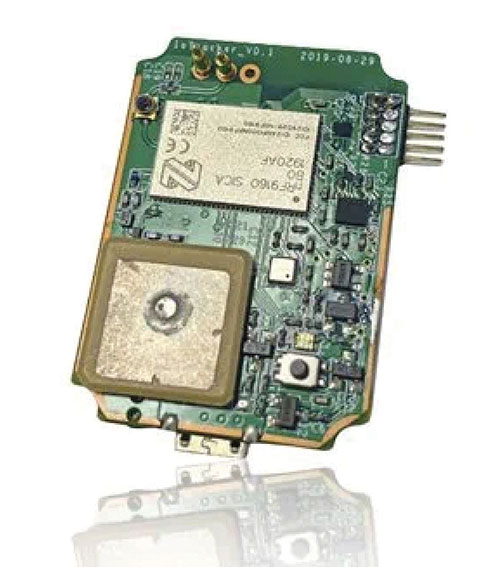
IoTeX has selected Nordic Semiconductor’s nRF9160 low-power System-in-Package (SiP) with integrated LTE-M/NB-IoT modem and GPS receiver to provide the cellular internet of things (IoT) connectivity for its Pebble Tracker.
The Pebble Tracker provides trusted location, environment and motion-tracking data for global asset tracking and industrial supply chain applications.
Critical features strengthen security from hacking and data corruption, meeting the demand of applications that require strong data security and integrity protection throughout the supply chain, the company said.
There are two versions of Pebble Tracker. The first targets blockchain and IoT developers, while a second commercial version is designed for the asset tracking and industrial supply chain markets.
The product combines an environmental sensor, a motion sensor (gyroscope and accelerometer) and an ambient light sensor. It enables cellular network connectivity and integrated GPS support in a global version supporting precise, long-range tracking of asset data using established cellular infrastructure.
The nRF9160 syncs with the IoTeX blockchain, enabling large-scale, decentralized asset-tracking applications. It sends environmental and GPS data securely across global cellular networks to blockchain-based backend services and applications. There, the data is used to determine whether smart contracts have been satisfactorily fulfilled. For example, the trusted tracker data can reveal if, when, and where an asset has been mishandled.
“Seen & Heard” is a monthly feature of GPS World magazine, traveling the world to capture interesting and unusual news stories involving the GNSS/PNT industry.
Image: ESA
Caught in a vortex
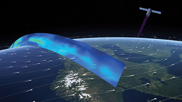
This winter’s polar vortex blasted the northern hemisphere. Understanding the vortex is the mission of the European Space Agency’s Aeolus satellite. Sudden stratospheric warming can disrupt the vortex, as it did this winter, causing the strong wind around the edge of the polar vortex to weaken or reverse (the processes involved are not fully understood). Aeolus emits short, powerful pulses of ultraviolet light from a laser and measures the Doppler shift from the light scattered back to the instrument from molecules and particles to deliver profiles of the horizontal speed of the world’s winds.
Image: LiveEO
Encroaching vegetation
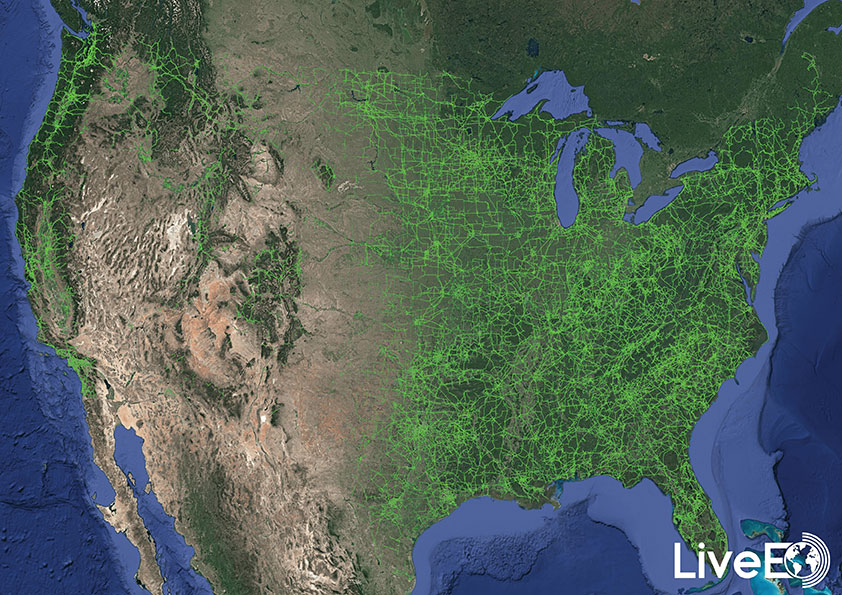
For the first time in history, according to Berlin-based start-up LiveEO, vegetation encroachment risk to the U.S. transmission grid has been analyzed from space. LiveEO used more than 15,000 satellite images to evaluate risk to 574,000 miles of electricity lines. The analysis covers the detection of vegetation along transmission corridors, as well as identification of grid segments exposed at dangerously close distances. Globally, vegetation causes up to 56% of externally triggered power interruptions.
Photo: Motional
What happens in Vegas
The Hyundai-Aptiv joint venture Motional in February tested its vehicles without safety drivers in Las Vegas. The tests came less than three months after the company received the green light from the state of Nevada to test its vehicles without a human safety driver. The vehicles navigated intersections, unprotected turns and interactions with pedestrians and cyclists. A Motional employee rode in the passenger seat and was capable of stopping the vehicle if needed.
A roundup of recent products in the GNSS and inertial positioning industry from the March 2021 issue of GPS World magazine.
OEM
GNSS Receiver
1-cm accurate multi-band receiver
Photo: SkyTraq
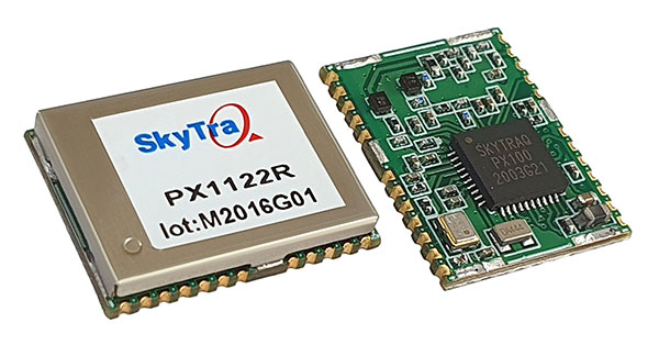
The PX1122R is a 12 x 16 millimeter multi-band real-time kinematic (RTK) receiver for centimeter-level-accuracy positioning applications. It uses GPS L1/L2C, Galileo E1/E5b, GLONASS L1/L2 and BeiDou B1I/B2I signals concurrently to maximize positioning availability even in difficult urban environments. A single-chip system-on-chip, the PX1122R is designed to deliver reliable positioning for autonomous unmanned ground or aerial vehicles, the internet of things, and traditional land surveying and precision farming applications. It has an RTK initialization time under 10 seconds and a maximum update rate of 10 Hz. Its update rate provides in-time positioning with a fast response time and improved guidance for fast-moving applications. Moving-base RTK for GNSS precise heading is also supported.
SkyTraq, www.skytraq.com.tw/homesite/
Iridium antennas
Available housed or embedded
Photo: Tallysman
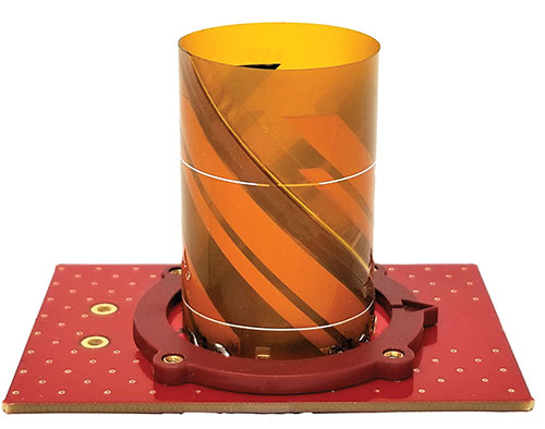
The housed HC610 and embedded HC610E active Iridium antennas operate in receive-only mode and enable Iridium terminals to be installed tens of meters away from the antenna. The lightweight and compact helical antennas are designed to receive the Iridium Satellite Time and Location (STL) signals. Both antennas are light and compact and feature a precision-tuned helical element that provides an excellent axial ratio and operates without a ground plane. They feature a low-current, low-noise amplifier (LNA) and pre-filter to prevent harmonic interference from high-amplitude signals, such as 700-MHz band LTE and other nearby in-band cellular signals. The housed HC610 weighs 23 grams, is 33 x 54.2 mm, and features an IP67 robust, military-grade plastic enclosure, with a base-mounted male SMA connector and two screw holes for surface attachment. At 10 grams, the embedded HC610E is 27.5 x 38.7 mm and can be installed in a custom enclosure. It provides a base-mounted female MCX connector. An optional embedded helical mounting ring is available to attach the antenna to a flat surface.
Tallysman Wireless, tallysman.com
Receiver front end
Designed for portable receivers
Photo: STMicroelectronics
The BPF8089-01SC6 GNSS receiver front end integrates the impedance-matching and electrostatic discharge protection circuitry typically implemented using discrete components. It provides a 50-ohm matched interface between the receiver’s antenna and LNA, and is ready for plug-and-play with the company’s STA8089 and STA8090 LNAs. It is suitable for use in portable receivers for the GPS, Galileo, GLONASS, BeiDou and QZSS constellations, which can be used in applications such as consumer satellite navigation, radio base stations, drones and tracking of assets or livestock.
STMicroelectronics, st.com
GNSS/INS board
Enhanced with an inertial measurement unit
Photo: Bynav
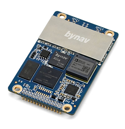
The Bynav A1 is a compact GNSS OEM board with a highly integrated tactical-grade inertial measurement unit (IMU) on board. With Bynav’s new-generation RTK algorithm engine and deeply coupled GNSS/INS algorithm engine, the A1 can provide continuous, reliable high-precision positioning, 3D attitude and velocity to applications such as autonomous driving, robotics, UAVs and mobile mapping. Weighing 25 g and measuring 46 x 71 millimeters, the credit-card-sized A1 is easy to integrate into any system while providing enhanced connection options including serial, Ethernet and CAN.
Bynav Technology, bynav.com
SURVEYING & MAPPING
GNSS/IMU receiver
With tilt compensation
Photo: ComNav
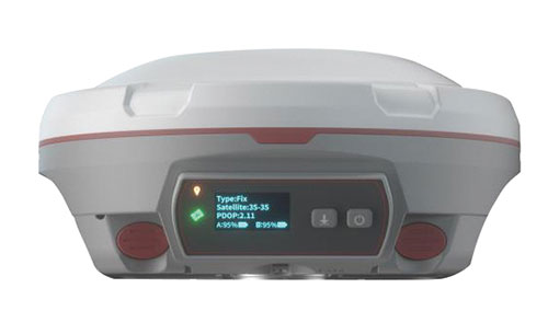
The N5 IMU RTK receiver is user-friendly, with up to 60° tilt compensation ensuring quick measurement and precise position acquisition. A combination of high-end inertial measurement unit (IMU) and advanced GNSS real-time kinematic (RTK) technology, along with ComNav’s core algorithm, ensures high accuracy of less than 2.5 cm, making surveying and mapping in difficult environments easier. The N5 receives all current and future GNSS signals: GPS, GLONASS, BeiDou, Galileo and SBAS. The high-quality OLED display with sunlight readability provides clear viewing and allows users to handle all surveying operations on the screen. A 6800mAh Li-battery allows more than 15 hours of continuous work.
ComNav Technology, www.comnavtech.com
Point creation software
Imports/exports layout files
Photo: Topcon
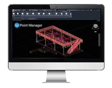
Topcon Point Manager software is available as a plug-in for Autodesk AutoCAD and Autodesk Revit users in the United States and Canada. It automates point creation and imports and exports layout files to and from a robotic total station. Users will be able to access the solution as a plug-in component to their design package, creating multiple points on building information modeling (BIM) objects and 2D/3D drawings from within the Autodesk environments. Quality assurance and control efforts are improved with point and deviation reports, a likely reduction in on-site personnel, and avoidance of costly errors. Topcon MAGNET users can wirelessly send points to the field for layout, and completed layout files can be sent back to the office to update the model to match as-built conditions.
Topcon, topcon.com
Paving control platform
Directly references design
Screenshot: Trimble
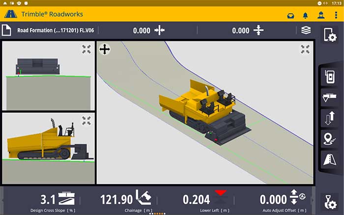
The Trimble Roadworks 3D Paving Control Platform is an accurate, automatic 3D screen control system. It can improve paving productivity and rideability by directly referencing the design rather than a surface or stringline to minimize asphalt usage, reduce waste and overruns, enabling users to finish projects on time and under budget. The Android-based application runs on the 10-inch touchscreen Trimble TD520 display. Operators can personalize the interface to match their workflows, and configurable views make it easier to see the right perspective. The software uses components from Trimble Earthworks, and users can download third-party applications.
Trimble, trimble.com
RTK Receiver
Out-of-the-box features
Photo: Emlid
The Reach RS2 is a full-featured multi-band RTK receiver. All of its features are available out of the box, along with a survey app for iOS and Android. The Reach RS2 tracks L1/L2 bands on GPS, GLONASS and BeiDou, and L1/L5 on Galileo, and acquires a fixed solution in seconds. It achieves centimeter-level precision for surveying, mapping and navigation, and maintains robust performance even in challenging conditions. Centimeter accuracy can be achieved on distances up to 60 km in RTK and 100 km in PPK mode. It provides up to 22 hours of autonomous work when logging data and up to 16 hours as a 3G rover, even in cold weather.
Emlid, emlid.com
Total stations
Integrate with GNSS
Photo: Sokkia
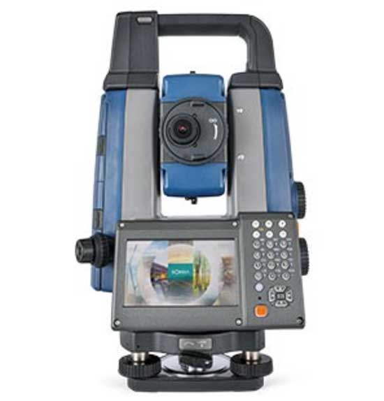
The iX-1200 and iX-600 robotic total stations are designed to be a part of a workflow solution for survey and layout in construction and infrastructure. They’re engineered for integration with field controllers, software and GNSS receivers. Users can switch to total station measurement integrated with GNSS through an optional upgrade. The stations also can be seamlessly integrated into BIM workflows.
Sokkia, sokkia.com
UAV
Thermal Payload
High-resolution gimbaled dual-thermal zoom
Photo: FLIR
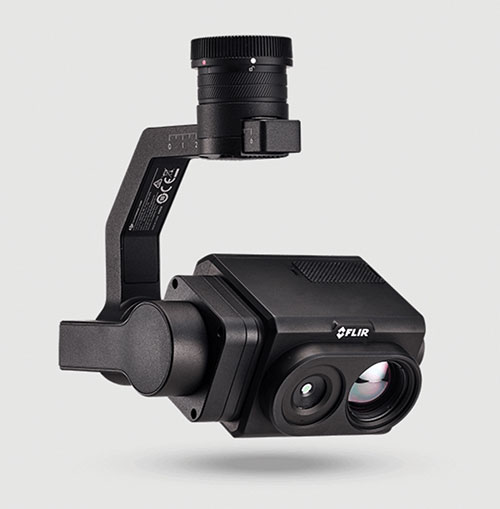
The FLIR Vue TZ20 plug-and-play payload is fully integrated with the DJI V2 Matrice 200 and 300 series airframes. With 20X zoom capabilities, the FLIR Vue TZ20 provides drone pilots from the public safety and industrial inspection sectors with improved image detail and magnification to assess situations and make critical decisions. The 2x to 20x zoom provides a wide 95-degree field of view for maximum situational awareness, covering large areas in a single flight, or a narrow 18-degree field of view to put more pixels on target when needed. Factory calibrated, the dual 640 × 512 Boson thermal cameras are equipped with expandable infrared video streaming at 30 Hz.
FLIR, flir.com
Fixed-wing UAV
For surveyors, GIS professionals
Photo: SenseFly
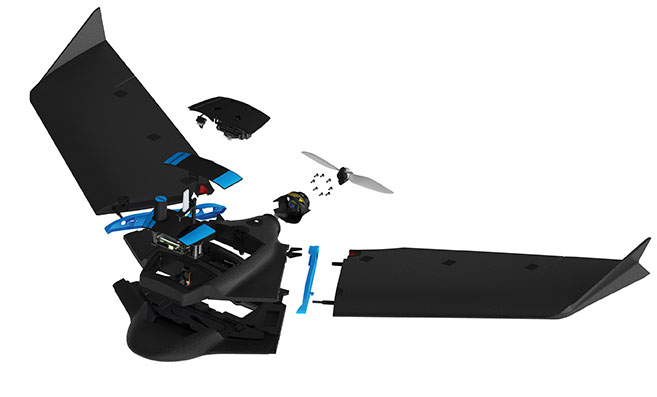
The eBee Geo represents the first extension into a new eBee X series of fixed-wing UAVs and is positioned as a cost-effective option for surveyors and GIS professionals who may be unfamiliar with fixed-wing UAV mapping and data collection. With a maximum 45-minute flight time, the eBee Geo can achieve single-flight coverage of 160 ha at 122 m (395 A at 400 ft), suitable for smaller surveying firms and project-based drone service providers. Construction, urban planning and land management users can also benefit from the RGB imaging capabilities of the supplied senseFly S.O.D.A. camera fixed payload, while achieving greater efficiency and absolute accuracy down to 2.5 cm from the eBee Geo’s real-time kinematic (RTK) function. The eBee X is a premium version that offers users the high-precision of on-demand RTK/PPK for achieving absolute accuracy of down to 1.5 cm (0.6 in) without ground control points. Customers also have access to senseFly’s intuitive eMotion flight planning software.
SenseFly, sensefly.com
Actuator
With CAN and UAVCAN connectivity
Photo: Hitec Commercial Solutions
The SG50BL actuator includes CAN 2.0 A/B or UAVCAN control options. It is designed with robust steel gears and a high-performance brushless motor. It is capable of operating at 18 to 32 volts. The actuator features a programmable digital circuit with a MOSFET amplifier; a BLDC motor; a magnetic encoder position sensor; five hardened steel gears with low gear backlash (less than .5°); a four ball-bearing supported output shaft; and nine needle bearing supported idlers. It has a rugged anodized aluminum alloy case and an IP68 waterproof rating. The SG50BL also is capable of 360° proportional rotation and has T4131012051-000 TE connectivity. Custom connector options are available.
Hitec Commercial Solutions, hitecnology.com
Smart antennas
Designed for tough environments
Photo: Trimble
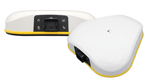
The AX940 and AX940i high-precision GNSS smart antennas are designed for a range of high-precision applications, including UAVs. With multi-frequency, multi-constellation support for GPS, Galileo, GLONASS, BeiDou, QZSS and NavIC, the smart antennas can deliver reliable centimeter-level accuracy in a variety of environments. In addition, the Trimble AX940 and AX940i provide reliable, high-accuracy positioning without the constraints of a local base station or cell modem by using Trimble RTX correction services. Built-in inertial sensors on the AX940i allow a tight integration with GNSS observations in the RTK/RTX positioning and orientation engine, providing continuous high-rate low-latency output to guidance and control systems. The Trimble AX940 and AX940i provide flexible interfaces with high-speed data transfer and configuration; simplified integrations reduce development times; and an intuitive 3D graphical web page allows easy input of the lever arm for easier set up.
The Trimble TSC5 Controller boasts a 5-inch screen, keypad keypad and all-day battery. (Photo: Trimble)
Trimble has released the TSC5 Controller, a rugged, lightweight field data controller for land construction and surveying.
According to Trimble, the TSC5 Controller, built for practical, everyday tasks, combines high performance and dependability so professionals can complete tasks efficiently and accurately.
“Surveyors expect to encounter challenging environments and must rely on their equipment to perform as expected in harsh conditions,” said Ron Bisio, senior vice president, Trimble Geospatial. “The TSC5 controller is a high-value, reliable solution that land surveyors can leverage for field data collection tasks performed all day, every day.”
The controller has a 5-inch screen, keypad keypad and all-day battery for reliable field data collection. It also is resistant to shock, dust and water, and features an anti-glare screen and backlit alphanumeric keypad.
The Trimble TSC5 Controller uses an Android 10 operating system and is fully integrated with Trimble’s land and construction surveying instruments and software packages, including Trimble Access 2021 Field Software, Trimble Siteworks Software. It’s also compatible with the Trimble EMPOWER Module system, which includes the ability to add the EM100 (GNSS), EM11X family (RFID/Barcode) and EM120 (long-range radio) modules.
“Civil construction surveyors trust Trimble to provide rugged, reliable hardware that connects them to the Trimble Connected Construction ecosystem,” said Scott Crozier, vice president, Trimble Civil Construction. “The TSC5 is a great addition to our family of connected controllers, giving contractors the ability to choose the solution that best fits their needs and budget.”
The Trimble TSC5 Controller running the Trimble Access field software is now available through Trimble’s geospatial distribution partners.
The Trimble TSC5 Controller with the Siteworks SE Starter Edition. (Photo: Trimble)
Every year, surveying associations worldwide celebrate Global Surveyor’s Day during the third week of March. This year is no different (even during a pandemic) and will be recognized on Tuesday, March 23.
While this past year has been full of challenges, the role of the surveyor on a global scale has continued to grow. As a professional land surveyor in the midwestern portion of the United States, my surveying experiences have been wide-ranging at times.
For those who know of me and/or have followed my writings here in GPS World, you probably understand how my perspective for the surveying profession has come to be. For those who have no clue about my background, let me give you a brief refresher:
Second-generation surveyor, born and raised in Central Illinois, United States
Surveyed in rural, suburban and urban environments
Began writing for GPS World in 2015 to share my surveying perspective
Even though my surveying career has spanned several decades, my experience has been limited to the areas described above. From my early days of spending hours in the county recorder’s office pouring through tract index books, all the way to viewing parcel shapes, scanned documents and high-resolution aerial imagery in today’s world, it seemed at face value that my experience covered most of the duties of the typical land surveyor.
My career has encountered robotic total stations, all iterations of GPS/GNSS data collection, laser scanning, and now UAV data collection. Throw in the development of the personal computer, COGO and CAD software, the Windows operating system, pen plotters, and countless software breakthroughs, and my perspective of the surveying profession had been front row for all the great things we now take for granted.
However, these advancements, in tandem with growing up in middle-class America, did not prepare me for a recent experience with a surveying/geospatial group new to me.
VCSP Wisdom Workshop
A virtual workshop was recently held to discuss the Volunteer Community Surveyor Program (VCSP) instituted in 2017 by the International Federation of Surveyors (FIG) and the FIG Young Surveyors Network (YSN). More than 125 attendees from worldwide locations logged into the sessions to learn about the program and how to become involved.
The program, titled “Sustainable Solutions for Land Based Community Problems: Tools and Modern Approaches,” spanned two days and two four-hour sessions. Before we jump into the specifics of the program, first we will offer another brief refresher on FIG and its YSN.
The Fédération Internationale des Géomètres, now known to English speaking nations as International Federation of Surveyors, was founded in July 1878. It has grown into a worldwide non-governmental organization representing more than 120 countries and their surveying/geomatics professions.
The National Society of Professional Surveyors (NSPS) is a member organization and participates at various levels throughout FIG.
The FIG Young Surveyors Network (FIG YSN) was initially established in 2006 as a working group, and upgraded in 2009 to network status due to its rapid growth. This group of young professionals and practitioners worldwide has worked with groups such as the United Nations, World Bank, National Society of Professional Surveyors (NSPS) and Council of European Geodetic Surveyors (CLGE) to promote the profession, increase opportunities for young professionals, and be an agent for social and climate change.
This YSN workshop set lofty goals, including providing information about the VCSP as well as informing participants of the current means and methods of surveying in underdeveloped countries. For context, here are the program topics covered over the two days:
DAY 1: Community problems, land tenure and tools for land management
Experiences and opportunities of humanitarian surveyors (past volunteer community surveys)
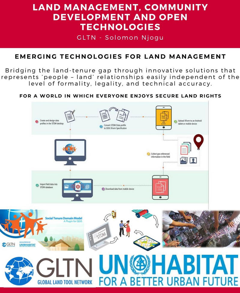
Land management, community development and open technologies
Identifying the relationship between land management and community development
The skills of a humanitarian surveyor
Introduction to STDM and Cadasta tools
An implementation of the STDM and Cadasta tools for land management
DAY 2: Building capacity and implementing modern land-management approaches
Leveraging land-management tools for problem solving and decision making
Designing country-scale solutions for land rights and tenure security issues
Gathering resources for land management projects
How much have land rights and tenure insecurity impacted your country?
Documenting and publishing experiences
What’s next? Parallel sessions by FIG region
Introduction to the humanitarian surveyor
Like most land surveyors in the United States, our role has been well-defined for generations. We establish and/or reestablish parcel boundaries (that is, original or retracement surveys). While our duties have expanded based upon technology, the central responsibility of the surveyor has been established as an expert measurer and provider of boundary information.
In the 200+ years since the westward expansion and formal establishment of most of the United States, the role of the surveyor has evolved into more of a commercial purpose. A surveyor’s principal responsibility is to protect the public, but that meaning has much different connotations in lesser developed countries.
FIG Volunteer Community Surveyor working with locals to discuss parcel possession. (Photo: FIG Young Surveyors)
In the recent past, surveying efforts in many developing countries have been like the early General Land Office surveyors in the 1800s. A surveyor in these regions is out in front of development of unclaimed lands, observing natural and manmade boundaries to guide the decision-making process in establishing parcel rights. The methods and procedures used to date in many lesser developed countries are much like 19th-century surveying — primitive instruments and crude maps sketch property claims with little to no authority.
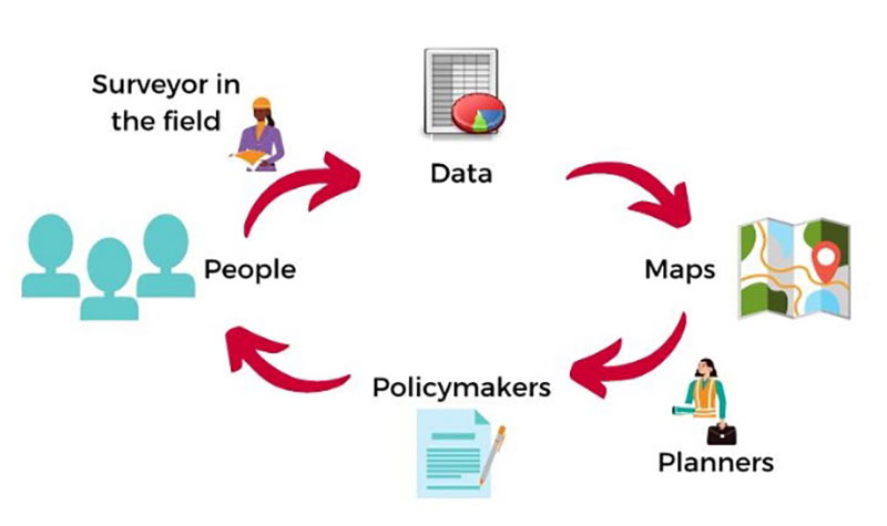
Surveying: The Next Generation. Here is where the concept of the community or humanitarian surveyor comes into the picture. A new generation of surveyors is using modern technology not just to map existing boundaries and improvements, but also to collect additional data that will be analyzed to help improve living conditions. With the introduction of GNSS technology, establishment of parcel boundaries now takes an accurate and precise shape in GIS databases created for improving conditions in these areas.
Additional attributes are collected to determine utility needs, communication availability and access to medical care.
The easy solution seems to be that, as a larger part of the surveying community, we send teams of surveyors to these countries to locate and establish boundaries as well as perform site studies to determine living conditions and potential improvements. If it were just that easy…
Local government: Friend or foe?
Often, these surveyors are going into regions where the local or national governments do not agree with empowering their citizens with property rights and allowing them access to basic utilities. Part of the humanitarian surveyor’s role is to get to know the “lay of the land” when it comes to local order.
Many remote places are controlled by local gangs, tribes or other factions. These groups forbid the population around them to own their property. Even though it may seem like these physical parcel boundaries exist, most of these people do not have title or land tenure rights. This is partly because of the local control situation, but can also be due to the lack of sophistication within the local or national government.
Communication hurdles. Another hurdle for the humanitarian surveyor has nothing to do with their professional capability — it relies solely on appearance, body language and ability to bridge a communication gap. For example, most first-world nations rely strictly on communication skills and the competence to effectively work with other people. We often easily trust those who present evidence of competency with no previous interaction.
In third-world countries, however, locals do not trust outsiders and place competency on those who have built long-term relationships with them. They also rely heavily on body language and facial expressions to convey trust. Local citizens in these areas are less likely to trust visiting older generations who are not able to understand these visual cues.
Combining the factors of trust of the local citizens with the unsteadiness of government and/or lawlessness, the humanitarian surveyor must also be able to determine common property lines, locate lines of occupation, and remain neutral in providing guidance to adjacent neighbors. These conditions often include areas for crops and livestock, as well as places for food growth and development.
With little to no money and lack of commerce available, many of these regions are food poor. Locals are forced to harvest their own food, so having a plot of land to grow these crops is critical.
The surveying procedure for the VCSP. (Image: FIG Young Surveyors)
In more established areas, it can be challenging to determine land tenant rights with many shanties and lean-tos being joined structurally. It is equally difficult to determine if any common utilities exist in these areas, such as stormwater channels to help with rainfall.
Add to these improvement location duties the need for better census data to help with government analyzation of population to apply for aid from other countries.
The good thing is that technology has progressed in creating tools for geographically locating all these entities, including population, with a multitude of attributes to complete proper analyzation. But there is a catch.
Technology challenges worldwide
One of the biggest issue surveyors face when providing services in these areas is the lack of advanced technology and computers. These areas may not have reliable utilities, such as electricity or running water, much less viable internet or Wi-Fi. If computers do exist with local government, they are often years behind in computing power and software. Even operating systems like Windows are a rarity in many of these countries.
Networking accuracy needed. Most humanitarian surveyors will bring their own equipment and computers, so that problem can be averted. But what about geographical locations? Yes, GNSS constellations are available worldwide, but accuracy using just satellite signals is not sufficient for location of parcels and improvements.
To get survey-grade accuracy, the surveyor will typically utilize a correction service or base station on a known value. Most of these corrections are based on Continuously Operating Reference Stations (CORS) or similar established reference stations, so creating a georeferenced datum for the surveyed location takes time and knowledge. Once the network is established, lots of work and oversight is necessary to provide quality control on the data being located.
Tackling parcel management on a global scale. (Image: FIG Young Surveyors)
To add to these issues, most of the staff necessary to complete the surveys must be brought in due to the lack of education at the location. The role of the humanitarian surveyor will also be to teach the craft of surveying to locals, who will continue to expand the area cadaster after the volunteer surveyor has left.
Open-Source Software. However, affording the necessary equipment, computers and software to continue the newly established system is also a hurdle for the community. While the price of computer hardware has greatly reduced over time, the advancement of software and cost of upkeep provides a greater monetary challenge.
Enter open-source software, based upon Linux and other free computer operating systems. This software has been developed with these situations in mind. It allows for customization to each user’s specific need. There are several GIS and data-collection platforms to fit the needs of these budding communities and countries. Open-source and public-domain software allow even the most basic of cadaster needs to be completed efficiently.
Young surveyors network to the rescue
From a technology standpoint, it makes sense that the FIG Young Surveyors Network began this program to help underdeveloped nations begin to create simple cadasters for assessing their property and improvement needs. The younger generation has grown up with technology and can easily teach someone how to embrace it and trust the results.
This younger generation is also the developer of open-source software and tools and sees the value in providing low- to no-cost applications to those who need it most. While the hard part is collecting the data and working with the locals to establish common boundaries, count the population, and determine the utility needs, they take pride in being part of a solution for a segment of the world that may not have any other chance or choice.
Participants in the Volunteer Community Surveyor Program (VCSP). (Photo: FIG Young Surveyors)
One of the interesting portions of the workshop was the breaks between segments. While it was a time to step away from the computer/tablet/phone, the organizers broadcast videos of musical groups from around the world and encouraged the participants to stand up and dance, with their cameras on. While I did not partake in the dancing (it was 4 a.m. at my home), I applaud the Young Surveyors for providing a welcoming atmosphere where each person could be themselves. Several of the participants were in Africa and Asia on cellphones, so creating a workshop environment that worked for all levels of engagement was fascinating.
What I learned
My biggest takeaway was simply learning about the term “humanitarian surveyor.” My earlier reference trying to relate these volunteers to the GLO surveyors, while in the same vein in establishing land boundaries, misses badly in terms of overall contribution to the communities in which the volunteers visit.
The work they perform is truly humanitarian. While I have tried to comprehend the conditions they are facing, I again fall short in fully experiencing what the role has to offer.
One of the testimonials was regarding a group that went to Nepal following the 2015 earthquake to help re-establish towns and parcels. The pictures were stunning, and the memories shared were heartfelt. To be one of these volunteers is truly a humanitarian effort.
Well done, FIG Young Surveyors Network and the Volunteer Community Surveyor Program. I will do my best to not take life here for granted anymore.
Topcon Positioning Group is partnering with CyArk, a non-profit organization committed to the conservation of cultural heritage sites around the globe.
Using 3D digital documentation technology, CyArk works to ensure that culturally significant sites can be thoroughly and accurately documented for the benefit of current and future generations. Many of the technologies needed for doing so come from the geospatial world, making the Topcon partnership a welcome one, according to John Ristevski, CEO of CyArk.
“We have supported the documentation of over 200 sites around the world from the Mosque City of Bagerhat in Bangladesh to the iconic statues on Easter Island, but the need for high precision documentation continues to grow and there are many exciting projects yet to come,” he said. “High-precision measurement and documentation of these culturally significant sites is critical for decision making, so we are thrilled to be partnering with Topcon, an industry leader in that area and more.”
The commitment from Topcon includes GNSS receivers, robotic total stations, field controllers, MAGNET software and a subscription to Topnet Live, the company’s real-time GNSS reference network. According to Ulrich Hermanski, executive vice president of Geopositioning for Topcon Positioning Group, having worked alongside CyArk in the past, it was a pleasure to continue to support the organization in this way.
”Our relationship with CyArk dates back to 2015 when we helped them digitally document the Sogi Power Plant, one of Japan’s national industrial historic sites,” Hermanski said. “We quickly recognized and admired the crucial role they are playing in ensuring cultural landmarks of all types are preserved in a digital format. Our expertise — providing precision measurement solutions — blends perfectly with their needs, now and as they move forward.
“One of the first projects on which they plan to use the new solutions is mapping the redwood grove in Big Basin Redwood State Park, in California, an area that suffered severe damage in the recent wildfires,” Hermanski said. “We are pleased to help with this important effort.”
CyArk’s mission, to record, archive and share the world’s most significant cultural heritage sites, stems from a desire to not only save these places digitally but provide critical information to aid in the physical conservation and restoration of the sites today.
“In recent years alone, we’ve seen instances in which culturally-invaluable sites were damaged or lost to arson, terrorism or the effects of climate change,” said Ristevski. “To know that the accurate digital documentation efforts can play a role in rebuilding or reconstruction is a humbling opportunity. We are grateful to have Topcon partnering with us in our efforts.”
PNT services, such as GPS, are a national critical function that enable many applications within the critical infrastructure sectors. However, “The increasing reliance on GPS for military, civil and commercial applications makes the system vulnerable,” according to Space Policy Directive-7 (SPD-7), issued Jan. 15. “GPS users must plan for potential signal loss and take reasonable steps to verify or authenticate the integrity of the received GPS data and ranging signal, especially in applications where even small degradations can result in loss of life.”
The PNT Integrity Library and Epsilon Algorithm Suite address this issue by providing users a method to verify the integrity of the received GPS data. “We are excited to release these resources to the PNT community to improve resiliency against potential GPS signal loss,” said DHS S&T PNT Program Manager Brannan Villee.
“Since GPS signals can be jammed or spoofed, critical infrastructure systems should not be designed with the assumption that GPS data will always be available or will always be accurate,” said Jim Platt, chief of Strategic Defense Initiatives at the Cybersecurity and Information Security Agency (CISA) National Risk Management Center. “Application of these tools will provide increased security against GPS disruptions. However, DHS also recommends a holistic defense strategy that considers the integrity of the PNT data from its reception through its use in the supported system.”
The PNT Integrity Library and Epsilon Algorithm Suite are open source and available free of charge. To view more details, visit the DHS S&T PNT Program.
Photo: William Barton/iStock/Getty Images Plus/Getty Images
Of the hundreds of papers researchers presented at the Institute of Navigation’s annual ION GNSS+ conference, which took place virtually Sept. 21–25, the following five focused on advanced technologies in high-precision GNSS. Papers are available at www.ion.org/publications/browse.cfm.
Railway health with GPS + Galileo
Railway infrastructure and vehicle maintenance expenditures are estimated to cost more than €20 billion per year at the European level. This indicates the demand for developing a low-cost system capable of providing prognostic information about the health status of the railway at the points of the interaction between the vehicle and the infrastructure (wheelset, pantograph, rail and catenary). To achieve these capabilities, SIA (System for vehicle-infrastructure Interaction Assets health status monitoring) is being developed by a consortium from five different European countries. Within the SIA, events are captured by a network of sensors, which are time stamped and then accurately geo-referenced by the positioning sub-system of SIA. The positioning sub-system is based on European GNSS (EGNSS) positioning algorithms tailored for the railway environment and comprises onboard as well as back-office processing.
GNSS-based positioning in the railway environment is very challenging. Hence, Galileo with its advanced signal structure is utilized in SIA (in addition to GPS) to improve availability as well as accuracy.
The onboard positioning algorithm has been developed based on a novel GNSS-inertial measurement unit (IMU) hybridized approach. The new approach can overcome frequent measurement gaps within the GNSS observations and maintain the accuracy level required by the SIA. An overview of the back-office positioning in SIA complements the presentation of the onboard processing.
Citation. Moradi, Ramin, Zheng, Yuheng, Hutchinson, Michael, Roth, Michael, Jahan, Kanwal, Goya, Jon, Alvarado, Unai, “Positioning for Train-infrastructure Asset Health Status Monitoring within the SIA-project,” Proceedings of ION GNSS+ 2020, pp. 2948–2959. https://doi.org/10.33012/2020.17636
Snapshot positioning
Snapshot positioning — from a very brief interval of the received satellite signal — is becoming popular for various applications. This paper studies the feasibility of achieving real-time kinematic (RTK) positioning using snapshot data, a method termed Snapshot RTK (SRTK). A major difference of this positioning method is the generation of code and carrier-phase GNSS observables, a procedure the authors explain. To explore the feasibility of achieving RTK under different scenarios, the rate of integer ambiguity resolution (IAR) is assessed by using snapshot measurements generated with different integration times and signal bandwidths under zero-baseline configuration. Under these assumptions, the key factor that influences the RTK fix rate is the code measurement noise. Double difference code measurement errors are evaluated and plotted with the resulting IAR fix rates to find the relationship between them. The performance of using multi-constellation and multi-frequency signals is tested as well. The fix rate can reach 100% when multiple constellations are used. The achieved positioning accuracy is shown to be less than 5 mm in horizontal domain when IAR is achieved successfully.
Citation. Liu, Xiao, Ribot, Miguel Ángel, Gusi-Amigó, Adrià, Closas, Pau, Garcia, Adrià Rovira, Subirana, Jaume Sanz, “RTK Feasibility Analysis for GNSS Snapshot Positioning,” Proceedings of ION GNSS+ 2020, September 2020, pp. 2911–2921. https://doi.org/10.33012/2020.17768
Cooperative positioning
Advances in low-latency communications networks combined with the paradigm of Intelligent Transportation Systems (ITS) have opened opportunities to develop network-based collaborative positioning and navigation. Recent research has fostered the concept of networked GNSS receivers supporting the sharing of raw measurements with other receivers connected to the network. Such measurements (for instance, pseudorange and Doppler) can be processed through Differential GNSS techniques to retrieve inter-receiver distances that can be integrated to improve positioning performance.
This paper investigates an improved Bayesian estimation for a sensorless, tight integration of Differential GNSS-based collaborative measurements through a modified particle filter. A particle filter natively supports the non-Gaussian noise distribution characterizing GNSS-based inter-receiver distances, so the proposed particle filter was designed, implemented and optimized according to the architecture of a proprietary INS-free GNSS software receiver and tested with realistic RF signals, thus showing remarkable improvement in positioning accuracy.
Citation. Minetto, Alex, Gurrieri, Alessandro, Dovis, Fabio, “DGNSS-based Cooperative Positioning using Statistics-Adaptive Particle Filter,” Proceedings of ION GNSS+ 2020, pp. 2652–2666. https://doi.org/10.33012/2020.17530
Virtual base station
RTK (Real Time Kinematic) is a positioning approach that provides centimeter level accuracy by using a reference station. When the rover and the base station are in proximity (short baseline), all common mode errors are eliminated by the double difference, allowing carrier phase ambiguity resolution. But in medium and long baseline cases, ionospheric and tropospheric delays are not completely eliminated, which affects positioning accuracy. This has limited the application of RTK, especially in certain regions where the closest base station is more than 50 km away.
Algorithms like RTK long baseline and VBS (virtual base station) have emerged as an alternative. The virtual base station (VBS) algorithm processes surrounding bases to generate a virtual one within a short distance of the moving rover. By doing so, atmospheric errors will continue to be eliminated in the double-difference model, and, presumably, RTK processing will be assured all across continents.
In this paper, a performance assessment of the algorithm is conducted under various conditions, including high ionospheric activity, high baseline, harsh multipath environments and, finally, in a long trajectory. The results show that the developed VBS algorithm ensures centimeter-level accuracy even under the harshest conditions.
Citation. Saidani, M., Sarri, P., Guinamard, A., Maya, D. Gallego, “Virtual Base Station Algorithm and Performance Assessment,” Proceedings of ION GNSS+ 2020, pp. 2696–2709. https://doi.org/10.33012/2020.17533
Open-world virtual reality
The Open-World Virtual Reality (OWVR) concept combines precise GNSS positioning and a smartphone-grade inertial sensor to provide globally-referenced centimeter-and-degree accurate tracking of a virtual reality headset. Unlike existing augmented and virtual reality systems, which perform camera-based inside-out headset tracking relative to a local reference frame (for instance, an ad-hoc frame fixed to a living room), OWVR’s globally referenced tracking enables a VR experience in which the user’s outdoor exploration is robust to extremes in lighting conditions and local visual texture. This paper introduces the OWVR concept and presents a prototype system with two candidate sensor-fusion architectures, one loosely and one tightly coupled. Comparative performance is evaluated in terms of tracking accuracy and availability of an integer-aperture-test-validated fixed tracking solution. For scenarios with degraded GNSS availability, which will be typical for outdoor VR, the tightly coupled architecture is shown to offer a critical tracking robustness advantage.
Citation. Humphreys, Todd E., Kor, Ronnie Xian Thong, Iannucci, Peter A., Yoder, James E., “Open-World Virtual Reality Headset Tracking,” Proceedings of ION GNSS+, pp. 2931–2947. https://doi.org/10.33012/2020.17635
Navantia has selected Luciad — Hexagon’s platform for building advanced location intelligence and real-time situational awareness applications — to equip the combat system of five future F-110 frigates for the Spanish Navy.
The agreement will also cover corresponding tests, validations and simulation environments, according to Hexagon’s Geospatial division.
Navantia and the Spanish Ministry of Defense signed a contract for the construction of the F-110 frigates in April 2019.
Starting in 2016, Hexagon’s Luciad was subjected to the strictest technical benchmarks by Navantia and the Spanish Navy, along with other comparable geospatial technologies on the market. Luciad surpassed the competition to secure the partnership.
Since then, Navantia has developed initial versions of the combat system, which integrates sensors, nautical cartography, AIS tracks and more.
“We are proud to support Navantia and the Spanish Navy,” said Jose Luis Peinado, vice president of Hexagon’s Geospatial division. “This partnership represents another step of our expansion in the defense market and is recognition of Hexagon as a leader in geospatial software for mission-critical environments, where robustness and high performance are key.”
As part of the new partnership, Navantia will join a growing list of systems integrators and defense ministries, including NATO, that have chosen Luciad as the engine for command and control, air defense, border surveillance, combat systems, intelligence and more.
Luciad enables intuitive and interactive map-centric views for aviation, smart cities and defense. It can connect to any database and more than 200 data formats, including real-time data with domain-specific standards. Users can guarantee the highest accuracy, as well as visualize situations in 2D and 3D with rich and flexible styling options.