On April 4, residents of Tel Aviv, Israel, noticed that map applications on their phones such as Waze, Google Maps and the taxi pickup app Gett were placing them in Lebanon’s capital, Beirut, 130 miles to the north. Cab drivers could not navigate and food-delivery apps were temporarily out of service, reported The Wall Street Journal.
The spoofing was a result of the Israeli military tampering GPS signals to brace for possible retaliation by Iran or one of its allied militias after a suspected Israeli airstrike on an Iranian diplomatic building in Syria. The attack killed a senior Iranian general, Mohammad Reza Zahedi, and six other military officials. It has marked an escalation of the yearslong conflict between Israel and Iran.
According to WSJ, analysts say a direct Iranian strike on Israel is unlikely. However, one day after Israel drafted reservists to boost air defenses, the Israeli military said it would pause all leave for combat units “in accordance with the situational assessment.”
Israel has withdrawn some of its ambassadors and evacuated its embassies in multiple locations. With tensions and uncertainty rising, several Israeli municipalities near Tel Aviv put out announcements to calm residents and refresh guidance for emergencies.
According to the Israeli military, the GPS spoofing — which can be used to confuse targeting systems for military weapons — was part of an effort to protect the country. “Today we initiated GPS disruption in order to neutralize threats,” said Israeli military spokesman Daniel Hagari. “We are aware that this disruption causes discomfort, but this is an essential and necessary tool in our defense capabilities.”
Israel has ramped up GPS jamming and spoofing since the start of its war with Hamas in early October 2023, but mainly in the north of the country, where the Iranian-backed Hezbollah militia has rockets to strike Israeli towns and military bases, according to Reuters.
The military has scrambled signals in southern Israel, mainly around the city of Eilat, the target of missile and UAV attacks by Iranian-backed Yemeni and Iraqi militias, according to Yigal Unna, former director general of the Israel National Cyber Directorate.
The GPS disruptions have intensified since the most recent strike and have spread to central Israel where a local taxi driver shared that his map application had located him at the Rafic Hariri International Airport in Beirut. In the south of the country, and in Jerusalem and the occupied Palestinian West Bank, GPS devices placed users in Cairo, residents told WSJ.
Mohammad Abdelhalim, founder of the Palestinian navigation app Doroob, said that signal interruptions have occurred regularly on various platforms that rely on GPS since the Oct. 7 Hamas-led attacks on Israel, ranging from a few minutes to several hours at a time.
Spoofing can pose risks beyond being a nuisance for citizens. Distorting signals can create challenges for civilian and commercial planes that use GPS signals for navigation. Spoofing can also throw guided missiles off their trajectory, which poses unpredictable risks to civilians.
The ramifications of the widening GPS blackouts remain unclear. Beyond the hassles for civilian drivers, there are safety concerns for emergency responders and commercial transit unable to reliably track locations.
The recent spoofing in Tel Aviv is one of countless reminders that the country’s active military actions are only miles away and can have cascading effects on aspects of daily life.
EpiSci and Northrop Grumman have entered a strategic collaboration to develop and deploy advanced autonomous tactical solutions to the United States and its allies.
Under the collaboration, EpiSci’s TacticalAI software will be integrated into Northrop Grumman’s aeronautics system architecture. This integration is anticipated to significantly enhance the operational efficiency and success of warfighter missions through trusted autonomous technologies, according to EpiSci.
The collaboration uses the U.S. government’s open-architecture design, allowing Northrop Grumman’s autonomy solutions to incorporate third-party technologies. This allows UAVs to adapt to evolving mission requirements and offers military commanders greater flexibility in complex scenarios.
EpiSci’s TacticalAI technology is designed to improve autonomous solutions for human-machine teaming. It offers cognitive sensing, adaptive communications and networking systems, and battle management command and control (BMC2). This technology is being developed to enhance autonomous defense capabilities across a wide range of platforms, including uncrewed aerial and maritime systems, as well as tactical fighter aircraft.
Topcon Positioning Systems has launched MC-Max asphalt paving and MC-Max milling solutions. The systems offer modularity, simplified configurations and advanced feature sets to increase productivity in asphalt paving and cold milling applications.
The MC-Max Asphalt Paving and MC-Max Milling systems, which are made up of GNSS receivers, total stations, displays and other high-precision sensors, are built with the new MC-X machine control platform. Users can choose from entry-level 2D systems that follow a reference, such as a string or a curb, or automated solutions that track a paver or miller in 3D.
Contractors can pave and mill at variable depths while meeting smoothness standardsmandatedby the U.S. Department of Transportation (DOT) mandated smoothness standards. The solutions also include MC-X licensing options. The technology is compatible with OEM CAN-based systems and has expanded to include compatibility with additional aftermarket systems, according to Topcon.
It is equipped with Virtual Ski intelligence software designed to simplify workflows in specific resurfacing applications, such as rural roads where there are fewer fixed points or intersections to match up to.
“Our mobile road scanner easily creates a 3D model of the existing road surface, which can be sent to the machine using our Sitelink3D cloud solution,” said Murray Lodge, executive vice president, Topcon. “Simply scan and mill or lay the base layer and let the milling machine or the paver do the surface design job instead of all that data having to go back to the office for the design work. This results in the production of a smooth surface more quickly with less effort and significant time savings. Thanks to the flexible, digital calculation, which follows the road direction even in tight curves, the overall quality and lifespan of the resurfaced road is improved.”
The company also released the RD-MC road construction machine control solution, which can be utilized in areas without satellite reception by using a local positioning system (LPS) solution to offer precise positioning when working in challenging GNSS coverage areas.
In February 2024, Vision Pro, Apple’s long-awaited extended reality (XR) headset, hit stores. It is Apple’s stab at the consumer XR market, but XR is not how Apple describes it. Instead, when it was announced last summer, Apple CEO Tim Cook said the headset marks the dawning of the era of spatial computing. “You’ve never seen anything like this before,” he added.
Greg Milner
That is not quite true.
The term spatial computing dates to the 1980s. Its modern definition entered the lexicon in 2003. Simon Greenwold, a graduate student in the Program in Media Arts and Sciences at the Massachusetts Institute of Technology (MIT), described spatial computing wherein a human interacts with a machine, and that machine retains and manipulates referents to objects and spaces in the real world.
But spatial computing extends back even further. It has been the cornerstone of geographic information system (GIS) technology since the software programs debuted in the late 1960s. Indeed, the theoretical foundation of GIS is that it is not only possible but inherently useful to retain and manipulate real objects within some form of virtual space.
In the first GIS programs, virtual space was synonymous with cartographic space. Spatial computing means using maps to organize large amounts of data in a visually intuitive manner.
The Roots of Spatial Computing
Early geospatial technology pioneers applied the concepts of such theorists as Ian McHarg, who described the world as a series of layers of information that exist and interact in the same physical spaces. If we analyze any spot on Earth, we encounter such informational layers as elevation, soil type, hydrology, biology and land use.
GIS brought this idea to life. The technology allows us to visualize and analyze layers of data on a map. In this way, GIS has become a key integrator of information about our world, from science to engineering to commercial operations.
Through innovation, GIS has grown beyond the bounds of mere 2D map layers to generate maps that are, in effect, 1:1-scale 3D models we call geospatial digital twins.
The major benefit of geospatial digital twins is the ability to provide maximum context. This is especially useful for smart planning of our urban environments. For example, architects can use a digital twin to test how their proposals will fare in such situations as flooding and extreme heat brought about by climate change. City planners can understand the effects of large-scale shifts in the urban environment with interventions focused on enhancing livability. The combination of visualization and hard data allows them to predict impacts and modify plans before making expensive changes to the physical world.
Spatial Computing and Digital Twins
Each advance in GIS technology has improved our ability to visualize, link and manipulate real objects and spaces in a digital realm.
GIS has evolved to offer truly immersive experiences. In particular, the combination of GIS and game engines such as Unreal and Unity has transformed the process of large-scale infrastructure projects.
In Brisbane, Australia, for example, a digital twin of the ongoing subway construction has been used to display progress. People can walk virtually through planned subway tunnels and stations. This contextual experience helps project leads show Brisbanites how the work is shaping up.
The experience also allows planners, architects, engineers and construction workers to make decisions with more information than could be provided by a paper map or even a traditional digital twin. They can stand on a platform and see how the design elements of a station will look to people moving through it.
Spatial Computing to Visualize What Could Be
Digital twins can be crystal balls. The virtual spaces can be reconfigured to model different versions of an environment. In practical terms, digital twins allow various stakeholders to have the same vision. This is especially useful in the age of climate change.
Planners and architects can test different versions of a project. If they are designing a subdivision in a coastal community, they can calculate the flooding and storm surge that will likely occur from storms of different magnitudes. Just as important, they can visualize this data, inhabit it, and study it with maximum context.
At root, what they are doing is investigating spatial relations against a realistic backdrop of the world. For the subdivision, these objects include homes, streets, streetlights, and parks, and what matters is their existence in relation to water under multiple scenarios. This is spatial computing: manipulating referents to real objects in a virtual world that, unlike the real one, can be changed at will.
Spatial Computing to Visualize Hidden Real Spaces
Immersive environments also offer the promise of displaying a world that is real and already exists yet remains largely invisible.
Public utilities and other companies involved with underground infrastructure have been some of the most enthusiastic adopters of digital twins because the experience can reveal critical connections buried beneath the earth — made visible without the need to dig.
In 2017, the Toms River Municipal Utilities Authority (TRMUA) in Toms River, New Jersey, began using mixed reality (MR) headsets to help crews find underground utility assets for electric, gas, water, telecommunications and sewer services.
GIS stores the location of these assets, and MR displays the underground infrastructure. Traditionally, utilities display this detail on a 2D map. What MR provides is maximum context. Workers in the field can visualize exactly what is under their feet—and see how it’s related spatially to what is all around them.
TRMUA credits MR with saving time and lowering the chances of breaking connections in the networks residents rely on for modern living — savings in the tens of thousands of dollars every day.
Many utilities have since followed TRMUA’s lead. MR setups serve multiple purposes, including training new employees and sharing information between teams in the field and staff in the office.
One utility industry publication recently noted that what these systems ultimately provide is the elimination of guesswork. The ability to know exactly where an asset is located — and to understand how changes will affect the area around it — leads to increased efficiency and customer satisfaction.
The World in Sharper Focus
Apple’s Vision Pro headset is not the only recent example of XR rebranded as spatial computing. Meta and Microsoft have also marketed their XR headsets — Quest 3 and Hololens, respectively — as spatial computers.
Spatial computing will continue its mainstreaming. Eventually, it will likely be the norm. As XR hardware increases in number and power, more organizations will look to unlock the value of all the spatial data recorded in GIS. Being able to experience data will add further value to the systems and workflows that create it.
GIS pioneers began exploring the outer limits of spatial computing a half-century ago. More recently they have realized its potential for smarter urban planning, climate risk mitigation, management of operations across industries and virtual exploration of real-world systems or scenarios via geospatial digital twins. Someday soon, those limits will be reachable by anyone.
As GIS users have learned through the decades, when we get a better sense of where we are in relation to things we care about, we can create the world we want to see.
Aerospacelab and Xona Space Systems have entered a strategic partnership to integrate Xona Space Systems’ positioning, navigation and timing (PNT) technology into Aerospacelab’s satellite platforms.
Under the partnership, Aerospacelab will use its Versatile Satellite Platform (VSP) for the design, manufactureand launch of Xona Space Systems’ first navigation satellite equipped with its PNT payload.
Xona is developing a commercial PNT service through a constellation of low-Earth orbit (LEO) satellites. The company plans to offer the service as a backup to PNT provided by GPS.
The collaboration aims to use Aerospacelab’s capabilities in small satellite design, manufacturing and operations alongside Xona’s specialized knowledge in PNT payloads to provide enhanced navigation solutions that address current and future needs in satellite navigation and applications.
The European Geostationary Navigation Overlay Service (EGNOS), Europe’s regional satellite-based augmentation system (SBAS), has added Safety of Life Assisted Service (ESMAS) for maritime users.
Designed to complement ground-based augmented signals, ESMAS aims to add a layer of protection against GNSS signal errors while increasing signal accuracy and ensuring integrity.
While GNSS remains the primary means of obtaining positioning, navigation and timing (PNT) information while at sea, users in the maritime realm generally employ augmentation services provided by ground-based technologies such as Differential Global Navigation Satellite System (DGNSS), which correct GNSS errors to provide more accurate positioning information.
ESMAS is delivered via existing EGNOS space-based and ground-based facilities and does not require any additional infrastructure. It is well-positioned to support navigation on the open sea and in coastal waters, covering harbor approaches and entrances.
ESMAS is provided openly and is accessible without any direct charge. It is available via all satellite-based augmentation system (SBAS) enabled GNSS receivers developed following International Electrotechnical Commission (IEC) standards. With such a receiver, users can navigate with increased accuracy and get GNSS error warnings.
EGNOS also interfaces with NAVAREA coordinators to provide timely maritime safety information (MSI), including navigation warnings and other urgent safety-related messages that are broadcast to ships through conventional channels.
According to Rodrigo da CostaDa Costa, EUSPA executive director, ESMAS is targeted towards aiding merchant vessels, but it is also available to all other SOLAS-conforming vessels from EU Member member States states and EGNOS contributing countries, including Iceland, Norway and Switzerland. Unlike other EGNOS services — which are delivered by European Satellite Services Provider (ESSP) under contract with EUSPA, ESMAS is to be delivered directly by EUSPA.
Quectel Wireless Solutions has expanded its antenna portfolio with the introduction of 5G antennas and high-performing GNSS antennas, designed to improve positioning and navigation capabilities for Internet-of-Things (IoT) devices.
The YEGB000Q1A and YEGN000Q1A active GNSS L1 and L5 antennas are designed to precisely tap into L1 and L5 frequency bands, which is crucial for advanced navigation applications. These antennas, operating within the 1164-1189MHz and 1559-1606MHz frequency bands, are designed to support a variety of installation methods, catering to diverse application needs with options for screw mount, adhesive mount, magnetic mount and various cable connections.
Quectel’s GNSS antennas are part of a broader release that includes the YEMN016AA and YEMN017AA 5G 5-in-1 combination antennas, which also feature GNSS capabilities.
These GNSS antennas are crucial for applications that require high levels of navigation accuracy, such as autonomous vehicles, UAV delivery systems and precision farming.
In addition to the GNSS-focused antennas, Quectel introduced external 5G antennas, the YECN001J1A and YECT000WBA, designed for omnidirectional high-speed data transmission. They are compatible across 5G NR Sub-6 GHz, 4G, 3G, 2G and LPWA bands, offering flexibility and high efficiency for wireless communication devices.
Quectel provides extensive support for its antennas, including custom antenna solutions tailored to users’ specific needs. This support includes design, simulation, testing and manufacturing services to offer optimal integration with Quectel’s wide range of modules for IoT deployments.
The MCMF GNSS platform combines CMC’s certification with the digital signal processing expertise of Hexagon | NovAtel. Designed to detect GNSS signal spoofing, it islightweight and compact.
The increasing threat of GNSS signal jamming and spoofing is not limited to military concerns. It has started to impact global commercial aviation and civilian sectors as well. In response, CMC Electronics and Hexagon | NovAtel seek to introduce a new era of MCMF GNSS positioning and assured positioning, navigation and timing (APNT). The collaboration aims to provide maximum reliability and dependability in solutions for the military, commercial aviation and unmanned aerial systems (UAS) sectors.
Under the partnership, CMC Electronics’ new receiver, which is certified to the exacting DO-254 Level A standards, is integrated with Hexagon | NovAtel’s GNSS measurement technology.
Based in Montreal, Canada, with additional facilities in the U.S., CMC Electronics designs and manufactures cockpit systems integration, avionics, display solutions and high-performance microelectronics for the military and commercial aviation markets. Hexagon’s Autonomy & Positioning division delivers comprehensive solutions for assured positioning across various applications, designed to progress autonomous technologies in essential industries.
Geneq has introduced SXblue GLOBE for GNSS positioning and GIS technology. The system is designed to deliver positioning accuracy, efficiency and reliability in challenging field conditions using a 448-channel GNSS board.
It has advanced technologies for multipath mitigation, which aims to reduce the effects of signal reflection and ensure the integrity of positioning service, even in GNSS-challenged environments. The SXblue GLOBE incorporates an anti-jamming and interference monitoring system, safeguarding against disruptions and ensuring uninterrupted operation in any scenario, the company says.
The system uses global or local coverage of correction services satellite-based augmentation system (SBAS), real-time kinematics (RTK) with an update rate of up to 100Hz. This seeks to provide users with enhanced accuracy and reliability in positioning activities. Sxblue GLOBE features Wi-Fi connection, which allows its parameters to be easily configured via a web user interface.
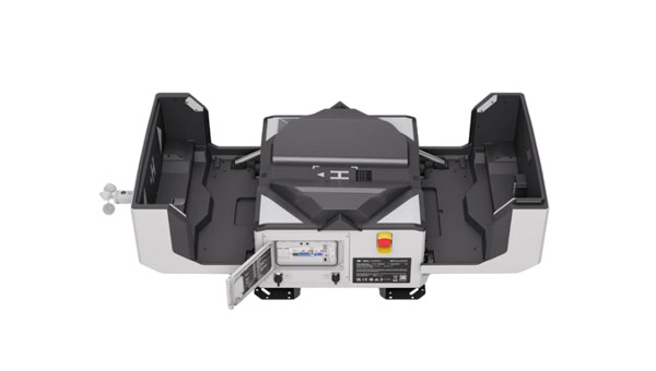
DJI has launched the DJI Dock 2. This lightweight drone-in-a-box solution features the Matrice 3D/3TD UAV and is compatible with DJI FlightHub 2, where automated aerial missions can be managed and monitored through cloud-based operations. DJIDock 2 can streamline daily operations for surveying, inspections, asset management and security.
DJIDock 2 weighs 75 lbs and is 75% smaller and 68% lighter than the previous generation. It uses vision sensors to evaluate a site before deploying the UAV to ensure the flight path and destination have good GNSS signals. This speeds up the site selection process to 12 minutes or less, down from five hours. Once ready, it can quickly complete propeller inspections and get accurate return-to-home (RTH) location information using its dual real-time kinematics (RTK) antennas, which allow the UAV to take off within a minute.
The solution can operate steadily in harsh climates and GNSS environments. It is IP55-ratedfor dust and water resistance and uses gauges for rainfall, wind speed and temperature to sense real-time weather changes. With DJI FlightHub 2 and its integrated online weather forecasting, timely warnings can be issued and flights can be terminated as needed.
Image: DJI
It can be programmed to complete missions automatically, but at any time, operators can control the flight and gimbal angle from any location. Internal and external fisheye lenses provide real-time conditions within and outside the dock, allowing operators to remotely observe weather conditions, environmental circumstances and takeoff and landing situations.
The Canadian Coast Guard (CCG) has awarded a contract to Zighra, an artificial intelligence (AI) solutions and cybersecurity provider, for its GenesysInsights platform. This technology will enhance the safety and security of Canada’s maritime territories by providing a previously unattainable level of analysis.
GenesysInsights combines AI interpretability and multi-sensor fusion, designed to offer automated threat detection and comprehensive situational awareness in maritime environments. The platform synthesizes information from Global Navigation Satellite System (GNSS) signals and terrestrial and space-based Automatic Identification System (AIS) data, which aids the CCG in detecting and responding to maritime threats. This initiative is part of the Innovative Solutions Canada program.
Position, navigation and timing (PNT) technology — integral to a range of critical applications, from military operations guidance to everyday smartphone navigation — has propelled commercial advancement. Despite its widespread utility, the susceptibility of these systems to manipulation presents significant threats, including unauthorized vessel activities and sophisticated cyber-attacks, such as jamming and spoofing.
GenesysInsights aims to transform the security of government infrastructure and operations by creating a cyber-secure digital environment across land, sea and space. The platform uses advanced machine learning algorithms to analyze a variety of sensor data inputs. By monitoring ship movements and communications alongside satellite signal integrity, the technology will detect unusual patterns or anomalies indicative of potential risks.
This pilot project will significantly improve real-time monitoring and analysis of maritime activities to boost safety and security across Canada’s maritime waterways.
It can quickly detect and respond to maritime threats, including sophisticated cyber-attacks, and has an integrated operational command system with automated alerts to enhance decision-making and coordination.
The CCG’s successful implementation of GenesysInsights could lead to broader adoptions in various critical infrastructure sectors such as aviation, ground transportation, logistics, space operations and national security, the company said.
Keysight Technologies has outbid VIAVI Solutions for the acquisition of Spirent Communications, according to Bloomberg News.
The deal proposed by Keysight values Spirent at 201.5 pence per share, inclusive of a 2.5 pence special dividend, leading to an equity valuation of $1.46 billion, based on information from Keysight and Spirent.
Following the announcement, Spirent Communications’ stock witnessed an approximate 11% increase, reaching 198.6 pence per share on the London Stock Exchange.
The intent to purchase comes after VIAVI Solutions extended an all-cash proposal in March 2024 to acquire Spirent for about $1.3 billion. In response to Keysight’s offer, Spirent’s board has retracted their earlier endorsement of VIAVI’s bid.
The successful completion of Keysight’s acquisition hinges on the acceptance of the offer by investors with at least 75% of the voting rights, in addition to obtaining the necessary regulatory approvals.