The Federal Communications Commission (FCC) is investigating whether the use of Russian and Chinese foreign satellite systems by U.S. mobile phones and other devices poses security threats.
The FCC has concerns that U.S. handheld devices are receiving and processing GNSS signals from satellites controlled by foreign adversaries in violation of commission rules.
The FCC is seeking answers from handset manufacturers Apple, Google, Motorola, Nokia, Samsung and others that collectively cover more than 90% of the U.S. smartphone marketplace.
“There is no established record of what security threats, if any, these signals carry and whether the manufacturers of handheld devices are processing these signals in violation of the Commission’s rules,” an FCC spokesperson said in a statement.
Representative Mike Gallagher, chair of the U.S. House Select Committee on the Strategic Competition Between the United States and the Chinese Communist Party, wrote FCC Chair Jessica Rosenworcel earlier this week raising concern about reports that U.S. cell phones were receiving and processing signals from Chinese and Russian satellites.
The FCC has only approved U.S. phones to receive and process signals from the U.S. Global Positioning System (GPS) and the European Galileo GNSS.
CHC Navigation (CHCNAV) has released the RS10 handheld SLAM lidar laser scanner integrated with a full real-time kinematics (RTK) GNSS receiver. Designed to improve efficiency across a wide range of mapping and surveying applications, the RS10 seeks to provide professionals with a versatile, all-in-one tool for capturing 3D geospatial data in both outdoor and indoor environments.
The device integrates a GNSS smart antenna for RTK positioning accuracy even in challenging environments. It delivers 5 cm measurement accuracy by fusing high-precision lidar, RTK, laser and visual SLAM using three HD cameras. It uses a powerful onboard processor for real-time georeferenced point cloud generation in the field. Users can receive instant feedback, which allows them to adjust while scanning. Large sites up to 13,000 square meters can be mapped in real time.
The integration of high-precision GNSS and SLAM technologies eliminates the need for traditional loop closure, which often complicates the data collection process for handheld scanners. Users can freely scan target areas without having to return to previous locations, which can streamline field data capture and significantly reduce time spent in the field.
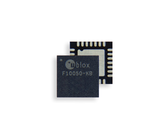
u-blox has introduced the F10 dual-band GNSS platform. It combines L1 and L5 bands to offer enhanced multipath resistance and meter-level positioning accuracy. The platform caters to urban mobility applications, such as aftermarket telematics and micro-mobility.
Applications that use GNSS receivers for accurate positioning are on the rise. Yet, current receivers do not fully perform in urban areas. Accurate and reliable positioning in dense urban environments — where buildings or tree foliage can reflect satellite signals — requires GNSS receivers to mitigate multipath effects. The L5 band’s resilience to these effects aims to improve positioning accuracy. Combined with the well-established L1 band, an L1/L5 dual-band GNSS receiver can deliver a less than 2 m positioning accuracy (CEP50), against about 4 m with the L1 band only. The u-blox team has conducted driving tests in several urban areas and reported significant improvement over GNSS L1 receivers.
The F10’s firmware algorithm prioritizes L5 band signals in weak signal environments to provide reliable positioning accuracy, even when paired with small antennas. The platform is also equipped with protection-level technology that provides a real-time positioning accuracy estimate.
When a cellular modem is extremely close to a GNSS receiver, it can interfere with the receiver’s reception. Some F10 module models, such as NEO-F10N, MAX-F10S, and MIA-F10Q, are equipped with a robust RF circuit that allows the GNSS and the cellular modem to operate without interference.
The u-blox F10 platform is pin-to-pin compatible with the previous u-blox M10 generation for easy migration. It also supports u-blox AssistNow, which offers real-time online A-GNSS service with global availability to reduce GNSS time-to-first fix and power consumption.
The u-blox EVK-F101 evaluation kit will be available in April 2024.
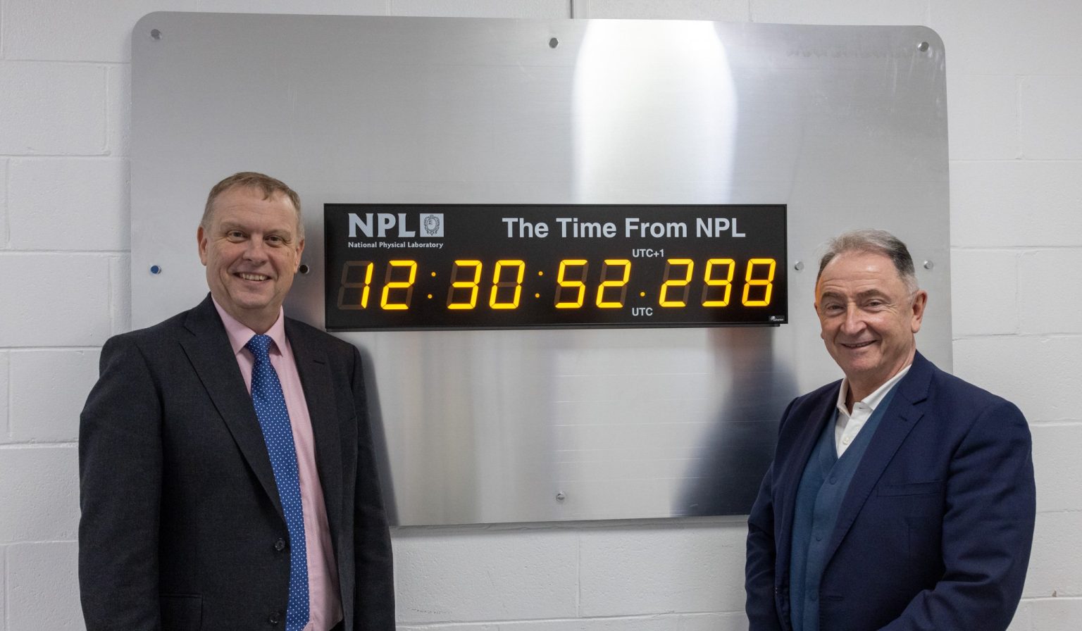
Peter Thompson, Ph.D., CEO of NPL, left, with Jim McDonald, professor at the University of Strathclyde. (Image: NPL)
The National Physical Laboratory (NPL) has marked the inauguration of the first of three innovation nodes designed to enhance the United Kingdom’s capabilities in the development of time-critical technologies. The initiative is aimed at sectors such as transport, telecommunications, fintech and quantum with the application of accurate and precise timing.
In a collaborative effort between NPL and host organizations, including the University of Strathclyde, the University of Surrey and Cranfield University, the Innovation Nodes stand as a cornerstone of NPL’s National Timing Centre Programme. It represents the UK’s nationally distributed time infrastructure and offers secure, reliable, resilient and highly accurate time and frequency data. This infrastructure is crucial for the development of new technologies in time-critical 5G and 6G applications, next-generation automated factories and connected autonomous vehicles.
Throughout the development phase, the node sites at the Universities of Strathclyde, Surrey and Cranfield have hosted feasibility and demonstrator projects funded by Innovate UK, the United Kingdom’s innovation agency. These projects have benefited from technical consultancy and access to high-accuracy timing signals, which encourage the development of new products and services. These initiatives were created as an effort to establish an evidence base for redistributing positioning, navigation and timing (PNT) data to air and ground-based autonomous systems within a smart city infrastructure. This will ensure the safety, reliability and security of autonomous transport.
NPL welcomes collaboration with industry and academia to leverage the Innovation Nodes for access to traceable and high-accuracy timing signals and promises to stimulate further innovation and development in critical sectors.
Professor Paul Griffin of Strathclyde’s Department of Physics pointed out the vulnerabilities of GNSS to jamming and spoofing, underscoring the NTC’s mission to provide robust timing for the UK independent of GNSS. The initiative includes the use of atomic clocks at Anthorn in Cumbria, aligning with UTC through the NPL Time Over eLoran (NTOL) project, led by Chronos Technology. This project demonstrates the transmission of NPL’s timebase via eLORAN and its decoding by Strathclyde’s Power Networks Demonstration Center (PNDC), which is a significant advancement in securing the country’s timing infrastructure against potential threats.
u-blox has partnered with Cellular Tracking Technologies (CTT), a specialist in wildlife telemetry and Internet of Things (IoT) solutions, in an initiative aimed at conserving Antarctic wildlife.
The collaboration has introduced a cloud-based positioning solution to monitor the activities of Adélie penguins in Ross Island, Antarctica. The venture began when Point Blue, an American wildlife conservation organization, reached out to CTT to create a tracking mechanism that could study the movements of young Adélie penguins. These birds are among the five penguin species inhabiting Antarctica and are considered crucial for environmental studies due to their sensitivity to ecological shifts caused by climate change and human activities, such as commercial fishing.
Due to the challenging conditions in Antarctica, tracking penguins required a device that was lightweight, non-intrusive, energy-efficient, and cost-effective in terms of data transmission. This was particularly important given the small size of the penguins, their rapid movement, and their extended underwater dives.
u-blox provided its CloudLocate positioning service to meet these stringent requirements, which led to the development of CTT’s Penguin Iridium GNSS tracker. The tracker is fixed to the penguins’ backs and uses one of u-blox’s compact GNSS modules. The CloudLocate service processes the positioning calculation in the cloud rather than on the device to save energy and enable prolonged monitoring periods without the need for frequent device replacements.
The tracker operates by sending a concise 50 B message, which captures essential location data during the brief moments when a penguin surfaces for air. This level of efficiency is critical in minimizing the costs associated with satellite connectivity, which is often prohibitively expensive in such remote regions.
This partnership marks an advancement in wildlife conservation technology by allowing for non-invasive, continuous monitoring of Adélie penguins and providing vital data for assessing the impacts of environmental changes. CTT aims to extend this tracking solution to a wider range of wildlife research and conservation projects to demonstrate the potential for technological innovation to contribute significantly to ecological preservation efforts.
A plane carrying British Defense Secretary Grant Shapps had its satellite signal jammed as it flew near Russian territory, the government reported on March 14.
The government said that the Royal Air Force jet carrying Shapps, officials and journalists “temporarily experienced GPS jamming when they flew close to Kaliningrad” on a flight from Poland to the UK.
The Times of London, whose reporter was onboard, said that for about 30 minutes mobile phones could not connect to the internet and the aircraft was forced to use alternative methods to determine its location.
Kaliningrad is a Russian enclave bordered by Poland and Lithuania, home to the Russian Navy’s Baltic Fleet. Prime Minister Rishi Sunak’s spokesman, Dave Pares, said “the jamming didn’t threaten the safety of the aircraft at any point.” He added that it is not unusual for aircraft to experience electronic jamming near Kaliningrad.
infiniDome, a provider of GPS protection and resilient navigation solutions, has opened infiniDome USA, a new subsidiary designed to enhance service to the United States defense industry.
By establishing infiniDome USA, infiniDome aims to strengthen its relationships with U.S. customers, offering more localized support and ensuring that its innovative GPS protection technologies meet the specific needs and challenges faced by American aerospace and defense sectors.
infiniDome’s anti-jamming technology offers resilience and reliability to critical systems across a variety of sectors including defense, timing systems, aviation, and autonomous vehicles.
According to the company, infiniDome’s expansion to the U.S. comes in response to the critical need for enhanced proportional GPS security measures amidst the growing threats to GPS-dependent technologies. In direct correlation to government and industry projects, calling for small, light, “attritable” UAVs, protection for such platforms also must be proportional in size, weight, and cost.
infiniDome invites industry partners, customers, and media to learn more about infiniDome USA and its advanced GPS protection and navigation resiliency solutions at AUVSI Xponential 2024 in San Diego, which takes place April 22 to 25.
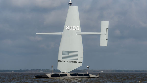
Saildrone has released its first aluminum Surveyor unmanned surface vehicle (USV) off the Austal USA production line in Mobile, Alabama. Chief of Naval Operations (CNO) Lisa Franchetti was on site to inspect the vehicle, ahead of these new USVs being tested under contract to the U.S. Navy.
The Surveyor USV is primarily designed for ocean mapping and maritime domain awareness. The wind, solar power and a diesel generator for long-range, long-endurance missions in the open ocean power it.
The Surveyor is equipped with the latest multibeam sonar technology, which enables it to map the seafloor up to a depth of 11,000 m. Additionally, it can carry defense and security payloads that are specifically designed to detect and respond to various maritime threats and challenges.
Upcoming Navy missions will focus on the ability of the Surveyor to deliver both surface and undersea intelligence for a range of high-priority applications, including anti-submarine warfare (ASW).
To meet the increasing demand for Surveyor USVs, Saildrone partnered with Austal USA, an Alabama-based ship manufacturer, to produce one Surveyor every six weeks, with the ability to scale up production as demand requires.
At 20 m long and weighing 15 tons, the Surveyor classifies as a medium USV, built to American Bureau of Shipping (ABS) Light Warship code. These first Surveyors are contracted to the U.S. Navy to test and evaluate Surveyor-class vehicles in multiple environments.
Abracon has partnered with u-blox to combine the u-blox ZED-F9P GNSS receiver module and the Abracon APXG6016GH full-band, multi-constellation active GNSS antenna. This pairing offers centimeter-level accuracy designed for a variety of industries such as precision agriculture and mobile robotics.
The APXG6016GH antenna is designed with a robust pre-filtered low-noise amplifier (LNA), which offers strong anti-interference performance in challenging environments. It supports multi-frequency reception, including L1, L2, L5, and L-band correction services, for robust signal reception and enhanced accuracy.
The u-blox ZED-F9P module is designed to provide precise and reliable performance in various applications. When combined with the Abracon APXG6016GH antenna, this module gives users access to accurate positioning data critical for demanding navigation tasks.
The Abracon APXG6016GH antenna features tightly grouped phase center variation with advanced multi-feeding technology, which provides consistent performance across various scenarios. Its compact and lightweight design makes it ideal for portability and UAV applications, providing users with flexibility and ease of integration.
Working in agriculture means facing a variety of challenges imposed by nature. Unfavorable weather conditions, such as irregular rainfall, strong winds and hail, are common obstacles for producers and companies involved in the sector. Additionally, a recent rise in solar flares has caused headaches for those who rely on precision agriculture technologies, such as satellite positioning technologies, to operate farm machinery.
Ionospheric scintillation is a phenomenon that causes rapid and irregular variations in the power of radio frequency signals that travel through the ionosphere, a region of the Earth’s atmosphere that has ionized particles, which makes it capable of reflecting and refracting radio signals, such as those used in satellite communications and GNSS.
These variations in the power of radio signals occur due to disturbances in the concentrations of free electrons in the ionosphere, which various factors, including solar activity, geomagnetic events and weather conditions in the upper atmosphere can influence. Fluctuations in the electron density of the ionosphere cause distortions in radio signals, leading to fluctuations in the signal’s power and phase. Some of the consequences of this phenomenon are almost imperceptible, such as a deviation of 1 m or 2 m in the position calculated by your cell phone’s GPS receiver. When it comes to precision farming, however, a few centimeters of error in machine positioning can severely impact operations by increasing input waste, reducing efficiency and decreasing production.
Many farmers, especially in Brazil, plant and harvest two crops a year, and rely on precision farming technology to sow and harvest quickly and accurately. With an estimated production of 317.5 million tons for the 2023/24 harvest, according to the Brazilian National Supply Company (Conab), these producers have buffer time to keep their machines idle. During planting and harvesting periods, farms often operate 24 hours a day, 7 days a week, and precise positioning via GNSS is essential for using solutions such as auto-steering and traffic control. When ionospheric scintillation affects the performance of location systems, it causes delays and inaccuracies, directly impacting the productivity of farms and damaging the operations’ efficiency and profitability.
To mitigate the impacts caused by ionospheric scintillation, as well as other problems that can affect receivers, farmers have several GNSS correction options at their disposal, such as precise point positioning (PPP) and real-time kinematics (RTK). These alternatives aim to increase positioning accuracy for high-precision applications and create different levels of resilience against ionospheric interference. However, it can still affect these services, causing errors in the receiver’s position calculations. In RTK systems, which rely on carrier phase measurements, scintillation can drastically impair positioning accuracy, especially at greater distances from the base station.
To overcome scintillation challenges, PPP positioning is a more reliable option. Unlike RTK, PPP estimates ionospheric errors at the receiver’s location and does not depend on corrections from a local base station. This allows users to achieve high precision anywhere within the global coverage area, regardless of the distance from the base station. In addition, PPP takes into account the immediate ionospheric environment, making it less sensitive to changes in atmospheric activity.
A study by Hexagon | NovAtel in 2020, analyzed the ionospheric activity in the central-western region of Brazil, comparing a standard RTK positioning solution and the PPP TerraStar-C PRO positioning solution, developed by NovAtel. A 24-hour data collection captured the nocturnal impacts of ionospheric activity and yielded some insights: while RTK position performance at 10 km from the base station was degraded for many hours, showing errors of up to 25 cm, the receiver using TerraStar-C PRO corrections continues to experience centimeter-level accuracy, with shorter maximum deviations of up to 10 cm.
In summary, ionospheric scintillation is a growing challenge for precision agriculture, affecting the productivity and efficiency of agricultural operations. To minimize its impacts, the adoption of correction services such as TerraStar-C PRO has proven to be a resilient and reliable solution, allowing farmers to continue their operations accurately and effectively, even in challenging conditions. The development of increasingly advanced precision solutions is crucial to ensuring the success of agriculture.
FrontierSI, a not-for-profit research organization specializing in positioning, geodesy, spatial infrastructures and rapid spatial analytics, has released a review of Australia’s resilient positioning, navigation and timing (PNT) policy to fortify the country’s PNT infrastructure. The review, expanded upon in a new white paper and technical report, was created in response to the increasing number of cyber threats.
“PNT is an essential utility we presently have no control over,” said Joshua Critchley-Marrows, FrontierSI’s space PNT lead. “Australia’s access to PNT is intrinsically linked to satellite-delivered services from foreign-owned and operated assets, such as the USA’s Global Positioning System (GPS). Investing in our infrastructure is crucial to ensure continuous access to this critical service that underpins nearly all aspects of our daily lives.”
According to FronteirSI, the reliance on foreign satellite systems exposes Australia to significant vulnerabilities, such as recent technological failures and cyber-attacks. These incidents emphasize the need for a self-reliant and robust PNT ecosystem capable of withstanding both unintentional and malicious disruptions.
FrontierSI aims to bolster PNT resilience by enhancing the systems’ robustness against disruptions and advocating for the development of assured, robust, augmented and alternative PNT solutions. The recommendations outlined in the white paper and technical report call for proactive measures, including legislative updates and supply chain risk assessments, to protect Australia’s critical infrastructure and economic vitality.
A roundup of recent products in the GNSS and inertial positioning industry from the March 2024 issue of GPS World magazine.
SURVEYING & MAPPING
GNSS Receiver Supports tilted measurement
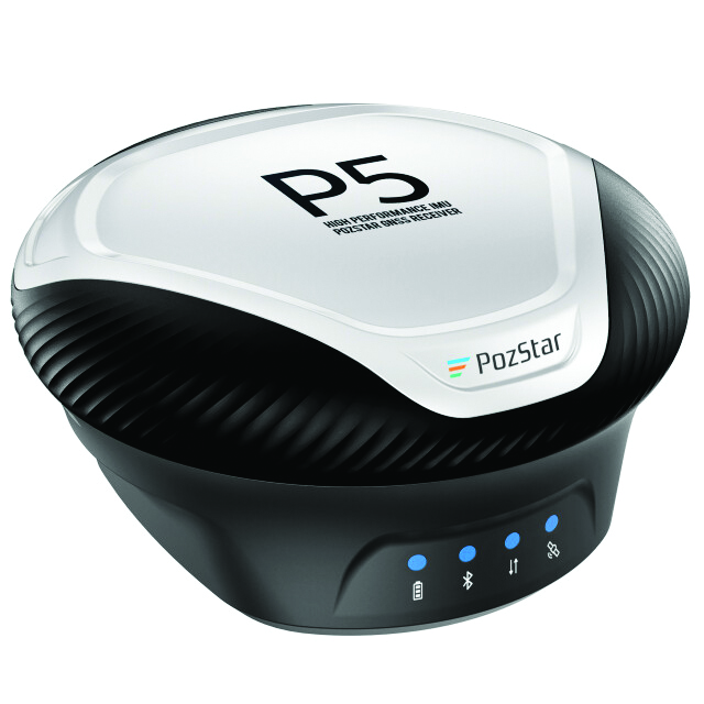
PozStar P5 is a high-precision GNSS receiver. It is powered by a 1,408-channel multi-band GNSS receiver designed to improve surveying in the field. It is equipped with Bluetooth, WiFi and UHF radio. The inertial measuring unit (IMU) supports tilted measurement, which allows users to obtain quick initialization and accurate measurements with an inclination of up to 60°.
The receiver comes with radio connector options used in a frequency range of 410 MHz to 470 MHz and a 5-pin serial port, which allows for external radio system connectivity and NMEA data output. It is also weatherproof, rated IP67.
PozStar P5 can collect control and surveying data for RTK equipment to perform surveying, map input and drawing operations. The receiver can be used with PozPad, an Android-based RTK field software.
PozStar, pozstar.com
Lidar System Designed for aerial surveying
The TrueView 540 lidar system integrates lidar technology with LP360 3D point cloud processing software to enhance survey-grade lidar applications.
The system is designed to provide enhanced data density, accuracy, and precision for aerial surveying. It combines lidar, an accurate positioning and orientation system and a full-frame industrial camera in a compact, lightweight package. It is suitable for a variety of UAVs, including the DJI Matrice 350.
The TrueView 540 features high-precision lidar technology comparable to high-end industry-standard payloads in terms of range, density and accuracy. It will be made available through GeoCue and its authorized distributors. GeoCue, geocue.com
GNSS Solution Combined with Septentrio’s mosaic-X5 module
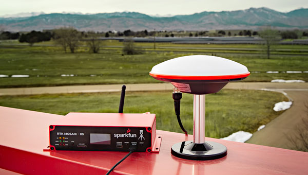
The SparkFun real-time kinematics (RTK) mosaic-X5 uses the multi-constellation, multi-frequency capabilities of the Septentrio mosaic-X5 module, which aims to improve accuracy and reliability in a variety of position applications.
The RTK mosaic-X5 is a 448-channel receiver that supports all four Global Navigation Satellite Systems (GNSS) — GPS, GLONASS, BeiDou and Galileo — and one of the two regional ones, NavIC. It can function as both an RTK base and rover, which allows users to achieve horizontal positioning accuracy down to 6 mm and updates at a rate of 100 Hz.
The device incorporates the Espressif ESP32-WROVER processor, which allows for high-speed processing and a variety of connectivity options. The ESP32 provides the device with USB-C, Ethernet-over-USB and an Ethernet to WiFi Bridge mode to ensure seamless integration into any project setup.
The device also has power flexibility, including USB-C, Power-over-Ethernet, and external DC sources, along with data logging in multiple formats such as RINEX and NMEA. Housed in a custom-designed aluminum case, the RTK mosaic-X5 features a comprehensive web server interface to simplify configuration and monitoring. SparkFun Electronics, sparkfun.com
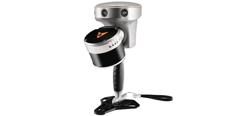
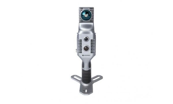
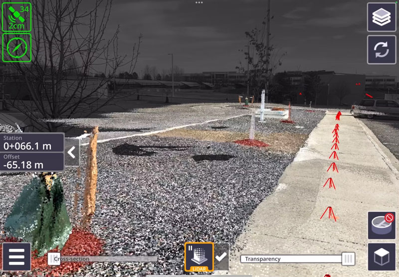
Hybrid Mobile Mapping Solution Combines mobile scanning with a stationary mode
The X70GO SLAM laser scanner is designed for fast and efficient large-area surveys. It combines mobile scanning with a stationary mode to scan with high resolution to enhance overall surveying capabilities.
X70GO is a real-time 3D model reconstruction device that integrates an inertial navigation module, high-performance computer and storage system. It is equipped with a 360° rotating head, which, combined with the SLAM algorithm, can generate high-precision point cloud data. The built-in 512GB memory disk stores survey results and the dismountable handle has a 1.5-hour battery life.
A 12MP RGB camera offers texture information, while a visual camera aims to enhance the real-time preview with the GOapp. Mapping results can be generated immediately inside the scanner. Users can then color the points and improve their accuracy during post-processing with GOpost software.
The system comes with a hybrid scanning capability. The X-Whizz mode combines the advantages of SLAM mode with the resolution of a static scan, which eliminates the need for multiple scan stations. Users can move around the scene to collect the entire 3D point cloud without time-consuming cloud-to-cloud alignment.
The technology incorporated in the new scanner is designed to provide extended range, a higher number of points per second and advanced onboard processing algorithms. The SLAM laser scanner is well-suited for challenging environments and can be used in a variety of applications, including BIM, industrial sites, real estate, heritage preservation, tunnels and mining.
Users can add an RTK module to set a point cloud in a global coordinate system. This can support adding GNSS information to that from lidar and the inertial measurement unit (IMU) in the SLAM algorithm. In situations with limited GPS connectivity – such as indoors or in challenging environments – the system will rely on lidar and the IMU for positioning purposes. Stonex, stonex.it
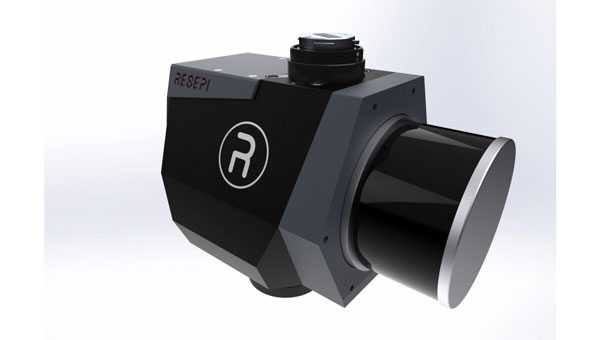
Remote Sensing Payload Integrates with UAVs and other platforms
The RESEPI lidar Gen-II remote sensing payload instrument comes in three modes: aerial mode for comprehensive airborne data collection, mobile mode for dynamic vehicular data collection and a versatile handheld/backpack that aims to provide portability and ease of use for ground personnel.
The RESEPI lidar Gen-II has a 175% increase in computing power, designed to speed up processing and enhance efficiency during complex tasks. Its memory capacity has been increased by 700%, which allows for extensive data handling and improved system performance. The system’s 50% increase in storage capacity aims to facilitate longer durations of data collection without frequent offloads.
The Gen-II features seamless integration capabilities with UAVs and other platforms. The system’s sensor-agnostic design allows for external sensors to be easily integrated, including lidar and cameras. It also can compute point clouds, trajectories and solutions in real-time, which is critical in time-sensitive missions. The system can be used in a variety of applications including mapping, inspection, autonomous vehicles, navigation and robotics. Inertial Labs, inertiallabs.com
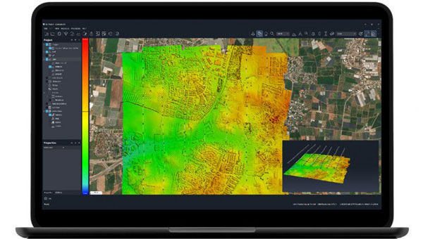
Mapping Software With upgraded cloud capabilities
The Correlator3D mapping software now has upgraded cloud capabilities. With its distributed processing capabilities, Correlator3D allows users to scale their processing to match individual operational needs.
With the upgrade, Correlator3D can process large mapping projects and deliver results from UAV, aircraft and satellite imagery. It features a software package – a patented, end-to-end photogrammetry solution — designed to generate high-quality geospatial data from a variety of sources, including satellite and aerial imagery and UAVs. The upgrade aims to improve the technology’s performance in diverse cloud scenarios.
Correlator3D is designed to provide aerial triangulation (AT) and generate dense digital surface models (DSM), precise digital terrain models (DTM), point clouds, orthomosaics, 3D models and vectorized 3D features. By using GPU technology and multi-core CPUs, Correlator3D offers enhanced processing speed to support the rapid production of large datasets. SimActive, simactive.com
MOBILE
Handheld GNSS Data Collector Ideal for construction surveying
TDC6 is a handheld GNSS data collector designed for high-performance construction surveying. The device allows contractors to work with more complex data sets more effectively in the field, connect to the office for on-the-spot approvals, and quickly communicate changes to field crews.
The small, rugged device offers integrated Wi-Fi and Bluetooth, built-in cameras and 5G compatibility in a lightweight, shock-, dust- and water-resistant package. The device integrates seamlessly with Trimble data collection applications, including Trimble TerraFlex GIS software and Trimble Access survey field software, as well as third-party apps such as Esri ArcGIS Field Maps. Trimble Geospatial, geospatial.trimble.com
Military-Grade Antennas Designed for mission-critical applications
This advanced military-grade antenna product line includes ruggedized GPS, manpack omni and vehicle omni antennas. The products are designed for mission-critical applications such as vehicle navigation, personnel communications, vehicle communications, electronic warfare, and jamming.
The antennas meet MIL-STD-810 to offer durability while adhering to strict quality standards. The antennas also are compliant with the Trade Agreements Act (TAA), which makes them suitable for government and defense applications.
Built to withstand tough conditions, these antennas feature heavy-duty construction and a rugged design for long-lasting performance in challenging environments. They are designed to perform in extreme weather conditions and on rough terrains.
Its robust construction and NATO/U.S. standard mounting options aim to simplify integration into various setups during critical operations. Fairview Microwave, fairviewmicrowave.com
Trimble SiteVision Software 5.0. (Image: Trimble)
Outdoor Augmented Reality System With 3D scanning capabilities
SiteVision Software 5.0 is a high-accuracy outdoor augmented reality system, now with a 3D scan tool. The new 3D scan tool allows users to use lidar sensors available on some Apple Pro devices. The Trimble DA2 GNSS receiver is designed to capture point clouds efficiently and accurately with a single handheld solution.
Users can visualize 3D scan data directly in the field with SiteVision’s augmented reality view. The software allows users to create as-builts of the job site on the go, measure and plan resource allocation, reduce scan times, supplement UAV data and more by combining scanning and precision in a mobile solution. The product aims to facilitate practical and accessible field-to-office workflows for surveyors, contractors and engineers.
Trimble Geospatial, geospatial.trimble.com
OEM
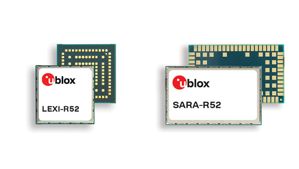
Two LTE Modules With integrated GNSS
The LTE-M cellular module series, the SARA-R52 and LEXI-R52, are designed to meet the needs of industrial applications requiring both positioning and wireless communication capabilities. Based on the u-blox UBX-R52 cellular chip, these modules are designed for a variety of internet of things (IoT) use cases, including both fixed and mobile applications.
The UBX-R52 chip is designed to simplify product design by reducing the need for additional components. It includes SpotNow, a positioning function developed by u-blox, which aims to provide location data with an accuracy of up to 10 m within a few seconds. This function is targeted at applications requiring occasional tracking, such as waste management, personal trackers and industrial machinery.
The chip’s uCPU feature allows the execution of custom software directly on the chip and eliminates the necessity for an external microcontroller unit (MCU). The smart connection manager (uSCM) is a feature designed to manage connectivity automatically, focusing on optimizing performance or minimizing power consumption under varying connection conditions.
The R52 series introduces the SARA-R520M10 combo module, which is equipped with an integrated u-blox M10 GNSS receiver. This module is designed to provide simultaneous GNSS and cellular connectivity, supporting applications that require continuous or periodic tracking with features such as low power consumption, improved time-to-first-fix (TTFF) and increased RF sensitivity.
Unlike many LTE-M modules that typically offer an RF output power of 20-21 dBm, the new R52 series modules offer a higher output power of 23 dBm to improve connectivity in difficult coverage areas. The LEXI-R52 offers the same functionalities as the SARA-R52 but comes in a smaller form factor, making it ideal for applications with space constraints, such as wearable technology.
These additions to u-blox’s LTE-M module portfolio are designed to address the integration of GNSS and wireless communication in industrial IoT applications, offering solutions for a range of use cases that require robust connectivity. u-blox,u-blox.com
UAV
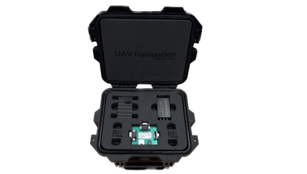
GNSS-Denied Navigation Kit For challenging environments
This GNSS-denied navigation kit is designed to offer navigation capabilities in challenging environments. It combines UAV Navigation’s attitude and heading reference system (AHRS), the POLAR-300, with its Visual Navigation System, the VNS01, to offer advanced dead reckoning navigation capabilities with minimal drift.
The technology has error rates as low as 0% to 1% over covered distances. This is made possible by the kit’s visual-based technology, which allows for precise attitude and position estimation to stabilize flights in challenging conditions. The kit is equipped with advanced algorithms that can detect and counter sophisticated spoofing and jamming techniques to offer reliable and secure navigation, even in the face of potential signal disruptions. The kit can be used in both civil and defense sectors.
UAV Navigation-Grupo Oesía, uavnavigation.com
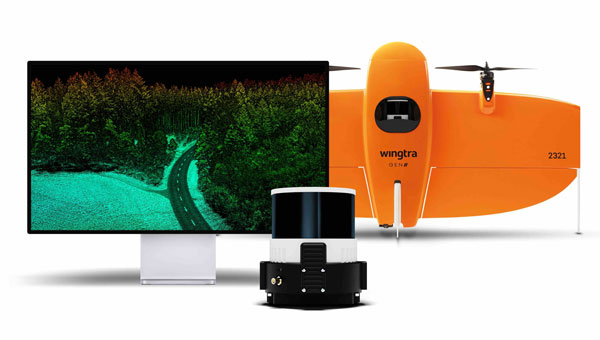
Lidar UAV Solution Offers immediate access to terrain information
The lidar UAV mapping solution combines the WingtraOne GEN II UAV with a newly developed lidar sensor. This integration aims to advance UAV lidar efficiency, increase accuracy and simplify integration.
The solution incorporates a Hesai scanner, Inertial Labs IMU and NovAtel GNSS receiver designed to optimize data acquisition and reduce the need for post-processing strip alignment. This advancement offers immediate access to precise terrain information following each flight and enhances the efficiency of mapping and photogrammetric analysis in various sectors.
One of the key features of the lidar system is its reduced field time, with no calibration needed and a one-minute initialization process. The Wingtra lidar application and the system’s automated features offer a streamlined data capture process, which makes it accessible even to those new to lidar technology.
The solution offers a vertical accuracy of 3 cm from a 60 m flight height, with leading point density in its class. The WingtraOne GEN II’s design and automated flight patterns offer consistent results across different pilots. Wingtra, wingtra.com
MACHINE CONTROL
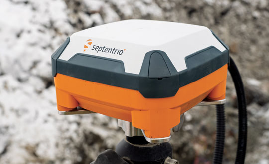
GNSS Smart Antenna Designed for industrial environments
AntaRx-Si3 is a GNSS/INS smart antenna housed in an ultra-rugged enclosure, designed for straightforward installation on machinery such as agricultural robots. It combines Septentrio’s centimeter-level GNSS positioning with an inertial measurement unit (IMU) within the same enclosure as the GNSS antenna, which uses FUSE+ technology.
The AntaRx-Si3 is designed for challenging industrial environments where GNSS signals are at risk of obstruction, such as under heavy foliage. The antenna’s exterior is crafted from impact-resistant polycarbonate with an IP69K rating and can withstand significant shocks, vibrations, and harsh environmental conditions.
It uses Septentrio’s GNSS+ algorithms to offer advanced multipath mitigation to operate in environments where satellite signals could be reflected off surrounding machinery or structures, such as silos. The antenna delivers high update rates and low latency positioning, which are crucial for the control loops of autonomous movements or rotations. Septentrio, septentrio.com
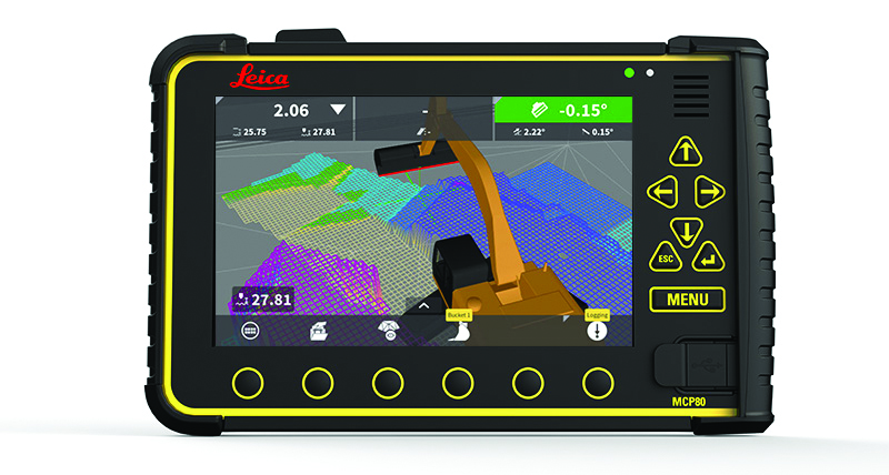
3D Machine Control Software Suitable for construction sites
The Leica MC1 software platform is designed to guide and automate machine control solutions.
Leica MC1 machine control software continues to evolve toward achieving a smart digital reality, with features such as Modify Models and surface logging. It compares the design model to the actual position of the machine’s cutting edge, such as the bucket or blade edge. The technology aims to assist operators in positioning machinery to achieve the planned design while allowing for a live digital representation of the progress. The software automatically controls the position of the machine’s cutting edge.
It is carried by the rugged hardware platform, the Leica MCP80 panel and MDS Series docking station, offering an interchangeable panel between machines on a job site. The MC1 platform is supported by the cloud-based Leica ConX productivity platform to offer more efficient management of heavy construction projects.
Leica Geosystems, part of Hexagon, leica-geosystems.com