From its very first issues, 31 years ago, this magazine has covered the role of GPS, now GNSS, in guiding ships, trains and automobiles. What were then some of the most aspirational visions of future applications are now routine. For all forms of transportation, navigation is a safety-critical issue. This is particularly true in the case of cars on public roads, which is also where the technical challenges are the greatest. Ships mostly travel in deep waters, far away from other traffic and fixed obstructions, and nearly always enjoy an unobstructed line-of-sight to GNSS satellites. So do trains, which have the additional advantages of being kept, literally, on track and of operating in controlled environments, with hardly any concerns for unexpected intrusions on their path. Cars, trucks, and busses, on the other hand, must contend with many other vehicles, including those with distracted, drowsy, drunk, or drugged drivers, as well as cyclists, pedestrians, accidents, construction and a bedeviling myriad of sudden and often unpredictable circumstances. Additionally, their view of the sky is often limited by overpasses, tunnels and tall buildings, which challenge GNSS-based navigation with signal occultation and multipath, and their view of their surroundings is often blurred by weather conditions.
Currently, prototype autonomous vehicles carry cameras, lidar scanners, radars and ultrasonic sensors to provide positioning relative to mapped features, as well as for collision avoidance. However, some use cases require absolute positioning sensors, consisting of GNSS receivers coupled with inertial sensors. For example, autonomy levels 3 and 4 require dynamic error bounds of no more than a few meters most of the time under challenging highway conditions and levels 4 and 5 will require this level of accuracy even in deep urban canyons.
This month’s cover story highlights progress in several transportation-related GNSS/PNT applications
Would it be beneficial for GNSS constellations to transmit signals at higher frequencies, such as in the S-band or the C-band, following the example of the Indian NavIC?
Jean-Marie Sleewaegen
“The S- and C-bands refer to frequency bands centered around 2492 MHz and 5020 MHz. The main advantage compared to L-band is the reduced effect of the ionosphere. However, this comes at the expense of higher propagation losses, increased phase jitter due to the lower wavelength, and extra cost in the receiver and antenna when combined with L-band. The added value for existing GNSS systems already transmitting multiple signals in L-band is probably low. However, because they are less congested than L-band, those bands could be attractive to new space-based PNT services.”
— Jean-Marie Sleewaegen, Septentrio
Alison Brown
“The main challenge with adding additional bands to GNSS constellations (other than getting frequency allocations) is that these will not be compatible with any existing GNSS chip sets or fielded antennas. The cost/benefit analysis is unlikely to be attractive for most GNSS chip vendors to develop products with this capability.”
— Alison Brown, NAVSYS Corporation
Ellen Hall
“There are benefits that the higher bands can offer in GNSS, however the constellation and system must be designed to take advantage of them, which makes it very difficult for the legacy systems that were designed around L-band only to tap into any of these benefits. Higher bands have lower ionospheric distortion, which enables better single-frequency accuracy and unlocks some interesting multi-frequency capability, while shorter wavelengths can allow for smaller antennas in user equipment. However, the tropo/atmospheric distortion gets worse as well as the spreading losses. Another consideration for the higher bands is spectrum interference, as the S-band area especially is extremely busy.”
Danalto was visited by Ireland’s Minister Damien English upon the announcement of an ESA contract. (From left) English, Mary Kathryn Midgett (danalto), Tom Kelly (Enterprise Ireland) and David McDonald (danalto). (Photo: danalto)
Dublin-based danalto Ltd., has won a contract with the European Space Agency (ESA) to demonstrate low-infrastructure indoor location technologies that complement GNSS, particularly Galileo. ESA seeks to improve this European capability in order to enable impactful, societal use cases, thus prompting its call for this investigation, assessment, and demonstration by danalto.
Danalto is a internet of things (IoT) software company specializing in positioning and spatial intelligence technologies. It has extensive experience in positioning intelligence with its FiLo, a LoRa 2.4 GHz-enabled solution known for both its low power and low infrastructure requirements.
During the 18-month contract, danalto will determine the best positioning technology, system algorithms and deployment aspects across a range of location accuracies. This will be done by critically analyzing both classic (observables-based) and disruptive (signal-based) positioning techniques, culminating in a hybrid combination technology solution.
The resulting solution will support use cases across multiple industries — including healthcare, logistics and emergency services — and will accelerate the increased adoption of location positioning solutions within the European market and beyond. The trajectory of this project aligns with danalto’s progression plan for next generation positioning solutions, which will be brought to market for commercial use in 2022.
On Oct. 27, danalto was visited by Minister Damien English and Enterprise Ireland for a briefing on FiLo’s progress to date and plans moving forward aligned with ESA and beyond.
China and the Arab states will expand their cooperation in using the China-developed BeiDou Navigation Satellite System (BDS), according to the third China-Arab States BDS Cooperation Forum and reported by XinhuaNet.
China and the Arab states will jointly implement pilot projects in key domains in the application of BDS and GNSS over the 2022-2023 period, according to a cooperation action plan signed at the forum, held Dec. 8 in Beijing.
Both sides will facilitate the establishment of BDS/GNSS centers in the Arab states, hold training courses on satellite navigation technologies, and exchange visiting scholars. Each year, China will offer scholarships to three to five students majoring in navigation and communications from the Arab states, said the action plan.
China and the Arab states will also carry out joint BDS/GNSS tests and evaluations, and promote the application of BDS in international search and rescue, among other initiatives.
All the moves are expected to boost “win-win cooperation” and make BDS better serve the Arab states, said the action plan.
This year’s forum was held after China officially commissioned BDS on July 31, 2020, opening the new BDS-3 system to global users.
Along with positioning, navigation and timing services, the BDS-3 system can provide a variety of value-added services such as global search-and-rescue assistance, short message communication, ground- and satellite-based augmentation, and precise point positioning.
The forum highlighted the achievements and experience of China and Arab states in BDS/GNSS cooperation and proposed a platform for both sides to upgrade the win-win cooperation.
BeiDou benefits in Arab States
The BDS-based applications and solutions have benefited multiple industries in Arab states. BDS has been providing real-time, continuous, stable and precise GNSS positioning information data and timely information via continuously operating reference stations (CORS) in Tunisia, Algeria and other places.
High-precision BDS/GNSS applications are also serving diverse fields such as land mapping, transportation, precision agriculture and environmental monitoring.
Project management of railway construction in the United Arab Emirates (UAE) has benefitted from the integrated technologies of BDS/GNSS and the internet of things, with efficient use of data and information.
BDS has entered a new phase of industrial and international development, according to the China Satellite Navigation Office.
Satellite communications company Inmarsat is working on a United Kingdom Space Agency-funded test project with the European Space Agency to deliver the first UK-generated satellite navigation signal. The project provides a potential platform for the UK to enhance its post-Brexit positioning, navigation and timing (PNT) capabilities.
Repurposing a transponder from the Inmarsat-3 F5 satellite, the test project — known as UK Space-Based Augmentation System (UK SBAS) — will provide an overlay signal to augment the U.S. GPS, refining its accuracy from a few meters to a few centimeters.
UK PNT without EGNOS
The UK no longer has access to the European Geostationary Navigation Overlay Service (EGNOS) Safety of Life services since leaving the European Union (EU) and is not involved in the EU’s Galileo programme for similar reasons. Therefore, this new national capability supported by current and future Inmarsat satellites could offer a new option for high-integrity, precision navigation across the country, in its airspace and within surrounding waters.
UK SBAS will provide a basis to assess its future development into an operational capability to support safety-critical applications such as aircraft approaching and landing at airports or navigating ships through narrow channels, especially at night and in poor weather conditions.
Goonhilly will provide the uplink for the system from Cornwall. Software from GMV NSL, based in Nottingham, will generate the ground-based navigation signal. This is a similar system to that already in use in Australia and New Zealand, supported by Inmarsat.
The project could be crucial for UK users who need accurate, high-integrity navigation capabilities to enable their operations. It will initially cover aviation and maritime operations, but has the potential to extend into rail and other land-vehicle applications. For example, UK SBAS will comply with International Civil Aviation Organization (ICAO) standards.
“It is very welcome news to hear that UK-based companies have teamed up to deliver this ground-breaking project, with help from government funding,” said Transport Minister Trudy Harrison. “From flying planes to steering ships, reliable and precise navigation support is a crucial part of travel. This development is a significant step forward for our world-leading space sector, as we accelerate towards a net-zero transport future.”
Best satellite candidate
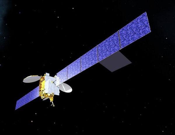
Artist’s impression of an Inmarsat-3 satellite. (Image: Inmarsat)
The Inmarsat-3 F5 satellite is in geosynchronous orbit at 54° west, ensuring that its signal covers the UK as part of its Atlantic Ocean region service overlay. This makes it an ideal candidate to participate in the test. The satellite was manufactured by Inmarsat’s Athena partner Lockheed Martin and launched in 1998.
“This project demonstrates British innovation at its best,” said Nick Shave, vice president of Strategic Programmes for Inmarsat Global Government. “Working with Goonhilly Earth Station and GMVNSL, supported by UK funding via the ESA Navigation Innovation and Support Programme (NAVISP), enables us to extend the long life of Inmarsat’s I-3 F5 satellite with additional new services designed two decades after launch.
“We look forward to exploring the potential for this project and the benefits it could deliver to the UK with more precise, high-integrity, resilient navigation services, whilst also exploring future capabilities on new satellites through Inmarsat’s fully funded technology roadmap,” Shave said. “This work also has the potential to be exported to other nations around the world, benefitting the UK economically as well as technologically.”
Javier Benedicto, left, with EUSPA’s Rodrigo da Costa. (Image: ESA)
Javier Benedicto will become the director of Navigation for the European Space Agency (ESA) on Feb. 16, 2022, when current director Paul Verhoef retires.
Verhoef has served as director for almost six years, after a 40-year career spanning the European Commission, ESA and private industry.
Benedicto is now head of the Galileo Programme Department within the Directorate of Navigation at ESA. A Spanish national, he spent his early career in academia, working as a microwave engineer at the Polytechnical University of Catalonia in Barcelona and as a telecommunications engineer at MIER Comunicaciones, also in Barcelona, before joining ESA in 1990. He is also a GPS World author, keeping readers apprised on the status of the Galileo program.
He holds a master’s degree in science and telecommunications engineering from the Polytechnic University of Catalonia and has more than 100 publications in technical journals and conferences. He also holds three international ESA patents and has five honors and awards.
Benedicto’s new role was announced Oct. 21, when the ESA Council appointed three new ESA directors. In addition to Benedicto as director of Navigation, Géraldine Naja will lead the new Directorate of Commercialisation, Industry and Procurement. Simonetta Cheli will succeed Josef Aschbacher as Director of Earth Observation Programmes; Aschbacher became ESA Director General in March 2021.
Spire Global has been awarded a contract under the European Space Agency’s (ESA) Navigation Innovation and Support Programme (NAVISP), specifically “Element 2 – Competitiveness in PNT.” The contract is funded by the United Kingdom Space Agency.
Spire will work with NAVISP to build on the current capabilities of the Spire constellation and develop tools needed for geolocation signal processing, which will be applied toward geolocating GNSS interference sources coming from the Earth’s surface.
Spire’s low-Earth orbit (LEO) nanosatellite technology will be used to collect suspect interfering RF signals from a range of geographic areas prone to disruptions. Using advanced processing algorithms, the project will develop a suite of geolocation signal collection and processing techniques (including single and multi-satellite) to detect and characterize signals from a variety of interference scenarios.
NAVISP Element 2 emphasizes maintaining and improving the capability and competitiveness of the position, navigation and timing (PNT) industry and its technologies and services in the global satellite navigation market. In recent years, PNT services have become ubiquitous and relied on by industry and critical national infrastructure such as telecommunications, emergency services, energy, finance, food and transport. The GNSS signals used in these applications are vulnerable to interference, which can disrupt PNT services.
Safran has entered into exclusive discussions to acquire Orolia from Eurazeo alongside the founders and management. Orolia is a world leader in resilient positioning, navigation and timing (PNT) solutions that improve the reliability, performance and safety of critical civilian, military and space operations, including in harsh or altered GNSS environments.
Safran is an international high-technology group, operating in the aviation (propulsion, equipment and interiors), defense and space markets. Headquartered in Paris, France, Safran has a global presence, with 76,000 employees and sales of 16.5 billion euros in 2020.
Orolia has a broad portfolio of technologies across the resilient PNT value-chain with full system capabilities, and is a provider of PNT equipment, simulation and test solutions. Orolia is also providing emergency locator beacons for commercial aviation and military applications.
The acquisition “represents a unique opportunity for Safran and Orolia to extend their resilient PNT solutions, through their remarkable complementarities,” Safran stated in a press release. “With this addition, Safran will be able to build a world-leading position in all aspects of PNT, inertial navigation, time and GNSS receivers and simulators, covering aerospace, governmental and high integrity applications.”
Safran intends to accelerate the development of Orolia under the leadership of CEO Jean-Yves Courtois, and in full collaboration with its teams. “The combination of Orolia and Safran will create a PNT world leader with capabilities that will be unsurpassed in depth and breadth,” Courtois said. “Our perfect complementarity in terms of technology expertise, market presence and geographic footprint will allow us to push further resilient PNT to the next level and to offer our government, aerospace and commercial customers the most advanced solutions they need for their critical operations. Orolia will contribute especially through its world-leading positions in timing, GNSS simulation and emergency location technologies, and through its strong presence in the U.S. market. We are looking forward to working with our new Safran colleagues to advance our common vision.”
Orolia is expected to generate revenues of more than EUR 100 million in 2021 and has approximately 435 employees with facilities in France, the United States, Switzerland, Spain and Canada.
The terms of the deal were not disclosed. The transaction is subject to the usual regulatory approvals. Orolia will be consolidated within Safran’s Equipment & Defense division upon closing, expected around mid-2022.
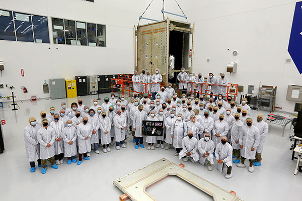
The GPS III government and industry team recently core mated GPS III Space Vehicle 10 (GPS III SV10) and, per tradition at the “birth” of a satellite, nicknamed it “Hedy Lamarr” after the actress and inventor. (Photo: Lockheed Martin)
The 10th and final GPS III space vehicle under the original GPS III contract recently completed a production milestone known as “core mate” to assemble it into a full satellite.
The satellite is named after Hedy Lamarr, the famous Hollywood actress and inventor who in 1941 patented frequency-hopping technology that laid the foundation for secure Wi-Fi, GPS and Bluetooth technologies used by billions worldwide today.
Traditionally, core mate marks the “birth” of a satellite and when it gets a nickname — chosen by the U.S. Space Force — to honor its completion. All nine previous GPS III satellites built by Lockheed Martin have been named after trailblazers, and GPS III SV10 is no exception. (See list below.)
“The core mating of GPS III SV10 is an important milestone in Lockheed Martin’s commitment to provide the U.S. Space Force with a modern, agile GPS satellite constellation that will assure mission success far into the future,” said Tonya Ladwig, vice president of Lockheed Martin Space’s Navigation Systems Mission Area. “With SV10, we’ve now assembled about a third of the satellites we need to modernize the current GPS constellation with new technology and greater warfighting capabilities.”
Along with Ladwig, Col. Edward Byrne, senior materiel leader of the Medium Earth Orbit Space Systems Division, and Scott Thomas, GPS III program manager, Space Systems Command, attended the final portion of the core mating event on Oct. 26 at Lockheed Martin’s GPS III Processing Facility (GPF), in Waterton, near Denver.
Core mating takes teamwork
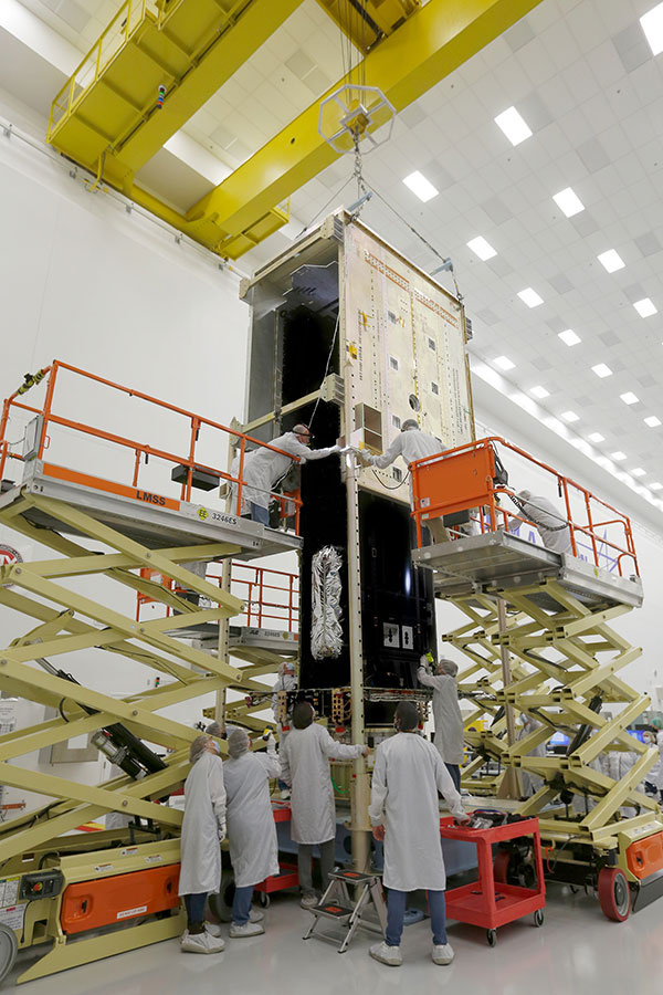
During the two-day core mate production event held Oct. 25-26, a 10-ton crane lifted and completed a 90-degree rotation of GPS III SV10’s system module assembly that holds the satellite’s operations and mission payload electronics. The crane then slowly lowered the system module the final 12 feet onto the satellite’s vertical propulsion core assembly.
Throughout the operation, technicians were strategically placed in elevated lifts 20 feet in the air to monitor the tight interfaces — within thousandths of an inch — and ensure a successful integration. Once the system module was fully seated, the technicians installed the nearly 200 screws bolting the two major components together. When the final screw was placed, the vehicle was officially mated. At that point all activity stopped and the newly assembled GPS III space vehicle was given its official name.
The core mate is one of the most intricate and critical operations of a satellite’s build. Completing the process requires teamwork and experience. Robert Peszek, GPS III operations manager, credited the culture of the GPS team for the core mating success and the success of the overall program. “This milestone is not something that many programs get to experience, with 10 satellites and the potential for more,” he said. “It comes down to our culture — people are not afraid to speak up, everybody has a voice, everybody has a role, and we respect everyone’s role.”
GPS III SV10 – the final space vehicle of the original GPS III contract – became a space vehicle when its system module assembly, which holds the satellite’s operations and mission payload electronics, was core mated with the satellite’s vertical propulsion core assembly. (Photo: Lockheed Martin)
Augmented reality
GPS III SV10 (and SV09 before it) also represent pivot points in digital transformation on the GPS III/IIIF production line. Some of the technologies used include 3D printed parts, HoloLens mixed-reality smart glasses, and model-based engineering images that were overlaid on top of the hardware.
“For these two vehicles, we have really done ‘crawl, walk, run’ for augmented reality,” Ladwig said. “They are transformational vehicles because we’re bringing that new technology, not just to the spacecraft, but also making it part of the production and build process.”
The digital transformation tools improved accuracy and cut production times. “Using the (HoloLens) we actually overlay design drawings onto the hardware, further ensuring that everything is done right,” Peszek said. In addition, the team cut the production schedule by 50% for SV09 and SV10, partly due to the use of augmented reality tools — and while working through the height of the COVID pandemic without missing any work days.
GPS III SV10 — the final space vehicle of the original GPS III contract — became a space vehicle when its system module assembly, which holds the satellite’s operations and mission payload electronics, was core mated with the satellite’s vertical propulsion core assembly.
GPS III satellite update
Of the other nine GPS III satellites, the first five — GPS III SV01-05 — have launched and been handed over to the Space Force for on-orbit operations. The next three — GPS III SV06-08 — have been completed and declared “Available for Launch” by the U.S. Space Force. Those satellites are in storage at the GPS Processing Facility until the Space Force determines their launch dates. GPS III SV09 is fully assembled and in final testing.
GPS III SV10 will undergo a comprehensive suite of system performance tests before moving to the critical thermal cycling and thermal vacuum test (TVAC) phase, which demonstrates the satellite’s ability to survive the thermal and pressure conditions of space.
After GPS III SV10, the GPS III Follow On (GPS IIIF) satellites will start to appear on Lockheed Martin’s production line. In 2018, the U.S. Air Force awarded Lockheed Martin a contract to build as many as 22 additional GPS IIIF space vehicles. GPS IIIF SV11–12 were part of that original contract. The government exercised options for GPS IIIF SV13–14 in 2020.
On Oct. 22, the U.S. Space Force exercised its second contract option valued at approximately $737 million for the procurement of three additional GPS IIIF space vehicles (GPS IIIF SV15–17) from Lockheed Martin.
Modernizing the constellation
Lockheed Martin is building GPS III/IIIF satellites to help the Space Force modernize the current GPS satellite constellation with new technology and advanced capabilities. GPS III satellites are the most powerful GPS satellites ever designed. Compared to legacy satellites in the constellation, GPS III satellites are three times more accurate and have up to eight times improved anti-jamming.
GPS III satellites are also the first to introduce the new L1C civil signal, which will enable interoperability between GPS and international satellite navigation systems.
GPS IIIF satellites build off GPS III’s innovative, modular design. GPS IIIF satellites will add new capabilities and advanced technology, including Regional Military Protection (RMP); a safety-improving Search and Rescue payload; and an accuracy-enhancing laser retroreflector array. The RMP capability further reinforces GPS III/IIIF as a warfighting system, providing up to 60x greater anti-jamming for our warfighters operating in contested environments.
GPS IIIF SV13 and beyond will incorporate the company’s LM2100 Combat Bus, an enhanced space vehicle that provides even greater resiliency and cyber-hardening against growing threats, as well as improved spacecraft power, propulsion and electronics. LM2100 Combat Bus vehicles are also capable of hosting Lockheed Martin’s Augmentation System Port Interface (ASPIN), which would allow for future on-orbit servicing and upgrade opportunities.
Satellite names honor trailblazers
In honor of the last GPS III satellite in the SV01-10 series, here are the names they share with famous explorers:
SV01 – Vespucci – Amerigo Vespucci, Italian navigator, explorer and merchant whose name is the origin of “America”
SV02 – Magellan – Ferdinand Magellan, Portuguese explorer and leader of first expedition to circumnavigate the Earth
SV03 – Matthew Hensen – First African-American Arctic explorer, part of the Peary expeditions.
SV04 – Sacagawea – Lemhi Shoshone woman who served as translator and guide for the Lewis and Clark expedition
SV05 – Neil Armstrong – Astronaut, first man to walk on the moon
SV06 – Amelia Earhart – Daring pilot, first woman to fly solo across the Atlantic Ocean, attempted circumnavigation around the world.
SV07 – Sally Ride – Astronaut, physicist and first American woman in space
SV08 – Katherine Johnson – American mathematician, NASA employee whose calculations made human spaceflight possible
SV09 – Onizuka – Named for Ellison Onizuka, astronaut, first Asian-American to reach space, crew member on the ill-fated Challenger space shuttle mission.
SV10 – Hedy Lamarr – Famous Hollywood actress and inventor who patented frequency-hopping technology that led to today’s secure Wi-Fi, GPS and Bluetooth.
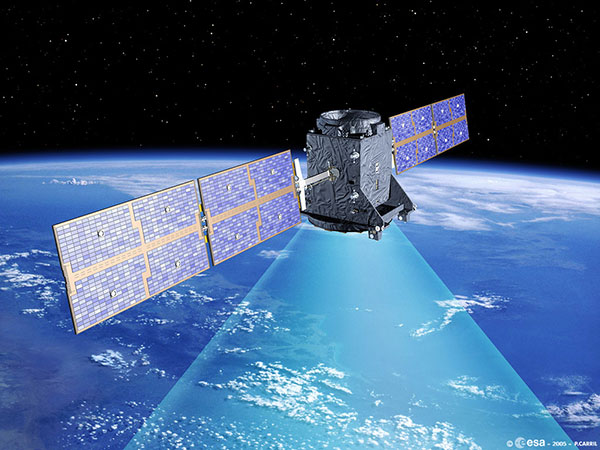
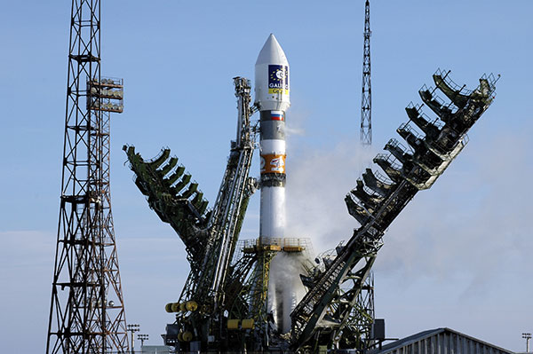
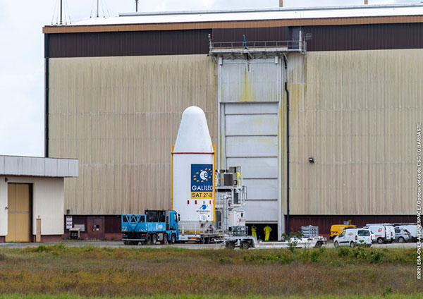
After a three-day delay, on Dec. 4, at 7:19 p.m. EST (00:19 GMT) launch service provider Arianespace launched Galileo satellites 27 and 28 on a Soyuz launcher from Europe’s Spaceport in French Guiana.
Manufactured by OHB, the satellites are operated by SpaceOpal for the EU Space Program Agency (EUSPA), which, in turn, is operating the mission on behalf of the European Commission.
These satellites are the first of Batch 3, comprising 12 additional first-generation Galileo satellites commissioned in 2017 to bring the constellation to full operational capability. They will be used to further expand the constellation up to 38 satellites and act as backups and spares for satellites that reach their end of life.
“Today’s lift-off marks the 11th Galileo launch of operational satellites in 10 years: a decade of hard work by Europe’s Galileo partners and European industry, over the course of which Galileo was first established as a working system then began initial services in 2016,” said Paul Verhoef, ESA director of navigation. “With these satellites, we are now increasing the robustness of the constellation so that a higher level of service guarantees can be provided.”
“Galileo is already delivering meter-scale accuracy everywhere on Earth,” added Matthias Petschke, the responsible director at the European Commission. “The Galileo partners are far from resting on their laurels, however. These two satellites will further reinforce Galileo and will — along with other launches to follow — enable novel signals and services, helping to ensure that Galileo retains its first-place status for many years to come.”
Soyuz launcher VS-26, operated by Arianespace and commissioned by ESA, lifted off with the pair of 715 kg satellites from the Guiana Space Center in Kourou, French Guiana. All the Soyuz stages performed as planned, with the Fregat upper stage releasing the satellites into their target orbit close to 23,525 km altitude, around 3 hours and 54 minutes after liftoff.
The satellites will spend the coming weeks being maneuvered into their final working orbit at 23,222 km using their onboard thrusters, at the same time as their onboard systems are gradually checked out for operational use – known as the Launch and Early Operations Phase.
The Soyuz rocket was produced by the Progress Space Rocket Center, which is a part of the Russian space agency Roscosmos. This is the 14th time this partnership aimed to send a Galileo mission to space. This mission, known as Galileo FOC-M9, was the 61st mission launched by Arianespace on behalf of ESA and carried the 83rd and 84th satellites for the partnership.
Artist’s rendering of GIOVE-A in orbit. (Image: ESA)
News from the European Space Agency
Europe’s first prototype satellite for Galileo, GIOVE-A, has been formally decommissioned after 16 years of work in orbit. The GIOVE-A mission in 2005 secured Galileo’s radio frequencies for Europe, demonstrated key hardware, and probed the then-unknown radiation environment of medium-Earth orbit.
“If not for GIOVE-A, the 26 Galileo satellites in orbit today would not exist,” said Paul Verhoef, ESA’s director of navigation. “Its speedy development and launch opened the way for our working constellation to follow.”
ESA had begun designing Galileo at the turn of the century, and radio frequencies had been set aside for the new system by the International Telecommunications Union. But these frequency filings came with a deadline attached: the frequencies had to be used from orbit by mid-2006 or they would lapse.
GIOVE-A was launched by Soyuz from Baikonur cosmodrome in Kazakhstan on Dec. 28, 2005. (Photo: ESA)
GIOVE-A Sped to Orbit
Galileo In-Orbit Validation Element-A, or GIOVE-A, was produced at a breakneck pace to meet this deadline. Developed in the second half of 2003, the satellite was designed, built and tested before the end of 2005, and launched on Dec. 28 of that year.
“At the time there was a lot of uncertainty: Would we make it or not?” recalled Javier Benedicto, head of the Galileo Project Department, ESA. “GIOVE-A transmitted its first Galileo signal-in-space on Jan. 21, 2006, meaning that Europe was formally in the navigation business.”
That March, ESA formally confirmed it had brought the Galileo-related frequency filings into use, three months ahead of the official ITU deadline.
Europe’s first navigation satellite GIOVE-A, short for Galileo In-Orbit Validation Element-A, during flight preparation. (Photo: ESA)
The mission also carried a prototype rubidium atomic clock — proving its functionality for the operational Galileo satellites that would follow — as well as a radiation instrument. Medium Earth orbit, 23,000 km altitude, was terra incognita at this point for European satellites, but it was known to possess enhanced radiation levels from the impinging of the outer band of Earth’s Van Allen radiation belts.
A second Galileo prototype, GIOVE-B, followed in 2008, this time hosting a prototype passive hydrogen maser — the second type of atomic clock that Galileo relies on — along with an enhanced payload able to transmit for the first time the GPS-Galileo common signal.
GIOVE-A Succeeded at New Mission
Once the first Galileo satellites were in orbit and working well, ESA ended use of GIOVE-A in 2012. The satellite was placed in a graveyard orbit 100 km above the operational satellites’ orbits, as was GIOVE-B after its own four-year mission.
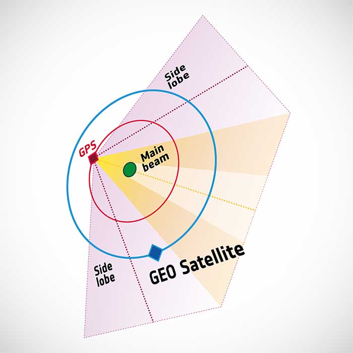
Control of GIOVE-A passed to manufacturer Surrey Satellite Technology Ltd (SSTL) in the United Kingdom. GIOVE-A was then employed for various in-orbit experiments, including demonstrating the reception of satellite navigation signals from GPS satellites orbiting below it — based on spillover sidelobe reception from satellites on the other side of Earth.
GIOVE-A was able to make use of signals emitted sideways from GPS antennas, within what is known as “side lobes.” (Image: ESA)
This proof that satnav can be relied on further out into space means that satellites in geostationary orbit are making use of satnav for positioning. As a next step, ESA is planning to extend satnav coverage all the way to the Moon.
The satellite also continued its radiation survey of medium-Earth orbit, acquiring a unique record extending across more than 10 years, analyzed by the Surrey Space Centre with ESA support. Multiple scientific papers have been written on these results, which encompass the “electron desert” of 2008-9 during the lowest levels of solar activity of the space era, followed by one of the largest electron storm events on record in April 2010.
A new model of the outer Van Allen belt electron fluxes, MOBE-DIC, has been produced from this dataset, helping to guide future satellite designs.
“Actually, the satellite itself is still operating well,” said Sarah Lawrence, SSTL. “The reason for ending the mission is software obsolescence in our control center. The decommissioning procedure involved transitioning the satellite to Earth-pointing mode, turning off the reaction wheels and setting the attitude and orbit control system to standby mode, before finally switching off the on-board computer and transmitter.”
“GIOVE-A over-delivered on its original lifetime and mission goals – an inspiring and game-changing mission on so many levels,” said Martin Sweeting, SSTL executive chairman.
SSTL went on to provide navigation payloads for operational Galileo satellites. Today, 26 Galileo satellites orbit the Earth. Galileo has become the world’s most precise satnav system, delivering meter-scale accuracy to more than 2.3 billion users around the globe.
The Launch Readiness Review on Nov. 26 confirmed that the satellites, the supporting ground installations, and the early operations facilities and teams are ready for lift-off on the early hours of Thursday morning, central European time.
UPDATE: Arianespace has postponed today’s launch and is now targeting launch on Friday (Dec. 3). Liftoff is set for Dec. 3 at 7:23 p.m. EST (0023 GMT).
Galileo satellites 27 and 28 are scheduled to be launched by a Soyuz launcher from Europe’s Spaceport in French Guiana on Dec. 2 at 01:31 CET (Dec. 1 at 21:31:27 local Kourou time).
These satellites are the first of Batch 3, comprising 12 additional first-generation Galileo satellites commissioned in 2017 to bring the constellation to full operational capability. They will be used to further expand the constellation up to 38 satellites and act as backups and spares for satellites that reach their end-of-life.
Follow the launch live on ESA Web TV Two starting at 0104 CET.
“Friday’s Launch Readiness Review confirmed that the first two satellites in this final batch of 12 Galileo first-generation satellites, are good to go, provided no external circumstances come up between now and the night of 1-2 December,” said Bastiaan Willemse, ESA’s Galileo Satellite manager, from Europe’s Spaceport in Kourou, French Guiana. “Meanwhile the preparation for the launch campaign of the next two satellites has already started.”
The Launch Readiness Review is an ESA-led review with participation of the satellite manufacturer OHB, the launch service provider Arianespace, the Galileo operator SpaceOpal, the EU Space Programme Agency (EUSPA) and the European Commission, as well as the programme’s Security Accreditation Board.
Friday’s review was the last before the Arianespace-led RAL (Revue d’Aptitude de Lancement) takes place next week when the latest status of the launcher, the launch facilities and site, the global launch tracking facilities, the satellites and supporting ground infrastructure will be reviewed, most likely resulting in approval for launch countdown.
The satellites arrived in French Guiana in early October, kicking off a busy launch campaign, including initial dispenser fit checks and the filling with the hydrazine fuel that will be used to maneuver them during their 12 years of working life.
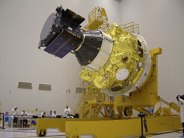
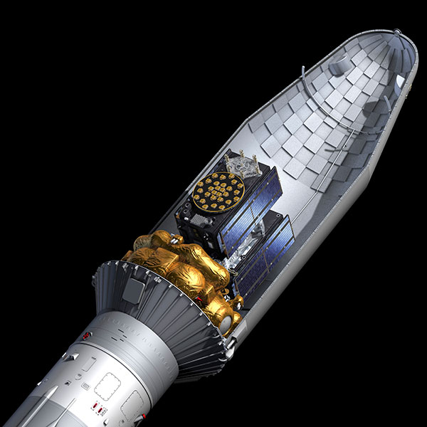
Galileos 27-28 seen atop their gold-wrapped Fregat upper stage within their Soyuz launcher fairing. (Photo: ESA)
The two satellites will add to the 26 satellites of the Galileo constellation already in orbit and delivering Initial Services around the globe.
This week’s lift-off will be the 11th Galileo launch in 10 years. Two further launches are planned for next year, to allow Galileo to reach Full Operational Capability in its delivery of services, to be followed by the launches of the rest of the Batch 3 satellites — all undergoing final integration at OHB facilities in Bremen and on-ground verification testing at ESA’s ESTEC Test Centre in the Netherlands.
In parallel to Batch 3’s completion of Galileo First Generation deployment, the new Galileo Second Generation satellites, featuring enhanced navigation signals and capabilities, are already in development with their deployment expected to begin by 2024.
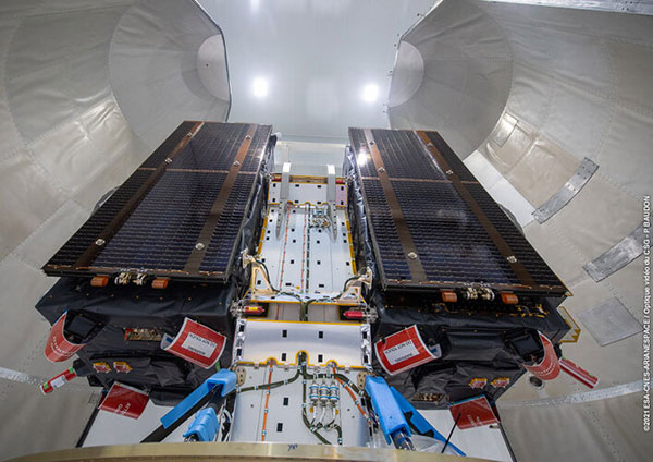
The combined upper composite for the Galileo launch being transported to the other three stages of the Soyuz at the launch site. (Photo: ESA)Galileos 27 and 28 are secured to the dispenser that holds them in place during launch. (Photo: ESA)The two Galileo satellites attached to the dispenser on which they will ride to orbit. (Photo: ESA)