A new space agency launched in Europe today, taking the place of the European GNSS Agency (GSA) and adding responsibilities to encourage Europe’s space enterprises.
The European Union Agency for the Space Program (EUSPA) marks the start of a new era for European Union space, according to an agency statement. EUSPA will build on the legacy of the GSA, which was established to promote use of Galileo and EGNOS, with additional responsibilities to create even more opportunities from space for European Union citizens and its economy.
An April 27 space regulation established EUSPA. Under the new space regulation, EUSPA’s mandate includes promoting Galileo and EGNOS, but with increased responsibilities, including their service provision and operational security. The agency also will coordinate the user-related aspects of government satellite communication in close collaboration with Member States and other entities.
Including Copernicus
Rodrigo da Costa, executive director, EUSPA (Photo: EUSPA)
EUSPA is also responsible for the development of downstream markets and fostering of innovation based on Galileo, EGNOS, and now also commercial uses of Copernicus (Europe’s Earth observation satellite program), leveraging funding mechanisms such as Fundamental Elements and Horizon Europe.
EUSPA is also responsible for security accreditation of all the components of the EU Space Program. The European Commission may also decide to entrust the agency with other tasks.
“More and more, our economies, our society and our safety depend on space,” said EUSPA Executive Director Rodrigo da Costa, former director of GSA. “Europe has incredible opportunities ahead that cannot be missed. By creating EUSPA, the European Union will further increase the return on investment made by EU citizens in the EU Space Program by strengthening its contribution to the priorities of the union. We will achieve this primarily by leveraging synergies between the various program components — particularly navigation, Earth observation and secure communications — to drive innovation across a broad range of sectors.”
In particular, bringing management of downstream and combined applications based on Galileo, EGNOS and Copernicus under the umbrella of one agency will make it possible to leverage synergies, according to the agency statement. “On their own, these technologies can play a key role supporting a digital and green transformation, but leveraging their synergetic and combined use will facilitate the generation of innovative solutions that bring a higher societal impact,” the statement read.
Focus on security
“The teams of committed professionals we have in place at our sites in Europe — from the EGNOS center in Toulouse to the European GNSS Service Centre in Spain and the Galileo Reference Centre in the Netherlands — will continue to ensure the high quality, robustness and reliability of EUSPA’s service provision,” reads the statement. “This will be backed up Galileo security monitoring centers in France and in Spain, and the industrial teams managed by EUSPA in the Galileo control centers in Germany and Italy, along with facilities around the world.”
In addition, the Security Accreditation Board will continue to initiate and monitor implementation of security requirements to ensure a robust and uniform level of security for the entire EU Space Program.
“The new agency has a core role in the security accreditation of all the components of the EU Space Program,” said Bruno Vermeire, chair of EUSPA’s Security Accreditation Board.
Looking to the future
While EUSPA’s mission has expanded, its core aim remains the same – to link EU investment in space to the needs of users in the European Union and around the world.
“The agency remains committed to its traditional users and will continue to deliver the high level of GNSS services that users have come to rely on,” the agency stated. Copernicus and satellite communications will also benefit from the former GSA’s user-oriented focus and “the experience it has gained in developing markets for Galileo and EGNOS.”
Fucino, Italy, hosts a Galileo Control Centre. (Image: Telespazio/ESA)
It said policymakers “could consider selecting the most resilient technologies as the cornerstone of the PNT suite for military missions, rather than defaulting to GPS.”
The 51-page report takes a comprehensive view of alternative PNT policy and leadership across the department. Its findings are an interesting and informative look at issues and efforts.
Increasing demands
The report comes at a time when U.S. forces have been seeing increasing interference with their own and allied GPS-enabled systems. The Organization for Security and Cooperation in Europe has regularly reported that its surveillance drones in the Ukraine have been jammed. Chinese press recently bragged that jamming caused U.S. Navy ships in the South China Sea to switch from using GPS to the Chinese BeiDou system. Additionally, U.S. military commanders have regularly described the Middle East as the most contested electronic warfare area on the planet, in large part because of regular interference with GPS signals.
The GAO study also comes on the heels of a provision in the National Defense Authorization Act (NDAA) for this year which directs DOD to provide non-GPS PNT to combatant commanders by 2023. The act says this timeline is consistent with responding to Joint Urgent Operational Needs, a formal method for commanders to communicate with department leadership. According to some sources, this suggests that the Pentagon has been receiving such requirements from field commanders, but has not responded to them in what Congress considers a timely manner.
Alternative PNT “not a priority,” resisted
Despite chronic GPS signal interference across the globe, outside experts and officials across the DOD told the GAO study team that developing alternative sources of PNT was not a priority for DOD. One example cited was the lack of a central program office.
One expert said, “PNT — It’s everyone’s need, but nobody’s business.” Another expert said, “Everyone wants to use [PNT], no one wants to pay or care for [PNT].” One DOD official characterized alternative PNT as an afterthought. DOD’s PNT Roadmap states that PNT capabilities, despite being mission critical, are not normally considered a key requirement, but rather may be treated as “a second-tier requirement.”
Worse, the report indicated that some forces within the department resist alternative PNT efforts.
According to one DOD official cited anonymously in the report “bureaucratic and political obstacles [represent] the biggest challenges for alternative PNT” and “anything that threatens GPS, such as alternative PNT technologies, faces pushback.”
The report cited another DOD official as agreeing that “there is an impression that the GPS program has a lot of political clout within DOD, and that those trying to develop alternative PNT technologies may face political challenges.”
Realistic requirements
Many missions do not need the accuracy provided by GPS, according to the report. Nevertheless. DOD programs often default to GPS performance standards when developing requirements. Many alternative technologies, while more resilient, are unable to achieve the same accuracy as GPS and therefore fail to meet the over-stated requirements.
Open architecture
Both DOD and GAO see development of modular open system architecture (MOSA) as key to PNT success in the future. This will allow addition of new PNT sources to a platform without the need for a major retrofit. With MOSA, all that would be needed is a new sensor module for the desired PNT source.
The GAO report endorsed this approach and encouraged DOD to institutionalize it with dedicated funding.
Working with industry
Decades of civil GPS use have benefited DOD in many ways. Broad academic and commercial research has resulted in a host of applications and improvements in the size, weight, and power requirements of equipment, as well as lowered costs. These benefits would almost certainly not have been realized at the current scale if the market for GPS equipment and apps had been restricted to military users.
The 2021 NDAA directs the department to “…enable civilian and commercial adoption…” of the GPS alternative technologies it develops for field commanders. The GAO report suggests DOD also work to leverage industry advances in technologies.
Scope and recommendations
GAO’s tasking for this effort did not include examining efforts to make GPS signals and equipment more resilient to disruption, nor use of non-U.S. satellite navigation systems. Neither were non-defense uses of PNT, nor improvements in such things as tactics, techniques, and procedures considered.
The study focused solely on department efforts to complement GPS services.
Six recommendations for policymakers are included in the report:
Increase Collaboration — Consider mechanisms to coordinate across DOD to clarify responsibilities and authorities in prioritizing the need for alternative PNT technologies.
Focus on Resiliency — Consider selecting the most resilient technologies as the cornerstone of the PNT suite for military missions, rather than defaulting to GPS.
Clarify Requirements — Consider opportunities to clarify what level of PNT performance is actually needed for missions, rather than defaulting to requirements that match GPS performance.
Coordinate with Industry — Consider ensuring that DOD and commercial industry coordinate so that industry is prepared to meet DOD’s needs, and DOD can leverage industry advances.
Institutionalize Open Architecture — Consider making the open architecture initiative more permanent, including providing funding.
Analyze Vulnerabilities — Consider having DOD conduct ongoing analysis of vulnerabilities of different PNT systems.
The May 2021 GAO report “Defense Navigation Capabilities: DOD is Developing Positioning, Navigation, and Timing Technologies to Complement GPS” is available here.
By Col. Ryan Colburn Director, Spectrum Warfare Divisionand Portfolio Architect, Space and Missile Systems Center
The United States’ Global Positioning System is used now more than ever before. With an estimated four billion users worldwide, industries of all kinds continue to leverage the precise and consistent data streaming from the GPS satellites. The universal use of GPS signals permeates our lives and creates positive impacts around the globe.
We continue to deliver on our decades-long commitment to provide precise positioning and timing data to the civil, commercial and scientific communities. To support the evolving use of this global utility, the government and industry GPS Enterprise team has embarked on major investments to modernize GPS capabilities for our stakeholders. These efforts are occurring across all of our segments and combine to deliver incremental capabilities and improvements over time.
Colonel Ryan Colburn leads the team dedicated to modernizing the GPS constellation to meet tomorrow’s needs. (Photo: U.S. Space Force)
GPS ENTERPRISE ROADMAP
The GPS Enterprise Roadmap is an overview of the many programs we have in execution or planning stages. These efforts will enable us to deliver new and improved positioning, navigation and timing (PNT) capabilities across all segments. We are upgrading each of the three GPS segments (space, control, and user equipment) to deploy modernized capabilities while continually replenishing the GPS constellation; ensuring we have 24 or more operational satellites available at least 95% of the time.
Additionally, we are always working on what’s next. We are actively researching, prototyping and planning; looking at how we will continue to evolve this architecture into one that is more robust and resilient than it is today. Our team is working to define the next set of capabilities for not only the GPS, as the backbone of our architecture, but also for ways to build off of this system and expand our ability to deliver PNT capabilities in new and useful ways.
“We continue to deliver on our decades-long commitment to provide precise positioning and timing data to the civil, commercial and scientific communities.”
2021 UPCOMING MILESTONES
Space Segment
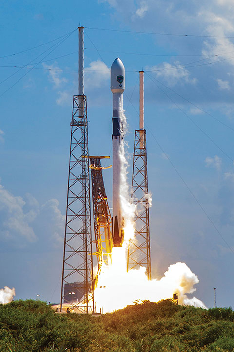
The GPS III program is off to a great start, further enhancing military readiness and bolstering the activities and assurance of all GPS users. The program continues to push space acquisition boundaries with the first reuse of a Falcon 9 rocket for a National Security Space mission.
Slated for launch in June, SV05 will launch on a flight-proven Falcon 9 booster that was recovered after successfully launching SV04 into orbit.
SV05 will continue the GPS constellation modernization effort and will deliver users a bump in performance and accuracy. The satellite features the interoperable L1C signal, the newest civilian L5 signal and anti-jamming improvements. For the military user, SV05 will become the 24th military-code (M-code) satellite, bringing M-code utility to its Initial Operating Capability.
The GPS III SV03 satellite is encapsulated in its protective launch fairings. (Photo: U.S. Space Force)
Ground Segment
2021 will be a big year for the Next Generation Operational Control System (OCX). OCX will soon complete the installation of an entirely modernized network of 17 global monitoring stations. These stations allow OCX to monitor the full suite of legacy as well as modernized military and civil navigation signals, including L2C and L5.
In the factory, OCX will continue to use a newly accredited GPS System Simulator (GSYS) in support of mission software testing. In parallel, OCX will continue to replace mission equipment with Hewlett-Packard Enterprise hardware prior to its deployment to operational sites. Once deployed, connections to the GPS command and control antennas will begin, and interconnections to other mission systems will be established.
This includes the GPS Global Information Grid Automated Information System (GGA) subsystem, which will ensure timely dissemination of important navigation data to the public. OCX’s Launch and Checkout System (LCS) will be used to launch and initialize GPS III SV05.
OCX 3F is a modification of the OCX baseline to support GPS IIIF-specific mission requirements. OCX 3F will maintain backward compatibility with the existing systems to support the legacy GPS constellation and will integrate future GPS IIIF capabilities. For example, it will implement command and control of the Regional Military Protection (RMP) and Rapid Warfighter Effects requirements. We are on track for an OCX 3F contract award later this year.
A GPS Antenna is installed at the Diego Garcia Tracking Station, part of the Satellite Control Network operated by the Space Force. (Photo: U.S. Space Force)
User Equipment Segment
In 2021, Military GPS User Equipment (MGUE) Increment 1 will culminate its ground user form factor efforts by completing a Field User Evaluation (FUE) of M-Code GPS technology in two service-nominated lead platforms. The Army FUE will be conducted with multiple variants of Stryker vehicles.
Meanwhile, the U.S. Marine Corps will use the Joint Light Tactical Vehicle (JLTV) for their FUE. Both events will assess the performance of the enhanced GPS receivers in operationally relevant environments. Toward the end of 2021, MGUE Increment 1 will deliver the aviation/maritime form factor, which will enable Navy Guided Missile Destroyer (DDG) and USAF B-2 bomber lead platform integration in 2022.
GPS III SV03 is rolled out to the launchpad before its daytime launch on June 30, 2020.
Enterprise Integration
None of these systems are delivered in a vacuum, and we work hard to integrate them all. It is the only way we can continue to deliver on our promises outlined in our published standards. From test campaigns and requirements management, to model-based systems engineering and roadmaps; it takes a united team of government and industry partners to deliver truly integrated capabilities.
We have many exciting milestones this year and we have a world-class government and industry team working tirelessly to ensure continued delivery, maintenance, and operations of GPS Enterprise capabilities. Our motivation is simple — continuing to deliver and evolve the gold standard PNT capabilities we all rely on day in and day out.
The U.S. Space Force’s Space and Missile Systems Center (SMC), located at the Los Angeles Air Force Base in El Segundo, California, is the center of excellence for acquiring and developing military space systems. The SMC’s portfolio includes space launch, global navigation satellite systems, military satellite communications, a meteorological satellite control network, range systems, space-based infrared systems, and space situational awareness capabilities.
The M-code-enabled SV03, shown launching in June 2020, was joined by SV04 in December. SV05, the 24th M-code-enabled satellite, is expected to launch by July 2021, completing the Initial Operating Capability of M-code. (Photo: U.S. Space Force)
A May 5 webinar about the GPS Backup Technology Demonstration by the U.S. Department of Transportation (DOT) provided valuable insights about the project and intended way forward for PNT efforts in the department.
It also evolved into a policy discussion with former government leaders saying establishing alternative positioning, navigation, and timing (PNT) systems would make GPS safer by “taking the bullseye off,” and that “the time is now, before it is too late.”
The webinar, titled “What Technologies Can Secure GPS?”, was hosted by the Space Policy Institute at George Washington University (GWU). A bipartisan constellation of civil PNT stars gathered to participate in the event.
Featured in the webinar were:
introductory remarks by Robert Hampshire, chief scientist for the U.S. Department of Transportation (DOT). He has also been nominated to be DOT’s assistant secretary for research and technology.
a presentation by Karen Van Dyke, director, Positioning, Navigation and Timing for DOT, and Andrew Hansen of DOT’s Volpe Transportation Systems Center.
discussion of the issues by Diana Furchtgott-Roth, adjunct professor at GWU and a DOT deputy assistant secretary during the Trump administration, and Greg Winfree, director of the Texas Transportation Institute at Texas A&M University and DOT assistant secretary during the Obama administration, both of whom led civil PNT issues for the federal government during their time in office.
Scott Pace, director of GWU’s Space Policy Institute, serving as moderator; he was executive secretary of the Space Council during the Trump administration.
Hampshire opened the event with an address that touched on Biden administration themes of “building back better,” modernizing infrastructure, reducing transportation deaths, making transportation more efficient, and preserving America’s technological leadership. All of these were linked to the need to improve PNT resiliency and reliability.
Robert Hampshire, U.S. DOT chief scientist, speaking at GWU webinar on May 5. (Image RNT Foundation)
Backup tech demo did not close any doors
Van Dyke and Hansen then gave a presentation on the results of the department’s technology demonstration project.
Van Dyke pointed out that, while “GPS backup” may be a popular term, we need complementary capabilities that come into play not just when GPS is unavailable but work alongside it and provide additional capability and resilience all the time.
She also mentioned that the department is well aware there are more candidate technologies than those selected for the demonstration. Companies offering other ways of providing PNT will not be excluded from future consideration and efforts just because they were not part of the demonstration project.
Also, while the government collected the data during the demonstrations, she acknowledged that the effort was designed to “showcase the technologies in their best light.” Further study, stress testing, and evaluation will be needed for any system or technology that might be of interest to the government.
Key elements in the demos
Hansen discussed the particulars of how the technology demonstrations were conducted and some of the results. While the department evaluated 14 measures of effectiveness during the project, Hansen said that two were key — accuracy and coverage per unit of infrastructure.
All the technologies demonstrating timing showed accuracy that would be useful across a wide range of applications, he said. Positioning accuracy, though, varied from a “ones of meters to around 300 meters” depending on the technology.
Hansen said that coverage per unit of infrastructure varied exceptionally between the technologies. These included satellite systems that provide global coverage with a fixed infrastructure, and radio frequency systems with widely different coverage areas per transmitter.
He also observed that the technology demonstration project was not the end of the department’s technical inquiries. In fact, some of its results—such as eLoran performance in an underground scenario—were unexpected and are being further examined.
Transportation has some of the most stringent PNT requirements for accuracy, integrity, availability, and reliability, he said. And not all safety-critical transportation requirements may be met by market-based business models. Commercial systems lack the open standards and specifications that have made GPS so useful and widely adopted. Hansen said that the department will be working on these issues going forward, as well as performance monitoring for alternative systems.
A recurring theme throughout the webinar from all participants was that there is no single solution, no silver bullet, to achieve sufficient national PNT resilience. A systems-of-systems approach was needed. In Hansen’s words “a plurality of complementary systems” is required to ensure PNT reliability and safety, as well as efficient transportation.
Take the bullseye off GPS! — An urgent national security issue
While agreeing with the systems-of-systems approach, Greg Winfree pointed out that a first step still needs to be taken. He said that the nation has known about the need for alternate PNT since a 2001 report by DOT’s Volpe Center. Twenty years later, still no long overdue first step has been taken.
Just establishing the first alternative and complementary system, Winfree said, will make GPS and the United States much safer. “We need to take the bullseye off of GPS,” he said. GPS is so critically important to this country that it is a very attractive target for those who would do us harm. Having even one just alternative in place would make it much less of a target.
Diana Furchtgott-Roth pointed out that China, Russia, Iran and others have terrestrial systems that complement space-based PNT. About establishing alternatives, she said “The time is now, before it’s too late.”
Provisions in the United States National Space Policy provide that “[a]ny purposeful interference with or an attack upon the space systems of the United States or its allies that directly affects national rights will be met with a deliberate response at a time, place, manner, and domain of our choosing.”
Scott Pace also commented that an having an alternative to GPS will contribute to national security and improve global stability. It will “lower the pressure on us to escalate and respond” should GPS satellites be damaged, or services disrupted, he said.
Next steps
One of the questions posed at the end of the session was about actions and expected accomplishments in alternate PNT at DOT in the next 18 months. When could the first alternative system be expected?
The DOT technology demonstration report recommended that the department work next to develop standards and requirements for alternative systems. Current government employees were appropriately reluctant to say much more.
Calling upon her recent experience in government, however, Diana Furchtgott-Roth that said she believed that the department needed time to stress test technologies, develop standards and finalize requirements. Since many capable technologies were mature, some already in operation, she thought the first capability could be up and running within a year after that.
The only missing element according to Furchtgott-Roth is funding, and the focus needs to be on motivating Congress to provide it. The stage is set, she said, with all parties agreeing on the importance of resilient PNT.
She observed that it is very difficult to get the two parties in Congress to agree, and to pass legislation. Yet this has happened three times in support of establishing GPS alternatives. And PNT is such a critical capability that the entire executive branch even came together to protect it last year opposing the FCC’s decision in the Ligado Networks application.
She also related that, when she was in office, she requested $15M for the current fiscal year to do needed stress testing and standards development, but the funding did not appear in the budget.
One reason could have been questions she was asked about whether it is the government’s job to pay for an alternative to GPS, she said.
As a conservative economist her answer was and is a resounding “Yes.” The national need is beyond the business model of one company or private entity. That is something also suggested in DOT’s report on the tech demo.
Also, “enormous value and vast efficiencies” come from one entity funding such a utility, she said. “Just as the government funds national defense, it should also provide a complement to GPS.”
George Washington University’s Space Policy Institute reports a recording of the webinar will be posted on YouTube within the next week.
Dana A. Goward is President of the Resilient Navigation and Timing Foundation.
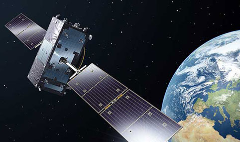
The European Space Agency has selected GMV to supply the radio-frequency constellation simulator (RFCS) for the Galileo second generation (G2G) program.
According to GMV, this is the multinational’s largest contract in Portugal.
From Portugal, GMV will lead a consortium to supply an RFCS covering both the first and second Galileo generations. The Galileo first generation (G1G), running since December 2016, consists of space infrastructure (26 satellites to date) and ground infrastructure.
Under the G2G RFCS contract, GMV teams in Portugal and Spain — partnering with Orolia and Tecobit — will develop an RFCS covering both Galileo generations as well as Galileo Open Service and Public Regulated Service (PRS). The RFCS will simulate the progressive deployment of the G2G with its new signals and will be key to supporting development of G2G infrastructure and testing of experimental user receivers.
The G2G aims to phase in new services, improve existing services, and boost system robustness. It also will enhance security while cutting operating and maintenance costs.
The RFCS will cover user characteristics such as dynamic behavior, signal impairments such as multipath and interference but also solution hybridization (for example, inertial sensors) and signal distortions. It will be designed to guarantee flexibility, configurability, modularity and scalability, as well as segregation of need-to-know information. For this purpose, the RFCS will be built with consumer-off-the-shelf products and follow a software-defined radio approach.
The project is closely linked with other PRS activities within GMV, identified as strategic for the maintenance of GMV’s European leadership position in the Galileo program.
Ground antenna at Schriever Air Force Base, home of the 50th Space Wing. (Photo: Raytheon)
The United States Space Force’s Space and Missile Systems Center (SMC) awarded a $228 million contract to Raytheon Intelligence and Space for the GPS Next-Generation Operational Control System (OCX) Follow-On (OCX 3F). The contract award was made on April 30.
OCX 3F upgrades the OCX Blocks 1 and 2 system to use the enhanced capabilities of the new GPS IIIF space vehicles being developed by Lockheed Martin. The OCX 3F program — in combination with the GPS IIIF space vehicle program — ensures positioning, navigation and timing (PNT) will continue to be available for future generations, said the Los Angeles Air Force Base in a press release.
The OCX 3F program is part of the GPS Enterprise Modernization effort. GPS OCX Blocks 1 and 2, planned for delivery in 2022, will represent a major evolution in capabilities for the GPS enterprise. In addition to supporting the latest U.S. Department of Defense standards and practices for cybersecurity, OCX 3F also supports advanced features over the legacy GPS ground segment. The new features include:
an enhanced and expanded network of monitoring stations for improved cybersecurity and improved anti-jam capability
enhanced operational capability to control the modernized military signals
support of GPS III boosted Earth coverage military code (M-code)
monitoring of new Galileo-compatible and safety-of-life signals.
“OCX is an adaptive architecture designed to evolve to combat emerging threats. OCX 3F is a great example of modifying the OCX Blocks 1 and 2 software baseline to launch and incorporate the GPS IIIF enhanced satellite capabilities,” said Barbara Baker, SMC Production Corps Command and Control Systems Division’s senior materiel leader. “I look forward to continuing our relationship with Raytheon in delivering the United States Space Force GPS capabilities.” Raytheon Intelligence and Space will perform the work in Aurora, Colorado, and delivery is expected in July 2025.
“The OCX 3F program office is looking forward to working with Raytheon on this new GPS ground control program. We are ready to take on any challenges and to work full bore to deliver the critical regional high-powered signals and GPS IIIF launch and control capabilities in support of joint warfighters,” said Lt. Col. Grant Spear, SMC OCX 3F materiel leader.
Racelogic, the company behind LabSat, has been named as one of the “10 Ones to Watch” in the 22nd annual The Sunday Times BDO Profit Track 100, which ranks Britain’s top private companies.
The Profit Track 10 Ones to Watch list represents a cross-section of companies that have achieved or predict good profit growth. In addition to profit performance, inclusion is also based on factors such as resilience in the face of the pandemic and strength of the business model.
Graham Mackie, CEO of Racelogic, was delighted to see the hard work of his team recognized by industry experts. “In a challenging year, we are proud of our performance and the way in which every member of the team at RACELOGIC has adapted to new ways of working and serving our customers,” he said.
The Buckingham-based business sells to more than 100 countries and generated 88% of its sales overseas last year. “We have great products that service a global market that provided some resilience to the impact of the pandemic,” Mackie said. “We are continuing to develop cutting-edge technology, which is enabling us to diversify into new sectors including the film and gaming industries.”
The sales growth and addition of new products has resulted in Racelogic expanding its workforce at a time when many are having to reduce staff numbers, Mackie said. “We are currently recruiting for a range of engineering and administrative positions, all of which can be found on our website. It is an exciting time to join Racelogic, and perhaps even more so now that we are officially ‘one to watch’.”
The 10 Profit Track Ones to Watch finalists will be judged by Stuart Lisle, senior tax partner at BDO, and Hamish Stevenson, founder of Fast Track. The winner will be announced at the Profit Track 100 virtual awards event in June.
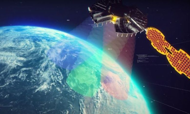
The NTS-3 experimental satellite will be launched in 2023, according to reports from C4ISRNET and Space News. The United States military will use the satellite for positioning, navigation and timing (PNT) as a supplement to GPS.
The satellite was originally set to launch in 2022.
The Air Force Research Laboratory (AFRL) plans to use the additional time to reduce risks and conduct more ground testing.
Navigation Technology Satellite 3 will help guide future GPS satellites, a priority area for the military as the technology has become easier to spoof and jam. Among other features, NTS-3 will have steerable beams for regional coverage and a software-defined payload that can be reprogrammed on orbit.
AFRL discussed the delay in a media roundtable held Wednesday, reports C4ISRNET. AFRL Commander Brig. Gen. Heather Pringle said that shift was out of the lab’s control since the satellite will launch as a rideshare with a U.S. Space Force payload, and that launch had been pushed back.
AFRL plans to experiment with the satellite in geosynchronous orbit for one year, testing PNT signals and architectures as well as ground-based command and control systems and software-defined radios. Following testing, NTS-3 will transition to the U.S. Space Force and integrate into the service’s other PNT capabilities.
Top-level current, former PNT leaders to discuss findings
A “Who’s Who” of positioning, navigation, and timing (PNT) leaders will gather virtually at 11 a.m. PDT/2 p.m. EDT on May 5 to discuss findings of the U.S. Department of Transportation’s (DOT) GPS Backup Technology Demonstration, which took place in 2020.
Included in the “What Technologies Can Secure GPS?” webinar will be DOT Research and Technology leaders from the Obama and Trump administrations, Greg Winfree and Diana Furchtgott-Roth, and currently serving career DOT officials Karen Van Dyke and Andrew Hansen.
Robert Hampshire, current DOT Acting Assistant Secretary for Research and Technology, will make his first public appearance discussing PNT issues.
The event is sponsored by George Washington University’s Space Policy Institute and moderated by Scott Pace. Pace served as the executive director for the Space Council in the last administration. In that capacity, he was responsible for a series of directives and policies impacting PNT in the United States.
Describing the plan for the event, the formal announcement states, “Three separate laws have required the U.S. Department of Transportation (DOT) to back up and complement the Global Positioning System, subject to congressional appropriations. To provide a roadmap, in January the department released its Complementary PNT and GPS Backup Technologies Demonstration Report.”
The program will open with remarks from Scott Pace, director of the Space Policy Institute, who will also moderate the discussion. Hampshire will offer introductory remarks. Van Dyke and Hansen will follow up with a presentation of the report. George Washington University Adjunct Professor Diana Furchtgott-Roth and the Texas Transportation Institute’s Greg Winfree will provide comments.”
A question-and-answer session will follow the addresses and discussion.
The event is free and open to the public, though advance registration is required. Registrants will receive a Zoom link. The webinar will also be recorded.
Are military tests that jam and spoof GPS signals a threat to the safety of civil aviation? If not, why? If so, who should do what about it?
Bernard Gruber
“I would offer that military tests that jam and spoof signals are a risk. The U.S. military takes great care to control tests of this nature in an informed and careful way in order not to affect civil aviation. I cannot speak for military tests that are conducted by other countries. We all recognize the worldwide proliferation of small and large jammers that can negatively affect GPS performance and satellite-born transmissions. Accordingly, GPS users should remain vigilant to these potential hazards, including spoofing, and consider alternative navigation means where risks dictate.” — Bernard Gruber
What are the remaining obstacles to creating a seamless indoor/outdoor positioning and navigation system that integrates data from GNSS, inertial guidance, indoor positioning systems, and signals of opportunity?
John Fischer
“The primary use case for indoor navigation is the smartphone. We can create multi-sensor navigation systems today that operate indoors, but not at the very small size, weight, power, and cost targets needed for the personal phone market. IMUs and processors continue to improve over time, so there may be a breakthrough there, but signals of opportunity (SoOP) navigation is promising and offers resiliency through diversity. The most ubiquitous SoOP is cellular and with ultra-reliable low latency (URLL) features coming on-line for 5G in the next few releases, we may see reliable positioning from 5G in indoor environments very soon.” — John Fischer
Can GPS support a greener, more sustainable planet? The answer is an emphatic “yes,” and it is already doing so today.
GPS has become a fundamental technology across nearly every sector of the U.S. economy, including agriculture, transportation, construction and municipal services. In each of these industries, the use of GPS has produced substantial environmental benefits, such as lowered carbon emissions, increased water efficiency, decreased use of environmentally sensitive inputs, and reduced waste.
Agriculture
Let’s take a closer look at how GPS is protecting our nation’s critical environmental resources. We begin with agriculture where it is estimated that the absence of GPS during peak planting season could result in an economic loss of more than $15 billion, according to a National Institute of Standards and Technology report.
During the past two decades, GPS has transformed American farming, enabling increased crop yields, cost efficiencies, and environmental sustainability through the precise application of seed, water, fertilizers and pesticides and the efficient use of fuel. In sum, precision agriculture lets farmers do more with less wasted seed, less fertilizer, less fuel, less pesticide, and more crop yield.
GPS Innovation Alliance (GPSIA) founding member Deere & Company reports that precision agriculture technologies can have a huge impact on resource efficiency and sustainability. By 2030, GPS-enabled precision agriculture implemented globally could save 180 billion cubic meters of water, says the World Economic Forum.
Similarly, according to the U.S. Department of Agriculture’s Natural Resources Conservation Service (NRCS), if “[GPS] guidance systems were used on 10 percent of the planted acres in the United States, fuel use would be cut by 16 million gallons, herbicide use by two million quarts, and insecticide use by four million pounds per year.” For a single Midwest row crop farmer, with 6,500 acres using precision agriculture techniques, Deere & Company estimates that more than 1,600 gallons of fuel could be saved, and more than 400,000 kg CO2 equivalent emissions could be avoided, over the course of a production cycle — the equivalent of nearly a million (992,000) passenger car miles driven per year.
Infographic: GPS Innovation Alliance
Construction
Construction is another industry that has been revolutionized by GPS. Today, high-precision GPS is used to support the building of roads, bridges and other significant infrastructure projects. In 2019, testimony before the U.S. House Small Business Committee, an executive of GPSIA founding member Trimble described several examples of how digital construction technologies, including GPS, can more efficiently plan and execute complex construction projects.
In one such example from Southern California, the improvements “reduced the wetland impact by 58 acres; reduced the impact to sensitive species; reduced landslide risk; reduced residential displacement; and minimized the impact on existing utilities (resulting in few utility relocations to undisturbed areas).”
GPS receivers are also embedded in many bulldozers, excavators and graders, resulting in reduced waste and lower fuel consumption. They can reduce greenhouse gas emissions, with an estimate from Trimble suggesting that the use of machine control technologies can cut more than one billion pounds of CO2 usage per year.
NextGen Air
GPS is also at the heart of the Next Generation Air Transportation System, or NextGen, of the Federal Aviation Administration (FAA). Capt. Sully Sullenberger, during a 2020 GPSIA-sponsored event, described air traffic control modernization as depending “massively on the ubiquity and reliability of GPS.”
Along with the safety benefits of knowing the precise location of an aircraft, GPS enables optimized flight paths that the FAA says can reduce “flying time, fuel use, and aircraft exhaust emissions.” These efficiencies have already resulted in $1.2 billion in fuel savings, according to the FAA.
During a 2010 test flight over Puget Sound, Washington, Alaska Airlines found that the use of GPS-aided flight procedures reduced emissions by 35% compared to a conventional landing. Other airlines have also quantified these benefits, finding substantial savings in fuel consumption simply by cutting a single minute from each flight.
Weather and Disaster Forecasts
No one can argue the fact that weather events like hurricanes, floods and droughts have a huge impact on the environment and public safety. According to the National Oceanographic and Atmospheric Administration (NOAA), in 2020 such events cost $95 billion in damages. You may not realize, however, that NOAA uses GPS signals to support three-dimensional meteorology, space weather and geophysical applications throughout the United States.
Even NOAA’s Geostationary Operational Environmental Satellites (GOES) use GPS signals to enhance their ability to provide the data we all receive in each morning’s TV weather forecast, improving weather predictions and our own storm situational awareness. GPSIA member Lockheed Martin manufactures both the GOES-R series of weather satellites and the U.S. Space Force’s more powerful, next-generation GPS III satellites that are now being launched to modernize the GPS constellation.
Municipalities
Lastly, we examine the environmental benefits for municipalities that use GPS for key government services, including the real-time tracking of garbage trucks, snowplows and buses. Throughout the country, towns and cities have seen substantial savings in dollars, fuel and time from implementing GPS-enabled technologies.
In Niles, Illinois, for example, the Department of Public Works partnered with GPSIA founding member Garmin to optimize the routing of snowplows. Using GPS technology, drivers reduced the use of salt by as much as 40%, resulting in more than 700 tons saved. In 2020, in recognition of its innovative use of GPS, the department received the Management Innovation Award from the American Public Works Association. Similarly, GPSIA member CalAmp found that GPS use for vehicle tracking can result in fuel savings of $90 per vehicle per month.
Ensuring GPS
Ensuring these environmental benefits can continue to be realized requires that the spectrum used by GPS be protected from harmful interference. It will also depend on continued funding by Congress to modernize the GPS constellation and ground control. Additionally, as Congress considers a major infrastructure bill, including funding for states and localities, we would encourage projects to make use of GPS and other innovative technologies that can drive down costs, reduce carbon emissions, and eliminate waste — including advanced digital-construction management systems that use GPS data to reduce project costs and speed project delivery.
GPS has changed our everyday lives for the better, and as our dependence on this technology continues to grow, so will its impact on environmental sustainability efforts.
In letters sent today to the White House and U.S. Congress, more than 90 organizations representing a broad range of industries urged President Biden and members of Congress to set aside the Ligado Order approved during the previous administration.
The industries urged the president and lawmakers to work with the Federal Communications Commission (FCC) to “stay and ultimately set aside the Ligado Order,” saying that it “poses significant threats to the reliability of GPS for millions of Americans.”
“The risk to American lives and to the American economy are simply too great,” the group wrote in the letters.
“A year ago today, the FCC made the dangerous and misguided decision to allow Ligado Networks to operate a terrestrial network on frequencies adjacent to GPS despite threats to GPS reliability and the concerns of Congress and virtually all federal agencies that rely on GPS to protect our national and economic security,” said Dale Leibach, spokesman for the Keep GPS Working Coalition.
“We are hopeful that under the new administration, something can be done to stop Ligado from proceeding with its plan and we are extremely thankful to the many members of Congress and government officials who have rightly pointed to the very harmful impact this decision will have on countless consumers, farmers, ranchers, pilots, boat owners, surveyors, engineers and construction companies if it is not reversed,” Leibach said.