Category: GNSS

  • EIB and GSA partner to advance European space technology

    EIB and GSA partner to advance European space technology

    Photo: GSA
    Image: GSA

    The European Investment Bank (EIB) and the European Global Navigation Satellite Systems Agency (GSA) have signed an agreement to cooperate on supporting investment in the European space-based service economy.

    The signing took place in Prague, Czech Republic, during the celebration to mark the 15th anniversary of GSA.

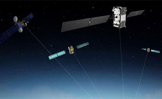
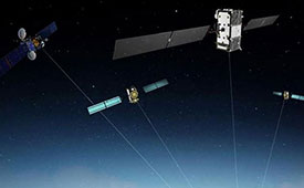
    To explore new investment support for the European space-based economy, the EIB and GSA are bringing together their expertise and experience. The common objective is to create high-skill jobs in the EU and improve the day-to-day lives of Europeans by supporting innovative companies and accelerating the development of new applications that use European global navigation satellite systems and earth observation data. These applications could be used to ensure smooth navigation, such as in search-and-rescue operations to save lives, for observing crops, and in precision farming to reduce the need for fertilizers and pesticides.

    “Space is the final frontier, and there is a new worldwide ambition in reaching it. The EU’s global competitors and new private actors are investing heavily in the space sector. At the same time, new disruptive technologies and business models are emerging and changing the playing field,” said EIB Vice-President Ambroise Fayolle, who is responsible for innovation. “We need to make sure that Europe stays in the game. That is why we are particularly enthusiastic about this agreement with GSA. It is an important step to develop further support for European space entrepreneurs and businesses to eventually give them and the EU a competitive edge in this new space race.”

    “Our expertise in market intelligence for satellite navigation and in supporting new business opportunities — thanks to EGNOS and Galileo — is the basis of our agreement with the EIB,” said Carlo des Dorides, GSA Executive Director. “We are confident that our cooperation will bring the extra added value required by entrepreneurs to transform their application businesses into globally successful companies.”

    A changing space sector

    The global space economy has been evolving rapidly in recent years. On average it has grown by 6.7% per year over the last 10 years, which is almost twice the 3.5% average yearly growth of the global economy. This growth has been partially driven by the US, China and other countries that have developed new ambitious space missions.

    The main driver, however, has been the “New Space” phenomenon: a number of technological and business model innovations that have introduced new products and services and reduced the cost of accessing and using space.

    The transformation of the space economy has seen new space companies investing over EUR 14.8 billion since 2000, with a fast accelerating trend: total investment in space companies grew by a factor of 3.5 in 2012–2017 compared with the previous six-year period. Moreover, US-based investors dominate the field accounting for around two thirds of the 400+ worldwide investors in space companies.

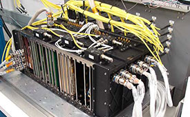
    Historically, Europe has always been at the forefront of publicly-funded space exploration, investing massively in space infrastructures such as the Copernicus and Galileo satellite programmes. Europe still boasts academic and scientific excellence but risks missing the next wave of space innovation unless it seizes the opportunity to stimulate more private investment in the new space sector.

    According to a recent EIB and European Commission study on the future of the European space sector, European space entrepreneurs feel there is a lack of private financing sources, particularly for late-stage investments. They therefore tend to keep an eye on private capital outside the EU, especially in the US.

    In this context, European public innovation instruments play an essential role in unlocking private capital for the space sector. 40% of the European companies surveyed seek public funding, which serves as a seal of approval in the market, as a precondition for further private investment.

  • US DOT prepares for GPS backup demonstrations

    US DOT prepares for GPS backup demonstrations

    Diana Furchtgott-Roth (Photo: DOT)
    Diana Furchtgott-Roth (Photo: DOT)

    The U.S. Department of Transportation is preparing for a GPS backup and complementary positioning, navigation and timing demonstration for the Department of Defense at the Joint Base Cape Cod, Massachusetts.

    Demonstration for testing is expected to begin in the spring of 2020, and DOT is seeking contractors to make Building #2410 at the base functional so that the demonstrations can be held there.

    Diana Furchtgott-Roth, deputy assistant secretary of Transportation for Research and Technology, is leading the project. Working through the Volpe National Transportation Systems Center, Furchtgott-Roth’s goal is to demonstrate as many of the technologies as possible and conclude the effort by March of next year.

    Learn more about the project here.

  • US DOT moves aggressively on GPS backup, RFP this month

    US DOT moves aggressively on GPS backup, RFP this month

    Diana Furchtgott-Roth (Photo: DOT)
    Diana Furchtgott-Roth (Photo: DOT)

    The last two U.S. presidential administrations failed to follow through on promises to protect GPS and the nation with a system to backup GPS. A recent Department of Transportation (DOT) appointee is aiming to fix that.

    Diana Furchtgott-Roth is deputy assistant secretary of Transportation for Research and Technology. Her office has a broad range of responsibilities including as the federal government lead for civil GPS and PNT issues.

    Since Furchtgott-Roth arrived at the department in February, she has been adamant about the need to establish a complementary and backup system that users can access when GPS is not available or signals need reinforcing. She notes that this has been a presidential policy requirement for DOT since 2004.

    There are also two Congressional mandates on this issue. The first mandate was in a law passed in 2017. The National Defense Authorization Act tasked the Departments of Defense, Transportation, and Homeland Security to jointly conduct a technology demonstration of GPS backup technology.

    Congress funded this project in 2018 through the Defense department, even though DOT was the lead agency. Bureaucratic delays in transferring the funds between departments has meant that, rather than concluding in the summer of 2019 as initially required, the demo is behind schedule by about eight months.

    Much of this transpired before Furchtgott-Roth arrived on scene and she is determined to make up for lost time.

    A Request for Information (RFI) seeking candidate GPS backup technologies was issued in early May of this year and closed 30 days later. Twenty-two responses were received, though some just offered comments and observations rather than proposing technologies.

    Working through the Volpe National Transportation Systems Center, Furchtgott-Roth’s goal is to demonstrate as many of the technologies as possible and conclude the effort by March of next year.

    “We want to thoroughly understand all of the proposed technologies, including their ability to penetrate indoors and underground without assistance,” Furchtgott-Roth said.

    The department’s procurement website forecasts a Request for Proposals for this effort this month (the site says it will be issued in the fourth quarter of the fiscal year which ends on Sept. 30). The opportunity is described as “Backup Global Positioning System (GPS) Technical Consulting Services for participation in a technology demonstration” with an estimated value of between $700,000 and $2,000,000.

    Small businesses that want to be on the notification list for this can do so through the FedBizOpps announcement page.

    The second legislative mandate was signed into law in December 2018. The National Timing Resilience and Security Act requires the Department of Transportation to establish a timing system to back up GPS by December 2020.

    Among the requirements specified in the Act are that the system must be terrestrial, wireless, have wide area coverage, be difficult to disrupt, and be capable of expansion to provide positioning and navigation services.

    Furchtgott-Roth plans to integrate the department’s responses to both taskings as much as possible. “What we learn from the tech demo should very much inform the implementation of the National Timing Resilience and Security Act,” she said.

    She also wants everyone on the project to keep in mind that establishment of the timing system is just the first phase of creating a more robust and resilient national PNT architecture. “Timing is important, and we are going to reinforce it first,” she said. “But it is not going to provide resilient positioning and navigation for drones, autonomous vehicles, and all our other transportation needs. America must have a combination of systems available that, when used together, will be very difficult to disrupt.”

    To keep things moving quickly, Furchtgott-Roth says she is leaning toward signals provided by a commercial entity, rather than a government-built system.

    “The Act suggests we consider a public-private-partnership, and there are a lot of advantages to that,” she said. “The government wouldn’t need to stand up a big acquisition staff or have a large appropriation of funds from Congress. Also, private entities are often able to act faster and be more agile. And they assume most of the project risk.” The aviation safety ADS-B system was created using such a procurement model.

    The only snag is that while Congress has appropriated money for the tech demo, it has not yet done so for the mandated operational system. Sources in Congress point out that although the House version of the 2020 budget has $32 million for Air Force “Resilient PNT,” nothing has been allocated for civilian users.

    “$32 million would go a long way for DOT’s efforts to protect the 99.9% of GPS users who are not in DoD,” said one congressional staff member. He was hopeful the Senate would designate funds in its version of appropriations for DOT and the issue would be resolved positively in conference.

    “GPS has become an invisible utility that so many of our technologies depend upon,” observed Karen Van Dyke, who leads PNT efforts for Furchtgott-Roth’s office. “Providing a complementary and/or backup capability ensures users have PNT even when GPS is disrupted. It may also help protect the signals themselves by deterring malicious actors who might otherwise want to jam or spoof GPS.”

    “President Trump’s top priorities are national and economic security. We can’t have GPS signals be a single point of failure for transportation and other critical infrastructure sectors,” Furchtgott-Roth said.


    Dana A. Goward is the president of the Resilient Navigation and Timing Foundation.

  • Finalists announced in MyGalileoApp competition

    Finalists announced in MyGalileoApp competition

    Ten projects in the MyGalileoApp competition have been named finalists.

    Out of a shortlist of 30 semi-finalists, the 10 were judged to be the most exciting in terms of innovation, market potential and technical feasibility.

    The 10 projects will now advance to the second development phase, at the end of which they should deliver a fully functioning app.

    The STPR augmented reality app. (Screenshots: GSA)
    The STPR augmented reality app. (Screenshots: GSA)

    Four of the 10 shortlisted projects are in the Augmented Reality and Games innovation area:

    • uMaze (Finland) — uMaze creates mazes in specific outdoor areas in which users can play.
    • ARGEO (Italy) — ARGEO allows users to discover content such as prizes, coupons and shopping cards geo-located around the streets of a city.
    • STPR (Poland, Australia, Ukraine) — The STPR app combines a virtual environment with game-related physical experiences in the real world.
    • arstory (Germany) — Arstory is a complete augmented reality ecosystem based on four main components: Galileo location, virtual objects in the real world, clustering of objects and a wide array of content options.

    Apps in the smart navigation and infotainment innovation area include:

    • Ready Park (France) — Ready Park makes parking easier by pairing drivers leaving a spot with users looking for one.
    • Galileonaut (France) —Galileonaut helps sailors navigate inside a port or a marina and provides a link to the harbour master’s office.
    • Trukatu (Spain) — Trukatu is a mobile C2C platform that connects people who want to rent or lease items with owners who have items to rent.

    Two of the shortlisted projects fall in the Fitness, Sport and mHealth category.

    • PanPan – Possible Assistance Needed (Germany) — PanPan serves as backup safety solution for potentially dangerous activities that may leave users in need of assistance.
    • LetMeAut (Italy) — LetMeAutmakes everyday tasks easier for people with autism.

    One app is in the Mapping, GIS and Agriculture innovation area.

    • Tractor Navigator (France) — Tractor Navigator provides guidance for farmers driving tractors, enabling them to visualise their current position and trajectory in an open field.

    The 10 projects have until Oct. 21 to deliver a finalized version of their app with 100% functionality. During this phase, the teams can receive technical support from the competition’s technical and business advisory team. At the end of the phase, the application should be already available for download on the Google Play and Apple platforms.

    “The standard of entry in this year’s competition was very high, which made the judges’ task a difficult one. However, the final 10 projects stood out in terms of their innovative approach and uptake potential and we are looking forward to seeing the final working apps in October,” said Justyna Redelkiewicz Musial, in charge of LBS and IoT market development at the European GNSS Agency (GSA). “We hope that the 20 projects that didn’t make it into the second development phase will continue to develop their apps because, at the finals, they will also have the opportunity to demonstrate the progress that they have made,” she said.

    All teams that will successfully complete the second development phase will be invited to the finals in November, where they will present their application to the GSA evaluation board.

    The awards will be decided after these presentations, with the first-place winner receiving a EUR 100,000 prize. The runner up and third place winners will receive EUR 50,000 and EUR 30,000 respectively.

  • French railways embrace Galileo to boost customer service

    French railways embrace Galileo to boost customer service

    More than 70 million TGV passengers will benefit from Galileo’s improved accuracy and positioning in 2019. (Photo: GSA)
    More than 70 million TGV passengers will benefit from Galileo’s improved accuracy and positioning in 2019. (Photo: GSA)

    News from the European GNSS Agency (GSA)

    The French national rail company SNCF is adopting Galileo technology to boost customer services, in particular in its high-speed TGV network. TGV is France’s intercity high-speed rail service, and is operated by the SNCF.

    With almost 50% of TGV trains already equipped with Galileo receivers, European GNSS is enabling improved customer information and traffic management.

    Galileo is a technology building block that can precisely and safely locate trains and contribute to the future evolution of the European Rail Traffic Management System (ERTMS). ERTMS aims to harmonize signaling systems across Europe, and European GNSS can help reduce its costs.

    SNCF is already embracing GNSS-based systems, in particular for passenger information, and fleet and traffic management.

    “At the beginning of 2019, some 250 high-speed trains were already equipped with Galileo-ready receivers,” said Antoine Barre, head of SNCF train localization projects. “This represents nearly 50% of SNCF’s TGV fleet. Some 320 trains are expected to be Galileo-ready by the end of 2019.”

    70 million passengers to benefit

    The aim is to deliver Galileo-enabled services along the entire train journey and customer experience. During 2019, more than 70 million passengers will benefit from the improved accuracy and positioning availability delivered to French TGV trains by Galileo.

    SNCF aims to equip its entire train fleet with Galileo receivers to assist non-safety relevant train localization. It also plans to further investigate the future contribution of European GNSS within ERTMS.

    “Having Galileo on the iconic TGV trains is a major milestone for us, confirming that European GNSS is delivering a clear value added to one of the main EU Railway undertakings,” said Daniel Lopour, GSA market development officer.

    “It is also good to see that SNCF is further progressing towards GNSS adoption on the regional fleet on the basis of the GSA position paper delivered earlier to the Community of European Railways (CER), explaining the benefits of Galileo for such applications,” Louper said.

    Currently, signaling is enabled by equipment installed along rail tracks that requires regular inspection and maintenance. Accurate and reliable geolocation using GNSS will enable rail networks to reduce the cost related to the infrastructure.

    Receivers installed in the train and connected via wireless networks should considerably reduce the costs of operation, maintenance and renewal of the network.

    SNCF has identified three main themes of work for future rail technologies: geolocation, telecommunication and the use of satellite images for infrastructure monitoring.

    Technology forward

    Speaking at the Space for Innovation in Rail event, held in Vienna, Austria, March 18-19, Corinne Talotte described SNCF’s Technology Forward programme. Talotte is director of Innovative Technologies at SNCF. Talotte explain that the SNCF program is looking to build the “Railway for the Future” — a railway that is “autonomous, connected and zero emission.”

    This spirit of innovation at SNCF aims to accelerate the implementation of new technologies. “First, this involves keeping an open mind on innovation and learning from other transport sectors,” Talotte said. “And our second important principle is to move to demonstrate innovative technologies as soon as possible in real operational situations to prepare the future deployment of innovations.”

    Highly precise geolocation is a key element to enable autonomy in all modes of transport and future mobility systems. For trains, autonomous operation can increase the density of trains operating in the network while at the same time improving safety and reliability of customer services.

    Space4Rail: From innovation to implementation

    “We need to know accurately the position, velocity and attitude in real time to enable autonomous train systems,” explained Talotte. “We are developing a multi-sensor system for localisation based on GNSS but combined with other inertial sensors.

    “This hybrid approach is inspired by the approach already adopted in the aviation sector. SNCF is undertaking a number of demonstrations with several partners, including the ERTMS user group and the Shift2Rail Joint Undertaking.”

    Hybrid architecture

    At the Space for Innovation in Rail event, Corinne Talotte said that SNCF was working on the remote operation of trains for use cases like shunting yards and the development of fully autonomous train prototypes.

    The hybrid architecture makes it possible to take advantage of the benefits offered by both technologies: GNSS corrects the natural drift of the inertial unit, and when GNSS is not available, for example in tunnels or in dense urban environments, the inertial unit can take over to ensure continuity of location data. The inertial unit also protects the system from any possible disturbances in the GNSS signal, such as jamming or spoofing, as well as environmental factors.

    The use of autonomous trains with innovative network control systems should enable SNCF to increase throughput on its lines. The objective is to carry more people and more goods, with greater regularity, improved energy efficiency and better economic performance, while ensuring continuing high levels of safety.

    SNCF believes that the autonomous train is no longer science fiction, but the immediate future. A first prototype remote-controlled freight train should be tested some time this year, and the first prototypes of freight and passenger trains with autonomous driving capability are predicted beginning in 2023, with gradual implementation.

  • U.S. Space Command re-established as 11th Unified Combatant Command

    U.S. Space Command re-established as 11th Unified Combatant Command

    Air Force General John W. Raymond (Photo: USAF)
    Air Force General John W. Raymond (Photo: USAF)

    In a move to enhance the United States’ space superiority capabilities, the United States Space Command (USSPACECOM) was formally re-established.

    USSPACECOM existed from 1985 to 2002 but was absorbed into U.S. Strategic Command in 2002 to make room for U.S. Northern Command and a greater focus on homeland defense.

    The Department of Defense established U.S. Space Command today as the eleventh Unified Combatant Command, with Air Force General John W. “Jay” Raymond as its congressionally confirmed commander.

    From establishment to full operational capability, General Raymond will remain dual-hatted as the commander of Air Force Space Command and U.S. Space Command. The GPS constellation is operated by Air Force Space Command’s 50th Space Wing at Schriever Air Force Base east of Colorado Springs.

    USSPACECOM will have a temporary headquarters of about 280 people at Peterson Air Force Base, Colorado.

    “Establishing USSPACECOM is a critical step that underscores the importance of the space domain and its strategic contributions to U.S. national security,” the U.S. Space Command stated in a news release. “The USSPACECOM establishment will accelerate the United States’ space capabilities to address rapidly evolving threats to U.S. space assets and the importance of deterring potential adversaries from putting critical U.S. space systems at risk.”

    “The scope, scale and complexity of today’s threat is real and it is concerning,” said Raymond during the establishment ceremony. “The establishment of a Combatant Command solely focused on the space domain demonstrates the United States’ commitment to protecting and defending its space assets against that threat.”

    Emblem of USSPACECOM
    Emblem of USSPACECOM

    The USSPACECOM mission is to deter aggression and conflict, defend U.S. and allied freedom of action, deliver space combat power for the Joint/Combined force, and develop joint warfighters to advance U.S. and allied interests in, from and through the space domain.

    The command will be postured to protect and defend, while increasing joint warfighter lethality by executing two primary missions focused on

    1. unifying and leading space capabilities for the Combined Force, and
    2. maintaining U.S. and Allied advantages in space through protection and defense.

    USSPACECOM’s global area of responsibility includes the area surrounding the earth at altitudes equal to or greater than 100 kilometers above mean sea level.

  • New NAVCEN chart shows GPS satellite locations

    New NAVCEN chart shows GPS satellite locations

    The GPS Directorate has approved a change to the Navstar GPS Control Segment to User Support Community Interfaces ICD-GPS-240 and ICD-GPS-870, reports the U.S. Coast Guard Navigation Center.

    The change removes the GPS satellite plane/slot and clock information from the Operational Advisory message. SVN/PRN, block type and NANU details will continue to be included.

    The change proposal was approved by the GPS Interface Control Working Group in December 2018.

    A depiction of the GPS constellation of satellites with slot and plane designations has been published by the U.S. Coast Guard Navigation Center as an easy-to-read graphic for use by the GPS user community.

    Chart: NAVCEN
    Chart: NAVCEN

    The chart can be found on the NAVCEN Constellation Status page and will be updated with the commissioning of new GPS satellites or upon any change in the constellation.

  • CHC Navigation introduces new corporate website

    CHC Navigation introduces new corporate website

    Image: CHC Navigation
    Image: CHC Navigation

    CHC Navigation has launched a new website to convey its expanding role as a provider of geospatial and GNSS products and solutions.

    “Our new website provides a clear insight of who we are and where our ambition lies when developing, delivering and supporting high-end, professional and innovative GNSS-based solutions to our customers,” the company stated in a press release. “The website offers extensive refreshed and updated resources presenting the entire scope of CHCNAV solutions to make any surveying work more effective.”

    In commenting on the new website, George Zhao, CEO of CHC Navigation said, “We have been enjoying double-digit growth for over 16 years demonstrating the strength of CHC Navigation in the professional GNSS-based markets. Our new website brings a comprehensive vision of our technology and innovation, expanding compelling solutions and our global customer care approach.”

    Founded in 2003 and based in Shanghai, China, CHC Navigation creates GNSS navigation and positioning solutions.

  • OCX supports second GPS III launch

    OCX supports second GPS III launch

    GPS OCX will maneuver satellite into final orbit over 10 days

    The U.S. Air Force used Raytheon Company’s GPS Next-Generation Operational Control System, known as GPS OCX, to support the launch of its second GPS III satellite into space. The ground system will now spend 10 days maneuvering the satellite into its final orbit, demonstrating GPS OCX’s ability to simultaneously support multiple GPS III spacecraft on-orbit throughout the checkout and calibration process.

    Raytheon’s GPS OCX has obtained the highest level of cybersecurity protections of any Department of Defense space system.

    “GPS OCX performed extremely well during the first launch and has exceeded performance requirements in the months since,” said Dave Wajsgras, president of Raytheon Intelligence, Information and Services. “The team was well-prepared for this launch, and we’re confident the system’s performance will continue to be positive.”

    GPS OCX, the enhanced ground control segment of America’s GPS system, has achieved the highest level of cybersecurity protections of any Department of Defense space system. Its open architecture design allows it to integrate advanced protections as they become available, and the system’s industry-leading cyber protections are why it will be used to support all future GPS III launches and GPS constellation operations upon operational acceptance.

    Earlier this year, the team completed final qualification testing of the system’s modernized monitor station receivers, which can receive and decrypt all GPS III military and civil signals. Global installation of the receivers starts next month and keeps the program on track for full system delivery by the program’s June 2021 contractual deadline.

    In addition to GPS OCX’s role, RGNext, a joint venture between Raytheon and General Dynamics Information Technology, provided operational launch support to ensure the safe launch of the United Launch Alliance’s Delta-IV rocket that was carrying the GPS III satellite. RGNext operates the launch range on behalf of the U.S. Air Force, providing maintenance, range safety, weather monitoring, communication and surveillance support for all launches conducted by defense, civil and commercial companies at the range.
    To access our press kit, which includes photos, videos and an animation, please visit us here. To learn more about the program’s progress and additional capabilities, visit us here.


    Featured photo: Raytheon

  • China’s super-thin atomic clocks achieve mass production

    China’s super-thin atomic clocks achieve mass production

    Photo: Beidou constellation
    Photo: Beidou constellation

    China’s super-thin rubidium atomic clock, which is just 17 millimeters thick, has been put into mass production, according to Xinhua News Agency.

    The clock, developed in 2018 by a research institute under the China Aerospace Science and Industry Corp. Ltd, (CASIC) is the key to the positioning and timing accuracy of BeiDou navigation satellites.

    In 2015, Chinese scientists developed a rubidium clock that is tiny enough to fit in the palm of your hand but was almost 40 millimeters thick. The new clock, with a length of 76 millimeters and width of 76 millimeters, is only 17 millimeters thick.

    Compared with the previous generation, the new clock is smaller in size but performs better. It adopts a plug-in design, making it easy to insert and remove on circuit board. With stronger resistance to high temperatures, it can work at 70 degrees Celsius (158 degrees Fahrenheit).

    In addition, it has a taming function, enabling the clock to be automatically recognized and tamed by the pulse per second (PPS) signal provided by navigation satellite systems, improving the accuracy of local frequency.

    The clock can be used in fields such as aviation, aerospace and telecommunications. According to its developers, the ultra-accurate clock will have a broader market prospect in the future.

    Atomic clocks are the most accurate time and frequency standards. They use vibrations of atoms to measure time. Due to its small size, low cost and high reliability, rubidium clock is the most widely produced atomic clock.

    A large number of self-developed rubidium and hydrogen atomic clocks have been carried by satellites that provide accurate positioning for China’s BeiDou Navigation Satellite System.

    The atomic clocks are the workhorses that send synchronized signals so sat-nav receivers can triangulate their position on Earth.

    China began to construct the BDS in the 1990s. The system started serving China with its BDS-1 satellites in 2000 and started serving the Asia-Pacific region with its BDS-2 satellites in 2012. China will complete the BDS global network by 2020.

  • Second GPS III in orbit, responding to commands

    Second GPS III in orbit, responding to commands

    A ULA Delta IV rocket carrying GPS III SV02 lifts off from Space Launch Complex-37 on Aug. 22. (Photo: ULA)
    A ULA Delta IV rocket carrying GPS III SV02 lifts off from Space Launch Complex-37 on Aug. 22. (Photo: ULA)

    The U.S. Air Force’s second next-generation GPS III satellite, built by Lockheed Martin, is responding to commands, under control and now using its own internal propulsion system to get to orbit following its successful Aug. 22 launch.

    At 11:01 a.m. ET, Air Force and Lockheed Martin engineers at Lockheed Martin’s Launch & Checkout Facility near Denver declared they had full control of GPS III Space Vehicle 02 shortly after the satellite’s separation from its United Launch Alliance (ULA) Delta IV rocket booster. The satellite, nicknamed “Magellan” by the Air Force, began its rocket ride to space with a 09:06 a.m. ET launch from Cape Canaveral Air Force Station.

    GPS III SV02 is now climbing towards its operational orbit about 12,550 miles above the earth under the power of its own Liquid Apogee engines. Engineers at Lockheed Martin Space’s Waterton, Colorado facility are commanding the satellite using elements of the GPS Next Generation Operational Control System (OCX) Block 0.

    “GPS III SV02 is receiving and responding to commands just as planned. In the days ahead, we’ll finish orbit raising to our operational slot and then send the satellite commands telling it to deploy its solar arrays and antennas,” said Johnathon Caldwell, Lockheed Martin Space’s Vice President for Navigation Systems. “Once we are set up, we’ll begin on-orbit checkout and tests, including extensive signals testing with our advanced navigation payload.”

    The payload is provided by L3Harris. The first GPS III satellite launched in December 2018 and its navigation payload has performed beyond expectations on-orbit during pre-operational testing, according to L3Harris.

    GPS III SV02 is the second GPS III satellite designed and built by Lockheed Martin to help the Air Force modernize today’s Global Positioning System (GPS) constellation with new technology and capabilities. GPS III satellites provide 3x greater accuracy and up to 8x improved anti-jamming capabilities. GPS III also provides a new L1C civil signal, compatible with other international global navigation satellite systems, like Europe’s Galileo.

    The First GPS III Satellite Completes On-Orbit Testing

    Image: ULA
    Image: ULA

    GPS III SV02 will be the second GPS III satellite in orbit and the second GPS III satellite now being commanded from Lockheed Martin Space’s facility.

    On Dec. 23, 2018, the Air Force launched the first GPS III satellite. Nicknamed “Vespucci,” GPS III SV01 underwent months of checkout and thorough testing of its advanced, new navigation payload provided by Harris Corporation.

    “GPS III SV01’s performance exceeded expectations during testing,” Caldwell said. “On July 12, we officially completed all On Orbit Check Out & Test activities. We are excited to see this satellite move to the next phase and perform in an operational environment.”

    That’s expected to happen later this year once the first satellite is handed over to the Air Force.

    Thinking Ahead From the Ground Up

    In preparation for this handover, in 2016, the Air Force awarded Lockheed Martin the GPS III Contingency Operations (COps) contract to upgrade its current GPS ground control system – the Operational Control Segment (OCS) – to be able to fly today’s 31-satellite constellation, as well as the new, more-powerful GPS III satellites, until OCX Block 1, still in development, is delivered.

    Lockheed Martin delivered the GPS III COps software upgrade in May and it is currently undergoing preparations for installation.

    COps is the latest GPS ground control upgrade project Lockheed Martin has had since it began sustaining the OCS in 2013. In November 2018, the company completed the AEP 7.5 upgrade — the largest architectural change in the system’s history — replacing significant code, hardware and software to improve the system’s cybersecurity capabilities and positioning the Air Force to better operate in contested, degraded and operationally limited environments.

    In December 2018, the Air Force awarded Lockheed Martin the GPS Control Segment Sustainment II (GCS II) contract to continue to further modernize and sustain the OCS through 2025.

    In 2020, the OCS is expected to receive the M-Code Early Use (MCEU) upgrade, which will allow control of M-Code, an advanced, new signal designed to improve anti-jamming and anti-spoofing, as well as to increase secure access to military GPS signals for U.S. and allied armed forces.

    With GPS III SV01 and SV02 now on orbit, GPS III satellites continue to roll off the production line at Lockheed Martin’s advanced $128-million GPS III Processing Facility near Denver. On May 27, the Air Force declared the GPS III SV03 Available for Launch (AFL) and had the company place it into storage waiting for a launch date. GPS III SV04-08 are now in various stages of assembly and test.

    In all, Lockheed Martin is under contract to build up to 32 next-generation GPS III/IIIF satellites for the Air Force. Additional IIIF capabilities will begin being added at the 11th satellite. These will include a fully digital navigation payload, a Regional Military Protection capability, an accuracy-enhancing laser retroreflector array, and a Search & Rescue payload.

  • L3Harris delivers eighth GPS III navigation payload

    L3Harris delivers eighth GPS III navigation payload

    The Harris-supplied navigation payload before integration into the second GPS III SV. (Photo: Harris)
    The Harris-supplied navigation payload before integration into the second GPS III SV. (Photo: L3Harris)

    As the U.S. Air Force prepares to launch its second next-generation GPS III satellite, L3Harris Technologies delivered its eighth navigation payload to GPS III satellite prime contractor Lockheed Martin.

    The first GPS III satellite launched in December 2018 and its navigation payload has performed beyond expectations on-orbit during pre-operational testing, L3Harris said in a press release.

    In May, the Air Force declared the third GPS III satellite Available for Launch, pending a launch date. L3Harris payloads are also already fully integrated in the GPS III 4-6 space vehicles currently in production and testing at Lockheed Martin.

    The GPS III navigation payload features a mission data unit (MDU) with a unique 70-percent digital design that links atomic clocks, radiation-hardened processors and powerful transmitters — enabling signals three times more accurate than those on current GPS satellites. The payload also boosts signal power, which increases jamming resistance by eight times and helps extend the satellite’s lifespan.

    In 2017, L3Harris announced that it completed development of an even more-powerful, fully digital MDU for the Air Force’s GPS III Follow On (GPS IIIF) program. The new GPS IIIF payload design will further enhance the satellite’s capabilities and performance.

    In September 2018, the U.S. Air Force selected Lockheed Martin for a fixed-price-type production contract for up to 22 GPS IIIF satellites. L3Harris is Lockheed Martin’s navigation signal partner for GPS IIIF satellites, and in January received a $243 million award to provide the navigation signals for the first two GPS IIIF satellites, space vehicles 11 and 12.

    L3Harris’ expertise in creating and sending GPS signals extends back to the mid-1970s — providing navigation technology for every U.S. GPS satellite ever launched. While the Air Force originally developed GPS for warfighters, millions of people around the world and billions of dollars of commerce now depend on the accurate, reliable signal created and sent by L3Harris navigation technology.