Category: Uncategorized

  • Spatial finance: Show me the money

    image: CalypsoArt/ iStock/Getty Images Plus/Getty Images
    Image: CalypsoArt/iStock/Getty Images Plus/Getty Images

    Money comes, and money goes. Who can stop the ebb and flow? It comes and goes whither it will. But we can watch the tide. We can paint the tide. We can measure the tide. We can harness the tide. And we can ride the tide. What would it be like to master the tide?

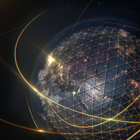
    Welcome to the world of spatial finance. Here is where money meets geographic information systems (GIS). It stops being just a quantity. It takes shape with x – y – z coordinates and moves through time. Mark money by its location and track it through time and you know its velocity — and Energy = Velocity x Mass ^2. When an object in motion hits another object, the transfer of energy is its impact. In the case of money, one dollar has the mass of 1, because it can only be divided up so many ways before it can’t buy anything, and then its impact is zero.

    Consider the mass of 1 million dollars. How far can it go before its impact reaches zero? Much further is the answer. And it stands to reason that the closer a person is to the release of the money, the greater the impact and, likewise, the further away, the lesser the impact, until it is just a trickle. That is, unless the money is released very slowly. Impact is a factor of speed. This is monetary theory.

    The astronomer Nicolaus Copernicus was also an economist, and he devised the quantity theory of money. Later theories postulated that quantity is only one variable, and an expanding quantity can be countered by velocity to control the impact of money in an economy.

    If the velocity of money is slowed down enough, then trillions of dollars can be released into the economy with minimal impact, or so the theory goes. But it is just a theory. It has never been tested before, at least not on a massive scale. Spatial finance helps understand the speed, location and direction of money, and thus, stem the flow of the tide.

    The chart below published by the Federal Reserve Economic Data (FRED) shows the mass and velocity of money since 1969 combined into a single chart. One line shows the increase in the amount of money in circulation (mass) and the other line shows the speed it is moving through the economy (velocity). It is obvious the velocity of money theory is in full practice as the mass increases parabolically against an exponentially decreasing velocity.

    Chart: Federal Reserve Economic Data (FRED)
    Chart: Federal Reserve Economic Data (FRED)

    Inflation has been in the news a lot lately. It will continue to be in the news. Trillions of dollars released into the economy in a short period of time has consequences. The effects are yet to be known, but it’s enough to know that the risk is there. Everyone is on high alert. We know this.

    It is the same if we lived along the coast of Indonesia or Sri Lanka. The tsunami in the Bay of Bengal took place 17 years ago now, in of December 2004. It will never be forgotten by the people who were there, and every day, those who live there do so with suppressed anxiety. They understand the destructive power and force of a rushing tide. Water, volcanoes and tectonic plates are powerful forces. When they are combined, the lives of 200,000 people end in an instant. Living on a fault line is perilous.

    Similarly, living on the world’s reserve currency might feel like standing on solid ground, but when trillions are removed from beneath the firmament, one has to wonder. It is not a question of if it will happen, but when? The stock exchange is at record highs. Many trillions are being printed, and trillions more will be. Is this the tsunami? Are we standing before a rushing tide? The higher the S&P goes, the more uneasy it feels. It is natural to wonder, is this where Noah began to build the ark? Or is it too late already?

    Perhaps we are looking at it all wrong. It is not a rising wave that will come crashing down. The S&P is measuring the depth of the rising water. Rather than crash down, it could just keep rising. It is now twice as deep as it was one year ago at the bottom of the pandemic. The speed of its recovery is its velocity. It took 157 years through peace, war, boom and bust for the S&P to get to the level it was when it crashed in March 2020. Since that time 18 months ago, it has more than doubled.

    Can the speed of that velocity be measured? How many hands did the trillions of dollars pass through before its impact reached zero? Is the money still changing hands?

    Where was the first wave of money spent? Who spent it? On what was it spent? Where did it finally settle?

    Is there a reservoir the money flows into when it reaches its end?

    Spatial finance seeks to answer these questions. It is a growing industry. New tools are coming online. The financial wizards of tomorrow will track and harness money with precision, knowing where it is and where it is going, and catching it before it gets there. Isn’t that how the game has always been played?


    The art of economics consists in looking not merely at the immediate, but at the longer effects of any act or policy; it consists in tracing the consequences of that policy, not merely for one group, but for all groups.”

    ~ Henry Hazlitt, Economics in One Lesson (1946)


    The Federal Reserve provides rudimentary geospatial economic data for mapping. Visit GeoFRED to learn more. The most current data is 2019; records go back to 1969. Spreadsheets of geospatial financial data can be downloaded for more in-depth analysis and mapping. Here is a .gif of how the income per capita in each county has changed year over year since 1969 to 2019.

    Income per capita by county 2000-2019 annually. (Image: GeoFRED)
    Income per capita by county 2000-2019 annually. (Image: GeoFRED)

    There is much more to spatial finance than I covered here. This is just one aspect of the growing field of study. You are encouraged to learn more. As monies transition toward digital currencies, this field will expand even further.

    I’d like to thank two people who helped me put this article together. Insights were provided by Robert Farnsworth, GISP; and Arnold Rogers, who wrote an article on the future trends in geospatial technologies and submitted it to me, which was an inspiration. Thank you both.

    Here is how to connect with them:

    Robert Farnsworth on LinkedIn

    Arnold Rogers at [email protected]


    William Tewelow is a senior aeronautical information specialist for the Federal Aviation Administration. He is a 2016 graduate of the FAA’s management fellowship Program for Emerging Leaders and a mentor with the FAA’s National Mentor Program. He served on special assignment to the U.S. Department of Transportation and led a national strategic geospatial initiative under the authority of the White House Open Data Partnership.

    William is a designated Geographic Information Systems Professionals (GISP). He has degrees in Geographic Information Technology and Intelligence Studies and is currently earning his master’s degree in Organizational Leadership with a focus on Performance Management.

    William retired from the U.S. Navy after serving 23 years as a Geospatial and Imagery Intelligence Specialist, a Naval Aviator, a Meteorologist, and a Tactical Oceanographer earning three achievement medals. He was among the first in the nation to earn a Geospatial Specialist Certification from the U.S. Department of Labor while working at NASA Stennis Space Center. He is married, enjoys traveling, connecting people, solving problems, and interested in new technology. His favorite quote is, “A man’s mind changed by a new idea can never go back to its original dimension.” ~ Oliver Wendell Holmes

  • Thank you for registering

    Thank you for registering for the upcoming webinar, “GPS & MGUE Program Update & High Dynamic Testing” sponsored by Spirent.

    A link to the live event will be sent to you two hours before the event. Your personalized event URL will be automatically generated by the ON24 system. To ensure receipt of the email, please whitelist this email address by adding it to your contacts: [email protected].

    This presentation will begin at 1 p.m. EDT / 10 a.m. PDT on Thursday, October 14.  A recording will also be sent to you the following day so you can watch it on-demand.

    Audience members may arrive 15 minutes prior to live time. If you have any questions, please contact event producer Aurora Harris at [email protected].

  • AUVSI Xponential takes over Atlanta

    AUVSI Xponential takes over Atlanta

    Logo: AUVSI Xponential 2021

    The Association for Unmanned Vehicles Systems International (AUVSI) brings its annual conference, XPONENTIAL, to Atlanta, Aug. 16-19. The event invites industry changemakers and end users to experience new technology that is solving real world problems, from safety and defense, to energy and infrastructure, business, construction, health, and the environment. The convention features keynote speakers, panel presentations, educational programs, specialized workshops, networking opportunities, and an exhibitor hall featuring newly developed technology to preview.

    “To support our community and these technologies as they continue to accelerate along the innovation curve, our theme this year is Assured Autonomy,” said Brian Wynne, President and CEO of AUVSI. “As an industry, we must work together to ensure these systems are created, deployed, marketed and regulated to create a virtuous cycle of trust, social benefit, and economic growth. You’ll see that focus throughout our programming on-site, as well as in the technologies and operational services on display from our exhibitors.”

    XPONENTIAL typically attracts 8,000+ attendees each year, who attend 100+ educational sessions organized by tracks focused around technology, policy, and public acceptance. The Solutions Theatre features the top experts in their field sharing best practices, technical discoveries and announces the AUVSI XCELLENCE Award winners. The Startup XCELERATOR Pavillion serves as a hub for emerging technologies and early-stage companies providing a glimpse into the industry’s future. Meanwhile, the XPO Hall provides access to more than 450+ companies all showcasing the latest breakthroughs in drones, robotics, and other unmanned systems.

  • Spire awarded contract for Earth observation data

    New task order continues delivery of comprehensive space data and opens availability to all U.S. government-funded researchers and federal agencies

    Image: Just_Super/iStock/Getty Images Plus/Getty Images
    Image: Just_Super/iStock/Getty Images Plus/Getty Images

    Spire Global,  a global provider of space-based data and analytics, has announced the continuation of its participation in NASA’s Commercial Smallsat Data Acquisition (CSDA) Program with a $6 million contract extension.

    The contract continuation, Task Order 6 (TO6), is a subscription data solution that includes radio occultation (RO) data, grazing angle GNSS-RO, total electron content (TEC) data, precise orbit determination (POD) data, soil moisture and ocean surface wind speed GNSS-Reflectometry data and magnetometer data.

    This data will be available to all federal agencies, NASA-funded researchers and, more broadly, to all U.S. government-funded researchers for scientific purposes.

    Under CSDA Program TO6, Spire will deliver a comprehensive catalog of data, associated metadata and ancillary information from its Earth-orbiting small-satellite constellation. The company operates its constellation in low Earth and collects upwards of 10,000 radio occultations per day with consistent global coverage.

    For TO6, Spire will provide rolling access to 12 months of radio occultation data with a 30-day latency. This data will be archived and maintained by NASA under the CSDA Program’s SmallSat Data Explorer (SDX) database.

    “Programs like CSDA highlight the incredible potential of private-public partnerships in the federal government to drastically accelerate our ability to confront some of the greatest challenges of our time, such as climate change,” said Peter Platzer, CEO of Spire. “With the end-user license agreements, our data is now available to all federal agencies and the larger NASA scientific community to help support Earth observation research across fields.”

    The program includes end-user license agreements (EULAs) to enable broad levels of dissemination and shareability. All federal agencies and U.S. government-funded researchers will have access to Spire’s data for scientific purposes under TO6 and will be able to request access to the data via the CSDA Program’s Commercial Datasets webpage.

    “At NASA, the CSDA Program has continued to blossom as a valuable resource to our team for our Earth observation research and analysis. We are committed to growing the program as well as continuing the work we have started,” said Will McCarty, project scientist at the CSDA Program and  research meteorologist at NASA Global Modeling and Assimilation Office. “Spire has been a valued partner through CSDA’s development since its inception, and with this additional task order, we are excited about the new insights and results that will come not only from within NASA, but also through broader collaboration through the domestic government scientific community.”

    NASA has used Spire data in its research on water and sea-ice levels in the polar regions, the height of the planetary boundary layer (PBL), and the day-to-day variability of thermospheric density at flight level.

    NASA also noted that Spire data has shown positive benefit to its GEOS Atmospheric Data Assimilation System, which uses space-based data to analyze the Earth’s atmosphere and assimilate the data into its Earth observation systems.

    As one of the original vendors for the CSDA Program, Spire provides NASA yearly updates to the scope of work under this agreement to ensure alignment of data to the agency’s needs.

  • Thank you for registering

    Thank you for registering for the upcoming webinar, “Precision Clocks for Resilient Timing in GNSS Denied Environments” sponsored by Microchip.

    A link to the live event will be sent to you two hours before the event. Your personalized event URL will be automatically generated by the ON24 system. To ensure receipt of the email, please whitelist this email address by adding it to your contacts: [email protected].

    This presentation will begin at 1 p.m. EDT / 10 a.m. PDT on Thursday, August 26.  A recording will also be sent to you the following day so you can watch it on-demand.

    Audience members may arrive 15 minutes prior to live time. If you have any questions, please contact event producer Aurora Harris at [email protected].

  • DARPA puts navigation for deep dives to the test

    DARPA puts navigation for deep dives to the test

    Robots, UAVs go head-to-head in DARPA subterranean challenge

    The U.S. Defense Advanced Research Projects Agency (DARPA) is looking for novel approaches to rapidly map, navigate and search underground environments during time-sensitive combat operations or disaster-response scenarios.

    Eight teams have qualified for the DARPA Subterranean (SubT) Challenge Systems Competition Final Event. On Sept. 21–23, the teams’ robots will have to quickly navigate unfamiliar underground environments at the Louisville Mega Cavern in search of common items including backpacks, cell phones, trapped survivors and even invisible gas.

    Those who find and identify the most items will win prizes of $2 million for first place, $1 million for second place and $500,000 for third place. DARPA-funded and self-funded teams have an equal chance to win prize money in the final event, DARPA states.

    An Elios drone from team CERBERUS roams a moulin in an earlier challenge. (Photo: DARPA)
    An Elios drone from team CERBERUS roams a moulin in an earlier challenge. (Photo: DARPA)

    The SubT Challenge has held three preliminary events over the past two years — tunnel, urban and cave circuits. The final event will include elements of all three subdomains.

    • Tunnel systems can extend many kilometers in length with constrained passages, vertical shafts and multiple levels.
    • Urban underground environments can have complex layouts with multiple stories and span several city blocks.
    • Natural cave networks often have irregular geological structures, with both constrained passages and large caverns.

    The SubT Challenge is run by DARPA’s Tactical Technology Office (TTO) to uncover innovative solutions to life-threatening, real-world impediments. “Complex underground settings present significant challenges for military and civilian first responders,” explained DARPA Program Manager Timothy Chung.

    Chung added that the project has already achieved success. “Multimodal sensing developed through collaboration of robots during this project has increased the probability of correctly identifying important targets in real life,” he said. “The SubT Challenge is pushing researchers and startups to move to greater autonomy and has led to huge leaps in capability within subterranean environments while allowing learning from failure in non-critical situations.”

    In addition to the Systems Competition involving physical robots, a Virtual Competition is being held. The teams that qualify for the final virtual competition will be announced later this summer. Teams in the Virtual final event will compete for up to $1.5 million, with additional prizes for self-funded teams in each of the Virtual Circuit events.

    In the final competition, helmets, rope and even gas must be located. (Photo: DARPA)
    In the final competition, helmets, rope and even gas must be located. (Photo: DARPA)

    FINAL EVENT TEAMS

    DARPA-Funded

    • CERBERUS: CollaborativE walking and flying RoBots for autonomous ExploRation in Underground Settings
    • CoSTAR: Collaborative SubTerranean Autonomous Resilient Robots
    • CSIRO Data61
    • CTU-CRAS-NORLAB: Czech Technical University – Center for Robotics and Autonomous Systems – Northern Robotics Laboratory
    • Explorer
    • MARBLE: Multi-agent Autonomy with Radar-Based Localization for Exploration

    Self-Funded

    • Coordinated Robotics
    • Robotika International (Czech Republic, United States and partners)FINAL EVENT TEAMS
  • Maxtena adds M9HCT-A-SMA multi-band GNSS antenna to helical family

    Maxtena adds M9HCT-A-SMA multi-band GNSS antenna to helical family

    Advanced multi-frequency antenna shaped for high-precision applications featuring L-band corrections

    Photo: Maxtena
    Photo: Maxtena

    Maxtena Inc. has introduced an advanced, tiny, patented GNSS antenna for high precision and autonomous multi-frequency applications. The M9HCT-A-SMA antenna is a high accuracy, multi-frequency active helix GNSS antenna + L-band corrections services.

    The design provides simultaneous GNSS reception in a rugged, compact, and ultra-lightweight form factor on:

    • L1: GPS, GLONASS, Galileo, Beidou
    • L2: GPS L2C, Galileo E5B, GLONASS L3OC
    • L5: GPS + L-band corrections

    The M9HCT-A-SMA is suitable for high-precision applications such as the UAV market, where high performance and low weight are driving features in antenna selection.

    The active helix design features Maxtena’s patented compact and lightweight Helicore technology. This technology provides excellent pattern control, polarization purity and high efficiency in a compact form factor.

    The M9HCT-A-SMA is ground-plane independent and offers extremely low power consumption and minimal phase-center variation over azimuth crafted for high-precision applications. The antenna offers superb axial ratio, ensuring multipath error is mitigated.

    For the embedded version, Maxtena provides support for installation and integration of the embedded antenna to offer an exceptional antenna performance. Maxtena can embed the antenna in any housing, then tune the antenna to match the housing’s materials, electronics, and space

    “The M9HCT-A-SMA combines all lower and upper GNSS bands including L1/L2/L5 across all constellations and features L-band corrections,” said Maxtena’s Chief Commercial Officer Vanja Maric. “At the same time, this antenna is the smallest solution with such a performance on the market. The superb axial ratio and multipath rejection allow the antenna to operate in the most RF noisy environments. We see a trend of higher accuracy demand across various industries from autonomous vehicles and robotics to commercial products such as lawn mowers and robotics using our antenna solution.”

  • Seen & Heard: Ingenuity’s PNT hiccup, Avengers assemble!

    Seen & Heard: Ingenuity’s PNT hiccup, Avengers assemble!

    “Seen & Heard” is a monthly feature of GPS World magazine, traveling the world to capture interesting and unusual news stories involving the GNSS/PNT industry.


    Integrity sits safely on Mars following an in-flight anomaly. (Photo: NASA)
    Integrity sits safely on Mars following an in-flight anomaly. (Photo: NASA)

    PNT Issue Rocks Ingenuity

    The Mars drone Ingenuity uses an inertial measurement unit (IMU) to track position, velocity and attitude. The IMU works with the rotorcraft’s navigation camera, which feeds images into the system. About 54 seconds into Ingenuity’s sixth flight on May 22, a glitch in the pipeline of images delivered by the camera caused Ingenuity to buck. The glitch caused a single image to be lost, resulting in all later navigation images being delivered with inaccurate timestamps. Ingenuity’s navigation system attempted to correct itself due to “phantom errors,” but the copter still managed to land within 16 feet (5 meters) of its target location. The Perseverance rover snapped an image of its flying companion the next day. The timing vulnerability is being addressed.


    The versatility of the ZEB-Horizon device enabled the Deep Time team to map the complex and challenging environment. (Photo: GeoSLAM)
    The versatility of the ZEB-Horizon device enabled the Deep Time team to map the complex and challenging environment. (Photo: GeoSLAM)

    Measuring Deep Time and Space

    Geospatial 3D mapping specialist GeoSLAM provided the technology to scan one of Europe’s largest caves as part of the Deep Time isolation study. For 40 days, 15 participants set up camp in the Lombrives cave in southwestern France with no clocks or sunlight, and zero contact with the outside world. Conducted by the Human Adaptation Institute, the experiment aimed to gain insight into human adaptability to isolation. For their first task, the “deeptimers” used the ZEB-Horizon to conduct a digital scan of the 3-km Lombrives cave — a system consisting of both narrow passages and expansive chambers up to 70 meters in height, formed more than 125 million years ago.


    Photo: Nearmap
    Photo: Nearmap

    Avengers Assemble!

    On June 4, Disney unveiled its Avengers Campus at its California Adventure park. Aerial image provider Nearmap, which has been flying over Disneyland and California Adventure twice a year since 2014, shared a bird’s-eye view of the park’s new area, which replaced “A Bug’s Life.” Nearmap also shared images comparing the crowd size in 2019 before COVID-19 to the reopening limit of 25% capacity in April.


    Photo: Geoscience Australia
    Photo: Geoscience Australia

    Tasmania First

    As part of the Positioning Australia program, Geoscience Australia is building new GNSS ground stations. The first new station was recently completed outside the town of Derby, Tasmania. This new station joins 10 existing stations in Tasmania, providing widely available GNSS-based precise positioning signals. To access the service, users can connect to a service provider offering a fully supported service with system integration; users with specialized equipment and the technical expertise to integrate GNSS positioning can connect directly to the station via Geoscience Australia’s GNSS Data Centre.

  • Skyward collaborates with Pix4D

    Skyward collaborates with Pix4D

    Screenshot: Skyward
    Screenshot: Skyward

    Skyward, a Verizon company, has announced its integration with Pix4D, a photogrammetry software suite for drone mapping. The partnership gives customers the ability to turn drone data into 2D maps and 3D models.

    Enterprises and drone pilots can now plan flights, receive FAA approval to fly in controlled airspace (LAANC), fly with Skyward’s InFlight ground control station, and process data using Pix4D from within the Skyward platform.

    Skyward Mapping & Modeling, powered by Pix4D, enables customers to create, view, measure, and export 2D orthomosaic maps and 3D photogrammetric models right from Skyward’s web app. With the processing power of Pix4D, Skyward customers can get business-ready data sets through a seamless plan, fly, process workflow.

  • Honeywell debuts MEMS sensor to help small sats navigate

    Honeywell debuts MEMS sensor to help small sats navigate

    The HG4934 Space Rate Sensor is compared in size to a typical smartphone. (Photo: Honeywell)
    The HG4934 Space Rate Sensor is compared in size to a typical smartphone. (Photo: Honeywell)

    New, smaller sensors provide high-performance navigation at a low cost with less power consumption, company said.

    Honeywell has unveiled a new rate sensor to help small satellites navigate increasingly crowded orbits above the Earth’s surface. The new micro-electro-mechanical system (MEMS)-based product provides low cost and power consumption in a smaller size than previous Honeywell offerings, while maintaining high performance levels. It is suitable for customers building smaller and lower-cost satellites, according to Honeywell.

    Honeywell’s HG4934 space rate sensor is roughly the same size and weight (145 grams) as a baseball. Compared to Honeywell’s previous rate sensors, it consumes only one-fifth the electric power, is more than 32 times lighter, and is 60 times smaller. It also is more tolerant of radiation, a key attribute in space.

    “With this new sensor, our customers can build smaller, lower cost satellites that are just as capable and reliable as their traditional predecessors, which will allow them to field new satellite technologies like 5G telecommunications or high-bandwidth global Internet,” said Mike Elias, vice president and general manager, Space, Honeywell Aerospace. “Furthermore, the number of satellites is only increasing, which leads to more crowded orbits. It’s critical that our customers have highly precise navigation solutions to help prevent accidents, which could knock functional satellites out of orbit.”

    A space rate sensor, also known as an inertial reference unit or IRU, is an inertial sensor composed of three gyroscopes that work together to sense rotation rates. They determine an aircraft or spacecraft’s change in rotational attitude over time and allow it to move from one location to another without using any external information. It can also serve as a backup solution to provide redundancy if other navigation systems fail.

    Celestial navigation options like star trackers are a popular method of obtaining pointing directions for satellites and spacecraft. This form of navigation uses angular measurements between objects in space (stars, planets, etc.) and the horizon to calculate location. However, sometimes these star trackers are blinded by the sun or affected by thruster gases. In this case, Honeywell’s HG4934 can act as a secondary method of attitude determination.

    Honeywell’s HG4934 Space Rate Sensor is available now for commercial, defense, and science applications. The first deliveries to customers began at the end of 2020.

  • Orolia GNSS simulators now support ultra-low latency of 5 ms

    Orolia GNSS simulators now support ultra-low latency of 5 ms

    Latest advancement from Skydel uses software-defined advantages to deliver real-time performance

    The Skydel Real-Time Performance graphs illustrate the software-defined engine’s low latency during a GNSS simulation. (Screenshot: Orolia)
    The Skydel Real-Time Performance graphs illustrate the software-defined engine’s low latency during a GNSS simulation. (Screenshot: Orolia)

    Orolia has announced the launch of its Real-Time Performance capability, which achieves an ultra-low latency of five milliseconds. The feature will be standard on all Skydel-powered GNSS simulators.

    Skydel is a software-defined simulation engine that powers Orolia’s advanced GNSS simulators including its BroadSim (available via Orolia Defense & Security) and GSG product lines.

    “Skydel is known by users for its intuitive nature and ability to be quickly redeployed for a variety of projects,” said Tim Erbes, director of engineering for Orolia Defense & Security. “Delivering Real-Time Performance with latency as low as five milliseconds further shows that Orolia is a market leader empowering our customers by exceeding their expectations.”

    Skydel’s software-defined architecture is designed to meet the demanding GNSS simulation testing requirements in the automotive, military, space and other high-tech industries. Skydel also supports hardware-in-the-loop simulations without sacrificing ultra-low latency and high-end performance.

    The user interface has a sophisticated dashboard showing Real-Time Performance graphs. The tool enables users to grade the simulator’s performance, interpret data, diagnose inefficiencies, and optimize scenarios on the fly. In a video tutorial, Orolia demonstrates how the simulation engine processes data and how easy it is to read the graphs through its visualization and precise indications. As the system reaches its limits, it remains stable and fully operational, preserving the integrity of the simulation.

    Erbes said the Real-Time Performance graphs not only instill confidence in the simulator, but also allow for better integration in the testbed.

    “For example, instead of just hoping their hardware-in-the-loop configuration is working, users can view the real-time data and see that low latency is being maintained,” he said. “This feature provides enhanced visibility not only into the performance of the simulation, but also into the reliability of the hardware-in-the-loop integration, resulting in a more robust solution. This is critical when generating complex environments with high dynamics, jamming, spoofing, repeating, and alternative PNT sensors.”

  • Sony launches Airpeak S1, its first professional drone

    Sony launches Airpeak S1, its first professional drone

    Sony’s first professional drone is small, but can be equipped with alpha mirrorless camera

    Sony Electronics Inc. has announced its first professional drone, the Airpeak S1. An introductory model in the new Airpeak line, the S1 is a small drone that can be equipped with Sony’s full-size mirrorless interchangeable-lens Alpha camera.

    The new drone uses a proprietary motor, propeller, control system and sensing technology, allowing it to fly at extremely high speeds with stable wind resistance.

    The Airpeak S1 features an advanced remote controller that can support the production of high-quality aerial images and freely control the aircraft. It also includes obstacle detection, automatic flight control via sensing and increased safety via cloud management of the aircraft and flight information.

    “Sony is excited to launch our new drone business with the Airpeak S1,” said Yang Cheng, Vice President, Imaging Solutions, Sony Electronics Inc. “Combining an extremely compact size with some of Sony’s most advanced imaging, sensing, AI and robotics technologies, the S1 will allow content creators, storytellers and commercial professionals to capture that which they’ve never been able to capture before.”

    Advanced flight performance

    The new Airpeak S1 offers dynamic flying capabilities, including a maximum speed of 55mph (90km/h), a maximum angular velocity of 180°/s, and a maximum tilt angle of 55°.

    Propulsion technology using a combination of key devices developed by Sony provides wind resistance in strong wind speeds up to 44.7 mph (20 m/s).

    In addition to the lightweight, highly efficient, sturdy and responsive proprietary 17″ propeller and brushless motor, the Airpeak S1 is equipped with an electric speed controller (ESC) for optimal control of these components. A unique, high-performance flight control system integrates the propulsion device and all sensor information to ensure stable flight and high maneuverability, Sony stated.

    Stable flight by sensing

    Stereo cameras equipped with Sony’s image sensors are installed in five locations (front, back, left, right, bottom) of the aircraft. Sony’s vision-sensing processor, which processes camera data at high speed and with low power consumption, and proprietary algorithms are used to accurately estimate the aircraft’s spatial position and orientation in real time, enabling stable flight even in environments where it may be hindered, such as indoors or under bridges.

    The Airpeak S1 is also equipped with a unique high-performance flight-control system that integrates all sensor information such as inertial measurement unit (IMU), direction, barometric pressure and infrared ranging to optimize the propulsion device.

    The Airpeak S1 uses multi-directional sensors to enable its obstacle braking function. The front, rear, left and right stereo cameras and the infrared range-finding sensor mounted on the top recognize obstacles in the vicinity of the aircraft, allowing the aircraft to automatically decelerate and stop according to its behavior and the surrounding conditions.

    Photo: Sony
    Photo: Sony

    Camera and lens variations

    Users have the flexibility to choose the right Alpha system for their desired application to expand their filmmaking horizons. The Airpeak S1 is compatible with a wide range of camera bodies including:

    • Alpha 7S series and FX3 for high descriptive capability with suppressed noise
    • Alpha 7R series for ultra-high definition
    • Alpha 9 series and others for distortion-free images

    The Alpha 1, which can shoot footage in 8K, is also compatible.

    The drone includes Airpeak Flight, an iOS- and iPadOS-compatible application that integrates the aircraft, transmitter, camera and gimbal, allowing the operator to monitor status information such as flight distance and remaining battery power, and change various operations and settings on the screen.

    Airpeak S1 also includes a dual-operation mode so that one user can operate the drone while another user can operate the gimbal and camera simultaneously while checking the same image, even in complicated scenes. The first-person view camera, which can be tilt-operated from the remote controller, is mounted on the nose of the aircraft and is useful for the operator to check the direction of the aircraft and the direction of travel.

    Photo: Sony
    Photo: Sony

    Airspeak Base

    The new drone includes “Airpeak Base,” a web application that allows the operator to manage equipment, create flight plans, and manage flight logs. In the equipment management, information on the equipment used is automatically listed and managed based on the flight log. This allows the operator to check the condition of the aircraft before going to the field, minimizing on-set issues.

    With Airpeak Base, the operator can create advanced flight plans and automatically fly the aircraft along the same course repeatedly, as if the drone were on rails installed in the air. It is able to set the position (latitude, longitude and altitude) and speed of the aircraft along the timeline, and specify the orientation of the gimbal and the timing of video or still image shooting. It can also draw smooth curves on the map. Reproduction flight is an automatic flight function that reproduces the flight route, gimbal, and camera movements based on the flight logs that have been flown in the past.

    All aircraft information, including logs, can be uploaded to the cloud via the mobile app Airpeak Flight. Airpeak Base allows users to check the status of the aircraft and can provide notifications if necessary. Users can manage the status of all managed aircraft in one place before flight. Past flight logs can be viewed on the logbook screen, and details such as in-flight errors can also be reviewed.


    Sony Group will be exhibiting Airpeak S1 at Japan Drone 2021, a drone exhibition to be held at Makuhari Messe in Chiba, Japan, June 14-16. In addition, Izumi Kawanishi, Senior Vice President, AI Robotics Business, Sony Group Corp. will provide the keynote speech on the morning of June 14.