Category: Uncategorized

  • GNSS key to farm of the future

    GNSS key to farm of the future

    Photo: Kamada Kaori/iStock / Getty Images Plus/Getty Images
    Photo: Kamada Kaori/iStock / Getty Images Plus/Getty Images

    GPS World spoke with Guillermo Perez-Iturbe, Trimble’s marketing director – agriculture, about the challenges for farms in adopting precision agriculture, including time, cost and connectivity issues in rural areas.

    What technical challenges are faced in applying GNSS?

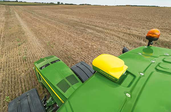
    GNSS technology is at the center of precision agriculture and is one of the key enablers for the farm of the future. GNSS helps boost productivity, environmental sustainability and economic competitiveness.

    Trimble’s GNSS agriculture solutions provide reliable, accurate positioning that can be tailored to meet specific needs, including different crops (broadacre vs. row crops) and activities (such as tilling, planting or fertilization). Trimble’s portfolio connects farming operations and includes guidance and steering; grade control, leveling and drainage; flow and application control; irrigation; harvest solutions; desktop and cloud-based data management; and correction services.

    However, one of the challenges to fully realize the benefits of the future farm is connectivity. Typically, ag customers are in rural areas, where the available communications infrastructure to support Wi-Fi or cellular data communications varies widely. This can impact the ability to share information between field and office as well as between machines in the field.

    But connectivity challenges have a lower impact on GNSS positioning. For example, farmers can leverage satellite-delivered corrections provided by Trimble RTX correction services using a compatible GNSS receiver and subscription service. This plays an important role in areas such as rural North America, Latin America and Australia. In many areas in Europe, farms can utilize a virtual reference station (VRS) for precise GNSS. There are also farms globally that operate their own GNSS reference networks or base stations to support accurate, high-precision, real-time positioning.

    What are the remaining obstacles to adoption?

    There is little resistance to the technology per se. The performance and value of precision farming are well known. Adoption rates can range from 80% to less than 40%, depending on geographic location, farm size (small family or large corporate farm), types of machines or crops, and etc.

    Obstacles can come from multiple forms. For example, in some parts of the world farm staff may lack the skills or qualifications needed to operate the systems efficiently. To lower the barrier to entry, Trimble has designed intuitive user interfaces and displays based on an Android operating system. In some regions, taxation and import restrictions hinder attempts to implement GNSS into precise farming. There are also business-related issues. For example, a smaller farm must prioritize its investments, and improving or repairing a planting machine might be more important than installing GNSS technologies.

    What does VerticalPoint RTK offer?

    Trimble developed VerticalPoint RTK Grade Control to help farmers mitigate issues in water management and land forming. It provides centimeter accuracy in the vertical component. This accuracy level enables the precise grading needed to provide shallow flow and slow water movement.

    When using VerticalPoint RTK, the GNSS rover receives and combines data from multiple reference stations to develop precise vertical measurements. It provides high confidence and can be used for grading, levees and berms, tile applications, and ditches. For larger-scale land forming based on precise terrain mapping, machines using VerticalPoint RTK can reduce the number of passes needed to bring the land to the designed grade and shape.

    Do you have any other RTK services for precision ag?

    The RTK technology used in Trimble agriculture solutions is consistent with RTK across other segments (construction, surveying, mapping and more). The differences are in the application and location, where we provide a variety of receivers, user displays, machine interfaces and software to produce accurate, reliable performance. The activities can range from tillage and grading to planting, adding inputs such as fertilizer or weed control — all the way through harvest. It is just a matter of talking with the farmers to understand their operations; we can then select and integrate components to optimize the solution.

    As part of this, farms using Trimble RTX correction services can choose different levels of service based on their needs. This approach enables farmers to achieve (and pay for) only the accuracy they need. For example, some basic tillage operations can use RangePoint RTX with good results. Other applications, such as fertilizing row crops, may require the 2.5-centimeter accuracy provided by Trimble CenterPoint RTX corrections service.

  • Precision agriculture grows with RTK

    Precision agriculture grows with RTK

    The John Deere StarFire 6000 RTK receiver operating in the field. (Photo: John Deere)
    The John Deere StarFire 6000 RTK receiver operating in the field. (Photo: John Deere)

    Precision agriculture — the practice of optimizing inputs of seed, water, and fertilizers while maximizing yields by mapping variations in soil characteristics and guiding machinery accordingly — began in the United States in the early 1980s and has been growing steadily. Key components include soil mapping based on sampling and remote sensing, proximal sensing of soils and crops, variable rate irrigation and variable rate spraying of fertilizers and herbicides, and automatic tractor navigation.

    “GNSS-based guidance is probably the most highly adopted precision ag technology, followed by variable rate and section control,” said John Fulton, associate professor at The Ohio State University. “I suspect that somewhere around 40% of those GNSS receivers use RTK-level corrections — which provide sub-inch accuracy — and that number is increasing.”

    Need for sub-inch accuracy

    Water runs downhill, of course, which makes vertical accuracy critical for hydrology. “AgLeader builds a plow to put tile in soil to drain water,” said Bill Cran, AgLeader Technology’s GNSS product specialist. “It might only be 4 inches round; so, if we are off by 2 or 3 inches vertically, that affects where water can run.” To get the best vertical accuracy possible, he recommends farmers install a base station in the field where they are operating.

    Sub-inch accuracy also enables farmers to determine where to plant each seed, rather than monitoring planters at the row level. “That may not be a requirement today, but it is certainly coming,” Cran said.

    Market demand for RTK in agriculture is increasing, an important factor for drone guidance or machine control, said Gustavo Lopez, market access manager at Septentrio. “The robots are very close to the crops. When small robots are working in a corn field, the corn plants are causing multipath or shadowing GNSS signals,” Lopez said. “You need either a good RTK or GNSS-INS, because if you lose satellite lock you can still coast for a while with an IMU.”

    Services and options

    AgLeader’s displays have a built-in networked transport of RTCM via internet protocol (NTRIP) client that enables it to connect to NTRIP networks and CORS networks, as well as other free and subscription-based networks. “That allows us to get RTK from the internet for customers that want to go that route,” Cran said. Alternatively, the company offers NovAtel GPS receivers, including Satel- or Freewave-based RTK options with 400 MHz and 900 MHz radio options that can communicate with a similar base station. This spring, it will begin to offer NovAtel’s TerraStar-X service. “We are calling that ‘RTK from the sky,’” Cran said. “The expectation is sub-inch accuracy, with a convergence time of less than one minute. Many of our customers and dealers are very excited about that option.”

    Septentrio’s GNSS modules for agriculture are used mostly in mapping drones, Lopez said. The modules mitigate interference and spoofing. “We have also been quite successful in robotics for agriculture,” Lopez said. Septentrio is working closely with the French agriculture robotics company Naïo Technologies, which integrates its robots with Septentrio’s smart antenna GNSS products, providing a full RTK solution as well as autonomy.

    For areas without RTK networks, some farmers buy and install Septentrio base stations that provide corrections to their robots or UAVs. Septentrio provides agricultural mapping software for post-processing data gathered without RTK. Also on offer are L-band receivers — while not as accurate as a local RTK network and possibly with higher convergence time, the relative accuracy of L-band corrections is more than good enough for many ag robots, Lopez explained.

    On the baseline

    The vegetable weeding robot Dino — shown here operating in Yuma, Arizona — uses a Septentrio GNSS receiver. (Photo: Septentrio/Naio Technologies)
    The vegetable weeding robot Dino — shown here operating in Yuma, Arizona — uses a Septentrio GNSS receiver. (Photo: Septentrio/Naio Technologies)

    Most RTK users are on a short baseline — under 5 miles from the base station to the rover, according to Al Savage, manager of John Deere’s StarFire network. Medium baseline is about 5–8 miles, and long baseline is up to 12 miles. In 2015 John Deere released its Base Station Manager, which enables dealers to remotely upload firmware, upkeep the rover access list, and monitor their base stations.

    As dealerships and their RTK networks merged and farms expanded, it became difficult for farmers to keep track of which base station to use. So, in 2019 John Deere released an Automatic Base Station Switching feature that links the RTK radio configuration to the field boundary in its Generation 4 display.

    Also new: A John Deere StarFire receiver can continue to operate if it loses connection to a base station using the RTK Extend feature. The StarFire SF6000 rover receiver can continue operating with RTK-like accuracy for up to 14 days without connecting to an RTK base station, compared to only 14 minutes for a previous receiver, Savage explained. The increase “was very well received by customers, especially those operating in areas challenged by line of sight or trees and foliage on field boundaries.”

    In South America, John Deere’s RTK Flex feature, “will automatically switch between RTK and SF3 during a time in the day when scintillation causes the greatest interference,” Savage said, enabling farmers “to continue working with similar accuracy when RTK is unavailable due to scintillation.”

    Remaining obstacles to adoption

    Despite’s RTK’s growing popularity, there are a few remaining obstacles to its adoption.

    Cost. “Though the cost has been greatly reduced over the years, RTK is still more expensive than other correction signals out there,” Fulton said. Part of the cost is due to the hardware, Cran pointed out. “There are rover and base station radios, there are towers to put up. On the NTRIP side, there are cell modems to put in vehicles, and they require keeping a data plan active.” The agriculture market traditionally has been very cost-sensitive and conservative, Lopez said. “Farmers expect to implement very low-cost solutions. They want to know whether they will have an ROI (return on investment) on these solutions.”

    Satellite services offer a cheaper alternative to RTK. TerraStar-X, for example, gets rid of the cell modem hardware and the requirement for base station hardware, Cran said. “At a lower accuracy level, there are other satellite-based TerraStar signals: TerraStar-C and TerraStar-C Pro, which get an accuracy maybe under 5 to 20 cm. Those are less-expensive alternatives that growers are using without making the leap to RTK.”

    Lack of Internet Connectivity. While most RTK services, including NTRIP, require an internet connection, many rural areas have limited broadband and even cellular connections. Some areas lack support for RTK, Fulton said.

    Lack of cross-platform compatibility. Farmers with a mixed fleet want to run a mix of receivers. “For example, John Deere and Trimble RTK do not work together,” Cran said. “It is still very manufacturer-specific. I cannot take a NovAtel receiver that is AgLeader branded and use it with a John Deere RTK network.” NTRIP partially enables cross-platform mixing and matching. “We’re excited about TerraStar-X, too, because, while it is specific to NovAtel receivers, it is not tied to any base station hardware,” Cran said. “So, a John Deere guy can put an AgLeader receiver on their vehicle and use TerraStar-X and still get that accuracy without being tied to the Deere RTK network.”

    Liability. While safety is not nearly as big an issue as it is with autonomous vehicles on the roads, liability questions will soon loom. “If, for example, a robot destroys a whole plantation, someone must be liable,” Lopez pointed out. “Was it the robot? The GPS receiver? Other sensors? The farmer? What if there is a spoofing attack and the robot goes to a neighbor’s field?” Such challenges are slowing adoption. “That is where the reliability of the GNSS is becoming important,” he said.

    The future

    Soon, satellite-based internet connections could make RTK correction more widely available and give more growers the option of using NTRIP, though at a cost. WAAS, a free service of the U.S. government, is broadcast by satellites but does not achieve the accuracy level of RTK. “RTK is still a localized correction,” Fulton said. “We may see that shift to satellite, but it will more likely be an online or some other type of communication.

    “Once farmers start using RTK, it is very unlikely that they will ever revert to another type of correction,” he added.“RTK is a very addictive correction service for folks.”

    Savage concurs. “RTK is addictive because of its accuracy, efficiency and repeatability.” Ultimately, however, to achieve universal adoption, RTK solutions will need to work everywhere, with little intervention by the farmer.

  • Seen & Heard: Drones and robots fight coronavirus

    Seen & Heard: Drones and robots fight coronavirus

    “Seen & Heard” is a monthly feature of GPS World magazine, traveling the world to capture interesting and unusual news stories involving the GNSS/PNT industry.


    Drone with megaphone. (Screenshot: Xinhuanet video)
    Drone with megaphone. (Screenshot: Xinhuanet video)

    Drones and robots fight Coronavirus

    China’s efforts to contain the coronavirus include drones and robots, according to news reports. Drones are being used to spray disinfectant and enforce instructions to wear face masks. Some reports say drones with thermal imaging are detecting people with fevers from the air. On the streets, hazmat workers are using tank robots to disinfect 50,000 square meters per hour. Other robots are feeding quarantined air passengers at a hotel and disinfecting rooms.


    Jakarta toll road. (Photo: GeorginaCaptures/iStock Editorial/Getty Images Plus)
    Jakarta toll road. (Photo: GeorginaCaptures/iStock Editorial/Getty Images Plus/Getty Images)

    Hungary helps Indonesia with road tolling

    Indonesia and Hungary are in talks to build a multi-lane free flow (MLFF) e-toll system that allows payments without gates while cars are moving. The technology is estimated to cost US$90 million. The GNSS e-toll system is already installed in several eastern European countries, including Hungary. Using GNSS, motorists are charged tolls through sensors installed inside vehicles that identify their locations.


    Photo: Anne Webberi/iStock/Getty Images Plus
    Photo: Anne Webberi/iStock/Getty Images Plus/Getty Images

    Albatross on patrol

    The albatross, which has a wingspan as long as 11 feet, is helping catch illegal fishing vessels. Henri Weimerskirch of the French National Center for Scientific Research has outfitted nearly 200 albatrosses with GPS trackers that detect radar from ships that lack an automatic identification system. This allows the birds to transmit the locations of fishers in the midst of illicit acts. Fishers who trawl without a license, exceed quotas or underreport their hauls imperil fragile ecosystems and cost the global economy up to $30 billion a year.


    A black bear in Shenandoah National Park. (Photo: USNPS/Neal Lewis)
    A black bear in Shenandoah National Park. (Photo: USNPS/Neal Lewis)

    How fare the bears?

    When problem bears are relocated outside the Great Smoky Mountains, 74 percent are never seen again. Do they thrive after being moved at least 40 miles from their home range? Upcoming GPS research may figure out what happens to them. “There is a mindset where everybody thinks we can just go catch a bear and move it somewhere else, and everything is okay. And it’s not,” said wildlife biologist Bill Stiver. The U.S. National Park Service has approved a three-year grant for a GPS research project beginning in 2021 to track bears relocated from the Great Smoky Mountains National Park and Shenandoah National Park in Virginia.

  • GNSS to assist construction on tunnel from Germany and Denmark

    GNSS to assist construction on tunnel from Germany and Denmark

    When completed, the underwater auto and rail tunnel will connect Germany and Denmark. (Image: Femern A/S)
    When completed, the underwater auto and rail tunnel will connect Germany and Denmark. (Image: Femern A/S)

    A European megaproject is relying on GNSS to guide supportive earthworks during construction. The Fehmarn Belt Fixed Link is a planned underwater tunnel that would allow travelers to go by car or train between Germany and Denmark in only seven to 10 minutes. Once completed, the 18-kilometer-long tunnel will be the world’s largest of its kind and is expected to employ up to 3,000 people.

    The 7 billion Euro project is expected to be completed in nine years. Danish construction company Holbøll A/S is building earthworks for 56 bridges on the main route crossing Denmark to where the tunnel would start. Holbøll’s undertakings include ramps and drainage work for the new bridges.

    Holbøll has 130 employees and a machine park of 22 machines equipped with machine control from Leica Geosystems, enabling it to deliver innovative and sustainable solutions on time and at the agreed price.

    At one of the bridges in Vordingborg, operator Flemming Ove Nielsen uses a Leica iCON GD4 3D system on the 61PX Komatsu dozer to perform the first rough work for building the slopes. Using the the iCON GPS 80 receiver, the iCON grade iGG4 system ensures fast and reliable grading with GNSS. Nielsen uses machine control to create the slope, and then the excavator takes over for the final grading work.

    Image: Femern A/S
    Image: Femern A/S

    “The dozer is very efficient for this sort of work because it can move so much dirt and, with machine control, hold the correct angle of the blade,” explained Carl-Ole Holbøll, co-owner and managing director of Holbøll. The dual GNSS solution for the dozer is an advantage because the slope is so steep, and to achieve an accurate cross-slope, dual GNSS is required.

    On another bridge, an excavator is using the Leica iCON iXE3 3D system for the finishing layer of the ramp slope. The operator can document the height of the different dirt layers simply by placing the bucket and letting the iXE3 register the height. This saves time — the operator doesn’t have to wait for a surveyor to conduct as-built documentation for each layer.

    The Fehmarn Belt Fixed Link prime contractor, Femern A/S, has taken the next steps to develop the area where the factory for the tunnel elements will be built. Continued archaeological surveys, preparatory supply infrastructure and drainage has been financed at 55 million Euros.

    Geared with Leica Geosystems, Holbøll A/S has prequalified for several of the derived projects, including the draining and moving of eight hectares in Strandholm Lake in Denmark.

  • Site contractor gains productivity edge with grade control platform

    Site contractor gains productivity edge with grade control platform

    The automatics on Trimble’s Earthworks Grade Control Platform enabled construction of a tricky retaining wall. (Photo: Trimble)
    The automatics on Trimble’s Earthworks Grade Control Platform enabled construction of a tricky retaining wall. (Photo: Trimble)

    Based in Vandalia, Ohio, R.B. Jergens has long been an early adopter of technology. The company purchased its first GPS-based surveying equipment, a Trimble base station and rover, in 1999 and has never looked back.

    The company has relied heavily on the Trimble GCS900 Grade Control System with automatic blade control for years, and recently put the new Trimble Earthworks Grade Control Platform to the test on several of its excavators.

    “While the user interface is completely different, moving from a soft key control box to a touchscreen control box, the transition from the GCS9000 has not been difficult,” said David Reynolds, surveying manager with R.B. Jergens.

    The new Earthworks platform includes intuitive, easy-to-learn software, is extremely customizable, and allows each operator to personalize the interface to maximize productivity, regardless of his or her experience or skill level. When the excavator is placed in “autos” or automatics mode, the operator controls the stick, and Trimble Earthworks controls the boom and attachment to stay on grade for a more consistent grade and higher accuracy in less time.

    One of the first jobs that the R.B. Jergens team used the Earthworks Grade Control Platform on was to construct a 1,000-foot-long ditch with a very flat profile of about 0.2%.

    A transmission tower complicates construction. (Photo: Trimble)
    A transmission tower complicates construction. (Photo: Trimble)

    “For this type of task, the automatics functionality is invaluable, because an operator would have a very difficult time maintaining fall,” said Reynolds. “It averages out to less than 3 inches over 100 feet, which is almost impossible to eyeball.”

    Traditionally, on a job with that flat of a profile, the surveyor would have had to set frequent grade stakes.

    “We used the automatics feature to construct the ditch and ensure that it held a consistent profile per the design specifications, even though the profile is extremely flat,” Reynolds said.

    A particularly challenging automatics-enabled project was the excavation near a transmission tower for construction of a soil nail retaining wall. Crews needed to excavate around the tower without undermining the integrity of its foundation.

    The soil nail retaining wall is 25 feet tall and about 150 feet long. To complete the job, the R.B. Jergens crew would excavate and expose up to five vertical feet of the bank face. Then the retaining wall contractor would drill holes in the soil, install and grout the steel rod, attach plates, and cover the face with a cementitious shotcrete. “We used the autos on the excavator to perform all of the excavations,” Reynolds said. “Without machine-controlled guidance and the automatics capability to pull those slopes in so tightly, I’m not sure how we’d have done this job.”

    Reynolds estimates that the surveyor and field crews saved three days of time each on the job — at least 40 hours total — with the use of automatics.

    “We’ve been able to reallocate resources more effectively and increase our productivity anywhere from 50 to 100%, so we’re leaner and more profitable.”

  • Autonomous track construction saves time, improves profitability

    Autonomous track construction saves time, improves profitability

    Photo: Trojak Communications
    Photo: Trojak Communications

    The most often cited reason for a company’s reluctance to move toward a GNSS-based capital equipment purchase is cost. Not so for the Redland Company, which embraced GNSS long ago and employs it in almost every facet of its operation.

    On a unique 475-acre Florida Department of Transportation (FDOT) project, Redland used millimeter-grade GNSS on a Gomaco 9500 trimmer to final grade a 2.25-mile oval track, saving months over traditional string line grading. For Redland, the solution has gone from a necessary expense to an entirely new profit center.

    The FDOT SunTrax project includes construction of a proving ground for autonomous vehicles. When complete, the 200+-acre center will offer a test chamber to simulate weather, an area where pick-ups and drop-offs can be replicated, and a precision-graded 2.25-mile oval test track.

    The oval is designed to replicate turnpike travel at 70 mph. “Because FDOT had some very strict tolerances on the track surface itself, the grade had to be extremely precise,” said Walt Thomas, Redland’s division superintendent for grading/trimming operations. “So when we got out here, all the rough grading had been completed and we were brought in to prepare it for the asphalt course.”

    Neatly trimmed

    Photo: Trojak Communications
    Photo: Trojak Communications

    For ultra-fine grading, Redland uses a trimmer/placer that offers advantages over a motor grader, including an ability to resist “floating” over higher density material or cutting into lower density material. To maintain grade, trimmers typically are used in conjunction with a string line which, while effective and accurate, is also labor-intensive, time-consuming and challenging.

    Because of the project’s size, Redland has used Millimeter GPS from Topcon Positioning Systems on its Gomaco 9500 for more than two years. “We have gotten tremendous results with it,” Thomas said. “We knew that, for here, it was the only viable trimming approach.”

    Redland’s Millimeter GPS uses a series of tripod-mounted Topcon LZ-T5 laser transmitters placed at an established reference point to generate a 33-foot-high Laser Zone signal. That signal is accessed by the receiver on the trimmer and used to determine elevation, set the necessary depth of the trimmerhead, and maintain the required tolerances.

    While most of the project only needed two lasers, four were used for the curved sections of the oval track, including a turnaround loop for testing larger autonomous vehicles like semi-trailers. “Trimming anywhere from 1 to 2 inches of material, we were averaging rates of about 800 square yards per day — and the accuracies have consistently been dead on,” Thomas said.
    The machine running the millimeter-grade system is in steady demand by many of the area’s premier grading contractors in Florida and North Carolina. “For us, it has paid nice dividends,” Thomas said.

    Comfort in 3D

    Photo: Topcon
    Photo: Topcon

    Topcon equipment that Redland Company used for the SunTrax construction included the 3D millimeter system, the Topcon HiPerV base and rover, laser units and FC-5000 controllers, purchased through Lengemann Corporation in Altoona.

    For Redland, Topcon GNSS solutions “have been great for our own operation and a powerful solution to offer as a subcontractor,” Thomas said. “We are getting to a point here in Florida where having a 3D capability is almost a prerequisite for bidding many jobs. No problem, we are already there.”

    The SunTrax facility is being jointly developed by Florida’s Turnpike Enterprise (FTE), Florida Polytechnic University and industry partners. The cutting-edge facility, which will offer unique opportunities for testing emerging transportation technologies in safe and controlled environments, is being touted as the only high-speed autonomous vehicle testing facility in the southeastern U.S.

    SunTrax is slated to open this year.

  • Quantum Reversal releases GPS L1/L2 anti-jamming unit and antenna

    Quantum Reversal releases GPS L1/L2 anti-jamming unit and antenna

    Photo: Quantum Reversal
    Photo: Quantum Reversal

    Quantum Reversal has released the QR100, a novel L1/L2 GPS anti-jamming unit, and the QR101, an  L1/L2 GPS anti-jamming antenna, designed for the commercial market to solve the issue of unintentional RF interference or jamming.

    The QR100 uses three external passive or active GPS antennas of the user’s choice, while the QR101 has three passive L1/L2 antennas embedded inside the enclosure. Low power consumption of 1 Watt and low cost allow for a wide range of applications where the continuity of GPS service is a must.

    “Clever RF signal nulling in the RF domain allowed us to eliminate the need for signal processing, and hence, significantly reducing the power consumption when compared to existing military solutions,” said Waldemar Kunysz, Quantum Reversal President and CTO.

    The technology prevents the RF front-end from saturation when the interfering signal is very strong due to its power or close proximity to the antenna. This extends the range of the operation for mobile applications and reduces susceptibility to nearby sources of interference for any type of fixed installations.

    Learn more at the company’s website.

  • Ecometrica Platform to help share NASA Earth data

    This image shows the Global Ecosystem Dynamics Investigation Lidar (GEDI) being assembled NASA’s Goddard Space Flight Center. (Photo: NASA)
    This image shows the Global Ecosystem Dynamics Investigation Lidar (GEDI) being assembled NASA’s Goddard Space Flight Center. (Photo: NASA)

    Under a contract with the University of Maryland, Ecometrica, a sustainability and space data company, will be helping disseminate data from NASA’s latest “Global Ecosystem Dynamics Investigation” (GEDI) lidar instrument.

    According to Ecometrica, the Ecometrica Platform will make processed maps more widely available to end users and reduce the need for additional processing of highly technical remote sensing lidar data.

    GEDI is led by the University of Maryland, in collaboration with NASA Goddard Spaceflight Center, and deploys a multibeam lidar instrument onboard the International Space Station to measure the forest vertical structure and biomass. Carried from Earth to the International Space Station atop a reusable SpaceX Falcon 9 rocket, it is already providing valuable raw data, which will be crucial in better understanding climate change and the Earth’s ecosystems, Ecometrica said.

    “The value of downstream satellite data in managing climate and environmental risks is significant and it is important that this is available and easily accessible to users all over the world,” said Richard Tipper, executive chairman at Ecometrica. “Projects such as Forests 2020, the global forest monitoring initiative that is part of the U.K. Space Agency’s international program, and managed by Ecometrica, are already proving very successful in using data from space to protect ecosystems on Earth. Importantly, this has also helped create an international skills-base and infrastructure across tropical forest countries, which can now benefit from the results of the very latest Earth observation instruments from NASA.”

    The lidar instrument is operated by the university, which is working with Ecometrica to make data available globally in a format that is easy to use for environmental monitoring and protection purposes. According to Ecometrica, its platform will display key findings on rapidly updating maps, allowing conservation organizations and government agencies around the world to tap into the findings and use the real-time data to monitor forest canopies and cover.

    The partnership is set to continue as part of the latest three-year contract.

  • Raven Industries partners with Razor Tracking for ag retailers, enterprise growers

    Raven Industries partners with Razor Tracking for ag retailers, enterprise growers

    Logo: Raven Slingshot

    Raven Industries has partnered with Razor Tracking, an SaaS and mobile application-based fleet tracking and management system, to provide ag retailers and enterprise farms with an expanded fleet and asset tracking suite through the company’s Slingshot platform.

    As a result of this partnership, Slingshot Fleet Tracking will be available as the integrated logistics tracking component of the Raven Slingshot platform. According to Raven, Slingshot Fleet Tracking allows users to seamlessly and wirelessly connect their office to the field by providing accurate location and machine running data in real-time. This partnership gives ag retailers and growers immediate fleet information — including work, idle and transit times — to better manage their equipment, assets and operations, the companies said.

    “This agreement enables Raven to quickly expand unmatched value to our growing ag retailer and grower customer base,” said Paul Welbig, director of Slingshot services & logistics for Raven Applied Technology. “From machine performance to diagnostics, and now expanded tracking of both in-field and operation support assets, users of Raven’s Connected Workflow can expect 20% efficiencies gained when using the technology delivered through the integrated Slingshot platform. This partnership continues our focus to offer efficiency-driving solutions that help reduce variability and increase profitability for our customers.”

    By leveraging Razor Tracking’s capabilities, Slingshot Fleet Tracking provides users with accurate real-time data on where their vehicles and assets are located to better maintain schedules for dispatching and increase overall efficiency, the companies added. Through the partnership, users will now also be able to monitor non-Raven equipped assets, including other battery-connected equipment and non-powered equipment.

    Customers will be able to subscribe to Slingshot Fleet Tracking to use it in their own operations beginning June 2020.

  • Pléiades Neo imaging satellites on track for mid-2020 launch

    The first two Airbus-built Pléiades Neo imaging satellites have started comprehensive environmental testing to ensure they are ready for in-orbit operation, according to Airbus.

    During the tests, the satellites are subjected to extreme temperatures and vacuum, vibration and acoustic noise, as well as electromagnetic interference. This will ensure they can withstand the harsh conditions they will experience during launch and their mission in orbit.

    These first two new generation very high-resolution satellites are on schedule for launch in mid-2020. They will join the Airbus constellation of optical and radar satellites, improving both the revisit and resolution capacities.

    Entirely funded, manufactured, owned and operated by Airbus, Pléiades Neo will provide institutional and commercial customers with high-level insights for the next 12 years. Each satellite will be adding half a million km² per day at 30-cm resolution to Airbus’ offering.

    The images will be streamed into the OneAtlas online platform, thanks to an innovative cloud-based ground segment architecture, allowing customers to have immediate access to freshly acquired and archived data as well as analytics.

  • U-blox SARA-R4 cellular modules integrates GNSS technology

    U-blox SARA-R4 cellular modules integrates GNSS technology

    Photo: u-blox
    Photo: u-blox

    U-blox, a global provider of leading positioning and wireless communication technologies, has extended its SARA-R4 family of LTE-M / NB-IoT and EGPRS cellular modules to include variants with the hardware and software features necessary to enable end-to-end security features and services for internet of things (IoT) data, devices and ecosystems.

    “The new SARA-R422 product series offers superior security protection, industrial output power to grant best coverage even in weak signal conditions, and everywhere location using state-of-the-art u-blox GNSS technology,” said Rado Sustersic, senior product manager, Product Center Cellular at u‑blox. “These represent valuable functionalities tailored specifically to the LPWA IoT market.”

    M8 GNSS. The SARA-R422M8S is pre-integrated with the u-blox M8 GNSS (global navigation satellite system) receiver and a separate GNSS antenna interface. This provides highly reliable, accurate positioning data simultaneously with LTE communications.

    The module also supports hybrid positioning strategies, in which positioning data provided by satellite constellations is enhanced with data from the u-blox CellLocate service, ensuring that location data is always available everywhere.

    The SARA-R4 series is designed for a wide range of mission-critical IoT solutions such as connected healthcare, industrial monitoring, point of sale and vending terminals, tracking and telematics devices, as well as smart lighting solutions and building automation.

    Security. Security features include a unique and immutable root of trust (RoT) for each device, as well as access to a scalable pre-shared key (PSK) management system. This provides the foundation for a trusted set of advanced security functionalities to enable data encryption and decryption, both on‑device as well as from‑device‑to‑cloud.

    The choice of PSK-based security, rather than the more complex and computationally intensive public key infrastructure (PKI) approach, strikes the right balance between implementation costs and level of security protection for many IoT applications.

    Robustness. All SARA-R422 modules provide 23-dBm output power, allowing the end device to properly operate in all network conditions. This means no issues at cell edges, no coverage issues in weak signal conditions, and, even more importantly, no unwanted re-transmission that shortens battery life by increasing transmit time and overall system power consumption.

    The series is designed for long working lifetimes in the field, through the inclusion of support for LWM2M, a lightweight machine-to-machine communications protocol ideal for IoT applications with the possibility of updating the firmware of modules already in the field over the air via the uFOTA (Firmware Over The Air) client/server firmware service provided by u-blox.

    The u-blox SARA-R4 series will be presented at Embedded World in Nuremberg, Germany, Feb. 25-27, at Hall 3/Stand 3-139.

  • ION calls for abstracts for ION GNSS+ 2020

    ION calls for abstracts for ION GNSS+ 2020

    Illustration: ION
    Illustration: ION

    The Institution of Navigation (ION) is asking for abstracts for ION GNSS+ 2020, which is set to take place Sept. 21-25 in St. Louis.

    ION GNSS+ 2020, themed “GNSS + Other Sensors in Today’s Marketplace,” will feature two tracks: commercial and policy tracks and research tracks. The commercial and policy tracks will include high performance and safety critical applications; status and future trends in GNSS; and mass market and commercial applications. The research tracks will include multi sensor and autonomous navigation; algorithms and methods; and advanced GNSS technologies.

    In addition, authors whose abstracts are accepted in these sessions (either as a primary or as an alternate presenter) will have the option to have their paper peer reviewed.

    The deadline for submitting abstracts is March 5. Submit your abstract here.