How are oblique views derived from aerial imagery?
Typically, a camera takes a field of view of 120 degrees (+/– 60 degrees either side of centerline). The nadir is straight down +/– 5 degrees either side, but everything beyond is considered oblique imagery.
Overlapping imagery is required to ensure clean images and to reduce the angle of obliquity. Too much of an oblique angle causes parallax, which distorts the image, so it is usual for imagery to overlap by 70% each pass, meaning that 30% either side of center is used, but everything except for a small path considered nadir is double imaged.
However, in the case of stereographic imagery, which is required for building a 3D mesh, the overlap has to cover the centerline of the last flight path, so the flights must be much closer together.
Oblique imagery allows 3D meshes to be created, which is a huge benefit to geospatial analysis. It allows the actual terrain to be measured not in a straight line, but in an actual topographic line that includes elevation changes for point-to-point distance.
Additionally, straight lines work when everything looks flat, but in reality straight lines are rare, and point-to-point measurements often have to take advantage of the existing terrain, avoiding steep terrain and aiming to stay on the highest ground to avoid marshy areas.
Oblique imagery also allows for mensuration, which is the measurement of the vertical based on the trigonometry of the sensor’s position and height compared to the target’s angle. More than one oblique image of the same target area allows for stereographic imagery for building the 3D meshes and seeing in 3D. Without the magic of oblique imagery, GIS would be a 2D science.
An electric cooperative that serves more than 33,000 member customers in Lakeside, Arizona — including the White Mountain Apache Tribe — is using an unmanned aerial system (UAS) to enhance the utility’s GIS effort, working with UAS specialist Skynetwest. Noah Ruiz started Skynetwest in 2015 to provide aerial photographic and videographic services, but seeing the potential of UAS he began making the pivot to high-value data retrieval.
Initial work for the Navopache Electric Cooperative (NEC) included an inspection of an area’s substations. Conducted on a day in which the winds were blowing at 20+ mph, with most other aircraft, the flight would have been extremely risky if not scrapped.
Skynetwest used an Intel Falcon 8+ Drone, Topcon Edition. Windspeed limits for the Falcon 8+ in GPS mode are set at 26 mph; in height mode that threshold is extended to windspeeds as high as 35 mph.
The Falcon 8+ has triple-redundancy inertial measurement units (IMUs), double-redundant compasses, dual-constellation GPS, eight propellers and two batteries. Built into the aircraft’s software is an algorithm that detects the electromagnetic frequencies coming off of power lines and tells the IMUs which one it wants to switch from, which GPS it wants to use, and which compass it wants to use.
The aircraft’s stability is key not only for power line work but also for items like inspection of oil and gas components. For inspection applications — close-up inspections to detect millimeter-sized damage, fine hairline cracks, leaks or heat power losses, for example — the Falcon 8+ payload consists of a Panasonic Lumix DMC-ZS50 camera for true-color RGB images and the FLIRTau 2 640 thermal imaging camera for infrared imaging. The hybrid RGB + 14-Bit RAW data inspection payload combines a near-infrared camera with a high-resolution digital camera mounted in parallel.
The mapping package Skynetwest uses includes a 36-megapixel RGB camera (Sony Alpha 7R) and delivers both orthophotos and 3D models in Topcon ContextCapture software, powered by Bentley Systems.
Upon completion of the substation project, using ContextCapture and Agisoft PhotoScan software, Skynetwest stitched together all of the images it had gathered to create a georeferenced 3D model of that substation. NEC is looking into building more 3D representations of the entire grid and ultimately hoping to build a complete 3D spatial record down to nuts and bolts — all with survey grade data.
A roundup of recent products in the GNSS and inertial positioning industry from the August 2019 issue of GPS World magazine.
OEM
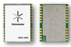
GNSS module
Ultra-low-power for wearables
Photo: Kolmostar
The JEDI-200 reduces the energy for one position fix by up to 150x compared to traditional GNSS sensors, providing a positioning solution for location-based internet-of-things applications.JEDI-200 specification highlights include 10-mW ultra-low-power consumption (measured) at 1-Hz navigation rate; 1-second ultra-fast time-to-first-fix from cold start, and 2-meter CEP high positioning accuracy. It supports GPS and BeiDou. It offers 100-byte compressed ephemeris (EPH) to enable A-GPS with speedy download via low-power wide-area network (LPWAN) technologies such as LoRaWAN and narrowband internet of things (NB-IoT). Kolmostar, www.kolmostar.com
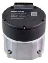
Inertial navigation
For GPS-denied environments
Photo: Emcore
The EMCORE EN-300 precision fiber-optic inertial measurement/navigation unit is a high-accuracy inertial system designed to be form, fit and function compatible with a legacy equivalent, but with better performance needed for GPS-denied navigation, precise targeting and line-of-sight stabilization. The EN-300 incorporates EMCORE’s proprietary integrated optics devices to enhance performance. The internal signal processing provides full stand-alone or aided navigation, and as an option can provide standard IMU delta velocity and delta theta. With the option of full navigation capability including coning and skulling compensation and sophisticated Kalman filtering, the unit also is able to statically find north to less than one degree through gyrocompassing. Emcore, www.emcore.com
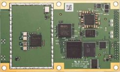
GNSS board
For positioning and heading
Phantom 40. (Photo: Hemisphere GNSS)
The Phantom 40 positioning board is the first Lyra-based offering in a line of low-power, high-precision boards. Its multi-frequency, multi-GNSS receiver processes 700 channels with access to Hemisphere’s Atlas GNSS global corrections network. The 60 x 100 mm module with 24-pin and 16-pin headers is a significant upgrade for existing designs using this industry-standard form factor. The new Lyra II digital ASIC and Aquila wideband RF ASIC designs will be available with the new board, as well as Cygnus interference mitigation technology. Hemisphere GNSS, www.hemispheregnss.com
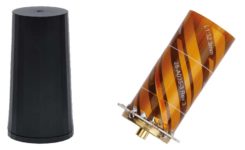
Helical antennas
Available in housed and embedded OEM versions
The new helical antenna in both housed (left) and unhoused form. (Photo: Tallysman)
The first three products of a new range of helical antennas include the HC871, HC872 and HC600. The active GNSS helical antennas feature a low-current, low-noise amplifier (LNA), and include integrated low-loss pre-filters, to protect against harmonic interference from high amplitude interfering signals, such as 700-MHz band LTE and other near in-band cellular signals. The HC871 is a housed, dual-band, active GNSS antenna supporting GPS L1/L2, GLONASS G1/G2, Galileo E1, and BeiDou B1 (25 grams). The HC872 is a housed, dual-band, active GNSS antenna supporting GPS L1/L2, GLONASS G1/G2, Galileo E1, BeiDou B1, and L-Band services (36 grams). The HC600 is a housed, passive Iridium antenna (18 grams). Tallysman, www.tallysman.com
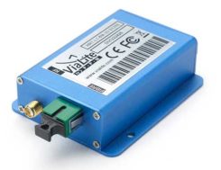
Fiber extension KIT
Carries signals up to 10 kilometers
ViaLiteHD Blue OEM module, one of the available formats for the GPS RF over fiber link. (Photo: VitaLink)
ViaLite’s new GNSS/GPS Fiber Extension Kit has been qualified for use with Microsemi’s timing and synchronization products, and carries timing signals over optical fiber links to 10+ kilometers. The kit includes the ViaLiteHD GPS Link, designed to provide a remote GNSS/GPS signal or derived timing reference to equipment located where there is no reception, such as inside buildings, tunnels and mines. The kit is suitable for GPS, Galileo, GLONASS and BeiDou bands, and the links provide a wide dynamic range with negligible signal degradation from noise or interference. ViaLite, www.vialite.com
SURVEY & MAPPING
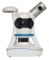
Lidar scanner
3D mobile scanner for urban areas, roads
Photo: Viametris
The second generation of the vMS3D lidar scanner is now more compact and simplified in both electronic and ergonomic terms to make it more robust and stable in adverse conditions and challenging environments. Despite being lighter, the second generation offers the same technological capacities as its predecessor, but is simpler to use and can be mounted on a vehicle in minutes. The system component (including the sensors) and the element to affix the device to the vehicle (the frame) previously formed one unit, but are now separated in a design that limits vibrations and prevents any strain on the mechanics during acquisition. The scanner’s receiver is a Septentrio AsteRx-m2a and its inertial measurement unit is an SBG Systems Ellipse2-D. Viametris, www.viametris.com
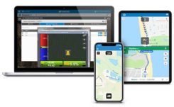
Job-site monitoring
Real-time 3D construction management gets remote support
Sitelink 2.0. (Photo: Topcon)
Sitelink 2.0 is the latest edition of Topcon’s real-time 3D job-site monitoring and management system. The update includes a new pay-as-you-go point-based service model, new features to Sitelink Support Desk, and a new Haul Truck application. Remote configuration via the support desk allows Topcon personnel to directly access and configure receiver components on connected machines, while simultaneously retaining an active remote session of Topcon’s 3D-MC grade-control software for machine control. Topcon, www.topconpositioning.com
Data collector
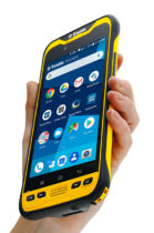
Connected smartphone for the field
Photo: Trimble
The TDC600 handheld is an ultra-rugged, all-in-one smartphone and GNSS data collector for geographic information system (GIS) and field inspection applications. The rugged handheld runs on Android 8.0 and has a bright sunlight-readable 6-inch display, 2.2-GHz processor, 4-GB memory and an enhanced-capacity all-day battery. It supports the Trimble Catalyst GNSS positioning service that delivers subscription-based accuracy on demand for Android devices. Its built-in receiver supports GPS, GLONASS and BeiDou plus satellite-based augmentation system (SBAS) capabilities for real-time positioning. It is rugged for GIS users in organizations such as environmental management, utilities and government agencies. Wi-Fi, Bluetooth 4.1 and 4G LTE cellular connectivity support data and voice calls, so field workers can use the TDC600 as they would any consumer smartphone, communicating between the field and office, sending emails and texting. Trimble, www.trimble.com
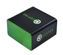
Vehicle scanner
1,200 scan lines per second
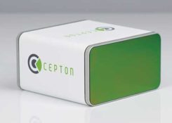
Photo: Cepton
The SORA-P60 is designed to provide accurate 3D scans and to enable automated classification of objects and volumetric scanning, including high-velocity vehicle scanning and classification. Cepton’s Micro-Motion Technology (MMT) lidar in combination with its edge-compute hardware SORA-Edge makes it a powerful, mobile object classification and volumetric measurement device that can send its data over Ethernet, Wi-Fi or LTE to a central processing server. The SORA-P60’s three scan lines, each scanning at 400 Hz, enable accurate scanning for classification of objects traveling at highway speeds — 400 Hz translates to a scan line every 5 centimeters for an object traveling at 50 miles per hour. For example, users can measure the size of a tow hitch and trailer on a vehicle traveling on a highway in real time. The SORA-P60 sensor is free of rotational or frictional components, making it impervious to mechanical wear and tear. In addition, the new SORA-P60 features rugged housing designed to withstand harsh environments, cold climates and salt spray. Cepton Technologies, www.cepton.com
UAV
Long-flight demonstrator
Completed maiden flight
Photo: U.S. Defense Department
The XQ-58A Valkyrie from National Security Solutions provider Kratos completed its maiden flight on March 5 at Yuma Proving Grounds in Arizona. Kratos Unmanned Aerial Systems (KUAS) and the Air Force Research Laboratory (AFRL) partnered on the development of the XQ-58A Valkyrie. During its 76-minute maiden flight, the UAV completed its test objectives. The runway-independent UAV is capable of long-range flights at high-subsonic speeds. Its development falls within AFRL’s Low Cost Attritable Aircraft Technology (LCAAT) portfolio, which has the objective to break the escalating cost trajectory of tactically relevant aircraft. Kratos Defense & Security Solutions, www.kratosdefense.com
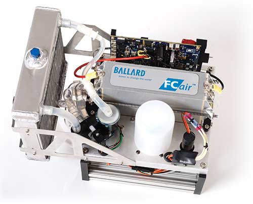
Fuel cells
Long-duration power solution for commercial UAVs
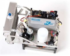
Photo: Ballard
The FCair hydrogen fuel cell can extend UAV flight time to up to 90 minutes, almost three times that of lithium-ion battery-powered drones. The product line includes FCair-600 and FCair-1200 liquid-cooled fuel-cell power systems, with built-in hybrid battery control and charging and delivering 600 and 1200 watts of power, respectively. These systems are in ongoing field trials, having previously been proven in harsh environments and at high altitudes. FCair includes a hydrogen fuel-cell power system, hydrogen storage vessels, pressure regulators, refueling solutions and hydrogen gas supply. The product line supports commercial UAV manufacturers and operators in the delivery of fuel-cell-powered UAV benefits, including: three times the flight duration of batteries; five times the reliability and a fraction of the noise of small internal combustion engines; and significantly reduced operational expenses. Ballard, www.ballard.com
Lidar platform
Compact for uav deployment
Photo: Teledyne
The CL-90 is a lightweight compact lidar platform for UAV deployment. It features exceptional canopy penetration, offering low-noise, high-quality survey-grade data to deliver high-quality performance in data accuracy and point precision. The CL-90 provides full lidar performance across the entire operating altitude range of the UAV, and offers a variable field-of-view capability that eliminates the need for multiple passes over a target. Teledyne, www.teledyne.com
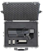
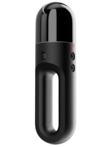
Drone countermeasure
Lightweight, compact handheld gun
Photo: DroneShield
DroneGun MKIII is a portable pistol-shape drone jammer weighing under 2 kg. DroneGun MKIII is designed to be an alternate product rather than a replacement for the previously released DroneGun Tactical unit. It has a shorter effective range of 500 meters versus 1–2 kilometers for DroneGun Tactical. DroneGun MKIII can be used in combination with other DroneShield products, including the RfPatrol body-worn detection device and the DroneSentinel stationary multi-sensor detection system. DroneShield Ltd., www.droneshield.com
A roundup of recent products in the GNSS and inertial positioning industry from the July 2019 issue of GPS World magazine.
OEM
Inertial sensors
Sensor fusion with GNSS receiver
Photo: xsens
The MTi 600-series of inertial sensors comes in a 31.5 x 28.0 x 13.0 millimeter IP51-rated case. It produces roll and pitch readings accurate to ±0.2 degrees. GNSS-assisted heading (yaw) measurements are accurate to ±1.0°. Xsens’ sensor fusion algorithms optimize output from new accelerometer, gyroscope and magnetometer components. It also has a CAN bus interface. The MTi 600-series modules are the first from Xsens to include an NMEA-compatible interface for GNSS receivers. Users can choose any GNSS receiver chip, module or system to work alongside the MTi-670, a GNSS/INS device that supplements the pitch, roll and yaw outputs available from other MTi 600-series products with global positioning information. Xsens, www.xsens.com
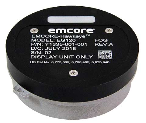
Fiber-optic gyroscope
For medium accuracy platforms
Photo: Emcore
The Emcore-Hawkeye series EG-120 FOG module is an ultra-compact, state-of-the-art design that is a small, affordable closed-loop FOG. The EG-120 delivers advantageous size, weight and power (SWaP) and is 35% smaller than Emcore’s previous generation FOGs. The Emcore-Hawkeye EG-120 incorporates advanced, next-generation field programmable gate array (FPGA) electronics that deliver increased performance and reliability combined with low cost. The Emcore-Hawkeye series features performance specifications for medium accuracy platform stabilization applications such as camera systems used in aircraft, unmanned aerial vehicles (UAVs) and gun stabilization systems. A wide variety of other guidance, navigation and aeronautics applications are supported. Emcore, www.emcore.com
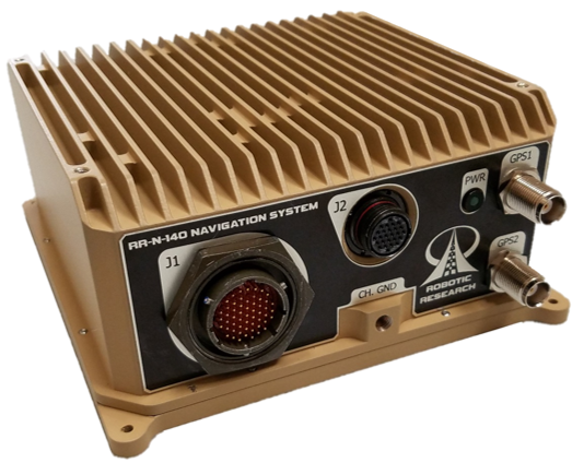
Navigation system
Customizable for ground vehicles of all sizes
Photo: Robotic Research
The RR-N-140 navigation system provides accurate, absolute and relative 3D localization information for ground vehicles of all sizes. It features dual-antenna GNSS for zero-speed heading detection and redundancy. The device delivers exceptional localization performance in GPS-denied or compromised areas. It is designed specifically for use on unmanned ground vehicles and is customizable to incorporate a wide variety of sensor inputs into the navigation solution. Robotic Research, www.roboticresearch.com
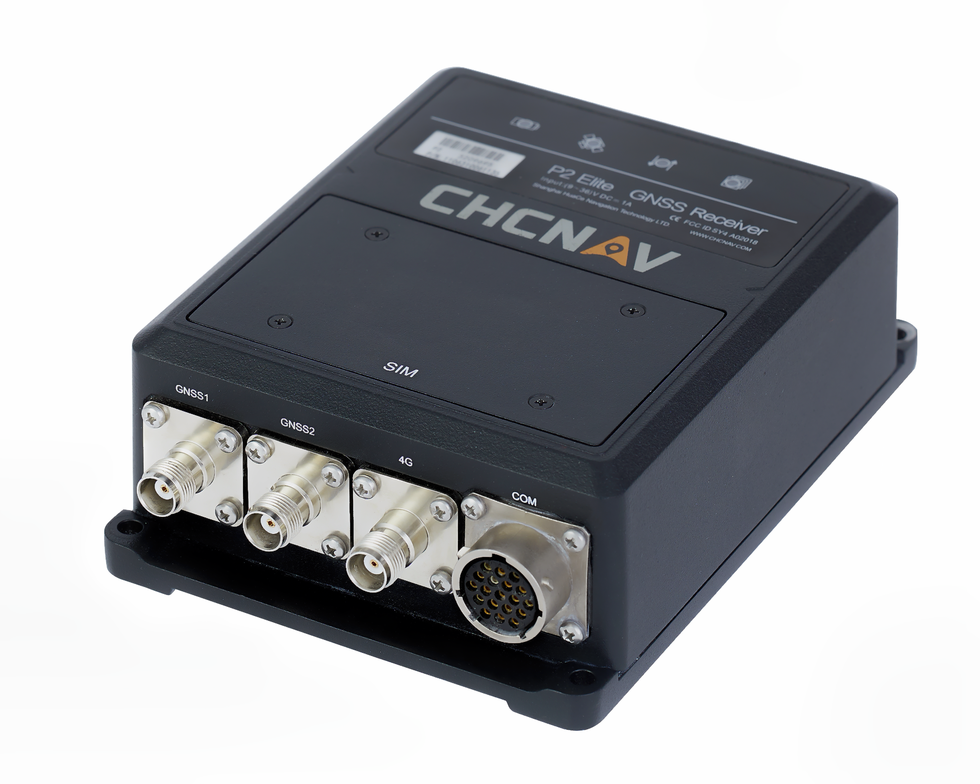
GNSS sensors
Combines numerous interfaces to speed system integration
The P2 Elite GNSS sensor. (Photo: CHC Navigation)
CHC Navigation’s new P2 GNSS sensor series provides high-accuracy positioning and heading in a compact, rugged enclosure. The series is suitable for a wide variety of applications such as reference stations, marine systems, unmanned navigation, industrial automation, robotics and machine control. The P2 GNSS series is designed to significantly reduce system integration efforts by combining numerous connectivity interfaces including RS232, low-latency PPS output, Ethernet, CAN bus protocol and a comprehensive web interface for configuration set-up. The series integrates the latest GNSS technology in a rugged IP67 and lightweight enclosure. It delivers reliable, uninterrupted, high-accuracy, real-time positioning and heading measurements. The P2 GNSS sensor offers cost-effective and powerful real-time kinematic (RTK) positioning. The P2 Pro GNSS adds a dual-antenna input for precise heading data. The P2 Elite integrates additional 4G and UHF modems to provide a powerful, all-in-one GNSS sensor. CHC Navigation, www.chcnav.com
TRANSPORTATION
Correction stream
Data enables precision positioning
RTX Auto is a GNSS software library for use in safety-critical automotive applications. The RTX Auto library can be integrated with any GNSS device and enables the decoding of Trimble’s RTX correction stream for centimeter-level absolute positioning accuracy. It works with other on-vehicle sensors to deliver a certified positioning solution that satisfies advanced driver assistance systems (ADAS) and autonomous driving requirements. It provides RTX-based absolute positioning for General Motors’ Super Cruise, a hands-free driving system for the freeway. After 2020, Super Cruise will will be available on all General Motors brands. Trimble, trimble.com
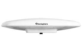
Smart antenna
Atlas-capable for marine markets
Photo: Hemisphere GNSS
The Vector V200 single-frequency, multi-GNSS smart antenna with integrated Atlas L-band is designed for general marine applications and markets. Powered by Hemisphere’s Crescent Vector technology, the V200 multi-GNSS compass system utilizes GPS, GLONASS, BeiDou, Galileo and QZSS (with future firmware upgrade and activation) for simultaneous satellite tracking to offer heading, position, heave, pitch and roll output. With support for NMEA 0183 and NMEA 2000, the V200 provides accurate position and heading information to autopilots, chart plotters and other general marine navigation applications. Hemisphere GNSS, www.hemispheregnss.com
Driver safety solution
Security for intelligent driving
The Proactive Security Solution for Intelligent Driving will enhance safety by supporting ADAS and driver monitoring systems (DMS). It integrates Quectel multi-mode LTE Cat 6 smart modules SC600Y/SC600T and an artificial intelligence (AI) algorithm from a third party to realize ADAS and DMS capabilities including monitoring irregular driving behaviors, conducting precise detection of vehicles and traffic signs, sending warnings of potential risks and more. For ADAS, it can precisely identify and locate vehicles, pedestrians, lanes and traffic signs and will send alerts to drivers if an imminent collision or an unintended lane departure is detected. The DMS supports facial recognition and detection, and is able to monitor driver attentiveness and measure eye blinks as well as head movements so that drivers will receive warnings of distractions, smoking, yawning or looking around. Quectel Wireless Solutions, www.quectel.com
Automotive module
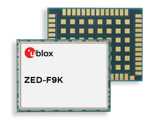
Aimed at urban lane accuracy
The ZED-F9K module is designed to keep cars in their lanes. (Photo: u-blox)
The ZED-F9K GNSS and dead-reckoning module brings continuous lane-accurate positioning to challenging urban environments. Building on the F9 platform, the module offers both high-precision multi-band GNSS and inertial sensors. It combines the latest generation of GNSS receiver technology, signal processing algorithms and correction services to deliver down to decimeter-level accuracy within seconds. The real-time kinematic (RTK) receiver module receives GNSS signals from all orbiting constellations. The inertial sensors constantly monitor changes in the moving vehicle’s trajectory and continue to deliver lane-accurate positioning when satellite signals are obstructed, such as in parking garages, tunnels, urban canyons or forested areas. The module’s accuracy and low latency make it suitable for automotive OEMs and Tier 1 automakers developing V2X (vehicle-to-everything) communication systems. By continuously sharing their location, V2X systems help increase overall road safety and reduce congestion. u-blox, www.u-blox.com
The Quanta UAV series is a line of inertial navigation systems (INS) dedicated to UAV-based surveying integrators. The small, lightweight and low-power INS is offered with two levels of accuracy. Quanta UAV and Quanta UAV Extra have been developed for compact lidar to high-end beyond-visual-line-of-site (BVLOS) mapping solutions. They provide precise orientation and centimeter-level position data both in real time and in post processing, eliminating the need for ground control points and reducing the need for overlaps. SBG’s post-processing software Qinertia gives access to offline real-time kinematic (RTK) corrections from more than 7,000 base stations in 164 countries. SBG Systems, www.sbg-systems.com
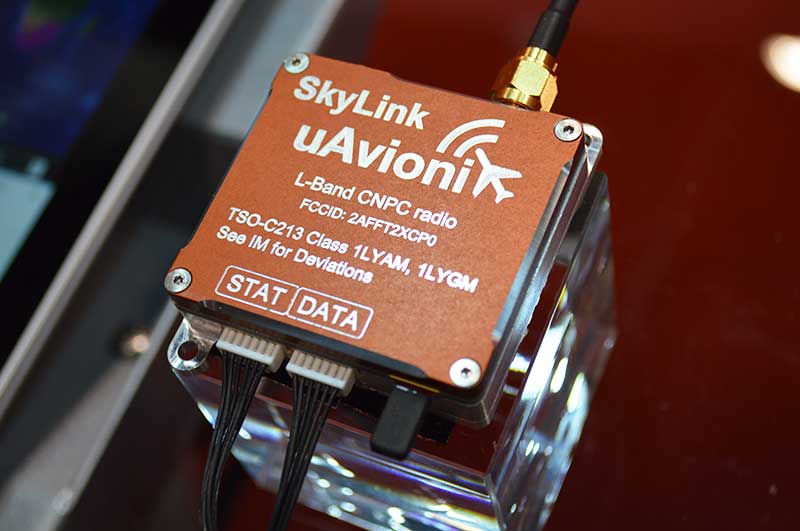
CNPC radio prototype
Being tested as command and non-payload control UAS radio
Photo: Allison Barwacz
SkyLink is an L-band frequency-modulated CNPC radio intended for point-to-point or networked BVLOS UAS operations. uAvionix has focused on minimizing size, weight, and power consumption (SWaP) while maximizing range and spectrum efficiency. The current 50-gram 10-Watt prototype is testing successfully at ranges exceeding 40 miles at low altitude. uAvionix is testing under an experimental transmit license and approval from the Federal Communications Commission and Federal Aviation Administration, respectively. uAvionix, uavionix.com
Thermal drone
Designed for solar farm inspections
The senseFly Solar 360 UAV is designed to enable the automated and efficient inspection of solar farms. Created in collaboration with software company Raptor Maps, the efficient thermal drone solution enables the automatic assessment of solar plant performance at a sub-module level. Created by combining eBee X fixed-wing drone technology, senseFly’s Duet T thermal mapping camera and Raptor Maps software, senseFly Solar 360 is a fast and fully automated drone. It can be integrated into solar management workflows without requiring either drone piloting skills or the manual analysis of aerial solar-farm data. Solar-farm inspection can be reduced from days to hours, with inspection of utility-scale solar farms completed more quickly, easily and accurately. SenseFly, www.sensefly.com Raptor Maps, raptormaps.com
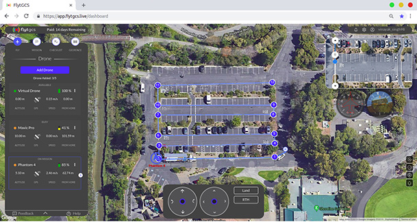
Remote operations
Cloud-based, enables BVLOS
Photo: FlytBase
FlytGCS is built for subject-matter experts, drone operations managers and UAV operators who wish to automate, simplify and scale their missions. To support automated BVLOS missions, FlytGCS offers features such as connectivity and control over 4G/LTE/5G, live high-definition video feed, fleet management, unlimited missions, remote gimbal control, pre-flight checklist and geofence, mission planner and cockpit view from a web dashboard. FlytGCS is a hardware-agnostic solution that helps securely deploy drones using a mobile app (for DJI drones) or onboard single-board computers (for Ardupilot and PX4 drones). FlytBase, flytgcs.live
Inspection drone
Collects data in dangerous areas
The Elios 2 is a collision-tolerant drone for indoor inspections. (Photo: Flyability)
The Elios 2 UAS is designed for inspection tasks. Routine inspection jobs indoors, underground and around complex pipework become quicker, safer and are fully documented by high-resolution video and stills. The Elios 2 includes a rotatable thermal and high-definition visual camera payload, 10,000-lumen oblique lighting system, and reversible rotors that enable the UAV to back out of tricky situations. The drone’s geodesic-like cage makes it collision-tolerant and enables flight in restricted areas such as refinery enclosures, mines, vats, cargo holds and nuclear containment vessels. Flyability, www.flyability.com
SURVEY
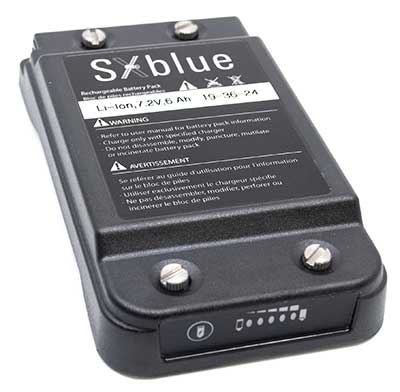
Battery upgrade
Long-life battery for extended fieldwork
Photo: Geneq
SXblue receivers now have an extended-life battery equipped with 4 Li-ion rechargeable cells that boost its capacity from 3900 mAh to 6000 mAh. When fully charged, the battery can last up to 16 hours depending on the SXblue model and Bluetooth connectivity — an up to 50% increase. The colored LEDs for the battery charge indicator have been enhanced for a better contrast. With only a 6-mm increase in thickness and the same weight as previous models, the user will not notice any change in handiness and ergonomics. The new battery is compatible with all past SXblue II and III models and current iSXblue II+ GPS, SXblue II+ GPS, iSXblue II+ GNSS, SXblue II+ GNSS and SXblue Platinum. Geneq, geneq.com
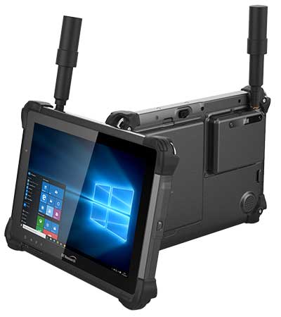
Fieldwork tablet
Captures detailed images
DT301X-TR rugged tablet. (Photo: DT Research)
The DT301X-TR rugged tablet includes an Intel RealSense 3D camera. The lightweight military-grade tablet is built to enhance precision for bridge and construction inspections, 3D surveying and mapping of underground utilities. It provides multi-frequency GNSS real-time kinematic (RTK) with carrier phase for mapping and positioning, and supports GPS, GLONASS, BeiDou, Galileo and QZSS. An optional foldable antenna supports high-accuracy field work, which can be measured with RTK GNSS positioning directly or used to connect to an external antenna for higher precision. DT Research, www.dtresearch.com
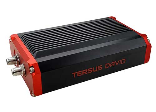
GNSS Receiver
Dual-antenna receiver with heading
Photo: Tersus GNSS
The David Plus dual-antenna GNSS receiver offers centimeter-accurate positioning and heading for intelligent transportation, construction, machine control, precision agriculture and navigation. Designed for efficient and rapid integration, the compact, lightweight receiver tracks GPS, GLONASS and BeiDou signals: GPS L1/L2, GLONASS L1/L2, BeiDou B1/B2 from the primary antenna, and GPS L1/GLONASS L1 or GPS L1/BeiDou B1 from the secondary antenna. The modular and flexible design can provide robust positioning and heading accuracy in a compact footprint for UAVs and other smaller autonomous projects. Tersus GNSS, www.tersus-gnss.com
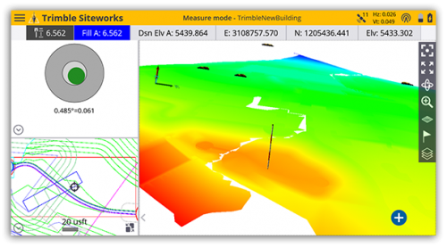
Tilt compensation
Android and Windows compatible
Screenshot: Trimble
Siteworks Software version 1.1 features GNSS tilt-compensation functionality and support for the Android operating system, meaning field workers can use smartphones or tablets. Contractors can run Siteworks on either Windows 10 or Android. Using Trimble Siteworks and a Trimble SPS986 GNSS smart antenna, construction surveyors can take measurements faster and perform more efficient stakeouts. It is designed to shield magnetic interference and can be used effectively anywhere on a construction site. Construction surveyors can capture accurate points without leveling the pole. Three modes support tilt compensation, so contractors can record accurate points while standing, walking or driving the site in a vehicle. Trimble, www.trimble.com
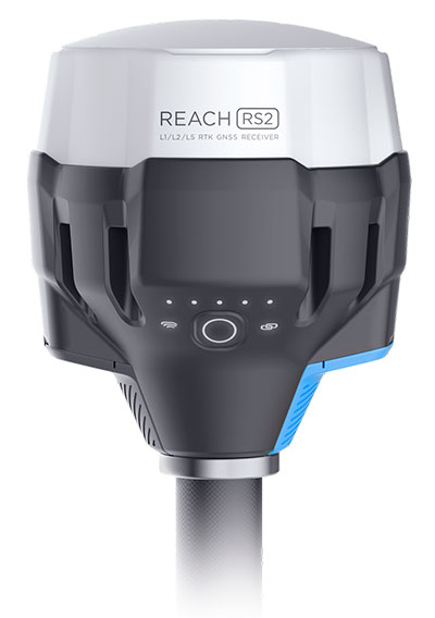
RTK receiver
Multi-band centimeter-accuracy
Photo: Emlid
The Reach RS2 is a multi-band GNSS receiver that features a built-in LoRa radio, a 3.5G modem, and a survey app for iOS and Android. The receiver determines a fixed solution in seconds and provides positional accuracy down to several millimeters. It tracks GPS/QZSS (L1, L2), GLONASS (L1, L2), BeiDou (B1, B2), Galileo (E1, E5) and SBAS (L1C/A), and reliably works in RTK mode on distances up to 60 kilometers and 100 kilometers in PPK mode. A multi-feed antenna with multipath rejection offers robust performance even in challenging conditions. RINEX raw data logs are compatible with OPUS, CSRS-PPP, AUSPOS and other PPP services so users can now get centimeter-precise results. Emlid, emlid.com
Mapping
High-speed camera
High resolution for aerial imaging
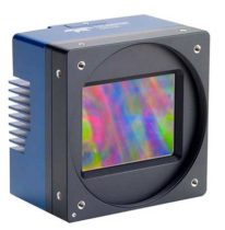
Photo: Teledyne
The Falcon 4 is a 86-megapixel ultra-high resolution and high-speed complementary metal oxide semiconductor (CMOS) camera. It offers capabilities for large-area, high-resolution, high-speed imaging. With 86 megapixels at 16 frames per second and a global shutter, the camera offers capabilities for large-area, high-resolution, high-speed imaging. Available in both color and monochrome models, the camera is sensitive into the near-infrared spectrum. The Falcon4’s high resolution and throughput serve a
variety of challenging applications including aerial imaging, reconnaissance, security and surveillance, 3D metrology and flat panel display inspection.
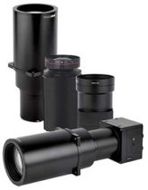
Three new high-performance lenses are designed for high-altitude aerial photography and long-range aerial and ground inspection applications. The 300mm AF, 180mm, and 150mm MK II lenses are designed to enhance the performance and flexibility of Phase One Industrial’s iXM-RS and iXM aerial camera series. Each offers precision imagery, taking advantage of the cameras’ ultra-high resolution backside-illuminated CMOS sensors, to maintain a smaller ground sample distance while flying at higher altitudes.
The SORA-P60L, part of Cepton’s SORA family of lidar scanners, is purpose-built to deliver long-range, high-resolution imaging for UAVs. It offers a 400-Hz frame rate, enabling drones to fly faster while maintaining high point-cloud density. With a 550-gram payload, the SORA-P60L prolongs UAV flight time allowing more ground to be covered in a single trip. Cepton’s Micro-Motion Technology faces all lasers downward at all times, providing a dense, uniform point cloud that, in combination with the high scan rate, makes it suitable for fixed-wing and fast-moving rotary-wing UAVs.
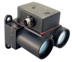
The WASP-200 LRF rangefinder is designed to measure ranges with accuracy and precision. It can be used for precision agriculture applications and as a proximity-to-ground sensor on board small or large unmanned aerial vehicles. It has 1-centimeter resolution and 10-centimeter accuracy, and is compatible with the Collins Aerospace Piccolo (CAN Bus and RS-232) and Pixhawk drivers. The WASP series of rangefinders also feature single-shot laser ranging for fast scanning and moving platforms; programmable burst mode averaging; and an IP-67 option. The rangefinders are suitable for robotics and UAVs, sense and avoid, industrial automation, height and distance measurements, and maritime operations.
The Leica BLK2GO is a small, portable, integrated handheld imaging scanner that offers mobility for scanning complex indoor environments. It combines visualization, lidar and edge-computing technologies to scan in 3D while in motion, allowing users to be more agile and efficient in capturing objects and spaces. Its dual-axis lidar scans up to 700,000 points per second. The handle contains WLAN connectivity, a rechargeable 45-minute battery, data storage for six hours of scans, a USB-C port for fast data transfer, and edge computing. The BLK2GO has a wide range of applications from adaptive reuse projects in the architecture and design industries to location scouting, pre-visualization, and VFX workflows for media and entertainment.
By Daniel S. Maier, Thomas Kraus, Daniela E. Sánchez, Ronny Blum and Thomas Pany, Universität der Bundeswehr München
This research paper presents an update of the authors’ real-time real-world testbed for new GNSS signals. It includes experience gained in setting up an airborne pseudolite, UAVlite, to analyze the code- and phase-ranging performance and to test navigation message authentication schemes.
UAVlites transmit GNSS-like signals free from any local transmitter multipath, in contrast to ground-based transmitters. A software-defined radio allows easy broadcast of new navigation signals, which can be tested in real environments.
Purpose. To improve GNSS signals, it is important to test and analyze signal performance under various conditions and harsh environments. This is done mainly with computer simulation. However, a simulation always relies on assumptions and simplifications of a real-world problem.
Therefore, the authors are developing a flexible, cost-efficient and highly adjustable test system, usable for real test scenarios. With this system, researchers can investigate GNSS signal structures, range performance, authentication methods, channel coding and signal behavior under foliage, blockage, jamming, spoofing and other interferences.
Testbed Setup. Key elements include a UAVlite, two ground stations and a composite binary offset carrier signal. The system has demonstrated decimeter code-range accuracy and millimeter phase-range accuracy. Performance of a Galileo Open Service Navigation Message Authentication implementation was also analyzed.
The testbed has potential in the field of signal analysis and optimization, especially in multipath, channel coding, authentication or robustness against jamming, spoofing or other interference for existing GNSS signals, and for developing potential new GNSS signals.
“Seen & Heard” is a monthly feature of GPS World magazine, traveling the world to capture interesting and unusual news stories involving the GNSS/PNT industry.
Tethered drone
Spanish police used a tethered drone system for traffic monitoring, crowd control and surveillance of the UEFA Champions League Final, played June 1 at the Wanda Metropolitano stadium in Madrid. An Elistair tethered U06 Plus drone oversaw 67,000 fans in the stadium and 200,000 in nearby streets. Use of the drone was in response to a heightened terrorist threat level in Spain, making it part of the largest security operation for any sporting event in the Spanish capital. Continuously supplied with power, the drone maintained its position at 50 meters high for 8 hours.
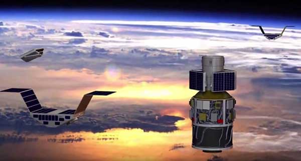
CYGNSS satellite launch. (Artist’s concept/NASA)
Tricky Signals
NASA’s eight CYGNSS (Cyclone Global Navigation Satellite System) microsatellites collect radio signals from GPS beacons to characterize hurricanes. A month after launch in December 2016, the CYGNSS team noticed the signals were wavering when the U.S. began to boost the radio power on 10 GPS satellites as they passed over northern Syria. The swings don’t interfere with other scientific uses of GPS, but for CYGNSS the measurements of high winds varied by 5 meters a second or more — the difference between a category-2 and category-3 hurricane. After two years of work, the CYGNSS team has compensated by repurposing a secondary antenna on the satellites to measure GPS signal strength.
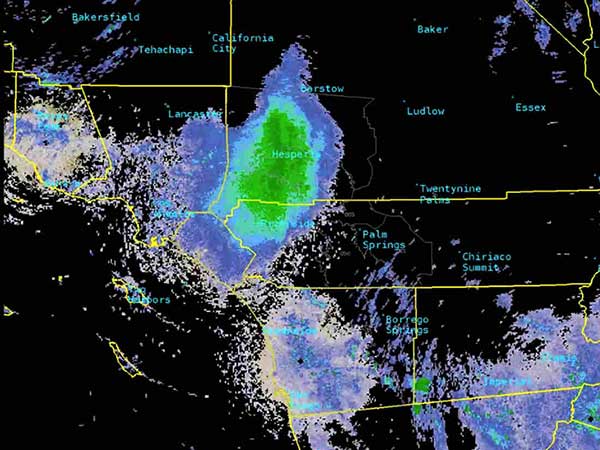
The ladybug blob tracked by Doppler radar. (Image: National Weather Service)
Ladybug, ladybug, fly away home
In this case, California. In June, a millions-strong swarm of ladybugs showed up on radar as a weather event when the insects took to the sky to hunt for aphids. One explanation for the unusual swarm is that a large population of ladybugs had been spread out in a mountainous area, and rising temperatures triggered their mass migration to valleys where they might find an abundance of aphids to eat.
New Zealand joins Aussies on SBAS
Land Information New Zealand (LINZ) will work with Australian counterpart Geoscience Australia to investigate ways to deliver a regional satellite-based augmentation system (SBAS) to significantly improve GPS accuracy. The proposed SBAS will support emergency helicopter crews, providing pilots with accurate vertical guidance for landing, enabling them to reach people faster in difficult terrain and bad weather. The SBAS will also improve the safety of self-driving cars. The new system will improve accuracy to less than a meter, and in some devices to 10 centimeters.
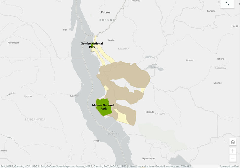
The StoryMap highlights how many remaining chimpanzee habitats are outside of protected areas, and how that habitat is in the care of local people and decision-makers. It also walks through JGI’s Tacare community-centered conservation approach which employs GIS and other tools to empower local communities in the pursuit of local conservation.
The StoryMap explains the start of Jane Goodall’s career and how she discovered that chimpanzees make and use tools, which led to the discovery that chimpanzees share 98.6% of human DNA. It also covers the importance of conserving chimpanzees and their habitats, specifically noting their habitats in Tanzania. Finally, it explains how Tanzanians are using mobile technology, paired with the Esri Survey-123 app, to turn land-use plans into reality.
The StorMap also offers an overview of JGI’s Tacare community-centered conservation approach, which emphasizes four steps: engage, listen, understand and act.
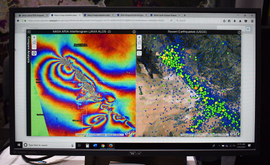
Satellite imagery and mapping have proven to be critical technologies when it comes to disaster relief efforts.
The NASA Earth Science Disasters Program has harnessed these technologies to help communities and governments recover from natural disasters like earthquakes, hurricanes and more.
“[The goal of the program is to] try to prevent natural disasters or limit their impact and also help people recover from them more quickly,” Jeremy Kirkendall, senior GIS administrator for the NASA Disasters Program, told GPS World in an exclusive interview at the 2019 Esri User Conference in San Diego. “We provide the products free to anyone to use, and data is only available if there is a good satellite pass.”
When a natural disaster strikes, researchers at the NASA Disasters Program will take satellite imagery of the affected location and create a map to show what the area looks like from an aerial perspective. Authorities who request this information can then compare the disaster map with maps of what the area looked like before the disaster took place.
“We do take requests from agencies or governments for disasters if they need help if data is available,” Kirkendall said. “We’ll create the products that show where the earthquake damage happened, where the fire burned or where the flooding is, and then users take that — combined with their local information — to determine what needs to be checked.”
For example, the NASA Disasters Program was able to map out the magnitude 6.4 July 4 Southern California earthquake.
“The earthquake that happened on July 4 caused a lot of deformation to the ground, so we mapped out that surface deformation and shared that information with other emergency managers, the Federal Emergency Management Agency, National Guard and U.S. Navy,” Kirkendall said. “You can look at things like roads, utilities, underground pipes for natural gas or geothermal wells, or fiberoptic cables. Then when you provide the product to these end users, they can overlay it with utility and infrastructure information to identify what’s the most at risk and what needs to be investigated.”
Sometimes, when a natural disaster occurs over a longer period of time, data is mapped throughout the duration of the occurrence, as well. This can help with search-and-rescue missions, infrastructure repairs and post-disaster analysis.
“We will create products during responses that can last a long time, like for Hurricane Florence or the flooding that recently happened in the Midwest,” Kirkendall said. “We’ll keep turning out flood products day after day when there’s good satellite passes that show that information.”
Kirkendall added that the National Guard has used the live data, along with 911 calls, to find individuals trapped in flooded houses. The data also serves as a tool for post-disaster analysis to understand where damage occurred, ways to fix it and how to prevent it from happening again.
“The program itself is gearing toward a resiliency effort, where we can provide these products when communities says, ‘We get flooded here all the time, over and over,’” Kirkendall said. “That’s where we need to be prepared to fix something. We need to do something to prevent that.”
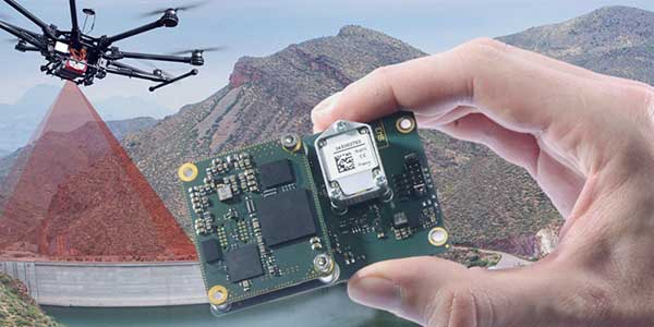
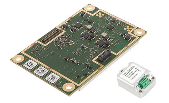
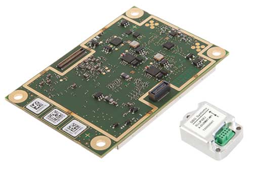
High-precision GPS/INS receiver is now available with a single-antenna option for faster integration, lighter weight and lower power consumption.
Photo: Septentrio
Septentrio’s GPS/INS receiver is now available with a single-antenna option. The single-antenna receiver brings the possibility of robust centimeter positioning and 3D attitude (heading, roll, pitch), while keeping weight and power consumption to a minimum. For Septentrio customers, this means simplified integration as well as increased operation time and productivity.
Septentrio centimeter-level positioning is based on multi-frequency, multi-constellation GNSS (GPS, GLONASS, Galileo, BeiDou, QZSS) technology. AsteRx-i S combines GNSS and an industry-grade inertial measurement unit (IMU) to deliver precise positioning together with 3D attitude and coasting functionality.
Septentrio’s unique GNSS/IMU integration algorithm enables continuous positioning in difficult environments such as near high structures, under foliage or during short GNSS outages (this is referred to as coasting or dead reckoning).
This makes AsteRx-i S a suitable positioning solution for robotics, autonomous vehicles and logistics. Previously available only as a dual-antenna product, AsteRx-i S is now available with either a single- or a dual-antenna option.
“By strengthening our GPS/INS integration portfolio we continue building upon our strategy of bringing reliable precise positioning together with 3D attitude to challenging industrial environments such as container parks or tree plantations,” said Danilo Sabbatini, product manager at Septentrio.
“AsteRx-i S has now become even more versatile with the support of both single and dual antenna operations on the same hardware platform,” Sabbatini said. “With the single-antenna AsteRx-i S delivers accurate 3D attitude in small-size applications where weight and power consumption are critical, while the dual antenna option is still the best solution for applications requiring short initialization time.”
Small, light, low power. The single-antenna AsteRx-i S requires minimal space which makes it suitable for robotic devices looking for small and light precise positioning solutions. Since only one antenna is required, there is less weight and lower power consumption, resulting in extended battery life. The dual antenna AsteRx-i S, on the other hand, is the best solution for devices requiring quick heading initialization and devices with prolonged static operation.
Advanced Interference Mitigation. AsteRx-i S comes with built-in Advanced Interference Mitigation (AIM+) technology. In robotic devices neighboring electronics can emit electromagnetic radiation which interfere with GNSS signals. AIM+ offers protection against such interference resulting in faster set-up times and robust continuous operation. A built-in power spectrum plot allows users to analyze interference, helping locate its source and mitigating it.
By offering both single and dual antenna options, Septentrio is now able to better accommodate specific needs of their customers interested in a GNSS/INS solution.
At the 2019 Esri User Conference in San Diego, Nearmap’s Tony Agresta discusses Nearmap 3D, which allows customers to stream and export 3D imagery on demand at massive scale, through its proprietary MapBrowser web application.
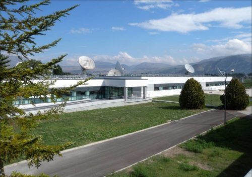
The Galileo signal outage, ongoing since Thursday, July 11, has been attributed to a problem with the system’s ground infrastructure, according to an announcement by the European GNSS Agency (GSA). “Experts are working to restore the situation as soon as possible,” states the GSA. “An Anomaly Review Board has been immediately set up to analyze the exact root cause and to implement recovery actions.”
No update has appeared at this time as to when service will resume.
[Photo: Galileo’s Ground Mission Segment in the Fucino Control Centre in Italy oversees Galileo navigation services and satellite payload operations. Photo: Telespazio.]
The announcement points out that Galileo is currently in its initial services phase, wherein its signals are available for use in combination with other GNSS and do not provide a complete solution in and of themselves. This status is expressly designed to allow for “the detection of technical issues before the system becomes fully operational,” according to the GSA.
Indeed, experiments undertaken with Galileo-capable smartphones found that these devices excluded Galileo participation in their position solution. This is likely true of commercial receivers as well, which employ sophisticated signal checks as well as following system notice advisories, which have been issued in this case.
“For each constellation, there is a defined maximum age of ephemeris that is considered valid,” explained Sandy Kennedy, vice president, innovation at NovAtel. “Once an ephemeris is too old, our receiver will deem it invalid. Measurements made to satellites without a valid ephemeris are not allowed to contribute to the PVT solution. We noticed the missing Galileo ephemeris within 3 hours of the broadcast stopping. It wasn’t the NAGU that alerted us to the problem.”
The company posted a bulletin to its website on Friday afternoon, July 12, stating: “During this time [without ephemeris], NovAtel receivers will continue to track Galileo signals, but without a valid ephemeris, the signals are not included in the position solution. . . . Once the Galileo service returns to normal and transmits ephemeris information, NovAtel receivers will revert to normal operation.”
The experiments mentioned above were conducted by the Navigation Signal Analysis and Simulation (NavSAS) Group at Fondazione LINKS (formerly the Istituto Superiore Mario Boella) and the Politecnico di Torino. In their account they state that, using a software receiver that tracked the Galileo signals in space (SISs), “the position solution computed using both the GPS and Galileo constellation is affected by errors on the order of 500 meters or even more.”
In a detailed technical analysis, the NavSAS Group found three other curious and unexpected aspects of the situation, all explored and illustrated at the Group’s posting.
The GPS World staff reported live from the Institute of Navigation’s (ION) 2019 Joint Navigation Conference, which took place July 8-11 in Long Beach, California, and the Esri 2019 User Conference, which took place July 8-12 in San Diego. Check out news, photos and videos from the shows.