New OEM boards provide next-generation ASIC technology
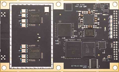
Phantom 40. (Photo: Hemisphere GNSS)
Hemisphere GNSS has released its next-generation digital and RF ASIC (application-specific integrated circuit) platforms, as well as three new positioning and heading OEM boards – the first products incorporating these technological advancements.
Hemisphere’s new Lyra II digital ASIC and Aquila wideband RF ASIC designs optimize performance and provide the ability to track and process more than 700 channels from all GNSS constellations, the company said. Signals supported including GPS, GLONASS, Galileo, BeiDou, QZSS, SBAS and L-band signal support and tracking for AltBOC and BS-ACEBOC, BeiDou Phase 3, L5, and QZSS/LEX CLAS-D and CLAS-E.
The new ASIC technology offers scalable access to every modern GNSS signal available.
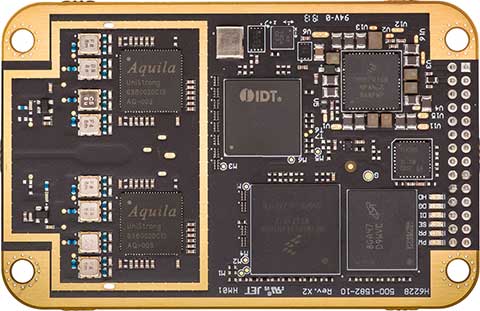
Vega 28. (Photo: Hemisphere GNSS)
Also, the Lyra and Aquila ASIC technology provide the foundation for a new GNSS receiver chipset architecture that significantly reduces the number of board components required, thereby reducing complexity, improving reliability and lowering power consumption.
The powerful technology platform also includes Hemisphere’s new Cygnus interference mitigation technology with built-in digital filtering capabilities and spectrum analysis. The Cygnus technology provides enhanced anti-jamming, interference detection, and mitigation.
“The successful development of these new ASIC platforms is an important milestone on Hemisphere’s technology roadmap,” said Farlin Halsey, president and chief executive officer of Hemisphere. “Lyra, Aquila, and Cygnus-based technologies represent a significant investment and addition to our intellectual property portfolio — one that enables us to continue providing best-in-class GNSS performance and allows our customers and OEM partners to take their solutions to an even higher level.”
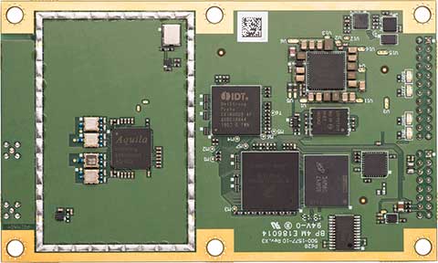
Vega 40. (Photo: Hemisphere GNSS)
The new Lyra, Aquila and Cygnus technologies will be made available with the new Phantom 40, Vega 28 and Vega 40 OEM positioning and heading boards.
According to the company, the Phantom 40 positioning board is the first Lyra-based offering in a line of all-new, low-power, high-precision OEM boards. The Phantom 40 is a multi-frequency, multi-GNSS receiver that boasts 700 channels including access to Hemisphere’s Atlas GNSS global corrections network. The 60 mm x 100 mm module with 24-pin and 16-pin headers is a significant upgrade for existing designs using this industry standard form factor.
The Vega 40 and Vega 28 are the first introductions in a new line of low-power, high-precision, positioning and heading OEM boards. The multi-frequency, multi-GNSS Vega 40 and Vega 28 GNSS receivers offer access to 1,100 channels including access to Hemisphere’s Atlas GNSS global corrections network.
The Vega 40 is a 60 mm x 100 mm module with 24-pin and 16-pin headers and is an upgrade for existing designs using this industry-standard form factor. The Vega 28 is a 41 mm x 71 mm positioning and heading module, which represents the smallest GNSS OEM heading module Hemisphere has ever offered to the geospatial market.
Hemisphere is integrating this new technology into other form factors and into many of its existing product portfolios and plans to introduce those products in the coming months.
When it comes to producing film imagery, it’s all about perspective.
Picture this: You’re in a courtyard surrounded by four high-rise buildings, looking up. You’re tasked with flying a drone equipped with a movie camera between two of the buildings, and then up one of them.
It’s a challenge, but perspective is critical when it comes to filming technology-focused movies like Pacific Rim: Uprising.
High-resolution imagery has become a critical component for Hollywood film producers over the years, and drones have played a paramount role in offering unique viewpoints.
More importantly, drones allow users to capture imagery that humans alone can’t produce.
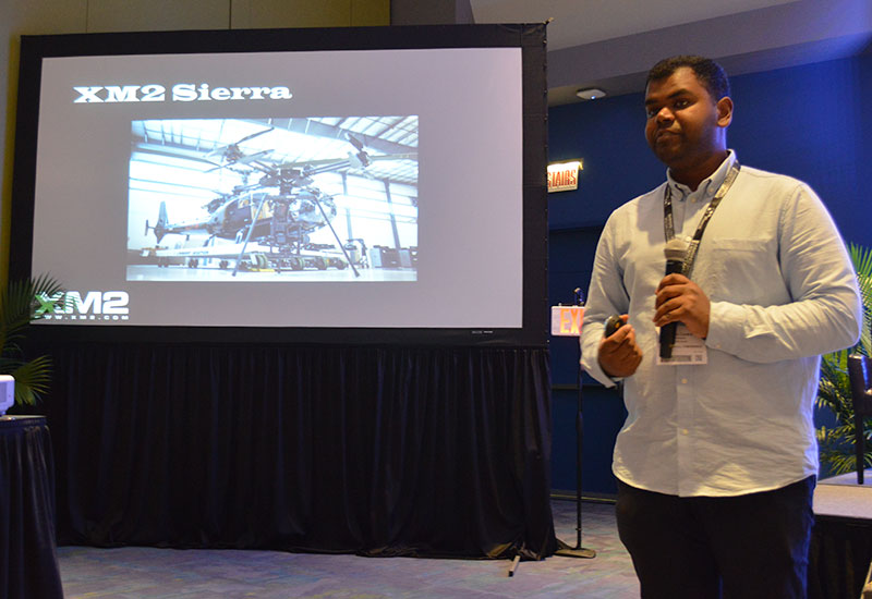
XM2’s Aaron Corera discusses the company’s drone imagery at Xponential 2019. (Photo: Allison Barwacz)
XM2, an aerial cinematography and photography company based in Melbourne, Australia, uses drones to capture this compelling imagery. The company has worked on a number of big-name projects, including Pacific Rim: Uprising, Thor: Ragnarok, Aquaman, season two of Westworld, Pirates of the Caribbean: Dead Men Tell No Tales and Star Wars: Episode IX.
“Star Wars: Episode IX was certainly a big challenge,” said Aaron Corera, drone pilot and safety manager at XM2, at an education session at Xponential 2019. “It was a massive challenge logistically to get all of our equipment over there, and then in an environment where there’s very little infrastructure, essentially, to be able to do some high-pressure tasks. It’s just a matter of being well prepared, being switched on and working through a checklist to make sure every box is being ticked.”
The company has manufactured a number of its own drones to meet the needs of its clients. One of its drones — the XM2 Sierra — is capable of carrying payloads up to 66 pounds.
“It is designed to be able to carry cameras that traditionally aren’t drone-based cameras,” Corera said. “That aircraft can carry the same cameras that are being used for the ground-based shooting, and that’s a big advantage. Having all platforms using the cameras saves them time in post-production.”
The company’s other house-manufactured drones include the Tango, Echo and Inspire Pro 2, which have been deployed over a number of the company’s projects.
The work didn’t come immediately, though. The 14-person staff at XM2 has only been working in the film industry for about seven years, Corera said.
“The work came in bits and pieces, and we gained momentum into it a little bit, then realized, ‘There’s a real opportunity here,’” he added.
One of the biggest challenges the company has had to face is unfamiliarity with the products and what XM2 can offer.
“I think one of the challenges includes familiarity, ultimately,” Corera said. “And that’s familiarity in the systems for the client and what it can and can’t do.”
Because a lot of people aren’t familiar with drones and the legal requirements to fly them, XM2 has had to find alternatives for client requests, as well as educate and ensure the safety of the people working around them.
“From the people management side of things, when we’re operating on a film set, it’s about coordination between the people that are involved in the shot itself and then the people that are managing the film set,” Corera said. “And then there will generally be on-set safety, as well. We’ll have a briefing in the morning, and explain what we’ve got planned for the day.
“When it comes to a specific shot, we take it upon ourselves to know exactly where everyone is, exactly what they’re doing and where they’re going. We make sure everyone knows what the plan is and what to do in case something goes wrong. It’s a combination of technical safety protocols and people safety protocols.”
Still, as technology evolves, the demand for high-resolution, drone imagery does, too. It’s all about perspective and, more importantly, capturing imagery from a viewpoint otherwise unseen.
By Urs Niesen, Jubin Jose, Xinzhou Wu, Qualcomm Technologies Inc.
Emerging automotive applications require reliable but at the same time low-cost positioning solutions. In this paper, we present such a solution by fusing the measurements from several consumer-grade sensors using a tightly coupled centralized filter.
The sensors used are a single-frequency GNSS receiver providing GPS and GLONASS pseudoranges and GPS carrier-phase measurements, a micro-electro-mechanical (MEMS) inertial measurement unit (IMU), a monocular camera, wheel-speed and steering-angle sensors.
We also employ vehicular constraints, integrated as pseudo-measurements. The centralized fusion architecture allows sensor cross-calibration and improves outlier detection. The filter runs in real time on the target platform, producing pose estimates at 30 Hz. Through extensive experimental evaluations, we demonstrate positioning accuracies of sub-meter 95-percentile horizontal errors even in GNSS-challenged deep-urban scenarios.
Conflicting Requirements. Accurate positioning is a requirement for several emerging vehicular applications such as advanced driver-assistance systems (ADAS) and autonomous driving. Positioning solutions for these applications face two competing constraints. To be technically viable, the computed position estimate needs to be reliable in scenarios ranging from open sky to deep urban, with less than 1-meter 95-percentile horizontal error as an often-mentioned target. To be economically viable, the system needs to be built from consumer-grade components.
We reconcile these conflicting requirements by fusing measurements from several low-cost sensors into a single pose estimate using one centralized extended Kalman filter (EKF). A multi-constellation single-frequency GNSS receiver provides GPS pseudorange and carrier-phase measurements and GLONASS pseudorange measurements. These are combined in a tightly coupled integration architecture with a consumer-grade MEMS IMU used to produce the reference navigation solution.
Tight integration enables outlier rejection directly for the raw GNSS measurements. This is crucial in deep-urban scenarios, since many or most raw GNSS measurements could be outliers in these conditions. We use a monocular camera and vehicular sensors, providing four wheel-speed measurements and a steering-angle measurement, as additional aiding sensors.
Constraints. Finally, vehicular constraints are integrated as pseudo-measurements. These sensors have very different noise sources and failure modes, which allows cross-calibration and improves failure and outlier detection. Given the tightly coupled integration in a single EKF, the filter state is quite large and can reach more than 100 dimensions. Despite its size, we are able to run the filter in real time and on target, producing pose outputs at a rate of 30 Hz.
We report the result of extensive experimental evaluations in different scenarios ranging from open sky with good satellite visibility to deep urban with long stretches of no or only limited satellite visibility. In each of these scenarios, we obtain the target accuracy of sub-meter 95% horizontal positioning error.
We show that, in the benign open-sky scenarios, GPS and IMU sensors are sufficient to achieve the target accuracy. However, in challenging deep-urban scenarios, all the integrated sensors are required to attain reliable sub-meter positioning performance.
Sensors and Components. We use Qualcomm SiRFstarV 5e B02 GNSS chipset, a low-cost commercial GNSS product, connected to a NovAtel GPS-702-GG dual-frequency GPS+GLONASS Pinwheel antenna, the only component not consumer-grade, to separate impact of a specific antenna on performance. We plan to evaluate low-cost antennas in the future. We use a TDK InvenSense low-cost MEMS 6-axis IMU (MPU-6150) and a vehicle interface with vehicle sensors through the controller area network bus. Accurate timestamping for tightly coupling sensor measurements is provided by a custom sensor sync board. The processor is a Qualcomm Snapdragon 820 automotive platform for real-time computation. (Qualcomm SiRFstar and Qualcomm Snapdragon are products of Qualcomm Technologies, Inc. and/or its subsidiaries.)
Honeywell displayed its HG4930 MEMS-based inertial measurement unit (IMU) at Xponential 2019, which took place April 29-May 2 in Chicago.
The company emphasized the IMU’s rugged design, which the company says allows the IMU to meet the needs of the most demanding users. The HG4930 also features gyroscopes, accelerometers and an internal environmental isolation system.
Check out the video below, which showcases the HG4930 being treated as a hockey puck.
According to Honeywell, the HG4930 can be used for applications in the agriculture, automotive, communication, construction, energy, inspection, mapping, marine, mining, robotics, surveillance and transportation industries.
Scientists continue to search for new technologies to serve the PNT mission. One novel way to augment GPS comes from a newly developed technology involving a quantum magnetometer.
Researchers at Lockheed Martin call it Dark Ice; it uses magnetic sensing as an alternative means of determining location without use of satellite signals.
Mike DiMario and his team have developed a prototype magnetometer that uses a synthetic diamond the size of a salt crystal to measure the direction and strength of nearly imperceptible magnetic field anomalies. They overlay that data with maps of Earth’s magnetic field, supplied by the National Oceanic and Atmospheric Association, to produce precise location information.
Special quantum-level impurities in the molecular structure of the diamond, where intermittently a carbon atom drops out and its neighbor is a nitrogen atom, enable the detection of magnetic field waves. These nitrogen vacancy (NV) centers are hyper-sensitive magnetic sensors. When illuminated by a laser, the diamond emits more or less light depending on the surrounding magnetic field’s strength.
The Dark Ice quantum magnetometer measures about 31 centimeters in length. (Image: Lockheed Martin)
Position + Direction. Dark Ice differs from current magnetic sensors aboard ships and planes in that it can measure both the field strength and the direction the field is pointing. “The real advantage of this quantum-based technology is its ability to produce a true magnetic field vector, while at the same time having a very large dynamic range and bandwidth,” DiMario explained.
Project development “was like peeling an onion: with each new layer removed, the team advanced. We had no idea of the expected outcome, other than what system modeling, the laws of physics and good engineering could predict. There was always something we could not have predicted or even thought of.”
In addition to developing this navigational capability, the team has also demonstrated that Dark Ice can harness Earth’s magnetic field to transmit communications across barriers intended to block all traditional signals, and track moving vehicles in real time.
Unjammable. “This project was designed for times when extenuating circumstances might prohibit your use of traditional GPS signals, and you need something that is unjammable, passive and always available. The Earth’s magnetic field meets this description if we can adequately sense and make use of it,” DiMario said.
He wants to downsize Dark Ice to hockey-puck size for convenient use on multiple platforms. “In real-world conditions, if I can get within 200 meters of GPS accuracy, that would be a huge success,” he claimed. Such precision would serve as a backup or verification to GPS, not a sole-means navigation system.
With its powerful sensing capabilities and small size, Dark Ice could function as the most reliable way to do things like identify hard-to-find watercraft in search-and-rescue missions and fly aboard aircraft in the battlefield. Navigation, search and communications — all in one compact sensor.
In a rare historic moment, Congress understood geospatial technology’s important role would be key to support the new Department of Homeland Security.
Written by Nate Smith; edited and co-written by William Tewelow, GISP
If it doesn’t kill you it makes you stronger, but therein is the rub: You first have to avoid dying. Nothing sharpens the mind like trying to survive.
On Tuesday morning, Sept. 11, 2001, the United States suffered a near mortal wound. In order to recover, there was no margin for error. Surviving depended upon getting it right. Failing to “connect the dots” again could prove fatal.
The cause, in large part, were organizational silos in the intelligence and security agencies and no structure upon which intelligence data could be shared across the silos. With terminal lucidity at failure’s dire consequences, in a rare historic moment, Congress, seldom praised for innovative thinking, understood geospatial technology’s important role and would be key for supporting the agency’s mission.
Click for an overview presentation on the GMO. (Image: DHS)
The government had to be restructured and given new tools and technologies to ensure our safety. The Department of Homeland Security (DHS) was the centerpiece of this effort bringing a number of established security focused organizations under its umbrella.
The creation of DHS was an unprecedented task in the modern era. Many of Congress’ recommendations were codified in the founding of the Geospatial Management Office (GMO) established within DHS.
Connecting the Geospatial Dots. The GMO’s mission was to create community, infrastructure, and the sharing of data and ideas ensuring future dots get connected to anticipate trends and stay ahead of adversaries avoiding another shock to our nation.
The early GMO was modestly funded and staffed with employees on short-term assignments from other agencies in borrowed office space at Federal Emergency Management Administration (FEMA) headquarters.
The first geographic information officer, Ryan Cast, developed the work plan, putting emphasis on discovering what data and opportunities already existed and identifying activities that supported and enhanced the component agencies. Integrating the agencies capabilities and optimizing their interoperability was the focus of his leadership laying a strong foundation for future GIO’s to build upon.
Weathering Hurricane Katrina
The GMO was still finding its sea legs when Hurricane Katrina struck in 2004. Since expectations were low, they did not bear the brunt of the critics. The GMO, seeing the negative attention directed towards FEMA, created innovative partnerships with National Geospatial-Intelligence Agency (NGA, which was NIMA at the time) and the United States Geographic Survey (USGS) employing their prototype technology to assist the recovery and response community, who were looking for innovations to ensure wide access to data and tools.
Before and after Hurricane Katrina: Photos taken off the coast of Bay St. Louis, Mississippi, show how the storm surge, estimated to have exceeded 20 feet in Waveland, destroyed homes and left only foundations. Trees have been denuded of all vegetation. (Photo: USGS)Before and after Hurricane Katrina:In the top image, taken in 1998, notice the Deep South Motel to the left and the apartment building to the right. The bottom image shows the same location on Aug. 31, 2005, two days after Hurricane Katrina made landfall. A small portion of the motel is only structure left standing. (Photo: USGS)
A key partnership was established between FEMA and Louisiana State University to develop a geospatial data clearinghouse, which proved to be useful to many agencies and researchers.
iCAV. One technical innovation in response to Katrina was the DHS Infrastructure Critical Asset Viewer (iCAV) interactive mapping platform branded as GIS for the Gulf.
iCAV was built on technology borrowed from NGA’s Palanterra Common Operational Picture (COP) system, repurposed for the DHS mission, providing map-based situational awareness.
From this operational experience, additional design elements were identified for improvement, including symbology on the front end and data modeling on the back end. These became central aspects of development for the GMO.
USNG. Katrina also highlighted the need for a more universally accepted referencing framework to assist field operations, planting the seeds for the development of a U.S. National Grid system (USNG).
I personally experienced the need for a USNG, having lived on the Mississippi Coast at the time. GIS in the government, especially the use of it domestically at the federal level was almost non-existent, and with all the landmarks and road signs gone, the entire coastal area was uncharted territory.
More than once I helped a lost Red Cross supply truck return to the main road.
Hurricane Harvey Hits Hard
Fast forward to Aug. 25, 2017, when there was a brief, collective sigh of relief as the full destructive force of Hurricane Harvey’s eye wall missed the highly populated areas of the Texas coast. The pause was brief. Coming into focus through rainfall observations and numerical weather models meteorologists and emergency managers understood another peril was imminent.
Harvey had lost its steering winds and would linger in the Houston area dumping over 50 inches of rain in the coming days. In Houston, there was alarm as this deluge would likely far exceed the engineered capacities of the channels and reservoirs and an epic flood was in the making. This anxiety was shared with the regional FEMA office and in the Washington, D.C. headquarters.
FEMA’s geospatial experts in D.C., having recently demonstrated their successful impact analysis approach in Louisiana, felt assured they could quickly grasp the magnitude of this event with high confidence, but were concerned about another type of flood — the flood of data and tools, as well as inquiries distracting them from their primary focus.
Partnerships, capabilities and expertise. Events such as these attract well intentioned and ambitious researchers and vendors seeking the time and attention of response leaders to share their resources and gain access to FEMA’s data. Even short conversations consume critical time.
These secondary groups often contribute valuable resources and services playing key roles in community learning and development so their outreach efforts need to be balanced.
Rather than ignoring these efforts, FEMA contacted the GMO to leverage their partnerships, capabilities and expertise to facilitate these exchanges. In one day, the GMO developed a publicly accessible portal and assigned a team of geospatial experts the responsibility to catalog and make discoverable all geospatial data related to Hurricane Harvey.
Over the following two weeks, this response became a model of transparency, innovation and collaboration, and the site is still available supporting research and providing an example for future events. The site was a great example of government getting it right, but it came at a price, and still there are two long shadows cast by towers no longer there.
Conclusion
From Greater Manhattan to Katrina’s desolation and the floods of Harvey, significant advances were on the horizon and expectations were on the rise for the GMO. In Part 2, we will explore this growth and see how these lessons and the efforts of many led to the current state of geospatial preparedness and capability in the DHS’ geospatial shop.
Geospatial Management Office, established by Intelligence Reform and Terrorism Prevention Act of 2004 Title VII, Subtitle B, Section 8201, Homeland Security Geospatial Information – Implemented through DHS Management Directive 4030, 11/12/2004.
Guest author Nate Smith is an independent consultant who has worked for over 25 years advancing the adoption of geospatial technology to disaster management, humanitarian response and natural disaster risk reduction.
A link to the live event will be sent to you two hours before the event. Your personalized event URL will be automatically generated by the ON24 system. To ensure receipt of the email, please whitelist this email address by adding it to your contacts: [email protected].
This presentation will begin on at 1 p.m. EST / 10 a.m. PST on Thursday, May 16.
Audience members may arrive 15 minutes prior to live time. If you have any questions, please contact event producer Grace Rybak at [email protected].
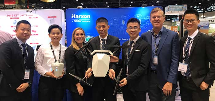
The Harxon team at AUVSI Xponential. (Photo: Harxon)
Harxon showcased its full range of UAV antennas and technologies for various UAV applications — especially for UAV base stations — at AUVSI Xponential, which took place April 30-May 2 in Chicago.
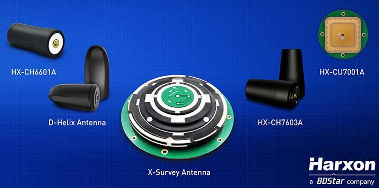
Harxon’s newly launched X-Survey antenna offers a 4-in-1 design for multi-constellation GNSS signal reception. It integrates Wi-Fi, Bluetooth and 4G modules for easy integration into real-time kinematic (RTK) systems.
It also ensures centimeter accuracy for precision positioning of UAVs, and stability of signal transmission, which provides the navigation and communication performance required by UAV base stations.
Additional UAV antenna products and technologies on display at booth #2218 include the HX-CH7011A and HX-CU7001A, new OEM antennas with small size and low weight, but with high gain and a stable phase center. Other available antennas include HX-CH7603A, HX-CH6601A, HX-CH7603A and HX-CSX601A for UAV and surveying applications.
Image: Harxon
Skycatch collaboration. Harxon has established strategic relationships with many industrial enterprises, such as Skycatch. Skycatch is an industrial data-collection and analytics company that focuses on indexing and extracting critical information. It provides combination GNSS base station and drone data-processing solutions that deliver high accuracy maps and point clouds in the 30 minutes or less.
Harxon — which specializes in GNSS positioning and navigation — is collaborating with Skycatch to give customers the opportunity to improve their UAV base station mapping solutions, and to maximize UAV operation efficiency and reliability.
High-precision GNSS solutions. The UAV industry, driven by new technologies, is one of the most dynamic growth sectors in the construction industry. The next phase of the drone revolution is flying towards standardization with precision solutions.
Harxon’s high-precision GNSS positioning technologies have been widely used in UAV-related applications, including UAV base stations, UAV power patrols, plant protection and machine control.
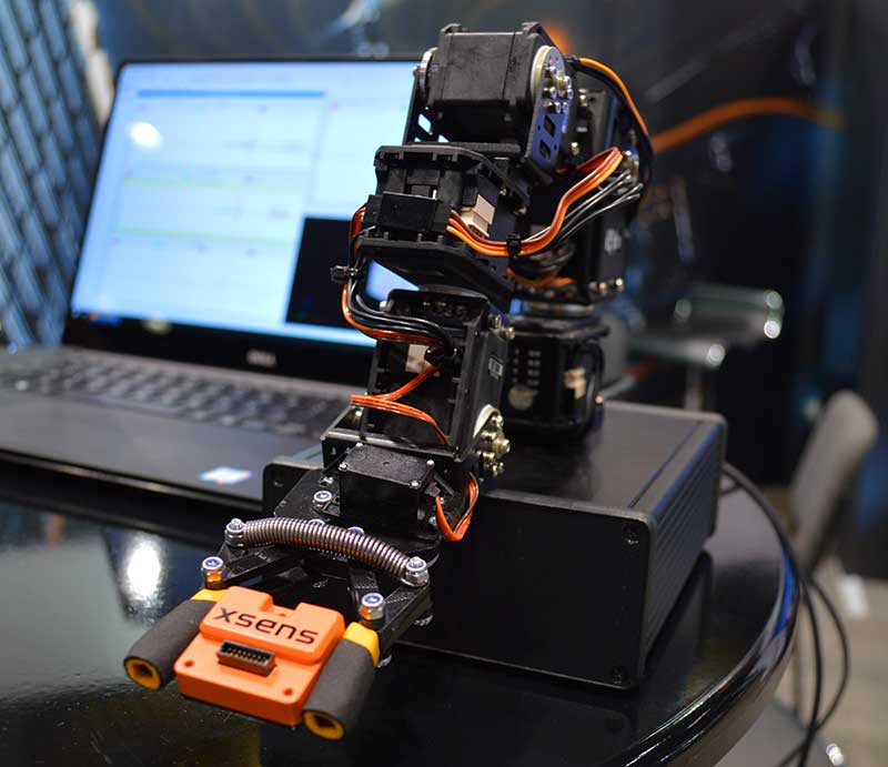
New MTi 600-series with flexible interfacing options is backed by software development suite for easy integration into space-restricted host systems such as drones, Xsens said.
The MTi 600-series is a generation of inertial motion sensors which set a new standard in the market for their small size, industrial-grade performance and competitive pricing, Xsens added.
The new MTi 600-series of inertial sensors, supplied in a 31.5mm x 28.0mm x 13.0mm IP51-rated case, produce roll and pitch readings accurate to ±0.2 degrees. GNSS-assisted heading (yaw) measurements are accurate to ±1.0°. Among the products’ new features are a CAN bus interface and NMEA compatibility.
To achieve this performance, Xsens has applied numerous innovations in its latest sensor fusion algorithms, which optimize the output from new accelerometer, gyroscope and magnetometer components.
Photo: Xsens
The MTi 600-series modules are the first from Xsens to include an NMEA-compatible interface for GNSS receivers. This means that users can choose any GNSS receiver chip, module or system to work alongside the MTi-670, a GNSS/INS device that supplements the pitch, roll and yaw outputs available from other MTi 600-series products with global positioning information.
Xsens is demonstrating the high performance of the new modules at its stand 2627 at AUVSI Xponential, taking place in Chicago this week.
The MTi 600-series modules are available for sampling on request to Xsens. Volume production is expected to begin in July.
The GPS World and Geospatial Solutions staff are reporting live from the Association for Unmanned Vehicle Systems International’s (AUVSI’s) Xponential 2019 April 29-May 2 in Chicago.
The event convenes the global community of commercial and defense leaders in intelligent robotics, drones and unmanned systems. Check out news, photos and videos from the show.
Wingtra and 3DR, producer of the Site Scan drone data platform, have signed a partnership agreement to benefit the mining and surveying industries.
Wingtra’s VTOL drone WingtraOne and Site Scan form a complete aerial surveying solution, including highly efficient aerial data collection, post-processing and analysis. Through the partnership, 3DR now endorses the WingtraOne as the preferred fixed-wing drone for its Site Scan platform.
Wingtra and 3DR will distribute the complementary solution across a range of industries, focusing particularly on mining and surveying teams. 3DR will sell Wingtra products through its existing distribution partnerships across North America, Europe and Australia, and Wingtra will sell Site Scan worldwide.
“We’re thrilled to officially partner with Wingtra and make a fixed-wing VTOL drone available to our customer base,” said Chris Anderson, 3DR CEO. “We’re looking forward to deepening this partnership and continue making Site Scan and Wingtra the go-to drone solutions for mining teams across the world.”
Mining and surveying professionals are turning to fixed-wing vertical take-off and landing (VTOL) drones because of their ability to take off and land vertically as a multicopter but fly as fast a fixed-wing craft.
The WingtraOne VTOL drone offers safe launch and land, as well as high resolution and broad coverage in a single flight with absolute accuracy down to 1 centimeter (0.4 inches).
Users can upload photos collected with the WingtraOne into the Site Scan cloud-based web application to process them into high-resolution maps and 3D models.
Site Scan users include mining firms such as Newmont, Newcrest and Gerdau. Site Scan offers an all-in-one software program for analyzing drone-captured data with a suite of measurement tools, securely sharing them with teammates and stakeholders, and exporting them for use in CAD, mine planning and geological software.
“Our partnership with 3DR lets our customers analyze high-precision aerial data directly in Site Scan — in a lot of cases without any additional tools,” said Basil Weibel, founder of Wingtra. “Together, WingtraOne and Site Scan make up a complete solution and we are very excited to offer this bundle to the industry.”
The task force brings together a cross-section of stakeholders representing the airport, UAS and manned aviation communities to refine procedural practices and provide a policy framework to address the timely and critical issue of incursions by unauthorized UAS at airports and how best to mitigate this threat.
The task force begins work on May 2 during a keynote session at AUVSI Xponential 2019 with a panel discussion featuring Huerta and a representative from the airport industry.
“UAS interfering with manned aviation is a serious issue, and it requires serious solutions. That is why we are bringing together the best and brightest minds to recommend a plan to keep our skies safe for the flying public,” said Brian Wynne, president and CEO of AUVSI during a news conference at Xponential 2019.
“While UAS hold tremendous societal and economic benefits, occasional bad actors threaten to undermine the great progress we have made and even put responsible, legal UAS operations in a negative light,” Wynne said.
Serious concerns regarding unauthorized and unsafe drone operations near airports have been highlighted by the major disruption such activity caused at London Gatwick Airport in December 2018 and Newark Liberty International Airport in January 2019.
Task Force members will examine and develop recommendations around two main areas:
They will generate expert-led dialogue to refine procedural practices for airports, law enforcement and other stakeholders to ensure efficient and seamless responses to future UAS incidents.
They will develop a longer term policy framework based on the experience from the initial efforts to deter incursions and emerging technologies.
The goal is for the task force’s work to lead to and inform future conversations about UAS mitigation at other facilities, such as national landmarks, stadiums, prisons and military bases.
“One of ACI-NA’s highest priorities is ensuring unauthorized and unsafe drone operations do not adversely affect the safety or security of U.S. and Canadian airports,” said Kevin Burke, president and CEO of ACI-NA, at the news conference. “With more and more drones flying in the airspace, we have found ourselves in a new situation with no clear playbook. By bringing together this exceptional group of experts, we are hopeful we can make significant progress in developing best practices that will help airports respond better.”
The Blue Ribbon Task Force will be comprised of former government officials, security professionals and aviation executives, including:
Michael Huerta, Former Administrator, Federal Aviation Administration (Co-Chair)
Deborah Flint, CEO, Los Angeles World Airports (Co-Chair)
Scott Brockman, President and Chief Executive Officer, Memphis-Shelby County Airport Authority
Rich Davis, Former Managing Director of Global Security, United Airlines
Trish Gilbert, Executive Vice President, National Air Traffic Controllers Association
Cathy Lanier, Senior Vice President of Security, National Football League
Huntley A. Lawrence, Director of Aviation, Port Authority of New York and New Jersey
Chad Makovsky, EVP of Operations, Dallas Fort Worth International Airport
Marily Mora, President/CEO of the Reno Tahoe Airport Authority (RTAA)
John Pistole, Former Administrator, Transportation Security Administration, and Former Deputy Director, Federal Bureau of Investigation
Jamie Rhee, Commissioner, Chicago Department of Aviation (CDA)
Expert advice and comments sought. As part of its work, the task force will meet with experts in UAS technology, national security and defense, law enforcement, government, and those working in the National Air Space, including UAS operators, commercial and general aviation pilots, air traffic controllers, and airline and airport leadership.
The task force will solicit comments on its website from the public and will explore holding a limited series of in-person and virtual public meetings on UAS mitigation. It anticipates releasing findings over the summer.
“The industry is working with our government partners on remote identification and tracking standards, but we understand that more needs to be done and at faster pace than the regulatory process allows,” Wynne said. “That’s why the industry is stepping up to explore near-term solutions before remote ID regulations are finalized and published.”