Category: Uncategorized

  • Winners announced for AUVSI XCELLENCE Awards

    The awards are presented to companies, organizations and individuals demonstrating achievement in the unmanned systems field.

    Winners for the second annual XCELLENCE Awards by the Association for Unmanned Vehicles Systems International (AUVSI) were named during an awards ceremony at AUVSI Xponential 2019 at McCormick Place in Chicago.

    Recipients represent the accomplishments by companies, organizations and individuals across the unmanned systems community.

    “The rapid growth of the unmanned systems industry is reshaping our future by expanding business markets, providing consumers with innovative solutions and even saving lives,” said Brian Wynne, president and CEO of AUVSI. “The XCELLENCE awards recognize companies and individuals who are achieving remarkable results with unmanned systems technology to benefit our communities.”

    The AUVSI XCELLENCE Awards honor innovators with a demonstrated commitment to advancing technology, leading and promoting safe operations and developing programs that use unmanned systems to improve the human conditions. These are the winners in each category:

    TECHNOLOGY INNOVATION

    Commercial/Enterprise Operation

    First Place: GBA, Eyes in the Sky Perform Bridge Delamination Assessment
    Second Place: Impossible Aerospace, Impossible US-1
    Third Place: Propeller, Propeller Software Platform

    Communication or Data Connection Solutions

    First Place: Persistent Systems LLC, Wave Relay® Mobile Ad Hoc Network
    Second Place: Simulyze, Inc., Mission InsightTM
    Third Place: MilSource, MILTECH 907

    Detect & Avoid Solutions

    First Place: Buffalo Automation, AutoMate
    Second Place: NASA, Independent Configurable Architecture for Reliable Operations of Unmanned Systems (ICAROUS)
    Third Place: Auterion, Auterion PX4 Avoidance

    Fleet Management Software & Solutions

    First Place: Kittyhawk IO, Kittyhawk Drone Operations for Enterprise
    Second Place: Auterion, Auterion Insights
    Third Place: AutonomouStuff, Platform Fleet
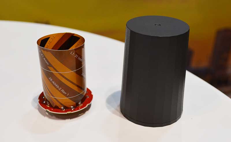
    Power Solutions

    First Place: SolidEnergy Systems, Lithium Metal Batteries
    Second Place: Global Energy Transmission Co., GET Air 12 Kilowatt Power Cloud and In-Air Drone Charging System
    Third Place: Unmanned Systems and Solutions, LLC, Long Endurance Aerial Platform (LEAP)

    Safety Solutions

    First Place: Fluidity Technologies, FT Aviator Drone Flight Controller
    Second Place: ParaZero, SafeAir Systems
    Third Place: UASidekick, UASidekick

    UAS Mitigation & Security

    First Place: WhiteFox Defense Technologies, Inc., DroneFox Mobile
    Second Place: Ascent Vision Technologies, XMADIS
    Third Place: Airspace, Galaxy

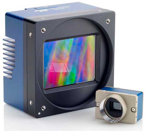
    Vision/Camera Systems & Components

    First Place: Xsens, Xsens MTi 600-series
    Second Place: Velodyne Lidar, Alpha Puck
    Third Place: Arbe, Phoenix Radar System

    XCELLENCE in Innovation

    First Place: WhiteFox Defense Technologies, Inc., WISDM
    Second Place: Fortem Technologies, Fortem SkyDome
    Third Place: Cepton Technologies, Inc., SORA 200

    OPERATIONS & SAFETY

    Operations & Safety Organization

    First Place: NASA, NASA Langley UAS Operations Office
    Second Place: Kansas Department of Transportation, KDOT UAS Safety Risk Management Program
    Third Place: AES Corporation, Striving for Safety Excellence with Global Drone Program

    TRAINING & EDUCATION

    Training & Education Organization

    First Place: Embry-Riddle Aeronautical University – Worldwide, ERAU-W UAS Program
    Second Place: Kansas State University Polytechnic Campus UAS, Kansas State University Polytechnic Campus UAS Program
    Third Place: Embry-Riddle Aeronautical University, Gaetz Aerospace Institute

    Training and Education Professional

    Winner: Barry J. Brennan, President & Founder, Flying Lion, Inc.

  • Tallysman releases new UAV helical GNSS antennas

    Tallysman releases new UAV helical GNSS antennas

    The new helical antenna in both housed (right) and unhoused form. (Photo: Allison Barwacz)
    The new helical antenna in both housed (right) and unhoused form. (Photo: Allison Barwacz)

    Tallysman, a manufacturer of high-performance GNSS and iridium antennas, launched the first three products of a new range of helical antennas. Additional models will be announced in the third quarter of 2019 and onward.

    Tallysman exhibited at booth 3739 at AUVSI Xponential 2019, which took place April 29 to May 2 in Chicago.

    The first three models of the Tallysman helical family are:

    • HC871 (25g) – A housed, dual band, active GNSS antenna, supporting GPS L1/L2,
      GLONASS G1/G2, Galileo E1, and BeiDou B1.
    • HC872 (36g) – A housed, dual band, active GNSS antenna, supporting GPS L1/L2,
      GLONASS G1/G2, Galileo E1, BeiDou B1, and L-Band services.
    • HC600 (18g) – A housed, passive Iridium antenna.


    The active GNSS helical antennas feature a low-current, low-noise amplifier (LNA), and include integrated low-loss pre-filters, to protect against harmonic interference from high amplitude interfering signals, such as 700-MHz band LTE and other near in-band cellular signals.

    Available in both housed and embedded OEM versions, the lightweight Tallysman helical antennas have excellent axial ratios, making them ideal for a variety of high-precision unmanned aerial vehicle (UAV) applications, the company said.

    The housed Tallysman helical antenna models feature a robust, military-grade plastic case, while the embedded Tallysman helical antenna models can be custom-tuned for any application and configured with a variety of cables and connectors.

    “We think — if anything — the price-performance ratio is the biggest benefit,” Allen Crawford, director of key accounts at Tallysman, told GPS World. “The pre-filter is also unique to us; the robustness of the enclosure is unique to us; and also the shortness, which is important to a lot of aerodynamic vehicles.”

    Patents have been applied for with respect to several aspects of these new products.

    “There is a clear requirement for lightweight, high performance antennas for the rapidly growing UAV market,” said Tallysman President and CTO Gyles Panther. “These new patented helical products are an extension to our existing range of superlight L1/L2 patch antennas, and will provide customers with a wider choice of antenna formats to suit their specific application requirements. These are the first of a number of new products we plan to introduce for this application to support our already wide customer base for UAV antennas.”

  • GE Aviation brings advanced avionics computing to unmanned vehicles

    GE Aviation has introduced a new advanced avionics computer specifically built for military and commercial unmanned vehicles. This new computer provides an open architecture design that integrates vehicle management and advanced mission processing into a compact, lightweight design.

    GE Aviation made the announcement at AUVSI Xponential, taking place April 29-May 2 in Chicago.

    “Our customers have told us that they require an integrated vehicle and mission processing solution that is secure, rugged, low size, weight and power and capable of meeting the needs of demanding autonomous platforms,” said Alan Caslavka, president of avionics for GE Aviation. “This new system hits it out of the park in this regard and then builds from there in terms of bringing new capabilities to the next generation of unmanned systems.”

    This new system incorporates the processing power required for mission functions such as sensor processing at the edge and hosting autonomy enabling algorithms and then also embeds an inertial/GPS package, software defined radio, datalink and an optional solid-state storage device.

    Caslavka added, “The new system incorporates diverse processing that’s capable of performing safety critical and non-critical functions while bringing a new level of security to legacy and future platforms.”

    The system integrates the functionality traditionally provided by up to six separate electronic units into a single package which drives out weight, power, and cost while meeting the security, exportability, ruggedness and processing needs of our customers.

    GE’s advanced avionics computer has undergone flight testing and is in use by a number of military and civil customers. The computer incorporates a hardware and software open architecture approach that offers flexibility and scalability. This design also provides the capability to host GE, customer and third-party software applications to maximize its versatility.

  • Raytheon system downs multiple drones in U.S. Air Force exercise

    Raytheon Company’s advanced high-power microwave and mobile high-energy laser systems engaged and defeated multiple unmanned aerial system targets during a U.S. Air Force demonstration. The mature HPM and HEL technologies offer an affordable solution to the growing UAS threat, the company said.

    Raytheon made the announcement at AUVSI Xponential, which took place April 29-May 2 in Chicago.

    Raytheon’s mobile high energy laser looks out into a wide-open sky. The company’s advanced high-power microwave and high-energy laser engaged and defeated dozens of unmanned aerial system targets in a recent U.S. Air Force demonstration.

    The HEL system, paired with Raytheon’s Multi-Spectral Targeting System, uses invisible beams of light to defeat hostile UASs. Mounted on a Polaris MRZR all-terrain vehicle, the system detects, identifies, tracks and engages drones.

    “Countering the drone threat requires diverse solutions,” said Stefan Baur, Raytheon Electronic Warfare Systems vice president. “HEL and HPM give frontline operators options for protecting critical infrastructure, convoys and personnel.”

    Raytheon’s HPM uses microwave energy to disrupt drone guidance systems. High-power microwave operators can focus the beam to target and instantly defeat drone swarms. With a consistent power supply, an HPM system can provide virtually unlimited protection.

    “After decades of research and investment, we believe these advanced directed energy applications will soon be ready for the battlefield to help protect people, assets and infrastructure,” said Thomas Bussing, Raytheon Advanced Missile Systems vice president.

    Raytheon’s HEL and HPM were the only directed energy systems that participated in this Air Force experimentation demonstration. The event expanded on previous directed energy demonstrations such as a U.S. Army directed energy exercise held in 2017.

  • Rugged tablet designed for accurate real-time measurements

    Rugged tablet designed for accurate real-time measurements

    RealSense 3D Camera is Fully Integrated to Capture Detailed Images

    DT301X-TR rugged tablet. (Photo: DT Research)
    DT301X-TR rugged tablet. (Photo: DT Research)

    DT Research is offering the new DT301X-TR rugged tablet, a lightweight military-grade tablet. The tablet is purpose-built to enhance the precision for bridge and construction inspections, 3D surveying and mapping of underground utilities.

    The DT301X-TR provides multi-frequency GNSS real-time kinematic (RTK) with carrier phase for mapping and positioning, and supports GPS, GLONASS, BeiDou, Galileo and QZSS.

    The optional foldable antenna supports high-accurate measuring field work, which can be measured with RTK GNSS positioning directly, or used to connect to an external antenna for higher precision.

    Its 10.1-inch high-brightness capacitive touch screen can be read in a wide range of lighting indoors and outdoors. The tablet comes with a choice of Intel 8th-generation Core i5 or i7 processors. Its MIL spec and IP ratings means it holds up to real-world hazards and performs in many industries and environments.

    Integrated 3D camera. The DT301X-TR integrates the optional Intel RealSense Depth camera which provides real-time 3D imaging to quickly and accurately create measurements for CAD, engineering, design, utility and project management, and crime/crash scene forensics. Scientific grade data, which is important for evidence as well as building plans, is now easier to access and use for specialists and non-credentialed workers alike.

    With this 3D camera technology, depth perception is integrated to add the most accurate image to make projects stay factual and consistent. The integration of the 3D camera with a rugged handheld tablet improves the mobility and reduces the bulk and limitations of a laser scanner for small, hard-to-reach spaces and brings the measurement, real- time scanning, and positioning together in one device which can also be used to process and transmit the data.

    Using rugged tablets with 3D technology allows the as-built status of a project to be tracked and documented in real time, reducing the project cycle time, and also allows data to be shared with the owner, general contractor and subs as it is captured. This boost to efficiency and accuracy validation shortens payment cycles as well as improving the overall BIM (building information modeling), getting infrastructure going quickly and getting payments to contractors faster.

    “The combination of the DT Research rugged tablet with the RealSense depth camera and DotProduct’s Dot3D Pro software enables projects to be quickly set up, tracked, and completed for all staff and tasks whether in the office or on the site. The ease of use these tools bring to 3D workflows can benefit a wide range of applications from construction verification to asset management to crime scene mapping.” says Tom Greaves, chief marketing officer at DotProduct.

    Data capture options besides the 3D camera are a 2D barcode scanner for equipment/location tags, long-range Bluetooth for 1,000-foot range suitable for connecting to robotic total stations and 4G LTE mobile broadband for the latest in high speed communications.

    The flexibility for set up and use is enhanced in the DT301X-TR rugged tablet with Microsoft Windows 10 IoT Enterprise operating systems for convenient integration with existing applications, bringing together the advanced workflow for data capture, accurate positioning and data transmitting.

    Another option is a bright LED light that can be attached to the DT301X-TR and stay consistently on for up to two hours, bringing light to underground infrastructure mapping and scanning.

    With high capacity 60 or 90 watt hot-swappable batteries, the rugged yet lightweight DT301X-TR keeps working continuously whether in the field, office, or vehicles, complemented with a variety of battery chargers so fully charged batteries are always available.

    This rugged tablet gives detailed accuracy combined with the latest 3D camera technology all in one tablet that is rugged and easy to use in the field. Whether at the construction site, mapping underground utilities, or at the freeway crash scene, the cost-effective DT301X-TR is ideal for accurate measurements to enable data-driven decisions, able to travel to wherever the work is.

    The DT301X-TR rugged tablet will be available in May 2019 from DT Research’s authorized resellers and partners. DT Research will be at booth 217 at AEC’s BuildTech show.

  • GE Aviation and Auterion team on commercial drone platform

    GE Aviation and Auterion team on commercial drone platform

    Photo: iStock.com/valio 84sl, via FAA
    Photo: iStock.com/valio 84sl, via FAA

    Team to provide all-in-one hardware and software platform for commercial drones.

    GE Aviation and Auterion are integrating the Auterion Enterprise PX4 operating system on GE Aviation’s Unmanned Aircraft System avionics platform.

    The companies signed a teaming agreement to provide a comprehensive hardware and software solution for drone manufacturers and operators seeking to enable commercial drone operations at scale.

    The hardware and software platform is designed with commercial vehicle original equipment manufacturers (OEMs) and service providers in mind. It is being displayed at Auterion’s booth (#2009) at AUVSI Xponential, taking place this week in Chicago.

    The teaming enables a full-stack solution with airborne autopilot and application computing hardware, flight management, safety management and integration. GE Aviation is providing the avionics hardware, application computing, flight management and integration into airframes. Auterion is providing Enterprise PX4, the operating system that runs on the vehicle, in the cloud and the ground station.

    The core architecture of the hardware and software platform has been implemented with the objective of supporting developers through global open software standards while maintaining an independent and authoritative safety controller.

    The combination of the two supports long-term flexibility and a high level of design assurance to enable commercial drone operations beyond visual line of sight (BVLOS) and within complex airspace and obstacle environments.

    Flight testing of the hardware and software platform took place over the last three weeks at Reno-Stead airport in Reno, Nevada.

    “In demonstrating a seamless integration of ground, cloud and airborne components, we’ve reached another milestone in helping to unlock the value in autonomous and UAS advanced operations,” said Alan Caslavka, president of Avionics Systems for GE Aviation. “Auterion’s open standards leadership and cooperative legacy with the developer community is the foundation to scale a sustainable solution critical for commercial drones.”

    “We are excited about the collaboration with GE Aviation that allows us to offer our operating system on high reliability hardware to meet future regulations,” said Kevin Sartori, Co-Founder of Auterion. “With this collaboration, the combined solution will significantly reduce barriers commercial cargo drones face flying in manned airspace or inspection drones to flying in urban areas.”

  • Ohio UAS Center, AFRL to test Skyvision drone detection

    The Skyvision RV. (Photo: Ohio UAS Center)
    The Skyvision RV. (Photo: Ohio UAS Center)

    The Ohio Unmanned Aircraft Systems Center and the Air Force Research Laboratory (AFRL) will soon begin testing groundbreaking aviation technology at the Springfield-Beckley Municipal Airport.

    Ohio Governor Mike DeWine, Lt. Governor Jon Husted and Major General William Cooley, commander of the Air Force Research Laboratory (AFRL) made the announcement April 26 at Wright Patterson Air Force Base.

    Skyvision was developed in a collaboration between AFRL and the State of Ohio. AFRL and a delegation of Ohio UAS industry experts will showcase the SkyVision system at AUVSI Xponential in Chicago April 30 to May 2 (Booth 4226).

    The SkyVision technology safely, accurately and effectively allows drones to detect and avoid other aircraft while in flight. SkyVision can be described as an air traffic control system for drones.

    Inside the Skyvision RV. (Photo: Ohio UAS Center)
    Inside the Skyvision RV. (Photo: Ohio UAS Center)

    The validation of this aviation technology led the FAA to grant AFRL a certificate of authorization to test defense-related drone technology without reliance on a visual observer or chase aircraft.

    Typically, drones can only fly within the uninterrupted line of sight of the person operating the UAS, but this special waiver allows AFRL and the Ohio UAS Center, which is part of the Ohio Department of Transportation’s DriveOhio Initiative, to use SkyVision to test drones beyond the visual line of sight (BVLOS) within a 200-square-mile parcel of unrestricted airspace near the Springfield-Beckley Municipal Airport.

    “As our country steps more and more into the unmanned age of flight, this technology is on the forefront of the aviation frontier, making Ohio a critical national asset for the research and development of UAS technology,” said Governor DeWine. “This also opens the door for commercial companies to work with Ohio, AFRL, and the FAA to test their own UAS-related

    technology using our SkyVision detection system. This is a major step in revolutionizing the transportation industry, with Ohio leading the way in aerospace, defense, and aviation innovation.”

    “This is an important development in the progression of unmanned aircraft,” said Major General William Cooley, Commander of AFRL at Wright-Patterson Air Force Base. “This waiver provides the latitude to test beyond-line-of-sight keeping AFRL on the leading edge of world-class research and accelerates the delivery of technology that makes a difference to the warfighter.”

    “By enabling our lower-altitude airspace for advanced modes of transportation, we’ll be able to facilitate new opportunities around advanced autonomous aircraft research and development,” said Lt. Governor Husted. “This will bring investment to Ohio and solidifies Ohio’s position as a world- recognized leader in aviation technology.”

    Ohio’s SkyVision detection system could potentially be used by the state to develop and test UAS technology to assist citizens in the event of a natural disaster or to significantly enhance the capability of search and rescue teams to find missing persons in time-critical situations. Commercial companies, such as those looking to use drones to survey damaged infrastructure or hoping to launch drone commerce operations, will also now have incentive to move to Ohio to test their own UAS technology.

    VyrtX, a company based out of Dayton, is among the first companies that has committed to expand into Springfield to work with AFRL and the Ohio UAS Center. VyrtX is currently developing technology for the potential transport of organ donations between hospitals for transplant surgeries.

    UAS test flights will take place at heights ranging from 1,000 feet above ground to 10,000 feet mean sea level. Air traffic control experts from the Ohio UAS Center will operate SkyVision during each flight. The SkyVision detection system is located within a mobile unit so that it can be flexibly placed in optimum positions for each flight.

    “Today’s announcement comes after years of hard work and collaboration among an incredible group of partners,” said Jeff Hoagland, President and CEO of the Dayton Development Coalition. “AFRL and Ohio had a bold vision to bring UAS into the national airspace for true beyond-visual- line-of-sight flight. The work done here will shape the industry for years to come.”

    The State of Ohio and AFRL both invested a combined $5 million for the research and development of SkyVision.

    Supported by the Ohio Department of Transportation, DriveOhio works to ensure Ohio’s regulatory environment and public policies are conducive to the development of the infrastructure and technologies needed for smart mobility.

  • Deseret UAS to showcase technologies at AUVSI Xponential

    Deseret UAS unveils premier test facilities and technologies from Utah-based companies.

    Deseret UAS will be exhibiting at AUVSI Xponential, offering commercial unmanned aerial systems (UAS)/urban air mobility (UAM) flight test facilities.

    Deseret UAS headquarters is located at the Xperience Center in Tooele City. (Photo: Deseret UAS)
    Deseret UAS headquarters is located at the Xperience Center in Tooele City. (Photo: Deseret UAS)

    Deseret UAS offers access to wide-open land and airspace, as well as the necessary Federal Aviation Administration (FAA) authorizations for large commercial UAVs and UAM aircraft.

    The organization’s commercial flight test amenities include a 4,500-foot paved runway with a covered airplane hangar, mobile test units, certified Part 107 pilots, data analytics, beyond visual line of sight (BVLOS) test capabilities and state-of-the-art training facilities.

    “We encourage all Xponential attendees to visit our booth and see firsthand the cutting-edge technologies being developed right here in Utah,” said Deseret UAS Board Chair Shawn Milne. “The unique assets we offer at an affordable cost have been a game-changer for companies seeking to operationalize their technologies.”

    The Utah Pavilion will also have Utah-based companies exhibiting their prototypes that have the potential to revolutionize mobility, safety, and security.

    Founded in 2017, ElectraFly is an aviation company building a hybrid-electric personal flying vehicle. It aims to increase lift capacity and flight times for vertical take-off and landing aircraft and is positioned between a personal jetpack and a large, helicopter-like air taxi.

    The ElectraFly prototype is being built to carry a rider — something ideal for first responders or military special forces. Other versions will be scaled for air taxi or search and rescue, and smaller versions will be ideal for shipping and package delivery.

    “There is an undeniable change happening in air transportation but there are problems in efficiency,” said John Manning, ElectraFly co-founder and director of development. “So many people, especially as children, dream about flying. We’re developing innovations to make the dream of personal flight a reality and to shape the future of urban air mobility.”

    Fortem Technologies is an innovator in airspace safety and security. Fortem’s AI-enabled SkyDome software and TrueView radar digitize airspace, making it possible to ensure safe urban corridors and to protect infrastructure, venues, borders and cities against rogue drones. This digitization can make drone package delivery and the safe transport of people a reality.

    “Safe air mobility of unmanned drones flying beyond visual line of sight is achievable,” said Fortem CEO Timothy Bean. “Fortem Technologies makes this possible by digitizing the airspace so that cooperative and non-cooperative air traffic can be differentiated, assessed for threats, and managed for safety of our airways.”

    Also exhibiting at the Utah Pavilion will be officials from the Governor’s Office of Economic Development (GOED) and the Economic Development Corporation of Utah (EDCU). GOED and EDCU will be available to answer questions about economic development opportunities in the state.

    “Utah has always been at the forefront of technological innovations that improve lives and the state’s investment in Deseret UAS is evidence of that,” said Ginger Chinn, managing director of Urban and Rural Business Services for the Utah’s Governor’s Office of Economic Development. “We whole-heartedly embrace unmanned aircraft technologies and are proactively developing a plan to build the aerial infrastructure needed for these innovations to flourish.”

  • Seen & Heard: April 2019

    Seen & Heard: April 2019

    Check out some GPS developments that have recently taken place around the world. (Click to enlarge; Map: iStock.com/nadla)

    Map: iStock.com/nadla

    1. A new use for GNSS satellites

    University of Padua researchers say GNSS satellites make possible global quantum communication, beaming information between a satellite and an Earth-based ground station. They exchanged a single photon over 20,000 kilometers to prove secure quantum communications can be implemented on a global scale using GNSS. Results show the first exchange of a few photons per pulse between two GLONASS satellites, using the passive retro-reflectors mounted on the satellites, and the Space Geodesy Centre of the Italian Space Agency. The results could provide solutions for GNSS security for satellite-to-ground and inter-satellite links by using quantum information protocols for quantum key distribution.


    GRITSS to improve reference frame University of Massachusetts Lowell researchers have received a two-year, $1.2 million grant from NASA’s Earth Science Division to develop a Geodetic Reference Instrument Transponder for Small Satellites (GRITSS) to significantly improve the accuracy of the International Terrestrial Reference Frame — the basis of GPS positioning and navigation. A virtual map of the Earth, the ITRF pinpoints specific geographic positions and describes Earth’s precise shape, physical topography, orientation and rotation with time based on a stationary, Earth-centered coordinate system.  The location of each GPS satellite is defined within the ITRF. (Photo: NASA)
    Click to enlarge. (Photo: NASA)

    2. GRITSS to improve reference frame

    University of Massachusetts Lowell researchers have received a two-year, $1.2 million grant from NASA’s Earth Science Division to develop a Geodetic Reference Instrument Transponder for Small Satellites (GRITSS) to significantly improve the accuracy of the International Terrestrial Reference Frame — the basis of GPS positioning and navigation. A virtual map of the Earth, the ITRF pinpoints specific geographic positions and describes Earth’s precise shape, physical topography, orientation and rotation with time based on a stationary, Earth-centered coordinate system.  The location of each GPS satellite is defined within the ITRF.


    Pigeon scientists Engineers from the University of Birmingham have developed a compact backpack to collect climate and pollution data. When the birds return to their lofts, the sensors are retrieved and the data downloaded, including GPS location, temperature, humidity, ambient light and air pressure. So far, scientists have been able to collect data from five birds — they made a total of 41 flights with a total length of about 1,000 kilometers. (Photo: Rick Thomas)
    Click to enlarge. (Photo: Rick Thomas)

    3. Pigeon scientists

    Engineers from the University of Birmingham have developed a compact backpack to collect climate and pollution data. When the birds return to their lofts, the sensors are retrieved and the data downloaded, including GPS location, temperature, humidity, ambient light and air pressure. So far, scientists have been able to collect data from five birds — they made a total of 41 flights with a total length of about 1,000 kilometers.


    China’s big brother program Evidence that China is tracking its Uyghur Muslim population in the Xinjiang region has been uncovered. A facial recognition database was left open on the internet for months, Dutch security researcher Victor Gevers told ZDNet. The database contains information on 2.5 million people, along with a stream of GPS coordinates. Data includes detailed and sensitive information: names, ID card data, addresses, photos and employers, as well as GPS coordinates where the user had been seen via public cameras labeled mosque, hotel, police station, internet cafe, restaurant and more. (Photo: Victor Gevers/ZDNet)
    Click to enlarge. (Photo: Victor Gevers/ZDNet)

    4. China’s big brother program

    Evidence that China is tracking its Uyghur Muslim population in the Xinjiang region has been uncovered. A facial recognition database was left open on the internet for months, Dutch security researcher Victor Gevers told ZDNet. The database contains information on 2.5 million people, along with a stream of GPS coordinates. Data includes detailed and sensitive information: names, ID card data, addresses, photos and employers, as well as GPS coordinates where the user had been seen via public cameras labeled mosque, hotel, police station, internet cafe, restaurant and more.

  • Teledyne Imaging showcases mapping, object recognition and tracking tech at AUVSI

    Teledyne Imaging showcases mapping, object recognition and tracking tech at AUVSI

    Photo:
    The Falcon 4 UAV camera. (Photo: Teledyne)

    Teledyne Optech, Teledyne DALSA and Teledyne Scientific & Imaging, all part of the Teledyne Imaging group, will share a combined presence at Booth #2520 at the AUVSI Xponential 2019 show in Chicago April 29-May 2.

    The three companies will showcase their new and advanced sensor and imaging solutions.

    Teledyne Optech presents a new compact lidar family, the CL-90. Attendees can preview the lightweight, compact lidar platform for UAV deployment. The CL-90 features exceptional canopy penetration, offering the low-noise, high-quality survey-grade data to deliver extraordinary performance in data accuracy and point precision.

    The CL-90 empowers full lidar performance across the entire operating altitude range of the UAV, and offers an exclusive variable field-of-view capability eliminating the need for multiple passes over a target.


    Teledyne DALSA will showcases its advanced thermal and visible cameras. The Genie Nano family of low-cost area cameras for UAVs are lightweight, power-efficient and compact.

    The Falcon 4 86-megapixel ultra-high resolution and high-speed CMOS camera offers capabilities for large-area, high-resolution, high-speed imaging.

    The Calibir series of long wave infrared (LWIR) cameras deliver compact, low-profile thermal solutions, designed for UAV applications such as agriculture, construction, defense and surveying. Calibir is customizable with smart embedded algorithms and capability for real-time VIS-LWIR image fusion.

    Teledyne Scientific & Imaging features a new artificial intelligence (AI) software stack capable of real-time performance on board UAVs. The AI stack enables automatic sensor processing for applications such as sensor fusion, asset recognition and tracking, and adaptive dynamic range for deployment in daytime and variable light operations.

  • Self-driving work zone vehicles enhance safety

    Screenshot: Kratos Defense & Security Solutions/Royal Truck & Equipment ATMA brochure
    Screenshot: Kratos Defense & Security Solutions/Royal Truck & Equipment ATMA brochure

    Kratos Defense & Security Solutions, a developer of advanced unmanned system technologies, has teamed with Royal Truck & Equipment, which builds Truck Mounted Attenuator (TMA) vehicles and highway safety systems, to deploy the Autonomous Truck Mounted Attenuator (ATMA), a self-driving work zone vehicle. The ATMA is an autonomous vehicle that uses driverless technology.

    According to the company, highway workers are routinely placed in high-risk situations, but are at especially high risk when assigned to drive a TMA vehicle. The TMA vehicle, also known as an Impact Protection Vehicle, is a truck that follows behind slow moving highway maintenance vehicles as a human-driven mobile crash barrier absorbing the impact of traffic accidentally entering the work zone.

    “Driving a TMA is extremely dangerous and drivers are at serious risk of lifelong injury, painful rehabilitation and even death,” said Maynard Factor, business development director at Kratos Defense. “To eliminate this dangerous assignment, Kratos Defense developed the Autonomous TMA (ATMA) by retrofitting standard TMA vehicles with driverless technology to enable unmanned operation.”


    The first ATMA systems were deployed in 2017 and have since then been deployed across the United States and Europe. The unmanned ATMA operates in a multi-vehicle leader/follower configuration with a human driven highway maintenance vehicle, the companies said. In the leader/follower configuration, the system enables the maintenance vehicle (leader) to transmit navigation data via encrypted V2V communications to the ATMA (follower). From there, the ATMA uses the data to follow the leader, unmanned, as it travels along the route.

    The ATMA systems features component redundancy, an active safety system, high accuracy GPS/GPS-denied navigation, encrypted V2V communications, and multi-modal front and side-view obstacle detection, the companies added. It also includes a user interface that provides system feedback, situational awareness, multi-camera views and operator controls.

    “Highways are becoming increasingly dangerous due to distracted drivers texting, following too closely, falling asleep, etc., and work zone fatalities from traffic-related crashes average in the hundreds per year,” Factor said. “Our main goal in developing the ATMA was to increase worker safety by removing them from behind the wheel of a vehicle deployed for the sole purpose of operating as a crash barrier.”

    Kratos Defense & Security Solutions will be exhibiting at AUVSI’s Xponential 2019 at booth #226.

  • How lidar boosts the value of mobile mapping

    Velodyne presents business cases of lidar solutions in forestry, utilities and surveying at AUVSI’s Xponential.

    Frank Bertini, UAV and robotics business manager at Velodyne Lidar (booth #1420), will deliver a featured presentation on the business cases for 3D lidar technology in mobile mapping applications at AUVSI Xponential 2019, taking place on April 29 to May 2, at McCormick Place in Chicago.

    Bertini will discuss revenue-generating strategies created by adding lidar to drones, backpacks and all-terrain vehicles (ATV) to build autonomous solutions.

    Bertini’s session, “Emerging Autonomous Applications for 3D Lidar,” will provide a technical overview of industrial applications for lidar onboard unmanned systems. The presentation focuses on emerging use-cases which are creating businesses opportunities in developing markets, including forestry management, utilities management, and surveying.

    The session takes place on Wednesday, May 1, 2-2:30 p.m. in XPO Hall – Solutions Theater.

    “Velodyne Lidar helps systems developers by providing rich computer perception data that enables high-performing mapping systems in a lightweight, versatile solution,” said Bertini. “Velodyne sensors make it quick and easy for companies to build highly accurate 3D models of any environment, such as forests, power corridors, and solar energy farms.”

    In the presentation, Bertini will examine how drones equipped with Velodyne’s lightweight, powerful lidar can produce high-density point clouds for a forest canopy as well as the terrain underneath.

    He will also explain how this can be done at ground level with a backpack application.

    Additionally, the session will include mobile mapping case studies involving a power line inspection and surveying a solar power field.

    Attendees to AUVSI Xponential 2019 can visit the Velodyne booth to learn about Velodyne’s state-of-the-art lidar technology that delivers a high-resolution surround-view image to accurately measure and analyze the environment.

    The performance, range and compact form factor of Velodyne sensors enable developers to design versatile systems that can be configured to any mapping need.