The U.S. Army’s Armament Research, Development and Engineering Center (ARDEC), located at Picatinny Arsenal in north-central New Jersey, has issued a sources sought notice for technology it can use for a variety of unmanned systems.
The notice says that technologies developed for the Autonomous Unmanned Systems Teaming and Collaboration In GPS Denied Environments program (AUSTC) could be used for small UAS, underwater vehicles and ground vehicles.
The center plans to to “identify, invest, mature and transition revolutionary/game-changing autonomous unmanned sensing technologies.”
“The AUSTC program employs a ‘think-tank’ and modified ‘skunk-works’ approach to identify and determine best path forward for new and game-changing technologies that may be available or in development to achieve U.S. Army RDECOM-ARDEC interest Sensitive Target Site Exploitation (STSE) mission,” the notice reads.
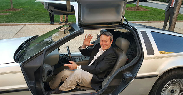
Wireless LBS Contributing Editor Kevin Dennehy sits in Delorean connected vehicle on “Back to the Future Day” Oct. 21 sponsored by ITS America.
The battle over when autonomous vehicles will be on the road for consumers seems to be divided along government/big auto companies/academic institutions vs. such technology companies as Google, Uber, Tesla and others. Two recent Washington events highlighted the gulf in expectations for full autonomous vehicle rollout. The question is, why are the two groups so far apart? Funding? Safety? Cyber Security?
WASHINGTON — A panel of business and auto experts discussed the quick rollout of autonomous vehicles and the implications on business and consumer mobility at an Oct. 14 National Press Club meeting here. In terms of the time for consumer rollout, Google founders Larry Page and Sergey Brin attended a DARPA autonomous vehicle challenge in 2007 and determined they didn’t want to wait 15-20 years to roll out a business, said Larry Burns, Univ. of Michigan professor and Google consultant.
Burns said that when he was the vice president of research and development at GM, it would have been hard to convince company execs and lawyers to go ahead with full-blown autonomous technology, while such technology companies as Google are forging ahead.
Burns acknowledged the technology has to work as the automobile is a complicated and sophisticated machine. “Google has driven over a million miles. They have engineers and technicians capture any real-time incidents and take them back to a lab to create computer programs. I can tell you the technology is very close,” he said. “I think we need to get a small fleet on the road in one place, because the technology has to be proven on real roads, to see what human drivers have to deal with. We have the tendency to rush to large volumes because we think it is the answer, but we need to learn on a small scale — and share the data between regulators and legislators.”
While Burns concentrated on the usual story — autonomous vehicles will dramatically decrease worldwide highway fatalities — he said that a new automotive DNA will shape a new market that will focus on the rise of electric vehicles and a sharing economy. “There will be more shared vehicles and the opportunity to created tailored vehicles. Average speeds are 25 miles per hour and most trips are less than eight miles,” he said. “It will change our dependency on oil, land use, parking and access.”
With automated technologies, a car will be able to decrease in size to 1,000 pounds, which allows an electric car’s battery to work more efficiently, Burns said.
Although they do not have an autonomous vehicle strategy, one Domino’s Pizza executive said that the technology would be important for their own fleets, but the franchisees would have to see a return on investment to purchase their own fleet.
“We own supply chain centers and drive 22 million miles delivering food to thousands of stores,” said Lynn Liddle, Domino’s executive vice president of communications, investor relations and legislative affairs. “The pizza industry has not been on the forefront of transportation. When we were founded, the goal was to get pizza to a dorm in 30 minutes. We are now into tech — quick ordering and texting through Ford Sync. Our Australian franchisees are using GPS-enabled systems that allow [customers] to know when their pizza is coming.”
Burns said he could see a two-person pod swinging by a Domino’s, hitting the post office and Fedex as part of the same trip. “The challenge of bringing goods to my door that weigh less than a pound in the last mile is formidable,” he said. “This is an exciting opportunity for the trucking industry. We may see this Class A trucks shortage of truck drivers [go away]. There is a great early opportunity for goods movement with a very good payback.”
One panel member from Securing America’s Future Energy, or SAFE, said the organization is establishing an Autonomous Vehicle Task Force, a group of industry experts that will assess the social, political, market and regulatory challenges of the new technology.
“It’s important to not be dependent on one fuel source, which is run by very high-priced cartels and national oil companies,” said Robbie Diamond, SAFE president and CEO. “This is the first time we have seen the convergence of technology and business models, not just the safety concerns. This is a once-in-a-century opportunity to have a better mobility system.”
Not Everyone Believes Autonomous Vehicles Will Be Ubiquitous By 2020…
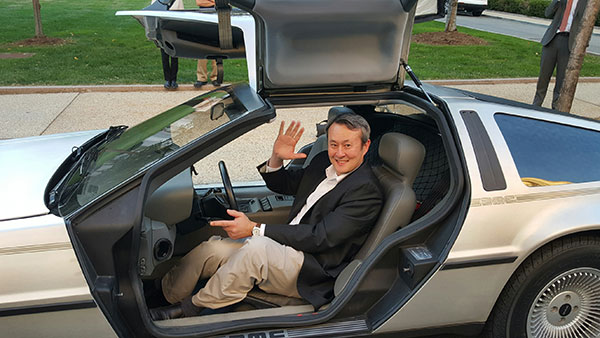
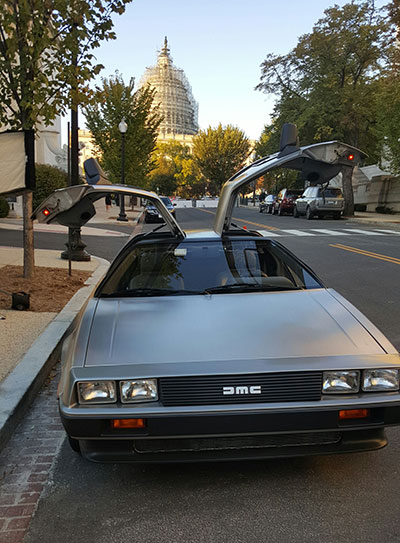
Delorean connected vehicle at “Back to the Future Day” sponsored by ITS America.
Some transportation industry veterans don’t buy that the autonomous vehicle will have a quick rollout. While autonomous vehicles are great for short trips, they may not be the solution for families who live in rural areas, said Thomas Dingus, Virginia Tech Transportation Research Institute, at a Capitol Hill panel sponsored by ITS America Oct. 21.
“The bestselling car today is a pickup. Why would you want an automated vehicle if you live in the country?” Dingus said. “Some [autonomous vehicle] adoption will be at a lower rate, some not at all. We will still have drivers on the road. There is no doubt that automated vehicles are coming, but it will be slower than people think.”
Dingus’ Virginia Tech entity is part of the Virginia Connected Corridor Project, which tested autonomous vehicles on two interstate highways in the Washington, D.C., area recently.
One panel topic is the need for better highway infrastructure in order for automated systems to work. Case in point was the problems Tesla has been having with its new lane-control feature because it cannot read the on-the-road markings. “Automated vehicle technology doesn’t work when you don’t have good lane markings. People who said the technology is ready today are wrong,” said Hillary Cain, Toyota director of technology and innovation policy. “We really need to make better investment in our infrastructure.”
Cain also said that the industry is far away from achieving National Highway Safety Testing Administration Level 4, or full self-driving automation. “We are much farther away than we think we are,” she said.
Despite a nationwide shortage of drivers, one trucking industry executive on the panel didn’t seem sold on autonomous vehicles. “The [automated] solution has to be 99.9 percent safe. You have to prove you could have done better than with a human being driving,” said Alan Korn, Meritor WABCO director of advanced brake systems integration.
Also at the panel, Sen. Gary Peters, D-Mich., gave his opinions of the Google car and the new Michigan Mobility Transformation Center, and said the new autonomous technologies will be disruptive to whole industries. “The number-one job at risk is drivers. But the most dangerous vehicle on the highway will be driven by humans,” he said. “I had the opportunity to ride in the Google car, it’s a bit freaky.”
In other news:
Driverless, the Business of Autonomous Vehicles, will be held March 22-23, 2016, at the Crowne Plaza Hotel-San Francisco Airport. More than 30 speakers will discuss worldwide autonomous vehicle markets, safety and security, new technologies and other topics. Go to www.driverlessmarket.com for more information.
In October 2014, Tesla started equipping its Model S with hardware to allow for the incremental introduction of self-driving technology: a forward radar, a forward-looking camera, 12 long-range ultrasonic sensors positioned to sense 16 feet around the car in every direction at all speeds, and a high-precision digitally controlled electric assist braking system.
Version 7.0 of Tesla’s software has now been released with Autopilot, which allows those tools to deliver a range of new features designed to work in conjunction with the automated driving capabilities already offered in Model S.
Tesla calls Autopilot a major step toward autonomous driving. “Tesla Autopilot relieves drivers of the most tedious and potentially dangerous aspects of road travel,” according to a Tesla blog. “While truly driverless cars are still a few years away, Tesla Autopilot functions like the systems that airplane pilots use when conditions are clear. The driver is still responsible for, and ultimately in control of, the car. What’s more, you always have intuitive access to the information your car is using to inform its actions.”
The combined suite of features represents an integrated autopilot system involving four different feedback modules: camera, radar, ultrasonics and GPS. “These mutually reinforcing systems offer real-time data feedback from the Tesla fleet, ensuring that the system is continually learning and improving upon itself,” the Tesla blog said.
Autopilot allows Model S to steer within a lane, change lanes with the tap of a turn signal, and manage speed by using active, traffic-aware cruise control. Digital control of motors, brakes and steering helps avoid collisions from the front and sides, as well as prevent the car from wandering off the road. “Your car can also scan for a parking space, alert you when one is available, and parallel park on command,” Tesla said.
Release of version 7.0 also features a significant visual refresh of the digital display. The instrument panel is focused on the driver and includes more functional apps to help monitor the ride.
Tesla founder Elon Musk said during a press conference that drivers should exercise caution in the initial months of the rollout, and consider Version 7.0 a beta release. “We’re advising drivers to keep their hands on the wheel at this early stage,” Musk said. The car’s dash alerts drivers when they need to take the wheel.
Just days after the launch, videos began appearing on the Internet showing near misses and other errors.
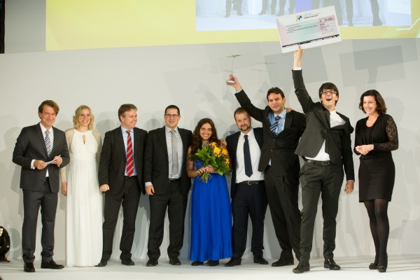
A UAV project, POSEIDRON, took top honors in the 2015 European Satellite Navigation Competition, which recognizes the year’s best innovations in commercial applications of satellite technology. POSEIDRON won over the international jury of experts with its remote-controlled multicopter built to support maritime search-and-rescue services — and took home the grand prize ahead of the European Satellite Navigation Competition’s 29 other winners.
The award ceremony took place during the Satellite Masters Conference. The ceremony was held at the ddb forum in Berlin Oct. 20. The awards ceremony was held in conjunction with the Copernicus Masters awards for Earth observation.
Thorsten Rudolph, Ulrike Daniels (both Anwendungszentrum GmbH), David Argiles (ValSpace Consortium), Rudesindo Hernando Meliá, Maria Dolores Albiol Simo, Manuel Pedreira Gimenez, Jorge Esteve Ripollés and Enrique Martínez Asensi (all Sincratech Aeronautics) and Dorothee Bär (German Federal Ministry of Transport and Digital Infrastructure (BMVI)). (Photo: Anna Kreuz)
Enrique Martínez Asensi and his winning team hope to see Poseidron save lives far out at sea when people fall overboard or are involved in shipwrecks that occur during illegal immigration. Custom-developed by Sincratech Aeronautics — a start-up based in Valencia, Spain — POSEIDRON can be launched from ships or platforms under virtually any weather conditions. The multicopter uses thermal cameras and the European positioning service EGNOS to quickly locate people in the water and transmit an alarm to rescue teams along with precise information. Capable of carrying up to 70 kilogrammes, it can also transport a dinghy and deploy it as soon as casualties are found. This is what makes POSEIDRON both faster and more cost-effective than other rescue systems, which in turn significantly increases the chances of survival — particularly in cold waters.
In addition to winning the ESNC’s EUR 20,000 grand prize, the innovative project will now have the chance to enter a 12-month incubation programme at one of five Science Parks in Valencia as part of the region’s prize.
The ESNC set a new participation record this year, with 515 innovations entered by companies from more than 40 different countries around the world. The competition more than matched the successes of past editions in increasing its overall figures to 272 winners awarded and 3,343 ideas received from more than 10,000 participants throughout its 12 years in existence.
“Time synchronization and reliable positioning information are essential to today’s digital economy: Without corresponding satellite-based services, the development of these and other innovations — including the Internet of Things, machine-to-machine communication, and Industry 4.0 — would not be possible,” explained Thorsten Rudolph, CEO of ESNC initiator and organiser Anwendungszentrum GmbH Oberpfaffenhofen. “As the ideas submitted to this year’s ESNC have shown to impressive effect, it is these forward-thinking technologies in particular that present a great deal of potential waiting to be unleashed by high-tech start-ups.”
Under the patronage of the German Federal Ministry of Transport and Digital Infrastructure (BMVI), the ESNC presented prizes valued at approximately EUR 1 million in total at its festive Awards Ceremony.
The competition’s jury of 240 renowned experts selected both the overall victor and 30 other regional and special prize winners. With their innovations in areas such as connected mobility, smart cities, tourism and environmental protection, these entrants demonstrated how fundamental precise satellite navigation signals are to Europe’s digital society.
2015 Winners
Overall Winner
Loles Albiol Simó, Rudesindo Hernando Meliá, Jorge Esteve Ripollés, Manuel Pedreira Giménez, Enrique Martinez Asensi :: OVERALL WINNER – Valencian Community / Spain POSEIDRON: Remotely Piloted Aircraft System for Search and Rescue and Environmental Defence
Special Prize Winners
Rafael Olmedo, Juan Domingo, Laura Concepción :: GSA
KYNEO: The Open Navigation Platform for the GNSS of Things (Read more abut this prize here.)
Su Zhenzhong, Tonio Gsell, Alexander Wolf :: ESA
RTKNAV – A Low-Cost, Compact, User-Friendly, Centimetre-Accurate, Real-Time Navigation Solution
Dariusz Tanajewski, Grzegorz Grunwald :: DLR
Mobile Underwater Positioning System (MUPS)
Jukka Talvi, Joni Jämsä, Kalle Arola, Jukka-Pekka Alanissi, Antti Koponen :: BMVI/BMWi
HALI – Always Green Traffic Signals for Emergency Vehicles
Prof Dr Nick van de Giesen, Dr Eugenio Realini :: University Challenge
GNSS Monitoring of Precipitable Water Vapour over East Africa Using Low-Cost Receivers
Jasper Ettema, Sabine Ettema :: GNSS Living Lab
Position-Based Assistance in Case of Sudden Cardiac Arrest
Regional winners
Suresh Babu Mandalanka :: Asia
GeoKey – A Locking System That Uses Geographic Locations as Keys
Jasper Ettema, Sabine Ettema :: Austria
Position-Based Assistance in Case of Sudden Cardiac Arrest
Dr Walter Naumann :: Baden-Württemberg / Germany
ICARUS – A New Global Tracking Service for Small Objects
Ladislav Bartuška :: Czech Republic
Biological Protection of Airports Using Drones
Ronny Webers, Bart Lenaerts, Vincent Jorissen :: Flanders / Belgium
JobWalkr – The First Mobile App That Informs You About Job Opportunities in Your Neighbourhood
Daniel Neveux D’Agata, Laurent Kerbrat, Maïwenn Penhouët :: France
WIZAR – A new way to discover history and heritage
Alberto Gonzalez, Antonio Vazquez, Bibiano Fdz-Arruti, Aaron Nercellas, Diego Hurtado, Diego Nodar, Fernando Aguado, Franco Pérez :: Galicia / Spain
Point&Pin – Remote Localisation for Emergency Situations
Oscar Serradilla :: Gipuzkoa / Spain
Pothole Avoider
Sibylle Geiger, Jens Liebau, Nezar Mahmoud :: Hesse / Germany
Discover a Great Variety of Local Foods with the frimeo App
Aidan Flanagan, Colm Murphy :: Ireland
112GPS.com – More accurate emergency calls
Ronen Bitan, Tal Lavi :: Israel
Trailze – Complete Outdoors Experience
Dr Saulius Rudys, Mantautas Rudys :: Lithuania
Fully Camouflaged GNSS-GSM Anti-Theft System for Bicycles
Carlos Callejero Andrés, Julio Pantoja Dominguez, Ignacio Gómez Maqueda :: Madrid / Spain
VardiaN – Big Data Platform of Connected PPEs to Prevent Accidents in Hazardous Environments
Prof Dr Nick van de Giesen, Dr Eugenio Realini :: The Netherlands
GNSS Monitoring of Precipitable Water Vapour over East Africa Using Low-Cost Receivers
Thomas Jelle, Ingjard Sandhei, Åsmund Tokheim, Dag Jomar Mersland, Morten Tvenning, Iván Sánches Ortega, Robert Badnall :: Norway
MazeMap – High-quality, interactive, searchable, and linkable indoor maps
Jan Filipowiak, Radoslaw Jastrzebski, Maciej Glowacki :: Poland
Pastguide: Virtual Reality in Real Places
Florin Banica, Andreea Diana Banica :: Romania
Shared Ahead – A Truck-Sharing System
Su Zhenzhong, Tonio Gsell, Alexander Wolf :: Switzerland
RTKNAV – A Low-Cost, Compact, User-Friendly, Centimetre-Accurate, Real-Time Navigation Solution
Zoe Farrington, Andrew Richardson :: United Kingdom
REALRIDER®
Loles Albiol Simó, Rudesindo Hernando Meliá, Jorge Esteve Ripollés, Manuel Pedreira Giménez, Enrique Martinez Asensi :: Valencian Community / Spain
POSEIDRON: Remotely Piloted Aircraft System for Search and Rescue and Environmental Defence
Nicolas de Kerchove, Joel Mendez, Oscar Marí :: Wallonia / Belgium
A New Concept for a Location-based Mobile Game with an Innovative Monetisation Platform
If we take a quick look at what’s been happening with rules for regular commercial UAV operations, some might say progress has been mixed. If you live in Finland, then the news is quite good, while back here in the U.S., there have also been steps toward regulation for UAVs.
Just this week, the Department of Transportation moved to require that UAVs be registered. The DOT has created a task force to develop recommendations, with representatives from the UAS and manned aviation industries, the federal government and other stakeholders.
Finland just published what are being called “the most liberal aviation regulations in the world” for the operation of unmanned aircraft. Trafi — the Finish Transport Safety Agency — last week issued a Regulation for the “Use Of Remotely Piloted Aircraft and Model Aircraft” that puts an onus on operators to observe quite broad safety rules. Provided an operator provides details of the UAV and what you intend to do, and then observe some common-sense rules of operation, you are free to go fly.
In particular, if you keep a small UAV (less than 15 pounds) at a safe “escape” altitude, you are allowed under certain conditions to operate over populated areas and open area crowds, and to use either Visual Line of Sight (VLOS) or Beyond Visual Line of Sight (BVLOS) — things that are really hot-potato issues here and are not currently generally allowed in the U.S. The FAA has permitted some exceptions for trial news gathering, but otherwise flights over people and densely populated areas are strictly verboten.
Finland’s Robonic UAV launchers.UAV image acquisition in Finland.
The objective for Trafi is to pave the way for full-scale benefits to be gained from this new segment of aviation, and to create business and developmental opportunities — particularly for testing and experiments that may further develop business activities. A far cry from how UAV life has been evolving here in North America…
Meanwhile, the FAA missed its congressionally mandated Aug. 30 deadline to integrate UAVs into the U.S. National Airspace System (NAS). This wasn’t altogether unexpected, and the FAA has been trying to otherwise enable the commercial use of UAVs by issuing a whole bunch of waivers to applicants who are ready to accept interim FAA operational rules. However, last week the FAA did fill in one of the missing pieces for commercial operators by setting up a registration program for drones, and even included a requirement to also register all recreational “model aircraft.”
Back in early September, the Association for Unmanned Vehicle Systems International (AUVSI) issued a report that summarized how the first 1,000 FAA waivers are going. The FAA approved the first set of commercial operators on Sept. 25, 2014 — six film and television production companies. In the first year of accepting exemption requests, the FAA approved almost 500 out of about 1,500 petitions. As of Sept. 1, the FAA has gone on to approve 1,407 out of over 2,650 petitions, with approval of about 50 new operations a week. However, AUVSI says that the number of applicants continues to significantly outpace approvals – a dig by AUVSI at the FAA to move forward much more quickly to issue formal regulations for small UAV (sUAV) operations.
The analysis goes on to state the applications involved (with numbers):
Aerial Survey (512)
Real estate (350)
General aerial surveying (301)
Agriculture (164)
Construction (134)
Film and television (91)
Utility inspection (78)
Environmental uses (61)
Search and rescue (52)
Emergency management (38)
Insurance (25)
A wide range of commercial applications — even though the numbers seem to be a little confusing at first when reviewing only the first 1,000 approved applications.
California and Florida have the most approved applications, while 90 percent are with rotorcraft, as opposed to 10 percent using fixed-wing vehicles — most are battery powered with electric motors driving lift props. Of the UAV/UAS used, Aeryon Labs sold almost $2.5 million, DJI Innovations Inc. over $2 million, and SenseFly over a million, while 12 other manufacturers’ sales were also significant. Finally, vehicles weigh between less than 1 pound to over 200 pounds, carry payloads of less than one pound and up to 36 pounds, and fly at between 22 mph up to 82 mph for between 10 minutes and 210 minutes.
So is it better to be in Finland looking for perhaps less-frequent UAV commercial business opportunities with what looks like less restrictive regulations, or try to capture business in the U.S .with a complex approval/waiver FAA safety judgement process? My guess would be for a valuable commercial opportunity it would probably be still better to stay with the program, work through the FAA delays, and wait for something to break in the logjam of sUAS regulation approval and waiver applications. This week’s FAA announcement of a vehicle registration program proves that things are in fact moving along, albeit without a grate deal of apparent haste.
PrecisionHawk will serve as a technical resource to regulators. (PRNewsFoto/PrecisionHawk)
PrecisionHawk is contributing to a safety task force created by the U.S. Department of Transportation and the FAA. The task force brings together a diverse group, representing the UAS and manned aviation industries, the federal government, and other stakeholders, to develop an augmented registration process for Unmanned Aircraft Systems.
“PrecisionHawk is working on many safety solutions, procedural and technological, that we believe can contribute to safer operations for commercial drones in the national airspace,” said Ernest Earon, PrecisionHawk CTO and co-founder. “The creation of this task force further demonstrates the willingness of the FAA to move forward with industry leaders to promote rapid and safe integration.”
“As a UAS technology company and operator, we know how important coordinated identification is to the environments in which we work,” said Thomas Haun, VP of Strategy at PrecisionHawk. “The goal of this task force, to create a streamlined registration process for UAS, will have a direct and positive impact on the operations of our partners and service teams.”
“This task force presents another opportunity for PrecisionHawk to serve as a technical resource to regulators as we move towards the adoption of UAV regulations. Earlier this year PrecisionHawk was also named, alongside CNN and BNSF, to the FAA Pathfinder Program to test and develop technology solutions to solve beyond line of sight operations,” PrecisionHawk said in a statement.
New Task Force to Develop Recommendations by Nov. 20
WASHINGTON — U.S. Transportation Secretary Anthony Foxx and FAA Administrator Michael Huerta today announced the creation of a task force to develop recommendations for a registration process for Unmanned Aircraft Systems (UAS).
The task force will be composed of 25 to 30 diverse representatives from the UAS and manned aviation industries, the federal government and other stakeholders. The group will advise the department on which aircraft should be exempt from registration due to a low safety risk, including toys and certain other small UAS. The task force also will explore options for a streamlined system that would make registration less burdensome for commercial UAS operators.
The task force may make additional safety recommendations as it deems appropriate. Secretary Foxx directed the group to deliver its report by Nov. 20.
“Registering unmanned aircraft will help build a culture of accountability and responsibility, especially with new users who have no experience operating in the U.S. aviation system,” Foxx said. “It will help protect public safety in the air and on the ground.”
Every day, the FAA receives reports of potentially unsafe UAS operations. Pilot sightings of UAS doubled between 2014 and 2015. The reports ranged from incidents at major sporting events and flights near manned aircraft, to interference with wildfire operations.
“These reports signal a troubling trend,” Huerta said. “Registration will help make sure that operators know the rules and remain accountable to the public for flying their unmanned aircraft responsibly. When they don’t fly safely, they’ll know there will be consequences.”
While the task force does its work, the FAA will continue its aggressive education and outreach efforts, including the Know Before You Fly campaign and No Drone Zone initiatives with the nation’s busiest airports. The agency also will continue to take strong enforcement action against egregious violators. At the same time, it will continue working with stakeholders to improve safety to ensure further integration and innovation in this promising segment of aviation.
Secretary Foxx was joined by representatives from the following stakeholder groups:
UPDATE: Read news of the official announcement here.
The federal government is expected to announce today a new plan requiring anyone buying a drone to register the device with the U.S. Department of Transportation. The registration of the drone will enable authorities to track a drone back to its owner if used in a dangerous manner.
Under the plan, the DOT would work with the drone industry to set up a structure for registering the drones, and the regulations could be in place by Christmas.
The government has been concerned about the rise in close calls between unmanned drones and aircraft flying into and out of some of the nation’s biggest airports. In July, a passenger jet preparing to land at New York’s John F. Kennedy International Airport had a close call with a drone, which was 100 feet away from the jet at an altitude of 1,700 feet. Normal safe separation distance is between aircraft is at least 1,000 feet.
Private drones were also blamed for hampering aerial firefighting efforts over a California blaze in July. Firefighting aircraft trying to attack the fast-moving blaze in the Cajon Pass had to leave the area for around 20 minutes over safety concerns, officials said. That fire swept over a freeway and burned 20 vehicles.
On Oct. 6, the FAA announced the largest civil penalty proposed yet — $1.9 million — against a UAS operator for endangering the safety of the national airspace.
Brian Wynne, president & CEO of the Association for Unmanned Vehicle Systems International (AUVSI), released the following statement on today’s announcement that he is joining the U.S. Department of Transportation’s Task Force to develop a streamlined registration process for unmanned aircraft systems (UAS):
“AUVSI welcomes the opportunity to join this task force of government and industry stakeholders. This collaborative effort to develop an efficient process for UAS registration should lead to increased accountability across the entire aviation community.
“Under the FAA’s proposed small UAS rules released earlier this year, commercial operators would be required to register their platforms. Extending this requirement to other UAS users will help promote responsibility and safety.
“In addition to UAS registration, it is essential for the FAA to finalize its small UAS rules as quickly as possible. Once this happens, we will have an established framework for UAS operations, allowing anyone who follows the rules to fly. Considering that safety is at stake, time is of the essence to finalize the rules.
“Because safe operations are essential for all users of the national airspace, AUVSI is also looking forward to continuing its work with the FAA, the Academy of Model Aeronautics and more than two dozen supporters of the ‘Know Before You Fly’ campaign to educate newcomers to UAS technology about safe and responsible flying.”
Data is curated by SpecOut.com and sourced from the Center for the Study of the Drone at Bard College.
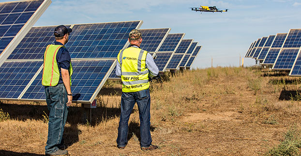
The Topcon Falcon 8 — powered by Ascending Technologies — is designed for inspection and monitoring, as well as survey and mapping applications.
“Along with our exemption for the Sirius fixed-wing system, the Falcon 8 exemption extends the Topcon UAS presence in the rotary-wing solutions market to be an even more powerful resource and provide demonstrations and training,” said Eduardo Falcon, executive vice president and general manager of the Topcon GeoPositioning Solutions Group. “Aerial data collection has a strong future in all the industries we serve, and the possibilities for survey, construction, agricultural, and emerging inspection applications are seemingly limitless.
“Building on the success the Falcon 8 has already seen in Europe, this exemption allows Topcon to expand on that momentum in the U.S. market,” said Falcon.
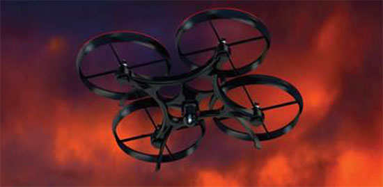
At this year’s Association of the United States Army (AUSA) Annual Meeting, Lockheed Martin unveiled a new capability that will allow users to detect and counter emerging threats from unmanned aerial systems (UAS). The solution, ICARUS, was designed to operate defensively in various threat environments. The AUSA meeting was held Oct. 12-14 in Washington, D.C.
“The U.S. government is seeing an increase in the use of commercially available UAS platforms for surveillance and weaponization,” said Deon Viergutz, vice president of Cyber Solutions for Lockheed Martin. “What Lockheed Martin has developed in ICARUS is a system that can detect, recognize and counteract these systems with pinpoint accuracy.”
Lockheed Martin’s Counter-UAS system has been field tested and demonstrated to several domestic and international customers over the past year. Those tests demonstrated the ability of ICARUS to identify and intercept commercially available unmanned aerial systems.
The development of the ICARUS software system draws on Lockheed Martin’s history of innovations in electronic warfare, cybersecurity and countermeasures associated with sophisticated threats. It was developed through Lockheed Martin internal investment and combines advanced cyber and cyber electromagnetic activity experience with sensor technology and non-kinetic techniques.
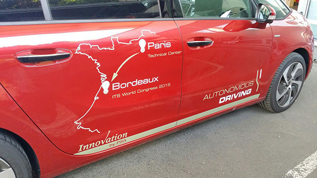
An autonomous Peugeot Citroën has driven itself all the way from Paris to Bordeaux, a distance of 360 miles (580 km). (Credit: PSA Peugeot Citroën)
On Oct. 2 one of PSA Peugeot Citroën’s four autonomous vehicles traveled the motorway from Paris to Bordeaux to take part in Intelligent Transport Systems (ITS) World Congress, which was held Oct. 5–9.
The 580-km trip was completed entirely in autonomous mode without driver involvement. The car autonomously adjusted its speed and changed lanes to overtake, taking into account other vehicles, speed limits and infrastructure.
In July 2015 PSA Peugeot Citroën became the first carmaker to obtain the relevant authorizations to carry out open road tests using four autonomous prototypes and some 15 such models in 2016.
PSA Peugeot Citroën is working to develop solutions and technologies to make the car of tomorrow smarter, the carmaker said, to enhance driver comfort and adapt to changing customer behavior and expectations. Autonomous driving features will help cut the number of accidents linked to human error and reduce driver fatigue in monotonous driving situations. These projects will soon be applied to production models, with the gradual deployment of driverless features.
“The journey made by our prototype today proves that autonomous vehicles are no longer of matter of science fiction. This ushers in a new era for mobility, which I find truly exciting,” said Carlos Tavares, chairman of the managing board of PSA Peugeot Citroën.
At the ITS World Congress PSA Peugeot Citroën presented its car-to-car and car-to-infrastructure communication systems, along with its autonomous vehicle. The systems, which offer a new source of information, use data transmitted by other vehicles and infrastructure to enhance awareness of the vehicle’s surrounding environment. The idea is to improve road user safety by anticipating certain critical situations to reduce the number of accidents.
The Federal Aviation Administration (FAA) has entered into a Pathfinder agreement with CACI International Inc. to evaluate how the company’s technology can help detect Unmanned Aircraft Systems (UAS) in the vicinity of airports.
In testimony today before the House Aviation Subcommittee, FAA Deputy Administrator Mike Whitaker said that flying an unmanned aircraft near a busy airfield poses an unacceptable safety hazard. During the hearing “Ensuring Aviation Safety in the Era of Unmanned Aircraft Systems,” Whitaker told the congressional panel the FAA signed an agreement this week to assess the safety and security capabilities of CACI’s product within a five-mile radius of airports, and the agency also will collaborate with its government partners.
A steep increase in reports of small unmanned aircraft in close proximity to runways is presenting a new challenge for the FAA. It is the agency’s responsibility to identify possible gaps in safety and address them before an incident occurs.
CACI’s prototype UAS sensor detection system will be evaluated at airports selected by the FAA. The agency and its federal government partners will work with the company to evaluate the effectiveness of the technology, while also ensuring that it does not interfere with the safety and security of normal airport operations.
The CACI partnership is part of the larger UAS Pathfinder Program, which the FAA announced in May. Pathfinder is a framework for the agency to work closely with industry to explore the next steps in unmanned aircraft operations beyond those proposed in February in the draft small UAS rule.
“Safety is always the FAA’s top priority, and we are concerned about the increasing number of instances where pilots have reported seeing unmanned aircraft flying nearby,” said Whitaker. “We are looking forward to working with CACI and our interagency partners to identify and evaluate new technologies that could enhance safety for all users of the nation’s airspace.”
“CACI is proud to partner in the FAA’s Pathfinder cooperative research and development agreement to address the escalating Unmanned Aircraft Systems safety challenges that airports are facing nationwide,” said John Mengucci, CACI’s CEO and president of U.S. operations. “The agreement provides a proven way to passively detect, identify, and track UAS — or aerial drones — and their ground-based operators, in order to protect airspace from inadvertent or unlawful misuse of drones near U.S. airports. This CACI-built solution will help ensure a safe, shared airspace while supporting responsible UAS users’ right to operate their aircraft.”