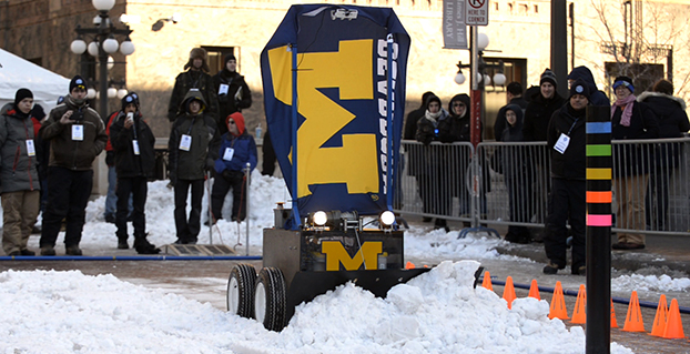
The University of Michigan’s snowplow earned the team $7,000 and a Golden Snow Globe Award. (Photo: Rory Thomas).
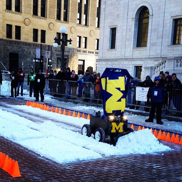
A team from the University of Michigan took home the fifth Institute of Navigation (ION) Satellite Division’s Autonomous Snowplow Competition. The competition was held Jan. 22-25 at Rice Park in downtown Saint Paul, Minn., in conjunction with the 129th Saint Paul Winter Carnival.
Sponsored by The ION Satellite Division and held in cooperation with the ION North Star Section, the ION Annual Autonomous Snowplow Competition is a international event open to college and university students, as well as the general public, that challenges teams to design, build, and operate a fully autonomous snowplow using state of the art navigation and control technologies to rapidly, accurately and safely clear a designated path of snow.
Eight teams participated during the four day competition, each using state of the art navigation systems to plow two different snowfields.
Teams included students, partners from private industry and faculty advisors from Case Western Reserve University; Dunwoody College of Technology; North Dakota State University, University of Calgary, University of Michigan, Dearborn, and The University of Minnesota – Twin Cities.
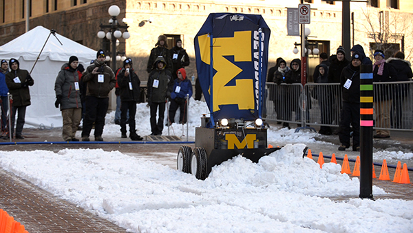
The winning snowplow by the University of Michigan team. (Photo: Kristen Sheikh)
Teams were judged based upon their cumulative scores earned throughout the competition phases: 75% of the total score was based upon the plowing competition; and 25% of the total score was based upon the presentations and pre-event report.
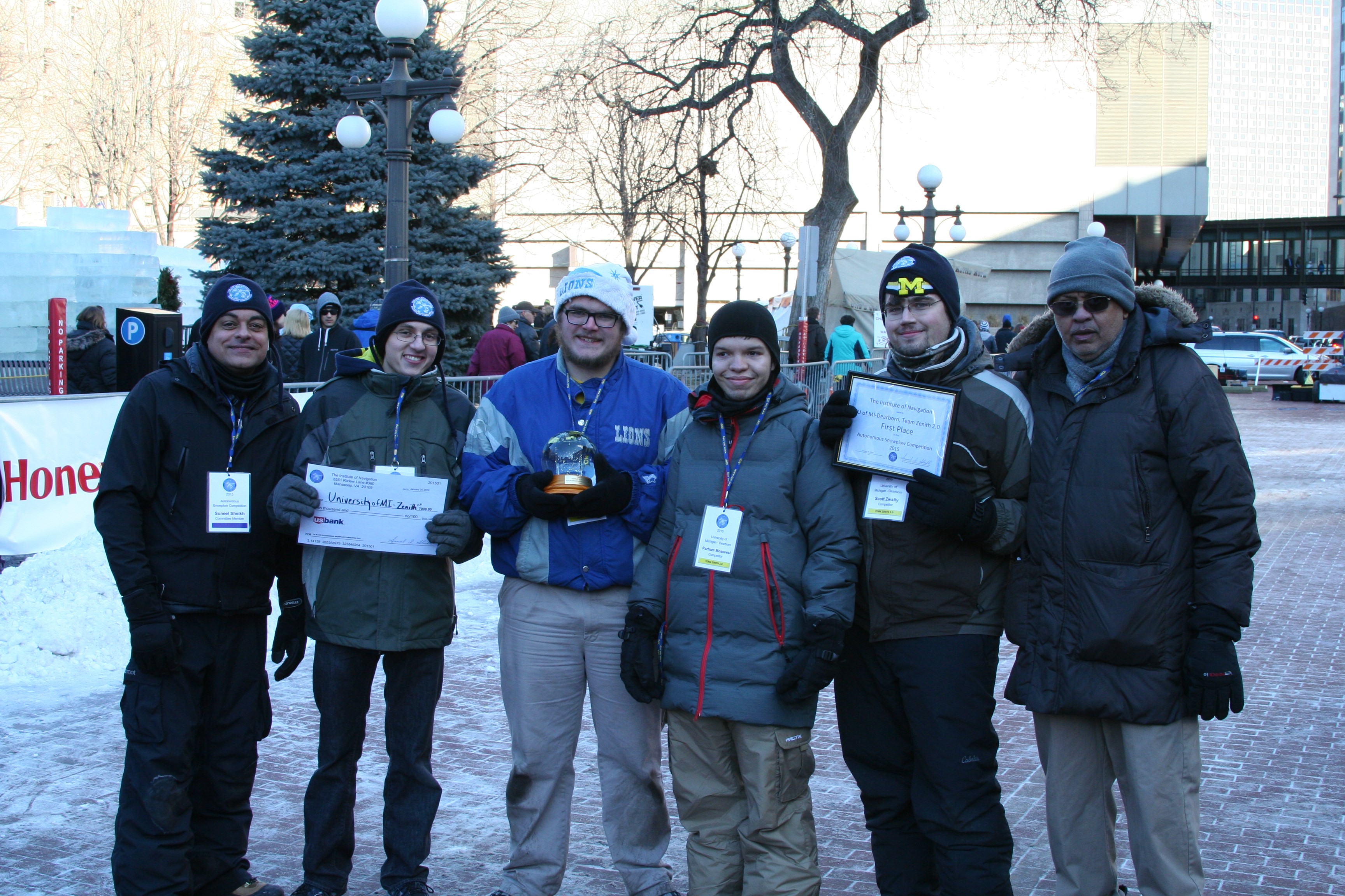
First place was awarded to the University of Michigan, Dearborn’s team “Zenith 2.0.” The first place prize included $7,000 and a Golden Snow Globe Award.
Second place was awarded to the University of Michigan, Dearborn’s team “Yeti 5.0.” The second place prize included $4,000 and a Silver Snow Globe Award.
Third place was awarded to the Dunwoody College of Technology’s team “Snow Devils 01012.” The third place prize included $2,000 and a Bronze Snow Globe Trophy.
In addition, the first place team, University of Michigan, Dearborn, has been invited to display the winning snowplow during ION GNSS+ 2015 conference Sept. 14-18 in Tampa, Florida.
Sponsors of the Fifth Annual ION Autonomous Snowplow Competition included Lockheed Martin Corporation, ASTER Labs, Inc., Honeywell, Inc., Alliant Techsystems Inc. (ATK), UTC Aerospace, US Bank, Space Exploration Technologies Corp. (SPACEX), The Toro Company, John Deere and Company, Proto Labs, Inc., Nuts and Volts Magazine, Servo Magazine, and Achievement Rewards for College Scientists Foundation (ARCS).
The competition received national media attention in addition to considerable local coverage helping to advance the goal of driving innovation for the future of autonomous robots.
The Sixth Annual ION Autonomous Snowplow Competition will be held in January 2016 at the Saint Paul Winter Carnival, St. Paul, Minnesota. For more information, visit www.autosnowplow.com.
inning team from the University of Michigan, Dearborn’s “Zenith 2.0.” From left: Suneel Sheikh, Jason Spurlock, Benjamin Pollatz, Paraham Moassesi, Scott Zwally, Narasimhamurthi (Nattu) Natarajan (team advisor).
The Federal Aviation Administration (FAA) declared today that Super Bowl XLIX will be a “No Drone Zone.”
“Many familiar sounds are associated with the Super Bowl: Cheering fans. Referee whistles. The spectacular halftime show. Booming fireworks,” the FAA wrote. “But one sound you shouldn’t hear is the whirring of an unmanned aircraft overhead. The Super Bowl is strictly a ‘No Drone Zone’.” The restriction applies to University of Phoenix Stadium in Glendale, Arizona, during the game.
The FAA bars unauthorized aircraft — including drones — from flying over or near NFL regular- and post-season football games. The same restriction applies to NCAA college games in stadiums seating 30,000 or more fans, Major League Baseball games and many NASCAR events. Other unauthorized aircraft include airplanes, hang gliders, hot air balloons, and model rockets.
The FAA Notice to Airmen makes it crystal clear that anyone violating the rules may be “intercepted, detained and interviewed” by law enforcement or security personnel. Besides possibly landing a violator in jail, flying an unmanned aircraft over a crowded stadium could result in an FAA civil penalty for “careless and reckless” operation of an aircraft.
The agency also produced a YouTube video with the same message.
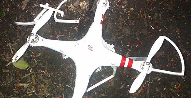
The quadcopter that crashed on the White House lawn. Photo: U.S. Secret Service
A government employee who crashed his friend’s drone on the White House lawn was apparently drinking while droning.
The employee, who works for the National Geospatial-Intelligence Agency (NGA), was questioned Jan. 26 by the Secret Service as the operator of the drone involved in Monday’s incident at the White House. On Monday at 3 a.m., the drone quadcopter crashed on the White House lawn.
The employee contacted authorities, according to the NGA. The employee was off duty and is not involved in work related to drones or unmanned aerial vehicles in any capacity at NGA, the agency said in a statement.
“Even though the employee was using a personal item while off duty, the agency takes the incident very seriously and remains committed to promoting public trust and transparency,” the statement reads.
The Secret Service is investigating the incident.
Firmware to Force No-Fly Zone Compliance
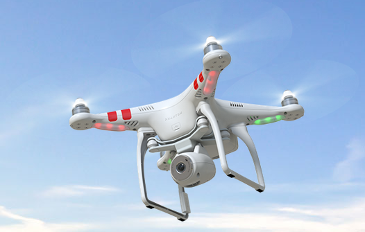
The drone is a Phantom made by Chinese company DJI. The company plans to roll out firmware within days to prevent any of its drones from flying over the D.C. area, in accordance with Federal Aviation Authority guidelines. This will help hobbyists who aren’t aware of or unable to comply with “no-fly zones,” such as the one that covers most of the D.C. area.
Once updated, the DJI drones will not be able to take off from or fly into the nation’s capital or a 15-mile radius around it. GPS technology in the drones will be able to identify the no-fly zone, warn the operator and then stop at the no-fly zone’s border. DJI’s flight software currently prevents flights within a radius of major airports.
“With the unmanned aerial systems community growing on a daily basis, we feel it is important to provide pilots additional tools to help them fly safely and responsibly,” said Michael Perry, DJI’s company spokesperson. “We will continue cooperating with regulators and lawmakers to ensure the skies stay safe and open for innovation.”
The mandatory firmware update is for the Phantom 2, Phantom 2 Vision, and Phantom 2 Vision+ models. It adds a No-Fly Zone centered on downtown Washington, D.C., extending for a 15.5-mile radius in all directions. Phantom pilots in this area will not be able to take off from or fly into this airspace.
“The restriction is part of a planned extension of DJI’s No Fly Zone system that prohibits flight near airports and other locations where flight is restricted by local authorities,” DJI said. “These extended no fly zones will include over 10,000 airports registered with the International Air Transport Association (IATA) and will expand no fly zones to ensure they cover the runways at major international airports.
“DJI is also continuing to update its no-fly zone list in compliance with local regulations to include additional sensitive locations and to prevent flight across national borders. These new safety features will be released across DJI’s flying platforms in the near future.”
Telematics Detroit, the connected car event, has officially changed its name to TU-Automotive Detroit to reflect the paradigm shift in auto mobility. The event will take place June 3-4 at The Suburban Collection Showplace in Detroit.
The name change to TU-Automotive Detroit is intended to reflect how “automakers are evolving from heavy manufacturers into nimble technology companies and the self-driving car is moving from the realms of science fiction onto the reality of our highways. The car as we know it is rapidly changing,” organizers said in a statement.
Experts will provide overviews in three core areas of telematics, mobility and autonomous cars.
“Anticipating the future trends of the automotive industry is exactly what this conference has always been about,” said Justin Parker, project director. “Accordingly, the new angle of the show addresses the headline topics of mobility and autonomous vehicles.”
Key topics:
Telematics – the here and now: Consider the building blocks of the connected car that continue to present challenges and opportunities such as the ultimate user experience, the connected society and the aftermarket. It is these foundations that are paving the way for the future of auto-mobility.
Auto-mobility: The role of the car is changing. From new ownership models to sustainable transportation and smart cities, get to grips with the technology and societal changes that are fundamentally reshaping mobility.
The autonomous car: Sensors, lasers, ADAS and regulators. The end-goal of the self-driving car is an exciting amalgamation of regulatory and technological developments. We’re deep into the journey of the autonomous car and now is the time for the industry to come together to collectively take the next step.
Get the latest updates and information and register for the brochure with full speaker line-up and agenda.
By 2020 a quarter billion connected vehicles will be on the road, enabling new in-vehicle services and automated driving capabilities, according to Gartner, Inc. During the next five years, the proportion of new vehicles equipped with this capability will increase dramatically, making connected cars a major element of the Internet of Things (IoT).
Gartner forecasts that 4.9 billion connected things will be in use in 2015, up 30 percent from 2014, and will reach 25 billion by 2020.
“The connected car is already a reality, and in-vehicle wireless connectivity is rapidly expanding from luxury models and premium brands to high-volume midmarket models,” said James F. Hines, research director at Gartner. “The increased consumption and creation of digital content within the vehicle will drive the need for more sophisticated infotainment systems, creating opportunities for application processors, graphics accelerators, displays and human-machine interface technologies. At the same time, new concepts of mobility and vehicle usage will lead to new business models and expansion of alternatives to car ownership, especially in urban environments.”
Gartner forecasts that about one in five vehicles on the road worldwide will have some form of wireless network connection by 2020, amounting to more than 250 million connected vehicles. The proliferation of vehicle connectivity will have implications across the major functional areas of telematics, automated driving, infotainment and mobility services.
The House Science, Space, and Technology Committee held a hearing Jan. 21 on the integration of commercial unmanned aerial vehicles in United States airspace. Colin Guinn, senior vice president of sales for 3D Robotics, demonstrated the Parrot Bebop drone during his testimony.
C-SPAN aired the event, as reported by the National Journal. Congress has tasked the Federal Aviation Administration with readying airspace for the integration of commercial drones. Drones are currently prohibited for use, but the FAA has granted a growing number of exemptions for certain industries, including an exemption to GNSS company Trimble for its UX5 drone.
Also, earlier this month, CNN signed a research agreement with regulators to test drone systems for news-gathering purposes.
This year’s CES featured the usual big TV screens, loudspeakers, wearables, 3D printers, drones and connected vehicles surrounded by 150,000 attendees over several Las Vegas meeting venues. What was interesting was the continued rise of autonomous, or self-driving, vehicles and platforms. Lost in all of the noise was a small, but important, location-based services enclave that consisted of GPS-enabled wearables and indoor positioning.
LAS VEGAS—A big chunk of the estimated 30 billion worldwide connected devices will be those linked to vehicles, say industry experts at the International Consumer Electronics Show here. Nearly all automakers had a presence at CES — all with a long-term connected vehicle strategy.
No matter how big and exhausting CES is, with long taxi lines and 150,000 attendees, there is good reason to come a day before the giant conference, as the Consumer Telematics Show and AT&T Developer’s Conference feature many industry executives and new developments. At the Consumer Telematics Show, speakers explained how and why connected vehicles are transitioning to autonomous capability.
The connected car industry has matured to the point where technology and market points are coming together, said Thilo Koslowski, Gartner vice president and practice leader, automotive vehicle ICT mobility, at CTS. “The opportunity of connected vehicles are becoming the center of mobile and [Internet of Things] innovations. It has come from, in 1997, a pure telematics safety and security device to vehicle integration, digital lifestyle convergence and Internet of cars,” he said. “At the end of the year, there will be 25 million connected vehicles in the world, but most in mature markets. That might not look like a lot, but only in five more years, I think that number is going to 150 million vehicles.”
In some cases, the newer outfitted vehicles will have only safety and security features, Koslowski said, but most will have two-way data communication, part of the 30 billion devices connected by 2020. He predicted last year that most automakers would have shifted general mobile applications to vehicle and customer-specific services.
Koslowski says the top connected car features that consumers have asked for include automated map updates, real-time weather and news, parking spot finder and driving assessment and coaching. “Consumers don’t want application downloads directly into the car. In addition, in-vehicle media purchases are not there yet, as are in-vehicle social networking updates,” he said. “I predicted in 2013 that 25 percent of the automakers would monetize mobile commerce transactions in their connected vehicle offerings such as parking, buying gas, etc.,” he said.
Self-Aware Vehicle Emergence
Imagine sleeping, or reading, in your car during the morning commute. It may be a reality, but major technical, cultural and legal issues need to be resolved before fully autonomous vehicles hit the road. “There is going to be trouble if [automakers] don’t get consumers involved early on. Or allow governments and insurance companies telling people when to hit the button (to drive),” Koslowski said. “You press the [drive yourself] button and you pay 30 percent more in insurance. About 39 percent of those we surveyed are interested in some sort of self-driving car — that doesn’t mean fully autonomous vehicles. But 61 percent say they are not ready.”
Koslowski says there is a lot of education that includes basic acceptance of the technology and trust that it really works. “There usually is a 30-second rule. The first 30 seconds is ‘holy moly, this thing drives itself’,” he said. “The second 30 seconds is ‘is this beneficial?’ There are real benefits such as reducing the cost of accidents, which amount to $900 per U.S. citizen.”
In terms of cyber security and privacy, Koslowski said it’s a big deal for autonomous vehicles. “A couple of breaches will be a big deal. Still, consumers are not that paranoid. They are willing to share information, especially if there is a monetary or societal function,” he said.
Cost is still big factor that will drive the adoption of autonomous vehicles. Koslowski says that consumers polled will only pay an additional $1,404 for autonomous capability. The cost of a test vehicle, right now, is about $85,000. “The good news is that number is coming down. It is shrinking to less than $6,595,” he said.
At the Transportation Research Board meeting a week after CES in Washington, Chris Urmson, who heads Google’s self-driving vehicle program, said the Kentucky Fried Chicken bucket-looking gizmo on top of their car cost $70,000 alone.
Cost aside, by 2016, three automakers will have concrete plans for upcoming autonomous vehicle launches, Koslowski said. “This is happening a lot faster from a technology standpoint than experts thought it would,” he said.
Overall, Koslowski said that big IT companies need to step up to make autonomous vehicles work. “Governments are a little behind. The slowness of automotive companies also make them vulnerable to technology companies to step in and take over the industry,” he said.
Indoor Positioning and Other Location Markets at CES
Such companies as CSR were at CES and said the show was good for indoor location providers. “CES was good for us. We had good interest in our live demo of indoor location where customers were free to walk around testing the performance of our (solution). We also saw a lot of interest from the automotive market for an indoor/outdoor navigation (product), such as being able to find your way back to the car in a complex shopping mall and the best place to park for access to your indoor destination,” said Dave Huntingford, CSR’s director of product line for location.
In 2015, the company believes that one of the key drivers for indoor location will be the ubiquity of maps for public locations, Huntingford said. “The availability of indoor maps for malls, airports and retail chains will help drive indoor location awareness with consumers for both utility value (not getting lost) and retail marketing applications,” he said. “We also expect to see a variety of social networking applications supporting indoor location, reflecting the fact that we spend the vast majority of time indoors.”
Huntingford believes a key limitation of many indoor technologies is the requirement to have dedicated, or upgraded, infrastructure such as BT Smart beacons or updated Wi-Fi access points with new location capabilities, and a dedicated manual survey of the building to measure indoor Wi-Fi signatures.
At CES, Magellan rolled out its line of 5-inch RoadMate Auto GPS Devices with 3D buildings and landmarks. “The units retail from $169 to $229. “We are surprised at the interest our PNDs are having in the market, particularly with back-up video,” said William Strand, Magellan associate director, product marketing. “The dash camera is a small market, but catching on to block insurance fraud.”
In other CES news:
Audi pulled off a coup when it invited journalists to drive with its autonomous vehicle from San Francisco to Las Vegas.
Most location companies have wearables product lines that are making retail chains take notice.
Transportation Research Board Meeting Becoming Big Autonomous Show
WASHINGTON—The Transportation Research Board Annual Meeting here has grown to be one of the bigger autonomous vehicle meetings, with 12,000 mainly government execs and academics meeting.
About 300 people showed up for a panel headlined by Chris Urmson, who heads up Google’s autonomous vehicle program. All was well and good hearing about Google’s self-driving vehicle technology except TRB had 100 chairs for 300 attendees…a lot of people left. But that is the level of interest autonomous vehicle is having in the government and academic community.
“We are planning to find out how our car does with red lights flashing in front of it. The software will figure out, along with GPS and insertional and high-resolution maps,” Urmson said. “The world isn’t empty. Our vehicle has to know about the pick-up making a lane change, the bicyclist pedaling next to it.”
Urmson said there are no sensors on the market that power the car — Google makes them in-house.
In other TRB news, TomTom announced it is partnering with the I-95 Corridor Coalition. The company is using one of three main real-time traffic products in its portfolio, said Nick Cohn, TomTom senior business developer. “It is all about our TomTom Traffic Flow product, which provides speed information for individual road segments every minute, based on our mix of probe data sources,” he said. “This is one of three main real-time traffic products we have. TomTom Traffic provides one-minute updates of locations and delays of traffic jams and other traffic incidents. The third product is a set of APIs for providing, for example, travel times that can be displayed on variable message signs along roadways to inform drivers about delays.”
The government market is a steady business for TomTom, which has seen traffic management success mainly in European cities such as Berlin, Rome and London, Cohn said.
CNN has entered into a Cooperative Research and Development Agreement (CRDA) with the Federal Aviation Administration to advance efforts to integrate unmanned aerial vehicles (UAVs) into newsgathering and reporting.
The cooperation arrangement will integrate efforts from CNN’s existing research partnership with the Georgia Tech Research Institute (GTRI). Coordination between and among CNN, GTRI and the FAA has already begun. The FAA will use data collected from this initiative to formulate a framework for various types of UAVs to be safely integrated into newsgathering operations.
“Our aim is to get beyond hobby-grade equipment and to establish what options are available and workable to produce high quality video journalism using various types of UAVs and camera setups,” said CNN Senior Vice President David Vigilante. “Our hope is that these efforts contribute to the development of a vibrant ecosystem where operators of various types and sizes can safely operate in the US airspace.”
“Unmanned aircraft offer news organizations significant opportunities,” said FAA Administrator Michael Huerta. “We hope this agreement with CNN and the work we are doing with other news organizations and associations will help safely integrate unmanned newsgathering technology and operating procedures into the National Airspace System.”
We’ve all been waiting with bated breath for the Federal Aviation Administration (FAA) to release its long-awaited regulations to enable safe operation of unmanned aircraft systems (UAS) in United States airspace. Well, probably only a small subset of us actually have been anxiously awaiting these FAA rules, but with the increasing visibility of even small UAS on TV, most of us have probably given these things some passing thought.
If you didn’t already know, the FAA has been mandated by Congress to integrate UAS into the National Airspace System (NAS) by September 30 of this year.
I’ve been following what’s been going on quite intently as far as FAA regulations for UAS. For the most part, the FAA has been making noises that it has not been able to maintain the planned schedule to achieve this objective. The UAS industry — and GNSS is a major component for that industry — has been quite disappointed by the FAA’s progress and has made quite a deal about the delays and lack of concrete results. So, for me, it seemed to be a good sign when the FAA recently started to issue restricted exemptions from its existing rules for regular manned aircraft, which may allow people to legally use UAS, for:
TV and movie making (7 exemptions),
Construction site monitoring (1 exemption)
Precision aerial surveys (3 exemption granted to Trimble and Woopert Inc.)
Flare stack inspections on 14 Shell Oil Gulf of Mexico production platforms (1 exemption)
Aerial video to augment real-estate listings (1 exemption)
Photogrammetry and crop surveying for precision agriculture (1 exemption)
As of January 9, that’s the list, but — given that the FAA has found this way to move forward on an individual basis to allow commercial UAS use — it’s quite likely there may be more. I pulled up these exemptions on the FAA unmanned aircraft systems site, which lists exemptions granted so far and explains the Section 333 regulation under which the FAA has chosen to proceed.
It seems the exemptions are being done now because the overarching regulations to integrate small UAS (sUAS) into routine NAS operations have still not made it out of the FAA barn — even following several years now since it was due to emerge. It’s once again scheduled for release for comment “later this year.” The FAA site goes on to say,
Section 333, “Special Rules for Certain Unmanned Aircraft Systems,” provides flexibility for authorizing safe civil operations in the NAS by granting the Secretary of Transportation the authority to determine whether airworthiness certification is required for a UAS to operate in the NAS.
The FAA regulations that govern today’s aircraft are found in Title 14 of the Code of Federal Regulations (14 CFR). There are 68 regulations organized into three volumes. A fourth volume deals with the Department of Transportation, and a fifth volume is focused on NASA.
Three primary regulations govern the airworthiness of an aircraft.
The “Big Three” are:
14 CFR Part 21 — Certification Procedures for Products and Parts
14 CFR Part 43 — Maintenance, Preventive Maintenance, Rebuilding, and Alterations
14 CFR Part 91 — General Operating and Flight Rules
These contain massive volumes of rules and regulations that govern everything from markings on the outside of the air vehicle, when and how often maintenance should be performed and even the parts to be used, all the way up to the qualifications needed by pilots for General Aviation and Commercial Transport aircraft operation.
Exemption No. 11138 has been granted to Realtor Douglas Trudeau of Tierra Antigua Realty in Arizona. Most people have come across real-estate promotional stuff, maybe house-hunted using websites with lots of pictures of houses and sometimes videos, so this might be a good example that most people can relate to for using a UAS.
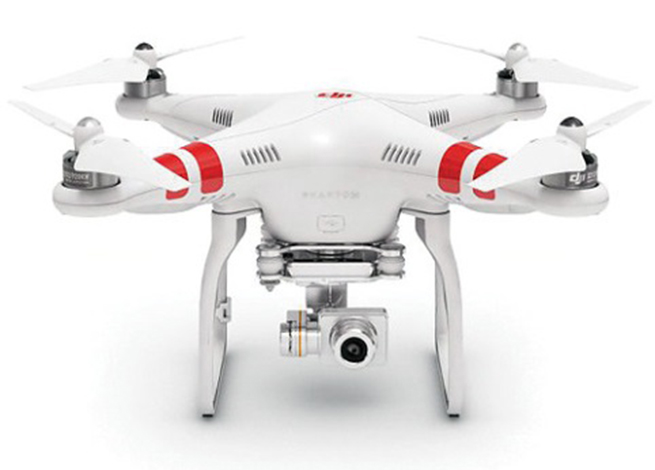
Phantom 2 Vision+ quadcopter UAS.
Realtor Douglas Trudeau.
Let’s look at what Trudeau has done to get his exemption and what he needs to do to use his three-pound Phantom 2 Vision+ quadcopter UAS, equipped with a lightweight video camera, to take real-estate pictures and videos.
First of all, he applied to the FAA unmanned aircraft systems office for an exemption. This involved picking through 14 CFR Part 21 regulations and looking for specific sections that he asked be waived so he could fly his UAV.
The exemption first lays out in detail the regulations from which Trudeau requested relief. Then it summarizes the information he supplied, including:
Details of the Phantom 2 Vision+: a three-pound quadcopter with four rotors driven by electric motors, battery powered. Maximum speed, 30 knots.
Area of proposed operation is near Tucson for real-estate listing videos.
Proposed operation in reasonably safe and in controlled places away from power lines, street lights, airports and actively populated areas, and there will be extensive preflight inspections where safety is of primary importance.
Proposed that aircraft certification requirements be waived.
Indicated that 2-6 inch markings on the UAV would be impractical.
Requested that regular aircraft maintenance be waived in lieu of preflight checks.
Indicated that while private pilots are prohibited from commercial operations, he can safely operate a UAV (no passengers or crew), that a pilot’s license will not ensure the skills necessary to fly a UAV, and the risks are much lower. Nevertheless, Trudeau did make an application for a 120-day temporary airman certificate to give him time to get a private pilot’s license.
Indicated that he’s already flown lots of practice flights in remote areas in different weather conditions.
Propose a safety/flight manual be with the UAS ground station rather than on the UAV.
Use of GPS with a barometric sensor rather than a standard aircraft altimeter.
That regular aircraft fuel reserve levels don’t apply to a battery-powered UAV.
Trudeau also proposed a number of restrictions on how he would operate the UAV:
Operations would be below 300 feet and within 1,000 feet of the controller to maintain direct line of sight and only 3-7 minutes per flight.
Land whenever there was low battery power.
Use the GPS flight safety feature whereby the UAV hovers and then slowly lands in the event of radio-control link failure.
Post pedestrian warning signs and continuously improve his own safety protocols.
Inform local airports — if within 5 miles — of estimated flight time, duration, elevation and other pertinent information.
Always obtain all necessary permissions prior to operation.
Have procedures to abort flights if there are safety breaches or any potential danger.
The FAA posted Trudeau’s application for waivers on the Federal Register asking for comments, and got five responses — two in support and three raising concerns, one of which opposed the idea. The trade associations that responded were the Air Line Pilots Association International (ALPA), the National Agricultural Aviation Association (NAAA), the United States Hang Gliding & Paragliding Association (USHPA) and another group, the Small UAV Coalition.
ALPA felt that UAS operators should be required to have a commercial pilots’ license. NAAA and USHPA had similar concerns about operator licensing. The Small UAV Coalition disagreed on pilot licensing for small UAVs. NAAA had concerns about low-level operations that may conflict with crop-spraying operations.
There were also a number of concerns about how this UAS would be operated and potential safety issues. The FAA agreed with these issues and has added a number of restrictions within the exemption, including the use of a visual observer, that the pilot be a current FAA certificated private pilot, and that a notice-to-airmen (NOTAM) be issued prior to operations.
The Small UAV Coalition supported Trudeau’s petition, suggesting that the FAA apply regulations differently to small UAVs rather than those of air transport/general aviation, rather than include all seven key factors — beyond visual line of sight (VLOS), weight, size, altitude, airspace, geographic area, and proposed technology — and consider Trudeau’s safety protocols, including his posting of warning signs, to enable operations in populated areas.
The Small UAV Coalition proposed that the FAA’s safety evaluation of UAV operations should not hinge on the type of operation (public, commercial, recreational or philanthropic) rather the operational risks and steps to eliminate or reduce risks. The coalition also commended Trudeau for his “Personal Protocols and Controls” document that details how he will contact any airport within 5 miles of proposed UAV operations.
In the end, the FAA granted Exemption No. 11138 with an additional 35 restrictions. Here’s a brief summary of those restrictions:
The exemption only applies to Trudeau’s Phantom 2 Vision+ UAS.
Indicated airspeed not to exceed 30 knots.
Altitude not to exceed 300 feet above ground level (AGL).
Operation always within visual line of sight (VLOS) of the Pilot In Command (PIC).
There must also be a visual observer (VO), who is in direct contact with the operator.
Trudeau has to have all the documentation and paperwork with him during operations, presumably so they can be reviewed by FAA personnel. If he makes any changes, he has to include updates in the paperwork.
Prior to flight, he must inspect the UAS to ensure it’s OK for safe flight. Any maintenance or changes to the vehicle must be documented in the aircraft records.
Record any alterations or any maintenance, and there must be a recorded test flight.
Pre-flight records must be made of inoperable components, items or equipment.
The operator must follow the UAS manufacturer’s aircraft/component, maintenance, overhaul, replacement, inspection and life limit requirements.
Maintenance, inspection and alterations must be noted in the aircraft records, including total flight hours, description of work accomplished, and the signature of the authorized person returning the UAS to service.
The UAS operated must comply with all manufacturer Safety Bulletins.
Any corrective action to fix discrepancies found between inspections must be recorded.
The operator must have at least a private pilot certificate and at least a current third-class medical certificate, and meet the required flight review requirements in an aircraft in which he’s rated.
He has to log 25 hours operating a rotorcraft UAS, and 10 hours with a multirotor UAS, before flying to make any real-estate videos.
He has to log 5 hours operating this make of UAS, and make three take-offs and landings in the preceding 90 days.
He has to demonstrate he can safely operate the UAS, including making evasive and emergency maneuvers and maintaining appropriate distances from people, vessels, vehicles and structures.
The UAS can only be operated during daylight in acceptable visual conditions.
The UAS cannot be operated within 5 nautical miles of an airport.
The UAS cannot be operated less than 500 feet below or less than 2,000 feet horizontally from a cloud or when visibility is less than 3 miles.
If the UAS loses communications or loses GPS signal, it must return to a pre-determined location within the planned operating area and land or be otherwise recovered.
The flight must be aborted in the event of unpredicted obstacles or emergencies.
A flight cannot be started unless (considering wind and forecast weather conditions) there is enough power to fly and land as intended and still have 30% battery power left.
Trudeau has to obtain a Certificate of Waiver or Authorization (COA) prior to conducting any operations under this grant of exemption. This COA will also require him to request a Notice to Airman (NOTAM) not more than 72 hours in advance, but not less than 48 hours prior to the operation.
He has to mark the UAV with a regular aircraft N-Number, which can be as large as practicable.
The radio control link has to comply with Federal Communications Commission (FCC) requirements.
The required documents must be available at the UAS Ground Control Station any time the UAS is operating, and must be made available to the FAA or any law enforcement official upon request.
The UA must remain clear and yield the right of way to all manned aviation operations and activities at all times.
The UAS may not be operated from any moving device or vehicle.
The UAS may not be operated over congested or densely populated areas.
Flight operations can only be 500 feet away from any people vessels, vehicles and structures, unless protective barriers are in place. If anyone or thing penetrates this protection zone, operations must be terminated. Property owners must approve operations, and there first has to be a safety assessment to ensure there is no “undue hazard.”
Each flight operation must be conducted over private or controlled-access property with the permission of the land owner/controller.
Any incident, accident or flight operation that goes outside operational boundaries of the area of the approved COA must be reported to the FAA’s UAS Integration Office within 24 hours. Accidents must be reported to the National Transportation Safety Board (NTSB).
Otherwise, his operations must comply with all applicable parts of 14 CFR — the full set of requirements for owning and operating a regular aircraft.
Quite a list, admittedly with quite a bit of repetition, but in all, Trudeau probably has his work cut out to cope with getting a private pilot’s license, not operating within 5 miles of an airport (since his area is right next door to one), and not fly over densely populated areas (since most real-estate is in suburbs with people, streets and houses everywhere). These seem to be the major impediments to what he wants to do.
When I talked with him, I found him unfazed by all this, and he is moving down the list, satisfying the requirements — he’s already got a pilot in training who’s done his three take-offs and landings and is accumulating operating hours, with Doug Trudeau the Visual Observer. He has a binder ready to carry around all the documentation, and applying for his first COA is the next step.
Doug Trudeau training with his Phantom 2. Photo: Phantom
Meanwhile, in California, a lawyer named Dana Hobart has been asking some good questions and got a piece published in the Los Angeles Daily Journal, “Recreational Drones are Facing More FAA Headwinds.”
Hobart argues that since 1981, anyone flying a model recreational aircraft has been exempted from FAA regulations. He says that the small consumer drones currently on the market fall within the FAA’s model-aircraft exemption. For these model aircraft, the FAA only encourages users to voluntarily stay away from populated areas and airports, avoid flying near full-scale aircraft, and fly below an altitude of 400 feet. It’s unclear if model aircraft can be flown for money, such as taking videos of real-estate to help sell houses.
But Hobart goes on to stress that recent incidents where UAVs may have tangled with commercial aircraft likely means that the days of unregulated recreational aircraft are coming to a close. Indeed, the NTSB ruled that a drone is an “aircraft” and the FAA has full authority to regulate all aircraft, whether or not it is “manned or unmanned, large or small.”
With a half million drones already sold in the U.S. over the past three years, and many more in the pipeline for purchase at a rapidly increasing rate, its possible that recreational UAS use might outstrip that of commercial “for money” applications.
I’ve also heard in the past that with this volume of vehicles coming into frequent use, the FAA risks losing all control of small UAS (sUAS) unless it quickly publishes regulations. Unfortunately, the FAA continues to delay release of appropriate sUAS rules — delays that are now being counted in years rather than months or weeks — while the urgency of the situation seems to be growing daily.
Hobart gave me something to think about when he compared a motorcycle with a small UAV — in terms of the “limited damage” that either could cause to others and to property. They do seem to be similar in damage-causing capability — in fact, a motorcycle might make pretty big holes in things because it’s pretty heavy and can go pretty fast! In the case of a motorcycle, we allow people to take a two-day intensive course on safety and operation, and then turn them loose on our roads and highways. Before things get totally out of control, something similar for sUAS operators might be in order.
The FAA indeed may be moving in this direction when it began collaborating with the Association for Unmanned Vehicle Systems International (AUVSI), Academy of Model Aeronautics (AMA) and the Small UAV Coalition, who represent the vast majority of UAS users and manufacturers, on the “Know Before You Fly” UAS Safety Campaign. These organizations hope that the campaign will help ensure the safety of the skies for all aircraft, both manned and unmanned. It would be good to see a formal UAS operator qualification program come out of this.
So if you bought your kids a radio-controlled helicopter for Christmas and have been out in the backyard flying it — look out! It’s now a recreational drone and woe betide you if it had a camera and you were taking video of your house. You may need an Exemption if you give your kids an allowance and encourage them to gain skills flying their toy.
Probably not a good example, really, but this particular Exemption does seem to have gone a little over the top.
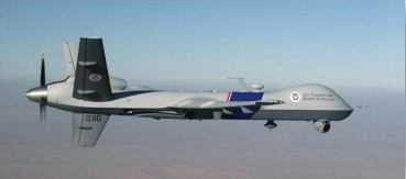
The CBP’s unmanned aerial program includes the Predator B aircraft, as well as ground control stations, pilots, sensor operators, video cameras, land and maritime radar, and communication equipment. (CBP Photo)
A new report by the Department of Homeland Security’s Inspector General’s office finds that use of unmanned aerial drones to patrol the U.S./Mexico border is not effective. The Customs and Border Protection’s (CBP) Unmanned Aircraft System program has been in operation for eight years.
Problems include a lack of performance measures and sky-high operational costs, according to the report, which was issued January 6. “Specifically, the unmanned aircraft are not meeting flight hour goals, and we found little or no evidence CBP has met its program expectations,” the report said. “We estimate it costs $12,255 per flight hour to operate the program; CBP’s calculation of $2,468 per flight hour does not include all operating costs.”
The $443 million CBP plans to spend on program expansion could be put to better use by using alternative technologies, the IG concluded.
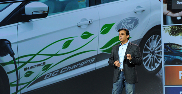
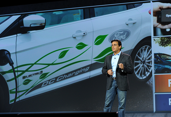
Mark Fields, President and CEO, Ford Motor Company, delivers the opening keynote address at the 2015 International CES. (Photo by: Sam VarnHagen/Ford)
Ford Motor Company highlighted the semi-autonomous vehicles it has on the road today and fully autonomous vehicles now in development at the 2015 Consumer Electronics Show in Las Vegas this week.
“We’re already manufacturing and selling semi-autonomous vehicles that use software and sensors to steer into both parallel and perpendicular parking spaces, adjust speed based on traffic flow or apply the brakes in an emergency,” said Raj Nair, Ford chief technical officer and group vice president, Global Product Development. “There will be a Ford autonomous vehicle in the future, and we take putting one on the road very seriously.”
Ford’s semi-autonomous vehicle features available today include lane-keeping assist, adaptive cruise control, Pre-Collision Assist with Pedestrian Detection and active park assist — with Traffic Jam Assist coming.
A fully autonomous Ford Fusion Hybrid research vehicle is undergoing road testing. The vehicle uses the same semi-autonomous technology in Ford vehicles today, while adding four LiDAR sensors to generate a real-time 3D map of the surrounding environment.
The vehicle can sense objects around it using the LiDAR sensors, and uses advanced algorithms to help it learn to predict where vehicles and pedestrians might move.
“Our priority is not in making marketing claims or being in a race for the first autonomous car on the road,” Fields said. “Our priority is in making the first Ford autonomous vehicle accessible to the masses and truly enhancing customers’ lives.”
Ford Smart Mobility
The automaker also laid out its Ford Smart Mobility plan for connectivity, mobility, autonomous vehicles, the customer experience and big data. Included are 25 experiments set for this year — eight in North America, nine in Europe and Africa, seven in Asia and one in South America.
Each experiment is designed to anticipate what customers will want and need in tomorrow’s transportation ecosystem. “We see a world where vehicles talk to one another, drivers and vehicles communicate with the city infrastructure to relieve congestion, and people routinely share vehicles or multiple forms of transportation for their daily commute,”said Ford President and CEO Mark Fields. “The experiments we’re undertaking today will lead to an all-new model of transportation and mobility within the next 10 years and beyond.”
The 25 experiments address four global megatrends — explosive population growth, an expanding middle class, air quality and public health concerns, and changing customer attitudes and priorities — challenging today’s transportation model and limiting personal mobility, especially in urban areas.
Fourteen of the 25 experiments are Ford-led research projects, and 11 are part of the company’s Innovate Mobility Challenge Series. The experiments include:
With the Innovate Mobility Challenge Series, Ford invited innovators and developers around the world to create solutions for specific mobility challenges in North America and South America, Portugal, Africa, India, China, England and Australia. Challenges included finding technology solutions to identify open parking spaces in urban areas, better ways to navigate crowded cities and the use of navigation and other tools to help people gain access to medical care in remote areas.
SYNC 3
Also at CES, Ford is demonstrating SYNC 3, the company’s new communications and entertainment system that is faster, more intuitive and easier to use with enhanced response to driver commands. SYNC 3 has more conversational speech recognition technology, a more smartphone-like touch screen and easy-to-read graphics to help drivers connect and control their smartphone while on the road.
The next-generation system builds on the capability of SYNC technology already in more than 10 million vehicles on the road globally. SYNC 3 begins arriving on new vehicles this year.
“Ford is delivering an easier way for customers to stay connected,” said Nair. “SYNC 3 is another step forward in delivering connectivity features customers most want, and they tell us this kind of technology is an important part of their decision to buy our vehicles.”
“Even as we showcase connected cars and share our plans for autonomous vehicles, we are here at CES with a higher purpose,” Fields said. “We are driving innovation in every part of our business to be both a product and mobility company — and, ultimately, to change the way the world moves just as our founder Henry Ford did 111 years ago.”
The Hobbico ORA, a new drone system for aerial photographers, is being demonstrated at the 2015 International CES, running January 6-9 in Las Vegas. The camera-equipped drone displays captured aerial images on a seven-inch touchscreen integrated into the transceiver. With a 370-mm diameter and an onboard 1080p HD camera, the ORA also delivers high-quality images, reliability and long range through its recording method and choice of radio frequencies.
Designed for taking aerial views of action sports, outdoor weddings, real estate, vacation vistas and more, the ORA delivers out-of-the-box aerial photo and video capture with no need for radio-control piloting experience. All images are recorded on an SD card built into the drone, providing higher resolution than systems that use the transceiver for data capture, Hobbico said. Use of the 5.8-GHz radio band instead of the typical 2.-4GHz or Wi-Fi ensures a robust connection and a 500-meter flight control and video signal range.
The seven-inch first-person view touchscreen built into the ORA transceiver displays what the UAV’s onboard camera sees in real time, eliminating the need to use a cell phone, tablet or other third-party device to view captured images. Users can frame scenes exactly as they want them filmed by remotely controlling the camera gimbal. One-, two- and three-axis gimbal options are available, each designed also to accept GoPro cameras.
The transceiver has an integrated Android device for programming ORA functions through the touchscreen. A separate OLED telemetry screen displays flight data such as GPS coordinates, altitude and battery power status.
Other highlights include:
30 minutes of flight time per battery charge
Built-in GPS programming that puts flight routes, speed and altitude on auto-pilot
Support for 32 separate GPS waypoints to execute complex flight patterns
The ability to hold a steady altitude and position via GPS to film desired scenes
The option to save coordinates and fly the identical path again any number of times.
Selecting “Return to Home” brings the ORA back to its pilot with a single command. An “Actual Direction” option prevents control reversal confusion during manual flight — when activated, the quad always moves in the same direction as the control sticks. Additional failsafe systems watch for dangers such as low-battery power and automatically bring the ORA and camera home for safe landing.
The Hobbico ORA is scheduled for early 2015 release at an MSRP of $1,500-$2,000 depending on the battery, gimbal and camera configuration. The package will include the drone, 10-channel touchscreen transceiver, gimbal, batteries and charger.
The drone is on display at CES Booth #25214 in the Unmanned Systems Marketplace at the Las Vegas Convention Center’s South Hall 2.