Tag: autonomous vehicles

  • Sprint launches Curiosity IoT precision mapping system with Mapbox

    Sprint launches Curiosity IoT precision mapping system with Mapbox

    Advanced AI, robotics and autonomous vehicle services on Sprint’s dedicated IoT network will adapt to the real world using highly accurate, detailed and constantly refreshed maps.

    Sprint and Mapbox are launching precision mapping technology with Curiosity IoT, allowing automated services that run on Sprint’s dedicated internet of things (IoT) network to move around the ever-changing world with pinpoint accuracy.

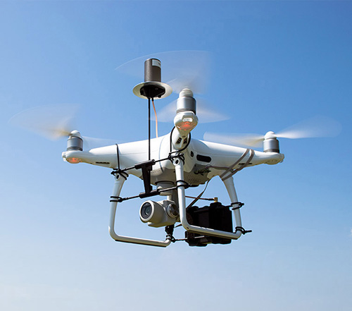
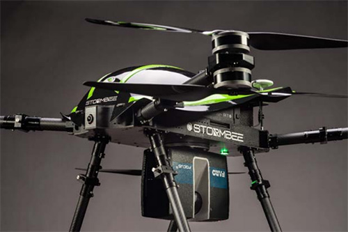
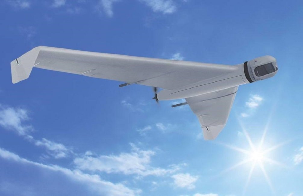
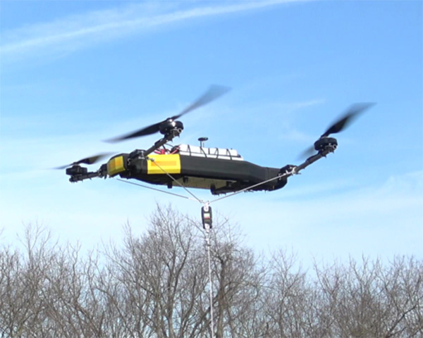
    Smart machines, from drones to autonomous delivery carts, will be able to make fast location and routing decisions using highly detailed, accurate maps that are updated as the environment changes.

    Sprint made the announcement this week at the Consumer Electronics Show being held in Las Vegas.

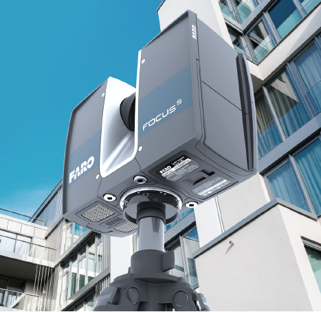
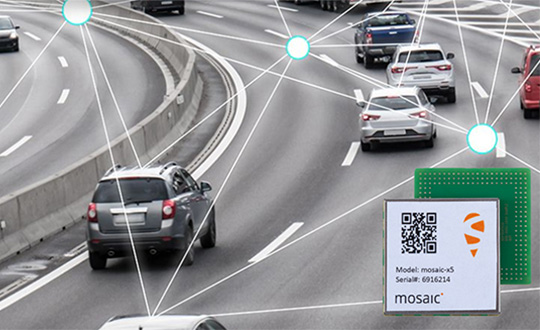
    High Accuracy and Precise Detail with Live Maps. Mapbox offers what it calls a “live map”, a map built not from traditional data surveys months or years before, but from data collected from hundreds of millions of location-enabled sensors that feed back information about the world in real time.

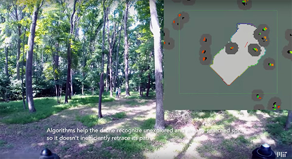
    Mapbox uses artificial intelligence (AI) to turn those massive data flows into a picture of real time transit paths that can be used for precise, up-to-date routing.

    Image: Mapbox
    Image: Mapbox

    Through its relationship with Sprint, Mapbox will leverage the inherent advantages of Curiosity IoT with 5G to take mapping to the next level. The network’s extreme bandwidth and low latency will allow Mapbox to collect higher volumes of richer data from the sensors, including high resolution video.

    That data can be processed to identify and detect changes in the physical environment. Those changes are then incorporated into updated maps which can be distributed at scale to a wide variety of smart machines. The result is more accurate, more up-to-date maps that reflect the world in real time.

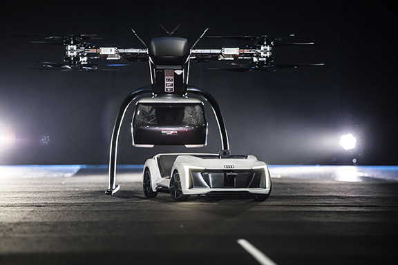
    “Smart machine-based services need to be able to make immediate mobility decisions similar to the way a driver might react to construction, traffic or other obstacles on a street,” said Ivo Rook, senior vice president, IoT and product development at Sprint. “The launch of Mapbox’s precision mapping technology allows all intelligent machines to move at a level of precision never seen before. Our fully dedicated Curiosity IoT network and operating system — soon to be powered by Sprint’s mobile 5G connectivity makes this possible. From autonomous vehicles to advanced AI-based machines, precision mapping is a big step forward in making smart service models a reality for the immediate economy.”

    “As maps guide new smart machines on IoT networks, you remove the human in the middle that used to compensate for differences between the map and the real world. Precision mapping services need to reflect the world as it is, at that precise moment so that those smart machines can travel safely and efficiently,” said Eric Gundersen, CEO of Mapbox. “Sprint’s Curiosity IoT network with mobile 5G provides platform services that make that real with high bandwidth, edge computing for object detection and data processing and super low latency.”

    Curiosity IoT with 5G. Sprint 5G and Curiosity will create the new standard in IoT which features device data intelligence, over-the-air device management and chip-to-cloud security, the companies said.

    When coupled with Sprint mobile 5G technology, Curiosity IoT’s dedicated, distributed and virtualized IoT core network is capable of supporting artificial intelligence, robotics, edge computing, autonomous vehicles and other IoT systems requiring extreme low-latency and high-bandwidth.

  • GeoCue enables third-party GNSS use with Phantom 4 RTK

    GeoCue enables third-party GNSS use with Phantom 4 RTK

    DJI Phantom 4 Pro with Loki PPK system. (Photo: GeoCue)
    DJI Phantom 4 Pro with Loki PPK system. (Photo: GeoCue)

    GeoCue Group (via its wholly owned AirGon subsidiary) has completed the integration of the DJI Phantom 4 Pro RTK (P4R) into its AirGon Sensor Processing Suite (ASPSuite).

    ASPSuite is a post-processing solution for GeoCue’s Loki direct geopositioning system for DJI and other manufacturer’s drones.

    ASPSuite enables integration of the P4R with third-party L1/L2 GNSS base stations such as systems from Septentrio, Leica, Trimble, Topcon, CHC and others in a high accuracy post-process kinematic (PPK) workflow.

    In addition to PPK processing, ASPSuite includes support for options often required in engineering-grade surveys such as:

    • vertical transforms (such as ellipsoid to country-specific geoids)
    • creation of and transformation between collection datums and local coordinate systems (site calibration)
    • application of antenna static and dynamic lever arm corrections
    • full support for Loki direct geopositioning systems.

    The DJI D-RTK-2 base station (optionally available) for the P4R can only be used in RTK mode, and then only if it is being sited on a known location. The D-RTK-2 does not currently allow access to an observation file, preventing it from being stationed using an online positioning service such as OPUS, AUSPOS, Canadian Geodetic Survey services and so forth. An additional consideration in the integration into ASPSuite is that professional surveyors already have the survey kit that they need incorporated into this workflow.

    GeoCue is offering camera calibration services for the P4R for customers who wish to do minimal or control-free high-accuracy mapping projects (the DJI “calibration” is an image de-warping algorithm, not a proper photogrammetric calibration). A test of a GeoCue-calibrated P4R using an OPUS-positioned base station and ASPSuite achieved about 4-cm horizontal and 5-cm vertical network accuracy (RMSE) with no ground control points.

  • In MIT project, drones map without GPS

    In MIT project, drones map without GPS

    (Screenshot from MIT video)
    (Screenshot from MIT video)

    Researchers at the Massachusetts Institute of Technology (MIT) presented a project at the International Symposium on Experimental Robotics involving an autonomous drone fleet system that collaboratively mapped an environment under dense forest canopy.

    Designed with search and rescue in mind, the drones used lidar, onboard computation and wireless communication, with no requirement for GPS positioning.

    Each drone carries laser-range finders for position estimation, localization and path planning. As it flies, each drone creates its own 3-D map of the terrain. A ground station uses simultaneous localization and mapping (SLAM) technology to combine individual maps from multiple drones into a global 3-D map that can be monitored by operators.

    The MIT team tested its concept via simulations of randomly generated forests, and world-tested two drones in a forested area at NASA’s Langley Research Center. In both experiments, each drone mapped a roughly 20-square-meter area in about two to five minutes, while the control system integrated their maps together in real-time.

    The drones were programmed to identify multiple trees’ orientations, as recognizing individual trees in impossible for the technology, and individual trees’ orientation very difficult. When the lidar signal returns a cluster of trees, an algorithm calculates the angles and distances between trees to identify the cluster and determine if it has already been identified and mapped, or is a new mini-environment.

    The technique also aids in merging maps from the separate drones. When two drones scan the same cluster of trees, the ground station merges the maps by calculating the relative transformation between the drones, and then fusing the individual maps to maintain consistent orientations.

  • Faro and Stormbee introduce airborne lidar scanning system

    Faro and Stormbee introduce airborne lidar scanning system

    The Faro Focus scanner attached to a Stormbee UAV. (Photo: Stormbee)
    The Faro Focus scanner attached to a Stormbee UAV. (Photo: Stormbee)

    3D measurement and imaging company Faro has joined with UAV provider Stormbee to offer an integrated airborne 3D scanning solution designed to quickly gather large area data for crash scene documentation, security pre-planning and military applications.

    The integrated solution includes the Faro Focus laser scanner, the Stormbee S series UAV and the Beeflex software suite.

    The airborne solution enables wide-area scanning missions, such as highways, train infrastructure, and buildings. While these would take days when scanned from the ground, they can now be completed in just hours without interrupting traffic or setting foot in a zone of interest.

    The Faro Focus laser scanner. (Photo: Faro)
    The Faro Focus laser scanner. (Photo: Faro)

    The solution further enhances productivity by allowing users to capture complex environments where traditionally would be inaccessible to ground based scanning and levels of accuracy and detail from the air with exceptional.

    The data can then download to FARO Zone for crash reconstruction, security pre-planning, military reconnaissance.

    The Faro–Stormbee airborne solution has no need for control points, meaning is quicker to start scanning an area compared to other lidar drones. Drone pilots can fly with ease as it goes up to 100 meters (328 feet) in the air. With the drone’s integrated redundancy, even if a propeller or battery fails the UAV still flies.

    “Stormbee has developed and validated its UAV credibility from real-life testing in the most rigorous environments,” said Liesbeth Buyck, CEO of Stormbee. “As a result, we are confident that this turnkey solution, that includes the Stormbee UAV and the FARO Focus laser scanner, creates a new reliability and quality benchmark for airborne 3D data capture solutions.”

    Users can create centimeter-level accurate point clouds directly from the in-flight data. The user-friendly Beeflex software takes little training to use and can be exported directly into Faro Scene or Faro Zone 3D software for further analysis or to combine aerial scans with the detail-rich data from terrestrial scanners.

    The Faro scanner can detach from the drone and be used as a terrestrial scanner or even a mobile mapper. This flexibility allows users to use one scanner in the air, on land or affixed to a vehicle.

    Combined with Faro’s Focus laser scanner compact design, IP54 rating and laser technology users can scan a vast variety of scenarios, from large areas (railways, cities), areas with no light (tunnels, burned buildings), and hard-to-document areas (cluttered crime scenes, inside dumpsters).

  • TDK offers Coursa Drive positioning software for autonomous vehicles

    TDK's booth at the Consumer Electronics Show (CES) is in South Hall 3, Booth #30306, and offers a look at sensors, passive components and more from TDK and its group companies. (Photo: TDK)
    TDK’s booth at the Consumer Electronics Show (CES) is in South Hall 3, Booth #30306, and offers a look at sensors, passive components and more from TDK and its group companies. (Photo: TDK)

    TDK Corporation has launched its InvenSense Coursa Drive software, an inertial-aided positioning solution for autonomous vehicle platform developers.

    A high-performance extension of the InvenSense Positioning Library (IPL) that has provided sensor-aided positioning to more than 50 million devices worldwide, Coursa Drive enhances inertial-only vehicle positioning to <0.2 percent of distance traveled. These precise levels of accuracy are critical to maintaining decimeter lane-level vehicle positioning in challenging GNSS/perception system environments.

    Coursa Drive’s inertial navigation system (INS) calibrates using absolute position inputs from either high-accuracy GNSS receivers or from perception-based systems (camera, radar, lidar) with high-definition (HD) maps.

    In real time, Coursa Drive provides high-rate, 100 Hz delta positions and orientation to the autonomous vehicle (AV) system, complementing the lower-rate position references from GNSS and perception systems.

    For improved system fault-tolerance, Coursa Drive can provide decimeter position precision for short periods when the GNSS or perception systems are uncertain or unavailable.

    For non-real-time applications such as HD map creation and maintenance, Coursa Drive’s offline mode reprocesses INS data at two to three times higher accuracy than real-time mode, providing HD map companies alternative position references to verify HD map accuracy, even without GNSS, for up to 60 seconds.

    “Coursa Drive delivers vehicle dead reckoning accuracy equivalent to high-end systems costing thousands of dollars,” said Mike Housholder, senior director of the TDK InvenSense Location Software and Services Business. “Our cost-effective software solution will help AV platform and Tier 1 vehicle manufacturers scale beyond prototype vehicles to high-volume mass production.”

    Coursa Drive provides autonomous vehicle platform developers with maximum flexibility for system integration. The solution is platform agnostic and can operate on Cortex-M4F-class microcontrollers, or higher, and supports most dual-frequency GNSS receivers. The Coursa Drive API specifications are available upon request.

    Coursa Drive is thoroughly tested and characterized using the InvenSense line of automotive-grade IMUs, including the IAM-20680 and IAM-20680HP, as well as several industrial grade IMUs. Coursa Drive is available now for select early partners and customers.

    TDK and its group companies offering a comprehensive portfolio of sensors, electronic components and solutions for mobile, wearables, AR/VR, automotive, IoT and industrial applications will be at CES 2019, showcasing the Coursa Drive solution, along with additional innovative sensor solutions, in Booth #30306, Las Vegas Convention Center, South Hall 3, Jan. 8-11, Las Vegas.

    Main applications

    • Level 2 to Level 5 advanced driver-assistance systems (ADAS)
    • Robotaxis
    • Trucking
    • Precision agriculture

    Key features

    • World’s first high-precision inertial-aided positioning software for AVs
    • Inertial-only decimeter precise positions provided during short GNSS or perception system outages/uncertainties
    • High-rate, 100 Hz position and orientation updates supplied to the AV system
    • GNSS-agnostic software solution offers flexible integration for full-stack AV solution providers
    • Unique offline mode further enhances accuracy by two to three times for HD map building and maintenance applications.
  • Septentrio and Sapcorda to demonstrate GNSS positioning for autonomous driving

    Septentrio and Sapcorda to demonstrate GNSS positioning for autonomous driving

    Septentrio, a high-precision GNSS company, and Sapcorda, a specialist in GNSS correction services, will conduct a live demonstration of a safe, high-accuracy positioning and correction solution for automated driving.

    “We are running the demonstration during the course of this week just south of  Las Vegas city center,” Neil Vacans told GPS World. Vacans is Septentrio’s vice president of  global Sales. The demonstration is taking place in Las Vegas during the Consumer Electronics Show, being held Jan. 8-11.

    Sapcorda and Septentrio have put together a solution that is ready for demonstration in Europe and North America.

    The companies have combined their respective technologies to deliver the benefits of SSR (space state representation) technology seamlessly to OEM automakers and Tier 1 integrators. These benefits include decimeter-accuracy within seconds, anywhere over an entire continent, to support autonomy levels from lane keeping to full autonomy in a totally homogeneous coverage, the companies said.

    The GNSS augmentation service is scalable through simple broadcast corrections, and safety-awareness is provided via Sapcorda’s integrity concept and Septentrio’s integrity monitoring engine.

    In December 2018, Septentrio announced its mosaic compact multi-constellation GNSS receiver SiP (system-in-package) module, available in 2019. The Septentrio mosaic, a multi-band, multi-constellation receiver in a low-power surface-mount module with a wide array of interfaces, is designed for mass-market applications like robotics and autonomous systems. The mosaic module integrates the latest GNSS and RF ASIC technology, as well as the robust positioning engine from Septentrio.

    All Septentrio GNSS receivers and modules feature AIM+ technology, an advanced on-board interference mitigation commercially available. Septentrio GNSS receivers can suppress the widest variety of interferers, from simple continuous narrowband signals to the most complex wideband and pulsed jammers.

    “We are excited to be able to provide live demonstrations of Sapcorda’s safe and precise correction service especially designed for autonomous driving,” said Jan Van Hees, business development director at Septentrio. “Sapcorda provides a unique high-precision GNSS correction service designed for fast, homogeneous accuracy at continental coverage, thus ideal for autonomous and mass market applications.”

    “Septentrio specializes in high-precision and high reliability GNSS positioning for a variety of industrial and commercial markets,” said Goran Jedrejčić, business development manager at Sapcorda. “They have developed a range of technologies, including unique jamming robustness and integrity positioning to support safety-sensitive applications in various challenging environments. Combining this with our safety-centered correction service, it is a unique solution for developers of autonomous driving systems.”

    “With fast and efficient implementation of Sapcorda SSR-based correction service into Septentrio’s GNSS-platform, we were able to demonstrate the efficiency of the technology for automotive use in a robust & highly efficient way,” confirmed Jedrejčić. “Septentrio offers a unique blend of GNSS-based technologies and is an ideal partner for both traditional and new markets, with growing demand for high-precision positioning.”

  • Russia company makes drones for Arctic work

    Russia company makes drones for Arctic work

    Photo: Zala Aero
    Photo: Zala Aero

    The ZALA Arctic drones are capable of successfully solving both civilian and military tasks, according to maker Kalashnikov.

    Russian small arms manufacturer Kalashnikov presented the ZALA Arctic unmanned aerial vehicle (UAV) adapted for work in Arctic latitudes at the eighth international forum, “The Arctic: the Present and the Future,” reports Russian state news agency TASS.

    The drone has its own GIRSAM alternative navigation system developed specially for the navigation of both UAVs and the ground-and water-based users amid the suppression or the absence of GPS or GLONASS signals.

    The ZALA 421-08M and ZALA 421-16E systems are suited for their operation at freezing temperatures, which makes it possible to carry out numerous surveillance operations and regularly monitor the ice. The ZALA Arctic’s capabilities facilitate oil and gas extraction planning in areas where accurate weather and ice situation forecasts are required, according to the Kalashnikov website.

    ZALA drones are equipped with the AIS system capable of detecting and identifying vessels at a distance of up to 100 kilometers, which exceeds the operational range of ground-based equipment. The user of the ZALA Arctic system receives information about each vessel: its name, size, course and speed.

    The operators can autonomously live in the Arctic in a specially developed all-weather living module based on a marine 200-feet container. It is also designed for maintenance of unmanned aerial vehicles at the place of their operation.

    “ZALA Arctic drones are capable of successfully solving civilian and military tasks for carrying out research in the Arctic zone, providing for the safety of sea shipping and the round-the-clock protection of the perimeters, organizing the full-fledged system of tracking the Arctic coast and territorial waters,” Kalashnikov Group CEO Vladimir Dmitriyev was quoted as saying.

    The forum, “The Arctic: the Present and the Future,” organized by the Association of Polar Explorers, took place Dec. 5-7 in St. Petersburg.

  • Microdrones merges with composites maker Schübeler Technologies

    Microdrones merges with composites maker Schübeler Technologies

    Schubeler Technologies logoMicrodrones logoAs part of ongoing global expansion, Microdrones has merged with Schübeler Technologies. Since its founding in 1997, Schübeler has built a global business by providing advanced fan propulsion jets and lightweight composite materials fabrication.

    Offering a full product lineup of robust turbo fans, jets, compressors, pumps, electric motors, carbon fiber and aluminum composites, Schübeler products are designed to withstand extreme conditions and demanding field use. These components provide thrust power and lightweight durability to high-tech applications including UAVs, professional motorsports and heavy-duty outdoor equipment.

    Microdrones, founded in 2005, has evolved from a manufacturer of commercial-grade unmanned VTOL aircraft to a provider of fully integrated systems for surveying, mapping, lidar and inspection applications. These systems are being put to use worldwide by professionals in the construction, mining, energy, agriculture and infrastructure trades.

    “We make life easier for professionals by offering the full solution; it has proven to be a successful strategy,” said Microdrones President Vivien Heriard-Dubreuil. “Perfectly integrated drones, sensors, software, workflow, training and support is what the market needed. Welcoming the Schübeler team, talent and capabilities to Microdrones delivers new aviation technology and capabilities to our customers in the form of next generation unmanned aircraft.”

    As the preferred provider of VTOL solutions to Trimble Dealers worldwide, Microdrones adds a global sales force and distribution network as well as technical centers and production sites spanning seven countries and three continents.

    “Merging with Microdrones empowers us to develop and deliver systems where we can best support customers locally,” said Daniel Schübeler, founder and CEO of Schübeler Technologies. “This is a happy homecoming for me and the team that we’ve built over the past 20 years.”

    Schübeler was an original founding partner in Microdrones and helped develop the pioneering technology that helped Microdrones gain global recognition for professional VTOL UAVs. He adds, “Both of these companies have enjoyed global growth and impressive technological advancements independently. Merging our talents and teams will yield amazing solutions in the years to come.”

    “This is a strategic growth initiative,” explained Francois Gerner, SVP of Corporate Affairs at Microdrones. We are adding technology, IP, talent, strong leadership and investment capabilities that are complementary to both brands. This deal brings us to more than 150 highly skilled employees worldwide, which translates to better products, service and support.”

    The merged companies will retain the Schübeler Technologies brand, which commands a niche’ audience of serious aeromodeling enthusiasts. Schübeler Technologies will continue to serve these markets as well as tackle large-scale custom R&D projects related to propulsion and materials.

  • Port of Amsterdam trials GPS-based UAV monitoring system

    The M.A.D.S. radomes track drones at the port, so they can be identified as beneficial or a threat. (Photo: Martek)
    The M.A.D.S. radomes track drones at the port, so they can be identified as beneficial or a threat. (Photo: Martek)

    The Port of Amsterdam has begun a four-week trial of a drone detection system. Martek Anti-Drone Systems is providing its M.A.D.S. (Marine Anti-Drone System) to build understanding of how, where and why drones are flying over the Port of Amsterdam.

    The M.A.D.S system will support the port by monitoring legal and illegal flying across its land. The system detects and identifies drones within a 5-kilometer range, providing GPS positioning of both drone and pilot together with the drone’s speed and heading.

    Configurable and escalating stage alarms in real time allow the drones’ intentions to be assessed in time to decide on appropriate defense actions.

    M.A.D.S. radomes are installed around the Port of Amsterdam. (Photo: Martek)
    M.A.D.S. radomes are installed around the Port of Amsterdam. (Photo: Martek)

    The data collected from the trial will have far-reaching influence on the future use of UAVs (unmanned aerial vehicles) across the 650-hectare port area, according to Martek.

    The port has identified the potential of drones for numerous use applications across its operations and its customers’ operations. Many port customers are preparing to use drones for infrastructure inspection and measurement of environmental parameters. The trial will monitor their use.

    Project manager of  innovation Joost Zuidema is overseeing the trial for the Port Authority. “This trial is an important part of our innovation strategy,” Zuidema said. “The M.A.D.S system gives us a first opportunity to get a feeling for the technology that will help us understand drone usage and make a first assessment on unwanted drone flights in a part of our port.”

    Like any tool, drones are being used for good as well as malevolent purposes. There is a potential threat to transport such as container ships and major infrastructure, such as ports, around the world. Threats include:

    • privacy invasion
    • terrorism threats of explosives or gas attack
    • flyby hacking to take control of autonomous or semi-autonomous systems
    • stealing valuable data off unprotected networks or breaking into insecure networks
    Infographic: Martek:
    Infographic: Martek:

    “As the Port Authority, we do want ensure drone flights in our port are carried out safely and responsibly, within the laws and regulations,” Zuidema said.

    “The growing trend for the use of UAVs being used on ports, commercial shipping and super yachts is, as yet, not fully recognised by authorities,” said Erik Van Wilsum, Martek. “We are delighted to be working with Port of Amsterdam, who are on the cutting edge of developing technology to understand the opportunities for drone use and the potential threats and benefits they can provide for key national infrastructure.”

    A report by International Data Corporation stated that it expected worldwide investment in drones to be US$12.3 billion in 2019, with drone purchase growing nearly twice as fast as the investment in robotics over the same period.

  • Audi, Airbus and Italdesign test flying taxi concept

    Audi, Airbus and Italdesign test flying taxi concept

    Audi, Airbus and Italdesign presented for the first time a flying and driving prototype of Pop.Up Next, a flying taxi. The companies demonstrated the concept at Drone Week, held Nov. 27-29 in Amsterdam.

    The concept combines a self-driving electric car with a passenger drone. In the first public test flight, the flight module accurately placed a passenger capsule on the ground module, which then drove from the test grounds autonomously.

    Photo: Audi
    Photo: Audi

    The demonstration was done with a 1:4 scale model. But as soon as the coming decade, Audi customers could use the flying taxi service in large cities — in multi-modal operation, in the air and on the road, without changing vehicles.

    “Flying taxis are on the way. We at Audi are convinced of that,” said Bernd Martens, Audi board member for sourcing and IT and president of the Audi subsidiary Italdesign. “More and more people are moving to cities. And more and more people will be mobile thanks to automation. In future senior citizens, children, and people without a driver’s license will want to use convenient robot taxis. If we succeed in making a smart allocation of traffic between roads and airspace, people and cities can benefit in equal measure.”

    To see what an on-demand service of this kind could be like, Audi is conducting tests in South America in cooperation with the Airbus subsidiary Voom. Customers book helicopter flights in Mexico City or Sao Paulo, while an Audi is at the ready for the journey to or from the landing site.

    “Services like this help us to understand our customers’ needs better,” Martens said. “Because in the future, flying taxis will appeal to a wide range of city dwellers. With Pop.Up Next we are simultaneously exploring the boundaries of what is technically possible. The next step is for a full-size prototype to fly and drive.”

    Audi is also supporting the Urban Air Mobility flying taxi project in Ingolstadt. This initiative is preparing test operations for a flying taxi at Audi’s site, and is part of a joint project of the European Union in the framework of the marketplace for the European Innovation Partnership on Smart Cities and Communities.

    The project aims to convince the public of the benefits of the new technology and answer questions concerning battery technology, regulation, certification and infrastructure.

  • Rolls-Royce and Finferries demonstrate fully autonomous ferry

    Rolls-Royce and Finnish state-owned ferry operator Finferries have successfully demonstrated a fully autonomous ferry in the archipelago south of the city of Turku, Finland.

    The car ferry Falco used a combination of Rolls-Royce Ship Intelligence technologies to successfully navigate autonomously during its voyage between Parainen and Nauvo. The return journey was conducted under remote control.

    Finnish ferry Falco uses Rolls-Royce ship intelligence to dock. (Photo: Rolls-Royce)
    Finnish ferry Falco uses Rolls-Royce ship intelligence to dock. (Photo: Rolls-Royce)

    During the demonstration, the Falco, with 80 invited VIP guests aboard, conducted the voyage under fully autonomous control. The vessel detected objects utilizing sensor fusion and artificial intelligence and conducted collision avoidance. It also demonstrated automatic berthing with a recently developed autonomous navigation system. All this was achieved without any human intervention from the crew.

    The Falco is equipped with a range of advanced sensors which allows it to build a detailed picture of its surroundings in real time. The situational awareness picture is created by fusing sensor data and it is relayed to Finferries’ remote operating centre on land, some 50 kilometres away in Turku city centre. Here, a captain monitors the autonomous operations, and can take control of the vessel if necessary.

    During the autonomous operation tests in Turku archipelago, Rolls-Royce has so far clocked close to 400 hours of sea trials. The Rolls-Royce Autodocking system is among the technologies that have been successfully tested. This feature enables the vessel to automatically alter course and speed when approaching the quay and carry out automatic docking without human intervention. During the sea trials, the collision avoidance solution has also been tested in various conditions for several hours of operation.

    Earlier this year Rolls-Royce and Finferries began collaborating on a new research project called SVAN (Safer Vessel with Autonomous Navigation), to continue implementing the findings from the earlier Advanced Autonomous Waterborne Applications (AAWA) research project, funded by Business Finland.

    “Today marks a huge step forward in the journey towards autonomous shipping and reaffirms exactly what we have been saying for several years, that autonomous shipping will happen,” said Mikael Makinen, president – Commercial Marine at Rolls-Royce. “The SVAN project has been a successful collaboration between Rolls-Royce and Finferries and an ideal opportunity to showcase to the world how Ship Intelligence technology can bring great benefits in the safe and efficient operation of ships.

    “This is a very proud moment for all of us and marks our most significant milestone so far. Today’s demonstration proves that the autonomous ship is not just a concept, but something that will transform shipping as we know it.”

    “We are very proud that maritime history has been made on the Parainen-Nauvo-route once again,” added Mats Rosin, Finferries’ CEO. “First with our world-renowned hybrid vessel Elektra and now Falco as the world’s first autonomous ferry. As a modern ship-owner, our main goal in this cooperation has been on increasing safety in marine traffic as this is beneficial for both the environment and our passengers. But we are also equally excited about how this demonstration opens the door to the new possibilities of autonomous shipping and safety.”

    The Falco is a 53.8 metre double-ended car ferry, which entered service with Finferries in 1993. It is equipped with twin azimuth thrusters from Rolls-Royce.

  • New multi-rotor UAV can lift 200 pounds

    New multi-rotor UAV can lift 200 pounds

    Mobile Recon Systems is offering an unmanned aerial vehicle that can lift more than its own weight.

    At 78 pounds, the Dauntless multi-rotor UAV has lifted an additional payload of 100 pounds as a tethered quadcopter, the company said. It is designed to lift more than 200 pounds as an octocopter, with a generator-powered flight time of several hours.

    Photo: Mobile Recon Systems
    Photo: Mobile Recon Systems

    “Drones have proven to be great for videography. But uses beyond that have been limited by low lift capacity, limited flight time and narrow functional capability,” said Mobile Recon Systems founder Mike Dowell. “With the Dauntless, that is no longer the case.”

    Not only can the Dauntless carry up to 160 pounds of supplies in a climate-controlled transport box, it is a multi-functional platform. It can be outfitted with sensors, radiation detectors, radar, weather stations, multi-spectral, thermal and infrared cameras, and other devices. It can perform eight or more different functions at once. Plus, users can easily swap or combine devices to meet their needs.

    Those capabilities enable this model to deliver high value services previously out of reach for UAVs, the company said.

    “The Dauntless is ideal for border and perimeter security, as well as natural disaster response, medical emergency first response, routine inspections and aerial analysis, and mapping,” Dowell said. “With its lift capacity, it can carry high-end lidar and cameras, as well as supplies. Our flexible platform offers a myriad of possibilities.”

    To illustrate, the Dauntless can carry an MSOP and four multi-axis gimbals, mounted on top and bottom, to accommodate optical, thermal and multispectral cameras, including a RED Epic. high-end digital camera. These can simultaneously capture multiple types of images from below, front, overhead, right and left of the flying platform.

    The Dauntless has a full 3K (military-grade) carbon-fiber body and titanium and aircraft aluminum frame. The propellers are carbon fiber, and are safely surrounded by the body. It is waterproof and sandproof.