Tag: autonomous vehicles

  • PrecisionHawk acquires Uplift for construction drone tech

    PrecisionHawk acquires Uplift for construction drone tech

    Uplift adds commercially trained pilots and expands PrecisionHawk’s industry expertise and relationships in drone-based services for construction and facility management nationwide.

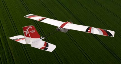
    PrecisionHawk Inc., a provider of drone technology for enterprise, has purchased Uplift Data Partners.

    Uplift specializes in the delivery of turnkey inspection services for construction, building information management and real estate, and has provided drone services for national and global brands.

    Its nationwide network of commercially trained drone pilots will join PrecisionHawk’s Droners.io network of more than 15,000 drone pilots. Suzanne El-Moursi, CEO of Uplift, will join PrecisionHawk’s executive leadership team managing the company’s construction line of business.

    This is the fifth acquisition for PrecisionHawk in 2018. Early acquisitions include Droners.io and Airvid. In September, it purchased both Hazon Solutions and InspecTools which specialize in the delivery of inspection services and technology for the energy industry. Their integration with PrecisionHawk has created dynamic synergy, providing solutions that elevate airborne intelligence and strengthen the data value chain for the enterprise.

    Similar to the energy space, the construction industry has experienced a rapid uptake in the adoption of commercial drone technology. Drones are now one of the leading innovative technologies that are transforming the construction process since they decrease the need for lengthy visual inspections, reduce planning time, improve worker safety and identify problems.

    Uplift Data Partners was formed in 2015 as a fully integrated subsidiary of Clayco, one of the nation’s largest architecture, engineering, design-build and construction firms, with more than $2 billion in annual revenue.

    Through the acquisition, Clayco will exclusively source its construction projects to PrecisionHawk, and will serve on PrecisionHawk’s Board of Advisors to support the growth of the company’s services and software in the construction industry.

    The PrecisionHawk UAV. (Photo: PrecisionHawk)
    The PrecisionHawk UAV. (Photo: PrecisionHawk)

    “PrecisionHawk is leading the commercial drone market by combining superior technology with deep expertise in the markets that they serve,” said Bob Clark, Clayco CEO. “Through this acquisition, Clayco customers gain access to a new level of technological sophistication for more scalable and robust operations, while continuing to benefit from Uplift’s deep understanding of the demanding nature of engineering and construction industry drone missions,.”

    “This acquisition displays PrecisionHawk’s commitment to strengthening our technology and expertise in high-growth markets,” said Michael Chasen, PrecisionHawk CEO. “By combining PrecisionHawk’s leading-edge products and services with Uplift’s industry experience and training standards, our customers will receive best-in-class aerial data and analytics for complex construction and facility inspection projects through a simple and easy to procure process.”

    “Our mission at Uplift is to support the modernization of the architecture, engineering and construction (AEC) industry by creating tools and training that improve the accessibility of drone services, thereby delivering true value to construction projects,” said Uplift CEO Suzanne El-Moursi. “The construction industry is uniquely rugged, yet defined by innovation and intelligence, and we are thrilled to join PrecisionHawk, a company that is both aligned to this mission and committed to the growth and expansion of the industry.”

  • Skycatch GNSS base station processes drone data in the field

    Skycatch GNSS base station processes drone data in the field

    Skycatch has announced an on-premise data processing and GNSS base station, the Skycatch Edge1, manufactured in partnership with DJI and now available worldwide.

    Edge1 base station. (Photo: Skycatch)
    Edge1 base station. (Photo: Skycatch)

    Tested and optimized for the Skycatch Explore1 and DJI Phantom 4 RTK drones, the self-positioning Edge1 allows commercial drone users the ability to process and receive data without the need for internet or cellular connectivity, the company said.

    Field teams can fly their drone, process the data and receive centimeter-level data outputs in 30 minutes or less, directly to a tablet. 2D maps and 3D point clouds are available for viewing and sharing directly from the tablet.

    The Edge1 concept began as a companion to the Skycatch Explore 1 drone. Now, a new generation of the Edge1 will support all DJI drones, including the recently released DJI Phantom 4 RTK, and will process any 2D geotagged images.

    In addition to a survey-grade GNSS base station, the Edge1 includes built-in WiFi, LTE, reliable sub-5-centimeter accuracy, and delivers high-quality data outputs, the company added. Built around a state-of-the-art compute module, the Edge1 is also capable of running deep learning algorithms to extract more insights from collected data in near real time.

    “It’s truly a revolutionary product that we’re excited to make available to the DJI community, and the construction and mining industry at large,” said Christian Sanz, founder & CEO of Skycatch. “With the partnership and support of DJI, the Edge1 will be assembled with precision execution in their world-class manufacturing facility, and will be available faster to the customer.”

    “As the commercial drone industry has grown, the amount of data collected by our enterprise users is unprecedented,” said Jan Gasparic, director of strategic partnerships at DJI. “We are glad to work with Skycatch to manufacture the Skycatch Edge1 GNSS base receiver, enabling enterprise customers, especially those in the construction industry, to process data from their DJI drones on-site and in real-time.”

    Skycatch is an industrial data collection and analytics company focused on indexing and extracting critical information from the physical world, using a combination of hardware, software and artificial intelligence. Built for enterprise, its turnkey solutions are deployed across global project sites with largest construction, mining and energy companies.

  • FAA restricts drones near DOD and USCG ships, subs

    FAA restricts drones near DOD and USCG ships, subs

    The Federal Aviation Administration (FAA) has issued more drone flight restrictions — this time, near U.S. Navy and U.S. Coast Guard vessels operating in the vicinity of Naval Base Kitsap, Washington, and Naval Submarine Base Kings Bay, Georgia.

    Drone operations are required to maintain a distance of at least 3,000 feet laterally and 1,000 feet vertically from the ships and submarines.

    The Ohio-class ballistic-missile submarine USS Nebraska returns to Naval Base Kitsap-Bangor following sea trials. (Photo: U.S. Navy/Lt.Cmdr. Michael Smith, Commander, Submarine Group Nine)
    The Ohio-class ballistic-missile submarine USS Nebraska returns to Naval Base Kitsap-Bangor following sea trials. (Photo: U.S. Navy/Lt.Cmdr. Michael Smith, Commander, Submarine Group Nine)

    At the request of the Department of Defense (DOD) and the United States Coast Guard (USCG), the FAA is using its existing authority under Title 14 of the Code of Federal Regulations § 99.7 — “Special Security Instructions” — to address concerns about potentially malicious drone operations over certain, high-priority maritime operations.

    The special security instructions, provided in an FAA Notice to Airmen (NOTAM), are now in effect. Additional information on these special security instructions includes a visual depiction and geospatial definition of the relevant airspace.

    The FAA also warns drone operators that the USN and USCG vessels are authorized by law to take protective action against drones perceived to be safety or security threats, which could result in seizure, damage or destruction of the drones.

    Operators who don’t comply may face civil penalties and criminal charges.

    Any operator with an overriding reason of public interest or necessity (such as conducting a search-and-rescue mission) to operate their drone in close proximity to the cited USN and USCG vessels must first coordinate with the USN or USCG point of contact.

    In a separate Special Notice Advisory NOTAM, also effective today, the FAA strongly advises drone operators to remain clear of DOD and Department of Energy (DOE) facilities and mobile assets, as well as USCG vessels.

    The notice applies nationwide and alerts operators who ignore this caution and conduct drone flights perceived to be a safety or security threat to these facilities and mobile assets could face a reaction by security forces that results in the interference, disruption, seizure, damage or destruction of their drone.

    Information can be found here on these two NOTAMs, and all of the locations currently covered by § 99.7 restrictions. This website also provides an interactive map, downloadable geospatial data, and other important details. Additional information, including frequently asked questions, is available on the FAA’s UAS website.

  • DroneNode designed to protect outdoor events from UAVs

    DroneNode designed to protect outdoor events from UAVs

    The portable DroneNode. (Photo: DroneShield)
    The portable DroneNode. (Photo: DroneShield)

    DroneShield has launched DroneNode in response to end-user requirements.

    DroneNode is an evolution of the company’s DroneCannon product. It is a portable, compact and inconspicuous counter-drone jamming device that law enforcement can use at large outdoor events without raising public concern.

    DroneNode comes in a portable case approximately 50 x 50 centimeters square. It can be set up in seconds and requires very little training to operate, the company said.

    It can simultaneously jam 2.4 GHz, 5.8 GHz and GNSS L1 and L2 bands up to one kilometer, causing drones to return to their point of origin or land. DroneNode is also effective against swarm attacks. Emergency broadcasts, cellphone communication and other dedicated channels will not be affected.

    According to the company, DroneNode’s covert design makes it a suitable counter-drone solution for public events where protection from drone threats is a priority. Designed within a rugged carry case, DroneNode is easy to transport and is protected from the elements.

    DroneNode is powered by a NATO-approved self contained battery with room for a second battery stored in the accessories tray.

    “The release of DroneNode continues DroneShield’s leadership in drone security for public events,” said Oleg Vornik, DroneShield’s CEO. “DroneShield’s recent credentials in the area include the 2018 Olympics, the 2018 Commonwealth Games, 2018 ASEAN-Australia Special Summit, the 2017 Hawaii Ironman World Championship, and the 2015 to 2017 Boston Marathons. The company’s products are well positioned to protect large public gatherings globally.”

    According to DroneShield, the product is particularly relevant given the recent drone attack on the Venezuelan president and the high-profile mail bomb terrorist attacks in the United States, heightening the awareness of law enforcement globally to potential threats to high-profile political targets.

    A Venezuela soldier received head injuries in the drone attack. (Photo: Released by Xinhua News Agency)
    A Venezuela soldier received head injuries in a the drone attack against the president. (Photo: Released by Xinhua News Agency)

    FCC Authorization Pending. DroneNode and DroneCannon have not been authorized as required by the U.S. Federal Communications Commission (FCC). The devices are not, and may not be, offered for sale or lease, or sold or leased, in the United States, other than to the U.S. government and its agencies, until authorization is obtained.

    The use of such devices in the United States by other persons or entities, including state or local government agencies, is prohibited by federal law. Laws limiting the availability of such devices of certain types of users may apply in other jurisdictions, and any sales will be conducted only in compliance with the applicable laws.


  • Kespry, DJI offer stockpile measurement solution for mining

    Image: Screenshot from Kespry video
    Image: Screenshot from Kespry video

    Kespry and DJI are partnering to offer the DJI Mavic 2 Pro drone as part of the Kespry stockpile measurement solution for mining and aggregates companies.

    The solution delivers the Kespry autonomous flight and aerial intelligence experience for stockpile measurement using a DJI drone. It enables large aggregates and mining companies to standardize and capture stockpile data across all their sites in the Kespry platform, while continuing to use Kespry 2s drones to support mine and site planning operations, Kespry said.

    Integration of data captured from a DJI drone is the next innovation in the development of the Kespry industrial sensor platform.

    Kespry provides inventory management and mine planning data to more than 200 mining and aggregates companies. As these customers scale their use of drone data, they are looking to standardize on a single platform to organize and analyze that data across sites, geographies and product divisions — even when those sites are highly distributed, Kespry said.


    The addition of the DJI Mavic 2 Pro to the Kespry lineup is designed to enable even more site data to be centralized in the Kespry cloud. It will be available with a new, cost-effective purchase point designed to support using Kespry across more sites.

    “Drone data is now the standard approach for measuring stockpiles at mine sites, however, millions of dollars are wasted through reconciling inconsistent data from different platforms and the time involved getting that data ready for analysis,” said George Mathew, CEO and chairman at Kespry. “Our goal with the addition of the Mavic 2 Pro to our solution is to respond to our customers wishing to use the Kespry aerial intelligence platform across all mine sites to standardize how stockpile data is generated — lowering their costs and helping drive the profitability of every site.”

    “DJI is excited to have Kespry offering the Mavic 2 Pro as part of its aerial intelligence platform portfolio,” said Jan Gasparic, director of strategic partnerships, DJI. “Pairing the Mavic 2 Pro with Kespry’s industry leading AI, ML, and analytics capabilities will be of enormous benefit to mining companies that are looking to take advantage of drone technology in a portable and powerful package.”

    According to the companies, the integration of DJI’s drone and sensors into the Kespry platform is the latest innovation in the delivery of an industrial sensor network, closely following Kespry’s recently announced high-resolution thermal capabilities for industrial inspection.

    This expansion in the range of data that can be explored and analyzed in the Kespry platform further enables customers to protect and maximize their assets across industrial sites.

    The Kespry platform is now capable of processing and analyzing a wide range of sensor data, enabling the future creation of industry-specific applications, including those under current development with leaders in the energy sector.

    “We have sites in North Carolina, Pennsylvania, Ohio and Maryland, so with the Kespry platform and DJI drone, we’ll be able to fly multiple sites at one time,” said Justin Dermont, accounting manager at Russell Standard. “I could be flying in Erie while my partners fly in North Carolina, but still be able to get the data in real time to the Kespry cloud.”

    “Having DJI as part of the Kespry system will help with the flexibility and the timeliness of us being able to take inventory at multiple locations, especially when we have to take inventory at the end of production, or month end, to make sure we have accurate readings,” said Craig Schiebel, controller at Russell Standard. “Being able to take inventory simultaneously at multiple locations is huge.”

    “We’re growing our business and recently acquired some new sites,” said Kyla Jungclaus, senior accountant at Brannan Companies. “We need all of our inventory to be done in just a couple days, so introducing the DJI drone to have another pilot surveying at some of our other locations will get inventory done even faster. I know that our measurements will be consistent and accurate even if I don’t do them myself, and I can manage them all in a single account in the Kespry cloud.”

    Kespry is offering the Mavic 2 Pro as part of its fully-managed, end-to-end annual subscription model. Kespry customers that choose the Mavic 2 Pro for stockpile measurement will benefit from the full Kespry experience, including its acclaimed support, training, customer success team, and drone up-time guarantee.

    The Kespry stockpile measurement solution with DJI will be available Q1 2019.

  • Microdrones used for Autobahn corridor mapping

    Screenshot: Microdrones video
    Screenshot: Microdrones video

    In Halle, Germany, Microdrones worked with construction company Strabag to fly the mdMapper1000DG above Highway A33 to create a point cloud and orthophoto of a 12-kilometer stretch of the Autobahn.

    The drone was equipped with special transponders to make it visible to German Air Traffic Control, enabling beyond-visual-line-of-sight (BVLOS) flight. BVLOS allows for longer flights that cover more area and capture more data.

    Using the drone for corridor mapping of the Autobahn enables closer inspection and visualization of the highway to find pavement imperfections, road wear and tear, and other potential safety hazards, Microdrones said.

  • Propeller Aero and DJI join on PPK drone solution

    Propeller Aero, a cloud-based drone analytics company, is partnering with DJI to create the Propeller PPK Solution leveraging the DJI Phantom 4 RTK drone.

    The solution provides customers in the civil, mining, aggregates and waste management industries with a reliable and fully integrated drone mapping system, helping them collect highly accurate data from any worksite without the challenges of traditional workflows, the companies said.

    The DJI Phantom 4 gathers data at a construction site. (Photo: DJI)
    The DJI Phantom 4 gathers data at a construction site. (Photo: DJI)

    According to Propeller Aero, Propeller PPK Solution is a fully integrated software and hardware system that reliably provides photogrammetric model outputs in geodetic, projected or local coordinate systems.

    The solution provides accuracy of 1/10 feet (3 cm) from independent checkpoints across small and large survey areas (checkpoints up to 1 km from GCPs). To capture surveys of this accuracy, all that is needed is one AeroPoint on the ground (over a known point if working in local coordinates).

    The Propeller PPK Solution has been shown to reduce the time required to complete a drone survey by 70 percent as compared to a traditional workflow using multiple GCPs across a worksite, Propeller Aero said.

    “DJI has led the drone market with their reliable and innovative products, and quickly demonstrated the ability for these machines to become useful tools in the heavy civil and natural resource industries,” said Rory San Miguel, CEO of Propeller Aero. “Globally, these industries are seeing real cost savings and efficiencies through cloud-based analytics and using innovative new technologies like PPK drones combined with AeroPoints. Accurate data is paramount to worksite analytics and Propeller has always been obsessed with helping teams achieve this. We introduced the world’s first smart ground control point, AeroPoints, and now we’ve partnered up with DJI to build an end-to-end PPK solution.”

    On today’s construction sites, lack of project data costs businesses more than $177 billion annually. To help solve this problem, Propeller developed a tightly integrated PPK workflow across the DJI Phantom 4 RTK drone, an AeroPoint, and Propeller’s cloud processing platform that visualizes real-time site data. Surveyors and contractors can Propeller PPK solution to gather verifiable, trustworthy data to help make data-driven decisions and prevent costly mistakes, the companies added.

    “Propeller’s deep expertise in aerial mapping and analytics coupled with DJI’s industry-leading open-platform drone hardware creates a highly accurate turnkey solution,” said Jan Gasparic, director of strategic partnerships at DJI. “We are excited about this partnership because it broadens the use of DJI drones to deliver accurate data at a cost-efficient price point, helping teams better answer questions about site progress and productivity.”

    The complete PPK solution will be distributed through channel partners, including Trimble’s SITECH distribution network. Trimble Stratus, a 3D cloud-based visualization platform developed by Propeller, along with AeroPoints, is already integrated with Trimble Connected Site solutions.

    “The advent of drones in the construction industry has improved efficiencies, and Trimble Stratus users are already benefiting from the ease-of-use and scalability of drone-based surveys,” said Scott Crozier, general manager, Trimble Civil Engineering and Construction. “With the new Propeller PPK Solution and Trimble Stratus software, we’ve seen first-hand how surveyors and contractors can collect aerial survey data in a fraction of the time it used to take, and get repeatable and reliable results.”

  • PrecisionHawk joins with DJI to refine airport geofencing

    PrecisionHawk joins with DJI to refine airport geofencing

    New risk-based “bow-tie” zones will help protect aircraft using PrecisionHawk’s Low Altitude Traffic and Airspace Safety (LATAS) platform.

    DJI is improving its geofencing technology to refine the airspace limitations for drone flights near airports, providing smarter protection for airplanes in critical areas.

    DJI has updated Geospatial Environment Online (GEO) Version 2.0, and will phase it in starting in November when the revised zones will take effect for airspace around airports in the United States. Upgrades in other regions will follow.

    Image: DJI
    Image: DJI

    The new system allows GEO to create detailed three-dimensional “bow-tie” safety zones surrounding runway flight paths, and to use complex polygon shapes around other sensitive facilities, rather than simple circles.

    The new restrictions better reflect the actual safety risk posed in those areas, while allowing more flights to the side of runways where risk is substantially lower.

    Runway exclusion zones. DJI’s new geofencing also incorporates the principles of Section 384 of the recently enacted U.S. Federal Aviation Administration (FAA) Reauthorization Act designating the final approach corridor to active runways at major airports to be “runway exclusion zones” for unauthorized drones. DJI customers should update their DJI GO 4 flight control app and aircraft firmware to ensure these improvements are implemented.

    To obtain reliable geospatial information for the enhanced shapes in GEO 2.0, DJI has chosen a new data provider that can provide highly accurate details such as the exact locations of airport runways and facility boundaries.

    PrecisionHawk’s LATAS. In North America, DJI will use data from PrecisionHawk Inc., replacing DJI’s previous geospatial data provider AirMap. Under a partnership agreement, PrecisionHawk’s Low Altitude Traffic and Airspace Safety (LATAS) platform will provide DJI customers with critical airspace information that will position them to fly safely in North America.

    DJI will be able to refine airspace limitations for drone flights near airports, providing smarter protection for drones in critical areas and clarifying restrictions, PrecisionHawk said.

    “PrecisionHawk has a corporate commitment to safely integrating drones into the airspace and enabling complex operations,” said Diana Cooper, senior vice president of policy and strategy at PrecisionHawk. “Through our work under the FAA Pathfinder Program, we have shown how technology can play a critical role in unlocking advanced operations, including beyond visual line of sight flight.”

    GEO 2.0 Development. DJI first created No-Fly Zones for its drones in 2013 and introduced the more refined GEO system three years later, adding live updates and new zones for prisons and nuclear power plants, while providing flexible self-unlocking for professionals.

    Both systems recognized that the overwhelming majority of drone pilots want to fly safely and responsibly, and want an easy-to-use guide to help them understand the airspace so they can do so.

    Image: PixOArtist's rendering of a no-drone sign near an airport. Image: PixOne/Shutterstock.comne/Shutterstock.com
    Artist’s rendering of a no-drone sign near an airport. Image: PixOne/Shutterstock.com

    To develop GEO 2.0, DJI collaborated with general aviation pilots through the Aircraft Owners and Pilots Association (AOPA) and with airports through the American Association of Airport Executives (AAAE) to incorporate their expertise and guidance about air traffic and airports into DJI’s new geofencing methods.

    DJI geofencing uses GPS and other navigational satellite signals to automatically help prevent drones from flying near sensitive locations such as airports, prisons, nuclear power plants and high-profile events.

    In certain locations, a DJI drone cannot take off or fly in a geofenced area without special authorization. Drone pilots with verified DJI accounts can unlock some areas if they have legitimate reasons and necessary approvals, but the most critical areas require special action from DJI to unlock them.

    DJI has streamlined the approval process so professional drone pilots with authorization to fly in sensitive locations can receive unlocking codes within 30 minutes.

    The GEO System. The GEO system previously geofenced a 5-mile circle around airports, with enhanced restrictions in a smaller circle encompassing the airport area.

    GEO 2.0 applies the strongest restrictions to a 1.2 kilometer- (3/4 mile)-wide rectangle around each runway and the flight paths at either end, where airplanes actually ascend and descend. Less strict restrictions apply to an oval area within 6 kilometers (3.7 miles) of each runway.

    This bow-tie shape opens more areas on the sides of runways to beneficial drone uses, as well as low-altitude areas more than 3 kilometers (1.9 miles) from the end of a runway, while increasing protection in the locations where traditional aircraft actually fly.

    Artist's concept of a drone approaching a commercial airliner. Image: PixOne/Shutterstock.com
    Artist’s concept of a drone approaching a commercial airliner. Image: PixOne/Shutterstock.com

    Aviation Parameters. DJI’s new boundary areas around airport runways are based on the International Civil Aviation Organization’s Annex 14 standard for airspace safety near runways and the FAA’s Part 77 parameters for “imaginary surfaces” and air navigation obstructions.

    DJI’s categorization of airports is based on traffic volume principles defined in statutes such as U.S. Title 49 section 47102, and the FAA’s criteria developed in 2012 for categorizing general aviation airports.

    Using these aviation parameters, DJI has aligned its geofencing safety feature to broader understandings of airspace and airport risk. This chart demonstrates how GEO 2.0 applies those detailed, risk-based airspace boundaries to the airspace around airports that can be considered to involve relative high, medium, and low risk (see graphic).

    LATAS. Through its work under the FAA Pathfinder Program, PrecisionHawk has shown how technology such as LATAS can play a critical role in unlocking advanced operations, including beyond visual line of sight flight. LATAS was tested under the Pathfinder Program to facilitate safe beyond visual line of sight operations.

    LATAS brings a combined set of geospatial and software tools to the market. In addition to providing improved geospatial data, the LATAS platform features specialized display elements, including telemetry and access to the Harris real-time manned aircraft feed. Using these elements pilots can easily observe the relative altitude and horizontal separation of intruding aircraft and other mission-critical measures.

  • EU ‘GLAD-2’ develop low-cost nav for UAVs

    EU ‘GLAD-2’ develop low-cost nav for UAVs

    A European Union-funded initiative has developed a low-cost positioning and navigation system for unmanned aerial systems (UAS).

    Photo: GSA
    Photo: European GNSS Agency

    Using multiple antennas, the device is based on off-the-shelf components and advanced data-fusion algorithms. It fuses GNSS and inertial data to enable accurate and reliable navigation.

    The EU-funded Horizon 2020 GLAD-2 project developed the system. The work involved in-depth analysis of algorithms, hardware and software redesign, exhaustive refinement and repeated in-field testing.

    Researchers used low-cost GNSS receivers, together with advanced data fusion with an inertial measurement unit, and barometer data to enhance the attitude and position of UAS in harsh GNSS environments. The system also avoided the use of magnetometers, making it immune to magnetic fields, and removing the need for system calibration when the magnetic environment is modified.

    Photo: GSA
    Photo: European GNSS Agency

    Engineers selected different GNSS antennas and measured their performance according to technical and economic criteria. A multi-antenna approach enabled UAS to take accurate headings without suffering the usual problems inherent to magnetometers.

    “The inertial sensors provide an excellent dynamic response at very high data rates, while GNSS serves as an absolute reference to prevent drift. In addition, differential GNSS carrier phase measurements can be used to obtain great accuracy in orientation by using the multi-antenna configuration,” said project coordinator Esther López of Spanish technology company ACORDE.

    GLAD-2 achieved the commercialization of the low-cost navigation system, culminating in the European Conformity (CE) certification mark following the corresponding certification process. The CE mark indicates conformity with health, safety and environmental protection standards for products sold within the European Economic area.

    The result is a highly competitive product aimed at the low-cost sector of the navigation systems market. “Due to its flexibility, the system fulfils the needs of a wide range of users, not only in UAS, but also in terrestrial and maritime environments applications,” López said.

  • Hurricane cleanup, shark patrol top UAV applications

    Another month, another hurricane in the southern United States. News channels showed drone-captured video of the mess left behind in Northern Florida, Georgia and the Carolinas. More useful is the video damage assessments UAVs are providing for first responders.

    A basketball hoop and backboard hang forlornly while both front and back walls of a school gym are gone, huge buildings are nothing but matchsticks, fallen trees and powerlines blocking roads — familiar scenes from hurricane Michael’s devastation of Panama City and area — video provided by drones operating in the disaster zone.

    Although the videos have now largely gone from the TV news, Panhandle residents will be living through this nightmare for months to come.

    Photo: Glenn Fawcett/Customs and Border Protection/Handout)
    Photo: Glenn Fawcett/Customs and Border Protection/Handout)

    Working with emergency teams — including the North Carolina Surf City Fire Department, Airborne Response, Florida FEMA Task Force and Missouri Task Force FEMA — Edgybees’ AR drone software was able to provide collaborative, real-time, situational visualizations of the areas affected by Michael. Status and location updates were available during critical missions, and key geographical data was provided to teams on the ground.

    Beach Patrol

    Another life-saving drone application comes from the other side of the Pacific – finding and deterring sharks which threaten bathers off the beaches of Australia.

    Shark deterrent tests.(Photo: Flinders University)
    Shark deterrent tests. (Photo: Flinders University)

    An artificial intelligence application on-board a SharkSpotter UAV monitors for shark attributes as it overflies inshore areas where the predators are known to hunt. If there is a match for typical shark behavior — size, shape, color, and movements in the water — an alert is transmitted to enable lifesavers to respond. The drone can even drop a flotation device to swimmers in trouble. A number of beaches in New South Wales were patroled this past summer, and many more UAV beach patrols are planned to be added for the coming season.

    SharkSpotter drone. (Photo: Ripper Group)
    SharkSpotter drone. (Photo: Ripper Group)

    Other work is underway to deter the animals using devices in the water which create electric fields aimed at interfering with shark sensory systems. Another cell-phone application estimates the probability of the presence of sharks based on a number of environmental factors. Several U.S. agencies are keenly watching these developments as shark attacks have increased here, off both Atlantic and Pacific beaches.

    Meanwhile, there has been another important step forward for drone integration into the US National Airspace System (NAS) and for integration in other countries’ airspace. Enabling drones to fly over people and property is a key part of potential airspace operations, and a safe recovery system which avoids possible injury to people is becoming essential. Most drones have a return-to-base fallback in the event of loss of the control signal, but this doesn’t help in the event of a fundamental mechanical failure.

    Parachute Recovery Systems

    DJI Matrice 600 with DRS-10 rescue system. (Photo: Drone Rescue)
    DJI Matrice 600 with DRS-10 rescue system. (Photo: Drone Rescue)

    Effective auto-release parachute systems may be key to solving this problem. Another supplier has emerged with a lightweight automatic system for the DJI Matrice 600 multicopter.

    Drone Rescue (DR) from Austria has announced its DR-10 parachute recovery system,for drones weighing 5-20 kg (11-44 lb). The DR-5 system is for lighter UAVs (8kg – 17.6lb).

    The DRS-M600 system has apparently been derived from the DR-10 specifically for the DJI Matrice drone.

    Photo: Drone Rescue
    Photo: Drone Rescue

    The parachute is mounted in a carbon cage and is released when a self-contained electronics system automatically detects an imminent crash. DR claims that their system works even in the event of control data link failure, and that incident data is collected in an on-board UAV flight-data recorder for subsequent analysis.

    It was previously announced that an FAA waiver for flight over people was granted to North Dakota UAS operator, Botlink using a ParaZero Israel drone recovery parachute system.

    Initial flights were conducted during a tailgating event prior to the North Dakota State University vs South Dakota State football game in North Dakota. The drone flew over crowds in the stadium’s parking lots and provided real-time video for local law enforcement and media companies.

    This drone parachute safety system includes a fully autonomous triggering system that deploys quickly and reliably without being dependent on any manual operator’s response. During FAA testing it was necessary to demonstrate that the descent rate was slow enough to provide acceptably low impact energy and that the system would operate correctly in multiple types of failure conditions.

    DHL Drone Delivery

    Meanwhile, DHL has joined other drone delivery companies to establish a medical delivery trial in Africa. DHL’s trial is in the Lake Victoria region of Tanzania.

    The six-month trial has focused on delivered medicines by UAV within 40 minutes to an island in Lake Victoria — the trip normally takes six hours by road.

    Photo: DHL
    Photo: DHL

    Over the course of 160 proving flights, using a 4-kg-capacity Wingcopter, medical supplies were successfully transported over the 60 kilometers between Mwanza and the hospital on the island of Ukerewe.

    The medicines reach their destination at least 3 hours earlier than by any traditional mode of transportation, and as a result of these tests, 400,000 people in the Ukerewe District will now have access to medical care and support in hours rather than days.

    Conclusion

    Drones helping out hurricane Michael recovery efforts in the Florida Panhandle, specialized drones tracking sharks to mitigate possible attacks off beaches in Australia, parachute recovery systems enabling drone flights over people, the integration of drones into regular airspace moving ahead, and more medical delivery trials in Africa. These are a few recent UAV applications that appear to be supporting even further drone use around the world.

  • Live from Intergeo 2018

    Logo: IntergeoThe GPS World staff is reporting from Intergeo Oct. 16-18 in Frankfurt, Germany. The massive trade show, dubbed the “global hub of the geospatial community,” brings together more than 17,000 visitors from more than 107 countries and features approximately 640 exhibitors. Check out the latest industry news, as well as photos and videos from the event.

    Videos

    Choose the video you’d like to watch by clicking the icon in the top left hand corner of the video screen.

    News

  • UAV images show inspection action

    The UAV inspection industry continues to grow, as evidenced by these photos of actual end-user application. Unmanned systems follow precise flight paths to gather the data needed for inspection missions in the fields of insurance (home roof inspection), mining, construction and the pulp paper industry.

    Kespry drone inspecting damaged roof for insurance claim. (photo Nathan Stump/Kestry)
    Kespry drone inspecting damaged roof for insurance claim. (Photo: Nathan Stump/Kespry)

    A free webinar on Thursday, Oct. 25 will show more of these applications and cover the requirements and challenges for positioning technology in commercial applications in urban and remote areas, including those generated by concerns about interference and spoofing.

    In the free webinar, attendees will learn:

    • Latest trends and challenges for drone-based aerial intelligence platforms for insurance and roofing applications
    • GNSS technology requirements for safe UAV BVLOS operations and a view of the regulatory frameworks
    • Importance of UAS traffic management systems (UTM)
    • Use cases in linear infrastructure inspection (railways, roads, power lines and others)
    • Challenges for GNSS systems in autonomous aerial vehicles and growing concerns about safety
    • Robustness of multi-GNSS receivers to jamming and spoofing
    • Latest innovation in GNSS technology concerning inspection applications and real-time accuracy/reliability
    Earthworks contractors use this drone technology to perform detailed topographic surveys of project sites throughout all phases of construction. The new survey tool is reducing costs and time, allowing earthworks contractors to increase their profitability and ensure project success. (photo Paul Ross/Kespry)
    Earthworks contractors use this drone technology to perform detailed topographic surveys of project sites throughout all phases of construction. The new survey tool is reducing costs and time, allowing earthworks contractors to increase their profitability and ensure project success. (Photo: Paul Ross/Kespry)

    In addition to a tailored application for roof inspections, targeted at insurance companies, UAV manufacturer Kespry provides a complete solution for construction and engineering companies to manage proposed and active earthwork operations. Without using multiple, cumbersome ground control points, survey-grade field data can be collected for an entire site in as little as 30 minutes.

    In the webinar,  attendees will learn how drone technology is being used to:

    1. Validate proposed earthwork – reduce rework and extra earthmoving costs before the job begins
    2. Safely measure earthwork activity – ensure subcontractor work and delivered material are constantly measured
    3. Perform regular earthwork progress topos – accurately document completed grading and drainage phases

    Further application examples in construction projects will show how drones are providing construction companies with a new method for accurate survey work throughout their entire worksite that can:

    Tablet software for UAV inspection enables 1-hour claim filing (Photo: Nathan Stump/Kespry)
    • Reduce up to 20 percent of total project costs by eliminating rework through regular cut and fill analysis of drone data
    • Eliminate up to 10 percent of earth moving costs through more accurate volumetric analysis
    • Perform more frequent surveys in-house with drones, reducing traditional survey equipment and service costs.
    x
    Kespry provides a complete solution for construction and engineering companies to better manage proposed and active earthwork operations. Without using multiple, cumbersome ground control points, survey-grade field data can be collected for an entire site in as little as 30 minutes. (Photo: Nathan Stump/Kespry)

    In the first example show above, insurance claims for roof damage, the fully-autonomous system improves safety, reduces loss adjustment expenses, and delivers more accurate risk assessments, while reducing overall costs. For commercial property, the UAV solution helps prevent losses and informs underwriting decisions with high-resolution aerial and thermal imagery to identify exposures. Accurate, unbiased reports are easily prepared and shared with all parties. Mobile tools are provided to review inspection quality imagery within minutes of flight; artificial intelligence (AI) technology generates fully-dimensioned wireframes and 3D roof models

    Drones for the pulp and paper industry
    The drone and analytics platform enables companies to improve profitability through quick, cost-effective, and accurate surveying of chip and roundwood sites.

    UAV applications in pulp and paper industry will be demo'd in the Oct 25 webinar (photo Jason Nichols/Kestry)
    UAV applications in pulp and paper industry will be demo’d in the Oct 25 webinar (Photo: Jason Nichols/Kespry)

    Kespry enables production plant and production managers to analyze stockpile inventories, better manage supply chain activity, and improve site operations — maximizing profitability across production and supply chain operations.

    The company also supplies a drone-based AI platform for the aggregates and mining industry supplies accurate inventory management and mine planning. It will be demonstrated in the free October 25 webinar.