Tag: product showcase

  • M3 Systems Announces Simulator Based on Vector Signal Transceiver

    M3 Systems Announces Simulator Based on Vector Signal Transceiver

    StellaNGC_Simulator-O

    M3 Systems is now offering the StellaNGC multi-constellation GNSS simulator based on the National Instruments (NI) vector signal transceiver.

    The simulator is designed for the testing of satellite navigation receivers for GPS, GLONASS, Galileo, and EGNOS/WAAS. It is designed to improve performance, scalability, and versatility, and reduce cost over existing navigation test solutions.

    GNSS is the predominant technology today for navigation and outdoor positioning. However, given the weakness of GNSS signals, receiver performance is often affected by interference from the local environment and propagation channel conditions. Understanding the effects of this interference is of particular importance not only for existing GNSS signals but also for future signals that will appear with the deployment of new constellations such as Galileo.

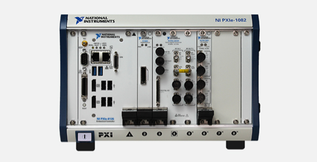
    To properly characterize receiver performance under varying conditions, the StellaGNC multi-constellation GNSS simulator provides signal generation, signal recording and replay, interference generation, signal and data processing, and complete analysis tools. The StellaNGC simulator is based on the NI vector signal transceiver in PXI for improved performance and full simulation capabilities. For record and playback only, a scaled-down version is also available based on the NI USRP (Universal Software Radio Peripheral). Both options were developed with NI LabVIEW and benefit from the performance and flexibility of the NI RF platform.

    The simulator provides a scalable solution that allows easy signal additions through software upgrades, multi-frequency, processing extensions with the addition of FPGAs with NI FlexRIO, and an HDD extension for storage increase. Because the simulator is based on the open PXI standard, the hardware investment can also be extended to other applications, such as simulation, record and playback, or payload simulation.


  • Generate Contour Maps on iPads and iPhones

    screen568x568-1   screen568x568

    CMTINC.COM (Corvallis Microtechnology, Inc.) has added a new dimension to its iOS-based GPS/GIS application software by releasing the Contour – Volume – Stakeout app for iPad and iPhone. Now that higher accuracy GPS receivers are available for use with iOS devices, it makes sense to develop GPS/GIS apps that utilize elevation values, the company said.

    The Contour – Volume – Stakeout app will generate contour lines and a colored contour map based on elevations or on the values of any numeric variable of interest (such as the amount of fertilizer to apply). It can compute volumes (such as the amount of soil to move) based on the contour information. It also provides stakeout functions to let the GPS guide the user toward a point or along a line or area boundary.

    The data to be contoured can be digitized and entered via the app itself, or it can be imported via Shapefiles or a text file. To aid data collection, the app provides a function to generate sampling grid points over an area. The contour map can be printed to PDF. The contour data can be exported to a text file. The Feature data can be exported to DXF and Shapefiles, and the contour data can be exported to a .CSV text file.

    The app is now available at the iTunes App Store.

  • TireStamp Chooses Telit for Tire Pressure Monitoring with GPS

    TireStamp Chooses Telit for Tire Pressure Monitoring with GPS

    TireVigil-Telit

    Telit Wireless Solutions has announced that TireStamp, a TPMS 2.0-certified vendor of Tire Pressure Monitoring Systems, embeds Telit cellular and positioning modules into its product.

    For fleet managers, tires represent the second-highest operating cost of running a fleet, second only to fuel. Tire maintenance can significantly impact highway safety, revenue potential, operational efficiency, and maintenance costs.

    The TireStamp TireVigil solution communicates with tire pressure sensors to provide real-time monitoring of tire pressure and temperature across vehicle types, tire brands, and location. The comprehensive tire data enables fleet managers to schedule maintenance, intervene in the event of an emergency, improve on-time delivery, and enhance regulatory compliance.

    Telit's Jupiter JF2 GPS module.
    Telit’s Jupiter JF2 GPS module.

    The TireVigil solution uses Telit’s Jupiter JF2 GPS module, a compact, low-power device that provides enhanced accuracy to help locate vehicles in the event of an emergency or at any time. TireVigil receives tire data from TMPS sensors, then communicates in real-time over the cellular network using the Telit HE910 cellular module. Part of the xE910 module family, the HE910 is pin-to-pin compatible with a suite of modules enabling TireStamp to customize its products to enable connectivity across cellular technologies and geographies.

    “Our customers are typically in the maintenance space,” said Scott Feagan, Chairman and CEO of TireStamp. “Reliability and support are extremely important to them – and to me. Pair that with family compatibility for fast time-to-market and global expansion, the opportunity to bundle connectivity with positioning, affordable pricing and on-time availability, and it’s easy to see why we chose to work with Telit.”

    “Between fleets and personal vehicles, more than a billion tires are sold around the world each year,” said Mike Ueland, president of Telit Americas. “Telit has a long history of supporting fleet telematics and automotive solutions and we’re pleased to enable the world’s leading tire pressure management system.”

  • Google Maps Adds Terrain View

    Google Maps now has Terrain View, which enables users to see terrain maps for an area.

    Terrain view shows the 3D elevation of natural geographic features, such as mountains and canyons. Topographic contour lines are overlaid on the map to show elevation levels with altitude information displayed in gray numbers.

    Google Maps also offers traffic, transit, and biking views.

    Google Maps tweeted about the new terrain feature, showing an example:

    GoogleMaps-Terrain

    Photo: Google


  • North Dakota, Delaware and Maryland Quads Updated

    The latest North Dakota, Delaware and Maryland Quads are now available from the United States Geological Survey.

    The new US Topo maps for North Dakota (1,402 maps), Delaware (38 maps) and Maryland (213 maps) have been posted to the USGS Map Locator & Downloader and are also accessible through The National Map viewer.

    The new maps feature a design that was launched earlier this year and replace the first edition US Topo maps for those states. The new design presents a crisper and cleaner presentation, which enhances the readability of the maps for online and printer use.

  • Ethertronics Unveils GPS Helix Antenna for Mission-Critical Applications

    Ethertronics Unveils GPS Helix Antenna for Mission-Critical Applications

    EtherHelix GPS antenna.
    EtherHelix GPS antenna.

    Ethertronics has unveiled EtherHelix GPS, a small, stand-alone, Right Hand Circularly Polarized (RHCP) external GPS antenna. Measuring 35 mm in length, the EtherHelix GPS is 27 percent shorter than other antennas on the market with no performance trade-offs, the company said. It is designed for high-performance, mission-critical devices such as walkie-talkies, tough books, tough tablets, first responders, public safety, military applications and more.

    EtherHelix can be tuned for various satcom frequencies and various polarizations (RHCP or LHCP). EtherHelix GPS is designed using Ethertronics’ patented Isolated Magnetic Dipole (IMD) technology providing high performance and efficiency in a small form factor.

    EtherHelix GPS has a high tolerance to frequency shifts given the technology’s high RF isolation, which is designed to resist antenna detuning that can otherwise impair reception. EtherHelix GPS provides exceptional coverage inside buildings, vehicles or other areas where weak signals and signal reflection occur, the company said.

    “GPS capabilities are critical for first responders and military applications. It is imperative that the antennas used in these devices are high-performance, small and rugged,” said Olivier Robin, general manager Americas and Europe at Ethertronics. “EtherHelix GPS is the most recent example of Ethertronics’ leadership in developing industry-first RF solutions to provide manufacturers with a way to differentiate their products and stand out in a competitive market. Already we have seen interest in our new EtherHelix GPS antenna given its best-in-class performance coupled with its smallest occupied volume.”

    Given its reduced weight and size — 11.8 g and 35 mm long by 15 mm in diameter — manufacturers benefit from simpler integration for an array of GPS devices, Ethertronics said. In addition, the new GPS antenna’s capabilities include high selectivity, which minimizes the need for additional filters. EtherHelix GPS’s ruggedized design includes IP-68 protection from dust and water, as well as a standard SMA male connector for easy integration. The RoHS Compliant antenna is designed and manufactured in the United States.

    EtherHelix GPS is commercially available now and is the first in a series of antennas for mission-critical applications.

  • Intuicom Announces Next-Generation RTK Bridge-X with Wi-Fi

    Intuicom Announces Next-Generation RTK Bridge-X with Wi-Fi

    Intuicom RTK Bridge-X.
    Intuicom RTK Bridge-X.

    Intuicom, Inc., a wireless data solutions provider for the survey, machine control and precision agriculture industries, has added to its line of RTK Bridge solutions with the Intuicom RTK Bridge-X.

    Along with providing reliable access to RTK corrections, the RTK Bridge-X features a Wi-Fi hotspot. Users can connect other Wi-Fi devices such as laptops, tablets and smartphones and access the Internet via the RTK Bridge-X’s cellular connection. Also new with the RTK Bridge-X is cable-free configuration. Configuration can now be accomplished through a wireless connection using any web browser.

    Users can then access email, send files, and perform other Internet-based tasks using the connection provided by the RTK Bridge-X. With new Remote Access, the RTK Bridge-X can be reached over the Internet from anywhere.

    The RTK Bridge-X also comes with internal GPS. Users can choose between an internal license-free 900-MHz radio, industry-standard UHF radio, or no radio.

    Other improvements include a real-time cellular signal strength indicator on the re-designed front panel, as well as an Ethernet port that can be used for configuration or Internet connectivity. A numerical LED display now shows which of the four configurable profiles is active as well as which radio channel is selected. Bluetooth connections are also supported.

    Like all Intuicom Bridge Products, The RTK Bridge-X is designed for easy setup and operation and is compatible with all major cellular carriers and equipment manufacturers including Leica Geosystems, Trimble, and others.

    RTK-Bridge-X-and-buttons-W

  • Leica Offers Next-Generation Mobile Mapping Platform, Pegasus:Two

    Leica Offers Next-Generation Mobile Mapping Platform, Pegasus:Two

    PegasusTwo_application-W
    photo: Leica

    Leica Geosystems has introduced its next generation vehicle-independent mobile mapping platform, the Pegasus:Two. By calibrating imagery and LiDAR point cloud data, the Pegasus:Two delivers highly accurate and economical geospatial data in a 360° spherical view while providing two methods for extracting data — either through LiDAR or via photogrammetry.

    With its enhanced sensor platform using six horizontal cameras, plus an optional rear camera and a skyward view camera, a single high-speed LiDAR sensor, and an external output for an additional sensor, the Pegasus:Two enables unlimited mobile mapping applications, from pavement analysis to geo-referencing railways systems, now possible within the same platform, the company said.

    From hardware to post-processing, Pegasus:Two allows economic data collection by balancing the largest pixel to sensor ratio on the market (5.5 x 5.5 µm), delivering extremely high image resolution, in a 4-MB camera and using a single low-noise, high-speed profiler. Users can download data via Wi-Fi or wired Ethernet, or even faster by using the latest USB3 interface, by means of a multi-core, industrial PC with 1-TB storage and a solid state drive, enabling longer missions. An optional rotation mount, designed specifically for the Leica ScanStation P20, also makes mounting the terrestrial scanner upside down or right side up while also enabling left or right rotation.

    The Pegasus:Two in its new streamlined housing with aerodynamic design.
    The Pegasus:Two in its new streamlined housing with aerodynamic design.

    Expanding on the success of Leica Geosystems’ mobile mapping software, the latest software now offers semi-automatic object extraction features, which enable easy-to-use two-click GIS metadata extraction or calculation of distances on-the-fly directly into ArcGIS for Desktop software.

    Leica Geosystems also introduces an external timing output and trigger signal for use with a variety of additional sensors, from a thermal camera, to ground penetrating radar, sonar, or even a pollution monitor. The External Trigger feature synchronizes time stamping and coordinates user data with one simple click, making 3D mobile mapping very user-friendly.

    Urban canyons. Equipped with the NovAtel’s ProPak6 high-precision receiver for the most demanding city or rugged environments, the Pegasus:Two offers users a truly global system. It is a future-proof investment that tracks signals of all available constellations, GPS, GLONASS, Galileo and BeiDou as well as L-band, SBAS, and QZSS band coverage to ensure the best signal even when moving through urban canyons. The system provides a low noise, 200hz Inertial Measurement Unit for tracking the vehicle path thereby ensuring data is positioned accurately.

    Aerodynamic design. The Leica Pegasus:Two mobile mapping system now comes with a new streamlined and compact look and continues to fit in only two travel cases. A convenient handle surrounding the unit enables easy mounting on and off your vehicles. The Pegasus:Two is a vehicle-independent system with a rechargeable 11 hour battery, and can be used on any moving platform.

    “The Leica Pegasus:Two platform is a unique complete solution,” said Stuart Woods, vice president for Leica Geosystems Geospatial Division. “By providing software and hardware designed to seamlessly work together, users not only receive the latest in mobile mapping technology but also optimal performance and faster workflows. By keeping the platform vehicle independent and adding new sensor options, we encourage our customers to find new ways, to try out different sensors, new revenue models, and new places to measure. ”

    Along with the Pegasus:Two, the advanced prototype, Pegasus:T2, a trolley based mobile system weighing less than 20 kilograms will also be on display at the HxGN LIVE 2014 Conference in Las Vegas.

  • Fanbeam Laser Radar Delivers Dynamic Positioning to Offshore Vessels

    Seajacks_and_Fanbeam-W

    The new Fanbeam laser radar sensor from Renishaw’s spatial measurement division provides repetitive, high-accuracy dynamic positioning (DP) to offshore support vessels (OSV) and other marine structures.

    This next-generation system adds greater performance and stability through new control software that increases reliability of its single-target tracking capability, and allows multiple operator stations for situations where control needs to be transferred between bridge personnel. The new software’s advanced target tracking and modeling prevent spurious targets from causing a drive off, while the intelligent clutter rejection capability provides clearer signals for a better understanding of the operational environment. A training package with a fully featured, realistic simulator is also included.

    The Fanbeam system uses position data to automatically hold vessels on station, and is typically the primary position reference during critical short-range operations, such as cargo container lifts from platform supply vessels. The system provides collision avoidance, gangway monitoring and docking assistance on vessels operating in crew supply, anchor handling tug supply, construction support, dive support, dredging and rock dumping capacities. Other applications include seismic source positioning for geophysical exploration vessels and positioning of mine detection equipment.

    Fanbeam laser radar sensor.
    Fanbeam laser radar sensor.

    The system uses a laser sensor with a unique vertically “fanned” output, allowing returns to be observed from passive retro-reflective targets despite relative movement of the vessel. Accurate to 20 cm, the laser rotates horizontally in both directions via motorized base, and can be tilted ± 15˚ in the vertical plane using a built-in Autotilt mechanism with servo-driven gearbox. The motorized yoke has a software-selectable scanning speed up to 50˚/s, horizontal range of 0˚ to 360˚ and 0.01˚ horizontal resolution. A reflective tube target is used for short-range operations, while various prism cluster target options allow long-range operations up to 6562 ft (2000 m).

    Built for harsh environments, the system’s operating temperature range is -13˚F to +158˚F (-25˚C to +70˚C), with a water/dust resistance rating of IP66, and is EN 60945/EN 609950-1:2001 compliant. A marine-grade embedded PC and machined aluminum enclosure equip the system for rugged use. The compact system is approximately 8”W x 12”L x 11.5”H (200 x 300 x 290 mm) and weighs only 28 lbs. (12.9 kgs).

    Fanbeam Production Moves to Renishaw Facility. After acquiring Measurement Devices Limited (MDL) in 2013, Renishaw moved production of Fanbeam systems to its assembly facility in Gloucestershire. The facility was named the UK’s Best Electronics Plant in 2012. “Vessel operators depend on Fanbeam systems for reliable, safe operations in tough conditions,” said Keith Park, Marine Business and General Manager, Renishaw. “Now, they can have confidence that these systems are produced at one of the world’s best design, production and servicing facilities.”

  • Altus Announces Second-Generation GNSS RTK Rover

    Altus Announces Second-Generation GNSS RTK Rover

    The Altus APS-NR2.
    The Altus APS-NR2.

    Altus Positioning Systems has introduced its new APS-NR2 RTK surveying receiver. The new product is being previewed at the 2014 Geo Business conference and exhibition in London May 28-29, and will be commercially available in July.

    “The APS-NR2 provides a powerful combination of high GNSS RTK performance, light weight, low power consumption, versatile Quad-band modem, remote Web-based access and connectivity with Esri’s cloud-based platform,” said Neil Vancans, Altus president and CEO. “The result is a versatile product designed to enhance productivity and minimize downtime in the field for a wide range of surveying and geolocation jobs.”

    The APS-NR2 is Altus’ second-generation RTK rover, building on the highly successful APS-3 product series. It features an easily accessible on-board web interface and integrated Wi-Fi for easy remote configuration and status monitoring, as well as Bluetooth for real-time data streaming, providing true cable-free operation. In parallel to RTK positioning, data can be recorded on a removable 2-GB SD memory card for post-processing.

    The APS-NR2 is built around a low-power 132-channel GPS/GLONASS L1/L2/L2C SBAS receiver, which offers robust RTK performance, as well as DGPS capability. The internal 3.5G Quad-band GSM/GPRS/EDGE cellular modem supports RTK network connectivity. Dual internal cellular antennae ensure a positive signal lock and minimize disruptions due to dropped calls.

    The new Altus receiver comes with two Li-Ion batteries. It has a built-in USB battery charger, as well as a separate two-bay external charger. The batteries are hot-swappable, allowing uninterrupted productivity on the job.

    With Altus’ open-architecture philosophy, the user has a choice of data collector software from Carlson SurvCE, MicroSurvey FIELDGenius or direct interface to Esri ArcGIS Online, as well as proprietary customer-developed software.

    The APS-NR2 doesn’t sacrifice essential processing power or connectivity and still weighs only 0.7 kg (1.5 lbs). The compact receiver is just 69 mm (2.7 in) high and 167 mm (6.6 in) in diameter. The rugged unit is waterproof to IP67 and has an operating temperature range of -40 to +85°C.

  • Raytheon’s VIIRS View App Provides World Weather to Mobile Users

    Raytheon’s VIIRS View App Provides World Weather to Mobile Users

    Raytheon-VIIRS

    Available for iPhone, iPad and Android, VIIRS View provides mobile device users a look into the type of data meteorologists and climatologists use every day to track the weather and monitor Earth’s environment.

    Based on data generated by the Visible Infrared Imaging Radiometer Suite aboard Suomi NPP, VIIRS View combines visible light imagery, low-light nighttime imagery and ocean chlorophyll concentration onto a full Earth globe, rotatable and zoomable on any location on the planet.

    A desktop version of the VIIRS View app, launched in February, has been downloaded more than 90,000 times.

    An original large format VIIRS View interactive tabletop display is being shown at Raytheon Booth #203 at the the 30th Space Symposium, being held this week in Colorado Springs, Colorado. GPS World Defense Editor Don Jewell is providing coverage from the symposium.

    The app can be downloaded by searching VIIRS View at the Google Play and Android stores, or by clicking here:

    Google

    Apple:
    VIIRS iPhone
    VIIRS iPad

  • Blue Marble Releases Global Mapper v15.2 with New Automation

    A flattened terrain surface model with 3D Vector features using Global Mapper.
    A flattened terrain surface model with 3D Vector features using Global Mapper.

    Blue Marble Geographics has released Global Mapper version 15.2, a minor release that adds functionality to automate the New Feature Creation process, as well as the addition of new online datasources, including OpenStreetMap vector data links via Web Mapping Services (WMS).

    Blue Marble’s geospatial data manipulation, visualization and conversion solutions are used worldwide by GIS analysts at software, oil and gas, mining, civil engineering, surveying, and technology companies, as well as governmental and university organizations.

    The minor release features updates to both the Global Mapper base product and the Global Mapper LiDAR Module. In particular, new functionality has been added to allow the user to automate the New Feature Creation process. Users can now create a series of features that share the same attribute structure, target layer, and other characteristics without having to repeatedly confirm these settings in the Modify Feature Info dialog box. This release also features the addition of free online datasources including full access to the Maine GIS catalog, as well as access to Aviation Charts and OpenStreetMap vector data via WMS.

    Other enhancements include support for creating buffer areas around line features with variable width from beginning to end and for creating buffers on just one side of a selected line feature. New scripting functionality has been added to allow conditional (IF/THEN/ELSE) processing within a script file. 3D models from Collada DAE files have been updated with the option to load BMP, JPG, PNG, and TIFF images with no geo-position information directly, improved 3DPDF support, and enhancements to CityGML.

    “These great new features and functions will streamline the user’s workflow, as well as save them time and money with the ease-of-access to a growing list of cloud based publicly available data,” stated Blue Marble President, Patrick Cunningham “This release is another great example of our mission to deliver a low-cost and easy-to-use GIS solution for everyone.”

    Enhancements to the LiDAR Module in v15.2 include added support for the transformation (shift/rotate/scale) of LiDAR point clouds and the option to filter selected LiDAR points to a certain elevation range and/or set of colors. A new LIDAR_CLASSIFY script command for classifying ground points in a script has been added. Users now have the option to keep the original file offset/scale, or to specify a new one when exporting to LiDAR LAS/LAZ files. They also now have the ability to crop to a selected area when specifying the bounds to import from a LiDAR point cloud and the ability to export point cloud to Esri File Geodatabases (GDB) as normal 3D point features. These LiDAR enhancements are a great addition to an already powerful module for those interested in adding advanced LiDAR functionality to Global Mapper.