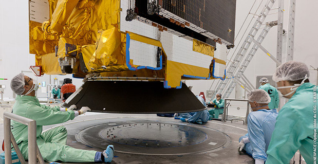
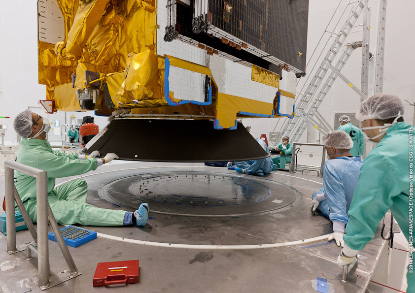
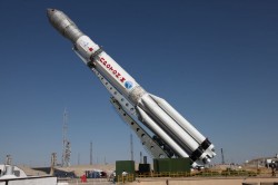
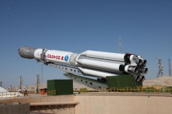
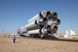
The ASTRA 5B is installed in preparation for launch Friday, March 21. (Photo credit: Arianespace)
The launch of the satellite ASTRA 5B, which will become part of the European Commission’s European Geostationary Navigation Overlay Service (EGNOS), is scheduled for Friday, March 21, according to satellite company SES. It will be launched into space from the European Space Centre in French Guiana on board an Ariane 5 ECA rocket between 19:05 p.m. and 20:02 p.m. local time (23.05 – 00.02 CET; 18.05 – 19.02 EDT).
ASTRA 5B will carry a hosted L-band payload for EGNOS. It will also extend transponder capacity and geographical reach over Eastern Europe and neighboring markets for DTH, direct-to-cable, and contribution feeds to digital terrestrial television networks.
ASTRA 5B was built by Airbus Defence and Space (formerly Astrium) in Toulouse, France, using a Eurostar E3000 platform. The multi-mission satellite will be located at 31.5 degrees East.
“The launch of ASTRA 5B will be the 39th launch of an SES satellite on board a European Arianespace launch vehicle,” said Martin Halliwell, chief technology officer of SES. “Our long-standing relationship is based on this proven track record and shows the continuous confidence we have in Arianespace and our commitment to Ariane as a launch vehicle. We look forward to a successful mission with this longstanding launch partner.”
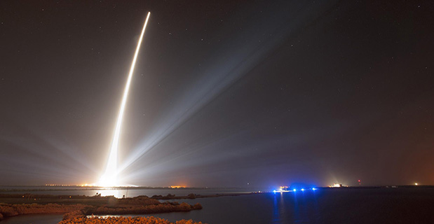
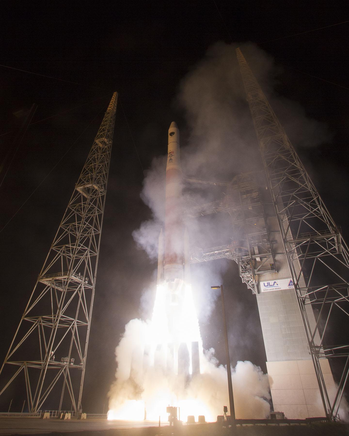
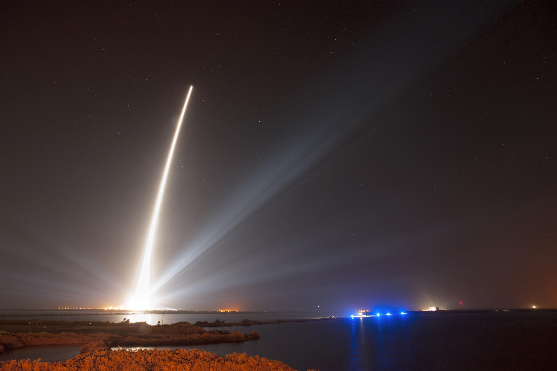
A United Launch Alliance Delta IV lifts off from Space Launch Complex-37 with the Air Force’s Global Positioning System (GPS) IIF-5 satellite. This launch marked the 25th Delta IV flight since the first flight in 2002. Credit: Ben Cooper/ULA
News compiled with the assistance of CANSPACE listserv.
After a brief delay due to concerns over solar radiation trends, the GPS IIF-5 satellite was successfully launched at the end of the designated launch window at 01:59 UTC on February 21. The satellite, attached to the launch rocket’s upper stage, was initially placed in a highly elliptical orbit. Following a third burn of the rocket, the satellite was released into its assigned orbit at about 05:37 UTC today.
Here is a video showing highlights of the launch:
GPS IIF-5 will replace the aging spacecraft known as GPS IIA-28 in Plane A, Slot 3 of the constellation.The GPS IIA-28 satellite was launched aboard Delta 249 on November 5, 1997, as the final member of the Block IIA series. It will go into a reserve role in the network for the remainder of its useful life.
This is the first of three GPS launches planned through July to replace aging craft in the constellation. GPS IIF-5 incrementally upgrades the constellation with improved accuracy, enhanced internal atomic clocks, better anti-jam resistance, a civil signal for commercial aviation, and a longer design life, all features of the Boeing-build Block IIF series. This will be the fifth of 12 Block IIF spacecraft being built to form the backbone of the GPS fleet for the next 15 years.
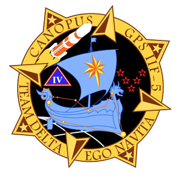
Launch logo. The nickname of the IIF-5 satellite is Canopus, the brightest star in the modern constellation Carina and the second brightest star in the night-time sky, after Sirius.
According to the Air Force, the new capabilities of the IIF satellites will provide greater navigational accuracy through improvements in atomic clock technology, a more robust signal for commercial aviation and safety-of-life applications, known as the new third civil signal (L5), a second civil signal (L2C) available for the dual-frequency GPS receivers and a 12-year design life providing long-term service. These upgrades improve anti-jam capabilities for the warfighter and improve security for military and civil users around the world.
“I am pleased with the outcome of today’s launch. The new capabilities provided by the IIF satellites will improve operations, sustainment and overall GPS service for the warfighter, international, commercial and civil communities,” said Col. Bill Cooley, director of the Space and Missile Systems Center’s Global Positioning Systems Directorate.
“The modernized capabilities that are coming on board with the successful launch of GPS IIF-5 will support the worldwide GPS community for years to come. I would like to recognize the outstanding commitment and the superb dedication to mission success from the 45th and 50th Space Wings, our industry partners: Boeing and United Launch Alliance, and the GPS IIF and Delta IV program teams at the Space and Missile Systems Center,” said he said.
The GPS Block IIF satellites are built by Boeing, and are operated by the United States Air Force following their launch by United Launch Alliance, using Evolved Expendable Launch Vehicles.
The first GPS IIF satellite was launched on May 27, 2010, and entered service on Aug. 26, 2010.
The second satellite, which launched on July 16, 2011, entered service on Aug. 22, 2011.
The third satellite launched on Oct. 4, 2012, and entered service 22 days later.
The fourth IIF was launched May 15, 2013, and entered service on June 21, 2013.
Every modern GPS satellite was launched from Cape Canaveral Air Force Station.
Each GPS IIF satellite delivers:
Greater navigational accuracy through improvements in atomic clock technology,
A new civilian L5 signal to aid commercial aviation and search and rescue operations,
Improved military signal and variable power for better resistance to jamming in hostile environments,
A 12-year design life providing long-term service and reduced operating costs,
An on-orbit, reprogrammable processor that can receive software uploads for improved system operation.
“Once again, a group of talented mission partners rose to the challenge of launching another successful mission from the Cape,” said Col. Douglas Schiess, commander, 45th Operations Group, who served as the Launch Decision Authority. “Those mission partners include the 45th Space Wing, the Space and Missile Systems Center, the 50th Space Wing, United Launch Alliance, Boeing, and our other industry partners with the Delta IV and GPS IIF launch teams.”
A United Launch Alliance Delta IV lifts off from Space Launch Complex-37 with the Air Force’s Global Positioning System (GPS) IIF-5 satellite. This launch marked the 25th Delta IV flight since the first flight in 2002.A United Launch Alliance Delta IV lifts off from Space Launch Complex-37 with the Air Force’s Global Positioning System (GPS) IIF-5 satellite. This launch marked the 25th Delta IV flight since the first flight in 2002.
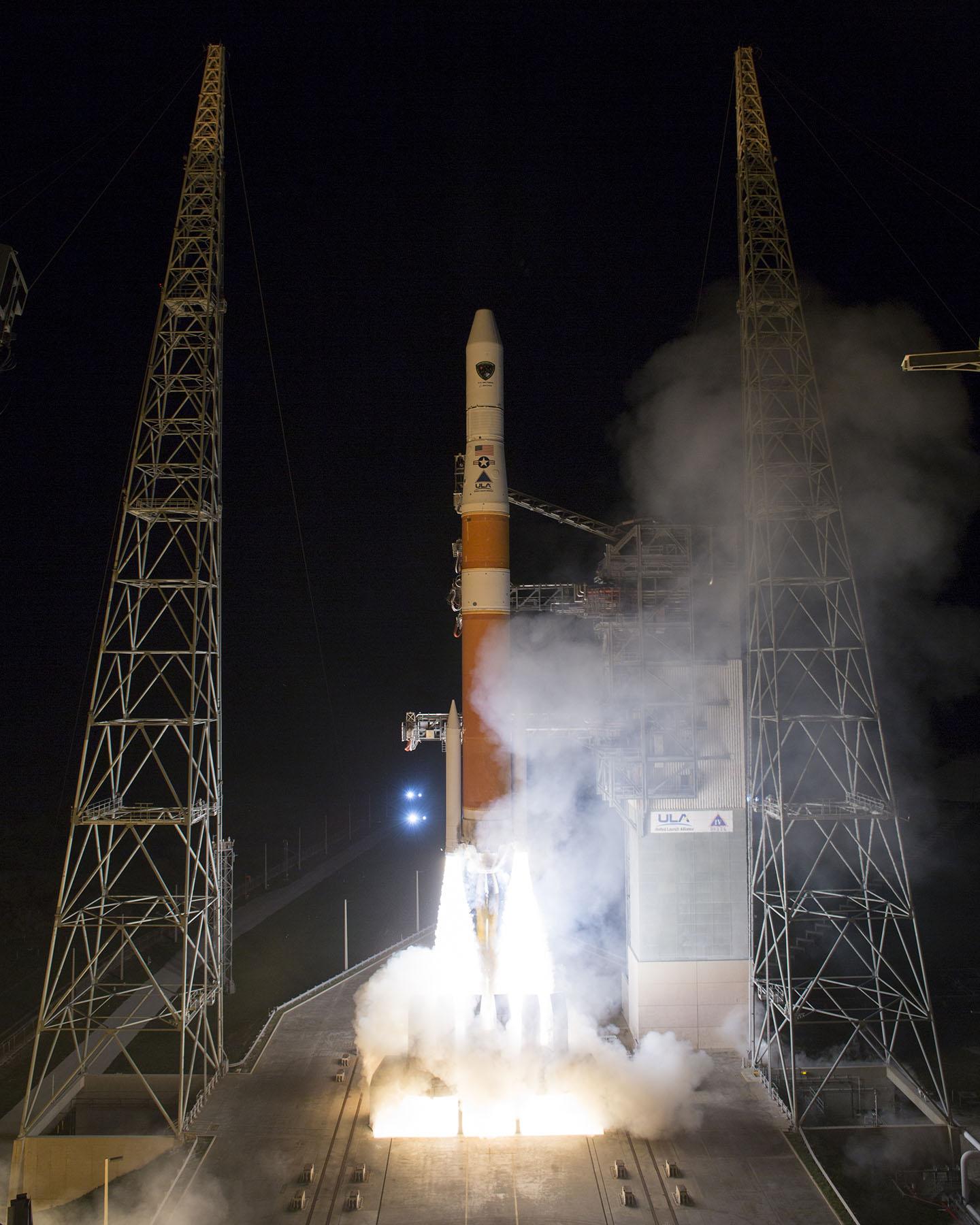
The United Launch Alliance Delta 4 rocket family will launch a new GPS IIF satellite from Cape Canaveral Thursday night.
Liftoff is scheduled for Thursday at 8:40 p.m. EST, at the start of a 19-minute launch opportunity, according to the United Launch Alliance. The window is timed to deliver the GPS IIF-5 satellite directly into Plane A of the navigation network 11,000 miles above Earth.
GPS IIF-5 will replace the aging spacecraft known as GPS IIA-28 in Plane A, Slot 3 of the constellation. The GPS IIA-28 satellite was launched aboard Delta 249 on November 5, 1997, as the final member of the Block IIA series. It will go into a reserve role in the network for the remainder of its useful life.
This is the first of three GPS launches planned through July to replace aging craft in the constellation. GPS IIF-5 incrementally upgrades the constellation with improved accuracy, enhanced internal atomic clocks, better anti-jam resistance, a civil signal for commercial aviation, and a longer design life, all features of the Boeing-build Block IIF series. This will be the fifth of 12 Block IIF spacecraft being built to form the backbone of the GPS fleet for the next 15 years.
The Delta’s flight will last three hours and 33 minutes from liftoff until spacecraft separation, firing its cryogenic upper stage in three different burns to reach an initial parking orbit and taking a two-step transfer route to reach the circular GPS orbit tilted 55 degrees to the equator.
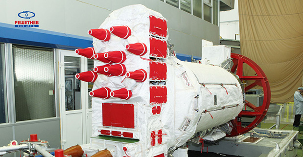
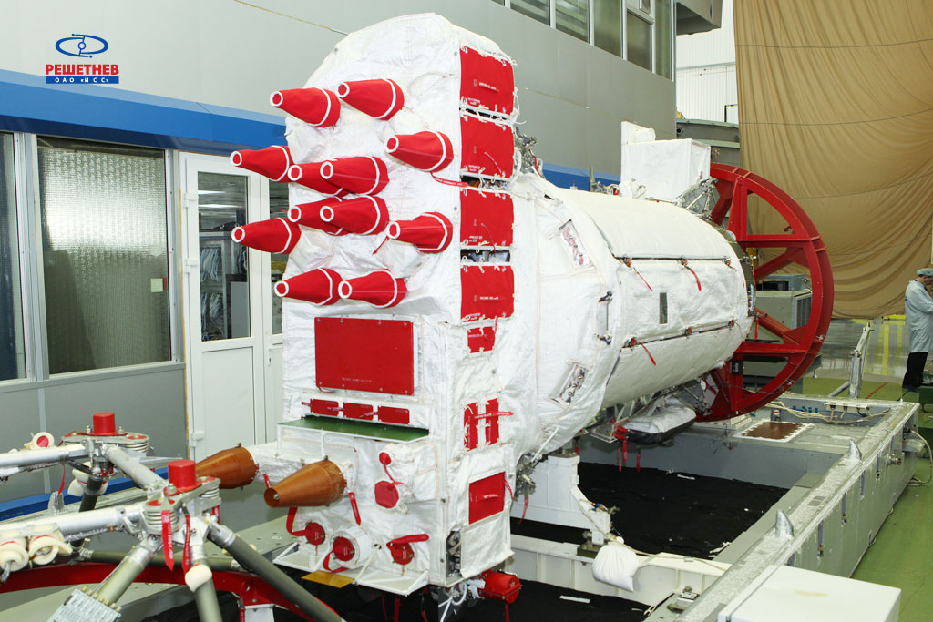
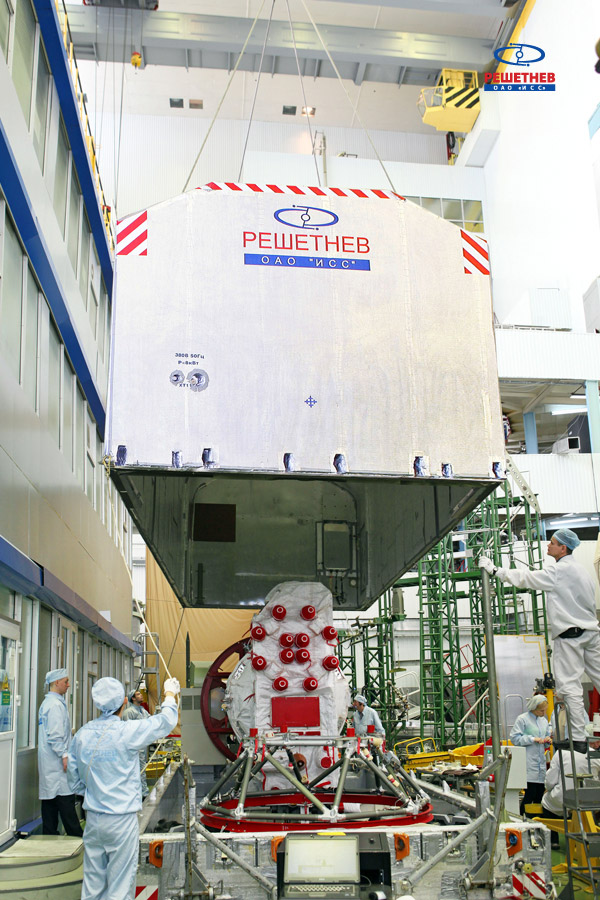
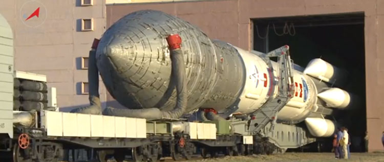
On the night of February 12-13, the GLONASS-M #54 spacecraft left ISS-Reshetnev’s facilities in Zheleznogorsk, Russia, and was transported by air to the Plesetsk cosmodrome.
A Soyuz 2.1b / Fregat rocket with the navigation satellite GLONASS-M #54 on board is scheduled for launch in mid-March. The exact launch date is due to be set at a meeting of the state commission.
As soon as the satellite arrived to the spaceport, the joint team of ISS-Reshetnev specialists and the cosmodrome’s staff members started the launch preparation campaign.
Five satellites of the GLONASS-M series are planned for launch in 2014 to maintain GLONASS in its full operational capability. Three satellites will be launched in a single batch, while the other two will fly into orbit in two single launches.
GLONASS-M #54 will also carry an additional instrument – a high-accuracy thermal stabilization unit that was installed on the spacecraft to undergo testing and flight qualification. Next-generation spacecraft intended for the GLONASS system are going to be equipped with this instrument to provide increased positioning accuracy.
Three more GLONASS-M spacecraft have already been built by ISS-Reshetnev and are being stored at the company’s premises waiting for launch.
Ria Novosti reports that Russia will launch two GLONASS navigation satellites later this year to make up for the loss of three satellites in the recent Proton rocket explosion after launch from the Baikonur space center in Kazakhstan, according to a senior space industry official.
“We are planning to launch two satellites from the Plesetsk space center [in northern Russia] to replenish the GLONASS orbital grouping following the recent Proton-M accident,” said Nikolai Testoyedov, the head of the Information Satellite Systems (ISS) company, which manufactures satellites for the GLONASS project.
The first GLONASS is scheduled for launch in the beginning of September, and the second at the end of October, according to Testoyedov. The official added that both satellites will be launched on board the Soyuz carrier rockets, which has proven to be more reliable than ill-fated Protons.
A group of 29 GLONASS satellites is currently in orbit, with 24 spacecraft in operation, three spares, one in maintenance, and one in test flight phase, according to Russia’s space agency, Roscosmos.
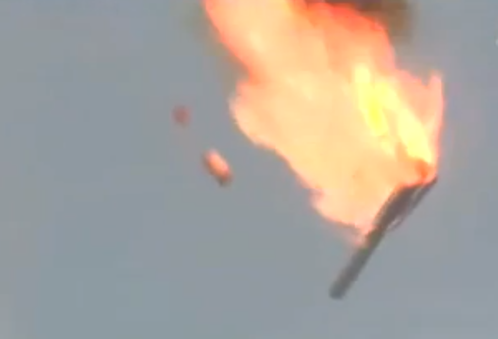
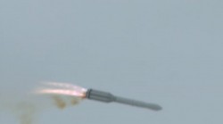
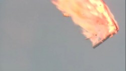
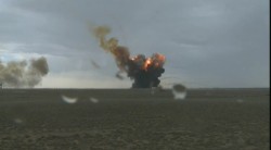
A Russian Proton-M rocket carrying three GLONASS navigation satellites crashed soon after liftoff today from Kazakhstan’s Baikonur cosmodrome, reports rt.com (Russia Today).
About 10 seconds after takeoff at 02:38 UTC, the rocket swerved, began to correct, but then veered in the opposite direction. It then flew horizontally and started to come apart with its engines in full thrust. Making an arc in the air, the rocket plummeted to Earth and exploded on impact close to another launch pad used for Proton commercial launches.
The crash was broadcast live across Russia. Fears of a possible toxic fuel leak immediately surfaced following the incident, but no such leak has been confirmed, rt.com reports. The rocket was initially carrying more than 600 tons of toxic propellants.
No casualties or damage to surroundings structures or the town of Baikonur have been reported.
As RT.com reports, the crashed Proton-M rocket employed a DM-03 booster, which was being used for the first time since December 2010, when another Proton-M rocket with the same booster failed to deliver another three GLONASS satellites into orbit, crashing into the Pacific Ocean 1,500 kilometers from Honolulu.
Photo: Russia Today
Photo: Russia Today
Photo: Russia Today
Photo: Russia Today
UPDATE: Russian Prime Minister Dmitry Medvedev has appointed a special government commission to investigate the causes of the crash and identify any officials who may have been responsible, reports the Christian Science Monitor. Medvedev also directed his government to prepare tougher oversight measures over the space industry to prevent such accidents in future, RIA-Novosti reported.
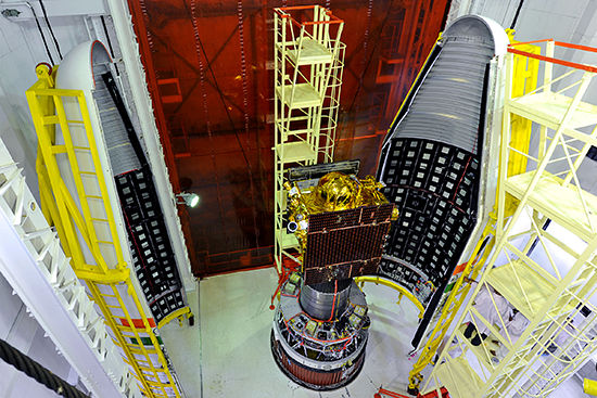
The first satellite of the Indian Regional Navigation Satellite System (IRNSS) was successfully launched today.
The launch of IRNSS-1A occurred on schedule at is scheduled for 18:13 UTC from the spaceport of Sriharikota. Liftoff from the first launch pad at the Satish Dhawan Space Centre occurred on schedule at 18:11 UTC. The 1,425-kg satellite was launched by the XL version of India’s rocket PSLV-C22, or Polar Satellite Launch Vehicle.
Solar panel deployment was confirmed and the satellite has power and is operating nominally according to reports.
The IRNSS-1A satellite is the first of seven that will make up the IRNSS. The constellation will consist of four satellites in geosynchronous orbits inclined at 29 degrees, with three more in geostationary orbit. IRNSS-1A is one of the geosynchronous satellites, and is expected to be positioned at a longitude of 55 degrees east.
GLONASS satellites 48, 49, and 50 are expected to launch at 02:38 UTC on July 2. Live launch coverage will be provided by TsENKI, the Center (for Operation) of Ground-based Space Infrastructure, starting at 01:00 UTC. Also, launch updates are available here.
Launch of the first satellite for the Indian Regional Navigation Satellite System (IRNSS) is scheduled for 18:13 UTC on July 1. Launch rehearsal has been completed successfully. The 64-hour countdown is expected to start at 7:11 (IST) tomorrow, June 29, and the launch will take place from the spaceport of Sriharikota. The 1,425 kg satellite will be launched by the XL version of India’s rocket PSLV-C22.
The launch of the next three GLONASS-M satellites is scheduled for July 2, according to an announcement by Roscosmos, the Russian Federal Space Agency.
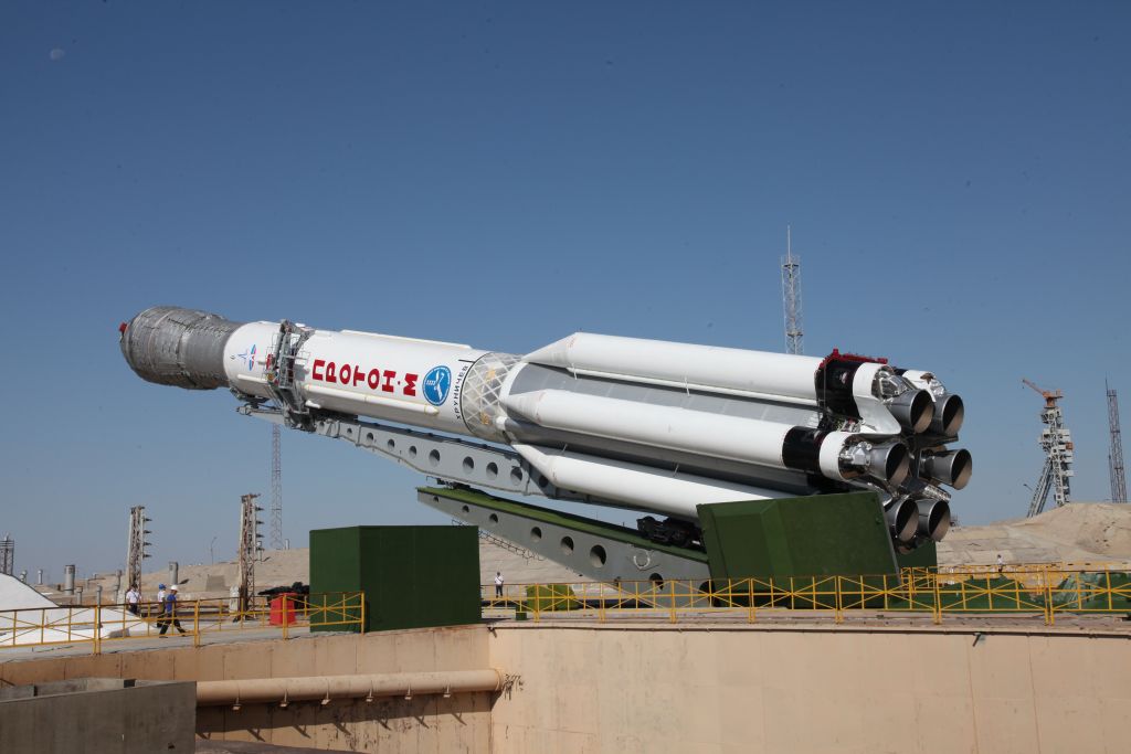
A Proton-M launch vehicle with the upper stage DM-03 and three satellites was rolled out from Baikonur Cosmodrome’s assembly and test facility site 92A-50 on June 28 to launch pad 81. The decision was made to transport the launch vehicle at a meeting of the technical guidance of the State Commission, held the day before.
The U.S. Air Force Space and Missile Systems Center has signed a Cooperative Research and Development Agreement (CRADA) with Space Exploration Technologies Corp., better known as SpaceX, as part of the company’s effort to certify its Falcon 9 v1.1 Launch System for National Security Space (NSS) missions. This cooperative agreement facilitates data exchanges and protects proprietary and export-controlled data. The CRADA will be in effect until all certification activities are complete.
A CRADA enables the Air Force to evaluate the Falcon 9 v1.1 launch system according to the Air Force’s New Entrant Certification Guide (NECG). As part of the evaluation, SMC and SpaceX will look at the Falcon 9 v1.1’s flight history, vehicle design, reliability, process maturity, safety systems, manufacturing and operations, systems engineering, risk management and launch facilities.
SMC will monitor at least three certification flights to meet the flight history requirements outlined in the NECG. Once the evaluation process is complete, the SMC commander will make the final determination whether SpaceX has the capability to successfully launch NSS missions using the Falcon 9 v1.1. SMC anticipates entering into additional CRADAs with SpaceX to evaluate its Falcon Heavy rocket and with Orbital Sciences for its Antares launch vehicle.
“Certifying Evolved Expendable Launch Vehicle’s for new entrants is in keeping with the Air Force strategic intent to promote the viability of multiple domestic EELV-class launch providers as soon as feasible,” said Col. William Hodgkiss, Launch Systems director.
Currently, United Launch Alliance’s Delta IV and Atlas V are the only certified launch vehicles capable of lifting NSS payloads — such as the GPS satellites — into orbit. The addition of multiple certified launch vehicle providers bolsters assured access to space by providing more options for the warfighter to place needed capabilities on orbit. While certification does not guarantee a contract award, it does enable a company to compete for launch contracts. Those contracts could be awarded as early as Fiscal Year 2015 with launch services provided as early as Fiscal Year 2017.
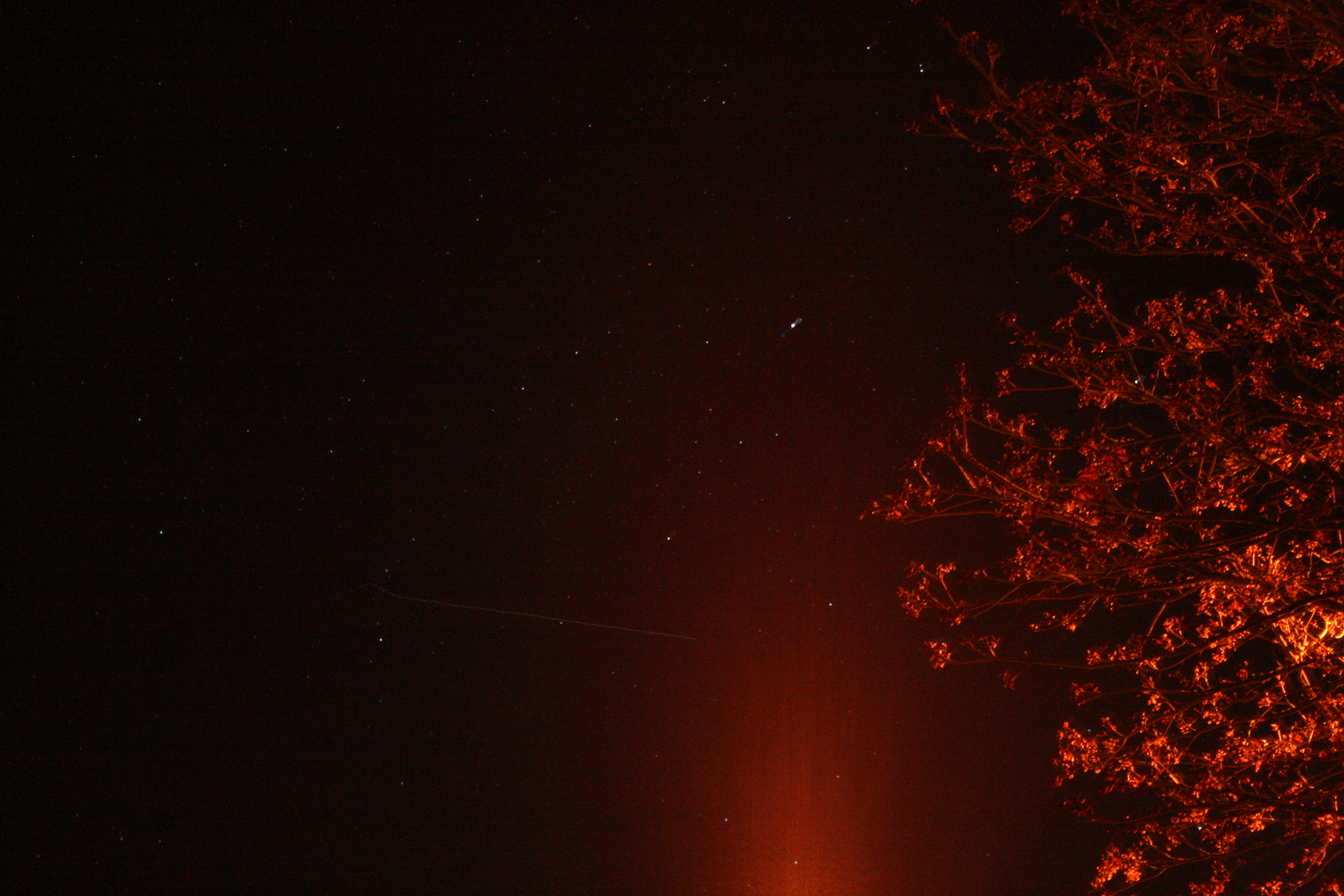
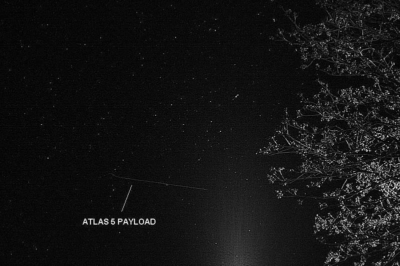
UPDATE, May 24, by Richard Langley: The Centaur upper stage with the payload still attached was photographed from Tavistock, Devon, in the U.K. by Andy Smith. As can be seen from the ground trace figure in an earlier GPS World news item, the Centaur passed over the U.K. following MECO1, the first main engine cutoff. From Europe, the Centaur could be easily seen by reflected sunlight against the background stars. Its maximum (apparent) brightness magnitude has been estimated as -1 or -2. (Sirius, the brightest star in the night sky, has a magnitude of -1.5; Betelgeuse in the constellation Orion has a mean magnitude of about 0.4; and the limiting visual magnitude for the unaided eye is about 6.)
Smith’s photograph was taken at 21:58:38 UTC (start) with a Canon EOS 450D Digital Rebel camera with an 18-55mm zoom lens. The camera settings were: focal length 55mm, aperture f/5.6, and an exposure of 8 seconds at an ISO value of 1600. Two images are shown below: the original, as obtained from the camera, and a greyscale image with edge enhancement.
The Centaur can be seen traveling left to right and starts its track as it crosses the constellation of Cygnus. There’s a slight wobble at the beginning as the shutter release was pressed. The glow at the bottom of the frame is from a streetlight. The elevation angle of the Centaur was approximately 12 degrees.
SVN66 will operate as PRN27 and it will eventually occupy the C-2 orbital slot, replacing SVN33/PRN03, a Block IIA satellite launched in 1996. SVN66 is currently in a drift orbit about 400 kilometers above the operational constellation. It should reach the C-2 slot within a few days from now. The satellite has already been added to the broadcast almanac although it has not yet started to transmit standard signals. It is currently marked as unhealthy in the almanac and will remain so, even after standard signals are switched on, until testing is completed sometime this summer.
Centaur upper stage with the payload still attached, original photo. Photo credit: Andy Smith
The same photo digitally enhanced:
Digitally enhanced photo. Photo credit: Andy SmithPhoto credit: Pat Corkery, United Launch Alliance.
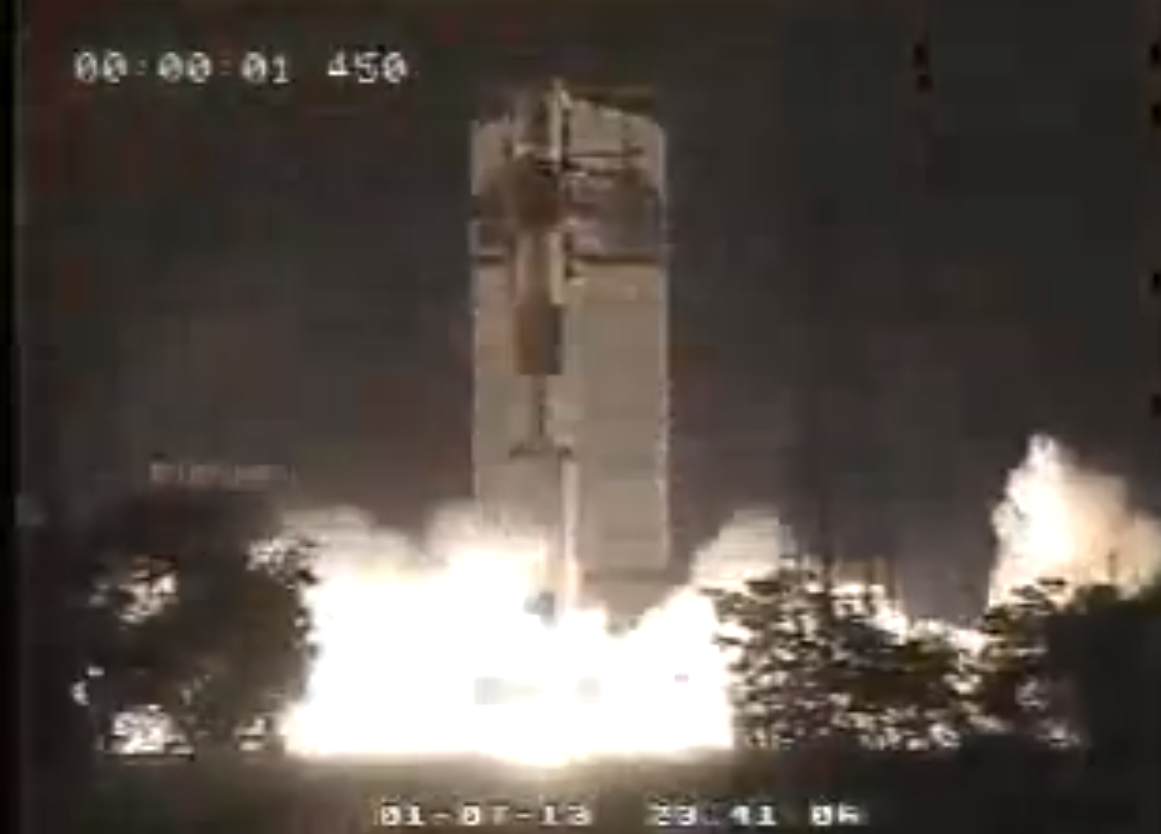
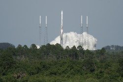
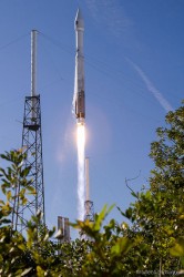
A U.S. Air Force Global Positioning System satellite built by Boeing was successfully launched May 15. The fourth GPS IIF satellite, Space Vehicle Number (SVN) 66, was carried aboard a United Launch Alliance Atlas V Launch Vehicle at 5:38 p.m. EDT (21:38 UTC) May 15 from Cape Canaveral Air Force Station, Florida.
The new capabilities of the IIF satellites will provide greater navigational accuracy through improvements in atomic clock technology; a more robust signal for commercial aviation and safety-of-life applications, known as the new third civil signal (L5); and a 12-year design life providing long-term service. These upgrades improved anti-jam capabilities for the warfighter and improved security for military and civil users around the world, the Air Force said in a statement.
“I’m extremely pleased with today’s launch and delighted to be part of this mission that enhances our nation’s critical GPS capability. Thanks to the superb efforts of the of the 45th and 50th Space Wings, United Launch Alliance, our industry partners, the Atlas V and GPS IIF launch teams, the GPS IIF-4 mission was successfully carried out,” said Col. Bernie Gruber, director of the Space and Missile Systems Center’s Global Positioning Systems Directorate.
“The GPS constellation remains healthy and continues to meet and exceed the performance standards to which the satellites were built. Our goal is to deliver sustained, reliable GPS capabilities to America’s warfighters, our allies and civil users around the world, and this is done by maintaining GPS performance, fielding new capabilities and developing more robust modernized capabilities for the future,” said Colonel Gruber.
Here are videos of the launch:
Opening photo by Pat Corkery, United Launch Alliance.
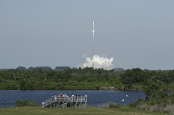
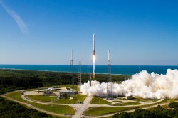
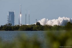
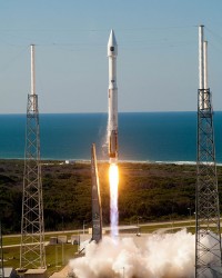
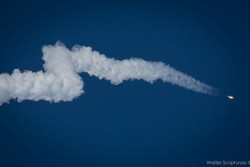
Photos show the launch of the U.S. Air Force’s GPS IIF-4 satellite from the Kennedy Space Center and Cape Canaveral Air Force Station.
Photo credit: Stephen Clark/Spaceflight Now
Photo credit: Stephen Clark/Spaceflight Now
Photo credit: Pat Corkery, United Launch Alliance.
Photo credit: Walter Scriptunas II/Spaceflight Now
Photo credit: Walter Scriptunas II/Spaceflight Now
Photo credit: Walter Scriptunas II/Spaceflight Now
Photo credit: Pat Corkery, United Launch Alliance.
Photo credit: Walter Scriptunas II/Spaceflight Now