Tag: Trimble

  • Trimble Adds Advanced Line Acquisition to Autopilot Steering

    Trimble has added advanced line acquisition technology to its Autopilot automated steering system Trimble OnSwath technology. The acquisition technology reduces the time lost turning at the end of a row by enabling the vehicle to make a tighter turn and approach the next line, or crop row, 50 percent faster.

    Using OnSwath, the farmer can decrease idle driving time, fuel consumption, soil compaction, crop damage, and working time in the field — which can lead to cost savings. OnSwath is a free upgrade to customers using the Trimble Autopilot automated steering system.

    The new OnSwath technology allows the user to customize their line acquisition to the vehicle, operation, and operator preference including adjusting turn angle, approach angle, and speed. Using OnSwath, the vehicle projects its path to the line, which allows it to get online faster. As a result of these improvements, vehicle performance is more controlled, predictable, and repeatable.

    “By adding OnSwath to Trimble’s Autopilot steering system, we’ve enabled farmers to be more efficient with their field operations,” said Erik Ehn, Smart Machines business area director of Trimble’s Agriculture Division. “OnSwath saves time, money and fuel, while also decreasing soil compaction and crop damage. Since we’re providing the technology at no additional cost, farmers who use Trimble’s automated guidance can leverage OnSwath and measure how much it can save their farm.”

    “With Trimble’s OnSwath, I’m able to get online much faster and more accurately,” said Joe Brightly, who began using the OnSwath technology this spring for planting and strip tilling operations. “After an end of row turn, I can get online in a matter of only a few feet, which has saved me a lot of time.”

    OnSwath is available with a software update to the Trimble Autopilot system.

  • Slideshow: 2014 Esri User Conference

    GPS World is at the 2014 Esri User Conference, being held July 14-18 in San Diego. Check out our slideshow for key photos from the first day of the conference. Follow tweets from GPS World and Geospatial Solutions for live updates from the conference.


  • Expert Advice: Tigers, Tycoons on View at China SatNav

    Expert Advice: Tigers, Tycoons on View at China SatNav


    CSNC-2

    Turetsky-callout
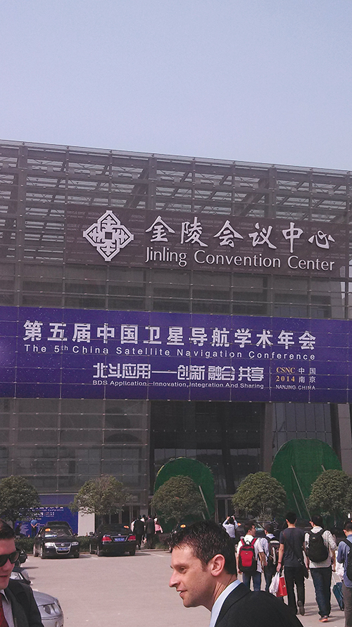
I attended the China Satellite Navigation Conference in Nanjing in May, the fifth year of CSNC and my third time attending. Tremendous progress was evident this year in terms of BeiDou (BDS) deployment and China’s general openness and willingness to collaborate over those years. I have also seen a slowly growing international presence at the show and expect that to continue to increase as well. You may recall my column last year about Little Tigers. Well, they aren’t so little any more. As for the tycoons, you will have to read to the end.

    The conference opened with the usual provider updates. Chenqi Ran, who runs the China Satellite Navigation Office, the lead government agency for BDS, started off. It’s always good to hear his update delivered in China, where the is a little more freedom to provide information beyond the standard pitch. China continues on pace to its plan for the third step of BDS with five geosynchronous-orbit, three inclined geosynchronous-orbit, and 27 mid-Earth orbit satellites for a worldwide system by 2020. They are meeting their stated goal of 10-meter accuracy regionally today, and as good as 5-meter near the Equator. Ran also provided interesting numbers for the fast-growing Chinese domestic market:

    • More than 2 million BDS chips sold in China in Q1
    • More than 300,000 vehicles equipped with BDS
    • 20 domestic brands offering car navigation systems
    • First consumer tablet (Samsung Galaxy Note 3) with BDS.
    • First consumer smartphone (Huawei B199) with BDS

    The updates from other providers (GPS, GLONASS, and Galileo) were relatively standard and did not contain much new information. I had hoped that maybe the Russian presentation would provide more information about the April outages, but nothing was forthcoming and I was not overly surprised.

    CSNC-4
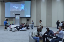
The conference itself is very well organized and runs nine parallel technical tracks over two full days, with additional special-interest sessions. All of the presentations are in Chinese, however the conference provides headsets for simultaneous translation, and many presenters have dual slide sets in Chinese and English, so it is easy to attend anything that seems interesting.

    I came as an invited speaker on the Institute of Navigation (ION) panel organized by Professor Jade Morton from Miami University, Ohio, and Professor Lu of the National Timing Service Center near Xian. The ION panel was well attended and included a short panel discussion at the end.

    One of the most interesting outcomes was that both Broadcom and Trimble showed approximately 25 percent accuracy improvement by adding Beidou to their existing GPS/GLONASS solutions. It was interesting not just because they reached the same number, but because Broadcomm was talking in meters about urban-canyon performance and Trimble was talking in centimeters about precise positioning.

    It became clear that everyone sees BDS as an important part of their roadmap at L1, regardless of how many frequencies they currently support. I must also note that both Professor Morton and Professor Lu were outstanding hosts and showed us some of the wonderful local sites.
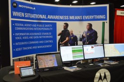
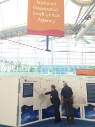
    Exhibit Hall

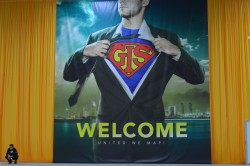
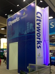
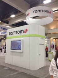
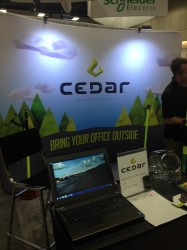
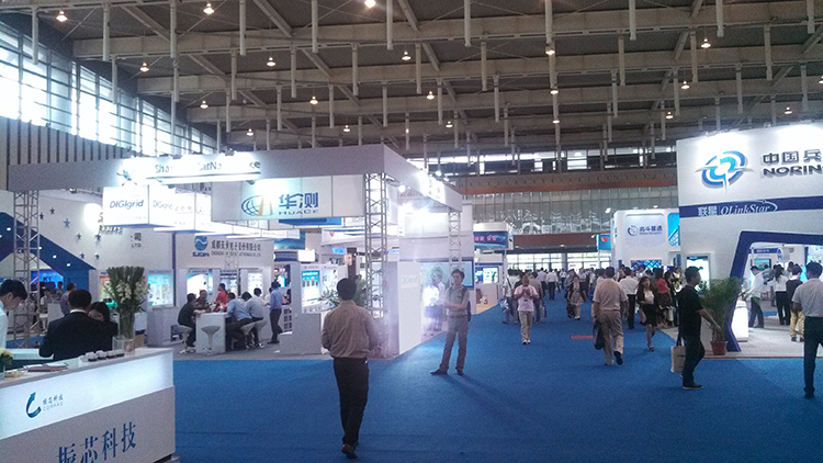
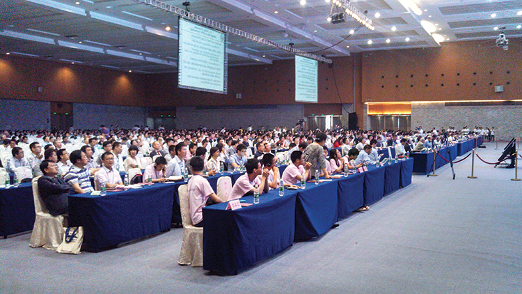
    The biggest change from last year was in the exhibit hall. I would estimate the overall floor space grew by 50 percent, with 106 companies in specially designed booths (up from 56 last year) and another 44 in standard booths.

    The content change was even more dramatic. Last year there were a lot of small booths with pretty basic displays, mostly of prototypes and slideshows. This year, there were many more extremely large booths that were very professionally created. They had evolved into displaying very polished-looking finished products with nicely edited videos. It was clear that this was all targeted at domestic buyers, as it was difficult to find anyone on the show floor who spoke English (except in the Spirent booth). These are no longer little tigers. These are now real companies, out hunting for new business.

    CSNC-3

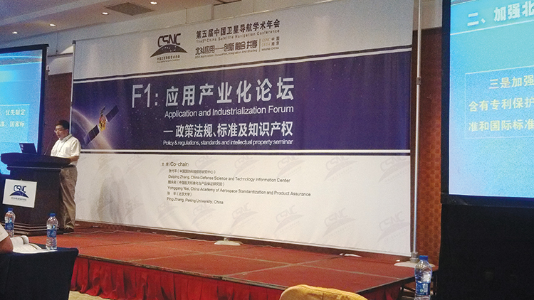
    Policy and Intellectual Property

    My other favorite topic to listen to at this conference is on policy and intellectual property (IP). That is where I spent most of my time and was not disappointed. There was in fact an entire session dedicated to intellectual property, and several presentations on the global state of affairs of patents in GNSS.

    Interestingly, most of the speakers were either lawyers or from government, but there were some corporate ones as well. Several speakers highlighted the recent disagreement and settlement of the patent dispute between the United States and the United Kingdom over complex modulation patents. There was a large element of underlying concern that although the U.S. had been able to settle the dispute, it might be very hard for China if either the U.S. or the UK came after them. They had several charts showing how far behind they were in GNSS patents, in an effort to encourage local companies to create more IP and patent it. They also showed they have made significant progress in recent years in domestic Chinese patents, though they still have a long way to go in international patents.

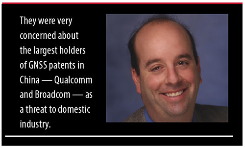
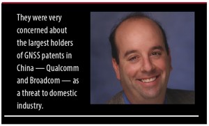
    They were also very concerned about the largest holders of GNSS patents in China — Qualcomm and Broadcom — as a threat to domestic industry. They cited the GlobalLocate/Broadcom versus SiRF/CSR lawsuit as a cautionary tale. Several presenters showed the dominance of Broadcomm and Qualcomm in terms of domestic Chinese patent holdings and referred to them as the “Tycoons.” I envisioned Rich Uncle Moneybags, the guy from the Monopoly game wearing the top hat, walking around with patents instead of dollar bills hanging out of his hat.

    CSNC-1Conclusion

    The little tigers have definitely grown up. They are much bigger, have real teeth, and are definitely trying to stake out territory in the fast-growing domestic market. But the Tycoons still have the upper hand in the mass-market battle for consumer devices. For the moment, anyway.

    The Tycoons are going to have to start spending some of their bounty in China if they want to maintain that market share against rapidly evolving domestic competition. I won’t be surprised if next year we see the Tycoons exhibiting at CSNC, and soon after that, the tigers looking to expand their hunting ground into nearby markets in Korea, India, and Japan.


    Greg Turetzky is a principal engineer at Intel responsible for strategic business development in Intel’s Wireless Communication Group focusing on location. He has more than 25 years of experience in the GNSS industry at JHU-APL, Stanford Telecom, Trimble, SiRF, and CSR. He is a member of GPS World’s Editorial Advisory Board.

    The statements, views, and opinions presented in this article are those of the author and are not endorsed by, nor do they necessarily reflect, the opinions of the author’s present and/or former employers or any other organization the author may be associated with.

  • Trimble Opens Registration for 2014 Dimensions User Conference

    Dimensions_2014_PSD_logoRegistration is open for Trimble’s International User Conference, Trimble Dimensions, being held November 3-5 at the Mirage and the Treasure Island Hotels in Las Vegas. The conference addresses innovations in agriculture, construction, civil infrastructure, engineering, government, mapping, natural resources, surveying, telecommunications, transportation, logistics and utilities.

    Trimble Dimensions provides insight into how information technology can transform the way professionals work by using integrated workflows to increase productivity, the company said. Participants can hear how industry colleagues use Trimble’s end-to-end technology to transform data into intelligent, usable information. Attendees will see first-hand how new tools, processes and ideas can help make a positive impact on their business.

    Throughout the conference, attendees will have a variety of opportunities to network with key industry players, nurture existing business relationships, build partnerships, and discover how to overcome challenges in today’s competitive business environment.

    Highlights include more than 400 educational sessions, including both on-site and off-site immersive training, more than 30 specialized tracks to advance career objectives with many sessions qualifying for Professional Development Hour (PDH) hours, and on-site product demonstrations.

    For more information, visit www.trimbledimensions.com or send an email to [email protected]. In addition, interested speakers are encouraged to visit the website to learn more about the conference and submission process. Abstracts can be submitted online at trimbledimensions.com/call_for_speakers.

  • ESA Recognizes First Galileo Navigation Fixes

    ESA Recognizes First Galileo Navigation Fixes

    ESA offered to issue certificates for the  first 50 Galileo positioning fixes — provoking responses from across the whole world. While half the applications came from Galileo’s home continent, others came from the rest of the world, including Australia, Canada, China, Egypt, New Zealand, Russia, United States, and Vietnam.
    ESA offered to issue certificates for the first 50 Galileo positioning fixes — provoking responses from across the whole world. While half the applications came from Galileo’s home continent, others came from the rest of the world, including Australia, Canada, China, Egypt, New Zealand, Russia, United States, and Vietnam.

    Billions of satnav position fixes are performed daily, but determining your place in the world using Europe’s Galileo system is quite new. Because of this, in March the European Space Agency (ESA) offered to issue certificates for the first 50 Galileo fixes.

    Responses to the offer came from around the world. While half the applications came from Galileo’s home continent, others came from Australia, Canada, China, Egypt, New Zealand, Russia, the United States, and Vietnam.

    The first two satellites of Europe’s Galileo constellation were launched in October 2011, followed by two more a year later. Four is the minimum needed for determining position, allowing testing of the full Galileo system to begin.

    Slovakian company GoSpace performed Galileo positioning while driving around Bratislava on 1 May 2014. The company was among those certified by ESA for their early Galileo positioning achievement.
    Slovakian company GoSpace performed Galileo positioning while driving around Bratislava on 1 May 2014. The company was among those certified by ESA for their early Galileo positioning achievement.

    The historic first positioning fix using only Europe’s civil-owned navigation system took place at ESA’s Navigation Laboratory in its ESTEC technical centre in Noordwijk, the Netherlands, on March 12, 2013.

    Galileo’s navigation signals could be picked up anywhere in the world that the orbiting satellites come into view, however. Equipped teams from industry, universities, research centers, and government institutions took the opportunity to perform their own fixes, along with a couple of private individuals.

    The Galileo team knew of fixes being performed on an informal basis. The idea came to mark the anniversary of the first positioning fix by issuing commemorative certificates to groups who had picked up the signals to perform their own fixes. Teams were asked to include details of the receiver they used, the start and finish of the fixes in Universal Time Coordinated (UTC) and a plot of their latitude/longitude positioning overlaid on a map, such as Google Earth.

    • Italy turned out to be the single best-represented country in Europe, with six separate fixes,
    • Germany and the UK followed Italy closely with five fixes each.
    • Several groups achieved fixes on the very same day as ESA.
    •     Figure 1. Positions obtained by only Galileo E1 Open Service (the antenna is located at the roof of the Ta Quang Buu library building inside HUST campus)
      Galileo positioning performed in the NAVIS Centre at the Hanoi University of Science and Technology in Vietnam on March 27, 2013, overlaid on a Google Earth map.

      Most of the receivers were software-based radio systems, with signal processing performed by software on a computer linked to a radio-frequency front end. Professional receivers were also customized.

    • A private individual from Gdansk, Poland, used his own receiver to perform a fix, intended for amateur rocketry.
    • An individual in Pec, Hungary, achieved a fix with a modified receiver.
    • Most of the applications were obtained with static receivers and simple position fixes with Galileo’s Open Service signals, but there were some special cases. These included precise point positioning, where offline processing is applied to give extremely precise centimeter-scale positioning — typically used in surveying, the oil and gas industries, and precision agriculture. Some of these fixes were actually performed before the first real-time positioning fixes, including fixes done at the University of New Brunswick.
    • Belgium’s Royal Military Academy performed Galileo’s first position fix at sea, aboard Belgian frigate Leopold-I, which sailed along the Norwegian coast.
    • A navigation company from New Zealand performed positioning while walking.
    • A technology firm in Slovakia performed drive testing.
    • A German telecom company made use of the satellite signals for timing and network synchronization. One of the most important applications of Galileo will be as a nanosecond-scale time source, enabling the effective synching of financial, power and data networks around the globe.
    A Trimble Navigation team used one of their own handheld receivers to perform Galileo-based positioning in pedestrian testing in Christchurch, New Zealand on 14 April 2014. The results are overlaid on a Google Earth map. 
    A Trimble Navigation team used one of their own handheld receivers to perform Galileo-based positioning in pedestrian testing in Christchurch, New Zealand on 14 April 2014. The results are overlaid on a Google Earth map.

    The certificates will be issued soon.

    General use of Galileo will begin as more satellites join the first four in orbit so the first services can be rolled out. The next two Galileo satellites are in French Guiana, beginning their preparations for launch.

    It should take only a slight software update to ready the current generations of satnav receivers to work with Galileo signals, ESA said.

    Sources of Galileo certification applications.
    Sources of Galileo certification applications.
  • Trimble CenterPoint RTX Correction Service Available for Heavy Construction

    Trimble’s CenterPoint RTX correction service is now available for heavy civil construction applications. Available worldwide as a subscription service, CenterPoint RTX offers construction companies a flexible and easy-to-deploy option for conducting pre-bid reconnaissance and initial site measurements without using a traditional base station, the company said.

    “Offering CenterPoint RTX for heavy construction applications further extends the Trimble Connected Site strategy to simplify site operations. CenterPoint RTX will make it easier to collect high-quality data in the early phases of site establishment, improving material estimates and job bids,” said Roz Buick, vice president and general manager of Trimble’s Heavy Civil Construction Division. “With more accurate material estimates and bids, contractors can incur fewer change orders and avoid unnecessary costs and delays.”

    Based on Trimble RTX technology, CenterPoint RTX is a satellite-delivered positioning source that streams GNSS corrections to rover systems with the Trimble SPS985 GNSS Smart Antenna, SPS985L GNSS Smart Antenna, or SPS855 GNSS Modular Receiver. There is no need to have an additional data plan or additional hardware.

    The CenterPoint RTX service is a correction source for construction sites in the pre-bid and site planning phases. Construction surveyors and estimating teams can use CenterPoint RTX to perform topographic surveys, estimate quantities, and conduct site planning quickly and easily, before a base station is needed on site for machine control and other high-accuracy applications.

    “Trimble strives to provide advanced GNSS correction services that fit our customer’s specific needs and applications,” said Patricia Boothe, general manager of Trimble’s Positioning Services Division. “For the heavy civil construction industry, this means a job crew can arrive on a new construction site and begin conducting site measurements and collecting data right away. CenterPoint RTX also makes it easier to work on multiple construction sites with the same rover system. There is no need to pair the rover with an existing base station at each individual site.”

    Trimble CenterPoint RTX is a subscription service available through Trimble Positioning Services in North America, South America, most of Europe, Russia and the Commonwealth of Independent States (CIS), Africa, Asia, and Australasia.

  • Trimble Adds Automated Mapping and Plotting to Office Suite for Surveyors

    Trimble has introduced a new version of its office software suite used by surveyors and geospatial professionals for processing and analyzing geospatial data. Trimble Business Center Version 3.21 introduces new coordinate reference systems and a specialized Advanced Drafting module, which enables faster project turnaround and better decision making.

    The optional Advanced Drafting module adds highly customizable templates and simplified selection tools, which are designed to reduce the time required to generate high-quality deliverables, such as geospatial maps and corridor cross-sections. Now, professionals working on road, pipeline, and railway projects can achieve efficiency gains through the software’s new automated cross-section plotting functionality.

    Also included in the new module is the ability to create 3D PDFs so that team members and clients can collaborate from any computer or mobile device using Adobe Reader software.

    “Trimble Business Center is the enterprise solution for surveyors and geospatial professionals to produce high-quality deliverables,” said Alain Samaha, business area director of GIS and Software for Trimble’s Geospatial Division. “These new capabilities demonstrate the continued evolution of our software portfolio to provide customers with an end-to-end solution to fulfill their client’s high-end requirements in the most efficient way.”

    Trimble Business Center Software version 3.21 and the Advanced Drafting module are now available through Trimble’s Geospatial Distribution Channel.

  • Intuicom Announces Next-Generation RTK Bridge-X with Wi-Fi

    Intuicom Announces Next-Generation RTK Bridge-X with Wi-Fi

    Intuicom RTK Bridge-X.
    Intuicom RTK Bridge-X.

    Intuicom, Inc., a wireless data solutions provider for the survey, machine control and precision agriculture industries, has added to its line of RTK Bridge solutions with the Intuicom RTK Bridge-X.

    Along with providing reliable access to RTK corrections, the RTK Bridge-X features a Wi-Fi hotspot. Users can connect other Wi-Fi devices such as laptops, tablets and smartphones and access the Internet via the RTK Bridge-X’s cellular connection. Also new with the RTK Bridge-X is cable-free configuration. Configuration can now be accomplished through a wireless connection using any web browser.

    Users can then access email, send files, and perform other Internet-based tasks using the connection provided by the RTK Bridge-X. With new Remote Access, the RTK Bridge-X can be reached over the Internet from anywhere.

    The RTK Bridge-X also comes with internal GPS. Users can choose between an internal license-free 900-MHz radio, industry-standard UHF radio, or no radio.

    Other improvements include a real-time cellular signal strength indicator on the re-designed front panel, as well as an Ethernet port that can be used for configuration or Internet connectivity. A numerical LED display now shows which of the four configurable profiles is active as well as which radio channel is selected. Bluetooth connections are also supported.

    Like all Intuicom Bridge Products, The RTK Bridge-X is designed for easy setup and operation and is compatible with all major cellular carriers and equipment manufacturers including Leica Geosystems, Trimble, and others.

    RTK-Bridge-X-and-buttons-W

  • Trimble Adds Agronomic Service to Connected Farm Solution

    Trimble is offering a new agronomic service that is part of its Connected Farm solution. The new service, Soil Information System (SIS), provides farmers and their trusted advisors with in-depth 3-D soil data they can use to make more informed decisions about their crop production goals.

    The SIS data is accessed through Connected Farm and can be used with Trimble’s Farm Works farm management software or other GIS platforms. Connected Farm enables better decision making by providing one central location for accessing key information impacting farm operations such as rainfall totals, weather forecasts, commodity tracking, planting coverage, yield mapping, fleet management, and irrigation monitoring and control, Trimble said.

    The SIS 3D soil mapping technology uses advanced sensors along with intelligent targeting and geoprocessing algorithms to produce high-resolution, accurate soil and topographic information. By providing a greater understanding of the physical and chemical characterization of the soil, including how inputs move through the soil, SIS enables farmers to initiate more effective solutions to resolve the unique challenges of each area of their fields. The SIS solution outputs precise, multi-layer soil models that are more comprehensive than traditional methods used in the industry today. Some examples of map types include: root zone depth, soil texture, plant available water, compaction depth, macro and micro-nutrient levels, soil nutrient holding capacity, and salt and toxicity concentrations.

    By analyzing soil variability and patterns prior to sampling — and by using its industry-exclusive data acquisition and analysis software — SIS provides targeted recommendations on the best locations where soil samples should be taken. In some cases this reduces the number of samples required to provide high-quality information by as much as 60 percent over traditional sampling methods. As a result, the solution enables agronomists to be more efficient with in-field data collection, providing valuable time and operating cost savings.

    “By adding the Soil Information System solution to Connected Farm, Trimble is providing farmers and their agronomists with critical soil information they can use to improve crop production and benefit the bottom line,” said Levi Kettle, Connected Farm business area director of Trimble’s Agriculture Division. “For example, knowing the soil’s plant available water capacity can aid in irrigation layout, scheduling, moisture sensor targeting, root stock selection and many other management decisions.”

    “Variability in yield and quality are due primarily to non-uniform soils being managed as uniform soils. In the past, our inability to identify the components of this soil variability prevented us from achieving greater crop uniformity and better economic returns,” said Robert Wample, Ph.D., a plant physiologist and owner of Edgeknoll Consulting, an SIS service provider. “SIS allows us to take a proactive approach to overcoming soil variability, and when combined with geo-referenced variability in crop yield and quality, the effectiveness of this approach is enhanced even more resulting in an ‘agricultural forensics’ approach to precision agriculture.”

    The SIS solution is available in several service levels depending on the accuracy and resolution required for the particular crop type and the grower’s production goals.

  • Trimble Introduces Compact OEM GNSS UHF Receiver Module for High-Accuracy Positioning

    Trimble Introduces Compact OEM GNSS UHF Receiver Module for High-Accuracy Positioning

    The Trimble BD930-UHF high-performance integrated UHF receiver.
    The Trimble BD930-UHF high-performance integrated UHF receiver.

    Trimble has introduced the Trimble BD930-UHF receiver and communication module. As part of Trimble’s GNSS OEM portfolio, the new compact module features centimeter-level, Real-Time Kinematic (RTK) positioning capabilities coupled with an integrated UHF receiver for precise mobile positioning. The BD930-UHF module’s connectivity and configuration capabilities allow system integrators and OEMs to easily add GNSS, centimeter-level positioning to specialized or custom hardware solutions.

    “The OEM and system integrator communities demand high performance, reliability and support for their positioning solutions,” said Dale Hermann, general manager of the Integrated Technologies division at Trimble. “The Trimble BD930-UHF delivers the latest GNSS and communication technology in an easy-to-integrate form factor for demanding conditions and applications such as field computing, port automation and lightweight robotic or unmanned vehicles. With the BD930-UHF module, customers are purchasing a solution not just a GNSS receiver.”

    Taking advantage of Trimble’s expertise in both GNSS and UHF communications, the Trimble BD930-UHF module has been designed for applications requiring centimeter accuracy in a compact package. By integrating wireless communications on the same module, the task of receiving RTK corrections is significantly simplified.

    The triple-frequency GPS/GLONASS/BeiDou/Galileo BD930-UHF provides customers with a multi-constellation solution that can reduce their integration effort and time to market. Ethernet connectivity and onboard web server allows high-speed data transfer and configuration via standard browsers. USB and RS232 ports are also supported. By tightly integrating communications with the GNSS receiver, integrators can reduce costs, power, weight and size.

    The Trimble BD930-UHF is expected to be available in July 2014 through Trimble’s Precision GNSS + Inertial sales channel worldwide.

  • Trimble Field Link Software for Construction Gets New Version

    Trimble is offering Field Link 2.20, the latest version of its software for management of layout tasks associated with building construction. The new release extends field layout capabilities for contractors and field teams, providing task-based workflows, customizable views, and a touch-screen user interface designed to optimize the information presented.

    To find the exact location of a point in the field, users can now visualize where they are inside the 3D model relative to the layout point in their Trimble Field Link software, giving a more intuitive, realistic 3D perspective viewpoint and making it easier to navigate to the selected point.

    Trimble Field Link Version 2.20 encompasses updates to Trimble Field Link for MEP and Trimble Field Link for Structures field software, which now include augmented 3D model support, and an enhanced in-model perspective layout view for a more productive and realistic field layout experience. Trimble Field Link also provides users with better visualization, navigation and rendering of building models, as well as the capability to import much larger, more sophisticated models.

    In addition to the advancements made in performing layout-specific tasks, Trimble Field Link adds reporting routines to detail layout productivity, and the ability to document existing site conditions for information requests (RFIs).

    Bentley Systems. Trimble also announced its collaboration with Bentley Systems to enhance information mobility between the design and field construction processes. This collaboration enables users to share their 3D constructible models between design and engineering applications and Trimble Field Link 2.20 via Bentley’s mobile i-model technology. A Bentley CONNECTIONS Passport, which entitles use of Bentley’s mobile apps and mobile i-models, is provided with Trimble Field Link.

    Bentley i-models are containers for the open exchange of infrastructure information that enable project team members to share and interact with complex project data and across product lines and technology platforms. Using i-models, project teams can exchange and distribute packages of information within multi-organizational, multi-disciplinary, and multi-phase construction projects to continue uninterrupted workflows, and to easily adapt to real-time project changes.

    “By joining forces with Bentley, Trimble is giving contractors and other building construction professionals greater choice, accuracy and flexibility in performing their field layout tasks,” said Mark Sawyer, general manager of the General Contractor / Construction Manager Division of Trimble Buildings Group. “Our companies share complementary visions of boosting productivity in all facets of construction projects, and we’re pleased to connect our advanced technologies to deliver greater benefits to the industry.”

  • Trimble Irrigate-IQ Solution Now Available in North America

    Trimble is making available the Trimble Irrigate-IQ precision irrigation solution in North America. Along with the North American launch, Trimble also introduced the Connected Farm Irrigate app, which provides farmers with real-time status and control of their pivot irrigation systems using a smartphone or tablet.

    The Irrigate-IQ GPS-controlled solution, which is installed on the pivot, enables farmers to remotely control their irrigators via the Internet, including performing variable rate irrigation, and receive reports about where water or fertilizer has been applied. With the solution, farmers can apply the optimal amount of water, fertigation or effluent where needed, which can improve crop quality and yield, while minimizing nutrient and chemical runoff. The solution enables farmers to conserve water use and improve efficiency, reduce energy costs for fuel and electricity, minimize input costs, comply with environmental regulations, and safely dispose of effluent. In addition, Trimble’s brand-agnostic strategy allows farmers to use the solution with most irrigator makes and models. Irrigate-IQ is also available in New Zealand.

    In addition, Trimble introduced the Connected Farm Irrigate app for use on an iPhone, iPad, Android smartphone or tablet. The app allows farmers to see the status of their pivots, including whether they are operating or not operating, in which direction they are traveling, the heading, pump pressure, pivot voltage and type of material being dispersed (water, fertigation, or effluent). It also gives farmers the ability to remotely start or stop their pivots, choose the direction (forward or reverse), turn the pump on or off or switch the type of material being dispersed. This new functionality comes in addition to farmers’ ability to remotely control their irrigators by accessing the Irrigate-IQ software on a desktop or laptop computer, rugged mobile computer or tablet.

    “Now that Trimble has expanded availability of its Irrigate-IQ solution, and launched the Connected Farm Irrigate app, farmers across North America and New Zealand will be able to monitor and control their irrigators from virtually any location,” said David Fitzpatrick, business area director of Trimble’s Agriculture Division. “Irrigate-IQ allows farmers to be more strategic with their irrigation planning, while the app creates time savings and increased efficiencies by allowing farmers to respond to weather changes or faulty equipment on the fly without being on site.”

    The Irrigate-IQ solution and Connected Farm Irrigate app are both part of Trimble’s Connected Farm solution, which includes a robust suite of recently announced features including soil analysis, rainfall totals, weather forecasts, commodity tracking, and now irrigation monitoring and control.