Blog

  • ComNav launches auto-steering system

    ComNav launches auto-steering system

    Credit: ComNav
    Credit: ComNav

    ComNav Technologies has introduced the AG502 automated steering system. It integrates advanced satellite reception, positioning, navigation and automatic driving to meet the diverse demands of modern agriculture.

    The system consists of a GNSS tablet, an electric steering wheel, two angle sensors and two GNSS antennas, offering a plug-and-play capability with simple instillation and calibration. It is equipped with a ComNav SinoGNSS to support full-constellation and multi-frequency tracking.

    It is designed to withstand harsh outdoor agricultural environments. With waterproof and dustproof properties, the system offers weather resistance and durability in diverse conditions.

    The AG502 is equipped with connectivity modules, featuring a 4G modem alongside UHF radio. It offers farmers the flexibility to access real-time kinematics (RTK) correction sources from local RTK networks or GNSS RTK base stations. It uses the combined GNSS+INS terrain compensation technology to provide automated steering accuracy, with a precision of 2.5 cm. This level of precision makes the system ideal for tasks such as ditching, planting and harvesting.

    For the remotely located or often network-lacking fields, the system offers a reliable precision point positioning (PPP) solution, which supports PPP-HAS and PPP-B2b service. It also features intuitive and user-friendly 2D/3D software, streamlining the learning and operation process for easy start-up. It supports various work modes such as straight, curved, automatic u-turn and pivot to accommodate diverse farmland and work requirements.

    ComNav offers comprehensive training videos of the AG502. In the event of technical challenges, users have access to remote technical support or can reach out to local dealers via phone, email or messaging apps for prompt assistance.

  • ESA invests €233 million to launch Genesis and LEO-PNT missions

    ESA invests €233 million to launch Genesis and LEO-PNT missions

    Genesis satellite. (Image: ESA)
    Genesis satellite. (Image: ESA)

    The European Space Agency (ESA) has initiated two navigation missions, Genesis and low-Earth-orbit positioning, navigation and timing (LEO-PNT) as part of its FutureNAV program. ESA has awarded contracts, totaling €233 million, to several European entities to begin the development of the missions. They are designed to address the growing demand for more resilient and precise navigation solutions in Europe.

    Genesis, with a contract value of €76.6 million, involves a consortium led by OHB Italia, tasked with the development and operation of the Genesis satellite and its payloads, supported by contributions from Italy, Belgium, France, Switzerland, Hungary and the UK. The satellite is expected to launch in 2028, with subsequent years dedicated to scientific exploitation. Genesis aims to significantly improve the International Terrestrial Reference Frame (ITRF) and offer unprecedented precision for navigation and a myriad of Earth sciences applications.

    For the LEO-PNT mission, ESA has distributed €78.4 million for each of the two contracts for the development of in-orbit demonstrators. These LEO-PNT satellites will explore new signals and frequency bands, designed to provide enhanced resilience, accuracy and speed in navigation. The projects are led by GMV Aerospace and Defense and Thales Alenia Space France and involve a broad consortium of more than 50 entities from 14 countries. The first LEO-PNT satellite is expected to launch within 20 months from the project’s commencement, with the complete constellation operational before 2027.

    LEO-PNT satellite. (Image: ESA)
    LEO-PNT satellite. (Image: ESA)

    Genesis is designed as a flying observatory to refine the ITRF to an accuracy of 1 mm and a stability of 0.1 mm/year, serving as a crucial reference for all space- and ground-based observations. This enhanced reference frame is designed to directly benefit satellite-based systems and applications across various sectors, including aviation, traffic management and autonomous vehicles. It is intended to have have broader implications for meteorology, natural hazard prediction and climate change monitoring.

    The LEO-PNT mission aims to establish a small constellation of demonstration satellites to test novel navigation signals and interoperability with GNSS to offer improved signal robustness and extended navigation services to challenging environments such as deep urban areas and indoors. This mission will explore the potential of LEO constellations in supporting a wide range of applications, from transportation and critical infrastructure to mobile devices and asset tracking using advancements in communication standards, such as 5G/6G.

  • NextNav enhances positioning and timing capabilities

    NextNav enhances positioning and timing capabilities

    Image: NextNav
    Image: NextNav

    NextNav has entered an agreement to acquire additional spectrum licenses in the lower 900 MHz band (902 MHz to 928 MHz) from Telesaurus Holdings and Skybridge Spectrum Foundation. This acquisition, valued at up to $50 million, significantly expands NextNav’s spectrum portfolio by an additional 4 MHz.

    With the completion of this transaction, NextNav’s total spectrum assets will surge to 3.5 billion MHz-PoPs, which marks a significant leap in the company’s capacity to offer reliable and precise positioning and timing solutions.

    The transaction involves an initial cash payment of $2.5 million due within 30 days following the court’s authorization to proceed. The balance will be settled in NextNav common stock, contingent upon reaching specific milestones, the final transfer of licenses and obtaining necessary regulatory approvals. The successful closure of this deal is subject to Court and regulatory clearances, including approval from the Federal Communications Commission (FCC).

    NextNav aims to deliver PNT solutions that use 3D geolocation and PNT technology, facilitated by its ownership of low-band licensed spectrum. The company’s technologies are designed to ensure accurate, reliable and resilient 3D PNT solutions across a broad spectrum of applications, ranging from critical infrastructure and GPS resiliency to various commercial use cases.

  • Seen & Heard: UAVs to the rescue, fire strikes in Chile

    Seen & Heard: UAVs to the rescue, fire strikes in Chile

    “Seen & Heard” is a monthly feature of GPS World magazine, traveling the world to capture interesting and unusual news stories involving the GNSS/PNT industry.


    Photo: ChristinaFelsing / iStock / Getty Images Plus / Getty Images
    Photo: ChristinaFelsing / iStock / Getty Images Plus / Getty Images

    UAVs to the rescue

    A child reported missing in Robbinsville, N.J., was found in less than 10 minutes using a UAV equipped with a thermal camera, WPVI reported.

    On the night of January 17, Robbinsville Police received a call reporting a missing child last seen running into a heavily wooded area. Officers dispatched the department’s UAV equipped with thermal imaging cameras, which allowed officers to quickly locate the missing boy through thick vegetation after dark. The child was unharmed, according to the report.


    Photo: Maxar Technologies
    Photo: Maxar Technologies

    Fire strikes Chile

    Maxar Technologies has released satellite images showing the widespread damage caused by raging wildfires in Chile’s Valparaíso region. The fires have killed more than 122 people. The images show entire neighborhoods destroyed east of the resort town of Viña del Mar yet do not show active wildfires. The fires reportedly surged in the Valparaíso region, fueled by winds and an intense heatwave that has seen temperatures of around 40° C.


    Photo: seregalsv / iStock / Getty Images Plus / Getty Images
    Photo: seregalsv / iStock / Getty Images Plus / Getty Images

    No drones in the prison yard

    The UK government has introduced regulations establishing a 400 m UAV “no-fly zone” around prison facilities. The announcement addresses the escalating use of UAVs by criminals attempting to transport illicit items — including phones, drugs and weapons — into prisons.

    The initiative is a response to the increase in the number of UAVs detected or sighted within prison grounds, which more than doubled between 2019 and 2021, according to a press statement from the UK government. The implementation of “no-fly zones” aims to enhance law enforcement’s ability to catch organized criminals in the act. Additionally, these measures are designed to prevent illegal aerial filming of prisons.


    Photo: Bim / E+ / Getty Images
    Photo: Bim / E+ / Getty Images

    Back to the fields

    GNSS jamming by the Israeli Defense Forces (IDF) has forced retired farmers in the Israeli settlement Mevo Hama to return to the fields. In an interview with CTech, local farmer Rami Laner shared that the younger equipment operators do not know how to operate the modern tractors for spraying or sowing tasks without the aid of their GNSS-based autonomous systems. With the IDF intentionally jamming and spoofing GNSS signals, civilians in the area are in search of alternative PNT systems to protect communities and maintain workflows.

  • Join the upcoming Resilient Navigation and Timing Foundation reception

    Join the upcoming Resilient Navigation and Timing Foundation reception

    Gen. David Thompson
    Gen. David Thompson

    Join the Resilient Navigation and Timing Foundation for a reception with the President’s National Space-based Positioning, Navigation, and Timing Advisory Board on April 23 at The Antlers Hotel in Colorado Springs. The event begins at 6:00 PM. General David Thompson, U.S. Space Force (retired) will discuss his experience as the first Vice Chief of Space Operations, the state of GPS, and the future of PNT.

    For more information and to RSVP, contact [email protected] by April 17.

  • PNT Advisory Board at 20:  Still serving up big ideas

    PNT Advisory Board at 20: Still serving up big ideas

    • Quickly prototype a GNSS interference detection and reporting system.
    • Implement an internet-based High Accuracy and Robustness Service (HARS)for GPS.
    • Relax export controls that currently restrict use of adaptive anti-jam antennas.

    These are just three of the efforts the U.S. government is pursuing as a result of recommendations from the President’s National Space-based Positioning, Navigation and Timing (PNT) Advisory Board.

    For 20 years the PNT Advisory Board has been providing the government independent expert advice about GPS and PNT.

    Established by presidential directive in 2004 and administered under the Federal Advisory Committee Act by NASA, its charter has been regularly renewed. The charter provides that the board shall:

    • Be composed of experts from outside the United States government.
    • Seek input from state and local governments, industry and academia on developments in the application of space-based PNT technologies.
    • Evaluate national and international needs for changes in space-based PNT capabilities and assess possible trade-offs among options.
    • Provide independent advice and recommendations to the National PNT Executive Committee (co-chaired by the Deputy Secretaries of Defense and Transportation) on policy, system requirements, and program needs.

    While “space-based” is in its name and charter, the board has long recognized that terrestrial assets also can play an important role in serving PNT users by augmenting, reinforcing, and complementing GPS. The use of complementary systems, for example, could help demotivate intentional jammers and spoofers and help safeguard users during any interference event. Thus, the board often considers a wide range of capabilities and systems.

    The board also discusses policy, education, international relations and other issues important to the PNT community. As one board member commented, “Technology doesn’t exist in a vacuum. It is developed by, and intended to serve, people. If you don’t recognize that, you are missing most of the picture.”

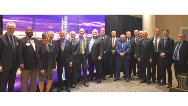
    The current board’s membership includes an impressive array of experts in PNT policy and technology. Its 29 members include a former governor, a retired admiral, three retired generals, GPS’ original chief architect, a former undersecretary, a former assistant secretary, three former presidents of the Institute of Navigation (ION), three international members and experts from across academia and industry.

    Chaired by former Coast Guard Commandant Admiral Thad Allen, the board’s primary efforts are driven by its six subcommittees, reflecting a holistic approach to effective PNT:

    • Strategy, Policy & Governance
    • Protect, Toughen & Augment
    • Emerging Capabilities, Applications & Sectors
    • Education & Science Innovation
    • International Engagement
    • Communications & External Relations

    While the subcommittees meet in fact-finding sessions to gather data, the PNT Advisory Board’s deliberations are public. Semi-annual meetings in  Washington, D.C. and other locations may be attended by anyone, either in person or virtually. Announcements on the board’s webpage and in the Federal Register provide details before each meeting. By law, the minutes of each meeting are available to the public, and video recordings of meetings are normally posted as well.

    Input from the public about PNT issues of concern is also welcome to inform the board’s current and future deliberations. Information on how to send input will be posted with the meeting announcement here

    According to board member Jeff Shane, former undersecretary at the U.S. Department of Transportation (DOT), the PNT Advisory Board is evidence of government at its best. “The very fact that the board was established underscores our government’s willingness to hear and consider the widest variety of views and input. It should be a source of optimism, and even pride, for the entire PNT community.”


    National Space-based PNT Advisory Board

    The next meeting will be from 9:00 a.m. to 6:00 p.m. MDT, April 24, 2024, and from 9:00 a.m. to noon April 25 at The Antlers Hotel in Colorado Springs, Colorado. Click here for information on a reception on April 23, featuring Gen. David Thompson.

  • SparkFun launches Iridium antenna

    SparkFun launches Iridium antenna

    Image: SparkFun Electronics
    Image: SparkFun Electronics

    SparkFun Electronics has released the 2J7426MPz by 2J antenna, a high-performance magnetic mount antenna designed to communicate with the Iridium satellite communication system. It is manufactured with high-quality polycarbonate (PC) and acrylic-styrene-acrylate terpolymer (ASA), a thermoplastic combination that offers strong resistance to UV, moisture, and heat and enhances mechanical properties.

    The antenna housing is waterproof to IP69 standards and designed to operate in extremely harsh environments, including those with frequent exposure to water, dust and debris. It has a recommended operational and storage temperature of -40°C to +85°C. The magnetic mount allows for easy installation and removal between vehicles or assets, and it is easily converted to an adhesive type for greater flexibility.

    It is delivered with a standard SMA-male connector and a standard 300 cm long coaxial LL100 cable. Iridium has certified the 2J7426MPz antenna for commercial use in connection with the Iridium communications system.

  • EAB Q&A: OCX is more than seven years behind schedule. What are the consequences?

    EAB Q&A: OCX is more than seven years behind schedule. What are the consequences?

    OCX is more than seven years behind schedule. What are the consequences?


    Greg Turetzky Principal Engineer Intel
    Greg Turetzky

    It’s more consequential than most people realize. The first and most impactful consequence is the limitation of the GPS constellation to
    32 satellites. There are more healthy satellites in the sky and, more importantly, Block III satellites sitting in the barn. These additional satellites and their modernized signals would improve navigation globally with improved accuracy and resilience. Additionally, without OCX the L5 signals are labeled ‘unhealthy’ and therefore the constellation is labeled ‘pre-operational.’ Without OCX, L5 cannot reach initial operational capability (IOC), which prevents certain market segments from being able to officially use them. GPS will remain in third place if the delay continues.

    — Greg Turetzky
    Consultant


    F. Michael Swiek
    Michael Swiek

    OCX seems more than seven years behind when you consider that we have been hearing about it as a concept and then a proposal for years before it became an actual program. In the Hope and Crosby movie, “The Road to Rio,” Jerry Colonna leads a cavalry charge to rescue the heroine across several brief scenes. He never arrives, and the heroine is saved by other means. Colonna then proclaims, ‘Well, we didn’t make it, but we sure added some excitement!’ While waiting for the heroic arrival of OCX, might the evolution of technology, and regular updates to the current system, already provide some of the improvements promised by OCX? The OCS is already upgraded to accommodate Contingency Operations for GPS III satellites, M-Code early use and incorporated cyber security protections. Is it, maybe, time to just move beyond OCX and start anew with today’s context and assessment of future needs?

    — Michael Swiek
    GPS Alliance

  • Kongsberg Discovery launches hydrographic surveying solution

    Kongsberg Discovery launches hydrographic surveying solution

    Image: Kongsberg Discovery
    Image: Kongsberg Discovery

    Kongsberg Discovery has released the Seapath 385 navigation system. It is designed to enhance precision in hydrographic surveying by using advanced navigation algorithms and integrating a range of satellite signals, including GPS, GLONASS, Galileo, Beidou and QZSS, alongside geostationary satellite signals.

    The system combines raw inertial sensor data from Kongsberg Discovery’s proprietary high-performance motion gyro compass (MGC) or motion reference unit (MRU) with GNSS data and corrections from real-time kinematics (RTK), precise-point positioning (PPP) or Differential Global Navigation Satellite System (DGNSS). The integration offers a robust and accurate navigation solution ideal for hydrographic surveying.

    The system’s dead reckoning capabilities are attributed to its advanced inertial sensors and updated navigation algorithms. It uses GNSS antennas for both positioning and heading determination designed to add an extra layer of robustness to the system. The Seapath 385 also introduces a new post-processing format that consolidates all necessary data and system configurations into a single file, which allows for centimeter-level position accuracy through either satellite orbit and clock data or data logged from base stations.

    Designed for ease of installation and continuous, reliable operation, the Seapath 385 is a modular system with a processing unit that handles all critical computations independently of the user interface on the HMI Unit. This feature offers precise measurements with a data rate of up to 200 Hz at multiple monitoring points, which makes it an ideal solution for accommodating sensors or systems that depend on motion or position data throughout the vessel.

  • FCC warns of security risks

    FCC warns of security risks

    Image: FCC logo
    Image: FCC logo

    The Federal Communications Commission (FCC) is investigating whether the use of Russian and Chinese foreign satellite systems by U.S. mobile phones and other devices poses security threats.

    The FCC has concerns that U.S. handheld devices are receiving and processing GNSS signals from satellites controlled by foreign adversaries in violation of commission rules.

    The FCC is seeking answers from handset manufacturers Apple, Google, Motorola, Nokia, Samsung and others that collectively cover more than 90% of the U.S. smartphone marketplace.

    “There is no established record of what security threats, if any, these signals carry and whether the manufacturers of handheld devices are processing these signals in violation of the Commission’s rules,” an FCC spokesperson said in a statement.

    Representative Mike Gallagher, chair of the U.S. House Select Committee on the Strategic Competition Between the United States and the Chinese Communist Party, wrote FCC Chair Jessica Rosenworcel earlier this week raising concern about reports that U.S. cell phones were receiving and processing signals from Chinese and Russian satellites.

    The FCC has only approved U.S. phones to receive and process signals from the U.S. Global Positioning System (GPS) and the European Galileo GNSS.

  • CHCNAV unveils handheld SLAM laser scanner

    CHCNAV unveils handheld SLAM laser scanner

    Image: CHCNAV
    Image: CHCNAV

    CHC Navigation (CHCNAV) has released the RS10 handheld SLAM lidar laser scanner integrated with a full real-time kinematics (RTK) GNSS receiver. Designed to improve efficiency across a wide range of mapping and surveying applications, the RS10 seeks to provide professionals with a versatile, all-in-one tool for capturing 3D geospatial data in both outdoor and indoor environments.

    The device integrates a GNSS smart antenna for RTK positioning accuracy even in challenging environments. It delivers 5 cm measurement accuracy by fusing high-precision lidar, RTK, laser and visual SLAM using three HD cameras. It uses a powerful onboard processor for real-time georeferenced point cloud generation in the field. Users can receive instant feedback, which allows them to adjust while scanning. Large sites up to 13,000 square meters can be mapped in real time.

    The integration of high-precision GNSS and SLAM technologies eliminates the need for traditional loop closure, which often complicates the data collection process for handheld scanners. Users can freely scan target areas without having to return to previous locations, which can streamline field data capture and significantly reduce time spent in the field.

  • u-blox launches GNSS platform for urban environments

    u-blox launches GNSS platform for urban environments

    Image: u-blox
    Image: u-blox

    u-blox has introduced the F10 dual-band GNSS platform. It combines L1 and L5 bands to offer enhanced multipath resistance and meter-level positioning accuracy. The platform caters to urban mobility applications, such as aftermarket telematics and micro-mobility.

    Applications that use GNSS receivers for accurate positioning are on the rise. Yet, current receivers do not fully perform in urban areas. Accurate and reliable positioning in dense urban environments — where buildings or tree foliage can reflect satellite signals — requires GNSS receivers to mitigate multipath effects. The L5 band’s resilience to these effects aims to improve positioning accuracy. Combined with the well-established L1 band, an L1/L5 dual-band GNSS receiver can deliver a less than 2 m positioning accuracy (CEP50), against about 4 m with the L1 band only. The u-blox team has conducted driving tests in several urban areas and reported significant improvement over GNSS L1 receivers.

    The F10’s firmware algorithm prioritizes L5 band signals in weak signal environments to provide reliable positioning accuracy, even when paired with small antennas. The platform is also equipped with protection-level technology that provides a real-time positioning accuracy estimate.

    When a cellular modem is extremely close to a GNSS receiver, it can interfere with the receiver’s reception. Some F10 module models, such as NEO-F10N, MAX-F10S, and MIA-F10Q, are equipped with a robust RF circuit that allows the GNSS and the cellular modem to operate without interference.

    The u-blox F10 platform is pin-to-pin compatible with the previous u-blox M10 generation for easy migration. It also supports u-blox AssistNow, which offers real-time online A-GNSS service with global availability to reduce GNSS time-to-first fix and power consumption.

    The u-blox EVK-F101 evaluation kit will be available in April 2024.