Marking the lines of a soccer field in Vejle, Denmark using a TinyLineMaker Pro X. (Photo. Unicore)
Robotic technology is increasingly integrated into daily life, including applications such as delivery vehicles, automated lawn mowers and line painting robots. Among the critical factors shaping the navigation capabilities of these robotic machines, precise positioning and heading are paramount. Leveraging Unicore’s high-precision GNSS real-time kinematics (RTK) module, TinyMobileRobots, a Danish company, has developed advanced autonomous systems that excel in navigating complex environments.
RTK technology, which greatly compensates for errors in GNSS satellite signals, enables real-time positioning accuracy within 1 cm to
2 cm. The RTK algorithm in Unicore’s UM960 multi-constellation, multi-frequency GNSS module gives it high reliability, precision and fix rate.
Sports fields grounds maintenance teams at schools, parks, housing developments and other locations often need to refresh line markings, which is a very labor-intensive and challenging process. In search of a more rapid and efficient solution, the team marking the lines of a soccer field in Vejle, Denmark, opted for TinyMobileRobots’ autonomous system. This system is becoming popular among groundskeeping teams due to its ability to queue multiple pitches for sequential marking without recalibration, maximizing productivity. It also alerts users when it is running low on paint and estimates its remaining time and distance. The enhanced capacity afforded by the robot’s efficiency also allowed the team to explore new service offerings, such as providing line marking services to other organizations.
The TinyLineMaker Pro X estimates when it will run low on paint and alerts users. (Image: Unicore)
For outdoor robotic applications, GNSS technology’s levels of accuracy range from sub-meter positioning to decimeter and centimeter levels in real time, depending on the specific application. When integrated with complementary sensors such as inertial navigation systems (INS), vision, and radar, robotic navigation can be effectively realized across diverse and complex environments.
Several technologies — ranging from very mature to nascent — are converging to make autonomous vehicles and devices more useful, efficient, and reliable than ever. They include real-time kinematic (RTK) GNSS, inertial navigation systems (INS), cameras, and radar for navigation; cameras, lidar scanners, multibeam echosounders, and a variety of other sensors for data collection; software-defined radios (SDRs) for secure communications; and artificial intelligence (AI) to plan routes, coordinate the movements of multiple autonomous vehicles and devices (including “swarms” of UAVs), and analyze the data collected.
Read this cover story, featuring case studies from Unicore and CHCNAV, interviews with executives at Per Vices and M3 Systems, and images from Frontier Precision and YellowScan.
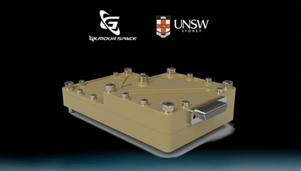
The Australian Space Agency has funded the development of an Australian aerospace-grade Global Navigation Satellite System (GNSS) receiver to use in rockets, satellites and aircraft under its Moon to Mars Supply Chain Capability Improvement Grants scheme.
Gilmour Space Technologies, in collaboration with the University of New South Wales (UNSW), will co-develop the GNSS receiver using an Australian supply chain and qualify it for use across a wide range of positioning, navigation and timing (PNT) applications. The GNSS receiver will be based on proven technology from UNSW, benefiting from Gilmour Space Technologies’ space manufacturing expertise and commercialization efforts.
Kody Cook, head of software, electrical, GNC and avionics at Gilmour Space Technologies, highlighted the importance of this initiative for the nation’s aerospace endeavors. “With the future becoming less certain, we’re thankful that Australia is investing in the sovereign development of exactly these types of fundamental capabilities,” he said. “If we could use more Australian-made avionics in our launch vehicles and spacecraft, we would.”
Inertial Labs and Sony have partnered to integrate lidar technology into Sony’s Airpeak UAV. The collaboration aims to improve the UAVs applications in surveying, mapping and cinematic videography, as well as provide high accuracy and detail to aerial data acquisition.
The partnership will incorporate Inertial Labs’ RESEPI lidar remote sensing payload instrument GEN-II into Sony’s UAV to enhance Airpeak’s ability to produce detailed aerial maps and 3D models.
Tailored for professionals, the lidar system integrated into Sony’s Airpeak drone UAVwill significantly enhance workflow efficiency and data accuracy, particularly in sectors such as construction, agriculture, and filmmaking, according to Inertial Labs. The system allows for extensive data handling and facilitates longer durations of data collection without frequent offloads.
In one way or another, GNSS is constantly in the news, even though it rarely makes the headlines. Three recent articles prove this point.
Matteo Luccio
The article “Starburst” in the March 4 issue of The New Yorker, written by staff writer Kathryn Schulz, details how the next big solar storm could devastate the U.S. power grid and communication systems and questions whether we are prepared for it. Schulz focuses repeatedly on the key role of GNSS and how devastating it would be if their signals were disrupted by a solar storm. She points out that a large solar storm has not occurred since widespread electrification, let alone in the digital age, and that some scientists now believe there is an approximately 12% chance of an extreme geomagnetic storm striking Earth in the next decade. “The Army,” Schulz wrote, “concerned about overreliance on vulnerable technologies, has reinstated courses in orienteering, and the Navy has resumed teaching sailors how to use a sextant.”
A March 12 article in WISPOLITICS — which bills itself as “Wisconsin’s Premier Political News Service” — reports on a letter from the chairman of the U.S. House Select Committee on the Strategic Competition between the United States and the Chinese Communist Party, Mike Gallagher, to Federal Communications Commission (FCC) Chairwoman Jessica Rosenworcel. Following reports that U.S. cell phones and other devices are receiving and processing signals from Chinese and Russian GNSS satellites, Gallagher asked Rosenworcel whether it is “contrary to FCC rules for handsets and other devices to receive and process signals from unauthorized GNSS constellations.” I have long wondered the same thing. If any of you readers has a firm understanding of this issue, please let me know. Gallagher also asked whether it is “the responsibility of component vendors, device makers, or carriers to ensure that such signals are not received and processed by devices that use GNSS” and whether the FCC has taken any enforcement actions on this matter.
A March 14 article by Elliot Ackerman and James Stavridis in The Wall Street Journal warns that, as its headline says, “Drone Swarms Are About to Change the Balance of Military Power.” Ackerman, a Marine veteran, is the author of numerous books and a senior fellow at Yale’s Jackson School of Global Affairs. Admiral Stavridis, U.S. Navy (ret.), was the 16th Supreme Allied Commander of the North Atlantic Treaty Organization (NATO) and is a partner at the Carlyle Group. “Drones have become suddenly ubiquitous on the battlefield — but we are only at the dawn of this new age in warfare,” they wrote. “[D]ozens or hundreds of drones in AI-directed swarms will have the capacity to overwhelm defenses and destroy even advanced platforms. Nations that depend on large, expensive systems like aircraft carriers, stealth aircraft or even battle tanks could find themselves vulnerable against an adversary who deploys a variety of low-cost, easily-dispersed and long-range unmanned weapons.” While the article focuses on AI and does not mention GNSS, the latter is a key enabling technology for UAVs, as readers of this magazine know well.
Iridium STL is being deployed by L3Harris to protect critical FAA data center infrastructure. (Photo: Iridium)
Iridium Communications has entered a five-year agreement with L3 Harris. Under the agreement, Iridium will provide its satellite time and location (STL) service to more than three dozen L3Harris-operated communications network backbone nodes and a similar number of Federal Aviation Administration (FAA) facilities throughout the United States.
L3Harris, responsible for operating a private network for the FAA, provides voice, data and video communications for the National Airspace System operations and mission support functions. Given the critical nature of timing synchronization within the L3Harris communications network, particularly for supporting various critical infrastructure applications, the Iridium STL service plays a pivotal role in the overall network timing architecture by eliminating dependencies on GPS as the primary timing source.
The solution for L3Harris includes compact devices provided by Adtran’s Oscilloquartz division, which are designed to receive Iridium STL signals. These devices seamlessly integrate into the network and meet nationwide network timing synchronization requirements.
In April 2024, Iridium acquired Satelles, a secure satellite-based time and location service provider.
Current state of the art multi-frequency GNSS receivers operate by receiving L1 first and then L5. L5-first is a viable answer to the call for more resilience in GNSS as is being discussed in government and technical circles to protect vital national infrastructure. It is suggested as part of “Toughening Category 4: Signal Alternatives” to protect, toughen and augment (PTA) the current GNSS systems described by Brad Parkinson’s article in the March 2022 issue of GPS World.
Paul McBurney
The need arises from attacks directed by bad actors on a large scale, such as electronic warfare, and on a more humane scale, by bad actors such as self-jammers and spoofers. On top of that, normal interference can cause desensitization and denial of service on GNSS receivers from myriad terrestrial and satellite communications.
The PTA plan presents the Denial Radius Reduction Ratio (DRRR) figure of merit and shows that a J/S increase of 15 dB produces a DRRR of 0.18. Whereas a receiver without this additional 15 dB of J/S could be denied fixing out to 1 km from a given transmitter, a receiver with an additional 15 dB J/S would be denied out to only 180 m from the same transmitter.
The improvement in terms of area is proportional to radius squared. The article identifies that the J/S capability is different among GNSS signals and the best performance is obtained with L5, mainly because it has the highest chipping rate. L1C has a code length of 10,230 chips, the same as L5, but it is spread over 10 msec and has the same chipping rate as L1 C/A.
There are currently 72 L5 signals between GPS, Galileo, BeiDou and QZSS transmitting the same physical layer features of 10.23 MHz chipping rate, 1 kHz overlay codes and higher transmit power compared to nearly all L1 signals with a 1.023 MHz chipping rate and lower transmit power. The combination of these features at L5 is close to achieving this 15 dB performance level over L1.
Unlike current hybrid receivers, L5-first survives L1 jamming. (Photo: Carkhe / iStock / Getty Images Plus / Getty Images)
One might conclude that the current start of the art of a receiver with both frequencies (aka, a hybrid L1+L5) has this resilience. However, the market does not currently offer the ability to directly acquire L5 signals overall use cases of GNSS assistance without first acquiring signals at L1. This means they can only achieve this resilience when the interference is encountered after acquiring and fixing at L1. As soon as the L1 is lost and the position and time uncertainty grow beyond the receiver’s capacity to autonomously search for L5 signals, the receiver is denied service at the interference level tolerable at L1. If you cut the receiver into L1 and L5 pieces, only the L1 side is capable of fixing autonomously. As noted by Dennis Akos et al. (“Testing COTS GNSS Receivers Using Only a Subset of Supported Signals,” ION JNC 2023), “support for several signals/frequencies provides integrity and robustness.” Specifically, “under jamming scenarios, signal diversity can allow a receiver to still generate an accurate position solution.”
Current receivers are not able to acquire L5 for reasons related to history, cost and power consumption. Historically, the promise of L5 accuracy was so attractive that it was added to legacy chipsets based on L1 even when it was only partially deployed. It was impractical at that time to require L5 acquisition when there were fewer L5 satellites than at L1. Cost and power are related to the fact that L1 receivers’ acquisition methods are sized to acquire the L1, E1, B1 and G1 signals. Memory and compute capacities, including the digital clock speed, are sized for slower chipping rates and hence shorter code lengths. At this performance level, conventional time domain correlation is adequate. Some receivers deploy frequency domain methods at L1 and achieve a lower cost and power than time domain methods with similar capacity. However, the L5 acquisition complexity with time domain correlation is 100 times more than L1 as its complexity increases with N2, meaning the cost and power to acquire L5 is out of reach. While using a time domain acquisition engine to acquire L5 may be possible for strong signals when the code and frequency search space is constrained for those signals, directly acquiring L5 with conventional methods would have serious shortcomings in many use cases.
Interestingly, the signal designers across all GNSS systems have cleverly designed the L5 signals so they can be easily acquired after acquiring their counterparts on L1. The L5 primary and secondary code is predictable based on learning the L1 primary code and navigation data bit phase. E5a and B2a primary and secondary codes can be predicted by learning the well-designed E1/B1 primary and secondary code phases that have the same total period: the combination of the 4 msec code lengths synchronous with 25 bits of secondary code are in phase with the E5a 100 msec overlay code. After an L1 fix with fine time, L5 can similarly be directly acquired easily with limited searching.
On April 4, residents of Tel Aviv, Israel, noticed that map applications on their phones such as Waze, Google Maps and the taxi pickup app Gett were placing them in Lebanon’s capital, Beirut, 130 miles to the north. Cab drivers could not navigate and food-delivery apps were temporarily out of service, reported The Wall Street Journal.
The spoofing was a result of the Israeli military tampering GPS signals to brace for possible retaliation by Iran or one of its allied militias after a suspected Israeli airstrike on an Iranian diplomatic building in Syria. The attack killed a senior Iranian general, Mohammad Reza Zahedi, and six other military officials. It has marked an escalation of the yearslong conflict between Israel and Iran.
According to WSJ, analysts say a direct Iranian strike on Israel is unlikely. However, one day after Israel drafted reservists to boost air defenses, the Israeli military said it would pause all leave for combat units “in accordance with the situational assessment.”
Israel has withdrawn some of its ambassadors and evacuated its embassies in multiple locations. With tensions and uncertainty rising, several Israeli municipalities near Tel Aviv put out announcements to calm residents and refresh guidance for emergencies.
According to the Israeli military, the GPS spoofing — which can be used to confuse targeting systems for military weapons — was part of an effort to protect the country. “Today we initiated GPS disruption in order to neutralize threats,” said Israeli military spokesman Daniel Hagari. “We are aware that this disruption causes discomfort, but this is an essential and necessary tool in our defense capabilities.”
Israel has ramped up GPS jamming and spoofing since the start of its war with Hamas in early October 2023, but mainly in the north of the country, where the Iranian-backed Hezbollah militia has rockets to strike Israeli towns and military bases, according to Reuters.
The military has scrambled signals in southern Israel, mainly around the city of Eilat, the target of missile and UAV attacks by Iranian-backed Yemeni and Iraqi militias, according to Yigal Unna, former director general of the Israel National Cyber Directorate.
The GPS disruptions have intensified since the most recent strike and have spread to central Israel where a local taxi driver shared that his map application had located him at the Rafic Hariri International Airport in Beirut. In the south of the country, and in Jerusalem and the occupied Palestinian West Bank, GPS devices placed users in Cairo, residents told WSJ.
Mohammad Abdelhalim, founder of the Palestinian navigation app Doroob, said that signal interruptions have occurred regularly on various platforms that rely on GPS since the Oct. 7 Hamas-led attacks on Israel, ranging from a few minutes to several hours at a time.
Spoofing can pose risks beyond being a nuisance for citizens. Distorting signals can create challenges for civilian and commercial planes that use GPS signals for navigation. Spoofing can also throw guided missiles off their trajectory, which poses unpredictable risks to civilians.
The ramifications of the widening GPS blackouts remain unclear. Beyond the hassles for civilian drivers, there are safety concerns for emergency responders and commercial transit unable to reliably track locations.
The recent spoofing in Tel Aviv is one of countless reminders that the country’s active military actions are only miles away and can have cascading effects on aspects of daily life.
EpiSci and Northrop Grumman have entered a strategic collaboration to develop and deploy advanced autonomous tactical solutions to the United States and its allies.
Under the collaboration, EpiSci’s TacticalAI software will be integrated into Northrop Grumman’s aeronautics system architecture. This integration is anticipated to significantly enhance the operational efficiency and success of warfighter missions through trusted autonomous technologies, according to EpiSci.
The collaboration uses the U.S. government’s open-architecture design, allowing Northrop Grumman’s autonomy solutions to incorporate third-party technologies. This allows UAVs to adapt to evolving mission requirements and offers military commanders greater flexibility in complex scenarios.
EpiSci’s TacticalAI technology is designed to improve autonomous solutions for human-machine teaming. It offers cognitive sensing, adaptive communications and networking systems, and battle management command and control (BMC2). This technology is being developed to enhance autonomous defense capabilities across a wide range of platforms, including uncrewed aerial and maritime systems, as well as tactical fighter aircraft.
Topcon Positioning Systems has launched MC-Max asphalt paving and MC-Max milling solutions. The systems offer modularity, simplified configurations and advanced feature sets to increase productivity in asphalt paving and cold milling applications.
The MC-Max Asphalt Paving and MC-Max Milling systems, which are made up of GNSS receivers, total stations, displays and other high-precision sensors, are built with the new MC-X machine control platform. Users can choose from entry-level 2D systems that follow a reference, such as a string or a curb, or automated solutions that track a paver or miller in 3D.
Contractors can pave and mill at variable depths while meeting smoothness standardsmandatedby the U.S. Department of Transportation (DOT) mandated smoothness standards. The solutions also include MC-X licensing options. The technology is compatible with OEM CAN-based systems and has expanded to include compatibility with additional aftermarket systems, according to Topcon.
It is equipped with Virtual Ski intelligence software designed to simplify workflows in specific resurfacing applications, such as rural roads where there are fewer fixed points or intersections to match up to.
“Our mobile road scanner easily creates a 3D model of the existing road surface, which can be sent to the machine using our Sitelink3D cloud solution,” said Murray Lodge, executive vice president, Topcon. “Simply scan and mill or lay the base layer and let the milling machine or the paver do the surface design job instead of all that data having to go back to the office for the design work. This results in the production of a smooth surface more quickly with less effort and significant time savings. Thanks to the flexible, digital calculation, which follows the road direction even in tight curves, the overall quality and lifespan of the resurfaced road is improved.”
The company also released the RD-MC road construction machine control solution, which can be utilized in areas without satellite reception by using a local positioning system (LPS) solution to offer precise positioning when working in challenging GNSS coverage areas.
AUVSI XPONENTIAL 2024 will be held April 22 to 25 at the San Diego Convention Center in San Diego, California.
The event’s key themes include infrastructure and operations, technical research and development, data and analytics, cybersecurity and policy and regulations. The conference will feature keynotes, educational sessions, specialized workshops, and an XPO Hall with more than 30 exhibit categories with technologies across air, land and maritime sectors.
XPONENTIAL attracts more than 7,500 attendees each year, who attend more than 200 educational sessions as part of the full conference. The current keynote sessions include innovators with diverse perspectives and backgrounds who will speak on pressing topics and address key questions affecting the autonomous community.
Confirmed speakers include:
Doug Beck
Director, Defense Innovation Unit
Operationalizing DIU 3.0
Responsible for accelerating the Department of Defense (DoD) adoption of commercial technology through the military, Beck will discuss how defense agencies and industry can collaborate to strengthen national security. This session will be moderated by Courtney Albon, emerging technology reporter for Defense News and C4ISRNET.
Michael Brasseur
Chief Strategy Officer, Saab Inc.
To Create, To Make, To Shape
Drawing upon his role in implementing Saab’s future capabilities strategy, Brasseur’s presentation will address how individuals and organizations can foster an environment of continuous improvement and advancement.
Hal Brands, Ph.D.
Henry A. Kissinger, professor of global affairs, Johns Hopkins School of Advanced International Studies
Advancing Technologies and Their Role in World Affairs
Using his knowledge in foreign policy, international relations and security strategy, Brands will help leaders conceptualize strategies to safeguard national interests and organizations to navigate geopolitical challenges.
Henrik I. Christensen, Ph.D.
Qualcomm chair of robotics and professor, computer science, director of contextual robotics institute, UC San Diego
Looking Ahead: Robotics and Artificial Intelligence
Henrik will explore the future of these technologies and how stakeholders can form strategies that capitalize on emerging opportunities.
Harry Yeff (aka Reeps One)
AI Artist and AI for Good Activist
Undoing a Narrative of Fear
Yeff, a London-born, neurodivergent artist, will share how we can foster a constructive dialogue on responsibly integrating technologies such as artificial intelligence (AI) and autonomy. His performance art pieces, integrated with AI and voice technology, have been exhibited internationally and garnered more than 100 million online views worldwide.
Additionally, a Federal Aviation Administration (FAA) Panel titled “Getting to Go,” will cover safety standards, implementation challenges and obstacles to technology development and testing. Panelists include three representatives from the FAA: Timothy Arel, chief operating officer of the air traffic organization, Marc Nichols, chief counsel and Laurence Wildgoose, assistant administrator for policy, international affairs and environment.
Matt McCardle, head of global regulatory affairs and strategy at Amazon Prime Air will moderate the discussion.
GPS World staff will be attending the conference. To follow our live coverage, click here.
More speakers will be announced in the coming weeks. Click here to learn more and register.
In February 2024, Vision Pro, Apple’s long-awaited extended reality (XR) headset, hit stores. It is Apple’s stab at the consumer XR market, but XR is not how Apple describes it. Instead, when it was announced last summer, Apple CEO Tim Cook said the headset marks the dawning of the era of spatial computing. “You’ve never seen anything like this before,” he added.
Greg Milner
That is not quite true.
The term spatial computing dates to the 1980s. Its modern definition entered the lexicon in 2003. Simon Greenwold, a graduate student in the Program in Media Arts and Sciences at the Massachusetts Institute of Technology (MIT), described spatial computing wherein a human interacts with a machine, and that machine retains and manipulates referents to objects and spaces in the real world.
But spatial computing extends back even further. It has been the cornerstone of geographic information system (GIS) technology since the software programs debuted in the late 1960s. Indeed, the theoretical foundation of GIS is that it is not only possible but inherently useful to retain and manipulate real objects within some form of virtual space.
In the first GIS programs, virtual space was synonymous with cartographic space. Spatial computing means using maps to organize large amounts of data in a visually intuitive manner.
The Roots of Spatial Computing
Early geospatial technology pioneers applied the concepts of such theorists as Ian McHarg, who described the world as a series of layers of information that exist and interact in the same physical spaces. If we analyze any spot on Earth, we encounter such informational layers as elevation, soil type, hydrology, biology and land use.
GIS brought this idea to life. The technology allows us to visualize and analyze layers of data on a map. In this way, GIS has become a key integrator of information about our world, from science to engineering to commercial operations.
Through innovation, GIS has grown beyond the bounds of mere 2D map layers to generate maps that are, in effect, 1:1-scale 3D models we call geospatial digital twins.
The major benefit of geospatial digital twins is the ability to provide maximum context. This is especially useful for smart planning of our urban environments. For example, architects can use a digital twin to test how their proposals will fare in such situations as flooding and extreme heat brought about by climate change. City planners can understand the effects of large-scale shifts in the urban environment with interventions focused on enhancing livability. The combination of visualization and hard data allows them to predict impacts and modify plans before making expensive changes to the physical world.
Spatial Computing and Digital Twins
Each advance in GIS technology has improved our ability to visualize, link and manipulate real objects and spaces in a digital realm.
GIS has evolved to offer truly immersive experiences. In particular, the combination of GIS and game engines such as Unreal and Unity has transformed the process of large-scale infrastructure projects.
In Brisbane, Australia, for example, a digital twin of the ongoing subway construction has been used to display progress. People can walk virtually through planned subway tunnels and stations. This contextual experience helps project leads show Brisbanites how the work is shaping up.
The experience also allows planners, architects, engineers and construction workers to make decisions with more information than could be provided by a paper map or even a traditional digital twin. They can stand on a platform and see how the design elements of a station will look to people moving through it.
Spatial Computing to Visualize What Could Be
Digital twins can be crystal balls. The virtual spaces can be reconfigured to model different versions of an environment. In practical terms, digital twins allow various stakeholders to have the same vision. This is especially useful in the age of climate change.
Planners and architects can test different versions of a project. If they are designing a subdivision in a coastal community, they can calculate the flooding and storm surge that will likely occur from storms of different magnitudes. Just as important, they can visualize this data, inhabit it, and study it with maximum context.
At root, what they are doing is investigating spatial relations against a realistic backdrop of the world. For the subdivision, these objects include homes, streets, streetlights, and parks, and what matters is their existence in relation to water under multiple scenarios. This is spatial computing: manipulating referents to real objects in a virtual world that, unlike the real one, can be changed at will.
Spatial Computing to Visualize Hidden Real Spaces
Immersive environments also offer the promise of displaying a world that is real and already exists yet remains largely invisible.
Public utilities and other companies involved with underground infrastructure have been some of the most enthusiastic adopters of digital twins because the experience can reveal critical connections buried beneath the earth — made visible without the need to dig.
In 2017, the Toms River Municipal Utilities Authority (TRMUA) in Toms River, New Jersey, began using mixed reality (MR) headsets to help crews find underground utility assets for electric, gas, water, telecommunications and sewer services.
GIS stores the location of these assets, and MR displays the underground infrastructure. Traditionally, utilities display this detail on a 2D map. What MR provides is maximum context. Workers in the field can visualize exactly what is under their feet—and see how it’s related spatially to what is all around them.
TRMUA credits MR with saving time and lowering the chances of breaking connections in the networks residents rely on for modern living — savings in the tens of thousands of dollars every day.
Many utilities have since followed TRMUA’s lead. MR setups serve multiple purposes, including training new employees and sharing information between teams in the field and staff in the office.
One utility industry publication recently noted that what these systems ultimately provide is the elimination of guesswork. The ability to know exactly where an asset is located — and to understand how changes will affect the area around it — leads to increased efficiency and customer satisfaction.
The World in Sharper Focus
Apple’s Vision Pro headset is not the only recent example of XR rebranded as spatial computing. Meta and Microsoft have also marketed their XR headsets — Quest 3 and Hololens, respectively — as spatial computers.
Spatial computing will continue its mainstreaming. Eventually, it will likely be the norm. As XR hardware increases in number and power, more organizations will look to unlock the value of all the spatial data recorded in GIS. Being able to experience data will add further value to the systems and workflows that create it.
GIS pioneers began exploring the outer limits of spatial computing a half-century ago. More recently they have realized its potential for smarter urban planning, climate risk mitigation, management of operations across industries and virtual exploration of real-world systems or scenarios via geospatial digital twins. Someday soon, those limits will be reachable by anyone.
As GIS users have learned through the decades, when we get a better sense of where we are in relation to things we care about, we can create the world we want to see.