Blog

  • Launchpad: dual-band antennas, mobile clocks, UAV upgrades and more

    Launchpad: dual-band antennas, mobile clocks, UAV upgrades and more

    Read a roundup of recent products in the GNSS and inertial positioning industry from the June 2025 issue of GPS World magazine.


    MOBILE

    Photo: SiTime

    Mobile Clock Generators
    With an integrated MEMS resonator

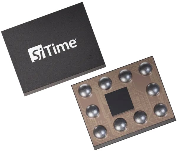
    SiTime’s Symphonic is a mobile clock generator built around the SiT30100, which integrates a MEMS resonator and a temperature sensor in a compact 2.22 mm² chip. Designed for 5G and GNSS chipsets, Symphonic delivers precise, resilient clock signals while supporting efficient power consumption in mobile and IoT devices, including smartphones, tablets, laptops and asset trackers.

    The integrated temperature sensor feeds data to compensation algorithms, providing frequency stability as low as ±0.5 parts per million to enhance GPS accuracy and shorten lock times, which is critical for reliable performance in challenging environments. The device operates across a -30°C to 90°C temperature range and is engineered for dynamic stability and power optimization, helping to mitigate electromagnetic interference. Symphonic features four configurable clock outputs, each capable of delivering 76.8 MHz, 38.4 MHz or 19.2 MHz, suitable for baseband, radio frequency and GNSS applications. The single-chip design eliminates the need for external resonators.

    SiTime, sitime.com

    Photo: Calian GNSS

    Dual-Band L1/L5 Antenna
    For critical positioning and timing applications

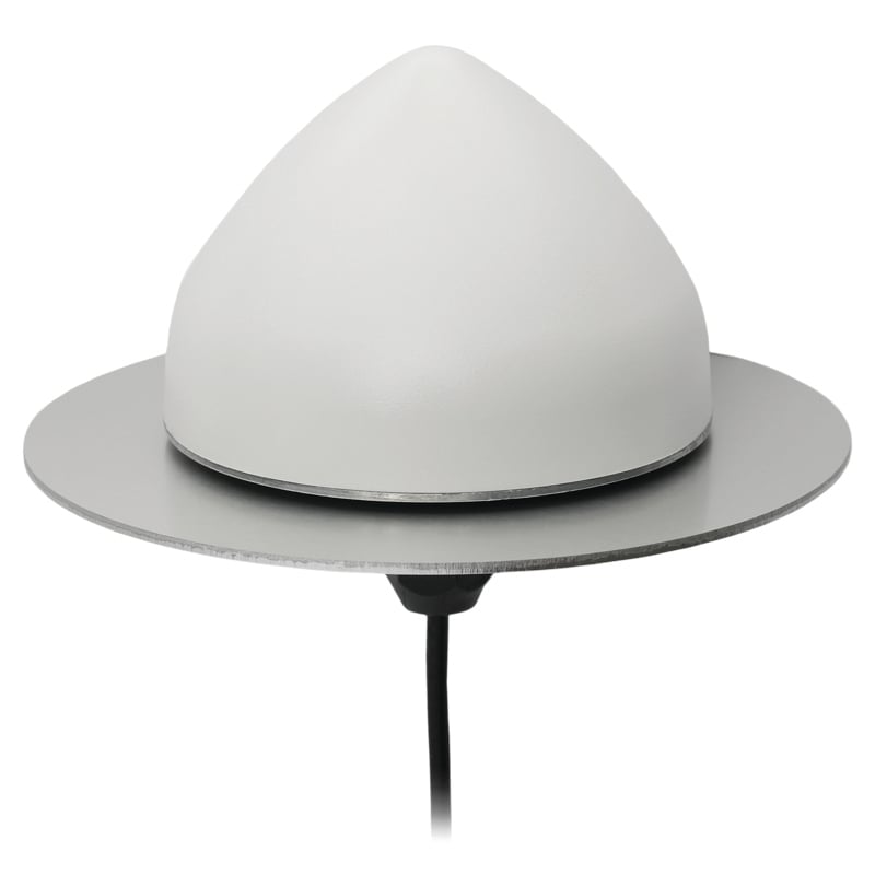
    The TW3885TL is a dual-band GNSS antenna engineered to deliver reliable, interference-free signal reception for critical positioning and timing applications. Supporting both L1 and L5 frequency bands, the antenna is compatible with a wide range of global navigation satellite systems, including GPS, QZSS, Galileo, BeiDou, GLONASS and NavIC, as well as regional satellite-based augmentation systems.
    The TW3885TL incorporates advanced filtering technology designed to reduce interference from crowded radio frequency environments. It features a low-noise preamplifier, with a typical noise figure of less than 2.5 dB, and offers high gain, typically around 40 dB. The antenna maintains a low axial ratio, under 2.0 dB, and exhibits tight phase center variation, which contributes to precise timing and superior signal quality. Constructed with a weatherproof enclosure rated to IP69K, the TW3885TL is suitable for permanent outdoor installations and can be mounted through-hole, with optional accessories available to support various mounting configurations.
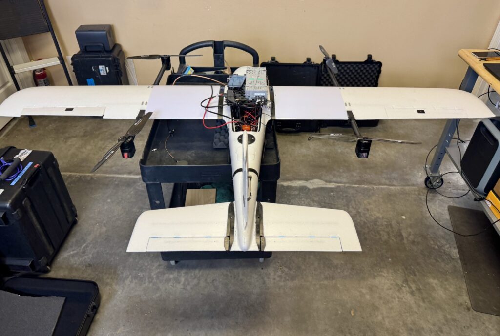
    Calian GNSS, calian.com


    UAV

    Photo: AgEagle Aerial Systems

    Software Upgrades
    Enable positioning in GNSS-denied environments

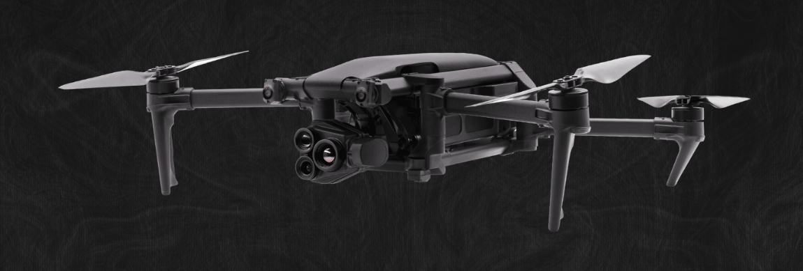
    eBee VISION application software now includes a suite of updates for UAV navigation in environments where GNSS signals are compromised or unavailable. The latest software enables autonomous position updates with map referencing, allowing for precise navigation even when satellite signals are jammed, spoofed or blocked. This product is suitable for defense personnel, public safety agencies, and industrial teams working in high-stakes environments where GNSS signals are unavailable (densely populated urban areas, near critical infrastructure, or in contested zones with active interference). The update introduces optical flow stabilization for target lock, which uses visual cues to keep the camera centered on a point of interest during zoom-ins or drone movement. The software allows for adaptive behavior after GNSS recovery or visual repositioning. Additional enhancements include real-time mission duration and return-to-home estimates, optimized cruise speed in windy conditions, high-precision landings using lidar-based altitude calibration, a gimbal auto-recovery mechanism to clear obstructions mid-flight, and smart motor speed reduction to prevent overheating during extreme conditions.

    AgEagle Aerial Systems, ageagle.com
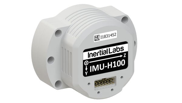
    Photo: Inertial Labs

    IMU
    For unmanned commercial and defense applications

    The IMU-H100 is a micro-electromechanical systems inertial measurement unit (IMU) designed to improve tactical guidance and navigation for UAVs, short-range missiles, precision-guided munitions, and a range of commercial applications.
    The tactical-grade unit features accelerometers and gyroscopes on all three axes. It offers a gyro bias of 1° per hour and an accelerometer bias of 1 mg. The unit measures 5 in³ and weighs 160 g. The IMU-H100 surpasses comparable products in data rate, measurement range, stability and repeatability, even under challenging conditions such as vibration, shock, high acceleration, spinning, temperature changes and acoustic noise.

    Inertial Labs, a VIAVI Solutions company, inertiallabs.com

  • Parrot shows off Anafi UKR micro UAV for defense at Paris Air Show

    Parrot shows off Anafi UKR micro UAV for defense at Paris Air Show

    Parrot has unveiled the Anafi UKR (Ukraine) range of compact defense micro-UAV drones at the Paris Air Show. The micro-UAVs are built to meet the critical demands of field operations, from defense theaters to public safety missions.

    Developed for defense forces operating in high-threat environments, AnafiUKR brings together embedded AI, optical navigation, and full offline autonomy in a sub-1 kg format. Building on this foundation, Anafi UKR GOV adapts the platform’s capabilities to the needs of law enforcement, first responders and government agencies, ensuring the same level of resilience, tactical awareness, hardened cyber-resilience, and total data sovereignty.

    “ANAFI UKR was born from the urgent need to defend a nation’s sovereignty and freedom. We’ve taken what we learned in high-intensity, GNSS-denied conflict zones, where drones are jammed, spoofed, and hunted, and turned it into a platform that public agencies can rely on. It’s the most advanced micro-UAV we’ve ever built: sovereign, powerful, and radically easy to use. When national security and civil protection overlap, as they increasingly do, agencies need tools that don’t compromise. ANAFI UKR is our response: the best of tactical autonomy, delivered in a micro-UAV that combines intuitive operation with advanced tactical capabilities.”

    Henri Seydoux, founder and CEO of Parrot

    Anafi UKR GOV is based on Parrot’s defense-grade micro-UAV deployed by several European, North American and NATO allied forces since mid-2024. Designed to remain fully operational in GNSS-denied environments and hostile electromagnetic conditions, the system integrates advanced optical navigation, anti-spoofing with frequency hopping military radio, and hardened cybersecurity architecture , all tested in live electronic warfare scenarios.

    Anafi UKR and Anafi UKR GOV are both in full production and commercially available. Deliveries are ongoing to defense and institutional clients, and the systems are now open to order for all eligible public safety agencies, law enforcement units, and government users worldwide.

  • Aquark, UK Royal Navy trial cold atom-based atomic clock

    Aquark, UK Royal Navy trial cold atom-based atomic clock

    Quantum sensing specialist Aquark Technologies has completed a second trial of its AQlock atomic clock system, facilitated by the Disruptive Capabilities and Technologies Office (DCTO) of the UK Royal Navy. The AQlock functioned continuously aboard HMS Pursuer in the Solent area over three days, what Aquark calls an important milestone for position, navigation and timing (PNT) technology and a step forward in the mission to reduce global reliance on GNSS.

    The Defence Science and Technology Laboratory supported the company’s latest trial, providing time and frequency test and evaluation expertise and equipment. It aims to improve conventional PNT by transferring the stability of atoms that have been cooled to near absolute zero to a conventional oscillator to reduce long-term drift. This makes the technology capable of maintaining high precision for longer, without the usual required correction from GNSS, augmenting existing timing capabilities. 

    The AQlock is an industrially designed and built cold atom-based atomic clock. The technology is underpinned by the supermolasses trap, a unique method of trapping atoms pioneered by Aquark that makes the technology highly robust, portable, and more affordable. The technology is suitable for miniaturization due to its reduced component count and power requirements when compared to alternative methods.

    By demonstrating its ability to continuously operate aboard a Royal Navy vessel in rough offshore conditions, the company is moving closer to its goal to improve conventional PNT and reduce global reliance on GNSS for military operations, infrastructure, telecommunications, finance, transportation and other sectors.

    The AQlock was developed with support from a Small Business Research Initiative (SBRI) grant from Innovate UK.

    “Ultimately, it moves us closer to a future where critical technologies can continue to operate seamlessly, even in the absence of GNSS,” said Alexander Jantzen, co-founder and COO of Aquark.

  • IATA and EASA release joint strategy to counter GNSS interference risks

    IATA and EASA release joint strategy to counter GNSS interference risks

    The International Air Transport Association (IATA) and the European Union Aviation Safety Agency (EASA) have published a comprehensive plan to mitigate risks stemming from GNSS interference. The plan was part of the conclusions from a jointly hosted workshop on the topic of GNSS interference.

    With incidents of GNSS signal jamming and spoofing rising, especially in Eastern Europe and the Middle East, the workshop called for a broader, more coordinated response. The plan focuses on four areas: improving information gathering, strengthening prevention and mitigation, making better use of infrastructure and airspace management, and enhancing coordination among agencies.

    “GNSS disruptions are evolving in both frequency and complexity. We are no longer just containing GNSS interference — we must build resilience,” said Jesper Rasmussen, EASA Flight Standards Director. “Through collaboration with partners in the European Union and IATA and by supporting the International Civil Aviation Organization, we are committed to keeping aviation safe, secure, and navigable.”

    According to IATA, the number of GPS signal loss events increased by 220% between 2021 and 2024. “With continued geopolitical tensions, it is difficult to see this trend reversing in the near term,” said Nick Careen, IATA senior vice president for operations, safety, and security. “The next step is for ICAO to move these solutions forward with global alignment on standards, guidance, and reporting. This must command a high priority at the ICAO Assembly later this year.”

    Detailed Workshop Outcomes

    The workshop concluded that four workstreams are critical:

    1. Enhanced Reporting and Monitoring

    • Agree on standard radio calls for reporting GNSS interference and standardized notice to airmen (NOTAM) coding, i.e. Q codes.
    • Define and implement monitoring and warning procedures, including real-time airspace monitoring.
    • Ensure dissemination of information without delays to relevant parties for formal reporting.

    2. Prevention and Mitigation

    • Tighten controls (including export and licensing restrictions) on jamming devices.
    • Support the development of technical solutions to:
      • reduce false terrain warnings;
      • improve situational interference with portable spoofing detectors; and
      • ensure rapid and reliable GPS equipment recovery after signal loss or interference.

    3. Infrastructure and Airspace Management

    • Maintain a backup for GNSS with aminimum operational network of traditional navigation aids.
    • Better utilize military air traffic management (ATM) capabilities,including tactical air navigation networks and real-time airspace GNSS incident monitoring.
    • Enhance procedures for airspace contingency and reversion planning so that aircraft can navigate safely even in the event of interference.

    4. Coordination and Preparedness

    • Improve civil-military coordination, including the sharing of GNSS radio frequency interference (RFI) event data.
    • Prepare for evolving threat capabilities, including those related to drones.

    The workshop was held May 22-23 at EASA headquarters in Cologne, Germany, and included more than 120 experts from the aviation industry, research organizations, government and international bodies

  • ComNav launches laser scanner designed for challenging GNSS environments

    ComNav launches laser scanner designed for challenging GNSS environments

    ComNav Technology has released the SinoGNSS LS600 laser scanner, a handheld 3D scanning device designed for professional use in both indoor and outdoor environments.

    It integrates lidar, GNSS, an inertial measurement unit (IMU) and dual-camera systems for detailed, colorized point clouds and precise positioning data production. The LS600’s also includes advanced SLAM algorithms, which work in tandem with a built-in real-time kinematic (RTK) GNSS module. This combination allows the scanner to achieve centimeter-level accuracy, even in challenging enviornments. The device’s high-speed lidar system supports 16-line and 32-line configurations, scanning up to 640,000 points per second with a 360° by 270° field of view. Detection ranges are available in both 120 m and 300 m options, accommodating a wide range of surveying applications.

    The LS600 features dual 16 MP wide-angle cameras that capture vivid, multi-angle color data. This visual information is merged with lidar data through visual-aided SLAM, enhancing the color fidelity and detail of the resulting point clouds. One of the scanner’s notable features is its Flash Point Cloud Technology, which enables real-time visualization of point cloud data immediately after scanning. This allows users to validate data in the field and make necessary adjustments on site, reducing the need for post-processing and minimizing project delays.

    In terms of workflow, the LS600 supports continuous, real-time positioning and data capture without the need for traditional loop closures, a step often required in standard SLAM processes. This advancement can decrease field time and improve overall efficiency. When operating in areas where GNSS signals are unavailable, such as basements or tunnels, users can establish ground control points for post-processing, maintaining high positional accuracy despite challenging conditions.

    The scanner is equipped with removable, rechargeable lithium-ion batteries, each providing up to 1.5 hours of continuous operation. Fast charging capabilities and an LED power indicator support efficient field use. Data transfer is facilitated through a USB-C 3.2 Gen 2 interface, and the device includes a 512GB solid-state drive for onboard storage. Designed for handheld operation, the LS600 can also be mounted on a mobile vest or pole, offering flexibility and ease of use in various field situations. Its lightweight, all-in-one construction supports rapid deployment and straightforward operation.

    The LS600 is suitable for a range of applications, including construction monitoring, as-built surveying, vegetation assessment, utility planning, urban renewal, mining and emergency response. Its combination of high accuracy, real-time visualization, and flexible deployment options is intended to improve data quality and operational efficiency for professionals across multiple industries.

  • GNSS jamming widespread in Strait of Hormuz, ships collide

    GNSS jamming widespread in Strait of Hormuz, ships collide

    GNSS jamming is causing confusion for ships traveling through the Strait of Hormuz, reports gCaptain. The regional threat levels are labeled “significant” because of air strikes between Iran and Israel, according to the Joint Maritime Information Center (JMIC). Maritime threat levels are marked as “elevated”.

    The JMIC highlighted GNSS jamming problems around the Port of Bandar Abbas and throughout the Strait of Hormuz and Persian Gulf regions. Nevertheless, commercial shipping traffic has continued at normal rates.

    Naivgational error is considered the cause of a collision June 17 between two tankers in the Gulf of Oman. The Very Large Crude Carrier (VLCC) Front Eagle, with 2 million barrels of Iraqi crude bound for China, hit the Suezmax tanker Adalynn 15 nautical miles off Fujairah. There was fire on both ships, but no injuries. The Front Eagle appeared to be onshore in Iran days before the collision.

    Nearly 1,000 ships in the Gulf have been affected by mass interference since the start of the Iran-Israel conflict on June 12, according to shipping analysis firm Windward. Recent tracking data has shown unusual positioning errors, with vessels appearing to be in impossible locations.

  • OneNav L5-direct navigates through GPS interference in field trial

    OneNav L5-direct navigates through GPS interference in field trial

    For the first time, the oneNav L5-direct receiver was flown on a UAV through a simulated electronic warfare GPS signal interference field. The assessment took place Feb. 12 at the Emerging Technology Lab at U.S. Special Operations Command (USSOCOM). This non-classified evaluation replicated battlefield conditions, including variable speeds, altitudes, maneuvers and robust L5 signal interference.

    Assessment Setup

    The assessment included two GNSS devices secured to the UAV, an onboard navigation computer and an onboard interference device. Two additional interference sources were located on the ground.

    A simplified block diagram of the assessment setup. (Credit: oneNav)
    A simplified block diagram of the assessment setup. (Credit: oneNav)

    The onboard navigation computer integrated data from both GNSS receivers to determine and maintain the vehicle’s position and guide its movement. GNSS 1 was a competitor L1/L5 dual-band receiver that uses the L1C/A signal for initial acquisition before adding L5 signals. GNSS 2 was the oneNav L5-direct receiver, which exclusively utilized modern L5-band signals for both acquisition and tracking.

    Test Conditions and Results

    The in-flight assessment, conducted on a UAV under real-world dynamic and RF interference conditions, demonstrated that the oneNav L5-direct receiver operates independently of legacy GNSS signals such as L1 and L2. While conventional dual-band receivers require L1 acquisition before transitioning to L5 tracking, the oneNav solution used only modern L5 signals for both functions6.

    The Emerging Technology Lab implemented comprehensive RF interference protocols, including both ground-based and airborne signal interference across multiple L5 frequencies. The oneNav L5-direct receiver maintained tracking capabilities during L5/E5a signal interference centered at 1176.45 MHz. This performance is attributed to the receiver’s wideband RF front-end architecture, which enables simultaneous processing across an extensive frequency range. The system leverages Galileo’s dual sideband configuration (E5a and E5b), automatically transitioning to E5b when E5a experiences interference—a feature unique to the oneNav technology. A brief six-second delay was observed during this transition, reflecting a three-second lock loss on E5a followed by a three-second acquisition of E5b. The ability to track E5b signals, despite a 10 dB power differential, highlights the receiver’s sensitivity.

    L5-direct FPGA attached to the assessment UAV. (Credit: oneNav)
    L5-direct FPGA attached to the assessment UAV. (Credit: oneNav)

    Key Findings

    • The oneNav L5-direct GNSS receiver acquired, tracked and provided location data to the drone flight computer under actual flight dynamics and through L5 band signal interference.
    • Direct acquisition and tracking using only L5-band signals was demonstrated, confirming immunity to L1 signal interference.
    • The receiver demonstrated resilience to L5 in-band signal interference at typical electronic warfare power levels, quickly adapting by switching to the E5b sideband when E5a was disrupted.
    • The receiver maintained stability and responsiveness when both E5a and E5b sidebands were blocked.
    • Continuous tracking functioned well with the BeiDou constellation off and the almanac on or off6.

    Technical Background

    The oneNav L5-direct technology was originally developed for consumer applications such as wearables, phones and surface vehicles. Its adaptability allows for rapid customization and deployment across a range of platforms, including those requiring robust performance in challenging environments.

    Because the L5-direct receiver uses signals exclusively within the L5 band, it can leverage the advanced features of these signals. L5-band signals offer greater power and increased resistance to RF interference compared to L1 signals. Industry experts, including Prof. Brad Parkinson, recognize the advantages of L5-only receivers for jam resistance.

    Currently implemented on FPGA architecture, a future L5-direct ASIC is expected to deliver performance improvements, including enhanced acquisition and tracking capabilities.

  • Thales invests €55M to advance resilient navigation in France

    Thales invests €55M to advance resilient navigation in France

    Thales, a European leader in resilient navigation, announced a €55 million ($63 million) investment to expand its industrial sites in Châtellerault and Valence, France. The investment, scheduled between 2025 and 2028, aims to address increasing demand for advanced navigation solutions in both civilian and military sectors and to reinforce the company’s sovereign industrial base.

    The company is responding to rising threats such as GNSS jamming and spoofing by deploying a suite of resilient navigation technologies. These solutions combine precision, autonomy and security, which are critical for maintaining operational continuity in military missions and civil aviation. Thales integrates inertial navigation systems with GNSS signal reception, enabling reliable navigation even in contested environments. The TopAxyz inertial navigation system ensures autonomous capability, while the TopStar-M receiver and TopShield anti-jamming technology protect signal integrity. These advancements are supported by France’s Directorate General of Armaments under the OMEGA program for the modernization of GNSS equipment for the armed forces.

    At the Châtellerault site, Thales plans to quadruple production capacity for inertial navigation systems by 2028. With six decades of expertise in laser gyroscopes, this facility is the only European supplier equipping civil aircraft and will expand its offerings for aircraft, land vehicles, ships and munitions. In Valence, mass production of TopStar-M receivers and TopShield systems is set to begin in 2026. The site will also introduce a new production line for inertial MEMS sensors, a technology that combines compact design with high performance, positioning Valence as a leader in France’s MEMS technology sector for defense. The launch will be accelerated with support from Tronics Microsystems for specialized industrial expertise.

    Currently, more than 800 employees work at the two sites, with plans to hire 150 additional staff by 2028. The investment seeks to strengthen Thales’ regional presence and contribute to France’s position in the industry.

  • Autonomous fighter drones join the front lines in USAF operations

    Autonomous fighter drones join the front lines in USAF operations

    The U.S. Air Force is increasingly referring to its next generation of unmanned aircraft as “fighter drones,” as the service prepares to integrate these vehicles alongside traditional fighter jets in combat missions. The Air Force’s Collaborative Combat Aircraft (CCA) program includes two separate vehicles under development by General Atomics Aeronautical Systems (GA-ASI) and Anduril, both designed to operate as combat-ready UAVs. These UAVs are being built to complement existing fighter fleets, providing additional capabilities and support during operations. According to Air Force officials, the new aircraft are expected to play a key role in future air combat by flying alongside piloted fighters and taking on a variety of tactical missions.

    One is an all-stealth design for undetected penetration of enemy defenses; the other is a sleek fighting companion.

    GA-ASI YFQ-42A fighter drone prototype (Credit: USAF)
    GA-ASI YFQ-42A fighter drone prototype (Credit: USAF)

    It appears the General Atomics YFQ-42A/CCA drew inspiration from the earlier stealth capabilities of the Avenger UAV, which has been in flight for more than a decade. This aircraft has a maximum ceiling of over 50,000 ft, flies at 400 mph, has around 15 hours of endurance and is powered by a built-in turbofan engine.

    Avenger UAV (Credit: GA-ASI/Tyson Rininger)
    Avenger UAV (Credit: GA-ASI/Tyson Rininger)

    One notable feature of the CCA version is its split, sloping “tailfin” and rounded design, along with a top fuselage air intake that shields the power plant from potential radar signals – all stealthy characteristics similar to those of its Avenger counterpart. Looking closely at the prototype, the doors on its belly appear to be for an internal weapons bay.

    Another USAF CCA prototype, built by Anduril, has been named the FYQ-44. It features a sleek and fast design, similar to earlier pre-stealth fighters, but also includes an internal weapons bay, rounded contours, and an air intake below the fuselage for a turbofan engine.

    Andruil YFQ-44 undergoes ground testing. (Credit: USAF)
    Anduril YFQ-44 undergoes ground testing. (Credit: USAF)

    The USAF’s release of these two CCA prototype contenders seems to suggest that they could be the fighter aircraft of the future. The CCA program, however, does talk about control of these armed UAVs by accompanying mainline manned fighter aircraft, but with autonomous capability to find and destroy once dispatched to attack a target.

    The intent is that these unmanned fighters will be significantly less costly to acquire than their expensive manned brothers so that high-risk targets may still be attacked and destroyed without potential loss of the flying pilot or their expensive aircraft. The unmanned fighters would be programmed by the manned aircraft and missiles in their internal weapons bay, would then go on to be controlled by onboard CCA weapons systems, which would relay data back continuously to the pilot who would have final go/no-go authority.

    Both prototypes are slated to fly later this year following extensive ground testing campaigns.


    After securing an initial $60 million contract from the USAF in 2021, Hermeus went on to raise $100 million in funding in 2022. This was followed by an investment from Raytheon Technologies’ RTX Ventures later that year. Additionally, the company landed a contract for Hypersonic risk reduction from the Defense Innovation Unit (DIU), allowing Hermeus to maintain its funding and momentum. This enabled the company to build and recently fly its first unmanned aircraft, which is designed to travel at extremely high speeds, according to the company.

    Hermeus Quarterhorse initial prototype UAV (Credit: Hermeus)
    Hermeus’ Quarterhorse initial prototype UAV (Credit: Hermeus)

    Initially, with an integrated GE J85 engine, Hermeus is now launching the incorporation of the Pratt & Whitney F-100 into its own “Chimera II turbine-based combined cycle (TBCC) propulsion system,” all aimed at taking subsequent iterations of their prototype to hypersonic speeds.

    Quaterhorse has been developed to demonstrate high-speed take-off and landing of a large unmanned aircraft, and is the first in a series of prototypes. And a couple of months ago, on May 27 at Edwards Air Force Base (AFB) in California, Quaterhorse did in fact take off, performed a short overhead circuit and landed! So, more flight tests are now expected to explore the drone’s flight characteristics.

    The TBCC two-phase engine with the Pratt F-100 front-end is slated to take Darkhorse, the next planned drone derivative, to Mach 2.8 on the F-100 and then up to over Mach 5 with the hypersonic back-end section of the engine. It could be said that the whole vehicle is being built around this monster engine!


    It will be interesting to see how flight testing of Quaterhorse progresses, but even more exciting to hopefully see if and when Hermeus gets the next hypersonic version flying. Additionally, we can anticipate the first flights of the USAF CCA prototypes.

    It is amazing how, from the humble beginnings of hobbyist radio-controlled recreational model aircraft, drones have evolved with sophisticated autopilots and are now becoming autonomous vehicles that are taking on front-line air force attack-support. Technological progress is now headed towards hypersonic capability.

  • SeRo Systems unveils live GNSS situation display to detect jamming

    SeRo Systems unveils live GNSS situation display to detect jamming

    SeRo Systems, a German-based leader in air traffic surveillance security and monitoring solutions, is expanding its portfolio with the launch of its newest monitoring technology for improved aircraft
    situational awareness. The live GNSS RFI Situation Display (GRSD) is a real-time solution that combines live air traffic information with SeRo’s advanced GPS jamming and spoofing detection and short-term predictive alerts — offering enhanced visibility into the airspace.

    For more than 10 years, SeRo has developed advanced air surveillance and monitoring technology for customers including EuroControl, Baltic air navigation service providers (ANSPs) and spectrum regulators, Austro Control, armasuisse and other aviation organizations. SeRo is the only company that provides real-time GNSS RFI monitoring to two of the three Baltic states.

    Operational picture at a glance

    Designed with and customized for ANSPs and spectrum regulators, the new GRSD leverages SeRo’s vertically integrated receiver network and uses its anomaly detection and high-precision multilateration (MLAT) to help users assess their operational picture at a glance. The system monitors the airspace and displays live traffic combined with a color-coded real-time GNSS interference intensity map that
    identifies zones subject to interference.

    Its short-term interference alerting feature utilizes AI to predict when aircraft will experience interference and gives the user a time estimate. As soon as an aircraft is impacted by spoofing, GRSD automatically highlights the aircraft and generates an alert indicating both the spoofed and the correct aircraft position.

    “With jamming and spoofing incidents on the rise, timely and actionable intelligence matters more than ever,” said Matthias Schäfer, CEO of SeRo Systems. “Our new GRSD product delivers real-time insights on GNSS RFI and provides a live operational view that helps users prepare and respond.

    GRSD works seamlessly alongside SeRo’s SecureTrack platform, combining real-time data for instant decision-making with historical insights for strategic airspace monitoring, analysis, reporting, and incident investigation. “Together with our SecureTrack solution, ANSPs and spectrum regulators now have the tools they need for unmatched situational awareness,” Schäfer said.

  • Safran Federal Systems upgrades BroadSim product line

    Safran Federal Systems upgrades BroadSim product line

    Safran Federal Systems introduced BroadSim Genesis, the latest addition to its BroadSim product line, at the Institute of Navigation’s 2025 Joint Navigation Conference in the Greater Cincinnati area.

    Developed for the U.S. defense community, BroadSim Genesis advances GNSS simulation and NAVWAR testing with significant improvements in signal capacity, operational flexibility and user experience. The system delivers high-fidelity, threat-representative environments designed to support next-generation positioning, navigation and timing (PNT) resiliency.

    BroadSim Genesis can generate up to 2,000 signals, enabling advanced multi-constellation simulations across medium Earth orbit, low Earth orbit and alternative PNT sources within a single test environment. The system is engineered to meet modern NAVWAR requirements, supporting multi-antenna and multi-vehicle configurations, M-Code, and integrated jamming and spoofing capabilities to counter sophisticated signal threats.

    The user interface features an integrated front panel with N-type connectors, removable drives and an onboard timing card, offering ease of use, security and field readiness.

    “BroadSim Genesis is built for operators who demand flexibility, fidelity and performance in their GNSS simulation tools,” said Trevor Dougherty, vice president of sales at Safran Federal Systems. “Whether validating mission equipment, training for NAVWAR scenarios or assessing new PNT architectures, BroadSim Genesis gives defense users the edge they need”

  • Crafting a GNSS curriculum for the future geospatial workforce

    Crafting a GNSS curriculum for the future geospatial workforce

    The Spatial Sciences Institute (SSI), part of the Dornsife College of Letters, Arts and Sciences at the University of Southern California (USC), is a national leader in geospatial research and education. Founded on July 1, 2010, SSI has been educating students and professionals with both the theoretical foundation and hands-on technical training to advance spatial thinking and geospatial technologies. 

    Graduates solve complex problems across diverse industries and domains such as environmental sustainability, geodesign, public health, human security and geospatial intelligence. Education and training with GNSS are integral to SSI’s mission.

    Addressing the Generation Gap 

    Despite its fundamental importance, the GNSS workforce is facing a growing generational gap as many experienced professionals near retirement, and fewer young individuals enter the field.  This decline in incoming talent poses a critical challenge for industries that rely on high-precision positioning, from infrastructure development and environmental monitoring to national security and disaster response. 

    Part of the challenge stems from a lack of early exposure and awareness among younger generations about the relevance and applications of GNSS technology. Many students encounter the topic only indirectly, if at all, in traditional STEM or Geography curricula. 

    To preempt this generic approach, SSI has invested in high-accuracy GNSS receivers, RTK-enabled UAVs and immersive virtual/augmented reality visualization equipment to provide students the capability to translate the theoretical lessons in geodesy, spatial data acquisition, data analysis and integration into technical skills that result in actionable information. 

    Additionally, SSI has developed a range of experiential learning opportunities in GNSS to bridge the gap between classroom instruction and real-world GIS applications. While completing their coursework, students often solve the same real-world challenges as many industry professionals. 

    Engagement Through Experimental Learning

    One such example is the undergraduate course SSCI 220L: Spatial Data Collection Using Drones, taught by Yi Qi, Ph.D., an associate professor with expertise in remote sensing and geospatial artificial intelligence. “When young students are introduced to imagery and geospatial technologies, one of the first questions they often ask is how the positions of real-world features are measured — and how accurate those measurements need to be for applications like building construction or urban tree mapping,” Qi explained. “This presents a great opportunity to introduce students to more advanced industry practices such as real-time kinematic (RTK) correction.” 

    Qi added, “We use the RTK-enabled DJI Mavic 3M drone for field data collections, which is often a highlight of the class.” One memorable field activity took place at the historic Los Angeles Memorial Coliseum, where students participated in drone flights alongside faculty. Before takeoff, they helped establish communication between the drone’s RTK system and the California Real-Time Network (CRTN), learning how to configure the system for centimeter-level accuracy. Later, they processed the imagery into high-resolution 2D orthophotos and 3D models. “This class benefits undergraduates by providing early exposure to GNSS,” Qi said. “This foundation is important for students to imagine their pathways in the geospatial industry and choose other advanced courses.” 

    At the graduate level, as part of the SSCI 587: Spatial Data Acquisition course, students are required to participate in a week-long intensive-learning field experience at the USC Wrigley Institute for the Environment and Sustainability campus on Catalina Island. Laura Loyola, Ph.D., assistant professor in SSI with specialties in ecological physiology and field data collection, has led this course for many years and acknowledges that, “Catalina offers the ideal location for rugged terrain data collection, practice with online or offline mapping, and incorporates spatial data collection utilizing the RTK-enable UAV and high-accuracy GNSS receivers, with spatial analysis and visualization methods.” 

    While on Catalina Island, students meet with industry partners, such as Isaiah Mack, the owner of Eclipse Mapping and GIS, and an alumnus of USC, who bring professional experiences and the latest technology from industry. “The question now facing industry is whether the added investment in both hardware and training of personnel on high-accuracy GNSS receivers for spatial data collection is viable and needed for everyday uses, especially with RTK and satellite-based augmentation systems (SBAS) available,” Mack said. “The answer is overwhelmingly yes, with many mapping and GIS professionals utilizing centimeter-level RTK accuracy, so I feel it is important to share with students the growing market for these careers.” 

    Students quickly learn that without a viable connection, such as Wi-Fi or Starlink in remote areas, RTK capabilities in the UAV are limited. This requires the ability to incorporate high-accuracy ground control points into their collection workflows for georeferencing the drone imagery. As students work through the image processing and integration workflow, they gain firsthand experience in how GPS accuracy influences final image quality. Loyola noted, “In remote environments where WiFi connectivity is limited or non-existent, smartphone positional accuracy is decreased even more from the standard 30 cm to 50 cm, forcing students to work offline and with external GNSS receivers.” 

    Lastly, in certain field scenarios where students are unable to physically reach the survey target, they have learned to apply alternative methods to ensure accurate data collection. One effective technique involves using a laser rangefinder to measure the distance to the remote object. By combining this distance measurement with GNSS-derived position and bearing data, students can use in-app tools to calculate the location of otherwise inaccessible features. These experiences not only demonstrate their problem-solving abilities in challenging environments but also reflect a practical understanding of integrating complementary technologies to achieve high-precision geospatial results.

    GNSS also has been integrated into the geodesign programs at SSI. Guoping Huang, Ph.D., is an associate professor with specialties in landscape planning and geodesign. “High-accuracy GNSS has become increasingly important in the architecture, engineering and construction sector due to the growing adoption of geospatial workflows,” he said. “These workflows span the entire project lifecycle — from spatially-enabled design tools that help create context-aware and environmentally responsive plans, to precision construction, where GNSS-integrated technologies such as sensor networks are used to monitor construction activities in real time.” 

    This integration ensures that construction adheres closely to the original design intent, minimizes costly deviations, and helps avoid damage to critical infrastructure. As a result, high-accuracy GNSS supports not only greater efficiency and accuracy but also enhances safety and sustainability in complex construction environments.

    Empowering the Next Generation  

    By integrating GNSS into education programs and engaging students through practical fieldwork, faculty in the spatial sciences spark interest and develop the next generation of geospatial professionals. These efforts are essential to sustain the workforce and fuel innovation in a field increasingly critical to smart cities, climate science, autonomous systems  and beyond. The experiential learning has inspired young generations to enter the geospatial workforce and make immediate, transformative impacts on existing practices. 

    Student Evelyn Vega commented, “The concepts and hands-on experience from course SSCI 220L helped me understand and appreciate GPS technology.” Recent graduate Yimiao Wang, who now works with the County of Riverside, California, has directly applied the GNSS data collection and processing techniques learned in course SSCI 587 to her work in roadway deterioration detection with RTK-enabled drone imagery. Her ability to leverage high-accuracy GNSS not only enhanced the quality and efficiency of her team’s outputs but also led to her career development success. These examples illustrate how GNSS education can empower students to drive innovation and advancement in the public sector and beyond.