Author: Jesse Khalil

  • Zephr.xyz to enhance GNSS resilience for US military operations

    Zephr.xyz to enhance GNSS resilience for US military operations

    The Air Force Research Laboratory selected Zephr.xyz — a company specializing in augmented position, navigation and timing technologies — to receive a $1.74 million Small Business Innovation Research Direct-to-Phase II contract. Under the contract, Zephr.xyz aims to develop a system for real-time detection of GPS/GNSS jamming and spoofing in contested environments while also geolocating the sources of these attacks.

    The company’s Networked GNSS technology, which converts standard mobile phones into a high-fidelity GNSS receiver network, will undergo extensive testing in Ukraine and various U.S. military exercises. Following these trials, the system is set to be integrated with the Department of Defense’s Tactical Assault Kit and the Department of Homeland Security’s Team Awareness Kit.

    Zephr.xyz has conducted field research in conflict zones in Ukraine and Israel, revealing limitations in current GNSS interference detection and localization techniques. The company’s solution aims to address these challenges by leveraging distributed mobile devices to create a decentralized sensor network. This network collects raw GNSS measurements to identify electronic attack indicators, which are processed in real time for detection and classification.

    The technology also aims to enhance positioning accuracy on TAK devices by integrating GNSS measurements from multiple devices with Position, Velocity, Attitude and Timing data. Zephr.xyz plans to make its detection and classification capabilities available as a software development kit, enabling mobile applications to alert users and improve positioning accuracy in electronic warfare scenarios.

  • Topcon and Pix4D advance photogrammetry solutions

    Topcon and Pix4D advance photogrammetry solutions

    Topcon Positioning Systems has become an authorized distributor of Pix4D’s photogrammetry software portfolio, expanding access to high-precision positioning and 3D mapping technologies.

    The partnership aims to enhance reality capture solutions across various industries, including surveying, mapping, architecture engineering and construction, energy, utilities infrastructure, public safety, and forensics.

    The agreement streamlines the procurement process for end-users by allowing them to access Pix4D‘s advanced photogrammetry software solutions through Topcon’s established global distribution network and ensures comprehensive technical support for users.

  • MIKROE unveils Click Board for precision applications

    MIKROE unveils Click Board for precision applications

    MIKROE has unveiled the GNSS RTK 5 Click, a compact add-on board for high-precision positioning and navigation demands. It features the UM980, an all-constellation multifrequency RTK positioning module from Unicore, with the advanced NebulasIV SoC for enhanced performance.

    It supports Swift Navigation’s Skylark precise positioning service, multiple GNSS constellations, and RTK positioning for centimeter-level accuracy. The board also features JamShield technology for robust performance in challenging environments, USB connectivity for easy configuration and visual status indicators for module status and GNSS signal reception.

    It can be used for a variety of applications, including surveying and mapping, precision agriculture, UAVs, autonomous robots and autonomous driving.

  • Eos Positioning Systems launches eco-friendly cases for Skadi GNSS receivers

    Eos Positioning Systems launches eco-friendly cases for Skadi GNSS receivers

    Eos Positioning Systems has introduced a new environmentally conscious initiative for its Skadi Gold, Skadi 300 and Skadi 200 GNSS receivers. These devices will now be shipped in a field-rugged carrying case made entirely from recycled materials. 

    The case is designed to meet the demands of professionals who utilize GNSS technology in challenging environments. Its construction incorporates durable, eco-friendly materials that can withstand various field conditions, from remote wilderness areas to urban construction sites. 

    A key feature is its composition of 100% post-consumer recycled resin, which significantly reduces waste and promotes environmental sustainability, according to the company. It is specifically engineered to be shock-resistant and weatherproof, providing comprehensive protection for the enclosed GNSS receivers. 

    The case is provided as a standard inclusion with every purchase of the Skadi Gold, Skadi 300 or Skadi 200 GNSS receivers at no additional cost.

  • GNSS disruption at sea level: An interference study in the Baltic Sea

    GNSS disruption at sea level: An interference study in the Baltic Sea

    For years, aviation safety organizations and maritime authorities have relied on ADS-B-based reports to assess GNSS interference. Services such as gpsjam.org, spoofing.skai-data-services.com and flightradar24 have provided valuable insights into interference patterns at high altitudes. However, this data tells only part of the story. Ground-based infrastructure — ports, telecommunications networks, and precision navigation systems — operate in a vastly different signal environment. High-altitude detections cannot reliably indicate the presence or impact of interference at sea level.

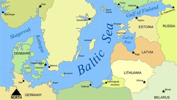
    To address this critical knowledge gap, GPSPATRON and Gdynia Maritime University have conducted a six-month study on GNSS interference in the Baltic Sea. Using terrestrial GNSS monitoring technology, the project examined the frequency, duration and characteristics of interference events affecting maritime navigation and other critical applications.

    Data collection and analysis

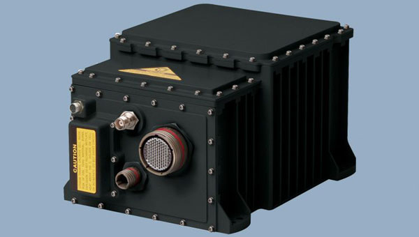
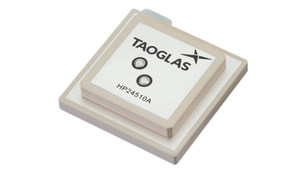
    At the core of this study is a terrestrial GNSS monitoring system developed by GPSPATRON, designed to capture and analyze signal disruptions in real-time. Installed at the Faculty of Navigation at Gdynia Maritime University, this system continuously recorded GNSS signal integrity and transmitted the collected data to a cloud-based analytics platform. This platform facilitated the automated detection, classification and visualization of GNSS interference events, providing a comprehensive understanding of interference patterns and their potential impact on maritime navigation. The results paint a stark picture of persistent and evolving interference patterns in the Baltic region. More than 84 hours of GNSS interference were recorded, with October exhibiting the highest activity. Two primary interference types were identified: multi-constellation jamming, prevalent in the summer months, and multi-tone interference, which emerged in October.

    Key findings

    • Persistent GNSS Interference: A total of 84 hours of GNSS interference was detected, indicating continuous disruptions in the region. Most incidents were caused by jamming rather than spoofing.
    • October saw peak interference levels: The month recorded six major jamming events totaling 29 hours, showing an escalation in disruption frequency and severity.
    • Maritime sources of interference suspected: Signal pattern analysis confirms that the source was mobile, reinforcing the likelihood of a single ship or multiple vessels operating the same advanced jamming technology.
    • High-Precision Jamming Signatures: The interference signals detected exhibit structured modulation patterns and frequency agility, suggesting the use of highly sophisticated jamming techniques. These characteristics indicate high-grade equipment, potentially of military origin, with capabilities far exceeding those of common commercial jammers. The consistency and precision of these disruptions highlight the need for further investigation into the source and intent behind these operations.
    • No link to ADS-B reports: Despite extensive ground-level interference, ADS-B-based monitoring systems failed to register corresponding events, highlighting their limitations in assessing terrestrial threats.
    • Long-duration disruptions: Some interference events lasted more than seven hours, significantly affecting GNSS-dependent operations in maritime navigation and port activities.

    Implications for maritime and critical infrastructure

    The findings of this study expose a critical gap in current GNSS monitoring methods. High-altitude interference reports, primarily based on ADS-B data, fail to capture the real impact of jamming and spoofing at ground level. Maritime operations, port logistics, and other critical infrastructure remain vulnerable due to this oversight.

    Ports, telecommunications providers, and emergency services rely heavily on GNSS for navigation, timing synchronization, and security. Without precise ground-level monitoring, disruptions can go unnoticed, leading to cascading failures across multiple sectors.

    A major concern is the false sense of security created by ADS-B-based detection systems. While these services report daily interference incidents, they do not reflect the full extent of ground-based GNSS disruptions. As a result, infrastructure operators may underestimate the risk, assuming that existing monitoring solutions provide adequate coverage. This misconception is dangerous, as it masks the severity of interference threats that remain undetected in high-altitude datasets.

    To mitigate these risks, there is an urgent need for a dedicated GNSS interference monitoring network along the Baltic Sea coast. Such a network would provide real-time, localized data to accurately assess threats, detect interference sources, and enhance infrastructure resilience against GNSS disruptions.

    Conclusion

    This study confirms that GNSS interference is a persistent issue at sea level, posing a serious threat to critical infrastructure, which predominantly operates at ground level. Prolonged interference events were recorded, some lasting several hours, leading to significant degradation in positioning and timing accuracy. This disruption directly impacts maritime operations, telecommunications, emergency response, and other sectors reliant on GNSS services.

    High-altitude interference detection alone is insufficient, as it fails to capture threats affecting ground-level operations. Relying solely on ADS-B-based reports creates a false sense of security, leaving critical systems vulnerable to undetected risks.

    To mitigate these risks, there is a clear need for a dedicated ground-based GNSS interference monitoring network. Such a system would provide real-time detection, precise geolocation of interference sources, and timely countermeasures to protect infrastructure.

    GPSPATRON and Gdynia Maritime University urge regulatory bodies to take proactive steps toward enhancing GNSS interference detection and mitigation. Without coordinated action, vulnerabilities in national infrastructure will continue to escalate, leading to potentially severe operational and security consequences.

    The full report can be downloaded from the GPSPATRON website.

  • Topcon launches GNSS receiver for precision applications

    Topcon launches GNSS receiver for precision applications

    Topcon Positioning Systems has introduced the HiPer XRa GNSS receiver for surveying, mapping and construction applications. The new receiver is designed to benefit a wide variety of users, including construction professionals, surveyors, GIS professionals, archeologists, engineering firms and others who rely on quality, precision measurements. The HiPer XR supports GPS, GLONASS, Galileo, BeiDou, IRNSS, QZSS and SBAS.

    The new receiver has advanced Topcon Integrated Leveling Technology (TILT) compensation, featuring a calibration-free and magnetic interference-immune integrated IMU that provides up to 60° of tilt for precision measurements in challenging positions. It has signal integrity protection, anti-jamming and anti-spoofing capabilities designed to keep data reliable, even in areas with interference or degraded signals.

    Through the myTopcon NOW! Website users can access online training materials, firmware updates, and additional software resources.

  • Leica Geosystems releases airborne bathymetric lidar system

    Leica Geosystems releases airborne bathymetric lidar system

    Leica Geosystems, part of Hexagon, has introduced the Leica CoastalMapper, an airborne bathymetric lidar system designed for coastline and river surveying. The system offers a wider field of view and the ability to operate at higher altitudes. As a result, the CoastalMapper can survey coastlines and rivers 250% faster than previous sensor models.

    The CoastalMapper is suitable for a wide range of mapping applications, from assessing infrastructure resilience to monitoring river floods and conducting environmental investigations in both shallow and deep waters.

    It features a combination of a high-performance bathymetric lidar module, a Leica TerrainMapper-3 topographic lidar and an imaging sensor, all integrated into a compact and lightweight sensor head. This allows the CoastalMapper to capture up to 1 million bathymetric data points and 2 million topographic data points per second while providing high-resolution imagery with a 5 cm ground sampling distance at typical flying heights.

    One of the key advantages of the CoastalMapper is its ability to collect bathymetric and topographic lidar data and imagery in a single flight. This simultaneous multi-data capture seeks to significantly reduce survey time, operational costs and the environmental impact of each mission. Additionally, it can be mounted on helicopters, allowing for surveys in challenging environments such as rivers in steep mountainous terrain.

    The CoastalMapper seamlessly integrates with Leica Geosystems’ airborne mapping workflows. It also offers cluster processing capabilities, allowing users to analyze large datasets and reduce the time from data collection to final deliverables. These outputs can include classified point clouds, digital terrain and surface models, and various imaging products, making the CoastalMapper a comprehensive solution for a wide range of mapping needs.

  • Xairos advances US defense with quantum timing technology

    Xairos advances US defense with quantum timing technology

    SpaceWERX, the innovation arm of the U.S. Space Force, has selected Xairos Systems Inc. for a $1.9 million Direct-to-Phase II contract to develop a fusion positioning, navigation and timing (PNT) system. This project aims to integrate quantum and optical synchronization of clock ensembles to address critical challenges faced by the Department of the Air Force (DAF).

    Xairos Systems is collaborating with Luminous Cyber Corporation and Eritek on this initiative. The team has recently completed a Preliminary Design Review. The Air Force Research Laboratory (AFRL) shared that the collaboration is part of a broader effort by the AFRL and SpaceWERX to streamline the Small Business Innovation Research and Small Business Technology Transfer processes.

    AFRL and SpaceWERX seek to streamline the Small Business Innovation Research (SBIR) and Small Business Technology Transfer (STTR) process through faster proposal-to-award timelines, changing the pool of potential applicants by expanding opportunities to small businesses and eliminating bureaucratic overhead by continually implementing process improvement changes in contract execution, according to AFRL.

    In 2018, the DAF launched the Open Topic SBIR/STTR program to broaden its funding for innovations. As part of this initiative, Xairos is developing innovative technologies that enhance the national defense of the United States.

  • Northrop Grumman advances airborne navigation for US Navy

    Northrop Grumman advances airborne navigation for US Navy

    The U.S. Navy has selected Northrop Grumman to advance its airborne navigation capabilities by integrating Northrop Grumman’s LN-251M, the upgrade of the LN-251 inertial navigation system (INS)/GPS. This new system incorporates M-Code technology, which provides an encrypted, military-specific signal with improved resistance to jamming, offering better protection against potential threats.

    According to the company, the LN-251M represents a significant advancement in naval aircraft navigation, being the first M-Code navigation system designed for this purpose. The M-code technology offers increased robustness against GPS signal degradation, which allows pilots to operate more effectively in areas where GPS signals may be compromised or unavailable.

    The LN-251 series is designed to integrate seamlessly with existing aircraft navigation systems and is compatible with future software and GPS modernization upgrades.

  • Advanced Navigation to develop INS for Gilmour Space rocket launches

    Advanced Navigation to develop INS for Gilmour Space rocket launches

    Advanced Navigation has secured grant funding from the Australian Space Agency through the Moon to Mars Initiative Grant. This funding will expedite the development of a space-grade high-shock inertial navigation system (INS) designed to endure extreme conditions during rocket launches.

    The INS will support Gilmour Space Technologies, an Australian launch services company, in the development and launch of Eris Rockets and Elara Satellite platforms to low-Earth orbits (LEO). This collaboration aims to enhance Australia’s sovereign aerospace capabilities and contribute to the growing space industry.

    The development of this advanced INS presents significant engineering challenges due to the harsh conditions experienced during rocket launches. From lift-off to payload deployment, every phase of a rocket’s journey requires precise engineering and seamless coordination. All electronic and fiber-optic components must be capable of withstanding intense shock, vibration, shifting gravity, payload impact and extreme temperature fluctuations.

    The onboard INS consists of a plethora of high-end sensors, including accelerometers and gyroscopes, sensitive enough to detect the smallest change in noise and vibration. To ensure accurate and reliable performance, these delicate components must be shielded from the extreme forces experienced during launch. One solution is the integration of a high-shock enclosure — a protective barrier encircling the INS housing. This enclosure acts as a cushion between the system and the surrounding structure, absorbing and redistributing intense g-forces from engine ignitions and launch vibrations. By dampening these shocks, the enclosure prevents disruptive forces from reaching the sensors, preserving their precision in the harshest conditions.

  • Taoglas launches multi-band GNSS antennas

    Taoglas launches multi-band GNSS antennas

    Taoglas has released a new family of active, multi-band GNSS antennas. Levity Series’ AHP24510 (L1/L2/L-Band) and AHP54510 (L1/L5/L-Band) directional patch antennas are designed for GPS, Galileo, GLONASS and BeiDou satellite constellations.

    These antennas offer improved performance through triangulation across multiple satellites, offering faster and more accurate signal acquisition and lock, specifically in urban environments. The L-Band capability allows compatibility with high-precision GNSS correction services, potentially achieving positioning accuracy better than 200 cm.

    The multi-band antennas seek to offer integral redundancy to minimize satellite security blind spots and reduce energy consumption due to faster acquisition requiring less system uptime to save power.

    The Levity Series active antennas feature a 45 mm x 45 mm x 10 mm wide-band, dual-stacked patch design with a dual-feed, low noise amplifier, providing 28 dB to 29 dB gain and filtering. They operate with a maximum antenna VSWR of 1-to-1 from 1,207 MHz to 1,603 MHz, and the passive antenna efficiency ranges from 39.93% to 68.51% in the L1 band. These antennas use right-hand circular polarization to mitigate multi-path interference.

    The Levity Series includes other multi-band products for high-precision applications, such as the HP24510A and HP54510A stacked-patch passive components, and the TFM.120A surface-mount front-end module, which covers the full multi-band GNSS spectrum including L-Band.

    These antennas are suitable for various applications, including wearables, transportation, robotics, precision agriculture and autonomous vehicles.

  • NATO selects SandboxAQ for 2025 Defense Innovation Accelerator Program

    NATO selects SandboxAQ for 2025 Defense Innovation Accelerator Program

    NATO has selected SandboxAQ as one of approximately 70 companies to participate in the 2025 Defense Innovation Accelerator for the North Atlantic (DIANA) cohort. The selection process involved more than 2,600 submissions from 32 NATO countries. DIANA, established by NATO in 2023, aims to address complex societal challenges by bringing together innovative companies developing dual-use technologies for both commercial and defense applications.

    SandboxAQ will join the cohort’s Sensing & Surveillance group, focusing on the development of its AQNav magnetic navigation system. AQNav is designed to provide a secure navigation alternative that does not rely on GNSS, making it resilient against jamming and spoofing. The system utilizes SandboxAQ’s proprietary Large Quantitative Models (LQMs), quantum sensors, and the Earth’s crustal magnetic field to offer an all-weather, day and night, terrain-agnostic navigation solution for military and commercial applications.

    The AQNav system has undergone extensive testing, including more than 200 hours of flight tests with the U.S. Air Force, involving more than 40 sorties across various geographies and aircraft types1. In July 2024, AQNav demonstrated its capability to serve as a primary navigation source and showed potential for scalability across similar aircraft types without individual calibration.

    As part of the DIANA program, SandboxAQ will receive resources, insights and developmental support to advance AQNav’s capabilities. The company will also have opportunities to test the system in specialized environments, leveraging DIANA’s network of experts in technology, commercial development and defense.