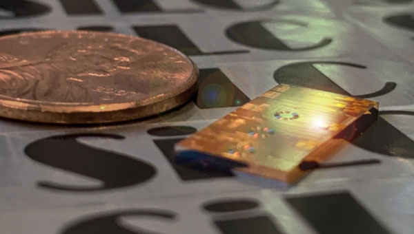
TDK Corporation has unveiled the AXO314, its latest addition to the Tronics AXO300 accelerometer platform. This digital MEMS accelerometer is designed for industrial applications operating under shock and vibration, with a ±14 g input range.
The AXO314’s closed-loop architecture provides linearity and high vibration rejection, offering a low-SWaP, digital alternative to tactical-grade quartz accelerometers.
It has a one-year composite bias repeatability of 1 mg and bias instability of 4 µg, offering a robust, miniature and precise acceleration sensing solution for dynamic systems in harsh environments.
This new accelerometer is well-suited for land, sea and air surveying and mapping applications and GNSS-assisted positioning systems for aerial and ground vehicles.
SiLC Technologies has received an investment from Honda to develop frequency-modulated continuous wave (FMCW) lidar solutions. This collaboration aims to advance artificial intelligence (AI)-based machine vision capabilities for autonomous vehicles and other mobility systems.
SiLC’s FMCW lidar technology offers long-range detection, precise measurements, interference resistance and enhanced object detection. It can detect objects at distances of a kilometer or more, offering accurate distance and velocity measurements while overcoming issues related to sunlight, reflectors and other lidar systems. Additionally, it can identify dark objects, such as tires, at long distances.
The investment from Honda supports the development of vision systems that are powerful, computationally efficient, compact, and scalable. These attributes are crucial for advancing autonomous transportation technologies that can enhance safety, reduce traffic congestion and minimize human error on the roads.
As a FMCW lidar developer, SiLC’s technology could play a role in advancing autonomous systems. The company’s Eyeonic Sensor and Vision System is an advanced lidar technology centered around the Eyeonic Vision Chip. This chip integrates multiple photonics functions, including an ultra-low linewidth laser, semiconductor optical amplifier, Germanium detectors and optical circuits on a silicon photonics chip. This compact design enables long-range detection of more than 2 km with sub-millimeter resolution, offering capabilities such as distance measurement, instantaneous velocity, and polarization intensity through FMCW lidar technology.
INTERGEO 2024, the premier global event for geodesy, geoinformation and land management, will take place from Sept. 24 to 26, 2024, in Messe Stuttgart, Germany. This year’s theme focuses on the power of geoinformation technologies and their critical role in addressing global challenges.
The event is expected to bring together more than 600 international brands, industry leaders and business professionals, providing a unique platform for networking, collaboration and knowledge exchange among geospatial professionals.
The event will cover a variety of topics, including building information modeling (BIM), Earth observation, digital twins, maritime solutions and developments in the UAV industry. A significant emphasis will be placed on how geoinformation technologies can help tackle pressing issues such as climate change, urbanization and resource management. Earth observation will be a focal point, featuring sessions dedicated to managing the green transition and discussing strategies for climate adaptation. This comprehensive event aims to showcase the potential of advanced geospatial technologies in contributing to solutions across the globe.The conference will feature keynote speeches from industry leaders and government officials, including Walther Pelzer Ph.D., Head of the German Aerospace Center, who will deliver a keynote on “Earth observation for a world in transition”. Burkhard Boeckem, Ph.D., CTO of Hexagon AB, will discuss developments at the forefront of geospatial technology.
Catch GPS World at INTERGEO 2024 from Sept. 24 to 26!
Click here to register and learn more about the conference.
Advanced Navigation, Hanwha Aerospace and Hanwha Defense Australia (HDA) have signed a memorandum of understanding (MoU) to co-develop strategic grade assured positioning navigation and timing (APNT) solutions.
Under the agreement, the three companies will collaborate on the development of high-performance inertial navigation systems (INS) for autonomous, airborne, and crewed systems. These systems will be used for precision targeting and vehicle navigation in GNSS-contested environments across land and air domains.
The co-developed solutions will be integrated into Hanwha Aerospace’s global supply chain to advance the broader strategic APNT interests for Australia and international markets.
By integrating Advanced Navigation’s IP in digital fiber-optic gyroscope (DFOG) technologies with Hanwha’s robust aerospace and defense capabilities, the agreement seeks to augment Australia’s manufacturing and supply chain resilience to meet the demand of global military supply chains.
Hanwha Defense Australia’s Armoured Vehicle Centre of Excellence (H-ACE) in Melbourne, Australia, will provide critical facilities supporting the production and sustainment of tracked armored vehicles, including multiple assembly lines, a 1,200 m test track, a deep-water test facility, an obstacle course and a research and development center. Stage 2 of the development will also include Australia’s EMI/EMC (electromagnetic interference/compatibility) chamber and test shooting tunnel alongside an expanded manufacturing capability.
In the neighboring state of New South Wales, Advanced Navigation’s manufacturing facility will be used for the secure production of APNT solutions. Specifically, it enhances the critical output of strategic-grade DFOGs, which possess the heightened sensitivity necessary to detect the Earth’s rotation.
Skylark Labs has released the Aerial Reconnaissance and Elimination System (ARIES), designed to enhance situational awareness and counter emerging threats.
ARIES utilizes artificial intelligence (AI) to detect, classify and respond to threats in real-time. The system’s AI continuously adapts to new threats across multiple domains without requiring manual updates to improve situational awareness and accelerate decision-making for military personnel.
The system can detect and track UAVs beyond visual line of sight (BVLOS). This capability extends the range and effectiveness of counter-unmanned aerial system (C-UAS) operations, providing early warning and enabling rapid response to potential threats.
ARIES seamlessly integrates with existing defense infrastructure, which eliminates the need for frequent manual system updates and seeks to improve overall mission success rates.
The system has been successfully demonstrated to key Department of Defense (DOD) stakeholders, showcasing its potential to enhance counter-UAS operations. During the demonstration, ARIES offered critical, real-time intelligence for swift decision-making in response to UAV incursions.
JammerTest in Bleik, Andøya, Norway. (Photo: David Jensen)
GNSS jamming trials have begun on the Island of Andøya in Northwestern Norway as part of Jammertest 2024. This event features both simple and sophisticated staged spoofing and jamming attacks, allowing participants to identify potential strengths and weaknesses in their GNSS-based systems.
The increasing frequency of jamming and spoofing incidents, particularly affecting Northern Norway and possibly linked to Russian activities, drives the demand for more resistant GNSS and non-GNSS-based contingency systems. In response, the Norwegian Defense Ministry has called for the development of alternative means of positioning, navigation, and timing (PNT) provisions to protect against GNSS jamming in maritime navigation.
During Jammertest 2024, researchers from both public and private sectors are assessing how effectively existing and new technology systems can withstand jamming and spoofing attacks in real-world scenarios. One of the staged jamming attacks, taking place from Sept. 4-13, 2024, is occurring on two stretches of road near Bleik, a small coastal town on Andøya Island. This trial was approved by Norway’s National Communications Authority and is being carried out by the Public Roads Administration, Defense Research Institute, Norwegian Space Center, and other partners.
Later in September 2024, the Defense Research Institute will conduct military jamming tests on Andøya, focusing on operational testing of military weapons systems and loss of GPS signals. Local inhabitants have been notified that they may experience relatively short-lived GNSS disruption during these trials, most of which will involve GPS jamming but not spoofing or meaconing.This year marks the third consecutive year that Jammertest is being held on Andøya, which is also the site of Norway’s Andøya Space Center.
The event has garnered record-high interest worldwide, with more than 300 applicants for Jammertest 2024. During the 2023 edition, 264 comprehensive tests were conducted, exploring various topics such as sensor fusion, radio frequency interference (RFI) countermeasures, and combinations of GNSS with alternative positioning, navigation and timing (PNT) solutions
SBG Systems’ INS Ellipse-D powers Leo Drive’s autonomous car.
The evolution of autonomous vehicles has been a fascinating journey, transforming from science fiction to reality over the past few decades. Most modern cars on roadways worldwide have varying levels of autonomy, ranging from Level 1 features, such as cruise control, to Level 5 fully autonomous features, including the ability to monitor roadway conditions and perform safety-critical tasks without human intervention.
In recent years, several technology and automotive companies have recognized the benefits of autonomous vehicles and their potential impact on communities and industries worldwide. In response, industry leaders have supported autonomous vehicle innovation and adoption by offering new products and working closely with educators, nonprofit organizations and other groups that aim to use autonomous solutions to connect the world.
New solutions combining GNSS technology with inertial navigation systems (INS) have emerged to increase autonomous operation efficiency and development. GNSS/INS serves as the foundation for various autonomous operations, ranging from self-driving vehicles on public roads to sophisticated port machinery. In urban public transportation, the accuracy of GNSS signals can be compromised by tall buildings and signal interference, leading to potential errors in navigation. Meanwhile, in the specialized vehicle sector, the lack of extensive experience in complex environments poses challenges, with unpredictable issues potentially arising.
As we enter a new era of advanced autonomy, companies such as SBG Systems and Septentrio, along with their partners, are pushing the boundaries of what is possible in self-driving technology. SBG Systems and autonomous vehicle developer Leo Drive are integrating GNSS/INS systems, multiple cameras and lidar sensors into Leo Drive’s autonomous platforms for precise navigation and accurate positioning data for safe and efficient operations in urban applications.
Septentrio and Smart yoUr Mobility Inc. (SUM) also are making significant strides in advancing autonomous operations. The companies have formed a strategic partnership to develop and implement a multi-sensor fusion system for autonomous driving. This collaboration aims to enhance self-driving vehicles’ accuracy, reliability and safety by integrating data from various sensors, including lidar, cameras and radar.
Additionally, recognizing the need for precise positioning in complex environments — such as ports packed with equipment and steel containers — SUM and Septentrio are working together on a solution that ensures accurate positioning and reliable autonomous operations in challenging port operations.
Enhancing precision and performance
Leo Drive offers scalable software and hardware solutions, providing a comprehensive, end-to-end service for integration into autonomous systems. The company’s mission is to enhance the accessibility and adoption of autonomous technology across various sectors, including UAVs, unmanned ground vehicles (UGVs) and autonomous driving systems.
To operate its autonomous vehicles effectively, Leo Drive was in search of an INS compatible with its existing platforms and robust enough to meet real-time processing demands in dynamic environments. The company also wanted an INS with dual-antenna RTK capability to offer consistently high precision in positioning and orientation, leading the company to SBG Systems’ Ellipse-D, a dual-antenna RTK INS.
Leo Drive integrated the Ellipse-D INS into its autonomous test vehicle, a passenger car converted for autonomous operations. Equipped with GNSS/INS systems, multiple cameras and lidar sensors, the vehicle requires precise navigation and accurate positioning data for safe and efficient operation. This vehicle serves as a critical platform for research and development (R&D) and technology demonstrations.
The test vehicle is powered by Autoware software, hosted by the Autoware Foundation, a nonprofit organization committed to developing open-source, collaborative software for autonomous vehicles.
Leo Drive mounted Ellipse-D INS onto its test vehicles using non-ferromagnetic materials to prevent interference and ensure optimal sensor performance. The electrical connections were made via RS-232/422 and CAN interfaces, and custom drivers were used within the ROS2 environment to integrate the Ellipse-D’s real-time data into their sensor fusion algorithms.
During the integration phase, the SBG Systems’ support team provided ongoing assistance to quickly address any challenges. The SBG Systems Support portal also was valuable, providing comprehensive guidance and troubleshooting assistance.
Leo Drive’s autonomous car is equipped with GNSS/INS systems, multiple cameras and lidar sensors for precise navigation as well as accurate positioning.
Ellipse-D played a key role in Leo Drive’s Autonomous Vehicle by providing accurate real-time navigation data. Its dual-antenna RTK capabilities ensure orientation data is reliable and supports the vehicle’s complex navigation algorithms. The sensor’s RS-232/422 and CAN connections allowed for easy integration with Leo Drive’s onboard computers. Custom drivers and nodes in the ROS2 environment facilitated smooth communication between the Ellipse-D and other vehicle sensors, enhancing overall system robustness.
Advanced features for better navigation
Since integrating Ellipse-D INS into its autonomous vehicle, Leo Drive said it has experienced several significant improvements, including:
Improved accuracy: Ellipse-D’s high positioning and orientation accuracy has been instrumental in refining the performance and reliability of Leo Drive’s autonomous systems.
Increased efficiency: Ellipse-D’s advanced algorithm enables smoother development processes and more accurate test results, streamlining R&D efforts.
Timely support: The comprehensive customer support, including detailed documentation and a responsive technical support team, ensured a seamless integration process.
Leo Drive identified three standout qualities of SBG Systems that have been critical to its success: exceptional customer support, high-quality products and a user-friendly support portal.
“Collaborating with SBG Systems and integrating the Ellipse-D into our vehicle has been essential in achieving the precision and reliability critical to our R&D efforts and autonomous operations,” said Oğuzhan Sağlam, Leo Drive’s sales manager.
Self-driving shuttles in South Korea
In 2022, Septentrio and SUM partnered for the joint development and technical application of a multi-sensor fusion system for autonomous driving. This led to the integration of Septentrio’s AsteRx-SBi3 Pro+ into SUM SMOBI platform vehicles.
Septentrio’s AsteRx-SBi3 Pro+ integrated into SUM’s autonomous vehicles.
The AsteRx-SBi3 Pro+ features Septentrio’s FUSE+ inertial sensor-fusion technology, which offers a comprehensive solution for these challenges. This includes centimeter-level positioning accuracy (horizontal: 0.6 cm + 0.5 ppm, vertical: 1 cm + 1 ppm) and integrated attitude accuracy (heading: 0.15°, pitch, and roll: 0.02° using a dual antenna set-up) to maintain precise vehicle operation. Additionally, the INS provides reliable speed data (0.02 m/s) for smooth and stable motion control.
In Gangneung, South Korea, a shuttle drives fully autonomously on the city’s roads. While a human driver is still required by law as a safety precaution, this is the first step to a more autonomous transport future.
SUM is collaborating with local governments to allocate bus routes for autonomous vehicles. The company operates autonomous buses on routes in Seoul, South Korea, including the Sangam Dong A2 autonomous vehicle for the Cheongwadae shuttle bus and late-night bus services. SUM also operates autonomous vehicles in Gangneung City.
According to members of the SUM team, this technology ensures accurate stops, optimal route planning, and improved passenger safety by minimizing the risk of collisions and ensuring timely arrivals. SUM’s autonomous shuttles and on-demand transit services benefit from precise positioning, allowing them to adjust routes dynamically based on real-time passenger requests and traffic conditions.
The benefits
According to SUM, coupling Septentrio’s AsteRx SBi3 Pro with SUM’s software and hardware solutions has unlocked many benefits, including:
Enhanced safety: Precise positioning and reliable navigation are paramount for the safety of all autonomous vehicles. Septentrio’s technology ensures accurate lane positioning and collision avoidance capabilities, safeguarding people and property across multiple sectors.
Greater reliability: Septentrio’s antennas ensure consistent and reliable performance for autonomous vehicles, even in challenging conditions. This minimizes downtime and disruptions.
Sustainable transportation: Autonomous vehicles can potentially reduce traffic congestion and emissions across the board. SUM’s technology, which is integrated into various autonomous vehicles, contributes to a more sustainable transportation future for cities and industries.
Additional application: Autonomous port operations
In ports around the world, many aging yard trucks are still being used. However, the industry has been gradually adopting automated port operations to move away from outdated positioning methods and toward autonomous solutions that can redefine operational standards.
Early attempts at using GNSS for positioning autonomous machines in ports faced significant challenges. The chaotic environment of large moving metal machines and constantly changing container stacks created blockage and multipath position errors, making it hard to achieve reliable centimeter-level GNSS positioning.
Modern GNSS technology has revolutionized port automation with its ability to achieve centimeter-level accuracy for autonomous trucks, forklifts and container carriers to navigate narrow lanes and confined spaces with unprecedented precision, dramatically reducing collision risks. Often, autonomous port vehicles must maneuver between cranes with minimal room for errors, highlighting the importance of reliable high-precision technology in the field. This level of precision and adaptability is vital in the logistics industry, given that 90 percent of the world’s goods are transported by sea and 60 percent are packed in large steel containers.
At the Port of Incheon in South Korea, which is on the Yellow Sea across from Northern China, SUM is conducting proof of concept (POC) trials of its autonomous vehicles using Septentrio’s AsteRx-SBi3 Pro+ rugged GNSS/INS receiver. The autonomous yard trucks at Incheon Port successfully navigate autonomously between point A and point B, with the SUM team nearby to identify and resolve any issues. The SUM team said they are focused on stabilizing the system to achieve a fully unmanned operation, aiming to enhance efficiency and automation in port logistics.
SUM notes that integrating Septentrio’s technology with autonomous vehicles in smart ports simplifies operations by providing accurate positioning, enhancing safety and optimizing routes, as well as improving overall port efficiency. The integration supports the seamless operation of autonomous vehicles, helping ports manage their logistics more effectively and respond to the dynamic demands of modern cargo handling.
The autonomous port trucks also are being tested with the new AntaRx-Si3 and AntaRx-AUX antennas installed simultaneously. High update rate logging can improve CPU load and how the antenna’s robust real-time kinematic (RTK) engine uses fewer satellites to reduce the CPU load.
Overcoming positioning obstacles
SUM’s advanced online localization system is designed to continuously track the position of its autonomous vehicles, even in GNSS-compromised environments.
“Our system leverages a sophisticated sensor fusion algorithm that primarily relies on high-accuracy GNSS/INS information from the Septentrio module,” said Daehyuck Park, Ph.D., managing director at SUM. “This module serves as the core source of our positioning data.”
To improve the robustness of the localization system, the company integrated additional sensors, including lidar and cameras. These sensors provide odometry data and facilitate map-matching using static landmarks in pre-mapped areas. By combining data from these sources, SUM explains that its system can perform reliable dead reckoning and offers precise map-based pose corrections to maintain high performance across various challenging environments.
One key challenge in this approach is the potential for GNSS blockages. To address this, SUM has incorporated dead reckoning technology into its systems, which augments the GNSS/INS module’s positioning capabilities by delivering continuous position estimates even when GNSS signals are unavailable.
Integrating vehicle localization systems further enhances dead reckoning by counteracting drift caused by biases in IMU measurements.
Additional sensors such as lidar can improve dead reckoning accuracy further, particularly during movements involving high wheel slips, which dilute the precision of wheel odometry. Despite these advancements, relying solely on dead reckoning for extended distances can lead to an unbounded accumulation of positioning errors.
According to the SUM team, Septentrio’s AsteRx SBi3 Pro+, coupled with SUM’s software and hardware solutions, has unlocked many benefits. Other urban use cases include enhancing delivery services by effectively managing routes and improving traffic management through fleet coordination. SUM adds that autonomous vehicles have the potential to reduce traffic congestion and emissions across the board. SUM’s technology, integrated with a variety of autonomous vehicle applications, contributes to a more sustainable future for our cities and industries.
SUM is continuing to focus on developing solutions to ensure accurate positioning and reliable autonomous operations in challenging environments. SUM and Septentrio aim to accelerate the integration of autonomous solutions to streamline port operations and autonomous vehicle applications in urban environments. The partnership is driving progress toward a more autonomous future, with the goals of reducing costs, increasing efficiency and adapting to the challenges posed by congested GNSS environments. Their joint efforts are being rigorously tested for accurate positioning throughout an autonomous vehicle’s entire journey, even in areas where GNSS signals may be compromised.
Saronic vessels equipped with advanced sensors in contested waters. (Photo: Septentrio / Saronic)
Anti-jamming and anti-spoofing technology protects receivers
Saronic, a Texas-based defense technology company, is leveraging the latest cutting-edge technology for their autonomous surface vessels (ASVs) designed for critical naval missions. These vessels are equipped with sensors for enhanced domain awareness in contested waters. They are designed for tactical deployment, alone or in collaborative swarms, via at-sea launch and recovery from expeditionary craft. Saronic selected Septentrio’s GNSS inertial navigation system (INS) receivers for resilient positioning and orientation for navigating in the most challenging environments. Advanced interference mitigation (AIM+) technology protects Septentrio receivers from jamming and spoofing attacks that threaten to disrupt GNSS-based navigation.
Telespazio, a joint venture between Leonardo and Thales, has been selected by the Italian Space Agency (ASI) to lead the creation of the “National GNSS Competence Centre” in Italy. As the primary contractor, Telespazio will head a team composed of Italian universities, research centers, and industrial companies to establish this new center, which will be headquartered at Telespazio’s offices in Rome.
The center’s primary goal is to develop a laboratory network that utilizes resources distributed throughout Italy to advance capabilities, solutions, and technologies in satellite navigation. The project team includes notable institutions such as the National Institute of Metrology Research (INRiM), the Italian Aerospace Research Centre (CIRA), Qascom and the National Inter-University Consortium for Telecommunications (CNIT), along with research units from the University of Pisa, the Polytechnic of Turin, the University of Padua and the University of Roma Tre.
The center will focus on creating new software tools for monitoring GNSS service performance and testing receivers. A cloud-based collaborative platform will be implemented to facilitate shared software development among all project participants. Additionally, the center seeks to expand its network by involving other academic and industrial partners while establishing itself as a national hub for satellite navigation expertise through workshops and training courses.
Telespazio will focus on developing precise, resilient, and robust navigation systems, particularly for emerging technologies such as autonomous vehicles in the aviation, rail, and automotive industries.
Telespazio operates one of two Galileo control centers at its Fucino Space Centre.
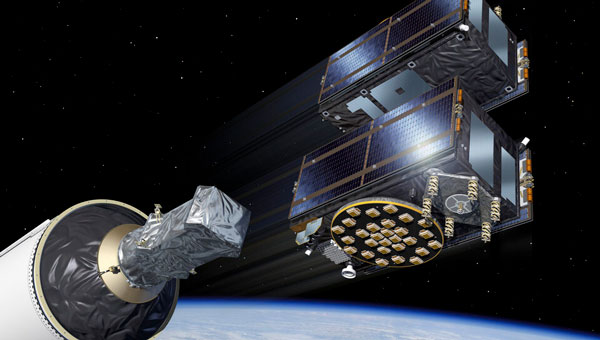
Galileo satellites 29 and 30 have reached their target positions at an altitude of 23,222 km and are now fully operational three months after being launched from Cape Canaveral, Florida, by SpaceX. These new additions to the Galileo constellation are now active and provide navigation signals to users.
Both satellites have been positioned on the same orbital plane, one of three that comprise the Galileo constellation. With this latest addition, two of the three Galileo orbital planes are fully populated, bringing the constellation close to completion. The next Galileo launch is planned in the coming weeks from the Kennedy Space Center in Florida onboard a SpaceX Falcon 9.
The Galileo Service Operator, supported by a team of approximately 30 satellite experts from the European Space Agency (ESA) and satellite manufacturer OHB, conducted early operations at the Galileo Control Centre in Oberpfaffenhofen, Germany, under supervision from the European Union Agency for the Space Programme (EUSPA). Following the initial operations, the satellites entered a drift phase, during which ground teams guided them to their final positions, which was reached on June 24.
On August 21, 2024, ESA, OHB and payload manufacturer SSTL evaluated the in-orbit test results, confirming that the satellites had not experienced any degradation during launch. ESA, in collaboration with EUSPA, then validated the satellites’ performance at the system level.
GNSS researchers presented hundreds of papers at the 2023 Institute of Navigation (ION) GNSS+ conference, which took place Sept. 11-15, 2023, in Denver, Colo., and virtually.
The following four papers focused on ways to combat GNSS jamming and spoofing. The papers are available here.
GPS World will attend this year’s ION conference in Baltimore, Maryland on Sept. 16-20.
Approximating Regional GNSS Interference Sources Using ADS-B Data
The Automatic Dependent Surveillance-Broadcast (ADS-B) system, widely used for air traffic operations and management, also has potential applications in identifying, detecting and localizing (IDL) GNSS/RFI jamming sources in regions with high air traffic. With the rise in global GNSS interference reports, it is crucial to identify and eliminate jammers to ensure safe air travel operations.
The Navigational Integrity Category (NIC) value included in the ADS-B message is a key indicator for detecting potential jamming from ADS-B data. Although NIC is not the most effective metric for interference detection, it can still signal the presence of jamming and offer a means to localize the source in real time.
This research aims to approximate the area of GNSS/RFI interference by fitting a Euclidean Cone to ADS-B data that reports low NIC values. The problem is formulated as a convex optimization problem, derived from an alternative version of the maximum inscribed ellipsoid approach. By fitting an optimal cone to the data affected by interference, the cone’s apex indicates the estimated jamming location. The research team processed, decoded, interpolated and filtered ADS-B data to enhance localization accuracy.
The proposed convex formulation was tested on two reported interference events: one near Denver International Airport in January 2022, for 36 hours, and another near the Dallas-Fort Worth area in October 2022, over roughly eight hours. In Denver, four estimated jamming locations, calculated from four six-hour time windows, were grouped between downtown Denver and the airport. In Dallas, three estimated jamming locations, determined from three one-hour windows, showed a tighter grouping on the southern side of the Dallas/Fort Worth area, indicating spoofing was nearby.
Michael Dacus, Zixi Liu, Sherman Lo and Todd Walter, “Approximating Regional GNSS Interference Sources as a Convex Optimization Problem Using ADS-B Data.”
Hybrid Autoencoder for Interference Detection
Malfunctions or failures in GNSS services can result in significant personal, material, and financial damages. Early identification of anomalous behavior in GNSS signals can enable timely countermeasures. However, many interference monitoring or mitigation techniques are only feasible with high-end receivers and demand a certain level of expertise to be used effectively.
This paper presents a GNSS interference monitoring approach employing machine learning methodologies for users of any expertise level and with any type of GNSS receiver capable of outputting raw GNSS observations. The research team used simple signal-to-noise ratio (SNR) observations and different hybrid autoencoder models, including denoising or variational autoencoder combined with recurrent neural network (RNN) models, which are trained and tested on real jamming and spoofing events. The developed monitoring system is represented by a “traffic lights” system, indicating the severity or level of concern associated with each detected anomaly.
The results compare different RNN-based autoencoder implementations and have been tested on input data from high-end to low-end GNSS receivers. The analysis of the test set showed that there is a 95 percent probability of catching anomalies. Additionally, similar results were achieved when applied to other geodetic receiver types such as u-blox or JAVAD GNSS receivers. However, smartphone data is subject to some limitations. Notably, missed anomalies are primarily attributed to the low transmitting power from the jamming and spoofing devices, which poses challenges for detection.
Karin Mascher, Stefan Laller and Philipp Berglez, “Hybrid Autoencoder for Interference Detection in Raw GNSS Observations.”
A Tool to Monitor, Analyze and Record Navigation Signals
Given the heavy reliance on GNSS for numerous critical applications, any disruption caused by intentional or unintentional RFI could pose significant threats to operations that depend on these systems, from transportation and logistics to emergency services and national security. Developing advanced countermeasures against RFI has become a priority to ensure the functionality and resilience of GNSS-dependent systems.
This paper presents an architecture for real-time detection and classification of RFI affecting multi-band GNSS signals based on a machine learning method. The study proposes an architecture combining an actual GNSS monitoring station for recording GNSS signals — a Navigation Signals Monitoring, Analysis, and Recording Tool (N-SMART) system — with a deep neural network approach to detect and classify different classes of interferences.
Researchers propose a novel architecture for real-time interference detection and classification of RFI, which can continuously monitor and record multi-band GNSS signals and provide timely warnings in case of RFI. The proposed architecture utilizes the N-SMART system to capture and store the GNSS signals, while detection and classification are implemented using a deep neural network technique. The core principle of the suggested method is to implement a convolutional neural network (CNN) classifier inside a Docker container, running on top of the N-SMART system.
The results of the experimental test campaign on real interfered GNSS signals showed an overall accuracy of 85 percent, demonstrating the potential for effective, real-time classification of RFIs in GNSS. The research team explains that future work could focus on optimizing the model or exploring new architectures of CNN to improve accuracy and reduce task completion time across a variety of applications.
Iman Ebrahimi Mehr, Alex Minetto and Fabio Dovis, “A Navigation Signals Monitoring, Analysis and Recording Tool: Application to Real-Time Interference Detection and Classification.”
GNSS RFI Mitigation in Commercial Airborne Receivers
Reports from air navigation service providers worldwide indicate that commercial airborne GNSS receivers are increasingly being subjected to jamming and spoofing attacks. Consequently, there is a growing need to ensure that the raw GNSS measurements provided to aircraft systems are not compromised by spoofing. Validating these measurements is critical to maintaining the integrity and reliability of navigation systems used in aviation.
This paper focuses on two techniques under development by Collins Aerospace to be incorporated via a field-loadable software update to the Collins GLU-2100 multi-mode receiver to combat spoofing attacks. The first method, Receiver Autonomous Signal Authentication (RASA), uses the known characteristics of the GNSS receiver oscillator to detect whether the received signals are from a spoofer.
A second technique, Staggered Examination of Non-Trusted Receiver Information (SENTRI), uses the inertial sensor data already available from the aircraft’s IRS/INS, to monitor the coherence between pure GNSS, pure inertial (INS) navigation solutions or tightly coupled inertial GNSS hybrid solutions without augmentation. SENTRI further allows the computation of position integrity levels (HPL and VPL) in the presence of GNSS spoofers. The paper will describe the overall RFI mitigation architecture that is implemented on the GLU-2100.
RASA and SENTRI can be used together in a complementary fashion to detect the presence of spoofers reliably. It will also provide improved robustness to data spoofing attacks that induce errors in ephemeris, almanacs, GPS time jumps, etc., and will enable the GLU-2100 to coast through GNSS outages that are induced due to spoofing or jamming.
Future technologies will use antenna techniques, signal analysis, DFMC signals and APNT to increase the robustness to new and evolving threats. The goal of this RFI mitigation roadmap is to continue to ensure that GNSS can be used safely and reliably in civil aviation.
Angelo Joseph, Joseph Griggs, Patrick Bartolone, Bernard Schnaufer, Huan Phan, Vikram Malhotra, “GNSS Radio Frequency Interference Mitigation in Collins Commercial Airborne Receivers.”
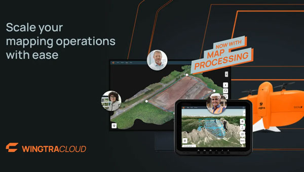
Wingtra has upgraded its WingtraCLOUD software platform by adding map processing capabilities. This upgrade aims to streamline the integration of aerial insights into industries such as construction, mining and urban planning.
The latest updates seek to help engineering firms and users transition more smoothly from UAV data to actionable insights. By consolidating all stages of aerial data management — from mission planning to insight sharing — into a single platform, WingtraCLOUD eliminates the need for multiple complex tools to simplify workflows.
This software is designed to reduce errors, prevent rework and accelerate project timelines, leading to increased productivity across key industries.
With WingtraCLOUD, large-scale mapping projects can be completed quickly. This rapid processing capability is ideal for industries such as construction, which helps avoid costly delays and resource waste, and mining, where it enhances safety through quick highwall inspections. In disaster scenarios, WingtraCLOUD’s fast mapping capabilities can aid in efficiently directing resources.
Locus Lock has partnered with Xona Space Systems to develop a GNSS receiver that uses Xona’s multi-frequency PULSAR service. Locus Lock aims to provide a robust software-defined GNSS receiver for commercial and military applications.
According to the company, Xona’s PULSAR service will be delivered via a constellation of low-Earth orbit (LEO) satellites, which orbit the Earth approximately 20 times closer than traditional GNSS satellites. This proximity allows PULSAR to offer higher signal power and a modernized signal design to offer improved multipath mitigation, higher accuracy and increased protection against radio frequency interference and spoofing compared to current GNSS systems.
The technology is suitable for various applications, including vehicles navigating dense urban areas, agriculture and construction, UAVs, high-speed aircraft and defense applications. Locus Lock’s GNSS software stack can be deployed on existing customer computational infrastructure, ranging from small embedded devices to larger centralized computers. This flexibility allows for adaptation and configuration of the software to suit specific deployed environments.
The system features inertially aided carrier-phase differential GNSS (CDGNSS) for maintaining precision in challenging ecosystems, advanced interference mitigation and detection technology to ensure authentic GNSS signals are received, and the dual-antenna, triple-frequency RadioLion RF front-end for capturing raw GNSS signals. These features offer signal situational awareness, anti-spoofing, and interference mitigation.