Category: Applications

  • ANELLO adds to its optical-gyroscope based navigation systems

    ANELLO adds to its optical-gyroscope based navigation systems

    ANELLO Photonics has added real-time centimeter-accurate positioning and localization capabilities to its line of optical-gyroscope based navigation systems.

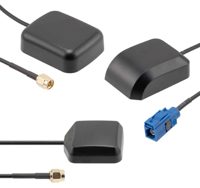
    Its real-time centimeter accuracy is achieved by using real-time kinematic (RTK) correction data from GEODNET, a community-based decentralized network of over 3,000 GNSS reference stations worldwide.

    Under the agreement, ANELLO Photonics users will have access to a free trial of RTK services and competitive options for long-term, high-volume correction data requirements.

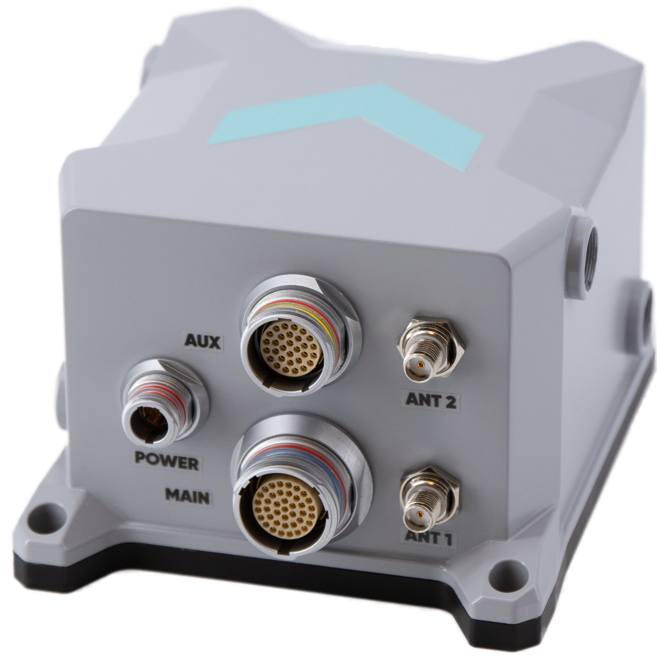
    By combining the ANELLO silicon photonics optical gyroscope (SiPhOG) with GEODNET’S global RTK correction network, users now have access to a new global cyber-infrastructure for reliable measurements.

    The partnership offers users a combination of optical gyroscope technology and a reliable and global RTK correction network that enables centimeter-accuracy for industries operating in challenging RF and GNSS-denied environments. These environments include city centers, construction sites and orchards.

    The agreement aims to address the challenging applications by using SiPhOG and its GNSS-denied dead-reckoning algorithms with GEODNET’s distributed global network of RTK stations. This combined technology offers high-level accuracy while reducing the total solution costs.

    The companies aim to simplify performance intensive applications such as high-definition mapping and aerial or terrestrial autonomous vehicle deployment.

    ANELLO is currently engaged in trials with users in the construction, farming, robotics, trucking, UAVs, autonomous vehicles, and defense space.

  • Pasternack releases vehicle GPS antennas

    Pasternack releases vehicle GPS antennas

    Image: Pasternack
    Image: Pasternack

    Pasternack, a manufacturer of microwave- and millimeter-wave products, has released a series of vehicle GPS antennas.

    The antennas come equipped with a high gain of 28 dB or 30 dB, enabling them to capture signals in challenging terrains and conditions. One of their standout features is the use of right-hand circular polarization (RHCP), which reduces signal interference and multipath effects.

    With waterproof and dustproof ratings ranging from IPX6 to IP66, these antennas are engineered to excel in the harsh environments and are ideal for vehicle tracking, fleet management, telematics, navigation systems and autonomous vehicles.

    The antennas also come with both SMA and FAKRA connector options, ensuring wide-ranging system compatibility. They are tailored for the GPS L1 frequency and are available in both passive and active versions. Mounting them is user-friendly, with options for direct vehicle mount or the added convenience of a magnet mount.

  • Exail releases INS for mobile mapping

    Exail releases INS for mobile mapping

    Image: Exail
    Image: Exail

    Exail has launched the Atlans 3, its new Inertial Navigation System (INS) dedicated to land and air mobile mapping applications. The technology was unveiled at INTERGEO 2023.

    The Atlans 3 is an all-in-one positioning and orientation system integrating unique micro-electro-mechanical systems. Fiber optic gyroscope (MEMS-FOG) hybrid technology and a dual-antenna RTK GNSS receiver are housed within one compact device.

    The INS offers North-keeping capability at FOG-level performance across a variety of land and air mobile mapping applications. It delivers real-time heading, even in GNSS-challenging environments such as urban canyons, mountainous terrain, or forested areas. The lightweight INS is designed to meet the requirements of high-performance lidars mounted on vehicles where space and weight constraints are critical.

    The Atlans 3 is designed to be quick and simple to install on all platforms. It offers efficient “set-and-forget” operations for a wide range of land and air applications including road and rail asset inventory, pavement condition survey, vehicle automation, HD mapping, ground-truth, airborne surveys and precision pointing.

  • First fix: Overlapping technologies

    First fix: Overlapping technologies

    Photo: lakshmiprasad S/iStock / Getty Images Plus/Getty Images
    Image: lakshmiprasad S/iStock / Getty Images Plus/Getty Images

    The natural sciences overlap — hence such fields as geophysics, astrobiology and biochemistry. So do the social sciences and humanities — hence such fields as political economy, political philosophy and social economics. Our very individual identities consist of multiple, intersecting factors — including gender, race, ethnicity, class, and sexuality.

    Analogously, this magazine covers overlapping technologies. While we focus on global navigation satellite systems (GNSS) and other positioning, navigation and timing (PNT) technologies such as inertial systems, these technologies are often embedded in larger systems that also include sensors (such as lidar, radar and cameras) and, increasingly, artificial intelligence (AI).

    That is why we so often cover unmanned aerial vehicles (UAV) — which use GNSS for positioning navigation, geofencing and stabilization; use sensors to collect data; and will soon use AI for mission planning and execution — and autonomous vehicles — which use GNSS and sensors for positioning and navigation and already use AI to make driving decisions in complex environments.

    Of course, UAVs are also much in the news these days:

    • Since the start of the Russian invasion of Ukraine, both sides have been using several hundred UAVs every day. According to the Royal United Services Institute, a British think tank, the Ukrainians are losing some 10,000 UAVs a month on the battlefield. (By way of comparison, the French army currently has a little more than 3,000 UAVs in its arsenal.)
    • In the United States, the number of companies granted waivers by the Federal Aviation Administration to conduct beyond visual line of sight (BVLOS) operations keeps growing, enabling them to conduct much more efficient monitoring, inspections and mapping of infrastructure.
    • Following a recent increase in encounters between swimmers and sharks along beaches on Long Island, New York, in July UAVs began sweeping the ocean three times a day to detect danger. On July 14, the state’s governor, Kathy Hochul, announced the allocation of $1 million to purchase 60 new shark-monitoring UAVs.
    • Also in July, 350 UAVs were lost during a practice light display show in Melbourne, Australia, ahead of a scheduled performance for the opening of the women’s World Cup. The UAVs appeared to stop mid-show and plummet into the Yarra River, most likely due to interference with GPS signals.
    • On August 30, researchers in Switzerland unveiled a small AI-powered quadcopter UAV that can outfly some of the best human competitors in the world. It whipped its way around an indoor racecourse in a matter of seconds and was able to beat its human rival in 15 out of 25 races, according to the journal Nature.

    From mapping coastal areas with airborne lidar bathymetry to delivering medicines, from locating lost hikers to mapping fires, from enhancing the situational awareness of first responders to monitoring invasive plant species, UAVs are quickly becoming ubiquitous and essential.

    Meanwhile, in San Francisco, where autonomous vehicles are already ubiquitous, but not everyone considers them essential, an anonymous group of protesters is surreptitiously placing orange traffic cones on some of them, confusing their sensors and rendering them inoperable.

    Matteo Luccio | Editor-in-Chief
    [email protected]

  • Meet the SSC GPS Certifications Branch

    Meet the SSC GPS Certifications Branch

    Image: SSC
    Image: SSC

    The United States Space Force’s Space Systems Command (SSC) has a specialized branch responsible for certifying GPS accuracy called the GPS Certification Branch. It is a specialized team within SSC that is responsible for certifying the hardware, software, and firmware used in GPS-based systems.

    The certification process conducted by SSC’s GPS Certification Branch involves the evaluation of design and testing for various components of GPS-based systems. This includes user equipment — the devices used by individuals or organizations to receive GPS signals and determine their precise location.

    The GPS Certification Branch works with GPS manufacturers, agencies of the U.S. Department of Defense (DOD), and others to establish and maintain certification standards. Collaboration with industry experts, research institutions, and other certification bodies is also an important aspect of the branch’s work to stay informed about technological advancements and ensure the certification process remains up to date with the latest developments.

    The certification process also includes space segments — the satellites that transmit the GPS signals, monitoring stations, which track and monitor the performance of the GPS satellites, and the terrestrial modules — that provide end user secured and accurate signals.

    Certification of hardware, software, and firmware is critical to ensure that GPS systems meet the standards set by the DOD. This certification ensures that the GPS-based systems used by the military and other DOD agencies are reliable, accurate, and secure. It also ensures that they are interoperable and compatible with other military equipment and communication networks.

    The assessment process conducted by the GPS Certification Branch involves thorough testing and analysis of the design, performance, and security of the GPS components. This includes assessing the hardware’s ability to receive and process GPS signals accurately, the software’s ability to interpret and utilize the GPS data effectively, and the firmware’s ability to maintain system integrity and security.

  • GPS jamming increases amid Israel Hamas conflict

    GPS jamming increases amid Israel Hamas conflict

    Image: GPSJam.org
    Image: GPSJam.org

    Israel has declared war on the Palestinian militant group  Hamas after it carried out an unprecedented attack by air, sea and land on October 7, 2023.

    The large-scale surprise attack has left more than 1,200 dead in Israel, said Israel Defense Forces spokesperson Lt. Col. Jonathan Conricus in an update on October 11. It has since prompted retaliatory Israeli airstrikes on Gaza that have killed more than 1,055 people.

    During the ongoing conflict between Israel and Hamas, the Middle East is witnessing a significant shift in the patterns of GPS interference, with data showing an increase in disruptions compared to just a week prior, according to Defence and Security Middle East.

    Reports have surfaced indicating Hamas has actively jammed Israeli communication systems during the initial stages of the conflict. This strategic move highlights the increase of jamming GPS and communication networks in modern warfare scenarios, where precision and coordination are imperative.

    Positioning, navigation and timing (PNT) services play a role in a variety of military systems and civil technologies. These services not only guide precision warfare, but also facilitate efficient transportation, communication and various civilian applications.

    The Middle East has a history of being a focal point for jamming and spoofing activities, impacting not only security but also regional stability and even commercial flights.

    For example, there have been recent reports of recurring interference allegedly caused by Russian systems in Syria, which frequently disrupts air traffic at Tel Aviv’s Ben Gurion airport. Regulatory bodies, such as the Federal Aviation Administration, the European Union Aviation Safety Agency, and Israel’s aviation authority, advised airlines to exercise caution when operating in the airspace of the region. Multiple airlines have now canceled or suspended flights.

    With airlines reducing services and regulatory bodies advising caution, the conflict’s repercussions extend well beyond the battlefield, highlighting the critical need for security assessments or alternative PNT systems to protect civilians.  

  • Harxon introduces new GNSS and helix antennas

    Harxon introduces new GNSS and helix antennas


    Image: Harxon
    Image: Harxon

    Harxon has launched its new survey GNSS antenna, HX-CSX600A, and helix antenna, HX-CUX615A, designed for high-accuracy positioning applications across the geospatial industry. These two antennas are set to debut at INTERGEO 2023.

    Survey GNSS antenna HX-CSX600A 

    HX-CSX600A boasts a pre-filtered Low Noise Amplifier (LNA) offering exceptional out-of-band rejection, ensuring strong anti-interference performance even in challenging environments. It is designed for high-precision GNSS applications, including agricultural vehicles, small robots and surveying.

    The new antenna offers reliable and consistent satellite signal tracking across a wide range of frequency bands, including GPS, GLONASS, Galileo, BeiDou, QZSS, IRNSS, SBAS, as well as L-Band correction services. With advanced multipoint feeding technology, HX-CSX600A maintains a stable phase center variation.

    Built with an IP67-rated compact and ruggedized housing, this antenna is designed to withstand dust, rain, sunlight, shock and vibration. Its standard TNC-K connector and pole mount aims to simplify the integration process.

    Helix antenna HX-CUX615A 

    HX-CUX615A is the housed version of Harxon’s HX-CUX012A, designed for UAVs. Its low profile design and simple integration process makes this antenna ideal for various UAV applications such as aerial photography, remote sensing, infrastructure inspection, traffic control and public security.

    Equipped with a pre-filtered LNA, HX-CUX615A offers out-of-band interference rejection to mitigate unwanted electromagnetic interference and provide reliable GNSS signals for seamless integration into positioning solutions.

    This light-weight antenna also adopts patented D-QHA (Dual-Quadrifilar Helix Antenna) technology, ensuring stable wide-angle circular polarization (WACP) performance. This results in low-elevation satellite tracking, while maintaining high gain and reliable signal tracking – even in challenging environments.

  • Tallysman releases new L-band GNSS antenna

    Tallysman releases new L-band GNSS antenna

    Image: Tallysman
    Image: Tallysman

    Tallysman Wireless has released the ARM972XF triple-band plus L-Band GNSS antenna.

    The ARM972XF uses Tallysman’s accutenna technology providing GPS/QZSS L1/L2/L5, GLONASS-G1/G2/G3, Galileo E1/E5a/E5b, and BeiDou B1/B2a/B2b + L-Band coverage. The technology is designed for precision triple-frequency positioning where light weight and a low profile are required.
    Tallysman’s ARM972XF is a small and lightweight housed triple-band precision mini ARINC GNSS antenna. It has an average phase center variation of less than 10 mm for all frequencies and overall azimuths and elevation angles. Additionally, both models are available with components qualified for low Earth orbit (LEO).

    Housed in a weatherproof (IP67) enclosure, the ARM972XF is available in four versions. Model ARM972XF-1 (ARM972XF-1-S for LEO space-qualified components) has an integrated 100 mm ground plane, while model ARM972XF-2 (ARM972XF-2-S for LEO space-qualified components) is 83 mm in diameter.

    The antenna also includes Tallysman’s eXtended filtering (XF) technology, designed to mitigate GNSS interference.

  • OxTS introduces INS for land and air applications

    OxTS introduces INS for land and air applications

    Image: OxTS
    Image: OxTS

    OxTS has released the xRED3000, its lightest and smallest inertial navigation system (INS) suitable for land- and air-based applications.

    Combining two survey-grade GNSS receivers and OxTS’ latest IMU10 inertial technology, the xRED3000 is designed to be the GNSS/INS component for products requiring accurate localization, even in harsh environments.

    The xRED3000 uses OxTS lidar inertial odometry (LIO), which takes data from a lidar in post-processing to reduce IMU drift and improve accuracy in areas with poor or no GNSS signal such as urban canyons. The technology also provides a position accuracy of 0.5 m, even after 60 seconds of no GNSS signal.

    The INS is compatible with OxTS Georeferencer, a post-processing and calibration software that aims to improve the accuracy and clarity of user’s pointcloud data. It warms up to specification in three minutes, even with low-dynamic movement, increasing flight time for aerial applications and reducing the space needed for land-based warmups.

  • Syntony launches CRPA GNSS receiver

    Syntony launches CRPA GNSS receiver

    Image: Syntony GNSS
    Image: Syntony GNSS

    Syntony GNSS has released CERBER, a GNSS receiver embedded in a CRPA solution.

    A classic CRPA system consists of embedded GNSS antennas and antijamming treatments. However, CERBER relies on the tight integration of a CRPA treatment (with a 4-array antenna) and the embedded GNSS receiver.

    The estimation of GNSS direction of arrival (DoA) is enabled and allows the receiver to check whether those DoA estimations are compatible with GNSS constellations or originate from very few directions. Therefore, users will be able to detect and locate spoofing devices or receivers instantly.
    The receivers are also able to constantly recalibrate the chains of reception based on the DoA and GNSS signals.

    CERBER’s embedded approach also enables a 6dB power gain in satellites’ directions, the continuity of GNSS signals’ phase when the space-time adaptive processing (STAP) filter is updated, the absence of additional noise that a GNSS receiver would imply with the re-generation and re-digitalization of RF signals and an improved rejection performance when compared to a classic CRPA + independent GNSS receiver solution.
    This technology is designed for the protection and the surveillance of civil critical infrastructures, including Galileo’s and EGNOS’ ground segments, airports or any infrastructure requiring precise and resilient GNSS timing.

  • Hexagon expands TerraStar-X GNSS correction service to South Korea

    Hexagon expands TerraStar-X GNSS correction service to South Korea

    Image: metamorworks/iStock/Getty Images Plus/Getty Images
    Image: metamorworks/iStock/Getty Images Plus/Getty Images

    Hexagon’s Autonomy & Positioning division and Munhwa Broadcasting Corporation (MBC) have partnered to bring precise positioning to South Korea through the TerraStar-X Enterprise Correction Service. The hardware-agnostic correction service provides instant convergence and lane-level accuracy in automotive, mobile and autonomous applications.

    As a leader in real-time kinematic (RTK) positioning across South Korea, MBC’s atmospheric data enhances the redundancy of Hexagon’s fast converging and reliable precise point positioning (PPP) network across the country. Through this collaboration, the TerraStar-X Enterprise service is now supported in testbeds across South Korea, China, Japan, Europe, and North America to accelerate development for advanced driver assistance systems, safety-critical applications, micromobility, industrial and smartphone applications.

    “With TerraStar-X Enterprise Correction Services now available across autonomous and consumer market applications, developers can design once and then deploy that design at scale worldwide,” said Paul Verlaine Gakne, positioning services product manager at Hexagon’s Autonomy & Positioning division. “TerraStar-X Enterprise is designed to be as flexible as possible for large-scale testing and deployment.”

  • ComNav Technology and Dominican Republic forge advanced CORS network

    ComNav Technology and Dominican Republic forge advanced CORS network

    ComNav Technology has collaborated with FUNDCORSRD, a non-profit institution, to establish a comprehensive network of continuous reference stations (CORS) across the Dominican Republic for conducting topographic surveys.

    As a result of this collaborative effort, there are now 32 CORS stations spread throughout the Dominican Republic that are fully implemented with the SinoGNSS CORS solution from ComNav.

    ComNav Technology’s choice of equipment for this project included the M300 Pro GNSS receivers and AT600 choke ring antennas for the CORS reference stations.

    The M300 Pro features robust satellite tracking capabilities, supporting multiple satellite constellations such as GPS, GLONASS, BeiDou, Galileo, SBAS, L-band, and QZSS. It also comes equipped with a built-in web server, interfaces for external devices, a user-friendly front panel display, optical fiber interface, and a secure TF-card with password protection.

    The AT600 high-performance choke ring antenna features high gain, accuracy, and reliability, along with full-constellation compatibility.