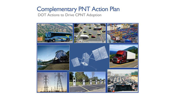
The U.S. Department of Transportation (DOT) awarded nine contracts for its Complementary Positioning, Navigation and Timing (CPNT) Action Plan.
The DOT’s CPNT Action Plan was issued in September 2023. The Action Plan aims to promote the use of CPNT services in the nation’s transportation systems and other critical infrastructure sectors. It provides a comprehensive roadmap to ensure the safety, security and efficiency of critical infrastructure through the adoption of CPNT technologies.
Also, in February 2024, the DOT, through the Volpe National Transportation Systems Center, issued a solicitation for proposals for the testing, evaluation and performance monitoring of positioning, navigation and timing (PNT) safety systems and critical infrastructure sectors.
According to SAM.gov, the companies granted contracts are:
Carahsoft Technology
Locata
Hoptroff
Microsemi Frequency and Time
NAL Research
NextNav
Parsons Government Services
Safran Trusted 4D
Tern AI
Through these contracts, the DOT aims to identify and support CPNT technologies that can ensure the reliability and security of critical PNT services, mitigating the risk of disruption and enhancing national resilience. The proposals demonstrate technological readiness and effectiveness. They also contribute to a collaborative effort to safeguard essential infrastructure against emerging threats to PNT services.
GPS vulnerabilities have been widely reported in the press. What steps have been taken to back up GPS use in U.S. critical infrastructure?
Jules McNeff
“President Biden on April 30 issued a National Security Memorandum on Critical Infrastructure Security and Resilience. GPS plays a vital role in the operation of critical infrastructure, and some sectors are considering their own backups. Other than conducting studies and meetings to admire the problem, the federal government has done virtually nothing to provide a comprehensive answer. In fact, the government is now dismantling the Loran system, though enhanced Loran (eLoran) is a viable and affordable GPS backup, specifically recommended for use by prior U.S. Department of Defense and U.S. Department of Homeland Security Deputy Secretaries. Given the vital role PNT and GPS play, it’s a mystery why such a viable solution is simply ignored.”
— Jules McNeff Overlook System Technologies
Will GPS remain the Gold Standard of space-based PNT services for the foreseeable future?
“GPS led the emergence and growth of a global space-based PNT service enterprise and has been the Gold Standard since its inception. The U.S. Department of Defense and Air Force (now Space Force) have maintained that standard through stable, transparent, and consistent policies and continuous performance improvements for the services it provides to all users. Now, in the face of foreign competition, hostile threats, budgetary pressures, reorganizations and management fragmentation, dilution of corporate memory, and inconsistent leadership support, those policy and performance foundations are in danger of eroding. The outcome for GPS and its future in the global PNT Enterprise is purely in the hands of our federal leadership today.”
NAVSYS Corporation has secured a $4.4 million contract from the Rapid Architecture Prototyping and Integration Development (RAPID) Laboratory of the Air Force Research Laboratory (AFRL). The contract is part of AFRL’s Commercial Alternative Positioning, Navigation and Timing (PNT) for RAPID (CAPR) program, which aims to provide the Department of Defense improved access to reliable and resilient PNT services, particularly in situations where GPS is unavailable or compromised.
The contract involves developing and maturing NAVSYS’ PNT as a Service (PNTaaS) system architecture. This technology uses existing SATCOM signals for PNT services, utilizing broadband signals outside of the L-band frequencies, which are often subject to jamming. The system employs multiple frequency allocations, including C-band, Ku-band and K-band, to offer high resilience and performance equivalent to GPS.
Test results previously published by NAVSYS have demonstrated the system’s capability to use satellites operated by Intelsat, Viasat, Eutelsat, SES and Telesat to deliver backup PNT capability to GPS.
VIAVI Solutions has launched its altGNSS geosynchronous orbit (GEO) SecureTime services designed to deliver nanoseconds-accurate UTC timing through L-Band and Ku-Band satellite signals. It is ideal for critical infrastructure including 5G networks, transportation, data centers, smart grid, high-frequency trading, military and first responder communications and satellite terminals.
The company said that operating independently of traditional GNSS, VIAVI’s altGNSS GEO service is difficult to jam or spoof and offers broad global coverage, further improving resistance to attacks.
SecureTime adds to the portfolio of solutions VIVAI offers for resilient PNT, and features navigation message authentication (NMA), which uses encryption to detect spoofing in any of the signals received from all sources — including GPS that does not support NMA. It builds on VIAVI’s existing multisource assurance, combining signals from government and commercial constellations across GEO, low-Earth orbit (LEO) and medium-Earth orbit (MEO).
These services have been tested and proven in live-sky battlefield scenarios, providing assured PNT in a simulated warzone with complete denial of GNSS signals.
VIAVI will integrate these services into its products and offer receivers for third-party solution providers to integrate into their systems. VIAVI’s SecurePNT 6200 hardware platform is powered by space and terrestrial SecureTime Services and TrustedPNT multisource fusion technology.
VIAVI is showcasing these solutions at the Assured PNT Summit on May 29-30 in Washington, D.C. and the Joint Navigation Conference (JNC) held June 3-6 in Cincinnati, Ohio.
The UK has successfully tested quantum-based navigation systems in flight. The commercial trial was led by Infleqtion, a quantum technology company, and is designed to improve resilience against GPS jamming and spoofing.
Although GPS jamming typically does not affect an aircraft’s flight path, quantum-based positioning, navigation and timing (PNT) systems aim to provide accurate and resilient navigation, complementing existing satellite systems and offering uninterrupted operations for global air traffic.
Infleqtion, in collaboration with aerospace companies BAE Systems and QinetiQ, conducted the trials at MoD Boscombe Down in Wiltshire. Science Minister Andrew Griffith participated in the final test flight on May 9. The project has received nearly £8 million in government funding as part of the National Quantum Strategy, which seeks to establish the UK as a leader in quantum technology.
The test flights included two key quantum technologies: the compact Tiqker optical atomic clock and an ultra-cold-atom-based quantum system, both tested aboard QinetiQ’s RJ100 Airborne Technology Demonstrator. These technologies are part of developing a quantum inertial navigation system (Q-INS), which aims to provide precise and resilient navigation independent of traditional GNSS.
The successful flight trials are a step towards deploying quantum navigation systems on aircraft by 2030 as part of the UK’s National Quantum Strategy. The demonstrated potential of quantum technology in enhancing navigation security is an important development for future aerospace applications.
SpacePNT, a Swiss positioning, navigation and timing (PNT) solution provider for the new space satellite market, has completed in-orbit validation tests of its NaviLEO spaceborne GNSS receiver platform. The platform is designed to deliver decimeter-level positioning and nanosecond-level timing accuracy in low-Earth orbit (LEO) and signal reception sensitivity for GTO/GEO/moon missions. Using its unique and proprietary hardware and software technology, it can operate in real time.
After its successful deployment in LEO onboard its hosting orbital transfer vehicle, the D-Orbit ION OTV SCV-011 satellite, on June 13, 2023, Space PNT conducted a series of experiments to validate the key functionalities of the radiation-tolerant technology. This is done by demonstrating multiple modes of operation, including dual-antenna and full-in-flight reprogramming using FPGA image and application software.
Flight models have already been delivered to commercial and institutional partners for these missions, said SpacePNT co-founder and CEO, Cyril Botteron.
The upcoming second-generation hardware platform reuses the same key radiation-tolerant electronics components, designed for telecom constellations. It also implements new functions to serve additional markets such as software-defined radio platforms for telecom and radar applications.
The new space satellite market refers to companies such as SpacePNT, SpaceX and Blue Origin that are developing reusable rockets to drastically reduce the cost of access to space. The growth of satellite technology and new business models, such as satellite-based internet services, have created new opportunities for private companies.
MerlinTPS has partnered with Bluespec to address the need for GNSS augmentation and backup technology as satellites continue to face new challenges, including wartime contested space as well as increased costs to produce and maintain satellites.
Under the partnership, MerlinTPS will develop its platform to support the expansion of PNT security capabilities by using existing signals of opportunity on the ground designed to combat jamming and spoofing.
“With our verification and validation-centric RISC-V solutions, MerlinTPS can develop customized solutions in a matter of weeks, allowing it to deliver highly differentiated products with minimal project and schedule risk,” said Charlie Hauck, CEO of Bluespec.
By implementing Bluespec’s RISC-V processors in Field Programmable Gate Arrays (FPGAs), MerlinTPS can quickly modify, generate and load new code onto FPGAs. This allows for hardware reuse, avoiding the need to build custom hardware for each task.
However, MerlinTPS can easily make customizations to Bluespec’s RISC-V soft processor cores — adding custom instructions designed to accelerate specific workloads — when needed. MerlinTPS plans to add artificial intelligence (AI) capabilities to the platform.
An interview with Chuck Stoffer, director of business development and Eric Hughes, design engineer at UHU Technologies. Click here to read more from this cover story.
UHU 1000 seven-element antenna array on a U.S. Army Stryker vehicle. (Photo: UHU Technologies)
What is your company’s main differentiator in the market?
CS: Our big differentiator is our ability to detect and mitigate GPS spoofing. There are many products that perform jamming mitigation using multi-element antenna arrays, but they usually don’t operate below the noise floor on spoofers. Our big differentiator is the ability to go underneath the noise floor and locate the spoofing threat.
About 10 years ago, our founder, Jeff Sanders, got interested in the GPS spoofing problem. Jeff’s previous company, Eclipse Electronic Systems, was dedicated to building high-end signals intelligence (SIGINT) receivers and the entire design team here at UHU worked for Jeff there. We built high-end, multi-channel receivers, often used in direction finding applications. When we started UHU, Jeff’s idea was to use direction finding to validate the constellation using satellite position.
EH: Our system looks like an anti-jam system, which it is. However, it does a whole lot more than that. We use a controlled reception pattern antenna (CRPA) to do angle of arrival (AOA) measurements on each GPS satellite.
We know where each satellite is supposed to be, then we calculate where it actually is in the sky. If a satellite is in the right spot in the sky, then we know that we can trust it. If it’s not — and, especially, if multiple satellites are not in the right spot in the sky — then we know there’s a spoofer.
Once we’ve done that, we can take it a step further and perform non-adaptive spatial nulling, subtracting out the bad PRNs from the signals.
Often people look at our system and think, “Oh, it’s an anti-jam system.” Yes, we do anti-jam, just like any other vendor out there would do, and we do the traditional adaptive null steering techniques, so that if there’s a jammer in the environment, we will automatically null it spatially. However, those systems don’t handle spoofers, which, as Chuck was saying, are often below the noise floor. Anti-jam systems — which are using power minimization techniques — will not do anything for something that’s below the noise. In fact, they may inadvertently amplify the weak signal because they weren’t designed to process signals below the noise.
As far as outputs, we provide a spatially validated PNT solution, meaning that we only include satellites whose sky position has been validated. We also provide an RF output that can feed other GPS receivers, including M-Code. Our products have a built-in web-based GUI for visualization of the threat environment, and all system measurements can be sent over the network using multiple industry standard protocols.
To “precisely geo locate the source of GPS jamming or spoofing threats,” as one of your marketing materials says you can do, requires at least two bearings and the range.
EH:One of the nice things about our approach is that once we’ve identified a spoofer or a jammer, we can then tell you the line of bearing or the angle of arrival from the threat. Both of our products — the Northstar and the UHU1000 —also have a built-in event-based I/Q recorder and a GPS-disciplined oscillator that provides precision time. That gives us baseband data with precision timestamps anytime there’s a spoofing or jamming event. This is a standard feature that’s available right now.
You can take multiple systems, network them together, and, if they all have a common view of the interference event, use the provided lines of bearing and precision time-stamped I/Q data to perform geolocation based on AOA and/or time difference of arrival (TDOA). This is a separate appliance that’s in development.
In our next software release we are adding single-receiver, AOA-based geolocation. However, it requires motion. So, if you have a single UHH1000 in motion, you get a coarse geolocation automatically.
CS:We’ve already demonstrated our geolocation algorithms on real-world data and our geolocation appliance is on our roadmap. We’ve proven the technology, and now we’re productizing it.
This works very well for aerial platforms, because you get a lot of motion and many different looks at it. For ground-based applications, where the source could be many miles away and the AOA doesn’t really change much, it might not be as useful.
How it the threat evolving and how are you dealing with that?
EH: One of the advantages of our AOA-based approach is that it’s outside of the signal. It’s a physics thing that is very hard, if not impossible, to spoof. At government-sponsored events, every year they throw a new attack at the participants, often by modifying the signal in some novel way. Those are all great things that need to be tested, but we don’t care about any of that because all we’re doing is checking whether a satellite is in the right spot in the sky. If it’s in the right spot, we trust it. If it’s not, we don’t. Because of that, we’re well positioned to handle new threats.
CS: We individually track every GPS satellite signal that we detect, even the same repeating pseudorandom noise (PRN) code coming from a different AOA. Each PRN gets its own hardware-accelerated tracking loop with its own beamformer. Once we know which PRNs are valid satellites and which PRNs are spoofers, we group and demodulate them separately. We provide the spoofer PNT solutions to the user in real-time.
Are all your boxes multi-constellation?
EH:Today, we process L1 C/A and L2C. Since L1 C/A is the backbone of most GPS receivers, effective spoofing attacks always spoof L1 C/A, and that has been our focus area. Of course, we have a roadmap to do more.
To the extent that you are at liberty to tell me, who has your box? Who will have it?
NextNav has petitioned the Federal Communications Commission (FCC) to add a new spectrum solution in the Lower 900 MHz band (902-928 MHz band) to complement and backup GPS. The Lower 900 MHz band plan aims to give access to 15 MHz of low-band spectrum for 5G services.
The company filed a rulemaking petition to the FCC, proposing to rearrange the band to facilitate a terrestrial positioning, navigation and timing (PNT) network and broadband. The petition specifically asks the FCC to reconfigure the band plan and adopt new rules, including enabling a high-quality terrestrial complement and backup to GPS for essential PNT services and providing 15 MHz of low-band spectrum for use by mobile broadband networks.
The proposal, according to the filing, “enables high-quality terrestrial PNT, with the potential for widespread and inexpensive adoption in many use cases because it will use the 5G standard.” Because the company’s NextGen PNT solution uses a small amount of capacity in the 10 MHz downlink, mobile network providers can use most downlink capacity for broadband, “making the spectrum appealing for integration into existing networks and thereby accelerating the availability of terrestrial PNT services.”
According to the filing, “The 15-megahertz band plan is necessary for this broadband deployment, which enables an at-scale PNT network to be deployed efficiently, providing a unique path to resolving the coverage, cost, and user device issues that have prevented broad terrestrial PNT usage to date.”
NextNav recently signed an agreement to acquire spectrum licenses covering an additional 4 MHz in the lower 900 MHz band from Telesaurus Holdings GB and Skybridge Spectrum Foundation. In March 2024, the Superior Court of the State of California, County of Alameda, issued an Order approving the Receiver’s request to sell all of its Lower 900 MHz spectrum holdings to NextNav, allowing the parties to move forward with obtaining FCC approval.
The company plans to partner with mobile network operators or others interested in commercial deployment in the band for 5G and will ensure incumbent operations are protected. According to the company, it has used its existing licenses to develop PNT expertise and products, but, because of a legacy band plan and rules that limit the use of the spectrum for 5G, much of this band is underused.
The NextGen PNT technology and network are designed to use 5G and offer a 3D positioning solution with single-digit accuracy. The positioning solution is available indoors and outdoors and in urban corridors. It also seeks to provide wireless distribution of precise, resilient timing.
The current Lower 900 MHz Band is “not conducive for either terrestrial PNT or mobile broadband,” according to the filing, with shortcomings that include fragmented geographic licensing arrangements, outdated command-and-control requirements and other restrictions. Consolidating the geographically licensed spectrum blocks into a 15MHz nationwide configuration for both PNT and 5G broadband changes. This allows the band to support better use cases and serve as a high-performing complement and backup to GPS.
Soldiers from the 101st Airborne Division conduct a terrain walk using the Dismounted Assured Positioning System during the 2023 PNTAX. (Photo: U.S. Army)
MerlinTPS has tested its Terrestrial Positioning System (TPS) at the Department of Defense (DOD) PNT Assessment Exercises (PNTAX), demonstrating resilience against electromagnetic radio frequency interference. This test positions TPS as an alternative to GNSS-based systems in environments where GNSS is compromised or unavailable.
PNTAX is designed to evaluate positioning, navigation and timing (PNT) technologies under conditions where traditional GPS signals are degraded or denied. MerlinTPS’s system uses broadcast radio signals, which are less susceptible to jamming and spoofing than satellite signals, to provide positioning and timing data.
The company is also working to enhance the portability and integration of TPS, collaborating with a RISC-V core engineering firm to reduce the size of their neuromorphic design, facilitating easier integration into OEM devices.
Throughout the PNTAX, Persistent Systems’ MPU5 radios supported backhaul communications reliably, even under harsh environmental conditions.
The tests at PNTAX represent a step forward for MerlinTPS in moving towards commercial deployment, with the goal of providing an alternative and reliable PNT solution across various industries globally, according to the company.
The GEODNET Foundation has received more than $2 million of strategic investments from new investors including CoinFund, Pantera, VanEck and Santiago R. Santos. The additional funds raised will support the Foundation’s near-term objectives of decentralization and developer accessibility.
GEODNET, the company’s blockchain-based global navigation network, has more than 5,000 GNSS reference stations added to its real-time kinematic (RTK) network, designed to enhance location and intelligent autonomy services. Standard GPS is typically off by two meters; however, devices connected to GEODNET’s global RTK network are designed to achieve instant accuracy within 1 cm to 2 cm.
The network can be used in agriculture, UAVs, consumer robotic devices and commercial global positioning services such as PPP precision point positioning (PPP), automotive-focused PPP-RTK services and low-Earth orbit satellite tracking.
GEODNET has more than 4,000 registered reference stations in more than 2,500 cities across 120 countries. It is designed to provide robust precision navigation systems to a variety of industries, including self-driving cars, agriculture, consumer robots, and more. An additional 2,000 stations are being delivered and installed.
Iridium STL is being deployed by L3Harris to protect critical FAA data center infrastructure. (Photo: Iridium)
Iridium Communications has entered a five-year agreement with L3 Harris. Under the agreement, Iridium will provide its satellite time and location (STL) service to more than three dozen L3Harris-operated communications network backbone nodes and a similar number of Federal Aviation Administration (FAA) facilities throughout the United States.
L3Harris, responsible for operating a private network for the FAA, provides voice, data and video communications for the National Airspace System operations and mission support functions. Given the critical nature of timing synchronization within the L3Harris communications network, particularly for supporting various critical infrastructure applications, the Iridium STL service plays a pivotal role in the overall network timing architecture by eliminating dependencies on GPS as the primary timing source.
The solution for L3Harris includes compact devices provided by Adtran’s Oscilloquartz division, which are designed to receive Iridium STL signals. These devices seamlessly integrate into the network and meet nationwide network timing synchronization requirements.
In April 2024, Iridium acquired Satelles, a secure satellite-based time and location service provider.