Category: Complementary PNT

  • ESA invests €233 million to launch Genesis and LEO-PNT missions

    ESA invests €233 million to launch Genesis and LEO-PNT missions

    Genesis satellite. (Image: ESA)
    Genesis satellite. (Image: ESA)

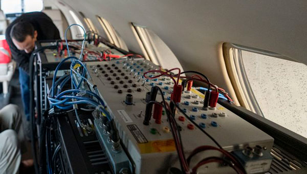
    The European Space Agency (ESA) has initiated two navigation missions, Genesis and low-Earth-orbit positioning, navigation and timing (LEO-PNT) as part of its FutureNAV program. ESA has awarded contracts, totaling €233 million, to several European entities to begin the development of the missions. They are designed to address the growing demand for more resilient and precise navigation solutions in Europe.

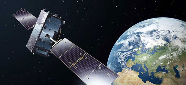
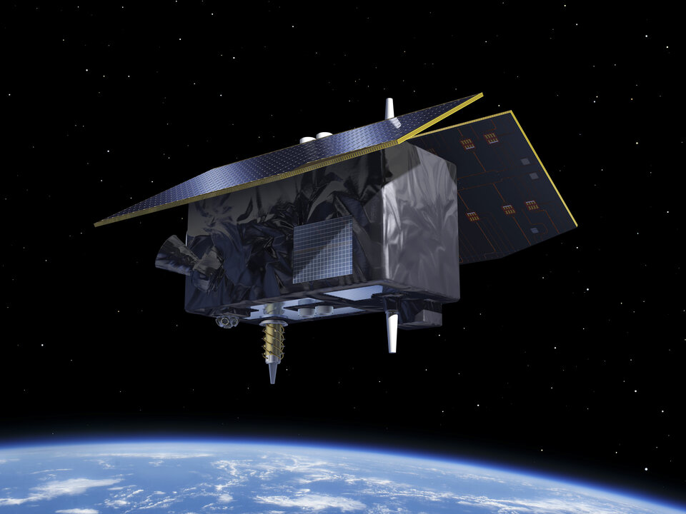
    Genesis, with a contract value of €76.6 million, involves a consortium led by OHB Italia, tasked with the development and operation of the Genesis satellite and its payloads, supported by contributions from Italy, Belgium, France, Switzerland, Hungary and the UK. The satellite is expected to launch in 2028, with subsequent years dedicated to scientific exploitation. Genesis aims to significantly improve the International Terrestrial Reference Frame (ITRF) and offer unprecedented precision for navigation and a myriad of Earth sciences applications.

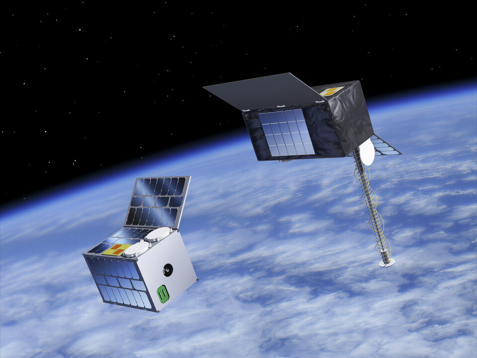
    For the LEO-PNT mission, ESA has distributed €78.4 million for each of the two contracts for the development of in-orbit demonstrators. These LEO-PNT satellites will explore new signals and frequency bands, designed to provide enhanced resilience, accuracy and speed in navigation. The projects are led by GMV Aerospace and Defense and Thales Alenia Space France and involve a broad consortium of more than 50 entities from 14 countries. The first LEO-PNT satellite is expected to launch within 20 months from the project’s commencement, with the complete constellation operational before 2027.

    LEO-PNT satellite. (Image: ESA)
    LEO-PNT satellite. (Image: ESA)

    Genesis is designed as a flying observatory to refine the ITRF to an accuracy of 1 mm and a stability of 0.1 mm/year, serving as a crucial reference for all space- and ground-based observations. This enhanced reference frame is designed to directly benefit satellite-based systems and applications across various sectors, including aviation, traffic management and autonomous vehicles. It is intended to have have broader implications for meteorology, natural hazard prediction and climate change monitoring.

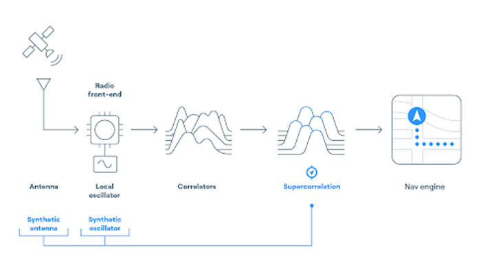
    The LEO-PNT mission aims to establish a small constellation of demonstration satellites to test novel navigation signals and interoperability with GNSS to offer improved signal robustness and extended navigation services to challenging environments such as deep urban areas and indoors. This mission will explore the potential of LEO constellations in supporting a wide range of applications, from transportation and critical infrastructure to mobile devices and asset tracking using advancements in communication standards, such as 5G/6G.

  • BlueSpace.ai launches AI-powered solution for GPS-denied environments

    BlueSpace.ai launches AI-powered solution for GPS-denied environments

    Image: Stanford Engineering GPS lab
    Image: Stanford Engineering GPS lab

    BlueSpace.ai, a Silicon Valley-based company specializing in off-road and unstructured autonomy, has released its assured positioning, navigation, and timing (A-PNT) solution. The solution — called BlueSpace Positioning Solution (BPS) — illustrates how artificial intelligence (AI) can enhance navigation precision in GPS-denied and GPS-degraded environments for both manned and unmanned vehicles.

    BPS is designed to address the challenges posed by weak GPS signals, susceptible to jamming, spoofing and unintentional blockages in various environments. It can support a cross-track error, or drift error, of less than 0.3%. This surpasses the industry standard of approximately 1% error over distance traveled. BPS also aims to maintain high performance while using industrial-grade inertial measurement units (IMUs), which leads to improvements in size, weight and power (SWaP).

    The AI solution is designed to eliminate geofence limitations and remove dependencies on prior training data and ultra-HD mapping.

    BlueSpace.ai has participated in a variety of defense and commercial applications, including applications in challenging underground mining environments, truck and bus automation and off-road autonomy.

  • Origin stories: Champions of GPS share beginnings, breakthroughs and what’s next

    Origin stories: Champions of GPS share beginnings, breakthroughs and what’s next

    Image: Defense Visual Information Center
    Image: Defense Visual Information Center

    As part of our celebration of the 50th anniversary of the Global Positioning System, three long-time players in the industry share their “GPS origin story,” recent breakthroughs, and their view on the next 50 years of positioning, navigation and timing (PNT). All three began their involvement with GPS between the late 1970s and the late 1980s, before the system was completed. All three are continuously making GPS more resilient and resistant to jamming and spoofing or augmenting it with layered multi-orbit architectures of complementary PNT.

    Read the origin stories, recent breakthroughs, and more insights from the following companies:

    BAE Systems: Pioneering military GPS technology

    Northrop Grumman: Integrating and developing GPS technology

    Spirent: From testing GPS to assuring PNT

  • Pioneering military GPS technology

    Pioneering military GPS technology

    Image: BAE Systems 
    Image: BAE Systems

    What is BAE Systems’ GPS origin story?

    BAE Systems has more than 45 years of military GPS experience. In fact, the first ever GPS signal reception on Earth happened at one of our offices in Cedar Rapids, Iowa, on July 19, 1977, when one of our legacy companies received the signal. Since that historic day, BAE Systems’ engineers have introduced more than 50 GPS products, including GPS anti-jam and precision landing systems.

    As a pioneer in military GPS technology, BAE Systems has delivered nearly two million GPS devices on more than 280 platforms around the world. We design and produce advanced GPS technology compatible with the next generation M-code signal, improving security and anti-jamming capabilities for critical defense applications.

    Can you share any recent innovations from BAE Systems?

    BAE Systems innovates a full portfolio of M-code-compatible military GPS solutions to meet warfighters’ needs. Our Strategic Anti-jam Beamforming Receiver — M-code (SABR-M) is the most capable integrated anti-jam (AJ) electronics GPS receiver and the first integrated AJ M-code receiver available for weapons systems. It delivers assured, global position, velocity, altitude and timing, as well as strong protection against GPS signal jamming and spoofing — critical capabilities for unmanned aerial vehicles (UAVs), precision-guided munitions (PGMs), and missiles in threat environments.

    This past June, at the Joint Navigation Conference in San Diego, BAE Systems unveiled NavGuide, a next-generation Assured Positioning, Navigation and Timing (A-PNT) device featuring M-code GPS technology. It is our response to strong defense market demand for a cost-effective, high performance handheld GPS upgrade. NavGuide provides an intuitive user interface and integrates easily into platforms currently using BAE Systems’ Defense Advanced GPS Receiver (DAGR).

    How is your company preparing for the next 50 years of PNT with GPS and beyond?

    BAE Systems is making advancements in our critical navigation capabilities for the warfighter through the Military GPS User Equipment (MGUE) Increment 2 program. We are developing a Next-Generation Application Specific Integrated Circuit (NG ASIC) for our small form factor Miniature Serial Interface (MSI) receiver. This will enhance our full portfolio of ground, airborne and weapons M-code assured GPS receivers beyond 2030.

    We have invested an enormous amount of time and energy into our facilities and simulator capabilities, especially in our state-of-the-art simulators powered by Spirent Federal signal generation and RF wavefront technology. We want to be prepared to meet the technical demands of an ever-changing threat environment, and we need to be certain our receivers are prepared for the fight the first time, every time. We put our receivers through the paces by running them through thousands of trials on our Spirent simulators to validate and verify our performance under the most demanding scenarios.

  • Integrating and developing GPS technology

    Integrating and developing GPS technology

    Image: Northrop Grumman
    A flight test of Northrop Grumman’s airborne navigation solution, embedded GPS/INS modernization, EGI-M (Image: Northrop Grumman)

    What was Northrop Grumman’s GPS Origin Story?

    Northrop Grumman’s involvement with GPS has its origins during the mid-1980s, when we became an early adopter. We applied our prior decades of technical expertise in defense and commercial navigation solutions to recognize the significance of GPS as an emerging technology to optimize our inertial navigation products. The first GPS receiver was integrated with the LN-33, our main product for military aircraft, in 1987.

    Around the same time, our engineers began to develop an indigenous civil GPS receiver to complement our inertial navigator for use in commercial airliners. This resulted in the certification and fielding of the LTN-2001 product, an eight channel C/A Code GPS receiver. This receiver, in concert with our Autonomous Integrity Monitored Extrapolation (AIME) algorithm, provided our customers a first-ever sole means navigation system using GPS/inertial for non-precision approach.

    By the early 1990s, advancements in the semiconductor industry facilitated the reduction of the GPS receiver from a 1,000 cu in stand-alone box to a roughly 6-in by 6-in circuit card. This critical milestone allowed GPS to be embedded into an inertial navigation system (INS) without a significant increase in its size or power consumption and thereby the ubiquitous Embedded GPS INS (EGI) was born. Our first inertial navigation system with embedded military GPS capability was the LN-100G in 1991. This standard form factor was produced across the industry with installations on virtually all the front-line tactical aircraft and rotorcraft for the U.S. Department of Defense (DOD) and many of our allies.

    Can you share a breakthrough?

    Inspired by accomplishments in the survey community, our team conducted early location accuracy experiments to demonstrate a few decimeters of accuracy between our Woodland Hills, California, location and a facility in San Jose, California, about 500 km away. Leveraging this experience and the same signal processing, our teams became a broader solution provider for adjacent mission applications including precise formation flying for in-flight automated refueling, precision approach and landing, and decimeter-level positioning for the intelligence, surveillance and reconnaissance (ISR) community.

    LN-100G. (Image: Northrop Grumman)
    LN-100G. (Image: Northrop Grumman)

    In parallel with these developments, Northrop Grumman, in partnership with the Defense Advanced Research Projects Agency (DARPA), improved the resilience of embedded GPS receivers with a more intimate coupling of INS and GPS. The DARPA GPS Guidance Package (GGP) program demonstrated a Navigation Grade Fiber Optic Gyro (FOG), greatly improved GPS tracking performance under extreme vehicle dynamics, and the ability to track at lower signal-to-noise levels. Our success on this program reinforced our reputation as a GPS integration leader and led to the introduction of Northrop Grumman’s current LN-251 product line, which is broadly used in tactical military aircraft.

    In the early 2000s, Northrop Grumman initiated research into the feasibility of a Global Navigation Satellite System (GNSS) software-defined radio and started development of what we now call SERGEANT (Software Enabled Reconfigurable GNSS Embedded Architecture for Navigation and Timing). The company used Spirent signal simulators to evaluate proper GPS M-code tracking over a wide range of test cases in a controlled laboratory environment. Together with the Air Force Research Laboratory (AFRL), Northrop Grumman demonstrated advanced receiver capabilities using SERGEANT starting in 2010. In 2018, AFRL used SERGEANT for the first real-time flight demonstration of a GPS M-code SDR.

    How is your company preparing for the next 50 years of PNT with GPS and beyond?

    SERGEANT Flight Test SDR. (Image: Northrop Grumman)
    SERGEANT Flight Test SDR. (Image: Northrop Grumman)

    Northrop Grumman foresees the world of GNSS being dramatically influenced by the emergence of alternative radio navigation sources as augmentations to traditional GNSS constellations to provide additional robustness and resilience. Our PNT SDR technology is a foundational tool to integrate these emerging radio navigation signals quickly and accelerate deployment to our customers.

    Northrop Grumman has led medium-Earth orbit (MEO) and low-Earth orbit (LEO) PNT technology studies through the DARPA Blackjack proliferated LEO (pLEO) program, starting in 2017. Northrop Grumman’s SERGEANT SDR transceiver is currently being integrated for use in emerging pLEO constellations. We anticipate that these capabilities, as well as emerging cooperative radio navigation signals, will become a critical part of the next 50 years of PNT with GPS.

  • From testing GPS to assuring PNT

    From testing GPS to assuring PNT

    A Spirent user employs a portable GSS6450 attached to an antenna to record GPS, other GNSS, and complementary signals for resilient PNT testing. (Image: Spirent)
    A Spirent user employs a portable GSS6450 attached to an antenna to record GPS, other GNSS, and complementary signals for resilient PNT testing. (Image: Spirent)

    What is Spirent’s GPS origin story?

    Spirent’s GPS genesis began on a rooftop in the middle of the night in the early 1980s. Engineers were attempting to acquire the new GPS signals with their receivers, scheduling their lives around the times when satellites would pass overhead, angling antennas off a roof in the dark, and hoping for favorable conditions. Those difficulties inspired an idea: since real-world conditions are never the same twice, simulating the signals in a lab would control variables and provide repeatable and trustworthy results.

    That idea grew to be Spirent’s positioning division — a team of experts whose sole focus is to partner with customers to accelerate the deployment of robust PNT technology. In 1985, one of the first groundbreaking simulators provided to a customer generated six GPS L1/L2 signals. Soon after, we developed the world’s first simulator with SA-A/S capability, establishing our reputation for innovation. Today, simulation is for much more than convenience. The further upstream testing starts, the better for R&D and investment decisions. Because of that, we work across the spectrum in close partnership with constellation developers, receiver manufacturers, and OEM application integrators.

    Can you share a recent breakthrough?

    GPS regional military protection (RMP) is a nascent anti-jamming capability that uses a steerable, narrow-beam M-code signal, allowing U.S. and allied forces to operate much closer to interference without losing connection. Spirent supports RMP, so modernized GPS user equipment (MGUE) can be tested and integrated with RMP long before live-sky signals are available.
    Another major breakthrough is in AltNav, a catch-all term that includes non-GNSS sources of RF and other complementary PNT, with recent attention focused on low-Earth orbit (LEO) constellations. Spirent has developed LEO AltNav simulators for both the military and commercial sectors that seamlessly integrate with Spirent’s extensive testbed for GNSS, threat simulation, inertial navigation systems, and additional complementary PNT.

    How is your company preparing for the next 50 years of PNT with GPS and beyond?

    As a trusted industry test partner, one of Spirent’s guiding principles over the past five decades has been to support PNT developers and early adopters by being first-to-market with new signals and constellations. Enabled by our flexible solutions, our dedication to that tenet will continue across the next five decades.

    NAVWAR resilience testing is an area where emerging test needs will continue to demand more from the test environment. Layered PNT positioning engines — including GNSS, secure military signals, CRPA systems, multi-orbit architectures, and sensor fusion — are driving complexity in the test regimes that support them. Spirent’s purpose-built solutions are designed to meet these advancements, with deterministic simulation that delivers definitive validation and accurate test results.

    Spirent pioneered the use of software-defined radios for GNSS simulation with the GSS9000, which enabled the same architecture to support new signal types, higher motion rates, user-defined waveforms, and more than double the generated signals. The next generation will extend that flexibility, capacity, and ease of integration to future complementary PNT sources while maintaining system performance across physical and virtual realms.

  • VectorNav releases two INS

    VectorNav releases two INS

    VectorNav Technologies has released two products, the VN-210-S and VN-310-S, which expand its tactical series of GNSS-aided inertial navigation systems (INS).

    The VN-210-S GNSS/INS combines a tactical-grade inertial measurement unit (IMU) comprised of a 3-axis gyroscope, accelerometer, and magnetometer with a triple-frequency GNSS receiver. The integrated 448-channel GNSS receiver from Septentrio adds several capabilities, including L5 frequencies, moving baseline real-time kinematic with centimeter-level accuracy, support for Galileo OSNMA and robust interference mitigation.

    These capabilities and high-quality hardware offer improved positioning performance in radio frequency-congested and GNSS-denied environments.

    Image: VectorNav
    Image: VectorNav

    The VN-310-S dual GNSS/INS leverages VectorNav’s tactical-grade IMU and integrates two 448-channel GNSS receivers to enable GNSS-compassing for accurate heading estimations in stationary and low-dynamic operations. The VN-310-S also gains support for OSNMA and robust interference mitigation, offering reliable position data across a variety of applications and environments. 

    The VN-210-S and VN-310-S are packaged in a precision milled, anodized aluminum enclosure designed to MIL standards and are IP68-rated. For ultra-low SWaP applications, VectorNav has introduced L5 capabilities to the VN-210E (embedded) when using an externally integrated L5-band GNSS receiver.  

    Image: VectorNav
    Image: VectorNav
  • First fix: Driving adoption of complementary PNT

    First fix: Driving adoption of complementary PNT

    Image: adamkaz/E+/Getty Images
    Image: adamkaz/E+/Getty Images

    Warning sirens about the vulnerabilities of GPS to jamming, spoofing, solar activity and other disruptions have been blaring for many years. Now the U.S. Department of Transportation (DOT), which represents other federal civil departments and agencies on all GPS-related matters within the federal government, might finally be moving from study to action. On September 12, at the annual meeting of the Civil GPS Service Interface Committee held in conjunction with ION GNSS+ in Denver, Robert Hampshire, DOT’s Deputy Assistant Secretary for Research and Technology and Chief Science Officer, announced the release of DOT’s Complementary Positioning Navigation and Timing Action Plan. It aims to drive CPNT adoption across the United States transportation system and within other critical infrastructure areas. You can read more here and download the plan here. 

    Which GPS vulnerabilities does DOT aim to address and how quickly can it “drive adoption” of CPNT? Attempting to answer these questions requires pushing through a dense thicket of bureaucratic jargon. I asked Karen Van Dyke, Director for Positioning, Navigation, and Timing (PNT) and Spectrum Management in Hampshire’s office four questions. What follows are excerpts from her answers. You can read her full response here.

    What is your office’s charter within the federal government to advance the development and deployment of complementary PNT?

    Her office’s efforts, Van Dyke told me, “support federal policy governing PNT programs and activities for national and homeland security, civil, commercial, and scientific purposes. These include Executive Order 13905, Strengthening National Resilience Through Responsible Use of Positioning, Navigation, and Timing Services (EO 13905) and Space Policy Directive 7, The United States Space-Based Positioning, Navigation, and Timing Policy (SPD-7).”

    Which GPS vulnerabilities and at what scale is this plan addressing?

    The action plan, Van Dyke told me, “addresses disruption, denial, and manipulation of GPS for critical infrastructure sectors” on “both a widespread and local scale.”

    How and when will this action plan move the federal government’s posture on CPNT from study to action?

    Van Dyke cited field demonstrations conducted in 2020 by the Volpe Center of candidate PNT technologies that could offer complementary service in the event of GPS disruptions and a 2021 report to Congress that distilled the PNT resiliency recommendations. DOT, she said, should develop “system requirements for PNT functions that support safety-critical services” and “standards, test procedures, and monitoring capabilities to ensure that PNT services, and the equipage that utilize them, meet the necessary levels of safety and resilience”.

    How does DOT intend to engage PNT stakeholders?

    Van Dyke pointed to a PNT Industry roundtable that DOT held in August 2022 that included representatives from CPNT technology vendors and critical infrastructure sectors and “informed the development” of the action plan. She also pointed out that on September 11, DOT issued a request for information “as one of the steps to drive adoption” of CPNT services “to augment GPS for the nation’s transportation system, and through the executive branch interagency process, for other critical infrastructure sectors.”

    Stay tuned.

    Matteo Luccio | Editor-in-Chief

    [email protected]

  • TRX Systems DAPS GEN II system now shipping to U.S. Army

    TRX Systems DAPS GEN II system now shipping to U.S. Army

    Image: TRX Systems
    Image: TRX Systems

    TRX Systems has announced it is now shipping the Dismounted Assured Positioning, Navigation, and Timing (PNT) System Generation II (DAPS GEN II) solution to the United States Army. The device provides assured PNT to warfighters operating in GPS-denied environments. 

    In March, the U.S. Army Program Executive Office for Intelligence, Electronic Warfare and Sensors awarded TRX a seven-year, $402 million contract to deliver the DAPS GEN II systems 

    TRX DAPS GEN II is a small, handheld device that features efficient power utilization algorithms that enable a continuous stream of assured PNT data for warfighters and their combat systems. To achieve this, the device fuses inputs from a diverse range of PNT sources including M-code GPS, a secure and higher-powered military GPS capability that is resilient against jamming and other threats, complementary sources of position and time data when GPS is degraded, and inertial sensors supporting integrity and positioning, independent of any satellite source. 

    The TRX DAPS II system is available for purchase by U.S. government entities. Distribution to U.S. allies is restricted to approved cases in the Foreign Military Sales Program. 

  • ESSP certified as pan-European Iris communication services provider

    ESSP certified as pan-European Iris communication services provider

    Photo: iStock.com/NicoElNino
    Image: iStock.com/NicoElNino

    The European Union Aviation Safety Agency (EASA) has certified Madrid-based European Satellite Services Provider (EESP) as a pan-European communication services provider for Iris data link services.

    Iris, a project supported by the European Space Agency (ESA) and various European partners, aims to develop a satellite-based air-ground communication system to enhance air traffic management. By 2028, Iris will enable full 4D trajectory management of airspaces globally, making it a crucial means of communication between cockpit crews and controllers.

    The certification of ESSP as an Iris data link services provider comes after more than a year of testing and audits at both ESSP and Inmarsat premises. The certification establishing compliance with relevant regulations and associated industrial standards for data link services.

    Additionally, ESSP recently signed a long-term contract with Viasat/Inmarsat to act as the Service Provider for Iris data link services, powered by Viasat’s SwiftBroadband Safety (SB-S) connectivity. As The European Geostationary Navigation Overlay Service (EGNOS) service provider, ESSP is already under a long-term contract with the European Agency for the Space Program (EUSPA), where it carries out EGNOS operations and maintenance.

    Iris is scheduled to be fully operational in Europe by 2024, providing services to airlines such as easyJet and ITA Airways. ESSP will lead the commercialization of Iris services, targeting European Air Navigation Service Providers (ANSPs). The service provision consortium includes ESSP SAS, Inmarsat, and SITA, with other communication network providers expected to join in the future.

  • FocalPoint upgrades Supercorrelation technology

    FocalPoint upgrades Supercorrelation technology

    Image: FocalPoint
    Image: FocalPoint

    FocalPoint has added new functionality to its Supercorrelation technology, S-GNSS, to simplify the integration process for chipset companies.

    The company has introduced an API interface between a GNSS chipset and an application or operating system that runs on its own navigation engine, easing deployment of Supercorrelation.

    Based on the existing Android open-source interfaces, the S-GNSS API will allow a normal GNSS chipset to run S-GNSS in a separate external host processor. With this additional software added to the GNSS chipset, the overall system can get the performance improvements necessary to upgrade the GNSS receiver to a S-GNSS receiver and offer enhanced positional capabilities.

    The S-GNSS API outputs the multipath-free line-of-sight correlation peak for each satellite and the corresponding corrected frequency, codephase and status flags. Optional outputs can be enabled with turn-on keys, spoofer detection and localization, and instantaneous magnetic-free heading estimation.

    Supercorrelation has recently been awarded the National Technology award for Security Innovation of the Year and is recognized by the UK Royal Institute of Navigation and the Institute of Navigation. This development is the latest technical upgrade for the S-GNSS product portfolio.

  • EAB Q&A: Could a new PNT constellation replace GNSS?

    EAB Q&A: Could a new PNT constellation replace GNSS?

    “Could a new PNT constellation using LEO satellites fully replace the services provided by the four existing GNSS constellations?”


    Mitch Narins
    Mitch Narins

    “From a pure capabilities standpoint, the answer is “Yes”. LEO constellations can provide the PNT performance metrics that users require. However, should this strategy be followed, it would lack the diverse, complementary solutions needed to ensure the safety, security, and efficiency of critical infrastructure. Many have recognized the need for resilient PNT solutions and identified system-of-systems approaches. Multiple satellite constellations — MEOs and LEOs (despite the number of platforms) — lack this needed resilience. A resilient system-of-systems should include satellites in multiple orbits and complementary ground-based PNT infrastructure, each providing needed performance and overall demonstrating resilience from diverse threats.”

    — Mitch Narins
    Strategic Synergies


    Photo: Orolia
    John Fischer

    “In theory, yes. With a much stronger signal (antijam) that is encrypted (antijam), they counter GNSS’s two main vulnerabilities. However, with a paid service business model, it is difficult to compete with a free service. Moreover, large constellations are needed to overcome GDOP. OneWeb, Starlink, et al. already have launched and will continue to launch large constellations, so they must compete with these high bandwidth communications constellations that can provide accurate PNT as a side service and don’t have a GDOP limitation because of their size. Adoption of a single-purpose PNT system will be difficult.”

    — John Fischer
    Orolia


    Bernard Gruber
    Bernard Gruber

    “Yes, it could. That said, as with any new product or technology, evolution of PNT capabilities will be dependent on competition, value or threats that undermine the current environment. Burgeoning systems such as Xona, Satelles or any number of augmentations utilizing “signal of interest” such as Starlink will rightly contribute to the evolution of enhanced PNT. Current advantages of LEO-based systems such as increased received power, decreased convergence time and numerical diversity are noteworthy, but replacing an investment of $100B+ government backed GNSS systems that adhere to well established policies and published ICDs is another.”

    — Bernie Gruber
    Northrop Grumman


    Headshot: Jules McNeff
    Jules McNeff

    “As my colleagues above note, the answer is yes from a technical perspective. However, in practice, not so much. Even with software-defined receivers, issues of signal reception and processing, interface standards, comm/nav service prioritization, security, integration into complex systems, integrity assurance, etc. make use of such nav services in lieu of purpose-built GNSS services impractical.”

    Jules McNeff
    Overlook Systems Technologies