Anyone keeping up with my columns may know that I have been highlighting the geodesy crisis and programs that advance the science of geodesy (July 2020, November 2022, December 2022, and March 2023). On June 13-15, I had the privilege of participating in a working group event convened by the Geomatics Emerging Scientist Consortium for Education, Research and Capabilities Enhancement (GEO-ESCON). The GEO-ESCON, established in the summer of 2022, is a multi-university consortium serving the need of the Office of Geomatics of the National Geospatial-Intelligence Agency (NGA) for personnel with advanced geomatics expertise, a sustainable pipeline of critical geomatics skillsets, and capabilities enhancement in geomatics and other applied sciences. The 15-member consortium is led by The Ohio State University (OSU), which serves as GEO-ESCON’s managing higher education partner.
GEO-ESCON is part of OSU’s Battelle Center for Science, Engineering and Public Policy in the John Glenn College of Public Affairs. As stated in an OSU press release, OSU was selected for its role with GEO-ESCON because of its longstanding commitment to geodetic education — its collegiate geodetic program is the oldest in the United States and offers undergraduate and graduate degrees in both geodetic engineering and geodetic science.
OSU is home to more than 80 researchers across six colleges who focus on core research and development aspects of geospatial science and technology, including geodesy, remote sensing, photogrammetry, GIS, positioning, navigation, and timing (PNT), computer vision, mobility, smart cities, data analytics, autonomous systems (UAS, UUS and UGV), medical imaging, and precision agriculture.
The GEO-ESCON consortium is designed to create a geographically distributed, multi-disciplinary network of universities to educate the federal geomatics workforce at advanced levels and provide opportunities for applied research and technology development. Higher education institutions are invited to participate in GEO-ESCON based on their capabilities in geomatics. As of July 18, the consortium has 15 members and two additional universities are in the process of becoming members. Click here for all GEO-ESCON member institutions.
GEO-ESCON convened the June Geomatics Challenge Working Group to discuss pressing geomatics challenges and discuss potential solutions. The event facilitated dialogue between representatives from NGA’s Office of Geomatics and academic attendees on geomatics challenges of national priority that could result in actionable proposals to address the challenges. The working group enables representatives of GEO-ESCON member institutions to gain a deeper understanding of NGA’s geomatics priorities, build relationships with NGA leaders, collaborate with colleagues at other institutions, and provide recommendations to GEO-ESCON and the NGA. There were 47 academic participants representing 14 universities.
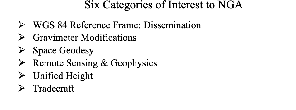
NGA aims to encourage institutions with varied expertise to propose solutions that achieve greater outcomes through collaborative work. The agency provided six broad categories of geomatics challenges for discussion. See the image below for the categories of interest.
Proposals submitted in response to the June Geomatics Challenges Request for Proposals (RFP) will be eligible for funding consideration and selected activities are expected to be awarded before the fall semester.
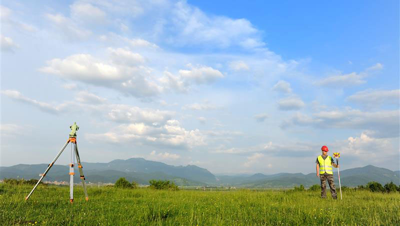
The word “tradecraft” in the categories of interest was intriguing. In general, tradecraft refers to the skills, techniques, and practices used by professionals in various fields to carry out their work effectively and discreetly. During World War II, however, the term became associated with spy work and now is mostly used to refer to the techniques and procedures of espionage. NGA is concerned with the dramatic drop in the number of individuals pursuing careers in geodesy — that is, the geodesy crisis in the United States.
Event attendees were asked to prioritize the topic(s) that most interested them, so that they could join a small group on the topic to identify issues, and discuss approaches, solutions, and potential actions for the challenge. Several universities had multiple representatives, so they selected different topics aligned with their individual interest.
The meeting had professional workshop facilitators, technical advisors, NGA subject matter experts (SME), and student recorders. Facilitators encouraged the full participation of all attendees to elicit a range of viewpoints and generate previously unconsidered solutions that could bridge differences in approach — resulting in solutions that were supported by many.
The small groups aligned with a specific challenge utilized the expertise of technical advisors — experts in geomatics or related fields with considerable industry, government, and/or research experience — who supported the development and maturation of proposed Geomatics Challenge solutions. The role of technical advisors was to work with the other leaders in their small group to encourage the full participation of all attendees and mentor the groups toward the generation of novel solutions. I was a technical advisor for the “unified height” topic.
NGA’s SME participated in the working group activities and provided additional context for the individual topics, and other unclassified details related to the Geomatics Challenges.
To capture the discussions at the group meetings, student recorders took detailed notes during the small group discussions. The recorders were graduate students — primarily in geodesy or other STEM fields — and they did an excellent job of capturing the discussion, action items, and potential proposals.
As previously stated, individuals self-selected the topic that interested them but over the course of the three-day meeting individuals were asked to participate in other Geomatics Challenge small groups to provide constructive critiques to produce the best research projects. This was an excellent concept that, in my opinion, helped to improve draft proposals and identify new collaborative projects.
As an example, the need for a unified height system that defines, assesses and correlates all height measurement processes became very evident when individuals participating in the “remote sensing and geophysics” topic engaged with the “unified height” topic members. This joint-topic group meeting helped form new partnerships and formulate new proposals.
The GEO-ESCON and the participating institutions have an ambitious schedule of submitting and awarding the grant proposals before the end of the government’s fiscal year. That said, the participants appeared to be up to the challenge and prepared to make it happen. For obvious reasons, I cannot describe any of the projects discussed, but I will highlight them when they become available for public distribution.
For now, I would like to state that GEO-ESCON is a great program, and it supports the advancement of the science of geodesy and geomatics. I believe that integrated and collaborative organizations are necessary for the successful development of geospatial products and services, and GEO-ESCON is the epitome of this concept. If you believe your institution would benefit from joining this consortium, I encourage you to visit their website to learn more or reach out directly to GEO-ESCON’s team ([email protected]). Click here to subscribe and stay up to date on GEO-ESCON news.
In conclusion, as in my previous column, I would like to remind everyone that geodesy is the foundation for all geospatial products and services.
Four T300’s from ComNav Technology have been used as active control GNSS points on the top of Sweden’s tallest building, Karlatornet, during its construction to deliver 3D coordinates to total stations and one was used as a base station. The building is set to be complete this month.
The T300 is a receiver with radio frequency, a baseband chip built in, and a unique quantum-real-time kinematic (RTK) algorithm. It supports full constellation systems including BDS-2, BDS-3, GPS, GLONASS, Galileo, QZSS and NavIC.
The receiver is designed for demanding surveying tasks, features tilt compensation, 4G/Wi-Fi connection, 8-GB internal memory and an easy survey workflow with Android-based Survey Master Software. It is designed to make collecting accurate data easy and fast, whether done by a beginner or experienced professional surveyor, the company said.
Venice arose after the fall of the Roman Empire. The city holds 450 palaces, more than 400 bridges and is home to the notable St. Mark’s Basilica. It is also known for its many canals, which are full of gondolas the way the streets of other cities are full of taxis or rickshaws. (Image: Freeartist/iStock/Getty Images Plus/Getty Images)
It is hard to believe that Italy’s “floating city” could be underwater soon.
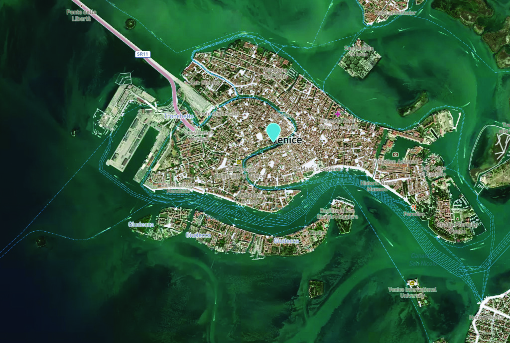
The average rate of relative sea-level rise is 2.5 mm/year, per the European Geosciences Union’s journal Natural Hazards and Earth System Sciences. This photo of Venice from the European Space Agency (ESA) was taken in 2008 by Ikonos-2, a commercial satellite (Image: ESA)
Predictions for the future of the city vary, but most scientists agree that the sea level is rising due to climate change. Natural Hazards and Earth System Sciences, an interdisciplinary journal of the European Geosciences Union, published a report in 2021 suggesting the average sea level could be between 17 cm and 120 cm higher in Venice by 2100.
Venice was built in the middle of a shallow lagoon in the Adriatic Sea. Therefore, it has always been at risk of flooding or “acqua alta,” meaning high water. There is evidence of severe flooding dating back to around the 8th century.
The Venetian lagoon is more than 500 km2 in total, but has an average depth of only 1 m, according to Royal Museums-Greenwich. High tides and severe storms have a devastating impact on the wetland environment on which Venice is built.
Compared to the image of Venice in 2008, this U.S. Geological Survey (USGS) satellite image of Venice from May 2023 shows the rise in sea level within the past 15 years. (Image: USGS)
In November 2019, Venice experienced the second-worst flooding event in almost 100 years. The tide reached 187 cm (6.1 ft) above sea level, covering 80% of the city in water, reported the BBC.
City records show there have been 324 intense high-water events since 1872 and more than half of those have been in the past 30 years. Among the many and vast consequences of human-caused climate change may be the end of one of the world’s most beautiful cities.
1Spatial — a global provider of geospatial software and solutions for improved data governance — has launched the 1Capture, a customizable mobile application for data capture.
1Capture is a mobile GIS editing application that is multi-use and configurable. It provides accurate and reliable GIS data collection and editing in the field for a multitude of asset, job, and survey types.
Customizable rules and actions work to improve data quality at the point of capture. This ensures good quality data is captured at source, minimizing re-surveys. The built-in rules engine automatically validates and corrects the GIS and non-GIS data collected, whether working online or offline.
1Capture connects with a variety of GIS environments including Esri ArcGIS and open-source technologies such as PostGIS and Geoserver.
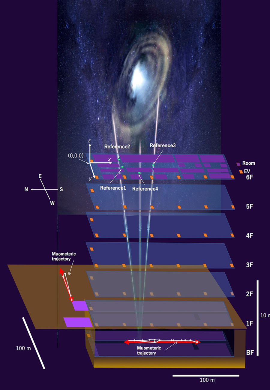
By using muon-detecting ground stations synchronized with an underground muon-detecting receiver, researchers at the University of Tokyo were able to calculate a receiver’s position in the basement of a six-story building without requiring GPS signals. The muometric positioning system (muPS) team was led by Hiroyuki Tanaka.
As GNSS cannot penetrate rock or water, muon technology could be used in future search and rescue efforts, to monitor undersea volcanoes, and guide autonomous vehicles underground and underwater. Muons are fast, subatomic-sized particles that have been used to wirelessly navigate underground.
MuPS was first created to help detect seafloor changes caused by underwater volcanoes or tectonic movement. It uses four muon-detecting reference stations above ground to provide coordinates for a muon-detecting receiver underground.
Early versions of muPS required the receiver to be connected to a ground station by a wire. However, new research uses high-precision quartz clocks to synchronize the ground stations with the receiver. The four parameters provided by the reference stations plus the synchronized clocks used to measure the muons’ “time-of-flight” enables the receiver’s coordinates to be determined. This system is called the muometric wireless navigation system (MuWNS).
To test the navigation ability of MuWNS, reference detectors were placed on the sixth floor of a building while a researcher took a receiver detector to the basement floor. They slowly walked up and down the corridors of the basement while holding the receiver. Rather than navigating in real time, measurements were taken and used to calculate their route and confirm the path they had taken.
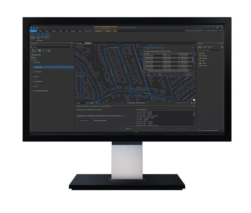
Trimble has released the Trimble Terra Office add-in for Esri ArcGIS Pro. The add-in is a part of Trimble’s Terra Office suite of desktop solutions for integrating Trimble TerraFlex field data collection software with GIS systems of record.
With a streamlined user interface, the new Terra Office add-in for ArcGIS Pro enables users to connect TerraFlex workflows directly to the ArcGIS platform from within ArcGIS Pro — Esri’s desktop GIS application. ArcGIS Pro users can now create and manage TerraFlex geospatial data collection projects without leaving ArcGIS.
Organizations that collect data in TerraFlex and bring it into ArcGIS through the add-in can also use the Trimble Offline GNSS Corrections service, for situations where real-time correction services are intermittent or unavailable. With this service, all data from the field is automatically processed in the cloud without user intervention, and the most accurate real-time or post-processed position is stored for each feature and made available for download through the Terra Office add-in for ArcGIS Pro.
For more information on the Terra Office add-in and its availability, click here.
A roundup of recent products in the GNSS and inertial positioning industry from the July 2023 issue of GPS World magazine.
TIMING
PTP Firmware To synchronize accurate time from GNSS
The 7.09.00 firmware with a precise timing protocol (PTP) feature enables users to synchronize accurate time from GNSS with other devices and sensors on a shared network. The 7.09.00 firmware’s PTP feature brings stable timing to a user’s other sensor systems connected through a local network to best support positioning, navigation and timing (PNT) and automotive and autonomous applications. The firmware includes SPAN GNSS+INS technology improvements — including a secondary INS solution for built-in redundancy and reliability in challenging conditions. The enhancements are available on all OEM7 cards and enclosures, including all PwrPak7 and CPT7 enclosure variants. The 7.09.00 firmware also features improvements to the time to first fix, a secondary SPAN solution for a more accurate and reliable GNSS+INS output and more. The 7.09.00 firmware is not for precision agriculture applications and is not supported on NovAtel’s SMART antenna products. Hexagon | NovAtel, novatel.com
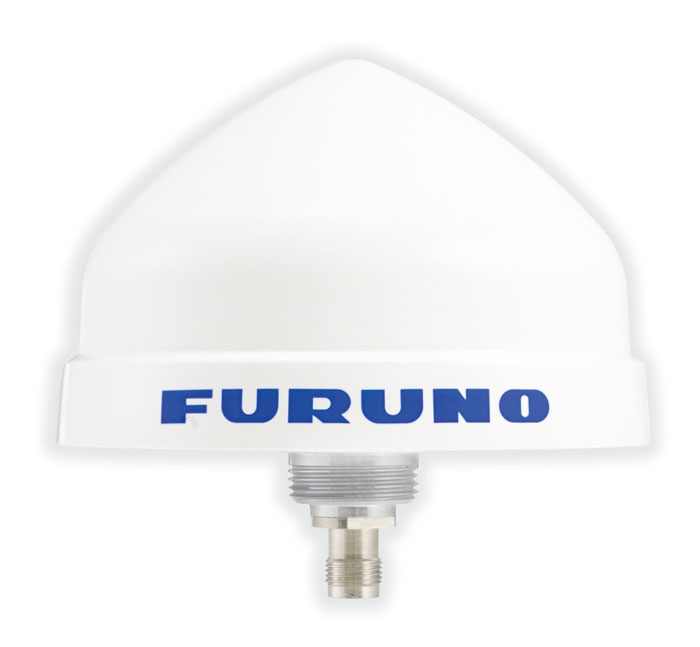
Timing Antenna A multi-GNSS and high-performance device
The AU-500 antenna is suitable for time synchronization applications. It supports all constellations in the L1 and L5 bands, including GPS, QZSS, GLONASS, Galileo, BeiDou, and NavIC. A built-in noise filter eliminates interference in the vicinity of 1.5 GHz caused by 4G/LTE mobile base stations as well as other radio waves that can adversely affect GNSS reception. The antenna is equipped with lightening protection and features a high-quality polymer radome that prevents snow accumulation. It is also waterproof and dustproof in compliance with IP67. The AU-500 achieves the best performance in time accuracy and robustness fundamental in critical infrastructure, when combined with Furuno’s GNSS receiver, GT-100. The antenna will be available this month. Furuno, furuno.com
Timing Module Dual-band and secure for 5G communications
The NEO-F10T offers nanosecond-level timing accuracy, meeting the stringent timing requirements for 5G communications. It is compliant with the u-blox NEO form factor (12.2 mm x 16 mm), allowing space-constrained designs to be realized without the need to compromise on size. The NEO-F10T is the successor to the NEO-M8T module, providing an easy upgrade path to dual-band timing technology. This allows NEO-M8T users to access nanosecond-level timing accuracy and enhanced security. Dual-band technology mitigates ionospheric errors and greatly reduces timing errors, without the need of an external GNSS correction service. Additionally, when within the operational area of a satellite-based augmentation system (SBAS), the NEO-F10T offers the possibility to improve the timing performance by using the ionospheric corrections provided by the SBAS system.
The NEO-F10T supports all four GNSS and L1/L5/E5a configurations, simplifying global deployments. It includes advanced security features such as secure boot, secure interfaces, configuration lock and T-RAIM to provide the highest-level timing integrity and ensure reliable, uninterrupted service. u-blox, u-blox.com
MOBILE
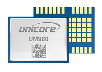
Image: Unicore Communications
GNSS RTK Module A high precision module for multiple applications
The UM960 module can be used for a wide range of applications, such as robotic mowers, deformation monitoring, UAVs, handheld GIS, and more. It features a high position fix rate and provides accurate and reliable GNSS positioning data. The UM960 module supports BDS B1I/B2I/B3I/B1c/B2a, GPS L1/L2/L5, Galileo E1/E5b/E5a, GLONASS G1/G2, and QZSS L1/L2/L5. The module also has 1,408 channels. In addition to its small size, the UM960 features low power consumption — less than 450 mW. The UM960 also supports single point positioning and real-time kinematic (RTK) positioning data output at 20 Hz. Unicore Communications, unicore.eu
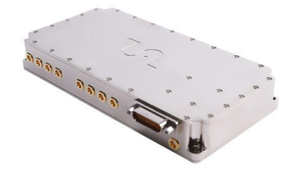
CRPA System A GPS/GNSS anti-jamming system
This system eliminates interference by applying novel beam forming techniques. With an 8-array CRPA antenna, the system can assure the normal operation of a GNSS receiver in the presence of multiple jamming sources. The anti-jam GNSS CRPA system can be deployed using various configurations and operates with civil and military GPS receivers for land, sea, air platforms (including unmanned aerial systems), and fixed installations. The device has an embedded GNSS receiver that supports all satellite constellations. The device is lightweight and compact. It requires minimal integration training and easily integrates into new or legacy platforms. The antenna also offers assured positioning, navigation and timing. Tualcom, tualcom.com
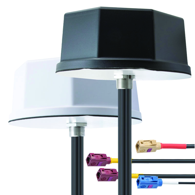
IoT Antennas Rugged and designed to enhance connectivity
KP Performance Antennas’ internet of things (IoT) multiband combination antennas are designed to enhance connectivity for vehicle fleets and base stations. The IoT multiband combination antennas have dedicated ports for cellular, Wi-Fi and GPS bands. They are also indoor and outdoor IP69K rated and can withstand harsh environmental conditions, such as extreme temperatures, water and dust. The antennas are suitable for transportation emergency response and agriculture applications. The IoT multiband combination antennas are in-stock and available now.
KP Performance Antennas, kpperformance.com
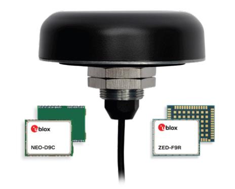
Smart Antennas With integrated technology for centimeter-accuracy
PointPerfect PPP-RTK augmented smart antennas combine the ZED-F9R high precision GNSS and the NEO-D9S L-band receivers from u-blox and Tallysman Accutenna technology. The multi-band (L1/L2 or L1/L5) architecture removes ionospheric errors, and the multi-stage enhanced XF filtering improves noise immunity while relying on the dual-feed Accutenna element to mitigate multi-path signal interference rejection. Some versions of the new smart antenna solutions include an inertial measurement unit (for dead reckoning) and an integrated L-band corrections receiver to ensure operation beyond terrestrial network reach. The PointPerfect GNSS augmentation service is now available in North America, Europe and parts of Asia Pacific. Tallysman Wireless, tallysman.com/u-blox, u-blox.com
SURVEYING & MAPPING
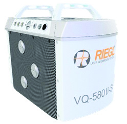
Airborne Laser Scanner Suitable for mapping applications
The compact and lightweight VQ-580 II-S meets the increasing requirements of compact laser scanners for medium- and wide-area mapping as well as for corridor mapping. The successor of the VQ-580 II airborne laser scanner, provides a maximum measurement range of 2.45 m. It can be integrated with gyro-stabilized mounts as well as into the VQX-1 Wing Pod. It features high accuracy ranging based on waveform-lidar technology. The VQ-580 II-S also has a mechanical and electrical interface for inertial measurement unit (IMU)/GNSS integration. RIEGL, rieglusa.com
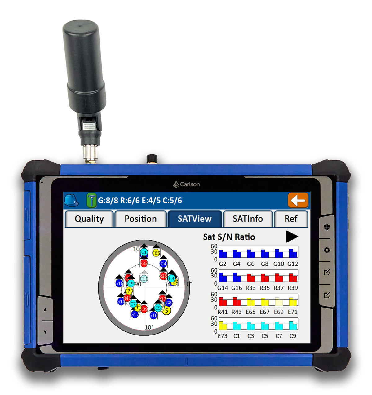
Tablet and GNSS Solution For surveying applications
The RT5 rugged tablet data collector and the RTk5 GNSS solution, which integrate the form factor of the RT5 with real-time kinematic GNSS performance, are suitable for land surveyors, engineers, GIS professionals, and users in need of advanced GNSS positioning with an RTK rover. The RT5 is designed for surveying, stakeouts, construction layout and GIS mapping, and is bundled with Carlson SurvPC — the Windows-based data collection program. The RT5 can run SurvPC with Esri OEM for use in the field. The RTk5 adds an advanced GNSS solution to the RT5, enabling accuracy in a compact, light and versatile package. It comes with a custom-built pole and cradle, a survey-grade antenna, and a small portable helix antenna for handheld GNSS use. Carlson Software, carlsonsw.com
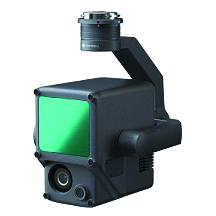
Lidar and RGB Solution Suitable for aerial surveying
The Zenmuse L1 integrates a Livox lidar module, a high-accuracy inertial measurement unit (IMU), and a camera with a 1 in CMOS on a 3-axis stabilized gimbal. When used with Matrice 300 real-time kinematic (RTK) and DJI Terra, the L1 forms a complete solution that gives users real-time 3D data, capturing the details of complex structures and delivering highly accurate reconstructed models. Users can render centimeter-accurate reconstructions with the high-accuracy IMU, a vision sensor for positioning accuracy, and the incorporation of GNSS data. The solution’s IP54 rating allows the L1 to be operated in rainy or foggy environments. The lidar module’s active scanning method enables users to fly at night. DJI Enterprise, enterprise.dji.com
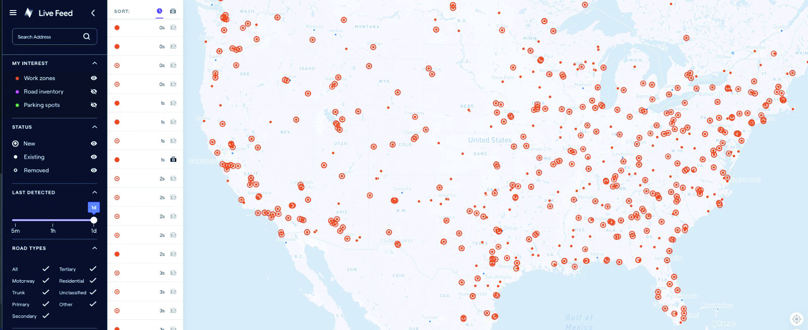
Mapping Platform Real-time, crowd-sourced map data
CityStream Live is a real-time mapping (RTM) platform that enables the mobility industry — including connected vehicles, maps, mobility services, digital twins or smart city applications — to access a continuous stream of crowdsourced road data. This platform provides real-time data on nearly every road across the United States at a reduced cost. Utilizing a crowdsourcing network and artificial intelligence software, CityStream Live offers users and developers a live data feed to increase situational awareness, enhance driving capabilities, increase safety and more. By combining massive data aggregation with real-time data curation, CityStream Live is the first platform to deliver road data streams in real time and at scale, supporting several urban and highway use cases. Nexar, us.getnexar.com
Leica iCON gps 160 (Image: Leica Geosystems)
Smart Antenna Contains features that increase productivity on construction sites
The iCON gps 160 is a versatile solution for various applications. It can be used as a base station, as a rover or for machine guidance. The device is a modernization and enhancement of the successful Leica iCON gps 60, which has been well accepted in the market. The result is a smaller, more compact GNSS antenna with additional features and a larger display for ease of use. The Leica iCON gps 160 is particularly suited to complex construction environments with different GNSS requirements because the ability to switch between the different applications is at the users’ fingertips. Besides checking grade, cut and fill, stakeout points and lines, users can also benefit from using this solution for basic-level GNSS machine guidance. It has an integrated color display, a user-friendly interface, smart setup wizards and an intuitive construction-specific workflow to help contractors get the most out of their investment from day one. Size and weight reductions make the iCON gps 160 easy to handle, while the latest GNSS and communication technologies improve data reception. Leica Geosystems, leica-geosystems.com
UAV
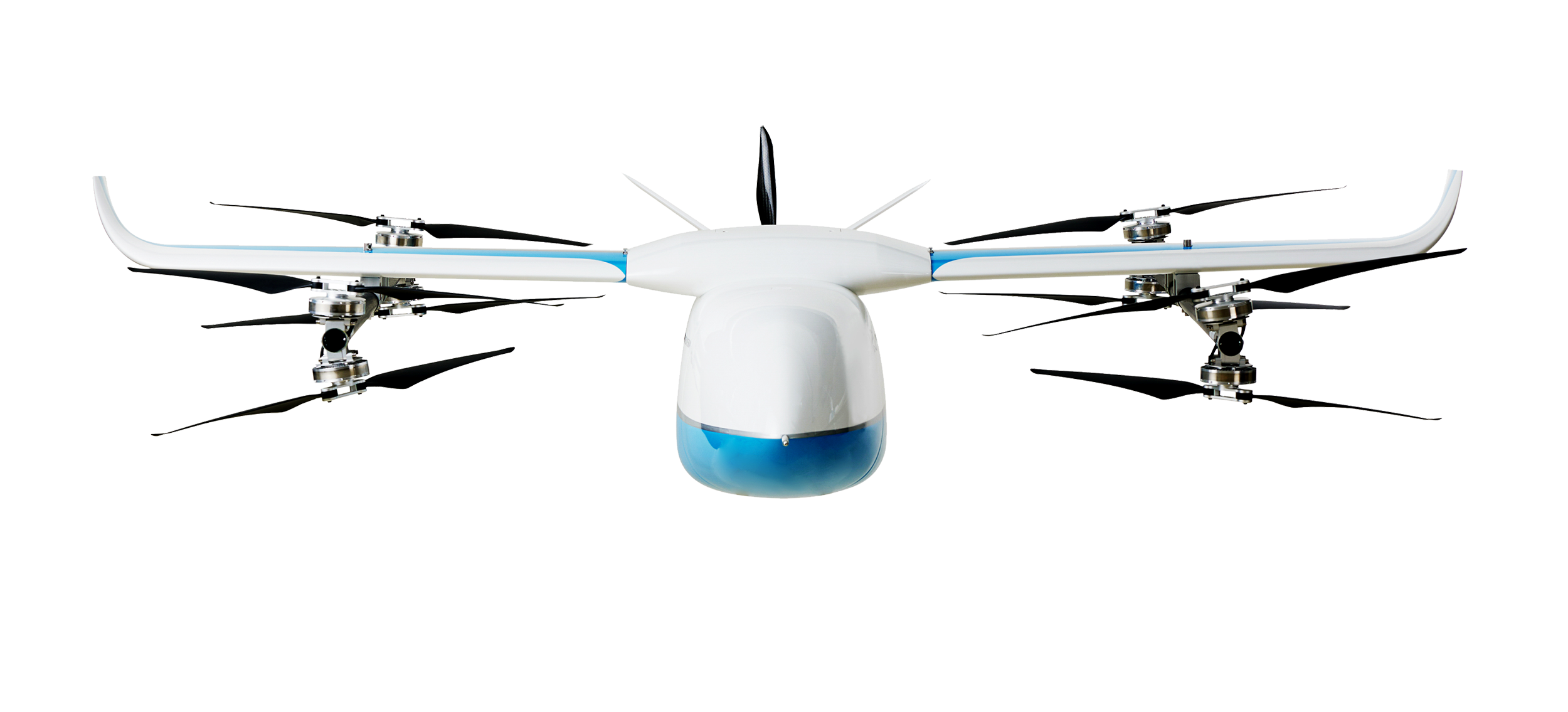
Positioning Solution For UAV delivery applications
The PX-1 RTX is designed for accurate, robust positioning and heading for commercial UAV delivery applications. This solution enables UAV integration companies to add precise positioning capabilities so operators can plan and execute takeoff, navigation and landing tasks as UAV delivery advances to take on more challenging operations. The PX-1 RTX leverages CenterPoint RTX corrections and small, high-performance GNSS-inertial hardware to provide real-time, centimeter-level positioning and accurate inertial-derived true heading measurements. This solution allows operators precise control of UAVs during takeoff and landing to tackle more demanding operations in tight or partially obstructed spaces. It also minimizes operational risks from poor sensor performance or magnetic interference by ensuring greater positioning redundancy, which is especially important as commercial UAV delivery operations venture into difficult urban and suburban environments. Trimble Applanix, applanix.com
Certification Reference Guide A guide for the AAM industry
Business and government leaders, engineers, members of the media and any user with an interest in the future of flight can use the Honeywell State of UAS and UAM Certification Guide to help navigate and communicate the complexities of vehicle certification and operational approval across multiple vehicle segments. Industry professionals can access the living document online at aerospace.honeywell.com/us/en/products-and-services/industry/urban-air-mobility. The certification reference guide summarizes evolving Federal Aviation Administration and European Union Aviation Safety Agency rules across multiple advanced air mobility (AAM) segments. It also links to documents that AAM professionals can reference to better understand detailed certification requirements. Honeywell Aerospace, aerospace.honeywell.com
Image: A2Z Drone Delivery
Delivery UAV Suitable for aerial mapping, UAV inspection, forestry services, search and rescue operations, water sample collection, offshore deliveries, mining, and more
The RDSX Pelican leverages a hybrid vertical takeoff and landing (VTOL) airframe with no control surfaces to combine the reliability and flight stability of a multirotor platform, with the extended range of a fixed-wing craft. With no ailerons, elevator, or rudder, the Pelican’s durable design eliminates common points of failure and extends operational time between maintenance overhauls. Designed to meet the 55 lb takeoff weight limitation for Federal Aviation Administration Part 107 compliance, the Pelican can carry payloads of 5 kg on missions up to 40 km, roundtrip. The Pelican can be optimized for extended range operations or to deliver payloads from altitude with the company’s RDS2 UAV delivery winch. Available in multiple configurations, the RDSX Pelican can be customized for an array of missions. The Pelican enables deliveries from altitude where spinning propellers are kept far from people and property, mitigating consumer privacy concerns of low-flying UAVs while abating intrusive rotor noise. Alternatively, for missions in which the UAV can safely land at its destination, a simple servo-release mechanism can release payloads and expand the Pelican’s payload capacity.
A2Z Drone Delivery, a2zdronedelivery.com
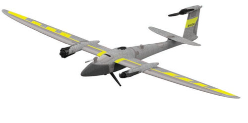
UAS Suitable for mapping applications
The Trinity Pro UAS features Quantum-Skynode autopilot, using a Linux mission computer. This provides additional onboard computing power, increased internal storage, versatility and interoperability. Included in the Trinity Pro system is QBase 3D operations software. As the Trinity Pro is built on the Trinity F90+ UAS, its new capabilities include planning functions for missions requiring takeoff and landing at different locations, allowing for efficient and safe long corridor flights and beyond visual line of sight operations. The platform also incorporates advanced self-diagnostics to ensure safe operation. The UAS now includes an enhanced terrain- following system. Additionally, improvements to trigger point calculations results in improved image overlap and higher data quality. The Trinity Pro features automatic wind simulation for crash avoidance in bad weather and a linear approach for landing. The UAS is equipped with a downfacing lidar scanner that provides highly accurate ground avoidance and landing control. The system features USB-C ports for faster data transfer. The Trinity Pro is protected against dust and water damage and features increased wind limits of up to 14 m/s in cruise mode and 11 m/s during hover.
Quantum Systems, quantum-systems.com
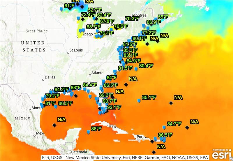
The ocean off the Gulf of Mexico is undergoing a marine heat wave that could pose a threat to coral reefs, as water temperatures reach 90°F. A coral reef watch map, provided by the National Environmental Satellite, Data, and Information Service of the National Oceanic and Atmospheric Administration (NOAA), shows that the water near the Florida Keys is significantly higher than usual, which causes coral bleaching and other marine life concerns.
Image: NOAA
The Gulf of Mexico is not the only place that is suffering this marine heat wave. 40% of the globe is experiencing extreme temperatures,Dillon Amaya, a physical scientist at NOAA, stated in an interview with the New York Times.
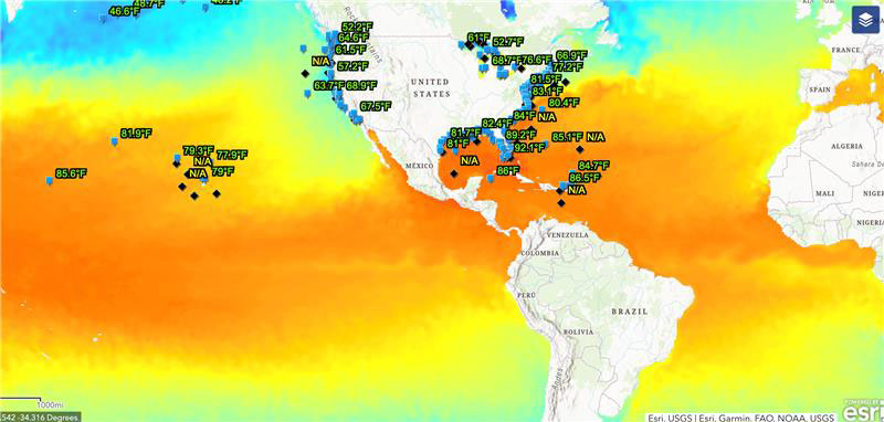
This map provides water temperatures globally. The blue-green colors represent cooler temperatures whereas yellow-orange colors represent hot temperatures. (Image: NOAA)
The current water temperatures are the hottest ever recorded. Scientists say that these high temperatures are typical, but not until August or September. It is only July.
The marine heat wave is mainly due to a climate phenomenon, El Niño, that typically brings warmer ocean temperatures. However, now El Niño is coming on top of long-term warming caused by greenhouse gas emissions and worldwide contribution to global warming.
When sea temperatures rise too high, corals bleach, expelling the algae they need to live. If the water does not cool quickly enough, and if bleaching events happen frequently, the corals die. Coral reefs are vital to the marine life that relies on them and 25% of all marine life — including more than 4,000 kinds of fish — depends on reefs, according to NOAA.
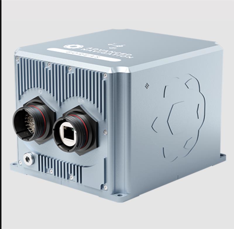
Advanced Navigation has expanded it Boreas digital fiber-optic gyroscope (DFOG) range, with the A series.
The Boreas A90 and A70 are strategic-grade inertial measurement units (IMU) that deliver acceleration and orientation with accuracy, stability and reliability under all conditions with no reliance on GNSS. They also feature automatic gyrocompassing.
The IMUs contain ultra-high accuracy DFOG and high performance closed-loop accelerometers. The Boreas A90 and A70 are both suitable for surveying, mapping and navigation across subsea, marine, land and air applications.
The Boreas A90 and A70 also offer an optional license to add INS capabilities and enable integration with external GNSS receivers using Advanced Navigation’s range of interfaces and communication protocols.
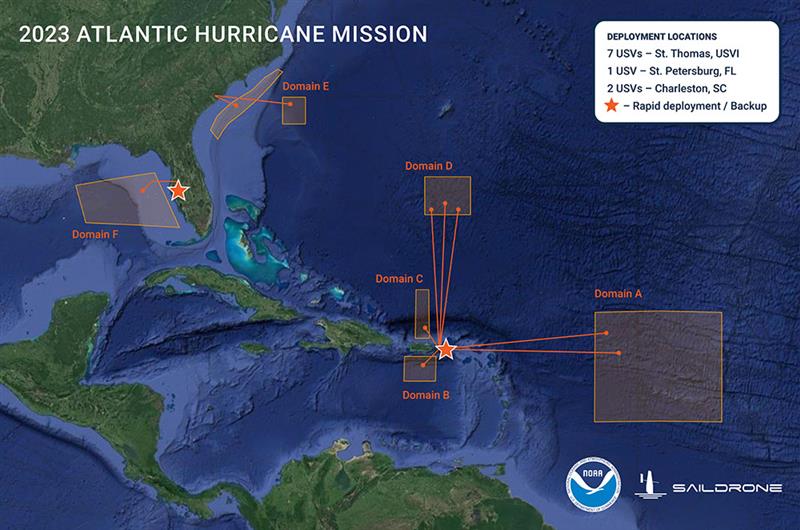
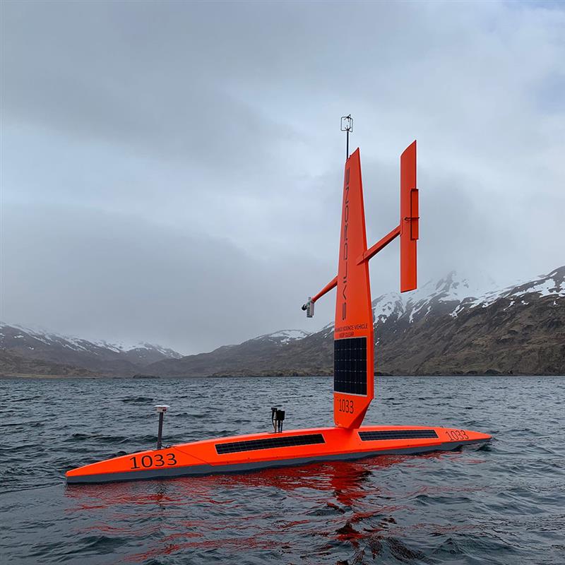
Graphic showing the USV domain areas during the 2023 Atlantic Hurricane mission. (Image: SailDrone)
Saildrone — a data solutions company for maritime security, ocean mapping, and ocean data — is deploying 12 uncrewed surface vehicles (USV) into the tropical Atlantic and Gulf of Mexico this summer, supporting the research by the National Oceanic and Atmospheric Administration (NOAA) to advance hurricane forecasting.
Saildrone is deploying 10 USVs from St. Thomas, U.S. Virgin Islands, St. Petersburg, FL, and Charleston, SC, to operate in areas with a high probability of intercepting a storm, as indicated by historical data. Two vehicles will remain on land, ready for quick deployment in the event of an approaching hurricane.
Image: SailDrone
A Saildrone Explorer is a 23-ft USV propelled by the wind and powered by solar energy. During the past two missions in 2021 and 2022, Saildrone vehicles sailed through several storms and major hurricanes, including Hurricane Sam in 2021, and Hurricane Fiona in 2022.
In addition to the Saildrone Explorers, NOAA is using a variety of aerial, surface, and sub-surface technologies, — including its Hurricane Hunter airplanes, small, uncrewed aircraft systems, gliders, drifters and floats.
The goal is to create a complete picture of the ocean-atmosphere interactions that drive hurricanes.
The USVs will transmit data, including air temperature and relative humidity, barometric pressure, wind speed and direction, water temperature and salinity, sea surface temperature, and wave height and period in near real time to scientists at NOAA’s Atlantic Oceanographic and Meteorological Laboratory and Pacific Marine Environmental Laboratory, Saildrone’s science partners for the mission.
NOAA will use the data collected by the USVs to improve hurricane forecast models. The data will also be archived by NOAA’s National Environmental Satellite, Data and Information Service and sent by NOAA to the World Meteorological Organization’s Global Telecommunication System, where it is available for the world’s major forecast centers — some 20 agencies worldwide, including NOAA.
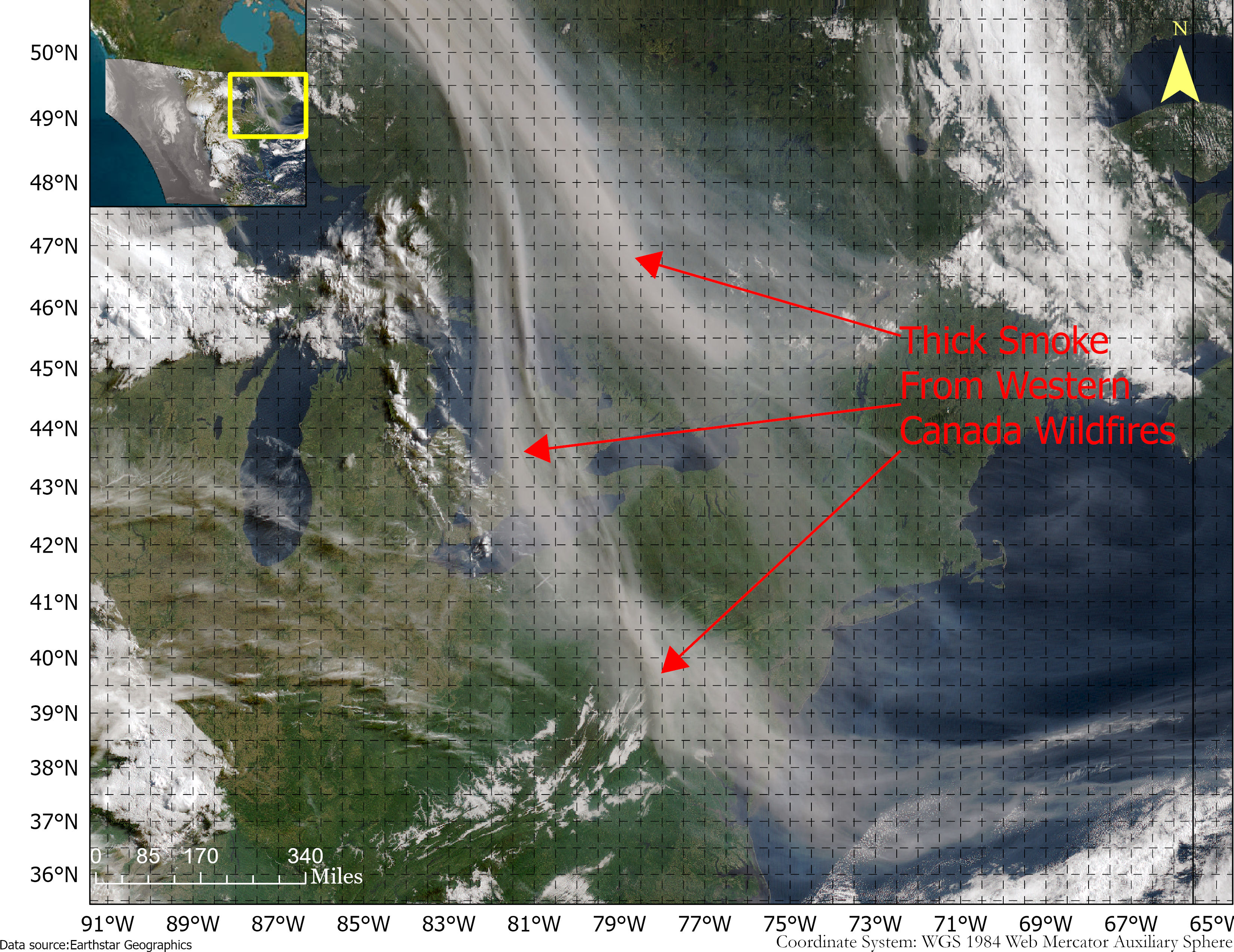
Smoke from the Canadian wildfires continues to pollute the air across the United States, mainly affecting cities in the northeast, including Pittsburgh, Chicago, Cleveland, Detroit and Buffalo.
According to the New York Times, in early June, the level of particulate matter in the air from smoke became so unhealthy that many U.S. cities set records. Visibility decreased in many cities as well, with the smoke creating an orange haze.
Most of the smoke can be attributed to several fires burning across Canada. Many of these fires were caused by lightning; however, with above-average temperatures and dry conditions, wildfires have been breaking out since May.
A storm system off the coast of Nova Scotia forced smoke from the fires southeast into the United States. (Image: NOAA)
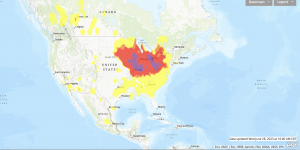
Based on data from the Canadian Interagency Forest Fire Centre, there are 480 active fires in Canada: 252 are out of control, 77 are being held in place, and 151 are under control.
The fires are mapped in the image below.
The red dots represent the out-of-control fires, the green dots are fires being held in place, and the yellow dots are fires that are under control. (Image: Screenshot of CIFFC wildfire map)
Understanding air quality importance
The Air Quality Index (AQI) measures the density of five pollutants: ground-level ozone, particulates, carbon monoxide, nitrogen dioxide, and sulfur dioxide. It was originally established by the Environmental Protection Agency to communicate the cleanliness of the air Americans are breathing every day.
The index runs from zero to 500 — the higher the number the more polluted the air is.
Effects of air pollution can range from mild symptoms, such as eye and throat irritation, to serious ones such as heart and respiratory issues. Pollution can cause inflammation of the lung tissue and increase the vulnerability to infections.
During wildfires, fine particles in the soot, ash and dust can fill the air.
The AQI identifies the concentration of particles smaller in diameter than 2.5 μM. When these particles are inhaled, the tiny specks can increase the risk of heart attacks, cancer, and respiratory infections — especially in children and older adults.
Below is an updated map of air quality from the U.S. AQI as of June 28.
The colors on the map range from yellow — which is unhealthy air quality — to purple, meaning the air quality is hazardous. (Image: AirNow.gov)
ComNav Technology has released the T20 palm real-time kinematic (RTK). The GNSS receiver with advanced technology is designed for surveying and mapping, GIS, marine, precision agriculture and machine control.
T20 is light, weighing in at 0.68 kg, and has low power consumption with 12 hours of battery life. It integrates functions such as a GNSS module, datalink module, 4G, 5.0 dual-mode Bluetooth, data memory system and more.
Powered by the SinoGNSS K8 high precision module, the T20 has 1,590 channels and can track all running and planned constellations including GPS, BDS, GLONASS, Galileo, QZSS and satellite-based augmentation systems. Additionally, the anti-interference algorithm enables the T20 to maintain accurate positioning and perform well in complex environments, providing surveyors with high-quality measurements.
The T20 is equipped with a third-generation inertial measurement unit from ComNav, which can be tilted and measured at an angle up to 60°. The T20 is also equipped with a U50 datalink module, which enables it to switch between base and rover.
The T20 is compatible with mainstream RTK receivers on the market.