Tag: Riegl

  • Launchpad: New surveying and mapping products,  MEMS sensors and more

    Launchpad: New surveying and mapping products, MEMS sensors and more

    A roundup of recent products in the GNSS and inertial positioning industry from the December 2024 issue of GPS World magazine.


    Mapping

    Photo: SPH Engineering
    Photo: SPH Engineering

    GPR System
    For terrestrial and airborne applications 

    The Zond Aero 500 NG is a versatile ground penetrating radar (GPR) system designed for both terrestrial and drone-mounted surveys, suitable for applications such as utility scanning, sinkhole detection, glaciology and geological studies. It operates in dual mode, allowing for ground-based and airborne surveys, enhancing data collection flexibility. Key specifications include a center frequency of 500 MHz, an operating bandwidth of 200 MHz – 900 MHz, a sampling rate of 25,600 samples per second and a scan rate of 50 scans per second, with depth penetration up to 4 meters in average soil conditions. The system features advanced electronics for real-time data collection, which can significantly improve the signal-to-noise ratio. It is compatible with DJI Matrice 300/350 UAVs for airborne applications.

    SPH Engineering, sphengineering.com

    Photo: DeltaQuad
    Photo: DeltaQuad

    Streamlined Lidar Mapping
    YellowScan’s Surveyor Ultra integrated with DeltaQuad Evo

    Integrating YellowScan’s Surveyor Ultra with the DeltaQuad Evo platform allows users to collect high-precision, high-density data across 1,200 hectares in a single flight while simultaneously capturing lidar and RGB data.

    DeltaQuad Evo’s long-range flight capabilities and efficient vertical take-off and landing (VTOL) design, paired with the Surveyor Ultra’s lidar technology, allow users to streamline their workflows to reduce time spent in the air and on post-processing tasks, making it particularly beneficial for large infrastructure projects, forestry analysis and environmental monitoring. The system can be used for surveying, construction, forestry and environmental research.

    DeltaQuad, deltaquad.com

    Photo: RIEGL
    Photo: RIEGL

    Airborne Mapping System
    With a ‘cross-fire’ scan pattern

    The VQ-1560 III-S is a dual-channel laser scanning system designed for airborne mapping applications. Its “cross-fire” scan pattern allows for simultaneous forward and backward viewing at the edges of the swath, along with a nadir view in the center. This configuration optimizes point distribution for effective target sampling. With pulse repetition rates reaching up to 4.4 MHz, the VQ-1560 III-S can operate at altitudes of up to 1,600 m above ground level (AGL). At a lower pulse repetition rate of 560 kHz, it can function at altitudes as high as 3,900 m AGL.

    The system features inertial measurement unit (IMU) and GNSS integration, with the option to include one or two high-resolution RGB/NIR cameras. It is ideal for professionals in fields such as urban planning, forestry and environmental monitoring.

    RIEGL, riegl.com

    Photo: Teledyne Optech
    Photo: Teledyne Optech

    Coastal Mapping Solution
    Features a lidar sensor

    This bathymetric lidar system is designed for coastal and inland water mapping. It combines high-resolution topographic and bathymetric capabilities, allowing for seamless data collection across land and sea. It can be used for coastal zone management, environmental monitoring, infrastructure planning and more.

    Fathom delivers data quickly by leveraging real-time quality control with Onboard and scalable processing with a CARIS workflow. It also includes a built-in topographic lidar and a multispectral camera for coastal surveys at a coverage of 50 km2/hour.

    Teledyne Optech, teledyneoptech.com

    Photo: Juniper Systems
    Photo: Juniper Systems

    Mounting Accessory
    Designed for mobile mapping 

    The Geode Grip is a mounting accessory featuring a specialized bracket. It allows users to securely attach smartphones directly to Juniper’s Geode GNSS receivers, offering an integrated and streamlined data collection solution.

    The Geode Grip is a tool designed for professionals in surveying, mapping and geographic information systems (GIS) to enhance mobile data collection. It replaces the traditional survey pole with a handheld setup that aims to improve ergonomics. It is ideal for field projects that require precise location data and mobile data collection, such as environmental research, land surveying, agriculture and infrastructure engineering. 

    Juniper Systems, junipersys.com


    Mobile

    Photo: Quectel Wireless Solutions
    Photo: Quectel Wireless Solutions

    New Product Bundle  
    For high-accuracy GNSS applications  

    Quectel Wireless Solutions has unveiled a new product bundle designed to facilitate the development of high-accuracy GNSS applications. The bundle includes the LG290P GNSS module, which is a quad-band, multi-constellation device capable of receiving signals from various satellite systems, including GPS, GLONASS, Galileo, BDS, QZSS and NavIC. The LG290P is engineered for high precision and supports RTK positioning, allowing for centimeter-level accuracy even in challenging environments. It can be used in diverse applications, such as autonomous vehicles, precision agriculture and surveying.

    In addition to the LG290P module, the bundle includes options for either the YEGN103W8A geodetic antenna or the YEGD006U1A patch antenna. Both antennas are designed to operate within the same frequency bands as the GNSS module and are compliant with environmental regulations such as RoHS. This pre-integrated solution simplifies developers’ procurement and integration process by providing a one-stop solution that combines antennas with GNSS modules and RTK correction services.

    Quectel Wireless Solutions, quectel.com


    Surveying

    Photo: Inertial Labs
    Photo: Inertial Labs

    Lidar Camera Payload
    For surveying and mapping applications 

    The RESEPI Ultra LITE is a lightweight payload combining lidar and camera technology for advanced surveying and mapping applications. The system integrates the XT-32 lidar scanner to offer users advanced data accuracy and point density across various operational modes.

    It has a compact design with a 5MP colorization camera, making it ideal for small unmanned aerial systems (SUAS) with strict volume constraints. It can be used for aerial and ground-based applications, including utility mapping, construction volumetrics, precision agriculture, forestry, site surveying and mining. Designed for seamless integration, the system is compatible with a wide range of platforms such as Freefly, WISPR, DJI, Sony and mobile setups. Inertial Labs’ proprietary SnapFit adapters ensure quick and secure mounting to enhance the system’s adaptability.

    Inertial Labs, inertiallabs.com

    Photo: Leica Geosystems
    Photo: Leica Geosystems

    RTK Rover
    With tilt compensation 

    The Leica GS05 is a compact and lightweight GNSS smart antenna designed for surveying tasks, featuring calibration-free tilt compensation. This robust device allows for accurate measurements even when the survey pole is tilted up to 30°, enhancing data collection in challenging environments. Its integration with Leica Geosystems’ portfolio, including Leica Captivate software and total stations, seeks to maximize efficiency. The GS05 can function as both a base and an RTK rover, supporting single base stations and RTK networks such as Leica SmartNet.

    Leica Geosystems, leica-geosystems.com

    Photo: Teledyne Marine
    Photo: Teledyne Marine

    GNSS/INS
    For marine surveying applications 

    Intrepid is a GNSS/INS system integrated with the SeaBat T20-ASV processor and includes a compact IMU and two GNSS antennas, ensuring reliable and precise positioning.

    It can automatically stream data to third-party software. This eliminates the need for manual sensor interfacing and reduces downtime. The Intrepid GNSS/INS benefits users in marine surveying applications by providing the precise navigation necessary for operational efficiency. Its intuitive design allows for simple configuration.

    Teledyne Marine, teledynemarine.com


    OEM

    Photo: Inertial Labs
    Photo: Inertial Labs

    Miniature MEMS Sensor-Based IMU
    Can withstand high shock and vibrations

    The KERNEL-201 features three-axis MEMS accelerometers and gyroscopes that offer ultra-low noise, high bandwidth and minimal latency. These characteristics make it ideal for applications such as pointing, stabilization and navigation in systems where performance and size are critical. Its volume of 0.38 cubic inches offers a high dynamic range.

    Fully calibrated and temperature-compensated, the unit offers consistent, precise measurements even in challenging environments. It features an in-run bias stability of up to 0.7 deg/hr for gyroscopes and 0.005 mg for accelerometers, along with a low angular random walk (ARW) of 0.065°/√hr and velocity random walk (VRW) of 0.015 m/sec/√hr.

    The unit is designed to withstand high shock and vibration while maintaining peak performance, making it suitable for a wide range of challenging applications. The KERNEL-201 can be integrated into various high-level systems, such as motion reference units (MRUs), GPS-aided inertial navigation systems (INS) and attitude and heading reference systems (AHRS). It offers continuous built-in testing (BIT), customizable communication protocols and flexible power options.

    Inertial Labs, inertiallabs.com

    Photo: Calian GNSS
    Photo: Calian GNSS

    Smart Choke Antenna
    Offers comprehensive GNSS signal reception

    The VCS6000XF full band smart choke antenna is engineered for CORS applications. It combines Tallysman Verachoke antenna elements with Septentrio’s Mosaic X5 full-band receiver to offer an integrated solution for OEM CORS systems.

    The VCS6000XF offers comprehensive GNSS signal reception, including GPS/QZSS L1/L2/L5, GLONASS G1/G2/G3, Galileo E1/E5a/E5b/E6/E5 AltBoc, BeiDou B1/B2/B2a/B3, NavIC L5, SBAS and L-Band correction services.

    The antenna features a 0.5 mm phase center variation and utilizes Calian’s eXtended filtering for near-band signal interference mitigation. The integrated Septentrio Mosaic X5 receiver provides capabilities such as anti-jamming, anti-spoofing, scintillation mitigation and receiver integrity by combining the antenna and receiver in the choke ring antenna.

    Calian GNSS, calian.com

  • Launchpad: Upgraded surveying software, application suite, GPS integrity module

    Launchpad: Upgraded surveying software, application suite, GPS integrity module

    A roundup of recent products in the GNSS and inertial positioning industry from the June 2024 issue of GPS World magazine.


    SURVEYING & MAPPING

    Photo:


    Upgraded surveying software
    With an improved CAD engine

    Survey Master 3.5.0 includes an enhanced CAD engine. A measurement grade has been added to the CAD to improve the software’s utility in design and planning projects. Additionally, the latest version features expanded CAD drawing and survey functions to offer users a comprehensive toolset — including point, line, polyline, curve, arc, square, rectangle, polygon, circle and text. Survey Master 3.5.0 features CAD capture mode from any point and allows users to easily display or hide point icons.

    The system added the Dominican predefined coordinate system, SBAS configuration, PPP and RTK PPP fusion, updated satellite frequencies and an external datalink CDL7 configuration. Existing software users can update directly in Survey Master.
    Comnav Technologies, comnavtech.com

    Photo:

    Scanning kit
    Combines photogrammetry with RTK precision

    The Pix4D & Emlid Scanning kit combines advanced photogrammetry with real-time kinematics (RTK) precision for quick data capture when documenting trenches and as-builts, performing volumetric measurements and enhancing aerial data with terrestrial scans. It includes the PIX4Dcatch app and the Emlid Reach RX RTK rover.

    The PIX4Dcatch app allows precise scanning for both photogrammetry and lidar projects. The hardware features the Emlid Reach RX RTK rover, which comes with an ergonomic handle and accessories. It is integrated with PIX4Dcatch and provides real-time positioning through NTRIP.

    The kit works with any correction network or GNSS base station broadcasting RTCM3. The rover gets a fix in less than five seconds, offering centimeter-accurate positioning in challenging conditions. It can also be used with the survey pole as an RTK rover for data collection and stakeout.

    Designed for urban surveying, the Reach RX rover is lightweight, rated IP68, sealed and protected from water and dust.

    The PIX4Dcatch mobile app allows users to use a smartphone for scanning, access RTK precision data through integration with Reach RX and generate a digital model within minutes. Users can also store, annotate, measure and share data online in PIX4Dcloud as well as verify geolocated positions and visualize the project in AR. It extracts insights from both terrestrial and aerial data and features online and offline processing, advanced photogrammetry capabilities, team collaboration and AR for CAD overlays.
    Emlid, emlid.com

    Photo:

    UAV surveying software
    Now with planimetric survey capabilities

    Virtual Surveyor version 9.5 is a smart UAV surveying program featuring new planimetric survey capabilities. Users can survey 2D features from UAV orthophotos and add them to a 3D topographic model generated from the same data set.

    The integrated Terrain Creator app photogrammetrically processes UAV photos to build survey-grade digital surface models (DSMs) and orthomosaics. These transfer seamlessly to the traditional Virtual Surveyor app where users can generate CAD models, create cut-and-fill maps and gather other 3D topographic information.

    No third-party software is needed to create surveys from UAV data. The system is ideal for users in construction, surface mining and excavation projects.
    Virtual Surveyor, virtual-surveyor.com

    Photo:

    RTK technology
    For GIS needs

    RTK Torch is designed for high-precision geolocation and GIS needs. It has tri-band reception and tilt compensation.

    The RTK Torch can provide millimeter-grade measurements. Users can connect a phone to the device over Bluetooth and receive the NMEA output and work with most GIS software.

    The RTK Torch features Zero-Touch RTK technology, which gives connected devices WiFi credentials for a hotspot or other WiFi network. The device will begin receiving corrections without any further setup, with no NTRIP credentials required. These corrections are obtained over WiFi from u-blox PointPerfect and are available in the United States, Europe and various parts of Australia, Canada, Brazil and Korea.

    The RTK Torch includes a one-month free subscription to PointPerfect. Additional subscriptions can be purchased if desired. If PointPerfect coverage is not available in the area, corrections from a local base station or service can be provided to the device over NTRIP, delivered via Bluetooth or WiFi.

    It is housed in an IP67-rated enclosure. It is waterproof when submerged up to 1 m for up to 30 minutes when the USB cover is closed. Under the hood of the SparkFun RTK Torch is an ESP32, a UM980 L1/L2/L5 high precision GNSS receiver from Unicore, and an IM-19 for tilt compensation. The addition of the L5 reception makes this portable GNSS device ideal for densely canopied areas where normal L1/L2 reception may have problems.
    SparkFun, sparkfun.com

    Photo:

    3D laser scanner
    For indoor and outdoor mapping

    The VZ-600i terrestrial laser scanner offers a broad range capability from 0.5 m up to 1,000 m and is suitable for indoor and outdoor 3D mapping applications. It features 3D position accuracy of 3 mm, less than 30 sec scan time for high-resolution scans with 6 mm point spacing at 10 m, weight less than 6 kg (13 lbs), 2.2 MHZ PRR, three internal cameras and is GNSS integrated.

    Designed for mobile mapping applications, the system is suitable for architecture, engineering and construction (AEC), building information modeling (BIM), as-built surveying, forensic and crash scene investigation, archeology, forestry and more.
    RIEGL, riegl.com


    OEM

    Photo:

    Application suite
    Featuring GRIT Technology

    The NovAtel Application Suite Version 2.0 now includes GNSS Resilience and Integrity Technology (GRIT). The GRIT Monitor application allows users to observe radio frequency (RF) interference through a comprehensive dashboard to make informed decisions to maintain robust positioning.

    GRIT is RF interference detection and mitigation technology available on all OEM7 GNSS receiver products, including individual cards and enclosures such as smart antennas, PwrPak and MarinePak.
    It includes positioning and device status overviews to serve as a mitigation assistant that indicates whether interference is detected. It features an interactive spectrum viewer, which shows all constellations and frequency bands (spectrum and waterfall), and a signal matrix indicating the signal quality and interference status by frequency band and constellation.

    The updated suite also introduces firmware compatibility and improvements to the user interface and extends support to include MarinePak, among other enhancements. The Manage application, previously known as Setup and Monitor, now supports satellite tracking for L-Band and SBAS and offers a global map view of connected receivers.

    Version 2.0 of the NovAtel Application Suite is designed to assist users in maintaining accurate GNSS positioning by quickly identifying and responding to RF interference. This update is targeted to industries that require precise location data, such as aerial mapping, agriculture and autonomous vehicle navigation.
    NovAtel, novatel.com


    DEFENSE


    Photo:

    Upgraded UAS
    With silent VTOL capabilities

    The VXE30 Stalker unmanned aerial system (UAS) features the new “Havoc” configuration, designed to double the system’s flight endurance and payload capacity.

    With the Havoc upgrades, the VXE30 can now support the complex demands of both small tactical units and larger brigade-level operations without extensive reconfiguration. The upgrades are designed to make the UAS more versatile across various military applications.

    The VXE30 Stalker UAS has silent, vertical take-off and landing (VTOL) capabilities and is payload agnostic with the Havoc configuration. It supports easy integration of third-party payloads and subsystems through a Modular Open Systems Approach (MOSA), requiring no additional training for current operators.
    Edge Autonomy, edgeautonomy.io

    Photo:

    CUAS technology
    Adheres to NDAA standards

    This counter-unmanned aircraft system (CUAS) is a high-speed kinetic interceptor UAS that utilizes advanced autopilot algorithms for calculating and tracking precise target trajectories, neutralizing Group 1 and 2 aerial threats with pinpoint accuracy.

    The system is manufactured in accordance with the National Defense Authorization Act (NDAA) to ensure it meets the federal requirements necessary for immediate deployment in both military and industrial settings in the United States.
    Nearthlab, nearthlab.com

    Photo:

    GPS integrity module
    Seamlessly integrates with existing platforms

    The Shift5 GPS integrity module is a platform-agnostic solution for military, aviation, rail, maritime and space applications.
    With real-time access and analysis of onboard data, the module assesses changes in navigational position through multi-faceted anomaly detection methods, which alert operators to GPS spoofing attacks as they happen.

    Using data collected from onboard systems, the module uses algorithmic position analysis to identify significant position deviations and GPS data validation to verify GPS information accuracy. Discrepancies or deviations that indicate tampering trigger an immediate notification, allowing operators to initiate standard operating procedures (SOPs) rapidly and accurately.

    The module is designed for cross-platform deployment, across commercial and military planes, locomotives, vessels and aircraft, as well as on other critical systems such as radar, unmanned aircraft systems (UAS) and weapon guidance systems. It seamlessly integrates with existing platforms and can deploy directly to onboard hardware.

    It offers multi-faceted detection and alerts for GPS spoofing attempts, designed to improve the safety and reliability of navigation systems. It uses physics-based spoofing detection to determine whether reported changes in position are physically possible to provide an effective method for initial spoofing detection. The system analyzes data from all sources to detect subtle, sophisticated spoofing attempts, which is essential for identifying more complex spoofing strategies that may evade traditional spoofing detection techniques.

    Shift5 alerts can be integrated into existing SOPs to help preempt contamination of other positioning and navigation data, such as inertial navigation calibration against false GPS data. Metadata about the time, location, duration and estimated position of the attack can be passed for inclusion in threat mapping and other geospatial systems for future route avoidance.
    Shift5, shift5.io

    Photo:

    VTOL UAS
    Designed for military forces

    The Rogue 1 loitering munition UAS is designed to provide military forces with enhanced versatility, survivability and lethality in modern combat environments.

    The Rogue 1 is an optionally lethal, vertical takeoff and landing (VTOL) capable of engaging both moving and stationary targets, including armored vehicles and dismounted threats. It features a unique mechanical interrupt fuzing system that allows for the drone to be safely recovered and reused if the mission is aborted or targets are disengaged.

    Equipped with advanced electro-optical and FLIR Boson 640+ thermal cameras, Rogue 1 offers day and night long-range reconnaissance and surveillance capabilities. The system’s gimballed payload allows for precise targeting, facilitated by a novel coupling between sensors and warhead. Operators can customize the munition with various modular, mission-specific payloads to effectively engage different types of enemy targets.

    It has a flight time of 30 minutes, can reach burst speeds exceeding 70 mph and has an operational range of over six miles, making it suitable for missions in harsh battlefield conditions, including communication- and GPS-denied environments.
    Teledyne FLIR Defense, flir.com


    UAV

    Photo:

    Delivery winch
    Improves safety and operational capabilities

    A2Z Drone Delivery has released new safety features and hardware upgrades for its RDS2 commercial UAV delivery winch, including a weatherproof cover and an auto-releasing bag hook. This aims to improve safety and operational capabilities as well as aid in regulatory compliance for beyond-visual-line-of-sight (BVLOS) operations.

    The system features entanglement auto-detection, which autonomously detects tether entanglements and allows the system to safely abandon the tether to prevent damage to the UAV. This feature can be customized to recognize different types of obstructions, whether at altitude or during the landing phase, enhancing safety across a variety of operational scenarios.

    Additionally, the overweight payload rejection feature ensures that the payload weight does not exceed the 5 kg limit. This is useful when picking up payloads from third parties, as it automatically confirms that the weights are within safe flying limits before proceeding with the mission. The RDS2 now includes Tether Lifecycle Alerts, which notify operators when the winch’s tether, rated for up to 800 deliveries, requires replacement.
    A2Z Drone Delivery, a2zdronedelivery.com

    Photo:

    Integration platform
    For fully autonomous operations

    Flinks is designed for one-click integrations with third-party applications and devices. The platform aims to streamline the coordination of various systems involved in UAV operations, creating end-to-end automated workflows for fully autonomous systems.

    It allows users to connect the FlytBase platform with critical business systems such as alarm systems, video management, data processing and more. By eliminating the need for complex, time-consuming manual interventions, Flinks is designed for users to seamlessly incorporate autonomous drones into their existing operations.

    By joining the Flinks Partner Program, organizations can access FlytBase’s global network of UAV service providers, system integrators and enterprise customers.
    FlytBase, flytbase.com


    MACHINE CONTROL

    Photo:

    Antenna
    Integrates with heavy construction equipment

    The iCON 120 machine smart antenna offers scalable and flexible machine control solutions for construction professionals.

    The iCON 120 is a GNSS antenna intended for integration within the existing Leica MC1 platform. Using the iCON 120, operators can benefit from a tailor-made, Leica MC1-based machine control, allowing for more streamlined operations and consistent workflows with a variety of heavy construction equipment and application requirements.

    Leica iCON 120 users can start with a single GNSS solution using a satellite-based augmentation system (SBAS), such as WAAS or EGNOS, or a HxGN SmartNet service. The HxGN SmartNet family offers network real-time kinematics (RTK) with RTK bridging and precise point positioning (PPP) services that work exclusively with Leica Geosystems GS sensors. The new smart antenna can be easily switched, with quick mounting and dismounting, between Leica MC1-prepared machines.

    Users can optionally upgrade their basic-level machine-control solution with the Leica CR50 communication unit to receive RTK correction data via radio or modem. The CR50 features a web interface, automotive ethernet communication, worldwide cellular modem and integrated dual-frequency UHF radio.
    Leica Geosystems, leica-geosystems.com

    Photo:

    GNSS smart antenna
    For construction Site Positioning

    The R780 GNSS Smart Antenna is designed for construction site positioning. It features a dual-band radio (450/900 MHz) that connects to diverse base stations and job sites without additional external radios. The dual Trimble Maxwell 7 GNSS ASIC chip allows the system to perform in challenging GNSS environments such as a blocked sky, multi-path or degraded signal.

    An activated and ready-to-use Trimble CenterPoint RTX subscription is included for the first 12 months. CenterPoint RTX is point positioning technology that provides real-time, centimeter-level corrections via satellite or cellular/IP.

    Using the R780 with Trimble FieldLink software supports underground and long-distance layout projects as well as QA/QC and field positioning tasks. The R780 can serve as a GNSS rover or as a base station for other GNSS operations including machine control.
    Trimble Civil Construction, heavyindustry.trimble.com

  • Launchpad: Lidar scanners, OEMs and anti-jamming receivers

    Launchpad: Lidar scanners, OEMs and anti-jamming receivers

    A roundup of recent products in the GNSS and inertial positioning industry from the January 2024 issue of GPS World magazine.


    SURVEYING & MAPPING

    Image: ComNav

    Laser Scanning Measurement System
    Compatible with specialized kits

    The LS300 3D laser scanning measurement system utilizes simultaneous localization and mapping (SLAM) technology and advanced real-time mapping techniques. The LS300 3D operates autonomously, independent of GNSS positioning, making it ideal for harsh conditions in both indoor and outdoor environments.
    LS300 includes a 120-meter working range and a sampling rate of 0.32 million points per second. Its point cloud accuracy is designed to perform in low reflectivity extended-range mode. The system is compatible with specialized kits, including the handheld form, back kit, car mount, and UAV kit.
    By using data processing software specifically designed and developed for the LS series, users can handle large volumes of point cloud data and simplify complex tasks, including point cloud denoising, point cloud splicing, shadow rendering, coordinate transformation, automatic horizontal plane fitting, automatic point cloud data report generation, forward photography, and point cloud encapsulation.

    During data post-processing, users can input absolute coordinates of control points, allowing these control points to adjust the data and improve scanning data accuracy. The LS300 incorporates a redundant battery design with two hot-swappable batteries, designed to prolong operation without frequent charging or interruptions.
    ComNav Technology, comnavtech.com

    Image: Kosminis Vytis

    Anti-jamming receiver
    A jamming protector for legacy receivers

    The KV-AJ3 tri-band anti-jamming receiver combines a digital antenna control unit (DACU) and a GNSS receiver. KV-AJ3 can be used as a jamming protector for legacy receivers or as a stand-alone GNSS receiver solution.
    The tri-band solution decreases interferences from up to three directions in three frequency bands, including S-band. This approach is designed to provide significantly higher protection against interference compared to single-frequency devices.
    The receiver has a digital port for navigation data output. Jamming-free RF signals can also be delivered to external non-protected GNSS receivers to obtain position, velocity, and time.

    KV-AJ3 contains a MEMS inertial sensor, which allows for GNSS-aided INS solutions where coordinates and attitude angles are required.
    Kosminis Vytis, kosminis-vytis.lt

    Image: RIEGL

    Lidar sensor
    Designed for high-speed airborne missions

    The VUX-180-24 offers a field of view of 75º and a pulse repetition rate of up to 2.4 MHz. These features – in combination with an increased scan speed of up to 800 lines per second – which makes the VUX-180-24 suitable for high-speed surveying missions and applications where an optimal line and point distribution is required.
    Typical applications include mapping and monitoring of critical infrastructure such as power lines, railway tracks, pipelines, and runways. The VUX-180-24 provides mechanical and electrical interfaces for IMU/GNSS integration and up to five external cameras.
    This sensor can be coupled with RIEGL’s VUX-120, VU-160, and VUX-240 series UAVs. The system is available as a stand-alone sensor or in various fully integrated laser scanning system configurations with IMU/GNSS systems and optional cameras.
    RIEGL, riegl.com

    Image: DroneShield

    UAV detection technology
    A 3D data fusion engine for complex environments

    SensorFusionAI (SFAI) is a sensor-agnostic, 3D data fusion engine for complex environments. It accommodates all common UAV detection modalities, including radiofrequency, radar, acoustics, and cameras.

    SFAI allows third-party C2 manufacturers to integrate SFAI into its C2 systems. This integration can be achieved through a subscription-based software-as-a-service (SaaS) model, enhancing system performance.

    Key features of SFAI include behavior analysis to track an object to determine classification and predict trajectory; threat assessment that determines threat level based on a range of data types; and an edge processing device called SmartHub for reduced network load and high scalability.
    DroneShield, droneshield.com

    Image: Topodrone

    Thermal mapping solution
    Designed for UAVs

    The PT61 camera is a thermal mapping solution for UAVs. The camera system provides detailed thermal orthomosaic maps and accurate 3D models. Developed in partnership with Agrowing, the PT61 is a versatile tool designed for multispectral data collection in renewable energy and other domains.
    The PT61 combines a 61-megapixel camera with integrated thermal imaging capability. It can also switch between RGB and multispectral modes, which aims to increase its versatility and address the increasing need for comprehensive data acquisition in various industrial and environmental applications.
    Integrated with Agrowing’s multispectral lenses, the camera offers detail across 10 spectral bands and an infrared band, making it ideal for solar plant inspection and dam management.
    The enhanced Topodrone post-processing software complements the hardware by streamlining remote sensing tasks, ensuring surveyors and researchers can achieve high levels of efficiency.
    Topodrone, topodrone.com


    OEM

    PhotImage: Furuno

    Dual-band GNSS receiver
    Achieves 50cm position accuracy without correction data

    eRideOPUS 9 is a dual-band GNSS receiver chip that achieves 50cm position accuracy without correction data. eRideOPUS 9 is designed to provide absolute position information and can be used as a reference for lane identification, which is essential for services such as autonomous driving. It also serves as a reference for determining the final self-position through cameras, lidar, and HD maps.

    The eRideOPUS 9 supports all navigation satellite systems currently in operation, including GPS, GLONASS, Galileo, BeiDou, QZSS, and NavIC. It can also receive L1 and L5 signals. The L5 band signals are transmitted at a chipping rate 10 times higher than L1 signals, which improves positioning accuracy in environments where radio waves are reflected or diffracted by structures, such as in urban areas — a phenomenon known as multipath.
    A dual-band GNSS module incorporating eRideOPUS 9 is being jointly developed with Alps Alpine Co. and is scheduled for future release as the UMSZ6 series.
    Furuno Electric Co., Furunousa.com

    Image: RIEGL

    Lidar scanning module
    Designed for OEM integration

    The VQ-680 compact airborne lidar scanner OEM is designed to be integrated with large-format cameras or other sensors in complex hybrid system solutions.
    It can be mounted inside a camera system connected to the IMU/GNSS system and various camera modules through a sturdy mechanical interface. The VQ-680 has laser pulse repetition rates of up to 2.4 MHz and 2 million measurements per second.
    The VQ-680 is ideal for large-scale applications in urban mapping, forestry, and power line surveying. With a field view of 60º and RIEGL’s nadir/forward/backward (NFB) scanning, the system offers five scan directions up to ± 20º.
    RIEGL, riegl.com

    Image: Inertial Labs

    INS
    A product for avionic applications

    The ADC inertial navigation system (INS) is designed to calculate and provide air data parameters, including altitude, air speed, air density, outside air temperature, and windspeed for avionic applications.
    ADC’s compact form simplifies integration into existing UAV systems with strict size and weight requirements. The INS calculates the air data parameters using information received from the integrated pitot and static pressure sensors, along with an outside air temperature probe.
    This compact device consumes less than one watt of power. It is designed for demanding environments, has an IP67 rating, and integrates total and static pressure sensors to calculate indicated airspeed accurately. ADC supports aiding data from external GNSS receivers and ambient air data, enhancing its precision in a variety of flight conditions.
    Inertial Labs, inertiallabs.com

    Image: VectorNav

    Two tactical-grade IMU
    With L5 capabilities

    The VN-210-S GNSS/INS combines a tactical-grade inertial measurement unit (IMU) comprised of a 3-axis gyroscope, accelerometer, and magnetometer with a triple-frequency GNSS receiver. The integrated 448-channel GNSS receiver from Septentrio adds several capabilities, including L5 frequencies, moving baseline real-time kinematics with centimeter-level accuracy, support for Galileo OSNMA, and robust interference mitigation.

    These capabilities and high-quality hardware offer improved positioning performance in radio frequency-congested and GNSS-denied environments.
    The VN-310-S dual GNSS/INS leverages VectorNav’s tactical-grade IMU and integrates two 448-channel GNSS receivers to enable GNSS-compassing for accurate heading estimations in stationary and low-dynamic operations. The VN-310-S also gains support for OSNMA and robust interference mitigation, offering reliable position data across a variety of applications and environments.

    The VN-210-S and VN-310-S are packaged in a precision-milled, anodized aluminum enclosure designed to MIL standards and are IP68-rated. For ultra-low SWaP applications, VectorNav has introduced L5 capabilities to the VN-210E (embedded) when using an externally integrated L5-band GNSS receiver.
    VectorNav, vectornav.com

    Image: Point One Navigation

    Real-time INS
    Used in large fleets

    The Atlas inertial navigation system (INS) is designed for autonomous vehicles, mapping, and other applications. Atlas provides users with ground-truth level accuracy in real-time, which can streamline engineering workflows, significantly reduce project costs, and improve operational efficiency.
    Atlas is designed to be used in large fleets. It integrates a highly accurate, low-cost GNSS receiver and IMU with the Polaris RTK corrections network and sensor fusion algorithms. The company aims to make it easier for businesses to equip their entire autonomous fleets with high-accuracy INS.
    The system features a user-friendly interface, on-device data storage, and both ethernet and Wi-Fi connectivity. Field engineers can easily configure and operate Atlas using smartphones, tablets, and in-car displays.

    Atlas can be used in a variety of sectors, including autonomous vehicles, robotics, mapping, and photogrammetry. Its real-time capabilities and affordability can enhance the widespread deployment of ground truth-level location in fleet operations.
    Point One Navigation, pointonenav.com


    UAVImage: CHCNAV

    USV
    For autonomous bathymetric surveys

    The Apache 3 Pro is an advanced compact hydrographic unmanned surface vehicle (USV) designed for autonomous bathymetric surveys in shallow waters. With its lightweight carbon fiber hull, IP67 rating, and semi-recessed motor, the Apache 3 Pro offers exceptional durability and maneuverability.

    The Apache 3 Pro uses CHCNAV’s proprietary GNSS RTK + inertial navigation sensor to provide consistent, high-precision positioning and heading data even when navigating under bridges or in areas with obstructed satellite signals. The built-in CHCNAV D270 echosounder enables reliable depth measurement from 0.2 m to 40 m.
    The USV is equipped with a millimeter-wave radar system that detects obstacles within a 110° field of view. When an obstacle is encountered, the USV autonomously charts a new course to safely navigate around it. The vessel uses both 4G and 2.4GHz networks to facilitate effective data transfer.

    Even with a fully integrated payload, the USV can be easily deployed and controlled by a single operator in a variety of environmental conditions.
    The Apache 3 Pro ensures reliable communications through its integrated SIM and network bridge with automatic switching. It also features seamless cloud-based remote monitoring that offers real-time status updates to enhance control and security. Its semi-recessed brushless internal rotor motors minimize drafts, which can improve the USV’s maneuverability in varying water depths.
    CHC Navigation, chcnav.com

    Image: Kosminis Vytis

    Anti-jamming receiver
    Provides stable navigation in three frequency bands

    KV-AJ3-A provides a stable navigation signal in three frequency bands, including S-band, even in the presence of jamming and other harsh conditions. The technology is MIL-STD compliant and meets the EMI/EMC requirements for avionics.

    The direction of interfering signals is determined using a phased array antenna, which can then remove jamming signals from up to three directions. The original signal is either restored and delivered to external GNSS receivers or processed by the internal receiver to obtain position data.
    The key components of this anti-jamming device are based on custom ASICs that allow users to achieve high jamming suppression and SWaP. KV-AJ3-A can be used for fixed installations and land, sea, and air platforms, including UAVs.
    Kosminis Vytis, kosminis-vytis.lt

    Image: Kosminis Vytis

    Development kit
    With anti-jamming and anti-spoofing capabilities

    This eight-channel, CRPA, anti-jamming development kit is a set of instruments designed to help users add anti-jamming and anti-spoofing capabilities to their receivers.
    The main development tool is NT1069x8_FMC — an eight-channel receiver board. The eight coherent channels are based on NT1069, the RF application-specific integrated circuit (ASIC) that supports a high dynamic range of input signals.

    Each channel performs amplification, down-conversion of GNSS signal to intermediate frequency (IF) and subsequent filtering and digitization by 14-bit ADC at 100 MSPS.

    The board is compatible with GPS, GLONASS, Galileo, BeiDou, NavIC, and QZSS signals in the L1, L2, L3, L5 and S bands. Each RF channel has an individual RF input with the option to feed power to an active antenna.

    The board also has an embedded GNSS receiver and an up-converter, or modulator, which can provide connection to an external GNSS receiver.
    Kosminis Vytis, kosminis-vytis.lt

  • RIEGL launches three airborne survey systems

    RIEGL launches three airborne survey systems

    RIEGL has released three airborne survey products. The three systems are designed to enhance sensor performances and capabilities in various segments, from terrestrial, to mobile and airborne applications.

    RIEGL VQX-2 – Helicopter pod for airborne surveying

    Image: RIEGL
    Image: RIEGL

    The VQX-2 helicopter pod is  designed for airborne data collection. It integrates a RIEGL laser scanner, a high-performance IMU/GNSS unit, and up to five cameras. It also can be easily mounted and dismounted onto UAVs.

    The VQX-2 can be used in a variety of applications such as corridor mapping, surveying large areas from high altitudes, monitoring glaciers and landslides and more. The solution includes the corresponding cabling; a “Minor Change Approval” is already available for Airbus Helicopters AS350 series helicopters.

    RIEGL VQ-680 OEM – Airborne lidar scanning module for OEM integration

    Image: RIEGL
    Image: RIEGL

    The VQ-680 compact airborne lidar scanner OEM is designed to be integrated with large-format cameras or other sensors in complex hybrid system solutions.

    The module can be mounted inside a camera system connected to the IMU/GNSS system and various camera modules through a sturdy mechanical interface. It also has laser pulse repetition rates of up to 2.4 MHz and 2 million measurements per second.

    The VQ-680 is ideal for large-scale applications in urban mapping, forestry and power line surveying, the company says. With a wide field view of 60º andRIEGL’s nadir/forward/backward (NFB) scanning, the system offers five scan directions up to ± 20º. This technology provides users exceptional coverage of vertical structures such as building facades or power poles at high accuracy.  

    The OEM’s sister type, the VQ-680, is offered as a high-end airborne lidar scanner that offers the full range of performance in a compact and lightweight scanner. This scanner can be coupled with up to six high-resolution RGB/NIR cameras and mounted onto appropriate aircraft hatches with or without using stabilized platforms. 

    RIEGL VUX-180-24 –UAV lidar sensor for high-speed surveying missions 

    Image: RIEGL
    Image: RIEGL

    The VUX-180-24 offers a wide field of view of 75º and a high pulse repetition rate of up to 2.4 MHz. These features – in combination with an increased scan speed of up to 800 lines per second – make it suitable for high-speed surveying missions and applications where an optimal line and point distribution is required.

    Typical applications include mapping and monitoring of critical infrastructure such as power lines, railway tracks, pipelines, and runways. The  VUX-180-24 provides mechanical and electrical interfaces for IMU/GNSS integration and up to five external cameras. For smooth and straight forward data storage, an internal SSD memory with 2 TByte storage capacity and a removable CFast memory card are available.

    This sensor can be coupled with RIEGL’s VUX-120, VU-160, and VUX-240 series UAVs. The system is available as a stand-alone sensor or in various fully integrated laser scanning system configurations with IMU/GNSS systems and optional cameras.

  • RIEGL laser scanner meets German UAV

    RIEGL laser scanner meets German UAV

    Image: RIEGL
    Image: RIEGL

    REIGL and StriekAir engineering GmbH have successfully completed the integration of an airborne scanning system, the RIEGL VUX-12023, on the StriekAir VTOL CarryAir UAV from Germany. During its inaugural flight, the integrated technology successfully captured accurate data of the ground structure.

    The RIEGL VUX-12023 laser scanner is recognized for its precision and accuracy in aerial surveys. When integrated with the VTOL CarryAir, the UAV can reach a cruising speed of 85 km/h and offers users a combination of point cloud density and efficient data acquisition.

    With the integration, users can acquire data about eight times faster than with conventional multicopters, according to REIGL. This time-saving feature aims to provide users with enhanced efficiency and data accuracy.

    Matthias Hutecek (RIEGL) and Thomas Strieker (StriekAir engineering GmbH). (Image: REIGL)
    Matthias Hutecek (RIEGL) and Thomas Strieker (StriekAir engineering GmbH). (Image: REIGL)

    The UAV can be utilized in a variety of applications — including surveying construction sites and infrastructure projects, mapping corridors, collecting topographic data for urban planning and environmental studies and more.

    The RIEGL VUX-12023 offers smooth integration on UAS/UAV/RPAS, small manned airplanes and helicopters. It is offered as a stand-alone UAV lidar sensor and also in various fully integrated UAV-based laser scanning system with appropriate INS/GNSS system and optional cameras based on users’ needs.

  • Launchpad: Laser scanners, rovers and PNT devices

    Launchpad: Laser scanners, rovers and PNT devices

    A roundup of recent products in the GNSS and inertial positioning industry from the August 2023 issue of GPS World magazine.


    SURVEYING & MAPPING

    Laser Scanner
    With several integration options

    The VQ-840-G is a fully integrated compact airborne laser scanner designed for combined topographic and bathymetric airborne and UAV-based surveying. The system is offered with an optionally integrated and factory-calibrated inertial measurement unit/GNSS system and can be complemented with an optional camera or IR rangefinder. It also has an optional integrated inertial navigation system. The scanner carries out laser range measurements for high resolution surveying of underwater topography with a narrow, visible green laser beam, emitted from a pulsed laser source. The VQ-840-G has high spatial resolution due to a measurement rate of 200 kHz and high scanning speed of up to 100 scans/second.
    Riegl, riegl.com

    Photo:

    Laser Scanning System
    A versatile reality capture solution suitable for surveying, construction and engineering users

    The X9 is designed to enhance performance in more environments while leveraging Trimble’s X-Drive technology for automatic instrument calibration, survey-grade self-leveling and laser pointer for georeferencing. The X9 expands on Trimble’s X7, delivering longer range, higher accuracy, shorter scan times and sensitivity, improving scan results. Advanced processing and a high-performance laser increase the sensitivity of all scans, enabling the X9 to capture difficult dark or reflective surfaces. A new center unit design also improves signal transmission for better scan quality. The X9 provides accurate and dependable data, enabling confident decision making both in the field and in the office through in-field registration with Trimble Perspective and FieldLink software by minimizing the need for target deployment. The auto-calibration eliminates the need for annual calibration. In addition, the X9 includes survey-grade self-leveling with the industry’s widest compensation range for fast, easy setup. The X9 data can be delivered directly from the Perspective or FieldLink software to Trimble’s office software — including the Realworks 3D scanning software — business center office software, SketchUp and Tekla, or exported to industry-standard formats to produce application-specific deliverables.
    Trimble, trimble.com

    C5 and C30. (Image: CHC Navigation)

    Survey Cameras
    For photogrammetric applications and to complement lidar survey data

    The C5 and C30 orthographic and oblique cameras are designed for aerial surveys. The systems provide high-quality imaging solutions for photogrammetric applications and to complement lidar survey data. The C5 camera is an efficient and lightweight system for aerial surveys, weighing 290 g for increased flight endurance. Its compact size of 75 mm x 63.5 mm x 102.5 mm allows easy integration into UAVs. The C30 camera’s weight is 600 g with a size of 110mm x 108 mm x 85 mm. The C30 is also designed for aerial surveying. The C5 and C30 cameras’ universal installation design makes them compatible with a wide range of fixed-wing and rotor UAV platforms. Both cameras are supported by the CHCNAV’s BB4 Mini and P330 Pro UAVs as well as the DJI’s M300 RTK. The C5 and C30 cameras give maximum flexibility for photogrammetric applications. They can be used independently on real-time kinematic-enabled UAVs to capture high-resolution imagery or installed directly on the CHCNAV’s lidar series to colorize point cloud data. This feature allows seamless imagery and lidar data integration for a more complete view of the surveyed area.
    CHC Navigation, chcnav.com

    Image: ComNav Technology

    GNSS Palm RTK
    For surveying and mapping, GIS and more

    The T20 is light, weighing 0.68 kg, and has low power consumption with 12 hours of battery life. It integrates functions such as a GNSS module, datalink module, 4G, 5.0 dual-mode Bluetooth, data memory system and more. Powered by the SinoGNSS K8 high precision module, the T20 has 1,590 channels and can track all running and planned constellations including GPS, BDS, GLONASS, Galileo, QZSS and satellite-based augmentation systems. Additionally, the anti-interference algorithm enables the T20 to maintain accurate positioning and perform well in complex environments, providing surveyors with high-quality measurements. The T20 is equipped with a third-generation inertial measurement unit from ComNav, which can be tilted and measured at an angle up to 60°. The T20 is also equipped with a U50 datalink module, which enables it to switch between base and rover. The T20 is compatible with mainstream real-time kinematic receivers on the market.
    ComNav Technology, comnavtech.com

    Image: Leica Geosystems

    Hybrid Imaging and Lidar Sensor
    Designed for airborne mapping

    The CountryMapper is designed for large-area imaging and lidar mapping. Combining a large-format photogrammetric camera with a high-performance lidar unit into a single system, the CountryMapper collects foundational geospatial data simultaneously to support a wide variety of user applications. The CountryMapper combines imaging and lidar sensor modules into a highly efficient hybrid airborne system. The sensor features CMOS-based Leica MFC150 camera modules that leverage true mechanical forward-motion-compensation to deliver high image quality. The sensor’s new Hyperion3 lidar unit features 60° field of view, improving the performance and flexibility of the system compared to previous lidar modules, while reduced laser divergence provides greater planimetric accuracy and better foliage penetration. The CountryMapper fully integrates with Leica HxMap multi-sensor end-to-end processing workflow, enabling distributed processing of images and point clouds to optimize productivity for very large data sets. The CountryMapper supports applications such as orthophoto generation, terrain mapping, hydrography, forestry monitoring and infrastructure management. Users of previous-generation sensors can leverage their initial investment and upgrade their systems to the CountryMapper configuration.
    Leica Geosystems, leica-geosystems.com


    MOBILE

    GNSS Network Rover
    Complete with an integrated MEMS IMU

    The Triumph-3NR (T3-NR) is a small, lightweight GNSS network rover with more than 25 hours of run time on a single charge. The T3-NR easily connects to real-time networks for corrections to get GNSS real-time kinematic with inertial measurement unit tilt compensation. The network rover has 874 channels and can track all constellations. It features an internal GNSS antenna, Wi-Fi, Bluetooth, and is USB compatible. The T3-NR is suitable for demanding industrial applications.
    JAVAD, javad.com

    Image: Harxon

    Image: Harxon

    Antennas
    Suitable for lawn mowers and other mobile applications

    The HX-CSX014A is a high gain, low profile and compact antenna with a new structure that simplifies integration into lawn mowers and minimizes the overall machine dimension. It features small size, high sensitivity and low power consumption. The HX-CSX231A, is a ready-to-use GNSS antenna with a highly reliable structure that makes it small and lightweight. It exhibits 4.5 dBi high gain performance with ultra-low signal loss. It also delivers wide beam width that covers wide frequencies with high marginal gain, a perfect option in complex environments. Additionally, the HX-CSX231A’s advanced LNA features improved signal filtering, out-of-band rejection, restrained unwanted electromagnetic interferences and a strong multi-path reduction capacity.
    Harxon, en.harxon.com


    DEFENSE

    Image: TRX Systems 

    PNT Device
    Enables dismounted maneuver operations even where GPS is compromised or denied

    The TRX DAPS II provides assured positioning, navigation, and timing (PNT) to dismounted users by disseminating assured position and time to dependent devices in GPS-challenged environments. TRX DAPS II fuses inputs from M-code GPS, inertial sensors, and complementary PNT sources. It is a small, lightweight PNT device that supports both standalone operation and integration with the Nett Warrior ensemble. It also can distribute PNT information to a customized tactical watch. The TRX DAPS II solution employs a modular architecture and adheres to Army PNT interface standards, facilitating the addition of new PNT sensors as threats evolve. This device will be in production for the Army later this year.
    TRX Systems, trxsystems.com


    TIMING

    Image: Microchip Technology 
    Image: Microchip Technology

    Atomic Clock
    Maintains system synchronization when GNSS signals are denied

    The 5071B cesium atomic clock can perform autonomous time keeping for months in the event of GNSS denials. This device is the next-generation commercial cesium clock to the 5071A. The 5071B is available in a three-unit height, 19-in rackmount enclosure, providing a compact product to work in environments where it can be easily transported and secured versus a larger alternative designed specifically for laboratory environments. The 5071B has upgraded electronic components to address possible obsolescence or non-RoHS circuitry. The clock provides 100 ns holdover for more than two months, maintaining system synchronization when GNSS signals, such as GPS, are denied. As a cesium beam tube product with no deterministic long-term frequency drift, the 5071B provides absolute frequency accuracy of 5E-13 or 500 quadrillionths over all specified environmental conditions for the life of the product. For military applications requiring rapid deployments for system radars, 5E-13 stability eliminates the need for the acquisition of external synchronization sources prior to radiating.
    Microchip Technology, microchip.com


    OEM

    NEO-F9P.png

    GNSS Positioning Modules
    For multiple applications

    automation of moving industrial machinery, and the ZED-F9P-15B provides customers in the mobile robotics market with an L1/L5 option in addition to the L1/L2 bands. These two modules are based on the u-blox F9 high-precision GNSS platform. The NEO-F9P and the ZED-F9P-15B GNSS modules feature concurrent reception of GPS, Galileo, and BeiDou; multi-band L1/L5 real-time kinematic; short convergence times; and reliable performance. The modules deliver centimeter-level accuracy in seconds and come in small, high-precision form factors.

    Its small size, coupled with very low power consumption and ANN-MB1 antenna compatibility, makes the NEO-F9P suitable for a wide range of uses. Offering reliable and efficient positioning, the module supports open as well as standards-based correction services for enhanced performance, such as the u-blox PointPerfect GNSS augmentation service.
    u-blox, u-blox.com

    Image: Septentrio
    Image: Septentrio

    GNSS Receiver Module
    Features built-in AIM+ technology for interference mitigation

    The mosaic-X5 is a multi-band, multi-constellation GNSS receiver in a low power surface mount module with a wide array of interfaces. It is designed for mass market applications such as robotics and autonomous systems — capable of tracking all GNSS constellations, supporting current and future signals. The mosaic-X5 has an update rate of 100 Hz, is easy to integrate, and is optimized for automated assembly. The mosaic-x5 is suitable for autonomous vehicles, logistics and port operations, mining and construction, precision agriculture, rail, robotics, surveying and mapping, UAVs and more.
    Septentrio, spetentrio.com

  • Launchpad: Mobile mapping, timing modules and UAVs

    Launchpad: Mobile mapping, timing modules and UAVs

    A roundup of recent products in the GNSS and inertial positioning industry from the July 2023 issue of GPS World magazine.


    TIMING

    Image: Hexagon

    PTP Firmware
    To synchronize accurate time from GNSS

    The 7.09.00 firmware with a precise timing protocol (PTP) feature enables users to synchronize accurate time from GNSS with other devices and sensors on a shared network. The 7.09.00 firmware’s PTP feature brings stable timing to a user’s other sensor systems connected through a local network to best support positioning, navigation and timing (PNT) and automotive and autonomous applications. The firmware includes SPAN GNSS+INS technology improvements — including a secondary INS solution for built-in redundancy and reliability in challenging conditions. The enhancements are available on all OEM7 cards and enclosures, including all PwrPak7 and CPT7 enclosure variants. The 7.09.00 firmware also features improvements to the time to first fix, a secondary SPAN solution for a more accurate and reliable GNSS+INS output and more. The 7.09.00 firmware is not for precision agriculture applications and is not supported on NovAtel’s SMART antenna products.
    Hexagon | NovAtel, novatel.com

    Image: Furuno

    Timing Antenna
    A multi-GNSS and high-performance device

    The AU-500 antenna is suitable for time synchronization applications. It supports all constellations in the L1 and L5 bands, including GPS, QZSS, GLONASS, Galileo, BeiDou, and NavIC. A built-in noise filter eliminates interference in the vicinity of 1.5 GHz caused by 4G/LTE mobile base stations as well as other radio waves that can adversely affect GNSS reception. The antenna is equipped with lightening protection and features a high-quality polymer radome that prevents snow accumulation. It is also waterproof and dustproof in compliance with IP67. The AU-500 achieves the best performance in time accuracy and robustness fundamental in critical infrastructure, when combined with Furuno’s GNSS receiver, GT-100. The antenna will be available this month.
    Furuno, furuno.com

    The u-blox NEO-F10T (Image: u-blox)

    Timing Module
    Dual-band and secure for 5G communications

    The NEO-F10T offers nanosecond-level timing accuracy, meeting the stringent timing requirements for 5G communications. It is compliant with the u-blox NEO form factor (12.2 mm x 16 mm), allowing space-constrained designs to be realized without the need to compromise on size. The NEO-F10T is the successor to the NEO-M8T module, providing an easy upgrade path to dual-band timing technology. This allows NEO-M8T users to access nanosecond-level timing accuracy and enhanced security. Dual-band technology mitigates ionospheric errors and greatly reduces timing errors, without the need of an external GNSS correction service. Additionally, when within the operational area of a satellite-based augmentation system (SBAS), the NEO-F10T offers the possibility to improve the timing performance by using the ionospheric corrections provided by the SBAS system.
    The NEO-F10T supports all four GNSS and L1/L5/E5a configurations, simplifying global deployments. It includes advanced security features such as secure boot, secure interfaces, configuration lock and T-RAIM to provide the highest-level timing integrity and ensure reliable, uninterrupted service.
    u-blox, u-blox.com


    MOBILE

    Image: Unicore Communications
    Image: Unicore Communications

    GNSS RTK Module
    A high precision module for multiple applications

    The UM960 module can be used for a wide range of applications, such as robotic mowers, deformation monitoring, UAVs, handheld GIS, and more. It features a high position fix rate and provides accurate and reliable GNSS positioning data. The UM960 module supports BDS B1I/B2I/B3I/B1c/B2a, GPS L1/L2/L5, Galileo E1/E5b/E5a, GLONASS G1/G2, and QZSS L1/L2/L5. The module also has 1,408 channels. In addition to its small size, the UM960 features low power consumption — less than 450 mW. The UM960 also supports single point positioning and real-time kinematic (RTK) positioning data output at 20 Hz.
    Unicore Communications, unicore.euTualcom

    CRPA System
    A GPS/GNSS anti-jamming system

    This system eliminates interference by applying novel beam forming techniques. With an 8-array CRPA antenna, the system can assure the normal operation of a GNSS receiver in the presence of multiple jamming sources. The anti-jam GNSS CRPA system can be deployed using various configurations and operates with civil and military GPS receivers for land, sea, air platforms (including unmanned aerial systems), and fixed installations. The device has an embedded GNSS receiver that supports all satellite constellations. The device is lightweight and compact. It requires minimal integration training and easily integrates into new or legacy platforms. The antenna also offers assured positioning, navigation and timing.
    Tualcom, tualcom.com

    KP Vehicle Antenna

    IoT Antennas
    Rugged and designed to enhance connectivity

    KP Performance Antennas’ internet of things (IoT) multiband combination antennas are designed to enhance connectivity for vehicle fleets and base stations. The IoT multiband combination antennas have dedicated ports for cellular, Wi-Fi and GPS bands. They are also indoor and outdoor IP69K rated and can withstand harsh environmental conditions, such as extreme temperatures, water and dust. The antennas are suitable for transportation emergency response and agriculture applications. The IoT multiband combination antennas are in-stock and available now.
    KP Performance Antennas, kpperformance.com

    Image: Tallysman Wireless

    Smart Antennas
    With integrated technology for centimeter-accuracy

    PointPerfect PPP-RTK augmented smart antennas combine the ZED-F9R high precision GNSS and the NEO-D9S L-band receivers from u-blox and Tallysman Accutenna technology. The multi-band (L1/L2 or L1/L5) architecture removes ionospheric errors, and the multi-stage enhanced XF filtering improves noise immunity while relying on the dual-feed Accutenna element to mitigate multi-path signal interference rejection. Some versions of the new smart antenna solutions include an inertial measurement unit (for dead reckoning) and an integrated L-band corrections receiver to ensure operation beyond terrestrial network reach. The PointPerfect GNSS augmentation service is now available in North America, Europe and parts of Asia Pacific.
    Tallysman Wireless, tallysman.com/u-blox, u-blox.com


    SURVEYING & MAPPING

    Photo:

    Airborne Laser Scanner
    Suitable for mapping applications

    The compact and lightweight VQ-580 II-S meets the increasing requirements of compact laser scanners for medium- and wide-area mapping as well as for corridor mapping. The successor of the VQ-580 II airborne laser scanner, provides a maximum measurement range of 2.45 m. It can be integrated with gyro-stabilized mounts as well as into the VQX-1 Wing Pod. It features high accuracy ranging based on waveform-lidar technology. The VQ-580 II-S also has a mechanical and electrical interface for inertial measurement unit (IMU)/GNSS integration.
    RIEGL, rieglusa.com

    Photo:

    Tablet and GNSS Solution
    For surveying applications

    The RT5 rugged tablet data collector and the RTk5 GNSS solution, which integrate the form factor of the RT5 with real-time kinematic GNSS performance, are suitable for land surveyors, engineers, GIS professionals, and users in need of advanced GNSS positioning with an RTK rover. The RT5 is designed for surveying, stakeouts, construction layout and GIS mapping, and is bundled with Carlson SurvPC — the Windows-based data collection program. The RT5 can run SurvPC with Esri OEM for use in the field. The RTk5 adds an advanced GNSS solution to the RT5, enabling accuracy in a compact, light and versatile package. It comes with a custom-built pole and cradle, a survey-grade antenna, and a small portable helix antenna for handheld GNSS use.
    Carlson Software, carlsonsw.comDJI Enterprise

    Lidar and RGB Solution
    Suitable for aerial surveying

    The Zenmuse L1 integrates a Livox lidar module, a high-accuracy inertial measurement unit (IMU), and a camera with a 1 in CMOS on a 3-axis stabilized gimbal. When used with Matrice 300 real-time kinematic (RTK) and DJI Terra, the L1 forms a complete solution that gives users real-time 3D data, capturing the details of complex structures and delivering highly accurate reconstructed models. Users can render centimeter-accurate reconstructions with the high-accuracy IMU, a vision sensor for positioning accuracy, and the incorporation of GNSS data. The solution’s IP54 rating allows the L1 to be operated in rainy or foggy environments. The lidar module’s active scanning method enables users to fly at night.
    DJI Enterprise, enterprise.dji.com

    Mapping Platform
    Real-time, crowd-sourced map data

    CityStream Live is a real-time mapping (RTM) platform that enables the mobility industry — including connected vehicles, maps, mobility services, digital twins or smart city applications — to access a continuous stream of crowdsourced road data. This platform provides real-time data on nearly every road across the United States at a reduced cost. Utilizing a crowdsourcing network and artificial intelligence software, CityStream Live offers users and developers a live data feed to increase situational awareness, enhance driving capabilities, increase safety and more. By combining massive data aggregation with real-time data curation, CityStream Live is the first platform to deliver road data streams in real time and at scale, supporting several urban and highway use cases.
    Nexar, us.getnexar.com

    Leica iCON gps 160 (Image: Leica Geosystems)
    Leica iCON gps 160 (Image: Leica Geosystems)

    Smart Antenna
    Contains features that increase productivity on construction sites

    The iCON gps 160 is a versatile solution for various applications. It can be used as a base station, as a rover or for machine guidance. The device is a modernization and enhancement of the successful Leica iCON gps 60, which has been well accepted in the market. The result is a smaller, more compact GNSS antenna with additional features and a larger display for ease of use. The Leica iCON gps 160 is particularly suited to complex construction environments with different GNSS requirements because the ability to switch between the different applications is at the users’ fingertips. Besides checking grade, cut and fill, stakeout points and lines, users can also benefit from using this solution for basic-level GNSS machine guidance. It has an integrated color display, a user-friendly interface, smart setup wizards and an intuitive construction-specific workflow to help contractors get the most out of their investment from day one. Size and weight reductions make the iCON gps 160 easy to handle, while the latest GNSS and communication technologies improve data reception.
    Leica Geosystems, leica-geosystems.com


    UAVPhoto:

    Positioning Solution
    For UAV delivery applications

    The PX-1 RTX is designed for accurate, robust positioning and heading for commercial UAV delivery applications. This solution enables UAV integration companies to add precise positioning capabilities so operators can plan and execute takeoff, navigation and landing tasks as UAV delivery advances to take on more challenging operations. The PX-1 RTX leverages CenterPoint RTX corrections and small, high-performance GNSS-inertial hardware to provide real-time, centimeter-level positioning and accurate inertial-derived true heading measurements. This solution allows operators precise control of UAVs during takeoff and landing to tackle more demanding operations in tight or partially obstructed spaces. It also minimizes operational risks from poor sensor performance or magnetic interference by ensuring greater positioning redundancy, which is especially important as commercial UAV delivery operations venture into difficult urban and suburban environments.
    Trimble Applanix, applanix.com

    Certification Reference Guide
    A guide for the AAM industry

    Business and government leaders, engineers, members of the media and any user with an interest in the future of flight can use the Honeywell State of UAS and UAM Certification Guide to help navigate and communicate the complexities of vehicle certification and operational approval across multiple vehicle segments. Industry professionals can access the living document online at aerospace.honeywell.com/us/en/products-and-services/industry/urban-air-mobility. The certification reference guide summarizes evolving Federal Aviation Administration and European Union Aviation Safety Agency rules across multiple advanced air mobility (AAM) segments. It also links to documents that AAM professionals can reference to better understand detailed certification requirements.
    Honeywell Aerospace, aerospace.honeywell.com

    Photo:
    Image: A2Z Drone Delivery

    Delivery UAV
    Suitable for aerial mapping, UAV inspection, forestry services, search and rescue operations, water sample collection, offshore deliveries, mining, and more

    The RDSX Pelican leverages a hybrid vertical takeoff and landing (VTOL) airframe with no control surfaces to combine the reliability and flight stability of a multirotor platform, with the extended range of a fixed-wing craft. With no ailerons, elevator, or rudder, the Pelican’s durable design eliminates common points of failure and extends operational time between maintenance overhauls. Designed to meet the 55 lb takeoff weight limitation for Federal Aviation Administration Part 107 compliance, the Pelican can carry payloads of 5 kg on missions up to 40 km, roundtrip. The Pelican can be optimized for extended range operations or to deliver payloads from altitude with the company’s RDS2 UAV delivery winch. Available in multiple configurations, the RDSX Pelican can be customized for an array of missions. The Pelican enables deliveries from altitude where spinning propellers are kept far from people and property, mitigating consumer privacy concerns of low-flying UAVs while abating intrusive rotor noise. Alternatively, for missions in which the UAV can safely land at its destination, a simple servo-release mechanism can release payloads and expand the Pelican’s payload capacity.
    A2Z Drone Delivery, a2zdronedelivery.com

    UAS
    Suitable for mapping applications

    The Trinity Pro UAS features Quantum-Skynode autopilot, using a Linux mission computer. This provides additional onboard computing power, increased internal storage, versatility and interoperability. Included in the Trinity Pro system is QBase 3D operations software. As the Trinity Pro is built on the Trinity F90+ UAS, its new capabilities include planning functions for missions requiring takeoff and landing at different locations, allowing for efficient and safe long corridor flights and beyond visual line of sight operations. The platform also incorporates advanced self-diagnostics to ensure safe operation. The UAS now includes an enhanced terrain- following system. Additionally, improvements to trigger point calculations results in improved image overlap and higher data quality. The Trinity Pro features automatic wind simulation for crash avoidance in bad weather and a linear approach for landing. The UAS is equipped with a downfacing lidar scanner that provides highly accurate ground avoidance and landing control. The system features USB-C ports for faster data transfer. The Trinity Pro is protected against dust and water damage and features increased wind limits of up to 14 m/s in cruise mode and 11 m/s during hover.
    Quantum Systems, quantum-systems.com

  • PNT by Other Means: Oxford Technical Solutions

    PNT by Other Means: Oxford Technical Solutions

    An exclusive interview with Paris Austin, Head of Product – New Technology, Oxford Technical Solutions. For more exclusive interviews from this cover story, click here.


    What are your title and role?

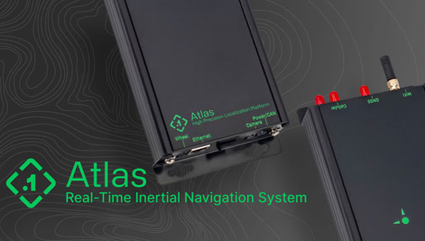
    I’m the head of product for core technology at OxTS. My role now is focused on R&D innovation. So, the research side, developing prototypes and taking new technology to market effectively. One of the key things we’re examining is GNSS-denied navigation: how we can improve our inertial navigation system via other aiding sources and what other aiding sensors can complement the IMU or inertial measurement unit to give you good navigation in all environments. Use GNSS when it’s good, don’t rely on it when it’s bad or completely absent.

    We rely increasingly on GNSS but are also increasingly aware of its weaknesses and vulnerabilities. What do you see as the main challenges?

    Excessive reliance on anything leads to people exploiting it, which is where the spoofing, the jamming, and the intentional denial come in. We all rely on technology nowadays to do all our menial tasks; then, if we lose the technology, we don’t have the skills to do the task ourselves and we’re in trouble. Reliance on a mass global scale on GNSS is a good and a bad thing. It is good for technology because costs come down. Access to GNSS data is increasingly easy and devices that use it are increasingly cost-effective. But if your commercial, industrial, or military operations rely too much on that one sensor, they can fall over. That’s where complementary PNT comes in: if you can put your eggs in other baskets, so that you have that resilience or redundancy, then you can continue your operation — be it survey, automotive or industrial — even if GNSS falls or is intermittently unavailable or unavailable for a long period of time.

    However, you can fully replace a GNSS only with another GNSS.

    You cannot replace GNSS with anything that has all the pros and none of the cons. You could use something like lidar or an IMU to navigate relative to where you started. However, you would not know where you are in the world without reference to a map, which would have been made with respect to GNSS global coordinates. The best thing you can do is use things with GNSS to plug the gaps or rely less on it periodically in the sense of having multiple updates per second and be able to at least start with a global reference, then navigate relative to that for a period of time and then get another global update. Then you can navigate in between either via dead reckoning or local infrastructure that is being referenced with respect to the global frame. That way, you can transition between GNSS and localized aiding without any dropouts in your operation or your functionality without relying on completely clean GNSS data all the time.

    As you say, you can’t replace it. If you do claim to be breaking free from GNSS you’re really playing a different game and just describing it in a way that sounds as good as GNSS, but in reality you’re saying, “I can navigate in this building but I don’t know where this building is” until you start saying, “Well, I’ve referenced it with respect to a survey point that used a GNSS survey pole.” At that point, you’re not breaking free from GNSS, you’re just using it differently.

    INS-GNSS integration has been around for a long time and the two technologies are natural partners because each one compensates for the other’s weaknesses. What have been some of the key recent developments in that integration?

    The addition of new GNSS constellations has helped a lot because you need four satellites for a position or time lock and six satellites to get RTK. What previously were 12 to 14 satellites from GPS and GLONASS visible at any one time have doubled with the addition of Galileo and BeiDou. So, your requirement for six satellites at any one time has become a much more reasonable proposition in terms of maintaining that position lock in the first place. Meanwhile, IMU sensors have been coming down in price. So, you can make a more cost-effective IMU than ever, or you can spend the same and get a much better sensor than you ever could before. Your period between the GNSS updates is also less noisy and you have less random walk and more stability.

    With less drift you can also go for longer periods without re-initializing your IMU.

    Yeah, exactly. Your dead reckoning period can go longer, while still taking advantage of tight coupling wherein you use the ambiguity area of the IMU to reduce the search area for the satellites. So, a better IMU means that you can use GNSS more readily when you go under a bridge or go through a tunnel. You can lock on to satellites quicker again because of the advancements that have been made with the IMU technology.

    What have been some of the key advances in IMU technology in the last five or ten years?

    With GNSS receivers, the market has become more competitive, there are now more options than ever before. People being disruptive in the space has allowed us to use lower cost sensors for the same performance or mix and match gyroscopes and accelerometers to get the best IMU complementary level. Previously, you may have had an accelerometer that far outweighed the performance level of the gyroscope. So, you would have very good velocity drift over time. But if you’re heading drifts, you still end up in the wrong place when you haven’t had GNSS for a while.

    So, that’s allowed us to pick a much more complementary combination of sensors and producing an IMU that we manufacture and calibrate ourselves, while using off-the-shelf gyroscopes and accelerometers. That allows us to make an IMU that is effectively not bottlenecked in any one major area. I think previously, with IMUs, you took what you could get and some of that technology was further ahead than other. So, it’s a good thing for us because the sensors that we’re getting do not cause single-source bottlenecks and we can achieve higher level of performance than we ever could, without having to significantly increase our prices.

    The way we’ve always seen it, either you add features or performance level and maintain the price, because the technology is maturing over time, or you disruptively lower your price with the same technology. On occasion, we have done that in the survey space. That’s where the performance level requirements are far tighter because people are moving from static survey using GNSS, where they’re used to millimeter-level surveys, into the mobile mapping space, where they still rely entirely on RTK GNSS.

    However, they also rely on high accuracy heading, pitch, and roll to georeference points from a lidar scan at a distance instead of only exactly where they are. Where new IMU technology has helped us is to get the better heading, pitch, and roll performance for georeferencing as well as reducing the drift while we dead reckon in a GNSS outage.

    What is the typical performance of IMU accelerometers and gyros these days?

    It boils down to what it gives us in terms of position drift or heading, pitch, and roll drift over 60 seconds. Real-time heading, pitch, and roll is heavily affected by gyroscope performance.

    How much more do you have to pay to get that increase in performance?

    There are definitely diminishing returns. When you look at some of the Applanix systems that have very good post-processing performance in terms of drift, you’re talking about something like $80,000 for a mobile mapping survey system that is maybe 50% better on roll and pitch in normal conditions, let alone an outage, vs. $30,000 to $40,000 for our top system, which is 0.03 roll and pitch, for example. If you go down to 0.015, you can pay double for the INS. Similarly, if you go the other way, and you go cheaper, you can probably get a .1 degree roll and pitch system for $1,000.

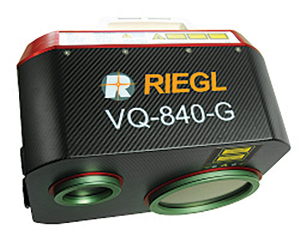
    So, it’s a very steep curve. The entry level systems are very disruptively low priced now but given the requirements for certain applications —particularly survey — that .1 degree means that you can never achieve centimeter-level point cloud georeferencing. And that’s where people are still justifying spending $80,000 or more on the INS. They also spend similar levels on their RIEGL lidar scanners and other profilers. So, it’s complementary to the quality of the other sensors. However, it really doesn’t make sense to spend $1,000s on your INS and then $80,000 on your lidar, because you’re going to be bottlenecking the point cloud that you get out of it at the end anyway.

    The same goes for autonomous vehicles, where people are now spending sub-$1,000 on their lidar or their camera, and they don’t want to spend $30,000 to $40,000 on their INS for a production level, autonomous vehicle. So, there needs to be that similar complementary pricing for sensors in that space, where you can offer an INS for hundreds of dollars, for example, that performs maybe only a percentage less than INSs do today.

    For an autonomous vehicle to stay in lane, it still needs these building blocks to be high accuracy, because they’ve only got 10s of centimeters with which to play. However, they are doing it from the point of view that they don’t care where they are in the global frame at that moment in time to stay in their lane, only where the lane markings are. However, they will care where they are in the global frame when they come to navigate off of a map that someone else has made and they’re looking for features within the map, for such things as traffic signs, stoplights, and things that are out of sight or occluded by traffic, so that they know if they’re approaching them and the camera is just blocked at that time. That’s where the global georeferencing comes in and where GNSS remains critical effectively. Right?

    It ranges price-wise. The top-end systems — Applanix and NovAtel — in the open road navigation sense, are not orders of magnitude better but you do end up paying double very quickly. If you look at the datasheet, positioning in open sky conditions is identical between a £1,000 power system and an £80,000 pound system. The differences all come in those drifts specs, or the heading, pitch, and roll specs that are being achieved, because the value really comes from the IMU being used at that point.

    Is most of the quality difference between these devices due to better machining, smarter electronics, or improved post-processing?

    Any one of them on their own will not get you a good navigation solution. Fundamentally, you can have a good real-time GNSS-only system that will work at a centimeter level if you just use, say, a u-blox receiver, which is less than $100. Adding a low-cost IMU can fill some gaps, but not particularly intelligently and you’ll get jumps and drop-outs or unrecoverable navigation. That’s when the algorithms come in to play in terms of intelligent filtering of bad data and when to fall back on one solution versus the other and when to blend the two.

    I was asking specifically within INS. When you’re talking about a $1,000 INS versus an $80,000 INS, how much of the improvement in performance is due to manufacturing, how much of it is due to smart electronics, and how much of it is due to algorithms or post processing?

    Most of it is probably down to the raw sensor quality and then the calibration of the sensors. An IMU calibration is important, in terms of compensating for bias and scale factor errors, but also for the misaligned angle of the sensors. So, you need to make sure that your accelerometers and your gyros are all mounted exactly orthogonal to each other. A $1,000 sensor is very unlikely to be calibrated to the same level as an $80,000 one. That’s probably because you’d get 10% more out of calibrating the $1,000 one but you might get three times the performance out of calibrating the $80,000 one. So, you have a lot more to get out of a high-end system in terms of unlocking the potential whereas the low-end sensors are probably already giving 80% to 90% of their potential out of the box, with no calibration at all.

    You affect such things as warmup time. A well-calibrated system will already be modeled accurately almost as soon as you power it on. If you don’t calibrate the system, you can still have a Kalman filter or something running in real time that can model the errors live. But it will mean that you won’t be at spec level performance as soon as you power up. When does it matter to you that you get the best data? Is it the instant you power up because you’re navigating an autonomous vehicle out of the parking garage? Or do you have 10 minutes before you need to take the data and use it for anything, and therefore you can take those 10 minutes to model the sensors live?

    You might save money on the electronics budget but spend it to pay the driver to do the warm-up procedure. You can reallocate where you spend your money. If you’re rolling out a fleet of 100 vehicles, though, you probably don’t want to have to have 100 drivers that are trained to do a warm-up procedure. So, you would spend the money on the electronics to have an INS that does not require a warm-up. That is an option that you can go with now. If you spend the extra you can get away from the warm-up procedure requirements, because things have been modeled during calibration instead of in real time.

    Your website focuses on three areas: automotive, autonomy, and surveying and mapping. Why those and what might be next in terms of markets or end user applications?

    Automotive is probably the bread-and-butter part of OxTS. For a long time, automotive users were looking for a test and validation device that could give them their ground truth data to validate onboard vehicle sensors. We were very much the golden truth sensor, making sure that the sensors they were putting into the production vehicles were fit for purpose and safe. So, if they claimed it had autonomous emergency braking, they used our sensor to say how far away it was from the target — for example, a pedestrian — when it made the vehicle stop. Did it break with the appropriate distance between them? They had a unit in each vehicle and got centimeter accuracy between them. That was very easy to do with GNSS. Because on a proving ground for automotive users, they always have RTK.

    Now the automotive world is moving into the urban environments and doing more open-road testing. So, the need for complementary PNT is more on their mind than ever. They are looking for a technology from us and our competitors that allows them to keep doing those tests that they did on the proving ground, but in real world scenarios. They may collect 1,000 hours of raw data and then only have an autonomous emergency breaking (AEB) event kick in three times in those 1,000 hours. They will then look at the OxTS data at that time and say something like, “Did the dashboard light come on and then did the brake kick in at the required time to avoid the collision?”

    So, they rely on the INS data to be accurate all the time. It cannot be that in 1,000 hours, if you get those three events, two of them do not meet the accuracy requirements to be your ground truth sensor. Because then they would basically say, well, we don’t know whether the AV kicks in at the right time on the open road. They would have to fall back to the proving ground testing to have any confidence. So, that’s where the automotive world is looking to use an INS to reference its onboard sensors.

    In autonomy and survey, on the other hand, the INS is used actively to feed another sensor to either georeference or, in the case of autonomy, actively navigate the vehicle. So, that data being accurate is critical because an autonomous vehicle without accurate navigation cannot move effectively and would have to revert to manual operation. There’s a lot to do with localization and perception and avoidance of obstructions and things like that.

    Timing synchronization is critical. People haven’t solved a way to synchronize multiple vehicles without using GNSS and PPS. Some people are using PTP to synchronize, but they’ll often have a GNSS receiver at the heart of it with the nanosecond-accurate time to be the actual synchronization time. And then everything else is a slave PTP device that operates off of that. So, if we did not give accurate timing, position and orientation, there is basically nothing that that vehicle could do to navigate other than navigating relative to where it was when it last had accurate INS time.

    Often, these vehicles will enter a kind of limp mode or stop completely and require user operation to get it to the next stage. It’s where you see the street drone-type small robots now, which will stop if a pedestrian walks in front of it, obviously, because it is a safety requirement. But also, if it doesn’t know where it is, like a Roomba operating inside, it cannot localize with respect to landmarks that it has in its map, it will just effectively try to re-localize off of random movements until it can orient itself. In that scenario, an INS or an IMU can help you reduce the number of times that you’re losing absolute localization. Where the autonomy side of things comes in for us is if we can offer the navigation quality, more of the time and to a high accuracy but for acceptable cost, then the sensor is a viable one to be put into the autonomous vehicle.

    In autonomy, our active and potential customers are looking to do everything for a very, very low cost base, because they know that they’re trying to reach consumers with these products rather than businesses. So, their value box is entirely within the algorithms that they’re selling. They’re trying to offer scalable solutions that could roll out to thousands or millions of vehicles around the world, with their algorithms at the center of them. That localization and perception stuff is where you see companies such as Nvidia getting involved, because they want to be at the heart of it. Then they say that they can support any sensor while not being tied to any one of them. However, their algorithm is always going to be there at the heart of it. They will have GNSS receivers they support, they will have IMUs, they will have cameras, lidar, and radar and all the other kinds of possible aiding sensors. But they will say that their algorithm will still function if you have any number of those being fed in at any time.

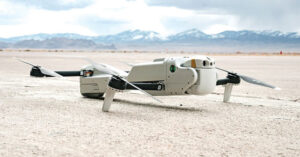
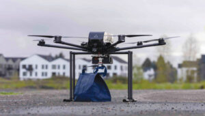
    So, autonomy relates to automotive in a sense, because you have autonomous passenger vehicles, but you also have autonomous heavy industry and autonomous survey, where people are flying drones autonomously or operating Spot autonomous dog robots, things like that, which can still be a survey application where you don’t want to have a human in the loop but you still need to navigate precisely. Someone may be sending a Spot dog robot into a deactivated nuclear reactor where they don’t want to send a human, but they still need to get to a very specific point within that power station and report back. They need to avoid obstructions, they need to georeference data they collect, and then take a reading from a specific object or sensor that’s inside and come back out safely. So, accurate navigation throughout the whole process is very important.

    I understand the role of OxTS in testing and development. However, are any of your systems going to be in any production vehicles?

    Many of the companies that are working on autonomous passenger vehicles are realizing that they are still a long, long way away.

    What about your presence in the auto market more broadly?

    They are used, but as separate components. You will have GNSS, IMU, radar, cameras, and lidar but the localization and perception will all be done by the OEM or by a tier one supplier to the OEM. So, they don’t want a third-party solution that is giving them a guarantee of their position because it’s a black box. They need to have traceability and complete insight as to what each sensor is saying so that they can build in redundancy and bring the vehicle safely to a stop if one of those systems is reporting poor data. For production vehicles, we are very much used as a validation tool in the development stage, but in terms of producing the production vehicle, they need to have that visibility of the inner workings of the system. Most INSs will not give you that insight as to how they arrived at their navigation output, because that is proprietary information. As a result, many automotive customers are looking to do that themselves. However, as I said, they’re realizing that it’s very difficult, and they’re quite a long way from navigating anywhere.

    Therefore, currently no OxTS products are in production vehicles.

    Not for passenger autonomy. However, they are used in some of the other autonomous spaces, such as heavy industry, that take place in private, fixed spaces such as mines, quarries, and ports where there is little interaction with the public. That is not only because the vehicle price point is much higher for some of these mining vehicles and heavy industry vehicles, but also because you don’t have to have your algorithm and perception capability deal with vehicles that are not autonomous or are driven by drivers that are not trained on health and safety in the area.

    In these private spaces, you can tune your systems to work with each other without having to worry about the pedestrians and the random vehicles for which you’ve not accounted in your perception algorithms. That’s where the divide comes at the moment. If there are untrained people in the area, then there’s a lot more to accommodate and that makes the proposition much more difficult.

    Are you at liberty to discuss any recent end user success story with your products?

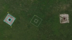
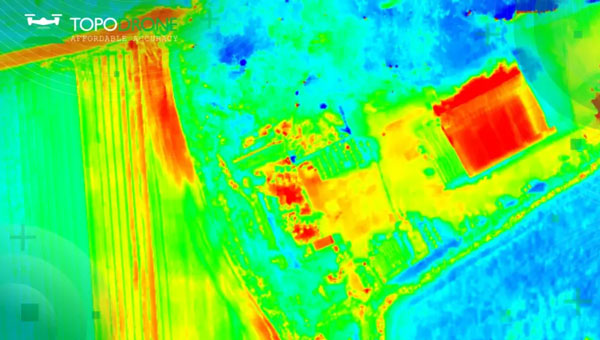
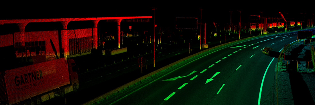
    The Ordnance Survey in the UK has been using our INS to create 3D maps on which they can then use semantic segmentation to classify features within the environment and pull out all the relevant features within a survey of a city, for example. They’re blending the raw data from OxTS lidar and map data that they have to create high accuracy 3D maps that can be used to add that third dimension to the high accuracy 2D maps that have been their value proposition for the past few decades. They can say, “here are all the trees in the environment” or all the traffic signs or buildings or that kind of thing that you’re going to see in Google Earth imagery. They start to reach the realms of high accuracy map data. They’re looking to sell that map data to commercial entities to monetize it and use it on a nationwide level and then on a global level.

    If you have that map data, there’s a lot that you can do with it, in terms of intelligent decision making about routing a vehicle, or many other things, such as monitoring the heat output of buildings. In the EU, there are many directives around such things as carbon emissions. If you’re being more efficient with the heat output of your buildings, you can effectively say that you’re hitting your CO2 emissions reduction goals, by running whatever initiative to insulate buildings better and things like that. It always starts with, “Where was I when I saw this object or this building?” Therefore, I can georeference that building, I can color it by thermal imaging and things like that.

    They can start to produce 3D imagery that is colored by thermal output, they can do it by any other number of sensors as well, that can give them meta data that can allow them to sell the data to someone else. It makes what was previously a very big job very efficient. So, they can drive hundreds of kilometers in a day where previously it was a static survey that was done over the course of weeks on foot. It’s also changing the efficiency metric that they can deliver to their end users.

    Thank you very much!

  • RIEGL, Schiebel team up for UAV-based airborne scanning

    RIEGL, Schiebel team up for UAV-based airborne scanning


    Image: RIEGL
    Image: RIEGL

    RIEGL Laser Measurement Systems GmbH and Schiebel have successfully completed the integration of a laser scanning system, the RIEGL VQ-840-G topo-bathymetric lidar sensor, on the Schiebel CAMCOPTER S-100 UAS. The RIEGL VQ-840-G, combined with the technical specifications and performance of the CAMCOPTER S-100 UAS, enables an efficient and secure way for surveying shallow waters, where monitoring from boats becomes a challenge.

    The applications of airborne lidar bathymetry include the mapping of coastlines and riverbanks, as well as the monitoring of natural habitats, water reservoirs and hydraulic engineering applications.

    In a single data acquisition mission, data below and above the water surface are covered.

    Photo:
    Image: RIEGL

    Additionally, the topographic laser scanners RIEGL VUX-1UAV/-LR and VUX-12023 can be integrated in the front payload bay of the CAMCOPTER S-100.

    The VQ-840-G topo-bathymetric laser scanner is designed for use in a variety of maritime and hydrographic environments. The lidar sensor payload system is controlled remotely via a data link, which was crucial for the integration into the S-100 system.

    The scanner is controlled by using the onboard software RiACQUIRE-Embedded via the available data link; data acquisition and laser safety are also monitored. Once the survey is completed, the raw data seamlessly integrates into the RIEGL data processing workflow.

  • WGIC announces executive board members and president for 2023-25

    WGIC announces executive board members and president for 2023-25

    Image: WGIC
    Image: WGIC

    The World Geospatial Industry Council (WGIC) at its annual general meeting announced the members of its board who will serve from May 2023 to April 2025. The board is comprised of 20 senior geospatial industry professionals drawn from WGIC’s patron, corporate and associate member companies. The board will provide strategic guidance to WGIC in pursuing its mission and achieving its programmatic goals during the next two years.

    WGIC Executive Board Members

    1. Theo Agelopoulos, Senior Director (Autodesk)
    2. Zubran Solaiman, Director (Bentley Systems)
    3. John Renard, President (Cyient)
    4. Bushra Zaman, Director (Deep Spatial)
    5. Elshan Musayev, EKM Global
    6. Dean Angelides, Corporate Director — international (Esri)
    7. Robert Hoddenbach, Global Director (Fugro)
    8. Jean-Francois Gauthier, Vice President (GHGSat)
    9. Adina Gillespie, Vice President (Hexagon)
    10. Steven Sawdon, Director (IIC Technologies)
    11. Paul Granito, Senior Vice President (Maxar Technologies)
    12. Harsh Govind, Principal Product Manager (Microsoft)
    13. Jayant Sharma, Senior Director (Oracle)
    14. Agnieszka Lukaszczyk, Vice President (Planet)
    15. James Van Rens, Senior Vice President (RIEGL International)
    16. Willy Govender, CEO (Terra Analytics)
    17. Marius Swanepoel, Director (TomTom)
    18. Bryn Fosburgh, Senior Vice President (Trimble)
    19. Joseph Seppi, Senior Vice President (Woolpert)
    20. Sanjay Kumar, CEO (Honorary Member) (Geospatial World)

    The bi-annual election for the office of WGIC president has witnessed a unanimous vote for Bryn Fosburgh, Senior Vice President, Trimble. Brian Nicholls, Vice President — Asia Pacific, Woolpert, was elected unopposed as the treasurer. To ensure business continuity, John Renard, President, Cyient — Europe, will continue as secretary general till April 2024.

    For more information, click here.

  • Inertial Labs releases laser for remote-sensing apps

    Inertial Labs releases laser for remote-sensing apps

    (Image: Inertial Labs)
    (Image: Inertial Labs)

    Inertial Labs has released a remote sensing payload instrument. The Resepi Hesai XT32 laser is designed for accurate remote-sensing applications. The Resepi laser can be used with commercially available lidar scanners, including Velodyne, Quanergy, Ouster, RIEGL, LIVOX and Hesai, as well as with UAVs.

    Resepi is completely modular, so users have full control for customization. The remote sensing device uses a GPS-aided inertial navigation system with NovAtel RTK/PPK single- or dual-antenna GNSS receiver, integrated with a Linux-based processing platform. It also comes with a 2 TB USB memory drive and has an embedded Wi-Fi cellular modem.

    Resepi has 3-5 cm point-cloud accuracy and can reach heights of more than 200 m above ground level. It is compatible with most UAV models; however, it is typically used with DJI M300, DJI M210 or DJI M600 models.

    The device is suitable for scanning and mapping, precision agriculture with lidar, simultaneous localization and mapping (SLAM) algorithm development, utility inspection and construction site monitoring. Resepi-supported software includes Hexagon NovAtel, PCPainter and PCMaster.

  • Mosaic debuts Mosaic X, compatible with REIGL mobile laser scanners

    Mosaic debuts Mosaic X, compatible with REIGL mobile laser scanners

    Photo: Mosaic
    Photo: Mosaic

    Mosaic, a geospatial imaging company, announced that its new Mosaic X high-resolution, spherical camera is now compatible with RIEGL’s mobile mapping systems.

    The development of the Mosaic X focused on delivering a high-resolution, global-shutter, 360-degree camera with precise GNSS time stamping to achieve extreme visual clarity and accuracy at once. These qualities fit the requirements to be integrated with mobile laser scanning systems such as the RIEGL VMX, VMQ and VMY series.

    Mobile mapping has uses across many industries and sectors, including private and public organizations. The two most consistent demands when mapping infrastructures are high-resolution, photo-realistic imagery and highly accurate data. Cameras such as the Mosaic 51 and Mosaic X capture road infrastructure with photo-realistic accuracy, which is more understandable to the human eye than a point cloud from a laser scanner.

    “The pairing between 360-degree imaging systems and mobile laser scanning systems results in high precision LiDAR-based point clouds, colorized by photo-realistic images,” says Mosaic co-founder and VP of engineering, Rostislav Lisovy. “This outcome will then have the benefit of both a precise point cloud and panoramic images – for precise measurements and evaluation of textures.”

    The push for sensor integration came from the customers, Mosaic CEO and co-founder Jeffrey Martin states. “We have had many requests from our customers who are looking to use RIEGL and Mosaic products in unison. The Mosaic X impresses with high-resolution panorama images and offers precisely time-stamped single-lens imagery for the purpose of point cloud coloring as well as the generation of undistorted, geo-referenced high-resolution imagery with 12 [megapixels] per lens.”