Tag: Seen & Heard

  • Seen & Heard: FAA updates interference resources, measuring Bangladesh’s highest peak and more

    Seen & Heard: FAA updates interference resources, measuring Bangladesh’s highest peak and more

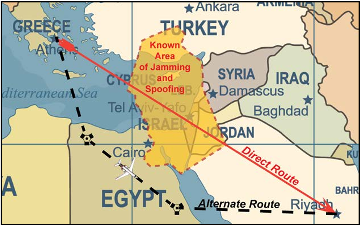
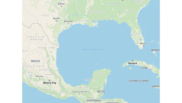
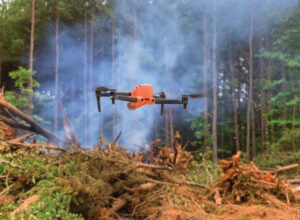
    Interference clocked by the FAA

    The U.S. Federal Aviation Administration (FAA) has updated its “GNSS Interference Resource Guide.” The FAA’s Flight Technologies and Procedures Division (AFS-400) developed the guide to provide operators and pilots with current information on GPS/GNSS jamming and spoofing. According to the guide, “As the threat of GNSS jamming and spoofing is constantly changing, the FAA will update this resource guide to provide the best guidance in the rapidly changing environments.”

    Download the guide here.

    UK scientists unite to uncover coastline mysteries

    The research vessel Cefas Endeavour at dock in Lowestoft.(Credit: Cefas)
    The research vessel Cefas Endeavour at dock in Lowestoft.(Credit: Cefas)

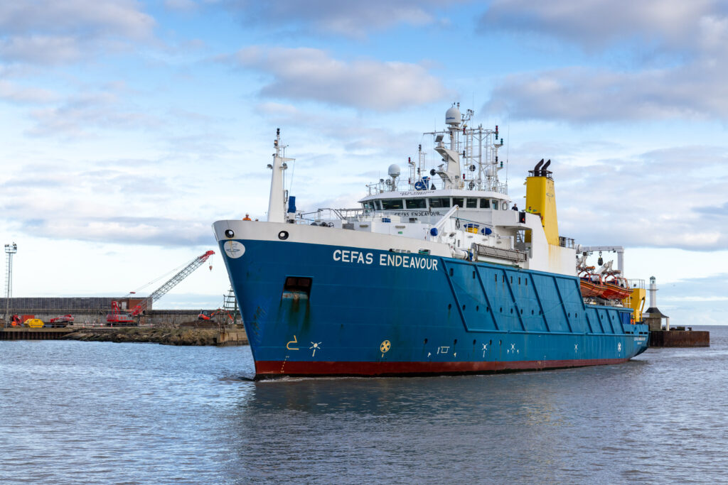
    The UK Centre for Seabed Mapping (UK CSM) conducted a survey to explore and map the seabed along the United Kingdom’s southwest coastline. For four weeks, a team of 26 maritime scientists collected hydrographic, geological and environmental data. According to UK CSM, the survey represents an unprecedented level of collaboration within the maritime sector. The team aimed to collect and share high-quality marine data and make advances in how the seabed is mapped, understood and managed. The findings will support a wide range of applications including offshore energy and infrastructure, marine ecosystem science, safety at sea, marine policy, and defense.

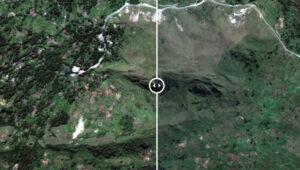
    Bangladesh at the top

    Credit: MD Maruf Hassan/E+/Getty Images
    Credit: MD Maruf Hassan/E+/Getty Images

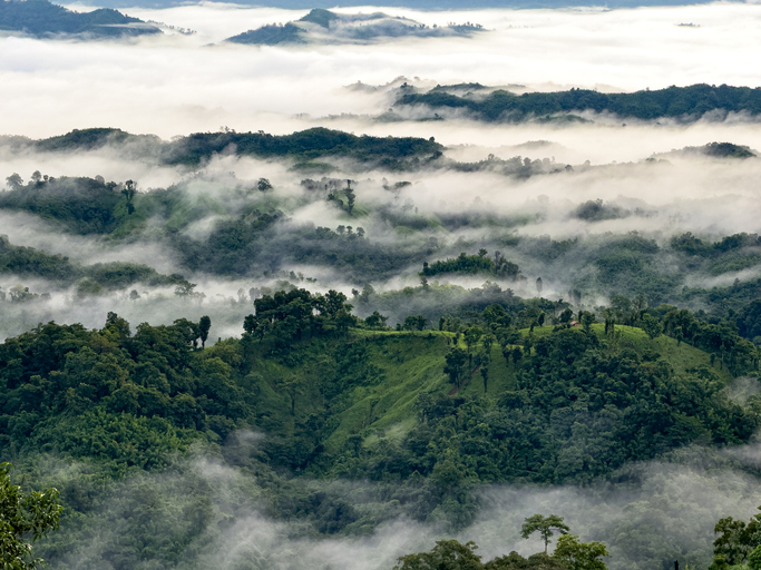
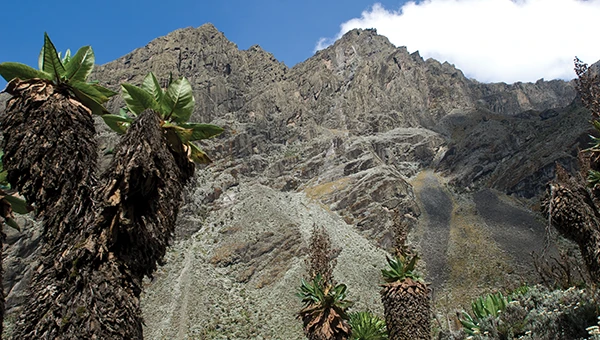
    In April, field teams for the Survey department under the Ministry of Defense
    conducted field work in the remote hill areas of Bangladesh to determine the
    highest peak. Surveyors used modern geodetic methods and advanced GNSS
    technology in the Bandarban district, and followed international standards to
    determine the height of the country’s highest peak above mean sea level (MSL)
    with centimeter-level accuracy, including latitude, longitude and elevation.

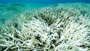
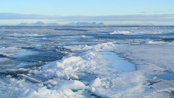
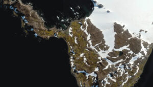
    Turbulence shrinks Antartica’s Ross Ice Shelf

    Sketch (not to scale) of GNSS sensitivity to atmospheric turbulence in Antarctica. GNSS stations can probe the spatiotemporal distribution of water vapor in the lower atmosphere because water vapor induces a measurable signal propagation delay. Water-vapor distribution is spatially homogeneous for a non-turbulent atmosphere and heterogeneous when the atmosphere is turbulent. (Credit: MIT)
    Sketch (not to scale) of GNSS sensitivity to atmospheric turbulence in Antarctica (Credit: MIT)

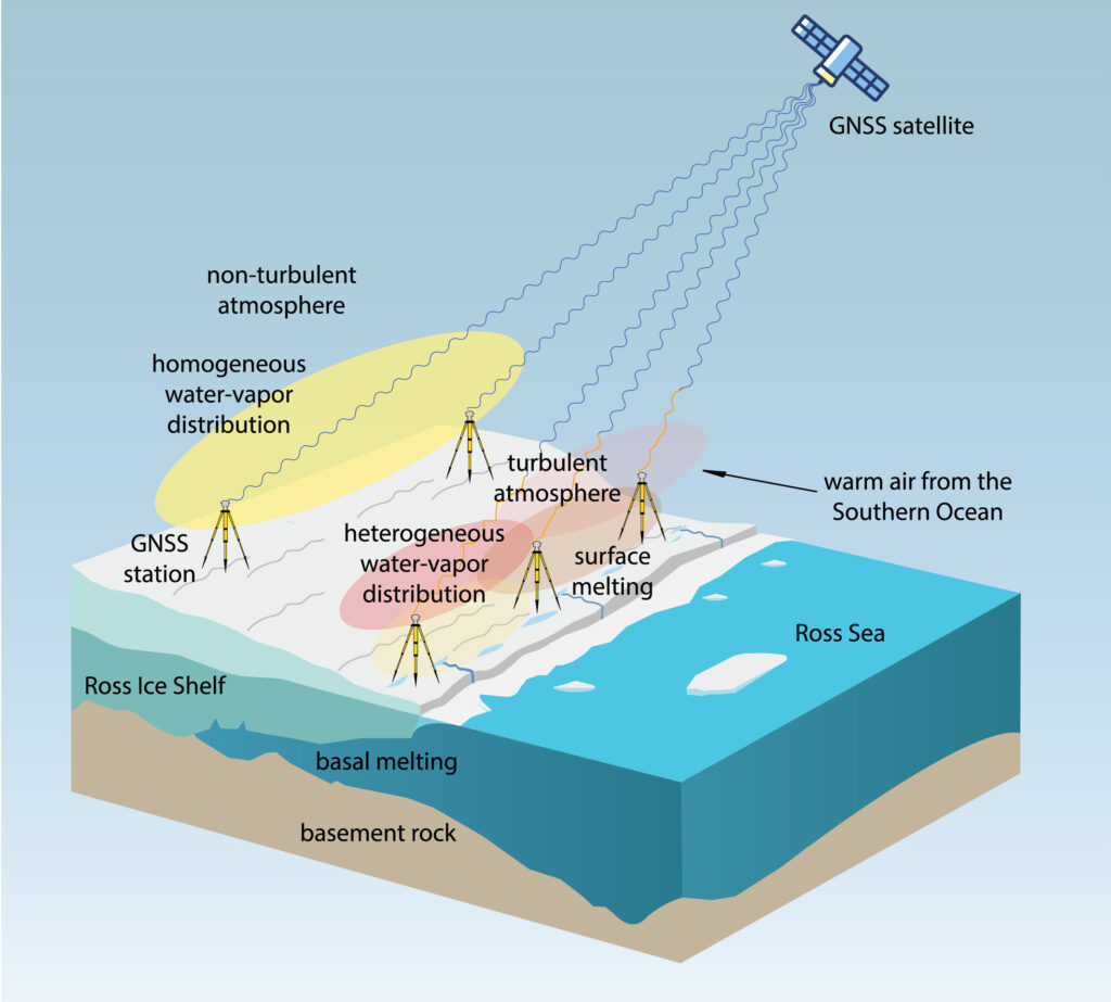
    GNSS observations suggest a major melting event at Antarctica’s Ross Ice Shelf was
    linked to atmospheric turbulence. While the shelf typically melts underneath from warm ocean water, an unusual surface melting episode occurred in January 2016. Researchers from MIT Haystack Observatory used data from existing GNSS stations, with 13 stations installed on the shelf, to examine atmospheric turbulence. Wind, water vapor and temperature variations drawn in by warm and humid air caused the surface to melt, with turbulence four times greater than usual.

  • Seen & Heard: Arctic Sea ice, Russian jamming and earthquake monitoring

    Seen & Heard: Arctic Sea ice, Russian jamming and earthquake monitoring

    New insights into Arctic sea ice

    micheldenijs/E+/Getty Images
    Image: micheldenijs/E+/Getty Images

    Research drawing on data from Spire Global’s GNSS-R constellation has enabled the generation of Arctic-wide sea ice maps, marking a major step forward for GNSS-R. The research, enabled by the European Space Agency — suggests harnessing GNSS-R signals could become an important complement to established ice-monitoring altimetry missions. The study leveraged Spire’s GNSS-R data to retrieve sea ice freeboard measurements across an entire winter season. The results show strong alignment with established altimetry datasets, including the ESA’s CryoSat mission.

    Russian jamming goes to the dogs

    Credit: Marit Leinan Abrahamsen/Finnmarksløpet
    Credit: Marit Leinan Abrahamsen/Finnmarksløpet

    Military jamming and spoofing from Russia’s Kola Peninsula interfered with GNSS trackers on dog sleds in Europe’s longest sled race, the 1,200- km Finnmarksløpet, held in Norway in March. The electronic warfare degraded GPS signals, forcing the mushers to rely more on trail markings and use traditional compasses and maps. Event organizers, who provided a live tracking system for fans, found it difficult to follow along, but the racers finished without incident.

    Historical photos find their places

    fstop123/iStock/Getty Images Plus/Getty Images
    Image: fstop123/iStock/Getty Images Plus/Getty Images

    Michigan Technological University is examining 11,000 historical images of the state’s Upper Peninsula to find precisely where each photographer stood to take the photo. According to university GIS data librarian Bob Cowling, the location will provide richer information about a place’s surroundings, especially if structures or environmental landmarks are no longer present. Donated historical images often arrive without any dates or location information attached to them. The project will make them easier to find on a map and make it possible to visualize what was there in the past.

    Türkiye establishes earthquake monitoring

    Credit: mustafaoncul/iStock /Getty Images Plus/Getty Image
    Credit: mustafaoncul/iStock /Getty Images Plus/Getty Image

    In February 2023, a devastating 7.8-magnitude earthquake struck near the Türkiye-Syria border, followed by a second nearly as strong. Six Turkish universities have launched TR-TRAK-GNSS, a real-time geodetic monitoring network to trace earthquake-related ground deformation across Thrace and the Southern Marmara region. The 28-station system is expected to evolve into a major scientific and early warning system for earthquakes. Once fully deployed, it will form a continuous monitoring ring encircling Thrace and Southern Marmara.

  • Seen & Heard: Mapping electronic warfare, Türkiye’s satellite system and quantum GPS backup

    Seen & Heard: Mapping electronic warfare, Türkiye’s satellite system and quantum GPS backup

    “Seen & Heard” is a monthly feature of GPS World magazine, traveling the world to capture interesting and unusual news stories involving the GNSS/PNT industry.


    West Point Cadets Map Electronic Warfare
    West Point cadets conducted a senior thesis project investigating the use of GNSS technology to map and visualize electronic warfare activities in the South Pacific, specifically focusing on GNSS spoofing. Their research, centered on the Huangpu River and Northeastern Shanghai, aimed to identify patterns of malicious GNSS interference and potential perpetrators, highlighting the strategic and economic motivations behind these actions in the region. By developing data visualizations of spoofing incidents, the cadets created a model that could be scaled up to analyze larger areas.

    Credit: Eric S. Bartelt / USMA PAO-VI
    Credit: Eric S. Bartelt / USMA PAO-VI

    South Africa Rising Above Water
    Researchers from the University of Bonn have found that South Africa’s land is rising by up to 2 mm per year, not because of deep mantle activity, but due to water loss from severe droughts. This uplift was detected using the TrigNet network of GNSS stations, which precisely measures changes in land elevation. As groundwater is depleted, the Earth’s crust rebounds upward — a process GNSS stations can monitor in real time.

    Credit: THEGIFT777 / E+ / Getty Images
    Credit: THEGIFT777 / E+ / Getty Images

    Türkiye to Launch Homegrown Satellite Navigation and Mapping System
    Türkiye is developing the Regional Positioning and Timing System (BKZS) to launch its own GPS and mapping application, in an effort to reduce dependence on foreign technology and enhance cybersecurity amid growing industrial automation. The system will provide precise location, navigation and timing data via Turkish satellites as an alternative to global systems including GPS, supporting critical sectors such as military operations, civilian communications, smart transportation, and precision agriculture.

    Credit: Tippapatt / iStock / Getty Images Plus / Getty Images
    Credit: Tippapatt / iStock / Getty Images Plus / Getty Images

    Quantum Navigation System Serves as GPS Backup
    Q-CTRL, a quantum infrastructure software company based in Sydney, Australia, has demonstrated a new quantum navigation system, Ironstone Opal, as a backup to GPS technology. The Ironstone Opal system uses quantum sensors to detect variations in the Earth’s magnetic field, determining precise geographic coordinates with the help of artificial intelligence-based software. Ironstone Opal is passive and does not emit signals, making it resistant to detection and jamming. Field trials showed the system outperformed a high-end inertial navigation system and served as a reliable GPS backup by up to 50 times in ground vehicles and 11 times in aircraft.

    Photo: Oundum / iStock / Getty Images Plus / Getty Images
    Photo: Oundum / iStock / Getty Images Plus / Getty Images

  • Seen & Heard: Google’s scammer takedown, Harvard’s free navigation history course and more

    Seen & Heard: Google’s scammer takedown, Harvard’s free navigation history course and more

    “Seen & Heard” is a monthly feature of GPS World magazine, traveling the world to capture interesting and unusual news stories involving the GNSS/PNT industry.


    Free navigation history course

    Photo: Harvard University
    Photo: Harvard University

    Harvard University offers PredictionX: Lost Without Longitude, a free online course that examines the evolution of navigation from ancient methods to modern technologies. The program explores the science and history of navigation, focusing on the challenges of determining longitude before GPS existed. It highlights key advancements, such as John Harrison’s marine chronometer and the Longitude Prize. Through multimedia content — including videos, infographics and Worldwide Telescope tours — the course is designed to demonstrate how centuries of advancement in navigation enabled humanity to achieve milestones such as landing on the moon.

    Self-driving cars collect geospatial data

    Photo: Finnish Geospatial Research Institute
    Photo: Finnish Geospatial Research Institute

    In Finland, self-driving cars are being used to collect geospatial data to address urban challenges. The ARVO autonomous vehicle from the Finnish Geospatial Research Institute is equipped with high-precision sensors that map its environment in real-time, collecting information on road conditions, urban vegetation as carbon sinks and factors influencing flood risks. In partnership with Aalto University and funded by the European Regional Development Fund, this initiative seeks to explore various uses of this data, such as city planning, environmental monitoring and infrastructure management.

    Stopping scammers

    Photo: Carlos Alvarez / iStock Editorial / Getty Images Plus / Getty Image
    Photo: Carlos Alvarez / iStock Editorial / Getty Images Plus / Getty Image

    Google has taken legal action against a network of scammers responsible for creating more than 10,000 fake business listings on Google Maps. The scammers fabricated profiles targeting urgent service industries and bolstered them with fake reviews to appear credible. Victims were misled into contacting these fake businesses, which then sold their personal information as “leads” to legitimate service providers without consent. Google has removed the fake listings and is suing individuals involved in the scheme, CBS News reported.

    Mapping Uganda’s disappearing tropical glaciers

    Photo: guenterguni / E+ / Getty Image
    Photo: guenterguni / E+ / Getty Image

    Project Pressure, in collaboration with UNESCO and the Uganda Wildlife Authority, conducted an expedition to the Rwenzori Mountains to map the region’s disappearing tropical glaciers. The team created the first 3D model of Mt. Stanley’s glaciers and installed monitoring equipment, revealing that Mt. Speke and Mt. Baker have lost their glaciers entirely, while the Stanley Plateau Glacier has shrunk by 29.5 percent since 2020 and is heavily fragmented. The project aims to continue monitoring the glacial retreat, develop mitigation strategies and engage the local community in ongoing research.

  • Seen & Heard: Students set for second satellite mission, GPS saves plane passengers and more

    Seen & Heard: Students set for second satellite mission, GPS saves plane passengers and more

    “Seen & Heard” is a monthly feature of GPS World magazine, traveling the world to capture interesting and unusual news stories involving the GNSS/PNT industry.


    UNB students prepare for second satellite mission

    The CubeSat team at the University of New Brunswick (UNB) is developing a second satellite after its first, VIOLET, failed to communicate with Earth. The team is refining its design based on lessons learned from the initial mission. VIOLET, deployed in 2024, was created through a partnership between UNB, the Université de Moncton and the New Brunswick Community College as part of the Canadian Space Agency’s CubeSat Project. This initiative provides students with hands-on experience in designing, building, testing, launching and operating miniature satellites.

    GPS saves 190 airline passengers

    Photo: Injenerker / iStock / Getty Images Plus / Getty Images
    Photo: Injenerker / iStock / Getty Images Plus / Getty Images

    GPS technology played a crucial role in preventing disaster during an EasyJet flight, The Daily Mail reported. As the Airbus A320 descended toward Hurghada, Egypt, it approached dangerously close to a mountain range, flying at an altitude of 3,100 ft — just 770 ft above the peak of the mountain. The Ground Proximity Warning System, which relies on GPS-enabled terrain data, alerted the cockpit with warnings such as “pull up, terrain ahead.” This alarm prompted the pilot to perform an emergency maneuver by pulling up the joystick to level off the plane, narrowly avoiding collision and saving all 190 passengers on board.

    Gulf of America’ name change leaves decisions for map creators

    Photo: TomTom
    Photo: TomTom

    With the U.S. government now recognizing the Gulf waters as the “Gulf of America” and not the “Gulf of Mexico,” TomTom is introducing a U.S. geopolitical view for its users in the United States; they will see “Gulf of America.” Translations will be available in English, Spanish, French and German, and users searching for “Gulf of Mexico” will find the “Gulf of America.” Map users outside of the United States will see the default map view showing the “Gulf of Mexico.” Users searching for “Gulf of America” will find the existing “Gulf of Mexico” feature. All users will be able to change the view based on their preferences

    New ‘surveyor’ app for improved mapping accuracy

    Photo: Apple
    Photo: Apple

    Apple launched the Surveyor app, a tool designed to enhance the accuracy of Apple Maps by collecting real-world mapping data. According to Apple, Surveyor relies on partner companies and users to gather data along assigned routes. The app focuses on capturing detailed information such as street signs, traffic signals and roadside features, which are then transmitted to Apple for precise map updates. By leveraging community-driven data collection, Apple aims to refine its mapping ecosystem and keep critical details current.

  • Seen & Heard: Amazon sued, Europe’s first lunar lander and more

    Seen & Heard: Amazon sued, Europe’s first lunar lander and more

    “Seen & Heard” is a monthly feature of GPS World magazine, traveling the world to capture interesting and unusual news stories involving the GNSS/PNT industry.


    Amazon sued for alleged privacy violations

    Photo: Hispanolistic / E+ / Getty Images
    Photo: Hispanolistic / E+ / Getty Images

    Amazon is facing a lawsuit in Washington state, marking the first dispute under the state’s My Health My Data Act. The lawsuit accuses Amazon of violating privacy laws by collecting location data from millions of Americans without their consent through its software development kits used in various mobile applications. The collected data allegedly included information that could indicate a consumer’s attempt to acquire health services, violating the My Health My Data Act, which requires explicit consent for collecting and selling health-related data.

    Europe’s first lunar lander underway

    Photo: ESA
    Photo: ESA

    The European Space Agency (ESA) has partnered with Thales Alenia Space to develop Argonaut, Europe’s first lunar lander. This spacecraft will provide autonomous access to the Moon, supporting international exploration efforts. Starting in the early 2030s, Argonaut will conduct regular lunar missions, delivering infrastructure, scientific instruments, rovers and essential resources for astronauts. Designed to withstand harsh lunar conditions for up to five years, Argonaut will play a crucial role in sustainable lunar exploration, according to ESA.

    Leica Geosystems, SCI-Arc equip future architects

    Photo: Leica Geosystems
    Photo: Leica Geosystems

    Leica Geosystems and the Southern California Institute of Architecture (SCI-Arc) have partnered to equip future architects with advanced technology skills. Leica is donating more than $200,000 in equipment, including lidar scanners, and offering expert guidance and scholarships to students. SCI-Arc students are applying this technology to create digital archives of Los Angeles structures and visualize rewilded wilderness.

    GNSS spoofing disrupts wildlife tracking

    Photo: rockptarmigan / iStock / Getty Images Plus / Getty Images
    Photo: rockptarmigan / iStock / Getty Images Plus / Getty Images

    In a recent study published by Nature Communications, researchers share that GNSS spoofing in conflict zones is disrupting wildlife tracking efforts, particularly affecting black-tailed godwits migrating through Eastern Europe. Researchers tagged 15 godwits in Finland in May 2024. Eight of these birds displayed spoofed geolocations during their migrations. The most significant spoofing occurred near Simferopol airport in Crimea, where birds were falsely located while flying over Ukraine or Romania. This spoofing added substantial errors to migration tracks, in one case creating a false 7,200-km round trip.

  • Seen & Heard: Self-driving cars get smarter, Antarctic Peninsula turns green and more

    Seen & Heard: Self-driving cars get smarter, Antarctic Peninsula turns green and more

    “Seen & Heard” is a monthly feature of GPS World magazine, traveling the world to capture interesting and unusual news stories involving the GNSS/PNT industry.


    Smarter self-driving cars

    Photo: hoi dongsu / iStock / Getty Images Plus / Getty Images
    Photo: hoi dongsu / iStock / Getty Images Plus / Getty Images

    Researchers at Drexel University have developed a testing method to enhance the robustness of autonomous driving systems. Their approach uses dynamic visual patterns to evaluate object detection capabilities in self-driving cars, focusing on critical objects such as traffic signs. A “Screen Image Transformation Network” (SIT-Net) simulates real-world image capture scenarios affected by environmental factors. By identifying weaknesses in autonomous vehicle perception systems, the researchers aim to improve safety and reliability in future self-driving technologies.

    Robo-dog gets an upgrade

    Photo: Boston Dynamics / Leica Geosystem
    Photo: Boston Dynamics / Leica Geosystem

    The Leica BLK ARC autonomous laser scanning module has become the first certified reality capture device capable of being fitted to Boston Dynamics’ robotic dog, Spot. The BLK ARC, when mounted on Spot, is designed for fully autonomous and repeatable scan missions. Users can plan scan paths remotely using existing drawings or BIM models, allowing the robot to navigate and capture data with minimal human intervention. Spot features a 360° vertical and 270° horizontal field of view, with a scan range of up to 25m.

    USGS aids recovery after Hurricane Helene

    Photo: Logan Combs, USGS
    Photo: Logan Combs, USGS

    The U.S. Geological Survey (USGS) is actively aiding recovery efforts following Hurricane Helene by collecting flood data, repairing damaged stream gages and analyzing new flood records. The agency has deployed its landslide event team to assess and document landslide impacts, conduct aerial surveys and map affected areas. By collaborating with local, state and federal agencies, the USGS is providing critical data and expertise to support disaster response and recovery efforts.

    Antarctic Peninsula turns green

    Photo: Tom Roland
    Photo: Tom Roland

    Satellite imagery revealed that the Antarctic Peninsula is experiencing a dramatic increase in vegetation, with plant coverage expanding from less than 1 km² in 1986 to nearly 12 km² by 2021. This trend has accelerated significantly, coinciding with extreme heat events and record glacier melting linked to climate change. The study, conducted by researchers from the Universities of Exeter and Hertfordshire and the British Antarctic Survey, indicates that warmer temperatures and increased precipitation create favorable conditions for mosses, which dominate the newly vegetated areas.

  • Seen & Heard: Free autonomous shuttle service launches in Detroit, Maui’s wildfire recovery and more

    Seen & Heard: Free autonomous shuttle service launches in Detroit, Maui’s wildfire recovery and more

    “Seen & Heard” is a monthly feature of GPS World magazine, traveling the world to capture interesting and unusual news stories involving the GNSS/PNT industry.


    FAA Greenlights Life-Saving UAV BVLOS Operations

    Photo: photovs / iStock / Getty Images Plus / Getty Images
    Photo: photovs / iStock / Getty Images Plus / Getty Images

    The Northern Plains UAS Test Site (NPUASTS) has assisted the Grand Forks, North Dakota, Fire Department in obtaining a Tactical Beyond Visual Line of Sight waiver from the Federal Aviation Administration, allowing first responders to operate unmanned aircraft systems (UAS) beyond visual line of sight (BVLOS) in extreme emergencies. This capability can be used to assess large fires, conduct aerial searches and locate missing persons. The NPUASTS team trained 11 first responders in UAS operations and flight protocols.

    Free Autonomous Shuttle Service Launches in Detroit

    Photo: Detroit
    Photo: Detroit

    A free autonomous shuttle program has launched in Detroit, Michigan. The four electric, wheelchair-accessible “Connect” shuttles will operate every 10 to 15 minutes during peak hours along a 10.8-mile route from Michigan Central to Bedrock’s 200 Walker Street on the East Jefferson Riverfront. Initially, the shuttles will be manually operated to allow for route adjustments and ensure smooth operation of autonomous features. Full autonomous driving is expected later this year.

    Maui Recovers One Year After Deadly Wildfires

    Photo: Maxar Technologies
    Photo: Maxar Technologies

    New satellite images from Maxar Technologies reveal the extent of damage in Lahaina, Maui, nearly a year after the catastrophic wildfires on Aug. 8, 2023, which resulted in more than 3,900 properties being destroyed and 100 fatalities. Despite the devastation, the satellite image shows signs of recovery, with debris removal progressing and new temporary housing being constructed for displaced residents. The images show cleared lots and returning greenery.

    Sea Lions on a Mission

    Photo: Nathan Angelakis
    Photo: Nathan Angelakis

    Researchers have attached lightweight video cameras to sea lions to explore previously uncharted areas of the ocean off the south coast of Australia. The footage, combined with a machine learning model, produced detailed maps of the ocean floor, revealing the distribution of different habitats and species. This method allows scientists to access deep and remote habitats that are unreachable by traditional hydrographic surveys. The study, published in Frontiers in Marine Science, highlights the potential of using animal-borne cameras for marine exploration and conservation efforts.

  • Seen & Heard: UAVs advance medicine delivery, increases in GPS jamming and more

    Seen & Heard: UAVs advance medicine delivery, increases in GPS jamming and more

    “Seen & Heard” is a monthly feature of GPS World magazine, traveling the world to capture interesting and unusual news stories involving the GNSS/PNT industry.


    Tracking down criminals

    Photo: m-gucci / iStock / Getty Images Plus / Getty Images
    Photo: m-gucci / iStock / Getty Images Plus / Getty Images

    In Deschutes County, Oregon, a sheriff’s deputy used a GPS-based tracker to tag a stolen pickup truck, leading to the arrest of a suspect who tried to evade a traffic stop. After a short pursuit, the deputy tagged the vehicle using a StarChase device, which can fire a GPS-based tracking device from a law enforcement vehicle to attach to a suspect’s vehicle. The truck was tracked, and the suspect was apprehended.

    UAVs advance medicine delivery

    Photo: Oundum / iStock / Getty Images Plus / Getty Images
    Photo: Oundum / iStock / Getty Images Plus / Getty Images

    Wing and Apian have partnered with Blackrock Health and St. Vincent’s Private Hospital in Dublin, Ireland, along with healthcare technology company Medtronic, to launch a UAV delivery trial for medical supplies and devices. The delivery service will include Medtronic’s ingestible camera, PillCam, sutures, surgical tools and heart valve repair products, with plans to expand to pacemakers and implantable cardiac defibrillators (ICDs) in the future. Wing’s UAVs are designed for quicker and more reliable deliveries than traditional transport methods, avoiding traffic congestion in Dublin.

    Finland faces increase in GPS jamming

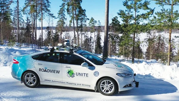
    Finnish authorities have reported a surge of GPS malfunctions in the area. Authorities speculate the disturbances are due to Russian jamming. The reports were brought to the public’s attention when a Finnish maritime pilot shared on social media a video depicting radar malfunctions. Traficom, Finland’s federal transport and communications agency, told local news outlet Iltalehti that there has been a noticeable increase in GPS malfunctions, although it detected no interference with radar frequencies in the Gulf of Finland.

    China takes PNT to the moon

    Photo: Elen11 / iStock / Getty Images Plus / Getty Images
    Photo: Elen11 / iStock / Getty Images Plus / Getty Images

    Scientists from the Beijing Institute of Spacecraft System Engineering proposed the construction of 21 positioning, navigation and timing (PNT) satellites around the moon to support China’s lunar ambitions. The satellites will be deployed in four types of orbits over three phases, featuring a sustainable and cost-effective design, according to a paper published in the Chinese Space Science and Technology journal. China aims to put astronauts on the moon by 2030 and build a research base at the lunar south pole with international partners around 2035, according to the paper.

  • Seen & Heard: Landslides, surveillance risks, 911 calls

    Seen & Heard: Landslides, surveillance risks, 911 calls

    “Seen & Heard” is a monthly feature of GPS World magazine, traveling the world to capture interesting and unusual news stories involving the GNSS/PNT industry.


    Surveillance risk in Apple products

    Photo: MStudioImages / E+ / Getty Images
    Photo: MStudioImages / E+ / Getty Images

    A recent study published by the University of Maryland revealed a major privacy vulnerability in Apple’s Wi-Fi Positioning System (WPS). Hackers can track Wi-Fi access points and their users globally. Apple’s WPS relies on the company’s vast network of iPhones, iPads and MacBooks to collect the geolocation of Wi-Fi access points based on their Basic Service Set Identifier (BSSID). When an Apple device uses GPS, it reports the coordinates of nearby Wi-Fi BSSIDs to Apple’s servers, allowing other Apple devices to estimate their location even without GPS. Hackers can access these points and access unsuspecting users’ locations.

    UAVS for 911 calls

    Photo: aerogondo / iStock / Getty Images Plus / Getty Images
    Photo: aerogondo / iStock / Getty Images Plus / Getty Images

    The New York City Police Department (NYPD) will soon improve its crime-fighting efforts with the Drone as First Responder (DFR) pilot program. The program will deploy UAVs in response to specific 911 calls for serious crimes in progress, such as shootings, robberies and missing persons. UAVs will launch from five precincts: the 48th Precinct in the Bronx, the 67th, 71st and 75th Precincts in Brooklyn and Central Park, New York. The UAVs will provide real-time video and telemetry to officers to enhance situational awareness and safety.

    Geospatial data offered in Africa

    Photo: Stanislav Gvozd / iStock / Getty Images Plus / Getty Images
    Photo: Stanislav Gvozd / iStock / Getty Images Plus / Getty Images

    AfriGIS, a geospatial solutions company, offers verified and validated geospatial data on administrative boundaries linked to postal codes throughout Africa. Expanding the company’s geospatial datasets to cover the continent, AfriGIS has developed a collection of shapes defined by closed lines that represent geographical areas — called a polygon dataset — for 21,600 towns, including 475,000 suburbs, over the past three years.

    Landslide in Papua New Guinea

    Photo: Maxar Technologies/Reuters
    Photo: Maxar Technologies/Reuters

    Maxar Technologies has released satellite images revealing the large scale of damage from the May 24 landslide in Papua New Guinea. The images show a significant portion of the mountainous Enga Province being torn away, with as many as 2,000 people believed to be buried under rubble. Satellite imagery from before and after the landslide illustrates the vast impact on the landscape.

  • Seen & Heard: Robotic dogs, coral bleaching, songs for cows

    Seen & Heard: Robotic dogs, coral bleaching, songs for cows

    “Seen & Heard” is a monthly feature of GPS World magazine, traveling the world to capture interesting and unusual news stories involving the GNSS/PNT industry.


    Songs for the Cows

    Photo: SWNS Media Group
    Photo: SWNS Media Group

    Farmers are controlling cows with a GNSS-based tracking system that plays “Waltzing Matilda” when they get too close to a virtual fence. Blue Carbon Farming in Somerset, England, has begun working with the Wildlife and Wetlands Trust (WWT) to allow cattle to graze in wetlands and salt marshes for the first time in 30 years. Farmers can now use the Nofence app and collars to track where the cows are and warn them away from danger with music. If a cow gets near the virtual fence, a boundary determined by the farmers, its collar will play the tune to warn it away from the area.

    Robotic Dogs on a Mission

    Photo: BMW
    Photo: BMW

    BMW is using a four-legged robotic dog to gather data for a digital twin at its Hams Hall engine production plant in the United Kingdom. The robot – a Boston Dynamics Spot model, which BMW has renamed Spotto – also will act as a watchdog and assist in other tasks at the site’s facilities. The autonomous robot is equipped with visual, thermal and acoustic sensors. The Hams Hall digital twin operates on three levels. On the first level, the twin generates 3D representations of the plant. The mobile robot feeds data into the second level – a data layer that also receives information from the site’s production facilities and IT systems. On the third level – the application level – programs sort the collected data, which personnel use for quality assurance and production planning purposes.

    Keep Your Hands on the Wheel

    Photo: Tesla
    Photo: Tesla

    The U.S. Department of Justice has launched an investigation into Tesla’s Autopilot and Full Self-Driving (FSD) systems. Tesla is under the microscope of U.S. federal prosecutors, as well as the U.S. National Highway Traffic Safety Administration (NHTSA), who want Tesla to share more information related to its autopilot system after crashes continued occurring despite a December recall of more than 2 million vehicles. The investigation focuses on Tesla’s Autopilot system and the more advanced Full Self-Driving package, which the company has been selling as an optional add-on. Neither system can fully automate the driving process without human supervision, a point of contention that has raised questions about the accuracy of Tesla’s promotional materials.

    Mass Coral Bleaching

    Photo: Rainer von Brandis / iStock / Getty Images Plus / Getty Images
    Photo: Rainer von Brandis / iStock / Getty Images Plus / Getty Images

    The Australian Institute of Marine Science (AIMS), in collaboration with the Great Barrier Reef Marine Park Authority, has observed extensive coral bleaching caused by elevated sea temperatures during aerial and in-water surveys of the reef. This information confirms that a mass coral bleaching event is taking place on the Great Barrier Reef, which is the fifth such event since 2016. The aerial surveys have so far covered almost two-thirds of the Great Barrier Reef Marine Park.

  • Seen & Heard: Dark matter, robots, Taiwan earthquake

    Seen & Heard: Dark matter, robots, Taiwan earthquake

    “Seen & Heard” is a monthly feature of GPS World magazine, traveling the world to capture interesting and unusual news stories involving the GNSS/PNT industry.


    Photo: ESA
    Photo: ESA

    Detecting dark matter with atomic clocks

    A team of researchers from Belgium’s Royal Observatory, SYRTE in Paris, the Université Côte d’Azur and the European Space Agency have used atomic clocks to search for dark matter transients in space. The team focused on a network of passive hydrogen masers (H-masers) on board the fleet of Galileo satellites to detect these transient variations. They presented a new technique that interprets fluctuations in fundamental constants as a specific kind of frequency modulation — a discrepancy in the expected times indicated by the satellite clocks. The findings are detailed in a paper titled “Searching for large dark matter clumps using the Galileo Satnav clock variations.”

    Photo: H2L Robotics
    Photo: H2L Robotics

    Gardening Robots

    H2L Robotics has deployed fully autonomous agricultural vehicles enabled by artificial intelligence (AI) across farmlands in the Netherlands. The robots are tasked with spotting and eliminating diseased tulip bulbs ahead of the country’s financially significant spring tulip bloom. The Selector180 robot uses GNSS to autonomously drive through tulip fields, and onboard cameras to take thousands of photos. An AI model then sorts the images, looking for potentially diseased bulbs. Finally, the Selector returns to the fields and removes diseased bulbs to prevent disease from spreading.

    Photo: DoorDash
    Photo: DoorDash

    Deliveries from the sky

    DoorDash has expanded its partnership with Wing to bring its UAV delivery pilot to the United States. DoorDash users who are near the Wendy’s fast food restaurant located at 2355 N. Franklin Street in Christiansburg, Virginia can order eligible menu items from the restaurant. They will see the new delivery option on the checkout page. Once they select the “drone” option, their order will be prepared and delivered via a Wing UAV within 30 minutes.

    Photo: USGS
    Photo: USGS

    Earthquake strikes Taiwan

    A 7.4-magnitude earthquake struck the eastern coast of Taiwan on April 3, according to the United States Geological Survey. USGS has released a ShakeMap providing near-real-time maps of ground motion and shaking intensity following the earthquake. According to USGS, the earthquake and aftershocks were strong enough to be felt across the island nation and parts of mainland China and Japan.